
Search for another town





Free U.S. delivery 7 to 10 days after you order
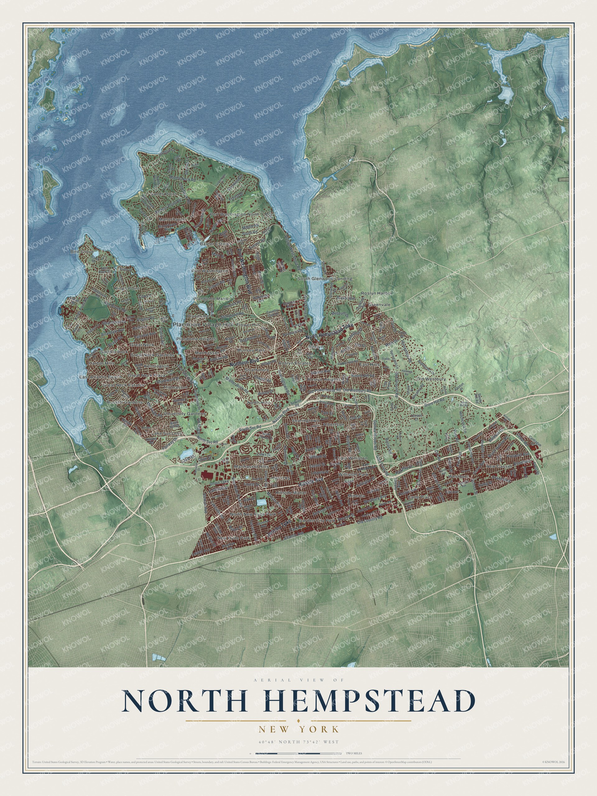
North Hempstead, New York Map Art
Building by building, with labeled streets and shaded relief.
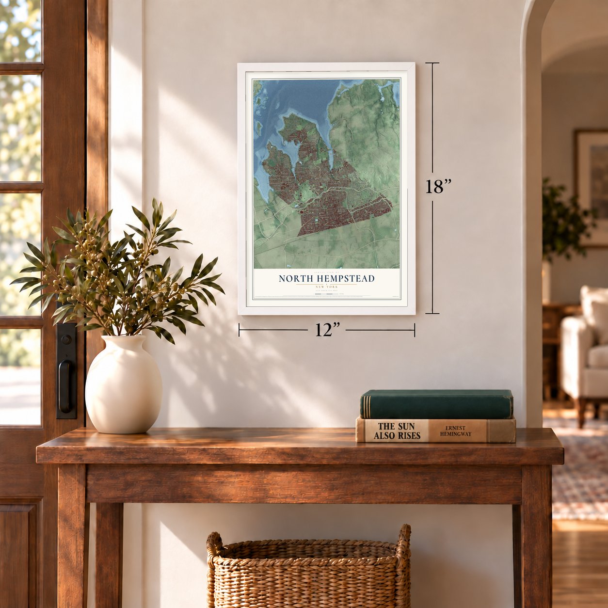
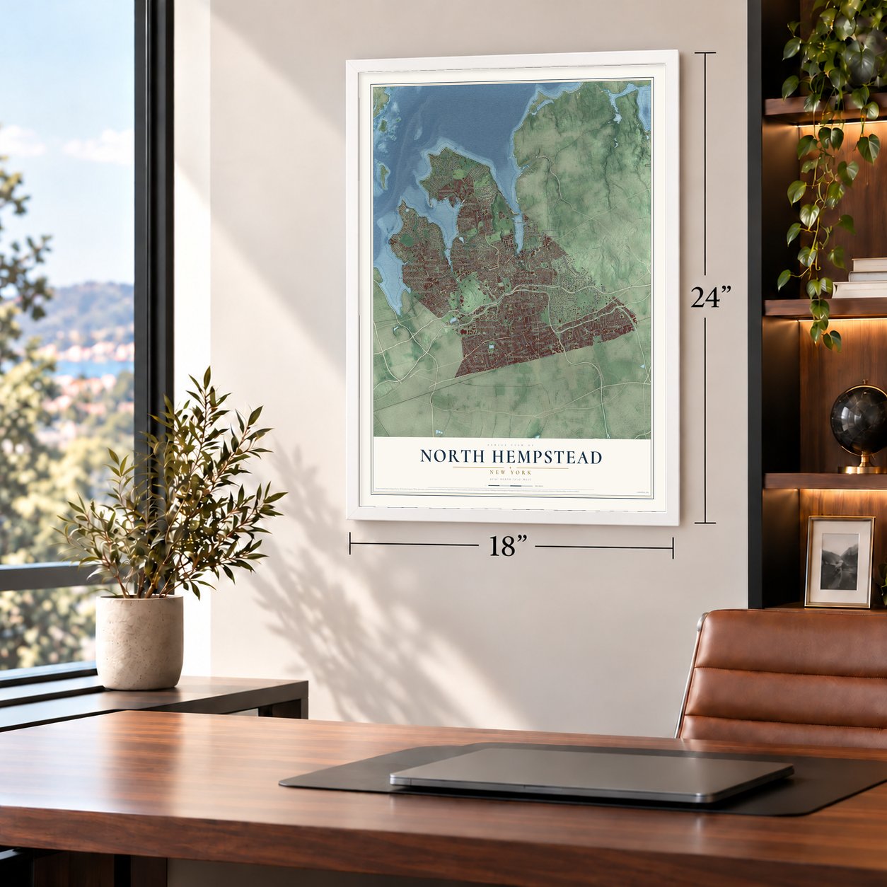
12" x 18" Archival Matte Print
A Map of Home. A Work of Art.
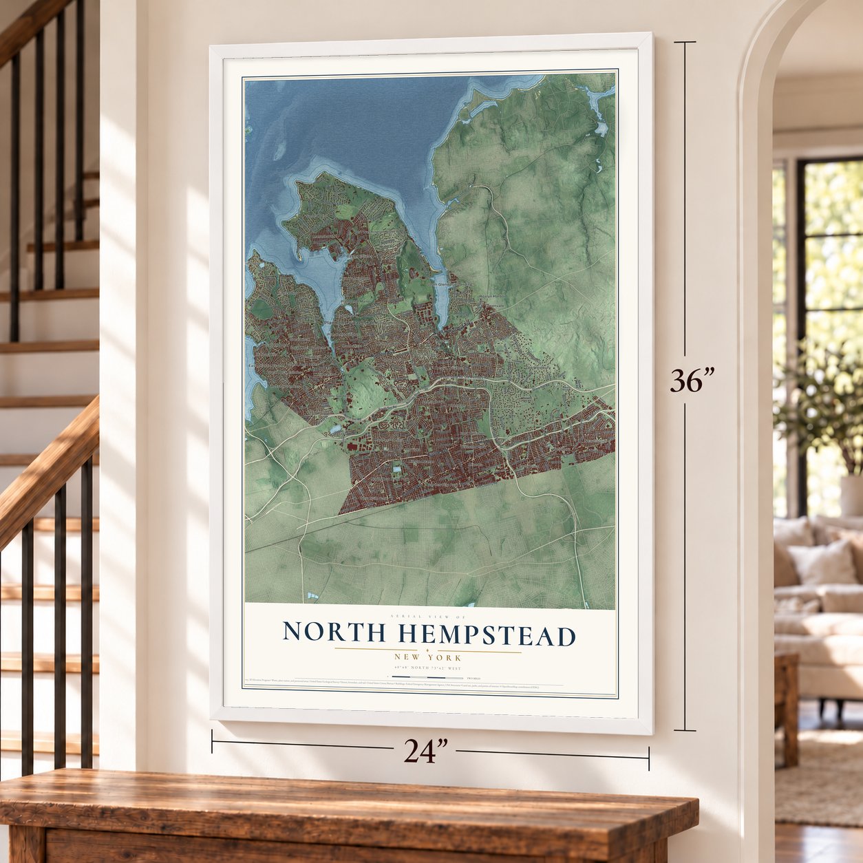
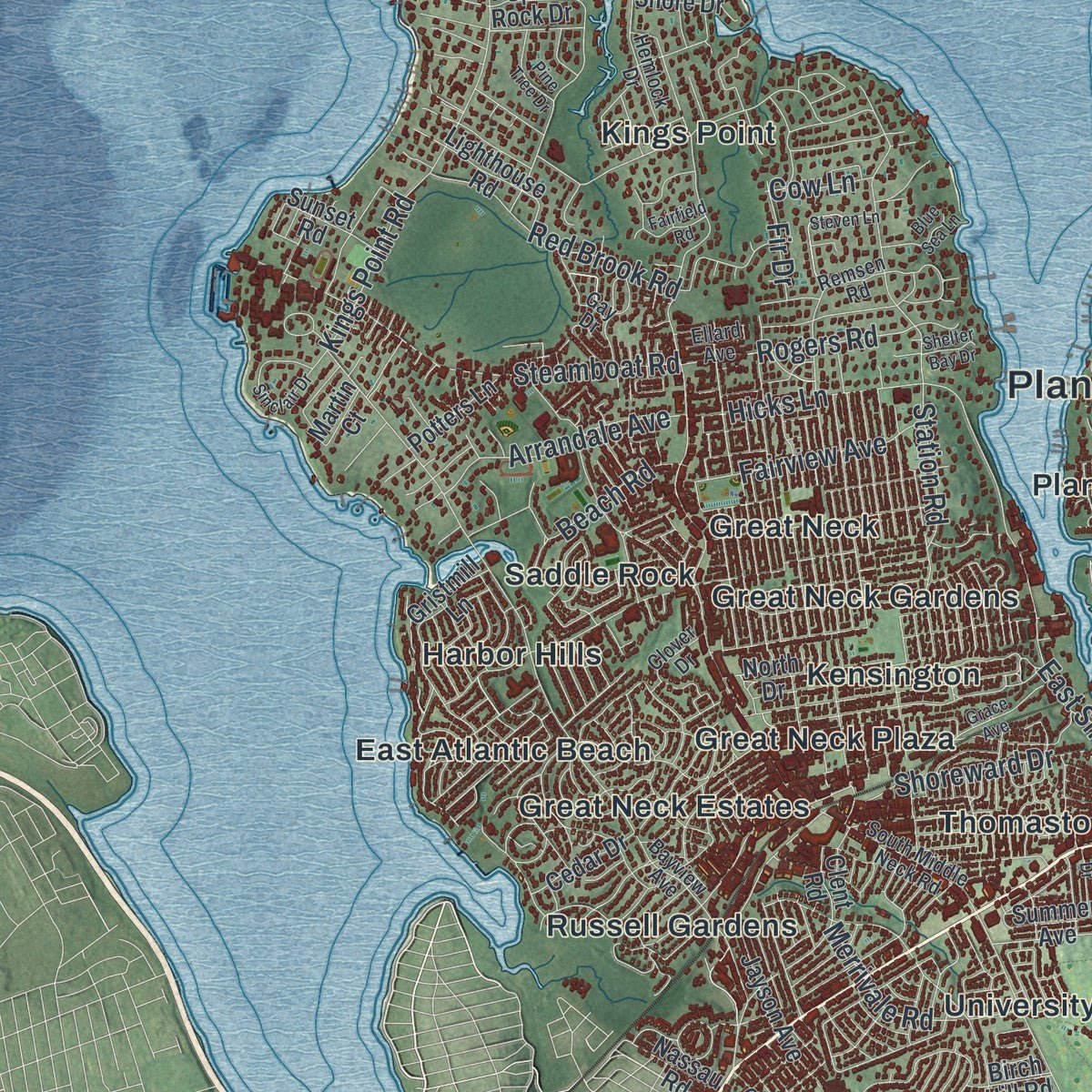
Explore North Hempstead, New York from a whole new perspective. Created using aerial imagery and detailed geographic data, this map captures North Hempstead building by building, with labeled streets, familiar landmarks, and shaded topographical relief that highlights the natural contours of the landscape.
Combining modern data with the timeless character of a vintage atlas, this map is just as interesting up close as it is beautiful on the wall. Whether you grew up in North Hempstead, spent memorable years there, or call it home today, this unique map is a great way to celebrate a place that means something to you. Zoom in on the preview to look for your street, and then order a print to put your memories on the wall.
Three ways to hang it
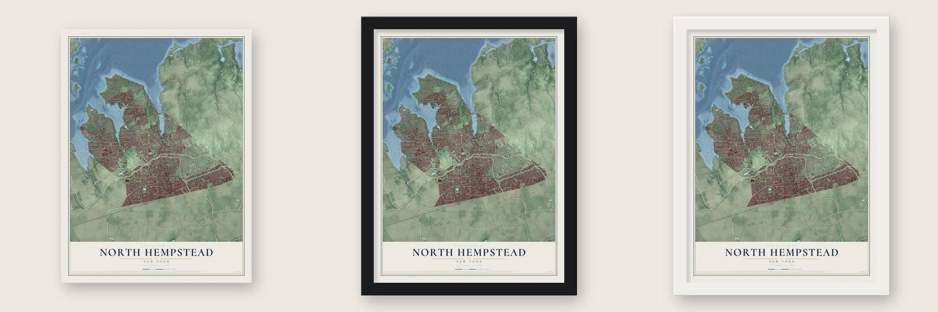
Unframed archival matte, a black wood frame or a white wood frame.
Up close
Geography Worth Displaying
This map was created using accurate cartographic data and authoritative geographic sources, including the U.S. Geological Survey (USGS) and FEMA. The map brings together terrain, waterways, roads, and building detail. The majority of the streets are labeled, houses are accurately depicted, and the topography is derived from government sources. Combining local data with carefully composed color and shading leads to this beautifully detailed North Hempstead artwork for your wall.
Rather than simply showing street outlines, we’ve included as many of the street names as we could reasonably fit on the map while keeping their names legible. Zoom in on the high resolution preview to see exactly what’s on the map. We truly set out to create a statement piece for anyone who loves North Hempstead. So whether it’s for you, or a gift for someone you love, we hope this map of North Hempstead brings back fond memories.
Explore the full map of North Hempstead, New York and read about the local places it shows.

Find your street
Names on the North Hempstead map
Every name below is printed on this map. Look for your street, your school, the park where you played, or the pond down the road.
Places and landmarks50
- Plandome Village Hall
- Albertson
- Baxter Estates
- Bird Grove
- Carle Place
- East Atlantic Beach
- East Hills
- East Williston
- Flower Hill
- Garden City Park
- Great Neck
- Great Neck Estates
Show all 50 places
- Great Neck Gardens
- Great Neck Plaza
- Greenvale
- Harbor Hills
- Herricks
- Hillside Manor
- Kensington
- Kings Point
- Lake Success
- Manhasset
- Manhasset Hills
- Manorhaven
- Mineola
- Munsey Park
- New Cassel
- New Hyde Park
- North Hills
- North New Hyde Park
- Old Westbury
- Plandome
- Plandome Heights
- Plandome Manor
- Port Washington
- Port Washington North
- Roslyn
- Roslyn Estates
- Roslyn Harbor
- Roslyn Heights
- Russell Gardens
- Saddle Rock
- Sands Point
- Searingtown
- South Glenwood Landing
- Strathmore
- Thomaston
- University Gardens
- Westbury
- Williston Park
Streets and roads334
- Jericho Turnpike
- Northern Boulevard
- Hillside Avenue
- North Hempstead Turnpike
- Port Washington Boulevard
- Old Westbury Road
- Roslyn Road
- Shelter Rock Road
- Nassau Boulevard
- Forest Drive
- Museum Drive
- South Svc Road
- Old Country Road
- Middle Neck Road
- Glen Cove Road
- Park Avenue
- Willis Avenue
- Lakeville Road
- Store Hill Road
- West Shore Road
- Marcus Avenue
- East Shore Road
- Broadway
- Bryant Avenue
- Main Street
- New Hyde Park Road
- Kings Point Road
- Harbor Road
- Cherry Lane
- Westbury Avenue
Show all 334 streets
- Soundview Drive
- North Svc Road
- Post Road
- Guinea Woods Road
- Valley Road
- Roslyn West Shore Road
- Lowell Avenue
- Searingtown Road
- Parkway Drive
- Fairview Avenue
- Post Avenue
- Bacon Road
- Steamboat Road
- Fairway Drive
- Prospect Avenue
- Elm Drive
- Dogwood Lane
- Atlantic Avenue
- Station Road
- Chestnut Drive
- Powells Lane
- Links Drive
- Stonytown Road
- School Street
- Laurel Drive
- Jackson Avenue
- Round Hill Road
- Ellison Avenue
- Second Street
- Center Street
- Foch Boulevard
- Beach Road
- Barkers Point Road
- Red Ground Road
- Main Drive
- Hicks Lane
- Grand Boulevard
- William Street
- Cow Neck Road
- Brush Hollow Road
- Old Powerhouse Road
- Cedar Lane
- South Road
- Red Brook Road
- Union Avenue
- Tara Drive
- Hitchcock Lane
- Sterling Lane
- Lake Road
- Arrandale Avenue
- Arlington Street
- Ash Drive
- Merrivale Road
- Oak Drive
- Terrace Boulevard
- Hoffstot Lane
- Stewart Avenue
- Shoreward Drive
- Summit Road
- Warner Avenue
- Union Turnpike
- Fir Drive
- Cedar Road
- Haven Avenue
- Baldwin Drive
- Luquer Road
- Sherwood Drive
- Patton Boulevard
- Bristol Drive
- Yale Street
- Chapel Road
- Birch Street
- Horseshoe Road
- McKee Street
- Rogers Road
- Grand Street
- Reed Drive
- Hamilton Drive
- Roslyn Avenue
- Middle Road
- Ursula Drive
- Andrew Road
- Wilton Street
- Evans Avenue
- Irving Street
- Club Drive
- Cow Lane
- Olive Street
- Frost Street
- Dirt Road
- Wheatley Road
- Locust Lane
- Glen Road
- West Ridge Drive
- Denton Avenue
- Shore Road
- Sands Point Road
- Herricks Road
- Country Club Drive
- Community Drive
- Elm Street
- Cedar Drive
- Fairfield Avenue
- North Drive
- Carle Road
- Birch Drive
- Cambridge Avenue
- Gristmill Lane
- Harbor Hill Road
- Lighthouse Road
- Wellington Road
- Brooklyn Avenue
- Harbor Park Drive
- Service Road
- Liberty Avenue
- Shore Drive
- Applegreen Drive
- Fifth Avenue
- Bond Street
- Ridge Drive
- High Street
- Raff Avenue
- Split Rock Drive
- Village Road
- Princeton Street
- Urban Avenue
- Hillside Boulevard
- Manorhaven Boulevard
- Nassau Avenue
- Crabapple Road
- Lee Avenue
- The Pines
- Woodland Road
- Devon Road
- Jayson Avenue
- Cantiague Lane
- Glenwood Road
- Broad Street
- West Drive
- Spring Hill Lane
- Mimosa Drive
- Martin Court
- Sunset Road
- Jasmine Avenue
- Jamaica Boulevard
- Seaview Boulevard
- Pond Road
- West Creek Farms Road
- Hillturn Lane
- Irma Avenue
- Deer Run
- Moore Street
- Mason Drive
- Terrace Court
- Clent Road
- Hemlock Road
- Lafayette Street
- Dogwood Avenue
- Plum Beach Point
- Wakefield Avenue
- Sylvia Lane
- Roger Drive
- The Tulips
- Nassau Road
- Potters Lane
- Royal Court
- Sintsink Drive East
- Grace Drive
- Glen Avenue
- Summer Avenue
- Arbor Lane
- Ward Street
- Gristmill Road
- Acorn Ponds Drive
- Steele Hill Road
- Ohio Drive
- Walnut Drive
- Yale Drive
- Forte Drive
- Sousa Drive
- Groton Place
- Voice Road
- Curtis Avenue
- Shelter Lane
- Willow Gate
- Albany Avenue
- Birch Hill Road
- Harbor View Drive
- Upland Road
- Cornell Street
- Arbor Road
- Finch Drive
- Joy Drive
- Todd Drive
- Turf Lane
- Betty Road
- Hill Lane
- Third Avenue
- Bayview Avenue
- Lakeville Drive
- South Drive
- Maple Drive
- Railroad Avenue
- Third Street
- Beacon Hill Road
- Manhasset Avenue
- Pinewood Road
- Dow Avenue
- Carriage Road
- Roselle Street
- Hemlock Drive
- Fourth Avenue
- Pine Street
- Grant Avenue
- Trumbull Road
- Clover Drive
- Remsen Road
- Concord Avenue
- Peach Drive
- North Court
- Richards Road
- South Middle Neck Road
- Robbins Drive
- Driftwood Drive
- Tibbits Lane
- Albertson Avenue
- Drexel Avenue
- Reni Road
- Grand Avenue
- Luckenbach Lane
- Linden Lane
- Queen Street
- Hastings Road
- Titus Avenue
- Stable Lane
- Peacock Drive
- Gay Drive
- Arden Lane
- Vanad Drive
- Miro Place
- Lynn Road
- Leonard Drive
- Ellard Avenue
- Woods Road
- Steel Hill Road
- Aintree Road
- The Terrace
- Dail Street
- Lea Place
- East Williston Avenue
- Maple Street
- Mineola Boulevard
- Grace Avenue
- Central Drive
- Garfield Avenue
- Sinclair Drive
- South Street
- Longview Road
- Ridge Road
- Vanderbilt Avenue
- Woods Drive
- Elm Place
- Steven Lane
- Butler Street
- Fifth Street
- Engineers Road
- Poplar Drive
- Birchdale Lane
- Ivy Avenue
- Boulder Road
- Campbell Street
- Albertson Place
- Doral Drive
- Holland Avenue
- Ashwood Road
- Netz Place
- Industrial Park Drive
- Dock Lane
- Carriage Lane
- Dover Street
- Payne Whitney Lane
- Mott Avenue
- Clover Lane
- Windsor Drive
- Allen Drive
- Lords Way
- Pine Tree Drive
- Blue Sea Lane
- The Loch
- Mansion Drive
- Town Path
- Hollow Lane
- Robbins Lane
- Shields Avenue
- Fairfield Road
- Clapham Avenue
- Duke Drive
- Midtown Road
- Beverly Drive
- Shelter Bay Drive
- Capi Lane
- Helen Drive
- Bly Court
- Gulls Cv
Names are listed as they appear on the printed map. Zoom into the product photos to find them.
About North Hempstead, New York
North Hempstead is a town of 237,639 people in Nassau County, with Long Island Sound along its northern edge. The Matinecock Nation lived on this land first, and European settlers arrived around 1643, when it still belonged to the Town of Hempstead.
The American Revolution divided Hempstead in two. Its southern half mostly backed the Tories, but the northern half had been settled by Yankees and sided with independence. After the war, in 1784, the north broke away and became a town of its own. It was named for its place north of Hempstead, which people around that time sometimes called South Hempstead.
- Steamboats from Manhattan in 1836Steamboats began running to the town from Manhattan in 1836, and the Long Island Rail Road later pushed its line through to Great Neck. Those connections brought wealth to North Hempstead. Today the Port Washington Branch crosses the Manhasset Viaduct on its way from Great Neck to Port Washington.
- No new village since 1932North Hempstead holds 31 incorporated villages, formed so each could set its own zoning rules. Port Washington North, in May 1932, was the last. In 1936 a revised county charter took zoning powers away from any future village, and every attempt to incorporate since then has failed, including a mid-20th-century push to make all of Strathmore south of Northern Boulevard a village. Carle Place, Manhasset, Port Washington and Roslyn Heights are run by the town itself.
- A town without a namesakeNo hamlet or village inside North Hempstead's borders shares its name, which makes it unique among Long Island's towns. Hempstead, Oyster Bay, Huntington, Islip, Southampton and the other Long Island towns all contain one.
- A 9/11 memorial in 2025On September 11, 2025, the town dedicated its memorial to the September 11 attacks in Manhasset Valley Park. The project took more than 10 years of planning, and builders finished it earlier that same year.
Keep exploring New York
North Hempstead is one of 2,165 New York towns we've mapped. Every dot on the map is a print of its own.
The search covers every state, New York first.
Near North Hempstead
Order 2 or more town maps and save 10%. Shown in the size and finish you picked above, so they hang as a set.
- Munsey Park 12" x 18" / Archival Matte Print $39.99
- Flower Hill 12" x 18" / Archival Matte Print $39.99
- Roslyn Estates 12" x 18" / Archival Matte Print $39.99
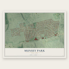
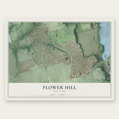

More maps nearby: Plandome, Plandome Manor, Plandome Heights, Roslyn and Manhasset.
The art of mapping a place
How This Map Was Made
Real places. Remarkable detail. Discover the layers that turn geographic data into a map of home.

The view from above
Aerial imagery reveals the character of the land: woodland, open fields, and the patterns of a place.

The shape of the land
Elevation data brings hills, valleys, and subtle changes in the landscape into view.

The details of home
Roads, waterways, and building footprints come together to make the map feel unmistakably local.

Geography becomes art
Considered color, shading, and typography bring the layers together in a map made for your wall.


Process illustrated with Mendon, Massachusetts. Aerial imagery: USDA NAIP. Terrain: USGS 3D Elevation Program. Map details and finished artwork: KNOWOL.
The Details
About This Print
Choose an archival matte print, or a black or white Ayous wood frame. The archival matte print is unframed.
Select your size and finish above to see the matching product image and price.
Materials & Craftsmanship
A contemporary map with the character of a classic atlas, printed on archival matte paper. Optional frames are made from Ayous wood.
Your printed map does not include the watermark shown in the full-map preview.
Shipping & Delivery
Free shipping within the United States. Every print is made to order in the USA.
Buying a gift? Add a note in your cart and we'll include it. We never put prices in the package.
Prints ship within 2 to 3 business days. Allow 7 to 10 days total from ordering for delivery. Timing may vary during holidays or periods of high order volume.
Read our shipping policy.
Returns and damaged prints
Each print is made to order. Change-of-mind refunds are not available after production.
If your print arrives damaged, misprinted or incorrect, contact support@knowol.com within 30 days of receiving it. Include your order number, photos and a description of the issue.
Read our full refund and replacement policy. For questions about your order, email support@knowol.com.