
Search for another town




Free U.S. delivery 7 to 10 days after you order
North Tonawanda, New York Map Art
Building by building, with labeled streets and shaded relief.
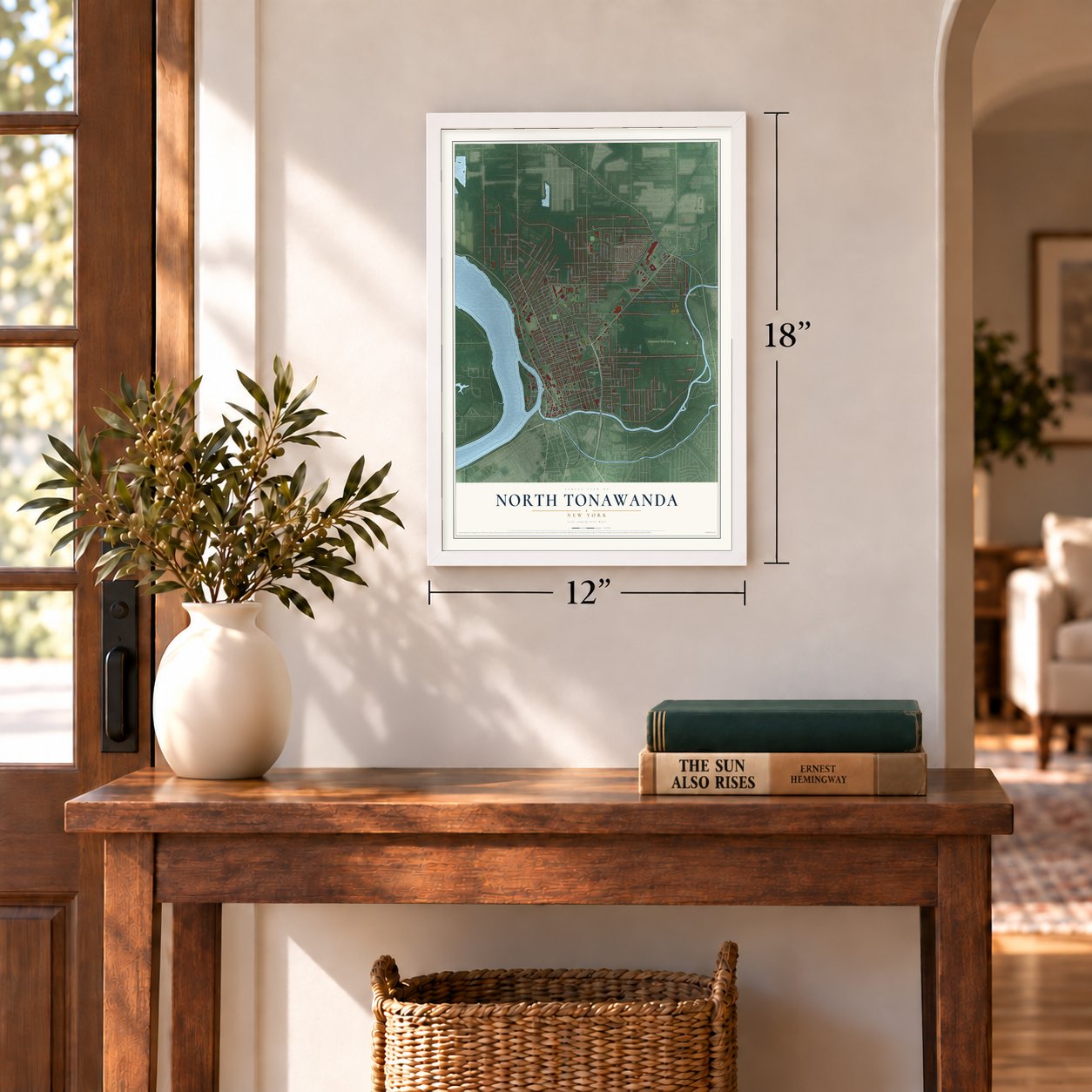
12" x 18" Archival Matte Print
A Map of Home. A Work of Art.
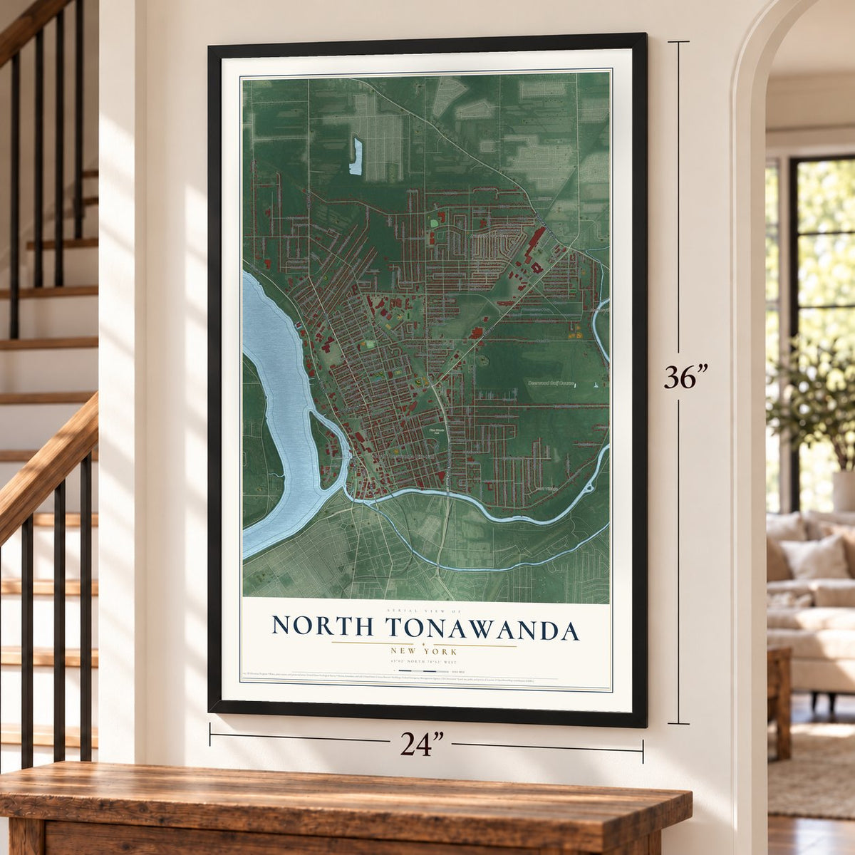
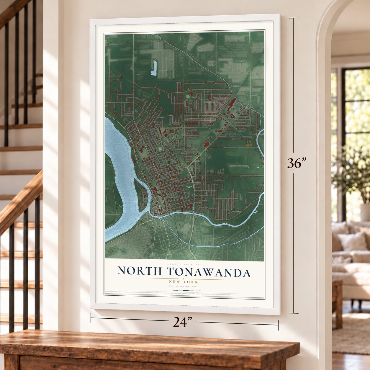
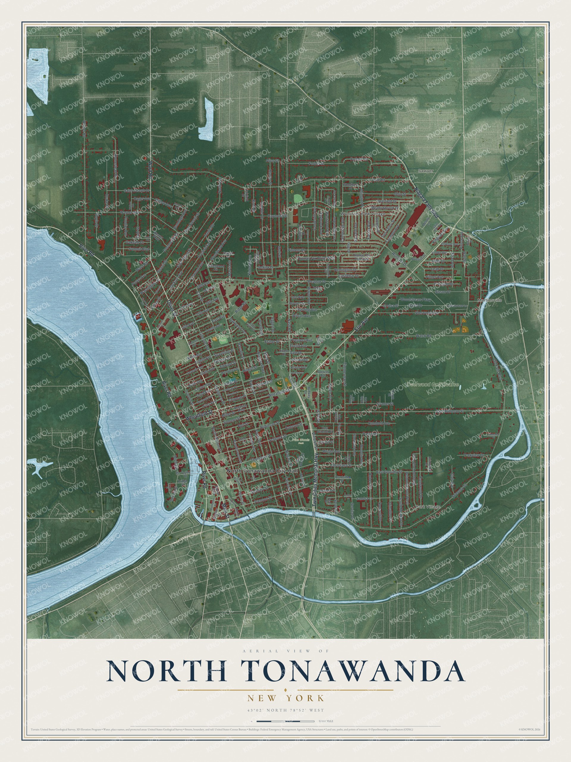
Explore North Tonawanda, New York from a whole new perspective. Created using aerial imagery and detailed geographic data, this map captures North Tonawanda building by building, with labeled streets, familiar landmarks, and shaded topographical relief that highlights the natural contours of the landscape.
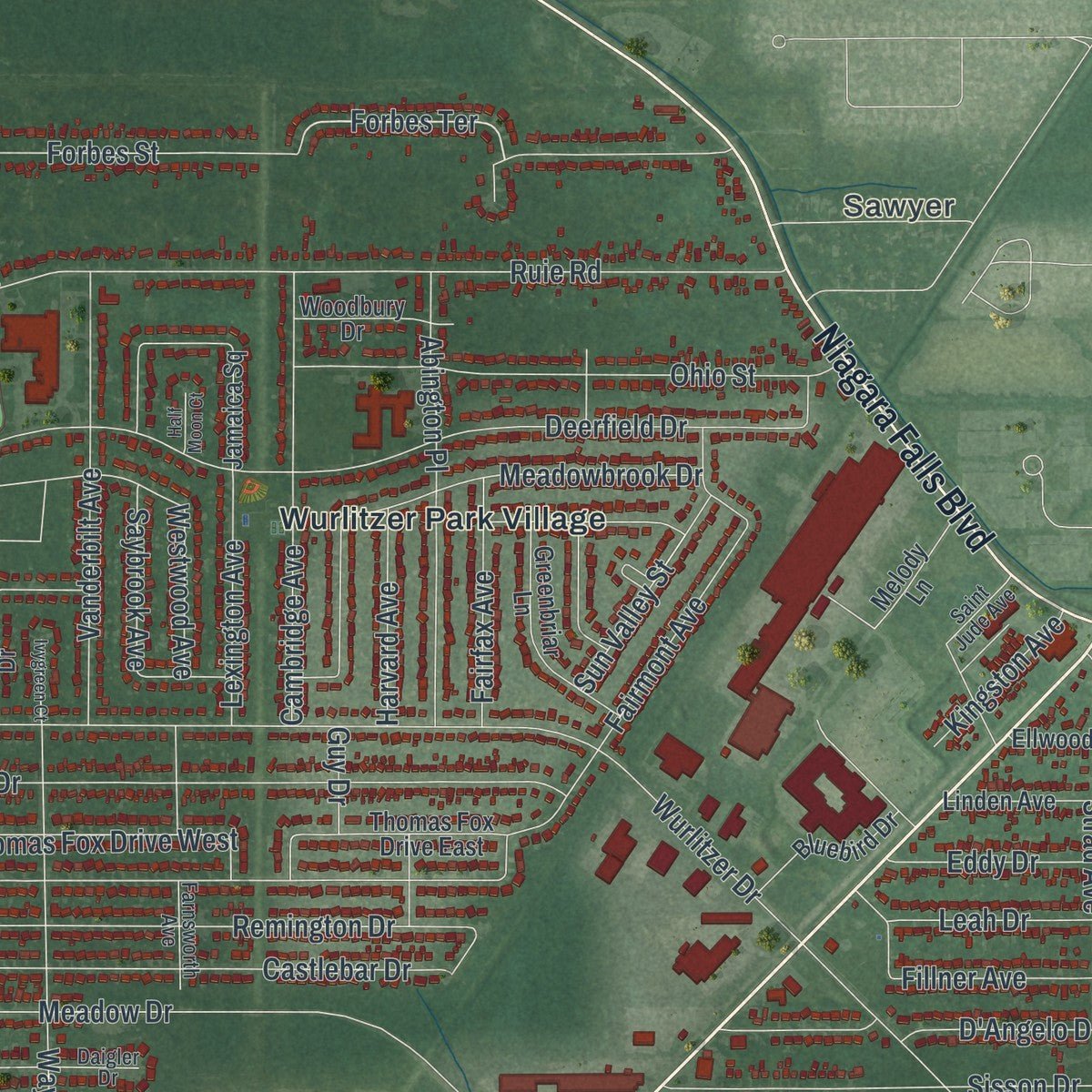
Combining modern data with the timeless character of a vintage atlas, this map is just as interesting up close as it is beautiful on the wall. Whether you grew up in North Tonawanda, spent memorable years there, or call it home today, this unique map is a great way to celebrate a place that means something to you. Zoom in on the preview to look for your street, and then order a print to put your memories on the wall.
Three ways to hang it
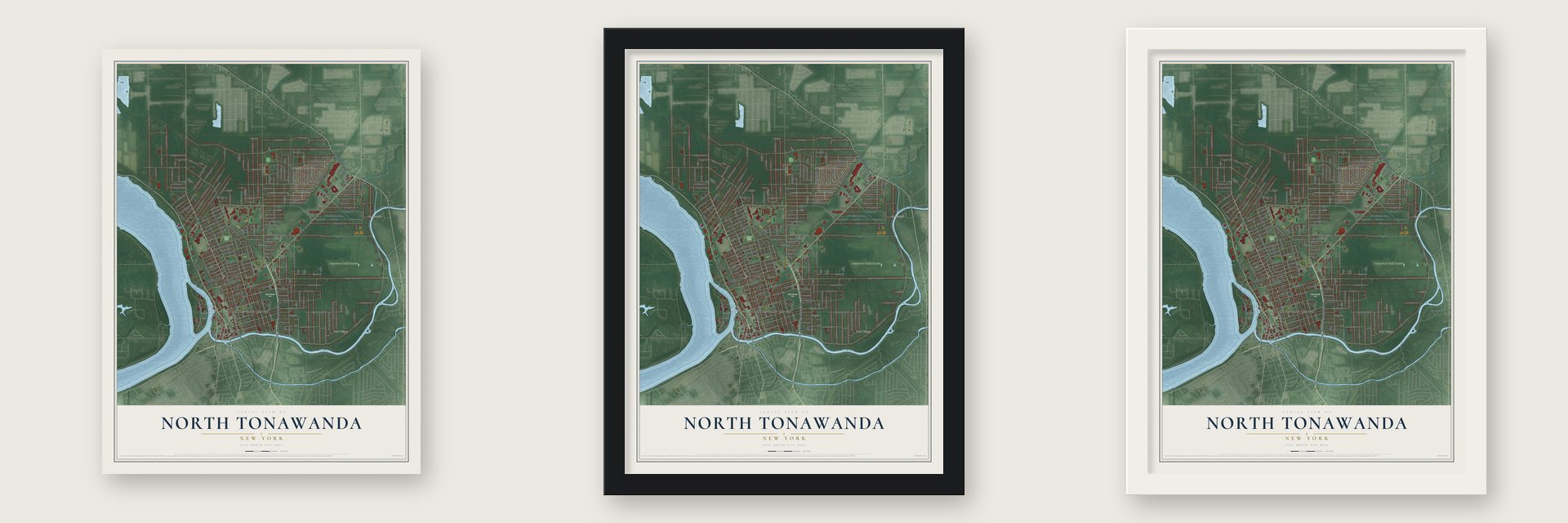
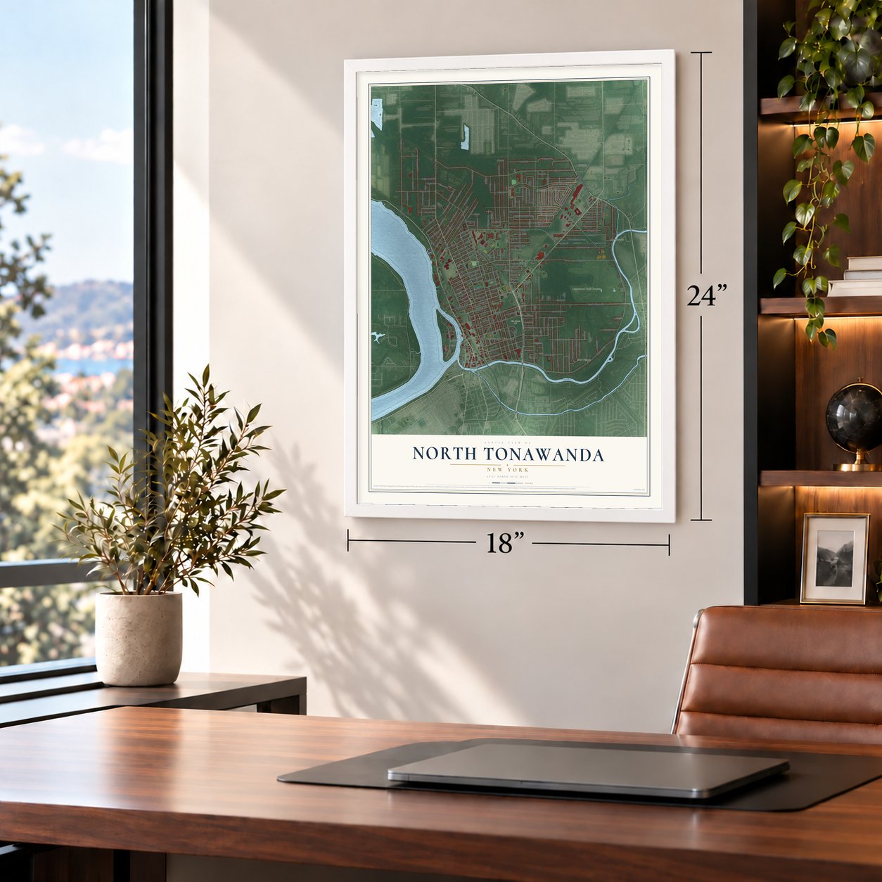
Unframed archival matte, a black wood frame or a white wood frame.
Up close
Geography Worth Displaying
This map was created using accurate cartographic data and authoritative geographic sources, including the U.S. Geological Survey (USGS) and FEMA. The map brings together terrain, waterways, roads, and building detail. The majority of the streets are labeled, houses are accurately depicted, and the topography is derived from government sources. Combining local data with carefully composed color and shading leads to this beautifully detailed North Tonawanda artwork for your wall.
Rather than simply showing street outlines, we’ve included as many of the street names as we could reasonably fit on the map while keeping their names legible. Zoom in on the high resolution preview to see exactly what’s on the map. We truly set out to create a statement piece for anyone who loves North Tonawanda. So whether it’s for you, or a gift for someone you love, we hope this map of North Tonawanda brings back fond memories.
Explore the full map of North Tonawanda, New York and read about the local places it shows.

Find your street
Names on the North Tonawanda map
Every name below is printed on this map. Look for your street, your school, the park where you played, or the pond down the road.
Places and landmarks8
- North Tonawanda City Hall
- Park Village
- Sawyer
- Martinsville
- Payne Park
- Pine Woods Park
- Wurlitzer Park Village
- Deerwood Golf Course
Streets and roads240
- Twin Cities Memorial Highway
- Oliver Street
- Erie Avenue
- River Road
- Niagara Falls Boulevard
- Ward Road
- Main Street
- Wheatfield Street
- Nash Road
- Shad Street
- Forbes Terrace
- East Robinson Street
- Christiana Street
- Thompson Street
- Stenzil Street
- Sweeney Street
- Payne Avenue
- Walck Road
- Ruie Road
- Wurlitzer Drive
- Meadow Drive
- Fairmont Avenue
- Goundry Street
- Old Falls Boulevard
- Division Street
- Deerfield Drive
- Bryant Street
- Witmer Road
- Tremont Street
- Homestead Drive
Show all 240 streets
- Zimmerman Street
- Robinson Street
- Gilmore Avenue
- Master Street
- Moll Street
- Fredericka Street
- Schenck Street
- Linwood Avenue
- Roncroff Drive
- Niagara Parkway
- Robert Drive
- Pioneer Drive
- Sherwood Avenue
- Spruce Street
- Forbes Street
- Niagara Street
- Falconer Street
- Vandervoort Street
- Rumbold Avenue
- Castlebar Drive
- East Goundry Street
- Remington Drive
- Brentwood Drive
- Meadowbrook Drive
- Miller Street
- Warner Avenue
- Ohio Street
- Sisson Drive
- Wright Avenue
- Wayne Avenue
- North Avenue
- Doebler Drive
- Carr Street
- East Avenue
- Wall Street
- Abington Place
- Cambridge Avenue
- Vanderbilt Avenue
- Belmont Court East
- Park Avenue
- Sommer Street
- Dimatteo Drive
- Jackson Avenue
- Michigan Street
- South Meadow Drive
- East Felton Street
- Ironton Street
- Drake Drive
- Lincoln Avenue
- Mead Street
- Hagen Avenue
- Cramer Street
- Fillner Avenue
- David Drive
- 17th Avenue
- 16th Avenue
- 15th Avenue
- Woodstream Parkway
- 14th Avenue
- Thomas Fox Drive West
- East Stenzil Street
- Strad Avenue
- Service Drive
- Woodward Avenue
- Pine Street
- Eddy Drive
- Keil Street
- Belmont Court West
- Oakdale Drive
- Daniel Drive
- Lee Avenue
- Saybrook Avenue
- Sandra Lane
- Center Avenue
- Fifth Avenue
- Westwood Avenue
- Eighth Avenue
- Sixth Avenue
- Lexington Avenue
- Leah Drive
- Parkview Drive
- Fairfax Avenue
- Raymond Street
- Summit Boulevard
- D'Angelo Drive
- Harding Avenue
- Felton Street
- Sun Valley Street
- Community Drive
- Selkirk Drive
- Elmwood Avenue
- Woodlin Avenue
- Washington Street
- Louisa Street
- Clair Avenue
- Euclid Avenue
- Harvard Avenue
- Hewitt Street
- Pierce Avenue
- North Marion Street
- Barrally Street
- Dale Drive
- Bennett Street
- Third Avenue
- First Avenue
- Oakwood Terrace
- Dahlgreen Place
- Kinkead Avenue
- Ridge Road
- Birch Drive
- Esther Street
- Porter Avenue
- Ransom Street
- Saint Joseph Drive
- Taber Place
- Frontier Avenue
- Wilson Avenue
- Kohl Street
- Kingston Avenue
- Doyle Drive
- Ninth Avenue
- 19th Avenue
- Chipman Place
- Willow Avenue
- Prospect Avenue
- Spaulding Street
- Brundage Avenue
- Oelkers Street
- Edward Street
- Donald Drive
- Detroit Street
- Marcia Drive
- Roger Avenue
- Jesella Drive
- Locust Street
- Eggert Drive
- Guy Drive
- Alice Street
- Webster Street
- Jamaica Square
- Twelfth Avenue
- Revere Avenue
- Beckrich Alley
- Seventh Avenue
- Thomas Fox Drive East
- Greenwood Circle
- Greenbriar Lane
- Pine Woods Drive
- 18th Avenue
- Tanglewood Drive
- Linden Avenue
- Second Avenue
- Melody Lane
- Lindsay Place
- Bluebird Drive
- Courtside Drive
- Dean Drive
- Weaver Parkway
- East Schenck Street
- Lansdowne Lane
- Woodbury Drive
- Ellwood Avenue
- Whiting Street
- Humphrey Street
- Backer Alley
- Bridge Street
- Orchard Place
- Sunset Drive
- Budwey Lane
- Klaum Avenue
- Spencer Avenue
- Briarwood Drive
- Fairfield Drive
- Cedar Street
- Knapp Street
- Duane Drive
- Taylor Drive
- Plastic Drive
- Hyland Avenue
- Edith Avenue
- Bowen Drive West
- Farnsworth Avenue
- Eleventh Avenue
- Allen Street
- Daigler Drive
- Manhattan Street
- Shartle Place
- Saint Jude Avenue
- Sweeney Court
- East Oliver Street
- Murray Avenue
- Belling Place
- Marion Street
- Evans Street
- Industrial Drive
- Riverview Avenue
- South Avenue
- Stanley Street
- Wallace Avenue
- Wardell Avenue
- Ganson Street
- Jesella Drive West
- Central Lane
- Leonhardt Street
- Ivygreen Court
- Columbia Street
- Rose Circle
- Grant Street
- Archer Street
- Half Moon Court
Names are listed as they appear on the printed map. Zoom into the product photos to find them.
About North Tonawanda, New York
North Tonawanda is a city of 30,496 people in Niagara County, between the Niagara River and the Erie Canal, with Tonawanda Creek along its southern edge. The first settlers came in 1809, and from May 1836 the area belonged to the Town of Wheatfield. From January 1854 to April 1857 it was half of a single village that also reached into Erie County and the Town of Tonawanda, but one village split across two counties and two towns proved clumsy, and the state removed the North Tonawanda half. North Tonawanda became a village again on May 8, 1865, and a city on April 24, 1897.
The name comes from a Seneca word meaning swift-running water, for the rapids in the creek before the Erie Canal tamed them. At the canal's height the city ranked as the largest port on the Great Lakes, and from the mid-19th century through the 1970s it shipped and forwarded lumber, which is why it still calls itself the Lumber City. More than 150 lumber companies were based here. The lumber barons built mansions along Goundry Street, among them Kent Place at number 208, designed by Stanford White.
- Home of the CarouselThe Herschell-Spillman Company, later the Allan Herschell Co., got its start in North Tonawanda and became one of America's leading carousel makers. Its old factory is now the Herschell Carrousel Factory Museum, and signs at the city line greet visitors to the "Home of the Carousel."
- From band organs to WurlitzerIn 1888 Allan Herschell persuaded Eugene de Kleist, a Belgian, to come to the city, and de Kleist opened the North Tonawanda Barrel Organ Factory to build band organs. He was elected mayor in 1906, and in 1909 the Rudolph Wurlitzer Company took over the business. Under Wurlitzer it grew into one of the world's largest musical instrument plants. The old factory now rents space to light industry, technology and commercial firms.
- A Mighty Wurlitzer from 1926The Riviera Theater on Webster Street fills a restored Italian Renaissance building with plays, concerts and movies. Its 1926 "Mighty Wurlitzer" organ is played at monthly concerts, and the theater is one of very few in the country whose projectors can still run nitrate film, the kind in common use until about 1951.
- Kit homes for 70 yearsThe Ray H. Bennett Lumber Co., one of the city's many lumber firms, turned its trade into kit homes and sold them across the United States and Canada for 70 years.
- A farmers' market since 1908The North Tonawanda City Market opened in 1908 and is the oldest farmers' market in Niagara County. It opens three days a week all year, and in summer and early fall more than 70 farmers from the area sell there.
Keep exploring New York
North Tonawanda is one of 2,112 New York towns we've mapped. Every dot on the map is a print of its own.
The search covers every state, New York first.
Near North Tonawanda
Order 2 or more town maps and save 10%. Shown in the size and finish you picked above, so they hang as a set.
- City of Tonawanda 12" x 18" / Archival Matte Print $39.99
- Wheatfield 12" x 18" / Archival Matte Print $39.99
- Tonawanda Town 12" x 18" / Archival Matte Print $39.99
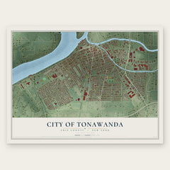


More maps nearby: Town of Tonawanda, Grand Island, University at Buffalo, Kenmore and Grandyle Village.
The art of mapping a place
How This Map Was Made
Real places. Remarkable detail. Discover the layers that turn geographic data into a map of home.

The view from above
Aerial imagery reveals the character of the land: woodland, open fields, and the patterns of a place.

The shape of the land
Elevation data brings hills, valleys, and subtle changes in the landscape into view.

The details of home
Roads, waterways, and building footprints come together to make the map feel unmistakably local.

Geography becomes art
Considered color, shading, and typography bring the layers together in a map made for your wall.


Process illustrated with Mendon, Massachusetts. Aerial imagery: USDA NAIP. Terrain: USGS 3D Elevation Program. Map details and finished artwork: KNOWOL.
The Details
About This Print
Choose an archival matte print, or a black or white Ayous wood frame. The archival matte print is unframed.
Select your size and finish above to see the matching product image and price.
Materials & Craftsmanship
A contemporary map with the character of a classic atlas, printed on archival matte paper. Optional frames are made from Ayous wood.
Your printed map does not include the watermark shown in the full-map preview.
Shipping & Delivery
Free shipping within the United States. Every print is made to order in the USA.
Buying a gift? Add a note in your cart and we'll include it. We never put prices in the package.
Prints ship within 2 to 3 business days. Allow 7 to 10 days total from ordering for delivery. Timing may vary during holidays or periods of high order volume.
Read our shipping policy.
Returns and damaged prints
Each print is made to order. Change-of-mind refunds are not available after production.
If your print arrives damaged, misprinted or incorrect, contact support@knowol.com within 30 days of receiving it. Include your order number, photos and a description of the issue.
Read our full refund and replacement policy. For questions about your order, email support@knowol.com.