
Search for another town





Free U.S. delivery 7 to 10 days after you order
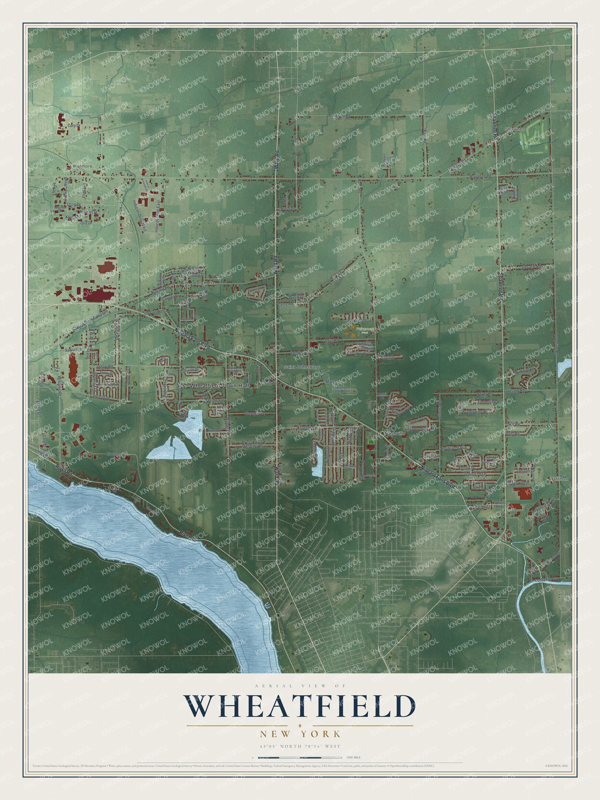
Wheatfield, New York Map Art
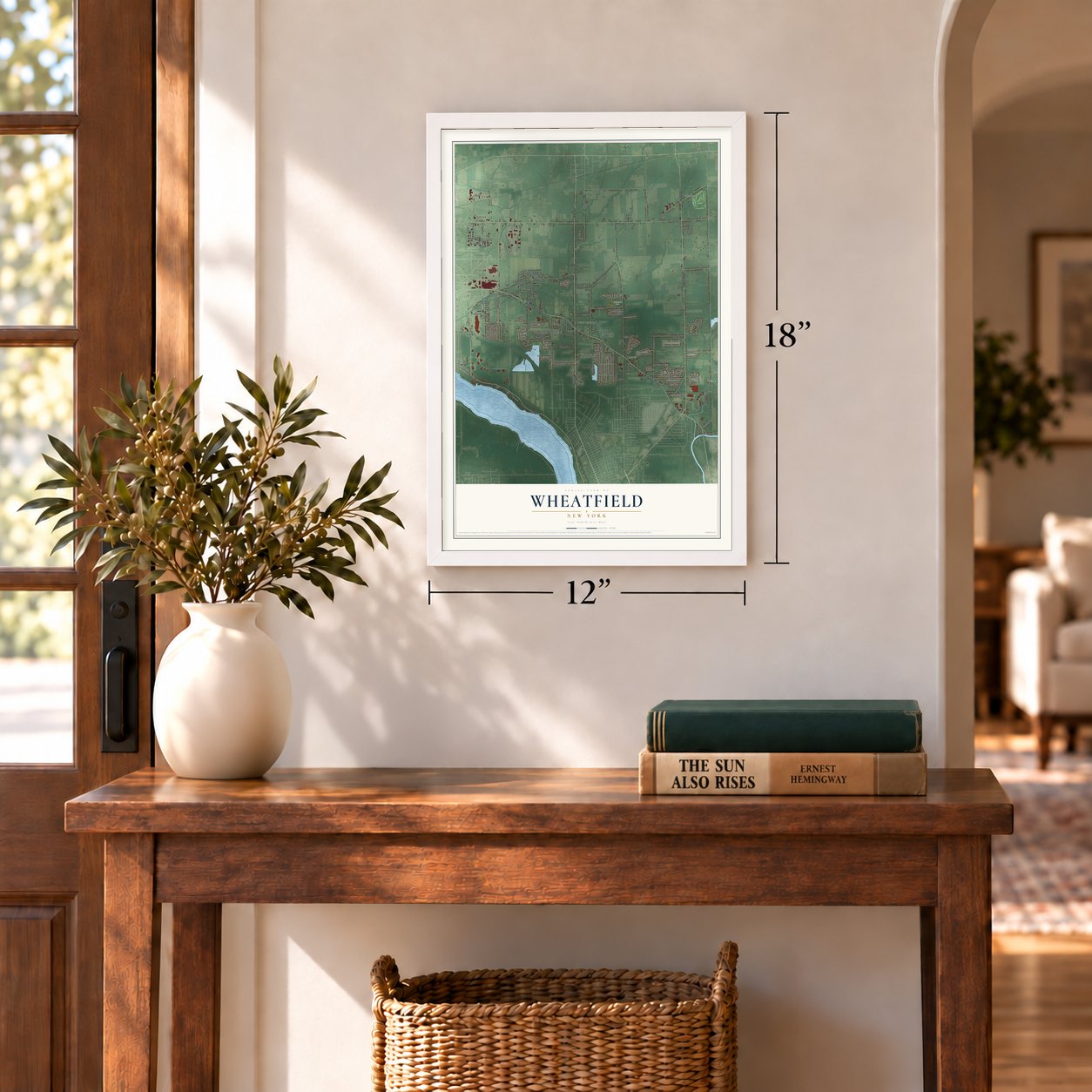
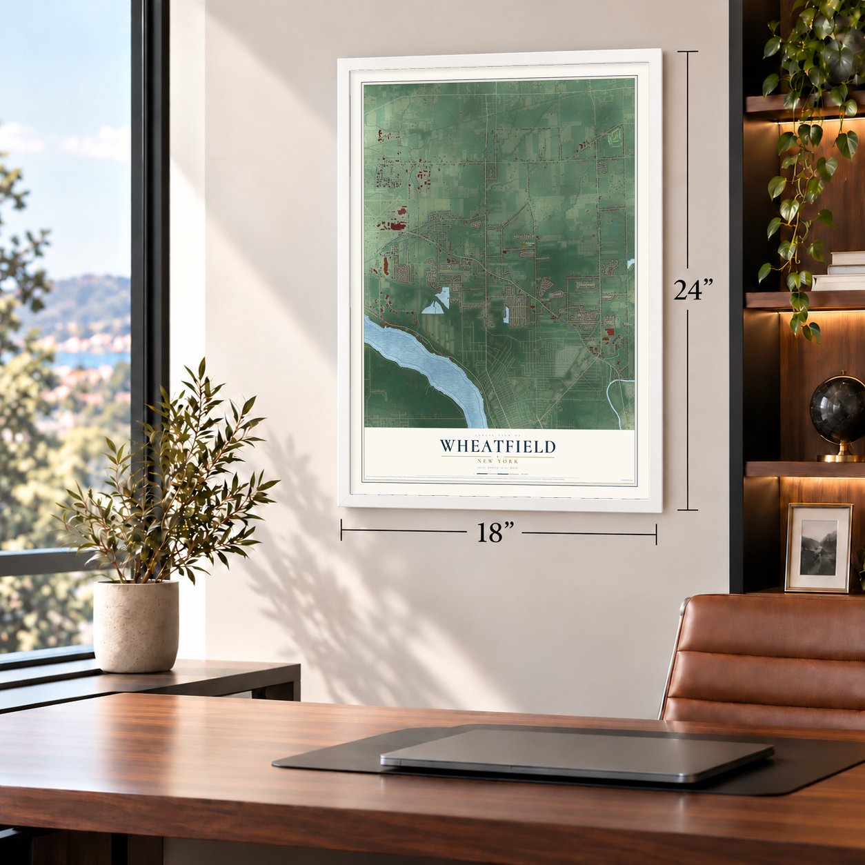
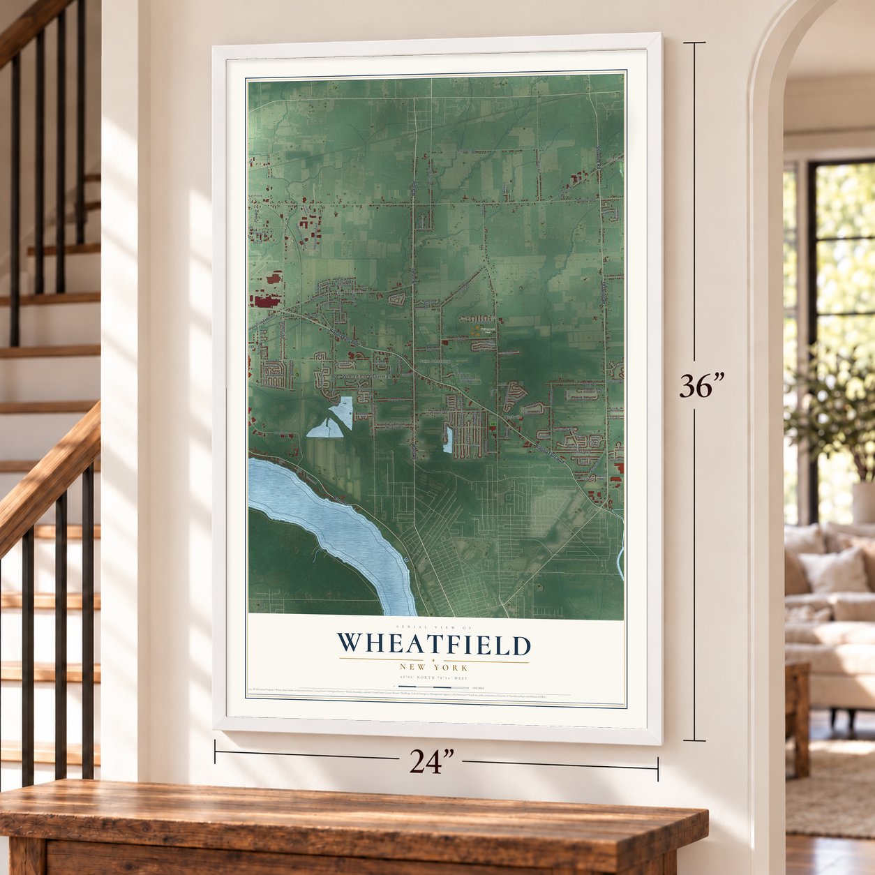
A new map of Wheatfield, New York, made in 2026 and printed to order on thick archival matte paper.
12" x 18" Archival Matte Print
A Map of Home. A Work of Art.
Bring a piece of Wheatfield home. Whether it’s where you grew up, your current home, or simply a moment in your life, this Wheatfield, New York map print brings those memories to your wall. Antique-inspired styling and modern geographic detail combine to create artwork that’s beautiful from across the room, with plenty to study and explore when you get up close.
Three ways to hang it
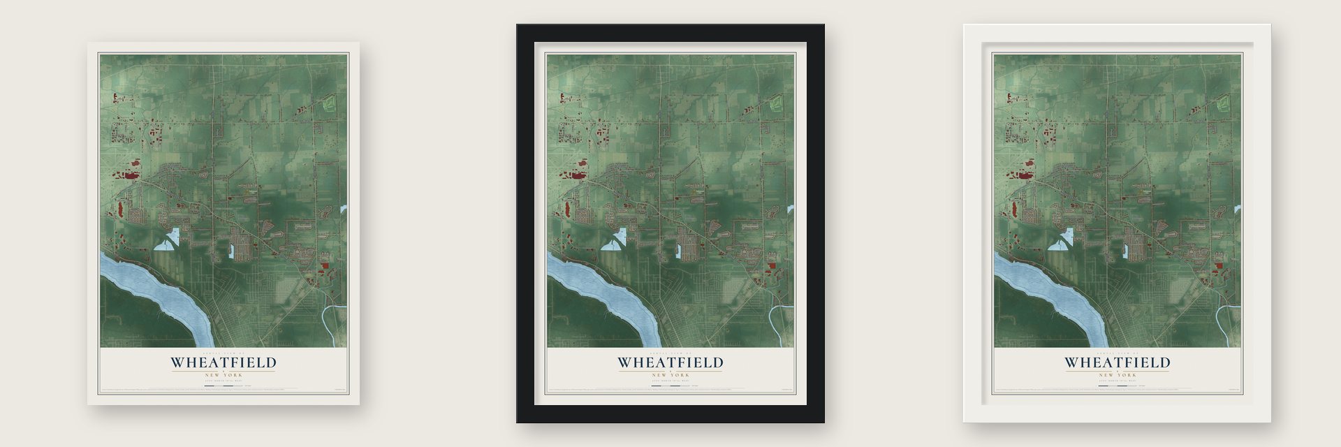
Unframed archival matte, a black wood frame or a white wood frame.
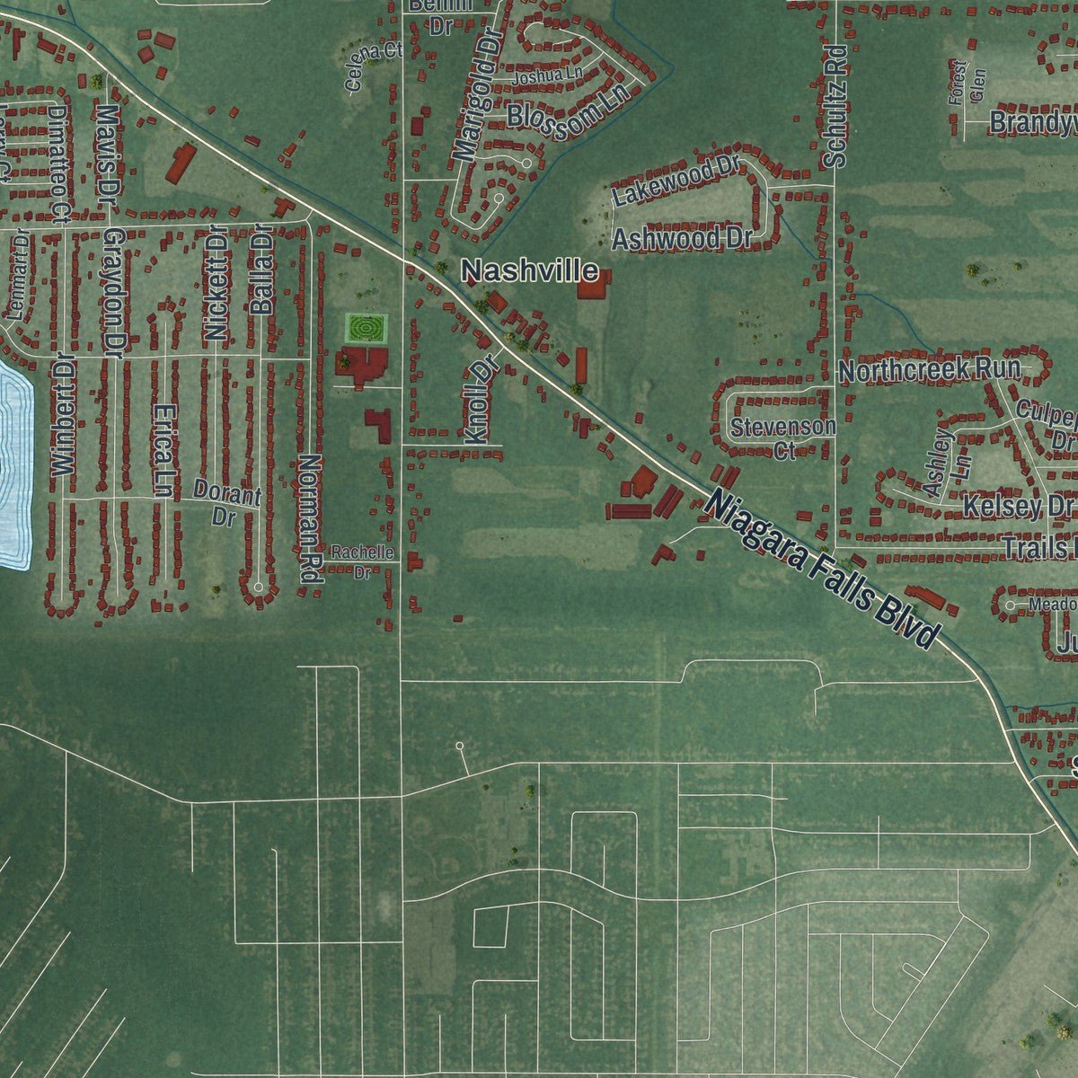
Up close
Real geography. Art worth displaying.
This map was created using accurate cartographic data and authoritative geographic sources, including the U.S. Geological Survey (USGS) and FEMA. The map brings together terrain, waterways, roads, and building detail. The majority of the streets are labeled, houses are accurately depicted, and the topography is derived from government sources. Combining local data with carefully composed color and shading leads to this beautifully detailed Wheatfield artwork for your wall.
Rather than simply showing street outlines, we’ve included as many of the street names as we could reasonably fit on the map while keeping their names legible. Zoom in on the high resolution preview to see exactly what’s on the map. We truly set out to create a statement piece for anyone who loves Wheatfield. So whether it’s for you, or a gift for someone you love, we hope this map of Wheatfield brings back fond memories.
Explore the full map of Wheatfield, New York and read about the local places it shows.

About Wheatfield, New York
Established in 1836 from the Town of Niagara, Wheatfield is a Niagara County town whose name reflects its historically wheat-friendly clay loam. The Niagara River forms part of its western boundary, while named communities include Bergholz, Shawnee, St. Johnsburg, Walmore, Hoffman, and Nashville. Its population reached 18,638 in 2020.
- First Town MeetingWheatfield's first town meeting took place on June 6, 1836, in the District No. 7 schoolhouse near the town's northern line.
- German SettlementsBeginning in 1843, German immigrants established Bergholz, St. Johnsburg, Walmore, Martinsville, and Gratwick in the area.
- Aerospace IndustryBell Aircraft operated in Wheatfield during World War II and later contributed the Apollo Lunar Module propulsion system before its facility closed in 1990.
- Four North-South RoutesNiagara Falls Boulevard, River Road, Shawnee Road, and Ward Road cross different parts of Wheatfield as major north-south corridors.
- Land and WaterWheatfield covers 28.6 square miles, including 27.9 square miles of land and 0.7 square miles of water.
Find your street
Names on the Wheatfield map
Every name below is printed on this map. Look for your street, your school, the park where you played, or the pond down the road.
Places and landmarks9
- Wheatfield Town Hall
- Hoffman
- Shawnee
- Walmore
- Fairmount Park
- Bergholtz
- Nashville
- Saint Johnsburg
- Sawyer
Streets and roads153
- Ward Road
- Niagara Falls Boulevard
- Shawnee Road
- River Road
- Hoover Road
- 102nd Street
- Niagara Road
- Lockport Road
- Townline Road
- Nash Road
- Walmore Road
- Errick Road
- Williams Road
- Raymond Road
- Liberty Drive
- Mapleton Road
- Witmer Road
- Cayuga Drive Extended
- Sy Road
- Jagow Road
- Forest Parkway
- Krueger Road
- Schultz Road
- Plaza Drive
- Inducon Drive West
- Lancelot Drive
- Moyer Road
- Steig Road
- Lakeside Drive
- Baer Road
Show all 153 streets
- Wildwing Drive
- Trails End Lane
- Balla Drive
- Inducon Drive East
- Klemer Road
- Winbert Drive
- Slusaric Road
- Graydon Drive
- Hill Road
- Loveland Road
- Norman Road
- Marigold Drive
- Luther Street
- Stenzel Avenue
- Utzig Drive
- Homeyer Road
- Ferchen Street
- Brandywine Road
- Cayuga Street
- Washington Street
- Stoelting Drive
- Marc Drive
- Nickett Drive
- Ashwood Drive
- Lockport Avenue
- Erica Lane
- Kelsey Drive
- Cory Drive
- Deborah Lane
- Walck Drive
- Rohr Street
- Parkside Drive
- Otis Drive
- Pearce Road
- Ent Avenue
- Lemke Drive
- Fritz Road
- Timberlink Road
- Danielle Drive
- Crescent Drive
- Hunt Street
- Rebecca Drive
- Sawyer Drive
- Craig Drive
- Northcreek Run
- Kinross Street
- Flint Avenue
- Blossom Lane
- Ontario Drive
- Katherine Drive
- Julie Court
- Krug Avenue
- Mavis Drive
- Wilrose Court
- Maple Drive
- Brent Drive
- Arnold Drive
- 103rd Street
- Spice Court
- Elaine Drive
- Knoll Drive
- Culpepper Drive
- Old Falls Boulevard
- Stevenson Court
- Woodland Court North
- Lakewood Drive
- Dorant Drive
- Tawny Drive
- Crasandan Lane North
- Knottingwood Drive
- Sunset Drive
- Skylark Lane
- Schultz Street
- Driftwood Drive
- Colleen Terrace
- Colin Court
- Pinelake Drive
- Larry Court
- Ashley Lane
- Hird Street
- Joann Court
- York Road
- Captains Way
- Hidden Ridge Lane
- Stone Ridge
- Dimatteo Court
- Church Road
- Rose Court
- Wagner Drive
- Benhil Drive
- The Square
- Amy Drive
- Wendt Drive
- Patel Drive
- Sage Court
- Lasalle Expressway
- Kirkbridge Drive
- Lake Mead Road
- Wurl Street
- Lenmart Drive
- Reynolds Road
- Celena Court
- Sylvan Place
- Lendell Drive
- Village Drive
- Deuro Drive
- Brian Lane
- Thornwoods Drive
- Meadowbrook Acres
- Woodland Court South
- Commerce Drive
- Osprey Lane
- Inducon Corporate Drive
- Milleville Circle
- Joshua Lane
- Forest Lake Drive
- Alder Creek Drive North
- Shawn Court
- Nickis Lane
- Rachelle Drive
- Forest Glen
- Violet Circle
- Rock Dove Lane
Names are listed as they appear on the printed map. Zoom into the product photos to find them.
The art of mapping a place
How This Map Was Made
Real places. Remarkable detail. Discover the layers that turn geographic data into a map of home.

The view from above
Aerial imagery reveals the character of the land: woodland, open fields, and the patterns of a place.

The shape of the land
Elevation data brings hills, valleys, and subtle changes in the landscape into view.

The details of home
Roads, waterways, and building footprints come together to make the map feel unmistakably local.

Geography becomes art
Considered color, shading, and typography bring the layers together in a map made for your wall.


Process illustrated with Mendon, Massachusetts. Aerial imagery: USDA NAIP. Terrain: USGS 3D Elevation Program. Map details and finished artwork: KNOWOL.
The Details
About This Print
Choose an archival matte print, or a black or white Ayous wood frame. The archival matte print is unframed.
Select your size and finish above to see the matching product image and price.
Materials & Craftsmanship
A contemporary map with the character of a classic atlas, printed on archival matte paper. Optional frames are made from Ayous wood.
Your printed map does not include the watermark shown in the full-map preview.
Shipping & Delivery
Free shipping within the United States. Every print is made to order in the USA.
Buying a gift? Add a note in your cart and we'll include it. We never put prices in the package.
Prints ship within 2 to 3 business days. Allow 7 to 10 days total from ordering for delivery. Timing may vary during holidays or periods of high order volume.
Read our shipping policy.
Returns and damaged prints
Each print is made to order. Change-of-mind refunds are not available after production.
If your print arrives damaged, misprinted or incorrect, contact support@knowol.com within 30 days of receiving it. Include your order number, photos and a description of the issue.
Read our full refund and replacement policy. For questions about your order, email support@knowol.com.
Find your town
Looking for another city?
Find a map of home in our New York collection.
Nearby
Maps of towns near Wheatfield
Know someone from one of these towns? Their map makes a great gift.


