


Search for another town





Free U.S. delivery 7 to 10 days after you order
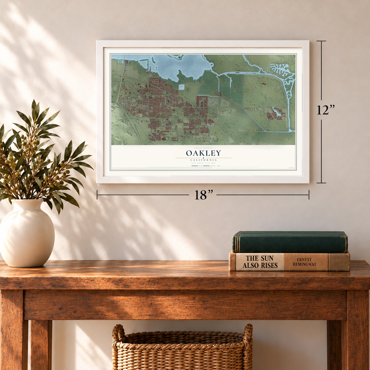
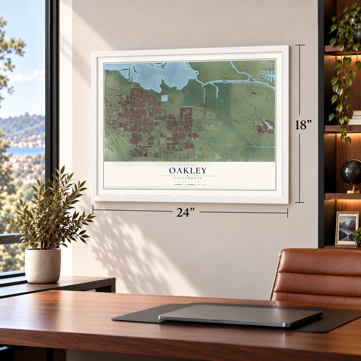
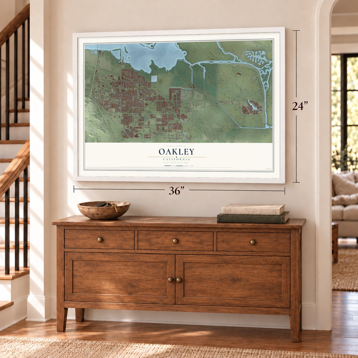
Oakley, California Map Art
Building by building, with labeled streets and shaded relief.
12" x 18" Archival Matte Print
A Map of Home. A Work of Art.
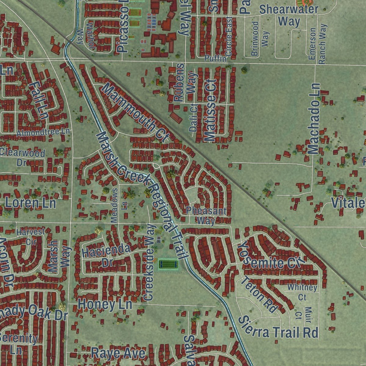
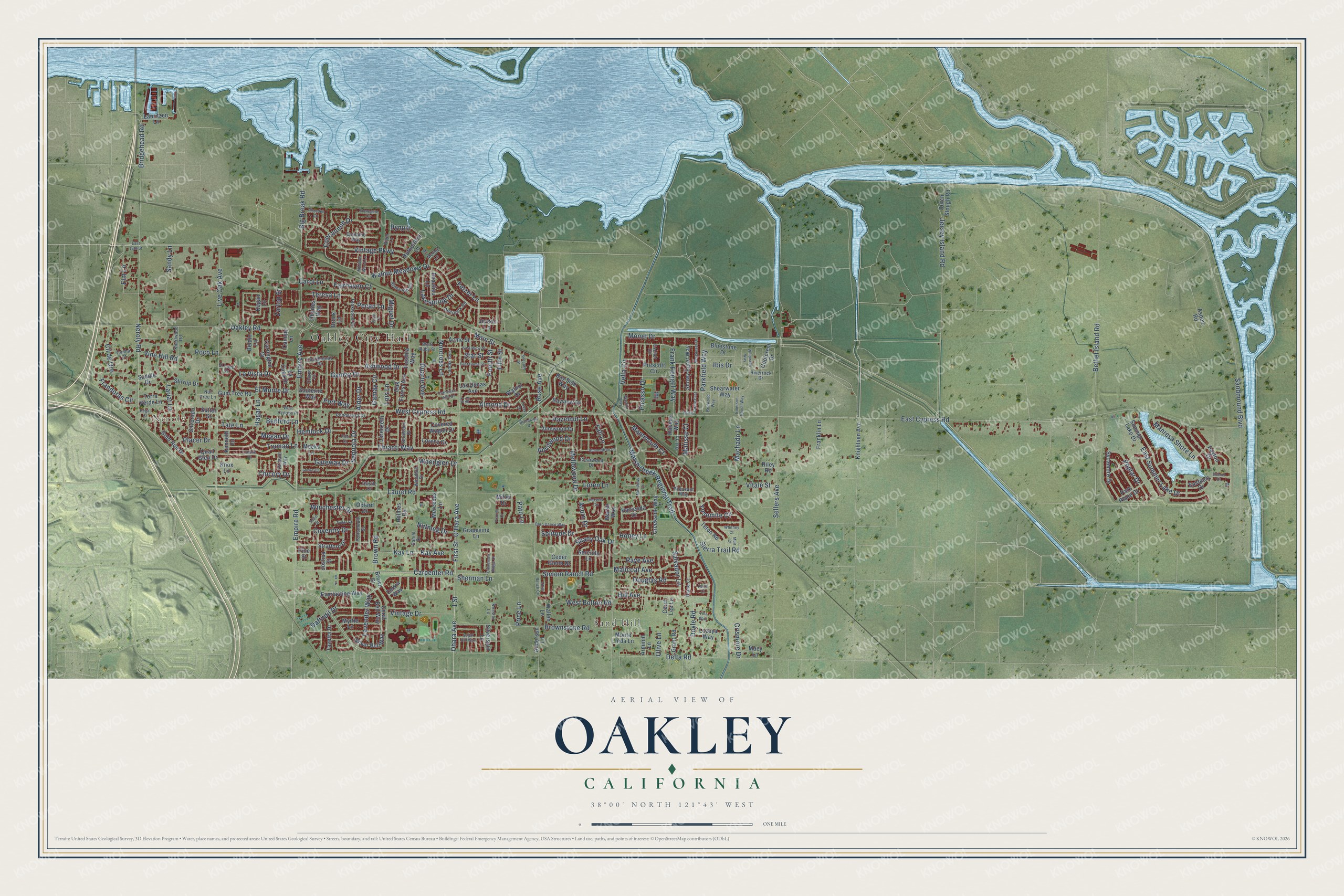
Explore Oakley, California from a whole new perspective. Created using aerial imagery and detailed geographic data, this map captures Oakley building by building, with labeled streets, familiar landmarks, and shaded topographical relief that highlights the natural contours of the landscape.
Combining modern data with the timeless character of a vintage atlas, this map is just as interesting up close as it is beautiful on the wall. Whether you grew up in Oakley, spent memorable years there, or call it home today, this unique map is a great way to celebrate a place that means something to you. Zoom in on the preview to look for your street, and then order a print to put your memories on the wall.
Three ways to hang it
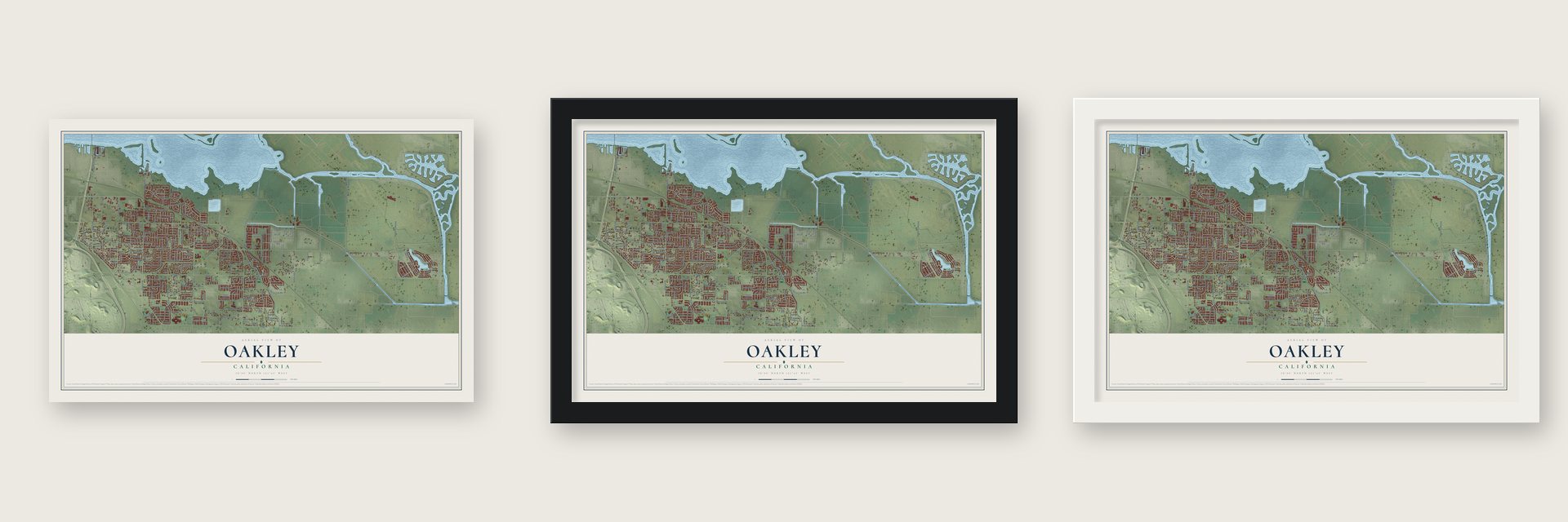
Unframed archival matte, a black wood frame or a white wood frame.
Up close
Geography Worth Displaying
This map was created using accurate cartographic data and authoritative geographic sources, including the U.S. Geological Survey and the Census Bureau. The map brings together terrain, waterways, roads, and building detail. The majority of the streets are labeled, houses are accurately depicted, and the topography is derived from government sources. Combining local data with carefully composed color and shading leads to this beautifully detailed Oakley artwork for your wall.
Rather than simply showing street outlines, we’ve included as many of the street names as we could reasonably fit on the map while keeping their names legible. Zoom in on the high resolution preview to see exactly what’s on the map. We truly set out to create a statement piece for anyone who loves Oakley. So whether it’s for you, or a gift for someone you love, we hope this map of Oakley brings back fond memories.
Read the story behind this map of Oakley, California from 2026.

Find your street
Names on the Oakley map
Every name below is printed on this map. Look for your street, your school, the park where you played, or the pond down the road.
Places and landmarks3
- Oakley City Hall
- Neroly
- Sand Hill
Streets and roads261
- Neroly Road
- Main Street
- Monet Drive
- Bridgehead Road
- Frank Hengel Way
- Frandoras Circle
- Parkfield Way
- Walnut Meadows Drive
- Gamay Drive
- West Bolton Road
- Miguel Drive
- East Cypress Road
- Laurel Road
- Sellers Avenue
- Empire Avenue
- Oakley Road
- West Cypress Road
- Carpenter Road
- Marsh Creek Regional Trail
- First Street
- O'Hara Avenue
- Ohara Avenue
- Empire Road
- Live Oak Avenue
- Jersey Island Road
- Vintage Parkway
- Rose Avenue
- Bethel Island Road
- Brown Road
- East Summer Lake Drive
Show all 261 streets
- Delta Road
- Brownstone Road
- 1 Street
- Carol Lane
- Big Break Road
- Lavender Way
- Sandmound Boulevard
- Chianti Way
- Malicoat Avenue
- Sequoia Drive
- Winchester Drive
- Vintage Drive
- Lariat Lane
- Concannon Drive
- Solitude Drive
- Truman Lane
- Daffodil Drive
- Mellowood Drive
- Sandy Lane
- Machado Lane
- Simoni Ranch Road
- Fetzer Lane
- Kay Avenue
- Kay Lane
- Manresa Shore Lane
- Yosemite Circle
- Almond Drive
- La Vista Drive
- Megan Drive
- Honey Lane
- Loren Lane
- Hill Avenue
- Shady Oak Drive
- Picasso Drive
- Woodglen Drive
- El Monte Drive
- Lakespring Drive
- Ibis Drive
- Douglas Road
- Ashwood Drive
- Duarte Avenue
- Vella Circle
- Norcross Lane
- Sierra Trail Road
- Gamay Circle
- Doyle Road
- Salvador Lane
- Port Way
- Gateway Drive
- Elm Lane
- Teresa Lane
- Crismore Drive
- Hazelnut Lane
- Hagar Lane
- Placer Drive
- Zartop Street
- Poplar Drive
- Cll de Oro
- Mammouth Court
- Fourth Street
- Bynum
- Nutmeg Drive
- Coventry Drive
- Anvilwood Drive
- Bedford Lane
- Tate Lane
- Star Street
- Vine Hill Road
- Vitale Street
- Raye Avenue
- Sherman Lane
- Fairhaven Court
- Fall Lane
- Matisse Court
- Alder Drive
- Fifth Street
- Lois Lane
- Hemlock Drive
- Chicory Drive
- Poco Lane
- Pecan Lane
- Price Lane
- Acorn Drive
- Olive Lane
- Pato Lane
- Dutch Slough Road
- Coolcrest Drive
- Shearwater Way
- Rutherford Lane
- Holmes Road
- Bay Side Way
- Walnut Drive
- Teton Road
- Coral Bell Way
- Prescott Circle
- Gold Run Drive
- Everlasting Way
- Sycamore Drive
- Park Place Drive
- Silver Bell Way
- Lozoya Way
- Stirrup Drive
- Bluestone Drive
- Carrington Drive
- Snowy Egret Way
- Oak Forest Avenue
- Jordan Lane
- Summer Lake Drive
- Knightsen Avenue
- Creekside Way
- Stratford Drive
- Gum Tree Road
- Myrtle Lane
- Acme Street
- Bayview Drive
- Tazetta Drive
- Grapevine Lane
- Carol Lee Lane
- Mercedes Lane
- Covered Wagon Drive
- Lorenzetti Drive
- Vinewood Drive
- Beaulieu Lane
- Hacienda Drive
- Serenity Lane
- Franklin Lane
- La Casa Drive
- Silverado Drive
- Ceder Glenn Drive
- Terra Verde Lane
- Fuschia Way
- Canopy Lane
- Charles Way
- Meeks Lane
- Beldin Lane
- Quail Glen Drive
- Silverspur Lane
- Wallen Lane
- Grant Road
- Anderson Lane
- Lorenz Drive
- Marsh Way
- Eastport Drive
- Oxford Drive
- Las Dunas Avenue
- Sauterne Way
- Monte Linda Lane
- Lauritzen Lane
- Joshua Street
- Kenneth Lane
- Arminio Lane
- Macy Lane
- Saddle Drive
- Sutter Street
- Rubens Way
- Kegan Lane
- Knox Lane
- Payton Drive
- Brown Street
- Riley Road
- Aspen Road
- Celsia Way
- Brock Lane
- Miller Drive
- Pine Street
- Portsmouth Street
- Fig Lane
- Teakwood Drive
- Clearwood Drive
- El Lago Drive
- Stony Hill Circle
- Chardonnay Drive
- Merlot Lane
- West Ruby Street
- Deerpark Road
- Bordeaux Drive
- Ponderosa Drive
- Knarlwood Road
- Domaine Way
- Woodhill Drive
- Piper Lane
- Richard Way
- Daniel Drive
- Landis Avenue
- Kessler Lane
- Riverrock Drive
- Pheasant Way
- Escher Circle
- Cunha Court
- Nut Tree Lane
- Diane Court
- Dali Court
- Thistle Court
- Claret Court
- East 18th Street
- Willowrun Way
- Puffin Circle East
- Merganser Drive
- Warhol Way
- Harvest Circle
- Stonegate Circle
- Little Ranch Circle
- Brinwood Way
- Almaden Circle
- Susie Street
- East Home Street
- Meadows Lane
- Barn Dance Way
- East Ruby Street
- Almondtree Lane
- Sugar Hill Way
- Frazier Drive
- West Cypress Place
- Emerson Ranch Way
- Biacalana Drive
- Francisco Villa Drive
- Cinnamon Ridge Drive
- Meadow Wood Lane
- Whitney Court
- Seventh Street
- Locke Court
- Tudor Court
- Sonnet Court
- Connie Court
- Yula Way
- Tokay Drive
- Pine Court
- Muir Court
- Regal Court
- Keith Court
- Pitta Court
Names are listed as they appear on the printed map. Zoom into the product photos to find them.
About Oakley, California
Oakley is a city of 43,357 people in Contra Costa County, with the Sacramento-San Joaquin Delta along its northern edge. Bay Miwok people, whom Spanish explorers called the Julpunes or Pulpunes, lived in this part of the west delta from about 1100 to 1770. The De Anza expedition crossed into what is now Oakley. It could not find a way through the tule swamps to the Sierra, so it turned back to Monterey.
Town founder Randolph C. Marsh wanted to call the place Dewey, after Admiral George Dewey's win at Manila Bay. His friend Joel D. Wightman liked Oakley better, for the meadows and oaks, and the two men settled it over a game of cribbage. Oakley won, and the first post office opened under that name in 1898. The town became a city in 1999, the newest one in Contra Costa County.
“Apricots ripen earlier in Oakley than in any other section, on account of the sandy soil, and these apricots are in great demand in the Eastern States.”
- Streets that spell MarshMarsh lost the naming contest, but he still left his name downtown. He chose the street names, and the first letters of Main, Acme, Ruby, Star and Home spell Marsh.
- Zinfandel countryPortuguese and Italian immigrants liked the climate here and planted thousands of acres of grapes starting in the late 1800s. Oakley still has about 700 acres of vineyards, and nearly 80 percent of them grow Zinfandel. The harvest comes to at least 2,000 tons a year, and the grapes go to local wineries.
- An ancient burial moundEarly in the 20th century, a large shell mound was found near what is now the town's eastern edge. Building has since destroyed many old village sites, so the Archaeological Conservancy bought one site, known as Simone Mound, to save it for study. Its burials date from around 1000 A.D.
- A rapper and a dancerPhife Dawg, the rapper from A Tribe Called Quest, moved to Oakley from New York. Lisa Joann Thompson, a dancer and actress who starred in In Living Color, lived here during her high school years.
Keep exploring California
Oakley is one of 1,990 California towns we've mapped. Every dot on the map is a print of its own.
The search covers every state, California first.
Near Oakley
Order 2 or more town maps and save 10%. Shown in the size and finish you picked above, so they hang as a set.
- Knightsen 12" x 18" / Archival Matte Print $39.99
- Bethel Island 12" x 18" / Archival Matte Print $39.99
- Brentwood 12" x 18" / Archival Matte Print $39.99


More maps nearby: Antioch, Discovery Bay, Byron, Pittsburg and Isleton.
The art of mapping a place
How This Map Was Made
Real places. Remarkable detail. Discover the layers that turn geographic data into a map of home.

The view from above
Aerial imagery reveals the character of the land: woodland, open fields, and the patterns of a place.

The shape of the land
Elevation data brings hills, valleys, and subtle changes in the landscape into view.

The details of home
Roads, waterways, and building footprints come together to make the map feel unmistakably local.

Geography becomes art
Considered color, shading, and typography bring the layers together in a map made for your wall.


Process illustrated with Mendon, Massachusetts. Aerial imagery: USDA NAIP. Terrain: USGS 3D Elevation Program. Map details and finished artwork: KNOWOL.
The Details
About This Print
Choose an archival matte print, or a black or white Ayous wood frame. The archival matte print is unframed.
Select your size and finish above to see the matching product image and price.
Materials & Craftsmanship
A contemporary map with the character of a classic atlas, printed on archival matte paper. Optional frames are made from Ayous wood.
Your printed map does not include the watermark shown in the full-map preview.
Shipping & Delivery
Free shipping within the United States. Every print is made to order in the USA.
Buying a gift? Add a note in your cart and we'll include it. We never put prices in the package.
Prints ship within 2 to 3 business days. Allow 7 to 10 days total from ordering for delivery. Timing may vary during holidays or periods of high order volume.
Read our shipping policy.
Returns and damaged prints
Each print is made to order. Change-of-mind refunds are not available after production.
If your print arrives damaged, misprinted or incorrect, contact support@knowol.com within 30 days of receiving it. Include your order number, photos and a description of the issue.
Read our full refund and replacement policy. For questions about your order, email support@knowol.com.