


Search for another town





Free U.S. delivery 7 to 10 days after you order
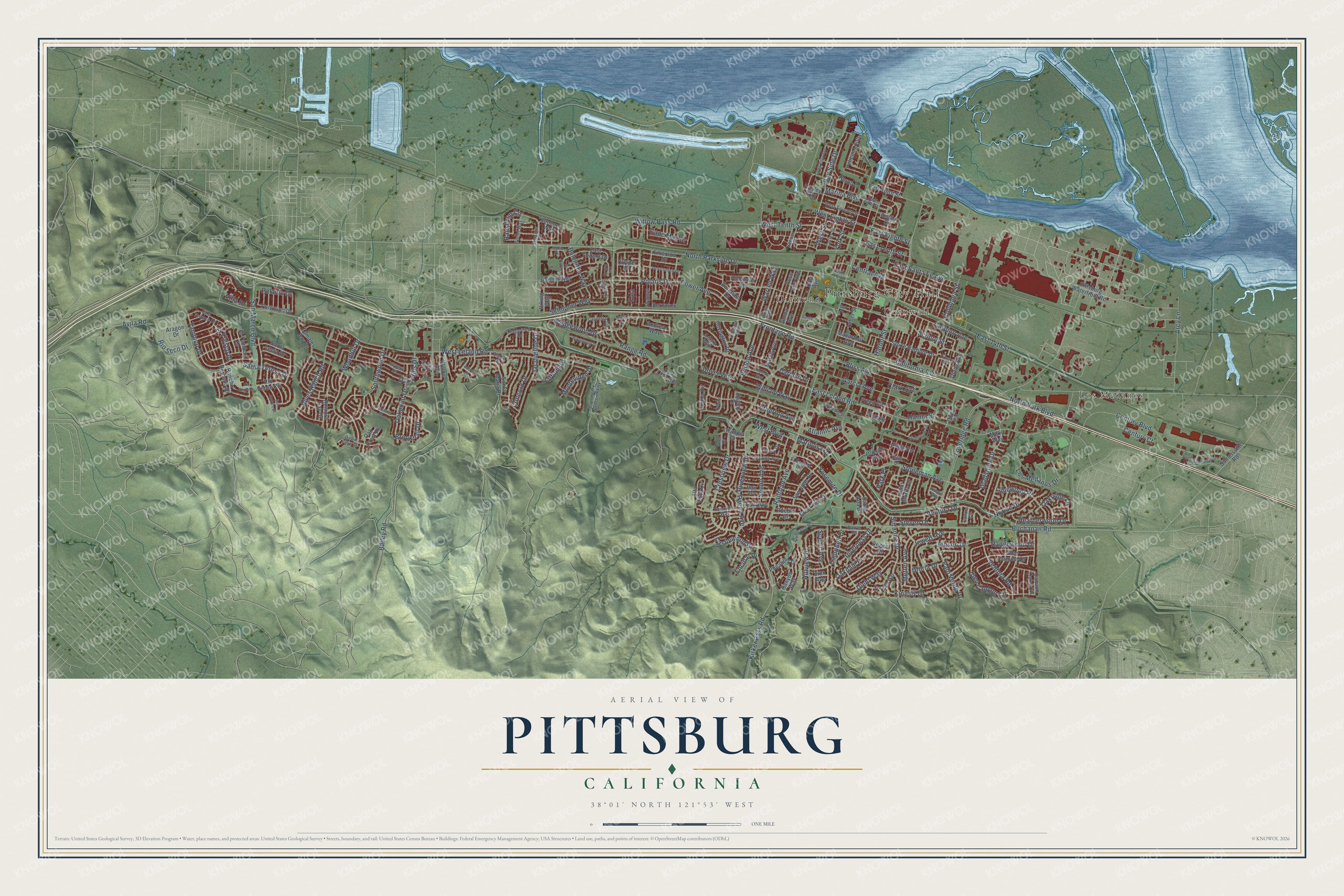
Pittsburg, California Map Art
Building by building, with labeled streets and shaded relief.
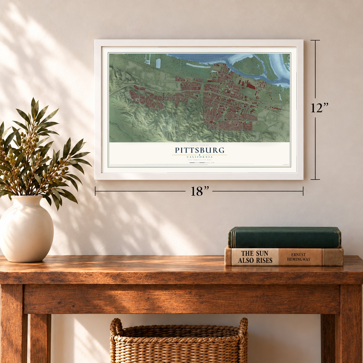
12" x 18" Archival Matte Print
A Map of Home. A Work of Art.
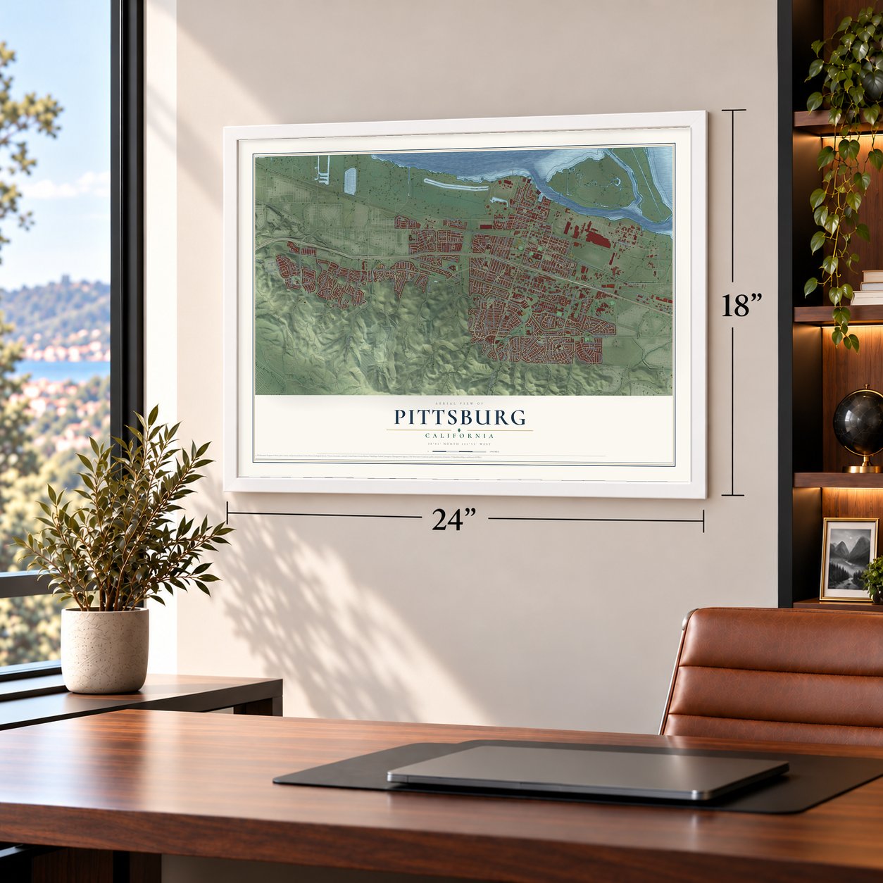
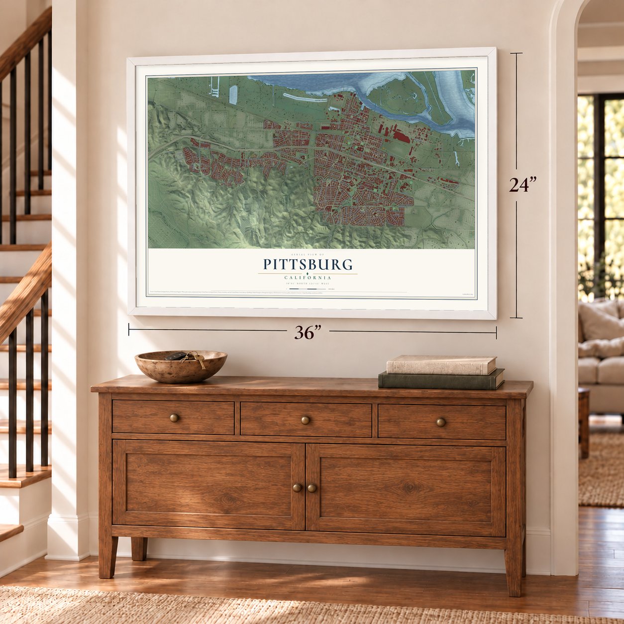
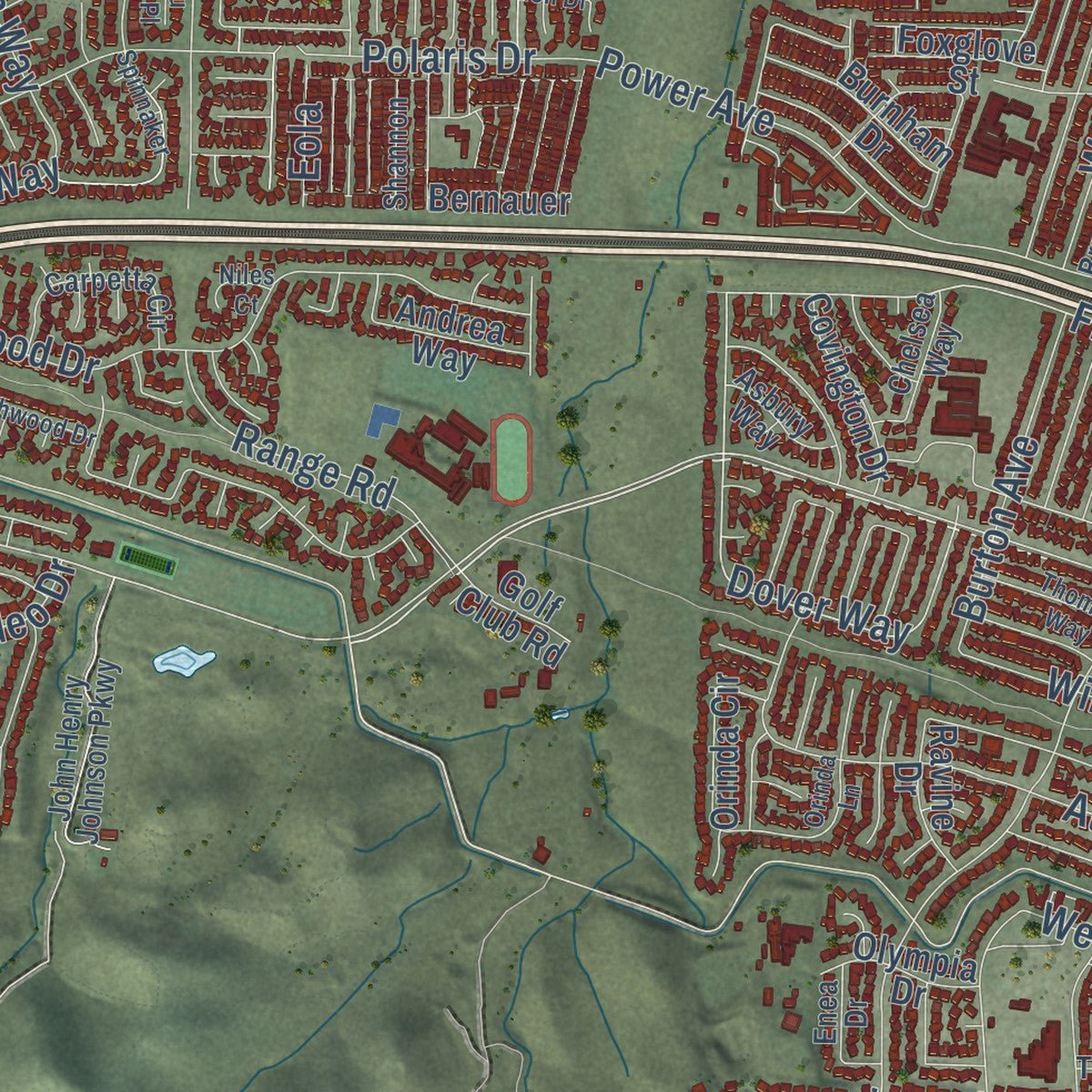
Explore Pittsburg, California from a whole new perspective. Created using aerial imagery and detailed geographic data, this map captures Pittsburg building by building, with labeled streets, familiar landmarks, and shaded topographical relief that highlights the natural contours of the landscape.
Combining modern data with the timeless character of a vintage atlas, this map is just as interesting up close as it is beautiful on the wall. Whether you grew up in Pittsburg, spent memorable years there, or call it home today, this unique map is a great way to celebrate a place that means something to you. Zoom in on the preview to look for your street, and then order a print to put your memories on the wall.
Three ways to hang it
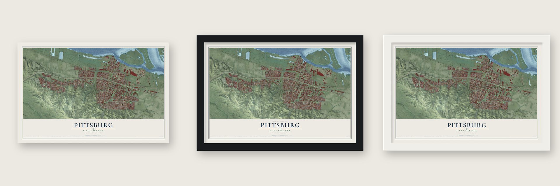
Unframed archival matte, a black wood frame or a white wood frame.
Up close
Geography Worth Displaying
This map was created using accurate cartographic data and authoritative geographic sources, including the U.S. Geological Survey and the Census Bureau. The map brings together terrain, waterways, roads, and building detail. The majority of the streets are labeled, houses are accurately depicted, and the topography is derived from government sources. Combining local data with carefully composed color and shading leads to this beautifully detailed Pittsburg artwork for your wall.
Rather than simply showing street outlines, we’ve included as many of the street names as we could reasonably fit on the map while keeping their names legible. Zoom in on the high resolution preview to see exactly what’s on the map. We truly set out to create a statement piece for anyone who loves Pittsburg. So whether it’s for you, or a gift for someone you love, we hope this map of Pittsburg brings back fond memories.
Read the story behind this map of Pittsburg, California from 2026.

Find your street
Names on the Pittsburg map
Every name below is printed on this map. Look for your street, your school, the park where you played, or the pond down the road.
Places and landmarks4
- Pittsburg City Hall
- Cornwall
- Diamond
- Los Medanos
Streets and roads215
- Frontage Road
- Bliss Avenue
- Dover Way
- East Leland Road
- West Leland Road
- North Park Boulevard
- Railroad Avenue
- Willow Pass Road
- Oakdale Place
- North Parkside Drive
- West Eighth Street
- Brooktrail Drive
- Harbor Street
- Loveridge Road
- Buchanan Road
- California Avenue
- Crestview Drive
- East 14th Street
- Bailey Road
- Century Boulevard
- Power Avenue
- Ventura Drive
- Marina Boulevard
- Polaris Drive
- Woodhill Drive
- Central Avenue
- Wedgewood Drive
- Range Road
- Santa Teresa Drive
- Stoneman Avenue
Show all 215 streets
- Garcia Avenue
- School Street
- Atherton Avenue
- Los Medanos Drive
- San Marco Boulevard
- Jacqueline Drive
- Tampico Drive
- Alves Ranch Road
- Arcy Lane
- Gladstone Drive
- East Eighth Street
- Kingsly Drive
- West Tenth Street
- Bay Side Drive
- Jewett Avenue
- William Way
- Jensen Drive
- Suzanne Drive
- Ventura Road
- Carpino Avenue
- Seeno Avenue
- Rangewood Drive
- Villa Drive
- Hillview Drive
- East Santa Fe Avenue
- Southwood Drive
- Riverview Drive
- Metten Avenue
- Rio Seco Drive
- Glen Canyon Circle
- Limewood Place
- Diehl Way
- Yosemite Drive
- Schooner Way
- Norine Drive
- Oak Hills Drive
- Palo Verde Drive
- East Tenth Street
- Heatherwood Drive
- Burton Avenue
- Oakpoint Drive
- West Street
- Clark Avenue
- Castlewood Drive
- Concord Drive
- Oakridge Lane
- Cape May Drive
- Warren Way
- West Boulevard
- Inverness Drive
- Rain Drop Circle
- Columbia Street
- Pacini Avenue
- Montevideo Drive
- Avila Road
- Kirker Pass Road
- Balclutha Way
- Campbell Drive
- Century Court
- Atlantic Avenue
- Daffodil Drive
- Steven Drive
- York Street
- El Fresco Drive
- Scenic Avenue
- Hanna Street
- Mariposa Drive
- Palacio Drive
- Gloria Drive
- Carolyn Drive
- Encinal Place
- Eola
- Park Place
- Pittsburg Waterfront Road
- Rancho Bernado Drive
- Glen Canyon Drive
- Emerson Drive
- East Third Street
- Tomales Bay Drive
- Alta Vista Circle
- Santa Lucia Drive
- Rio Verde Circle
- Freed Circle
- Canyon Oaks Circle
- Heron Drive
- East Trident Drive
- San Juan Drive
- Avalon Circle
- Davi Avenue
- Pelican Loop
- Jimno Avenue
- Rose Ann Avenue
- Stone Harbour Drive
- Viking Way
- Brookside Drive
- Orinda Circle
- Pheasant Drive
- Aragon Drive
- Santa Maria Drive
- Romora Bay Drive
- Santa Ana Drive
- Hanlon Way
- Dias Circle
- Macarthur Avenue
- Marsh Avenue
- Saint Moritz Drive
- Covington Drive
- Portofino Drive
- Burnham Drive
- Willow Avenue
- Andrea Way
- Summer Way
- Somersville Road
- Oak Crest Place
- Canyon Way
- El Tambor Drive
- Pueblo Drive
- Olympia Drive
- Ravine Drive
- Diane Avenue
- Lois Avenue
- Foxglove Street
- Kings Road
- Regent Drive
- Bernauer
- Leber Street
- Milky Way
- Queens Way
- Zion Avenue
- Golf Club Road
- Clipper Drive
- Hasley Way
- Sugartree Drive
- Cutter Street
- El Dorado Drive
- John Henry Johnson Parkway
- Bruno Avenue
- Oak Hills Circle
- Villa Terrace Drive
- Carpetta Circle
- West Seventh Street
- Foothill Way
- Sandra Circle
- Beacon Street
- Lorraine Avenue
- Barrie Drive
- Mae Avenue
- Winter Way
- Lynbrook Drive
- Sunnyhill Way
- Chelsea Way
- Westgate Drive
- Seasons Drive
- Quercus Lane
- Presidio Lane
- Asbury Way
- Tiffany Drive
- Shannon
- Dawn View Court
- Palm Drive
- East Fifth Street
- Enea Drive
- Alamo Court
- Delta Gateway Boulevard
- Fieldgate Drive
- San Andres Drive
- Spinnaker
- Bayberry Circle
- River View Park Drive
- Linda Vista Avenue
- Trident Drive
- Jack London Drive
- Rio Verde Drive
- Birchwood Drive
- Thomas Way
- Marlin Drive
- Lou Ann Place
- Natalie Way
- Center Drive
- Orinda Lane
- Adobe Place
- Niles Court
- Oak Place
- Cross Street
- Leslie Drive
Names are listed as they appear on the printed map. Zoom into the product photos to find them.
About Pittsburg, California
Pittsburg is a city of 76,416 people in Contra Costa County, on the south shore of Suisun Bay. In 1839 Governor Juan Bautista Alvarado granted Rancho Los Méganos, almost 10,000 acres, to the brothers Jose Antonio and Jose Miguel Mesa. During the gold rush in 1849, Colonel Jonathan D. Stevenson of New York bought the rancho as an investment. He planned a town on the land and named it New York of the Pacific, and Lieutenant William Tecumseh Sherman drew its first streets on the west side. Schooners sailing from San Francisco to the gold country stopped here halfway.
On April 17, 1850, the county court split Contra Costa into three townships, and this one was named New York. Coal was found at nearby Nortonville in 1859, so the Black Diamond Coal Mining Company built a railroad down to docks here. That boom lasted until 1885. The town incorporated in 1903, and its voters named it Black Diamond after the coal company. Because the site looked ready for industry, a change to Pittsburg was proposed in 1909, and city officials made it official on February 11, 1911.
- Ten canneries by 1882Commercial fishing took hold in the 1870s, when the Black Diamond Cannery opened at the lower end of Los Medanos Street. Ten canneries lined the Delta by 1882. Sicilian immigrants made up most of the fishing families, and they built the biggest Delta fishing community in California. Their trade ran the waterfront until the State of California closed the Delta to commercial fishing in 1957.
- A steel town from 1910C.A. Hooper bought the old land grant in 1900 and started the Industrial Center of the West in 1903. He gave land to the Columbia Steel Company, which opened its plant here in 1910 with one foundry and 60 workers. The mill joined U.S. Steel in 1930 and reached 5,200 employees in the early 1950s. In 1986 a $450 million joint venture with Pohang Iron and Steel turned it into USS-POSCO Industries.
- Camp Stoneman, 1942The Army built Camp Stoneman here in 1942. Troops gathered there before shipping out during World War II and the Korean War, and the camp kept that role until 1954.
- The California TheatreThe California Theatre opened in 1920 with live vaudeville and silent films, and cowboy stars Tex Ritter and Tim Holt appeared there. It closed in 1954 and fell into decay. A $7.6 million renovation in 2008 and a $2 million restoration in 2022 brought back its 981 seats and grand balcony.
Keep exploring California
Pittsburg is one of 1,990 California towns we've mapped. Every dot on the map is a print of its own.
The search covers every state, California first.
Near Pittsburg
Order 2 or more town maps and save 10%. Shown in the size and finish you picked above, so they hang as a set.
- Bay Point 12" x 18" / Archival Matte Print $39.99
- Clayton 12" x 18" / Archival Matte Print $39.99
- Antioch 12" x 18" / Archival Matte Print $39.99


More maps nearby: Concord, Clyde, North Gate, Pacheco and Vine Hill.
The art of mapping a place
How This Map Was Made
Real places. Remarkable detail. Discover the layers that turn geographic data into a map of home.

The view from above
Aerial imagery reveals the character of the land: woodland, open fields, and the patterns of a place.

The shape of the land
Elevation data brings hills, valleys, and subtle changes in the landscape into view.

The details of home
Roads, waterways, and building footprints come together to make the map feel unmistakably local.

Geography becomes art
Considered color, shading, and typography bring the layers together in a map made for your wall.


Process illustrated with Mendon, Massachusetts. Aerial imagery: USDA NAIP. Terrain: USGS 3D Elevation Program. Map details and finished artwork: KNOWOL.
The Details
About This Print
Choose an archival matte print, or a black or white Ayous wood frame. The archival matte print is unframed.
Select your size and finish above to see the matching product image and price.
Materials & Craftsmanship
A contemporary map with the character of a classic atlas, printed on archival matte paper. Optional frames are made from Ayous wood.
Your printed map does not include the watermark shown in the full-map preview.
Shipping & Delivery
Free shipping within the United States. Every print is made to order in the USA.
Buying a gift? Add a note in your cart and we'll include it. We never put prices in the package.
Prints ship within 2 to 3 business days. Allow 7 to 10 days total from ordering for delivery. Timing may vary during holidays or periods of high order volume.
Read our shipping policy.
Returns and damaged prints
Each print is made to order. Change-of-mind refunds are not available after production.
If your print arrives damaged, misprinted or incorrect, contact support@knowol.com within 30 days of receiving it. Include your order number, photos and a description of the issue.
Read our full refund and replacement policy. For questions about your order, email support@knowol.com.