


Search for another town


Free U.S. delivery 7 to 10 days after you order
Concord, California Map Art
Building by building, with labeled streets and shaded relief.
12" x 18" Archival Matte Print
A Map of Home. A Work of Art.
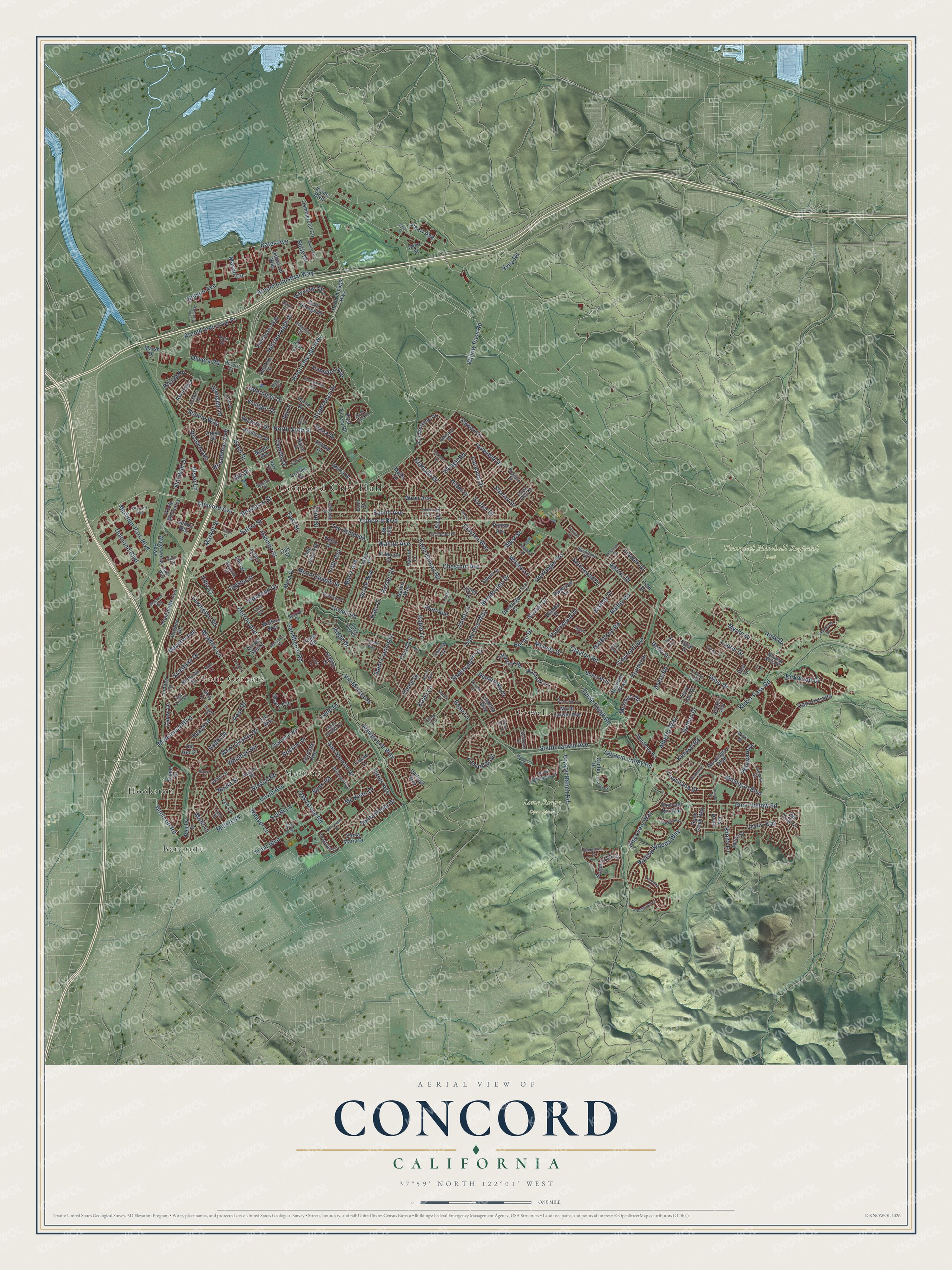
Explore Concord, California from a whole new perspective. Created using aerial imagery and detailed geographic data, this map captures Concord building by building, with labeled streets, familiar landmarks, and shaded topographical relief that highlights the natural contours of the landscape.
Combining modern data with the timeless character of a vintage atlas, this map is just as interesting up close as it is beautiful on the wall. Whether you grew up in Concord, spent memorable years there, or call it home today, this unique map is a great way to celebrate a place that means something to you. Zoom in on the preview to look for your street, and then order a print to put your memories on the wall.
Three ways to hang it

Unframed archival matte, a black wood frame or a white wood frame.
Up close
Geography Worth Displaying
This map was created using accurate cartographic data and authoritative geographic sources, including the U.S. Geological Survey and the Census Bureau. The map brings together terrain, waterways, roads, and building detail. The majority of the streets are labeled, houses are accurately depicted, and the topography is derived from government sources. Combining local data with carefully composed color and shading leads to this beautifully detailed Concord artwork for your wall.
Rather than simply showing street outlines, we’ve included as many of the street names as we could reasonably fit on the map while keeping their names legible. Zoom in on the high resolution preview to see exactly what’s on the map. We truly set out to create a statement piece for anyone who loves Concord. So whether it’s for you, or a gift for someone you love, we hope this map of Concord brings back fond memories.
Read the story behind this map of Concord, California from 2026.

Find your street
Names on the Concord map
Every name below is printed on this map. Look for your street, your school, the park where you played, or the pond down the road.
Places and landmarks8
- Concord City Hall
- Lime Ridge Open Space
- Thurgood Marshall Regional Park
- Bancroft
- Meinert
- Cowell
- Four Corners
- Hookston
Streets and roads320
- Monument Boulevard
- Grant Street
- Concord Avenue
- Pearl Avenue
- Olive Drive
- North Sixth Street
- Limeridge Drive
- Murchio Drive
- Hickory Drive
- Concord Boulevard
- Clayton Road
- Willow Pass Road
- Point Chicago Highway
- Treat Boulevard
- Cowell Road
- Bailey Road
- Ygnacio Valley Road
- Kirker Pass Road
- San Miguel Road
- Minert Road
- Oak Grove Road
- Arnold Industrial Way
- Crystyl Ranch Road
- Alberta Way
- Detroit Avenue
- Ayers Road
- Esperanza Drive
- Turtle Creek Road
- Pine Hollow Road
- Market Street
Show all 320 streets
- Solano Way
- Lynwood Drive
- Salvio Street
- Olivera Road
- San Simeon Drive
- Clayton Way
- Bates Avenue
- Bonifacio Street
- South Larwin Avenue
- Mount Diablo Street
- Farm Bureau Road
- David Avenue
- Myrtle Drive
- Mohr Lane
- Walnut Avenue
- Wilson Lane
- Whitman Road
- Landana Drive
- Denkinger Road
- Glazier Drive
- Rolling Woods Way
- Diamond Boulevard
- Chestnut Avenue
- Laguna Street
- Sunshine Drive
- Meadow Lane
- Mendocino Drive
- Ridge Drive
- East Street
- West Street
- Thornwood Drive
- Euclid Avenue
- Navaronne Way
- Claudia Drive
- Arnold Industrial Place
- Granada Drive
- Lewis Way
- Hillsborough Drive
- Hamilton Avenue
- Joan Avenue
- Michigan Boulevard
- Ryan Road
- Claycord Avenue
- Risdon Road
- Discovery Way
- Grove Way
- The Alameda
- Laurel Drive
- Cape Cod Way
- Wren Avenue
- Peach Place
- Richard Avenue
- Santa Paula Drive
- Court Lane
- Louisiana Drive
- Village Road
- Bancroft Road
- Apple Drive
- Babel Lane
- Cam Estrada
- Matheson Road
- Pear Drive
- Kirkwood Drive
- Stanwell Drive
- Mason Circle
- Via Montanas
- Mc Kean Drive
- Ida Drive
- Kaski Lane
- Holly Drive
- Shakespeare Drive
- Bayview Circle
- Wildcat Lane
- Nelson Avenue
- Gill Drive
- West Gilardy Drive
- Melody Drive
- Shary Circle
- Meridian Park Boulevard
- Galindo Street
- Fifth Avenue
- Nuala Street
- Krona Lane
- Smith Lane
- Saint Francis Drive
- Oakmead Drive
- Citrus Avenue
- Bisso Lane
- Roslyn Drive
- Rockne Drive
- Alray Drive
- Satinwood Drive
- Broadmoor Avenue
- Bishop Drive
- Kenwal Road
- Rose Lane
- Mayette Avenue
- Janet Lane
- Lexington Road
- Sattler Drive
- Gehringer Drive
- Hilltop Road
- Pembroke Drive
- Sharon Drive
- Weaver Lane
- Delaware Drive
- Adams Drive
- Lincoln Drive
- Bel Air Drive
- Balhan Drive
- Carey Drive
- Krueger Drive
- Glenside Drive
- Edie Court
- Netto Drive
- Maria Avenue
- Avon Avenue
- Dena Drive
- Lane Drive
- Third Street
- Avila Road
- Jamie Drive
- Hale Drive
- Sprig Drive
- Oak Street
- North Larwin Avenue
- East Olivera Road
- Port Chicago Highway
- Commercial Circle
- Sanford Street
- Galaxy Way
- Sixth Street
- Salem Street
- Waterworld Parkway
- San Vincente Drive
- Autumn Oak Circle
- Fallbrook Road
- Vancouver Way
- Franquette Avenue
- Huron Drive
- Elkwood Drive
- Washington Boulevard
- Walters Way
- Stimel Drive
- Paso del Rio Way
- Linden Drive
- Lillian Drive
- Baker Drive
- Tioga Road
- Santa Maria Drive
- Chelsea Way
- Industrial Way
- Bentley Street
- Allegro Avenue
- Saint George Drive
- Boxer Boulevard
- Charlotte Avenue
- San Jose Avenue
- Noemi Drive
- Del Rio Circle
- Floyd Lane
- Altura Drive
- Darlene Drive
- Chalomar Road
- Hemlock Drive
- Academy Road
- Ellis Street
- Argyll Drive
- Scenic Drive
- Denkinger Court
- Elm Road
- Via de Mercados
- Center Drive
- Heather Drive
- Nicholas Drive
- Rock Creek Way
- Barbis Way
- El Monte Drive
- Del Trigo Lane
- Baywood Drive
- Newhall Parkway
- Frayne Lane
- Lee Lane
- Via Doble
- Daffodil Way
- Fox Way
- Mesa Street
- Garnet Lane
- Terry Lynn Drive
- Delta Street
- Athene Drive
- Marsh Drive
- Poplar Avenue
- Dianda Drive
- Vis del Monte
- Kobio Drive
- Paul Lane
- Lacey Lane
- Maple Avenue
- Kinne Boulevard
- Malta Circle
- Coral Court
- Tobi Drive
- Dalis Drive
- Davis Avenue
- Indiana Drive
- Parkside Drive
- Burnett Avenue
- Ridge Park Drive
- South Montecito Drive
- Graymont Circle
- Sargent Road
- Parkside Circle
- Ranchito Drive
- Alro Avenue
- Ashbury Drive
- El Campo Court
- Woodland Drive
- Wilmore Avenue
- Adelaide Street
- Roland Drive
- Systron Drive
- Larkspur Drive
- Erie Drive
- Windsor Place
- Royal Arch Drive
- Cuneo Drive
- Knoll Drive
- Agadir Street
- Todd Avenue
- Merritt Drive
- Saint Joseph Drive
- Roxbury Drive
- Civic Court
- Wilke Drive
- Meadow Wood Place
- Rae Anne Drive
- Barberry Court
- Estates Drive
- Stafford Avenue
- Hotel Way
- Arleda Lane
- Trent Street
- Bacon Street
- Olivera Court
- Tilley Circle
- Park Avenue
- Mount Hood Circle
- First Street
- Carlotta Drive
- Montgomery Avenue
- La Vista Avenue
- Royal Ann Lane
- Reva Drive
- Liscome Way
- Rhoda Way
- Barrymore Drive
- Sutter Street
- Clearbrook Drive
- Diamond Way
- Glenwillow Lane
- Deercreek Lane
- Aspenwood Court
- Placer Drive
- Kentucky Drive
- Laura Alice Way
- Hiddencrest Court
- Regina Lane
- Jefferson Street
- Mallard Drive
- Fernbank Drive
- Overlook Drive
- Monument Court
- Landini Lane
- Montecito Drive
- Robin Lane
- Greer Avenue
- Crenna Avenue
- Lodato Court
- Illinois Court
- La Corte Bonita
- Yeoman Drive
- Reganti Drive
- Yukon Street
- Water Oak Court
- Welch Court
- Gross Lane
- Dupre Court
- Laila Lane
- Leo Lane
Names are listed as they appear on the printed map. Zoom into the product photos to find them.
About Concord, California
Concord is a city of 125,410 people in Contra Costa County, in the valleys north of Mount Diablo. Miwok people hunted elk and fished the mountain's streams here. Spanish explorers began crossing the area in 1772, but none of them stayed. Salvio Pacheco II, a Californio rancher, founded the town in 1869 and called it Todos Santos, meaning all saints. The name later changed to Concord.
The new town grew because its neighbor struggled. Fire and flood ruined the once busy economy of Pacheco, and most of its people moved to Concord. The first Concord post office opened in 1872, and the city was incorporated on February 5, 1905. The downtown plaza, a full city block between Willow Pass Road and Salvio Street, still carries the old name of Todos Santos.
“In 1834 Don Salvio Pacheco was awarded a grant called Monte del Diablo and on June 24, 1835 completed this two-story adobe, the first building to be erected in this valley.”
- Wheat, grapes and walnutsFarms filled the Ygnacio and Clayton valleys, growing grapes, walnuts, almonds, wheat, hay and tomatoes. To the east, a few wheat ranches covered more than 5,000 acres each and stretched almost to the Suisun Bay marshes. Prohibition led farmers to pull out many vineyards and plant walnut orchards in their place. Cowell, a town later absorbed by Concord, made cement.
- The Port Chicago explosionThe Concord Naval Weapons Station opened in 1942 to store arms for ships at Port Chicago. On the evening of July 17, 1944, munitions blew up as sailors loaded a Navy cargo ship, killing 320 people at the pier. No single wartime incident killed more African Americans. When 258 black sailors then refused to load ammunition, the Navy held its largest mutiny trial and convicted 50. Thurgood Marshall watched most of it and called the court prejudiced.
- 151 wins in a rowFrom 1992 to 2004, the football team at De La Salle High School won 151 straight games, a national record. In that run it took 12 North Coast section titles and was named national champion five times. The 2014 film When the Game Stands Tall tells the story of the streak.
Keep exploring California
Concord is one of 1,990 California towns we've mapped. Every dot on the map is a print of its own.
The search covers every state, California first.
Near Concord
Order 2 or more town maps and save 10%. Shown in the size and finish you picked above, so they hang as a set.
- Pacheco 12" x 18" / Archival Matte Print $39.99
- Clyde 12" x 18" / Archival Matte Print $39.99
- Pleasant Hill 12" x 18" / Archival Matte Print $39.99
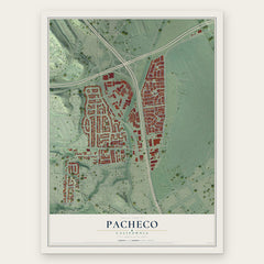

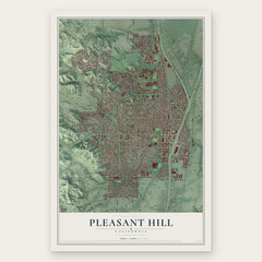
More maps nearby: Contra Costa Centre, Clayton, North Gate, Bay Point and Shell Ridge.
The art of mapping a place
How This Map Was Made
Real places. Remarkable detail. Discover the layers that turn geographic data into a map of home.

The view from above
Aerial imagery reveals the character of the land: woodland, open fields, and the patterns of a place.

The shape of the land
Elevation data brings hills, valleys, and subtle changes in the landscape into view.

The details of home
Roads, waterways, and building footprints come together to make the map feel unmistakably local.

Geography becomes art
Considered color, shading, and typography bring the layers together in a map made for your wall.


Process illustrated with Mendon, Massachusetts. Aerial imagery: USDA NAIP. Terrain: USGS 3D Elevation Program. Map details and finished artwork: KNOWOL.
The Details
About This Print
Choose an archival matte print, or a black or white Ayous wood frame. The archival matte print is unframed.
Select your size and finish above to see the matching product image and price.
Materials & Craftsmanship
A contemporary map with the character of a classic atlas, printed on archival matte paper. Optional frames are made from Ayous wood.
Your printed map does not include the watermark shown in the full-map preview.
Shipping & Delivery
Free shipping within the United States. Every print is made to order in the USA.
Buying a gift? Add a note in your cart and we'll include it. We never put prices in the package.
Prints ship within 2 to 3 business days. Allow 7 to 10 days total from ordering for delivery. Timing may vary during holidays or periods of high order volume.
Read our shipping policy.
Returns and damaged prints
Each print is made to order. Change-of-mind refunds are not available after production.
If your print arrives damaged, misprinted or incorrect, contact support@knowol.com within 30 days of receiving it. Include your order number, photos and a description of the issue.
Read our full refund and replacement policy. For questions about your order, email support@knowol.com.