


Search for another town





Free U.S. delivery 7 to 10 days after you order
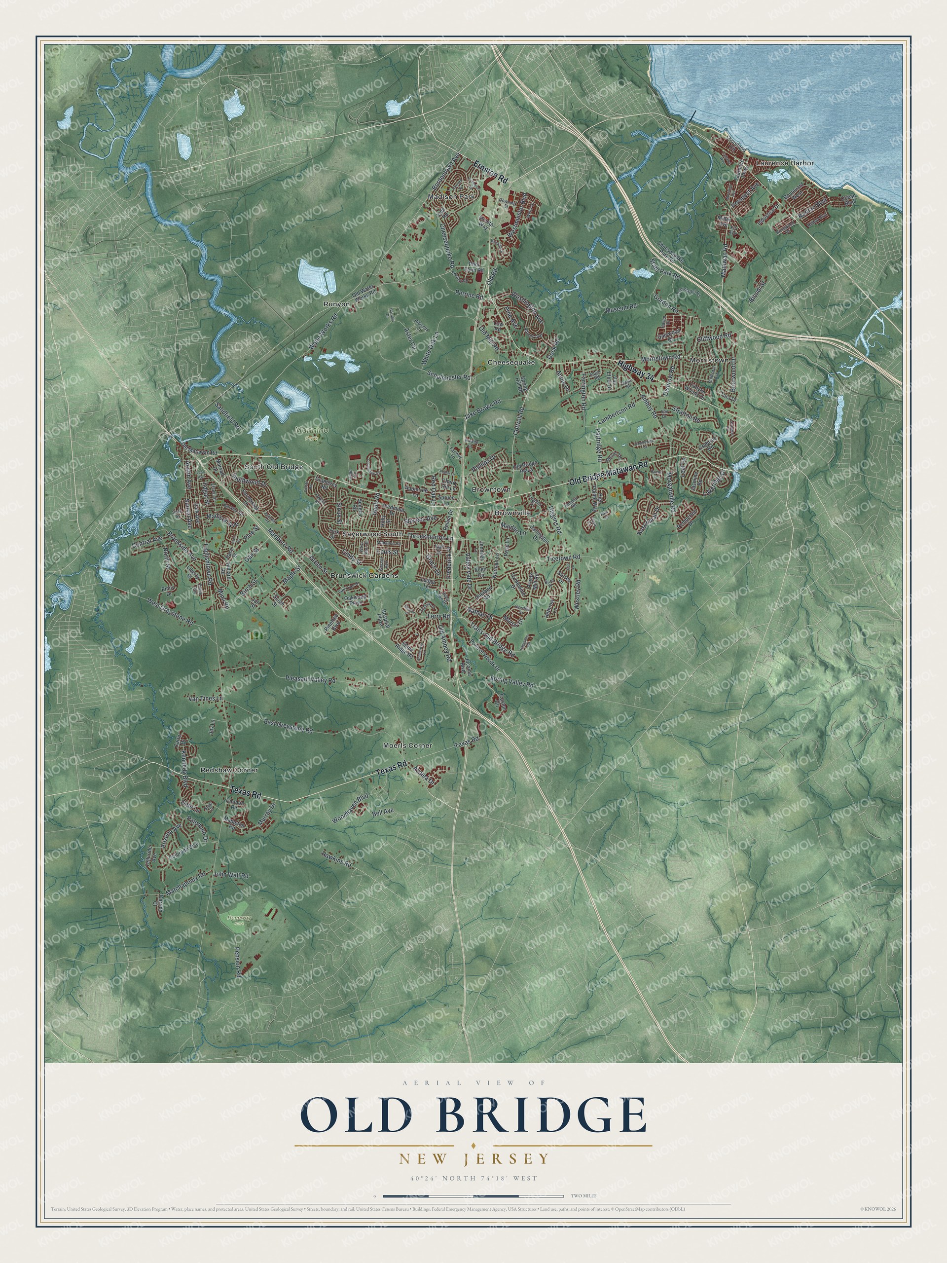
Old Bridge, New Jersey Map Art
Building by building, with labeled streets and shaded relief.
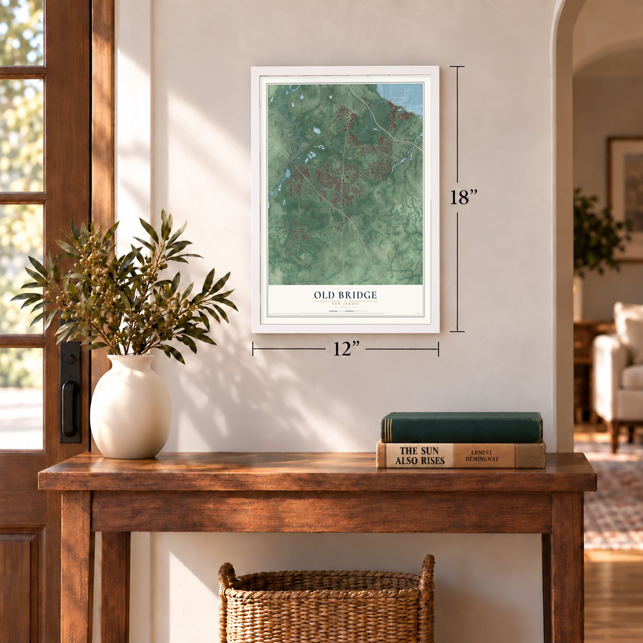
12" x 18" Archival Matte Print
A Map of Home. A Work of Art.
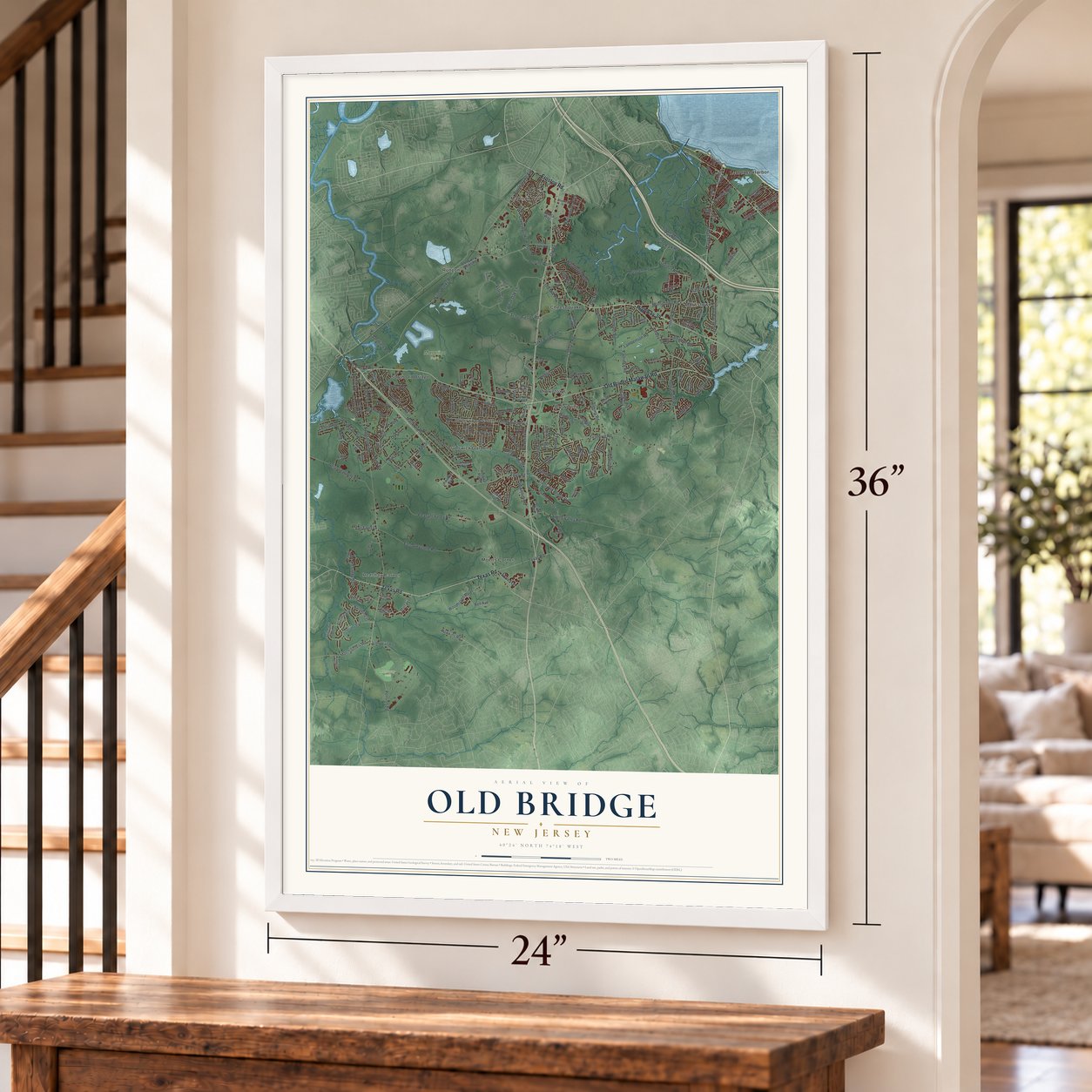
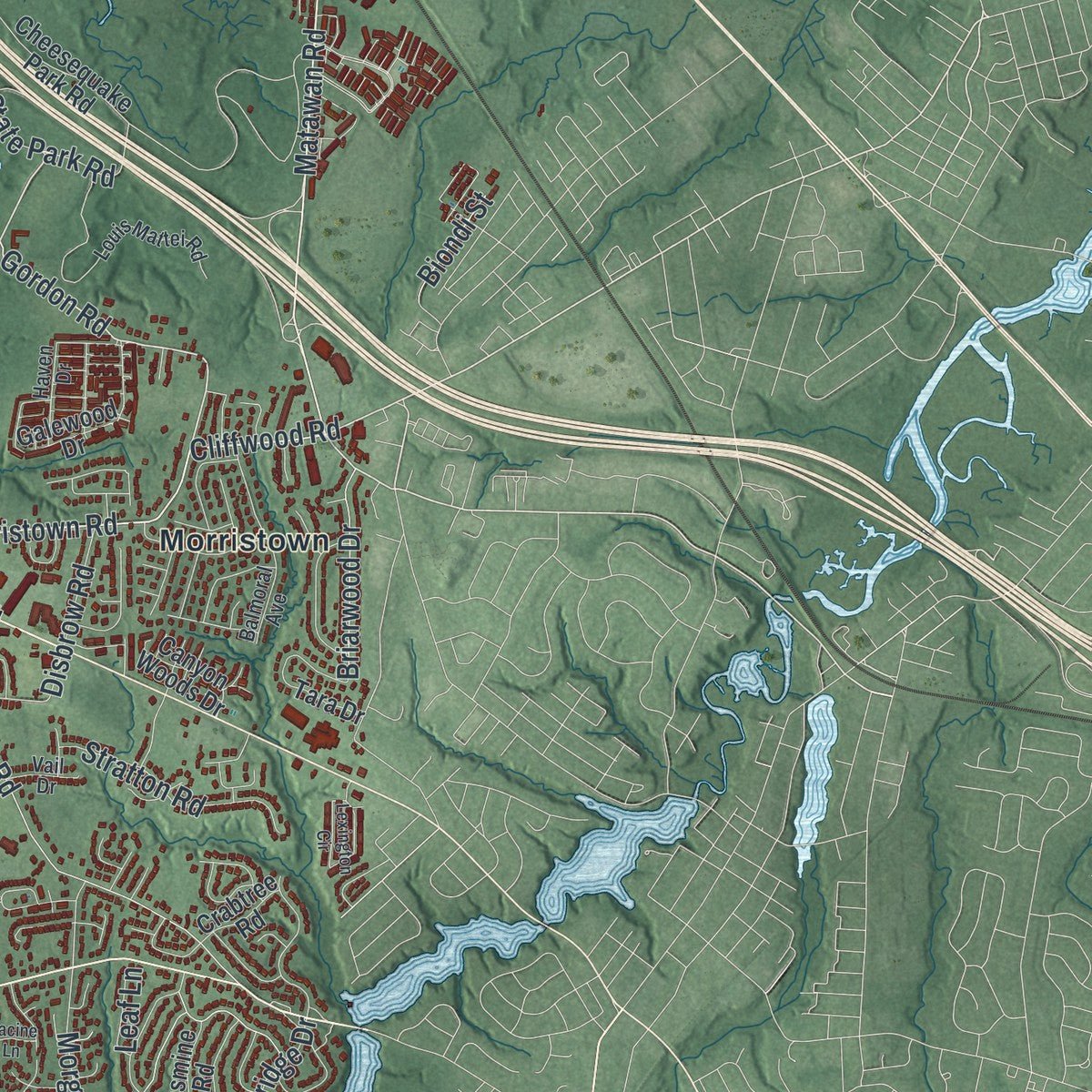
Explore Old Bridge, New Jersey from a whole new perspective. Created using aerial imagery and detailed geographic data, this map captures Old Bridge building by building, with labeled streets, familiar landmarks, and shaded topographical relief that highlights the natural contours of the landscape.
Combining modern data with the timeless character of a vintage atlas, this map is just as interesting up close as it is beautiful on the wall. Whether you grew up in Old Bridge, spent memorable years there, or call it home today, this unique map is a great way to celebrate a place that means something to you. Zoom in on the preview to look for your street, and then order a print to put your memories on the wall.
Three ways to hang it
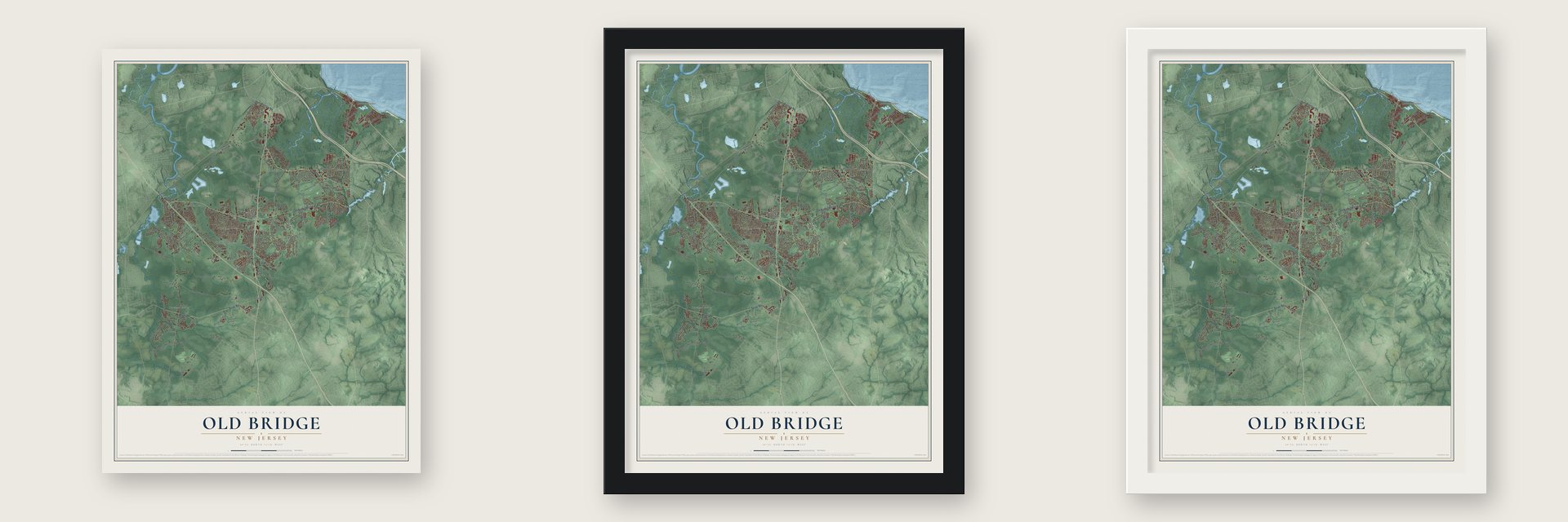
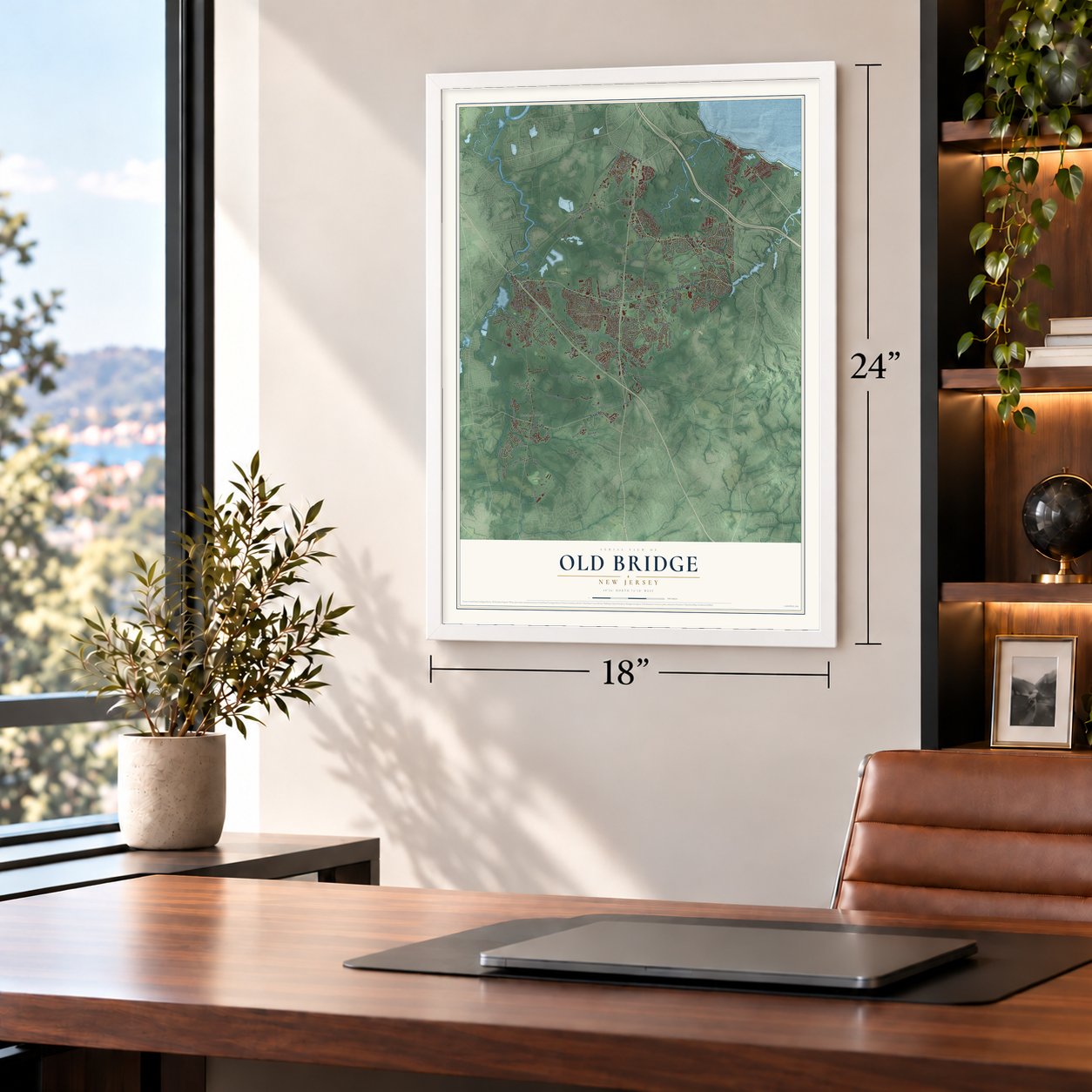
Unframed archival matte, a black wood frame or a white wood frame.
Up close
Geography Worth Displaying
This map was created using accurate cartographic data and authoritative geographic sources, including the U.S. Geological Survey (USGS) and FEMA. The map brings together terrain, waterways, roads, and building detail. The majority of the streets are labeled, houses are accurately depicted, and the topography is derived from government sources. Combining local data with carefully composed color and shading leads to this beautifully detailed Old Bridge artwork for your wall.
Rather than simply showing street outlines, we’ve included as many of the street names as we could reasonably fit on the map while keeping their names legible. Zoom in on the high resolution preview to see exactly what’s on the map. We truly set out to create a statement piece for anyone who loves Old Bridge. So whether it’s for you, or a gift for someone you love, we hope this map of Old Bridge brings back fond memories.
Explore the full map of Old Bridge, New Jersey and read about the local places it shows.

Find your street
Names on the Old Bridge map
Every name below is printed on this map. Look for your street, your school, the park where you played, or the pond down the road.
Places and landmarks14
- Mannino Park
- Raceway Park
- Browntown
- Brownville
- Brunswick Gardens
- Cheesequake
- Laurence Harbor
- Madison Park
- Moerls Corner
- Morristown
- Redshaw Corner
- Runyon
Show all 14 places
- Sayerwood South
- South Old Bridge
Streets and roads216
- Old Bridge Matawan Road
- Texas Road
- Highway 34
- Ernston Road
- Cottrell Road
- Matawan Road
- Morristown Road
- Gordon Road
- Cliffwood Road
- Morris Drive
- Englishtown Road
- Marlboro Road
- Water Works Road
- Bordentown Avenue
- Trans-Old Bridge Road
- Cindy Street
- Ticetown Road
- East Greystone Road
- Pleasant Valley Road
- Spring Valley Road
- Higgins Road
- Jake Brown Road
- Amboy Road
- White Oak Lane
- West Greystone Road
- Throckmorton Lane
- Aster Circle
- Museum Road
- Southwood Drive
- Pension Road
Show all 216 streets
- Morganville Road
- Washington Avenue
- State Park Road
- Ferry Road
- Sunset Avenue
- Brookside Avenue
- Lakeridge Drive
- Birch Street
- Arizona Avenue
- Woodhaven Boulevard
- Farrington Road
- Raritan Boulevard
- Matchaponix Road
- Cheesequake Road
- Maple Street
- Austin Avenue
- Westminster Boulevard
- Palomino Drive
- Old Amboy Road
- Madison Avenue
- Oak Street
- Phillips Drive
- Valley Vale Drive
- Perrine Road
- Disbrow Road
- Old Mill Road
- Stratton Road
- Westley Road
- Green Street
- Bell Avenue
- Lambertson Road
- Central Avenue
- Nathan Drive
- North Street
- Schulmiester Road
- Mimi Road
- Partridge Road
- Briarwood Drive
- Old Road
- Grace Drive
- Stevens Avenue
- Maiden Lane
- Murray Drive
- Edgar Street
- Gaub Road
- Kennedy Boulevard
- Sandfield Road
- Kirschman Drive
- John Wall Road
- Prospect Avenue
- Hawkins Road
- Van Tines Lane
- Frederick Place
- Pine Street
- Annie Drive
- Red Oak Lane
- Azalea Drive
- Biondi Street
- Gate Lane
- Dock Road
- Pine Avenue
- Louis Street
- Sioux Street
- Leaf Lane
- Laurence Parkway
- Miller Avenue
- Old Water Works Road
- Cheesequake Park Road
- Ocean Boulevard
- Shoreland Circle
- Park Avenue
- Spring Hill Road
- Point of Woods Drive
- Van Ethel Drive
- Falston Circle
- Appletree Lane
- Galewood Drive
- Darlington Drive
- Oakland Road
- Colorado Boulevard
- Norman Lane
- Hilliard Road
- Meleta Way
- Emily Drive
- Cymbeline Drive
- Ellen Circle
- Cherry Hill Lane
- Prests Mill Road
- Cannon Road
- High Pointe Way
- Spruce Lane
- Surrey Drive
- Tara Drive
- Old Matawan Road
- Piedmont Drive
- York Street
- Low Road
- Gramercy Road
- Farmbrook Drive
- Poor Farm Road
- Rellim Drive
- Telluride Avenue
- Old Bridge Plaza
- Oakwood Parkway
- Pemberton Drive
- Rose Lane
- Industrial Drive
- Hospital Plaza
- Boulevard West
- Joy Lane
- Canyon Woods Drive
- Pinetree Boulevard
- Mapleton Road
- Seneca Road
- Stone Ridge Road
- Hethrow Lane
- Jennifer Lane
- Carter Drive
- Marsad Drive
- Karrich Court
- Jasmine Road
- Crabtree Road
- Karl Drive
- Jon Street
- Liberty Street
- Holly Street
- South Street
- Jocama Boulevard
- Ledge Terrace
- Pace Street
- Yale Road
- Louis Mattei Road
- Athens Avenue
- Thames Drive
- Balmoral Avenue
- Haven Drive
- Owens Road
- Hibiscus Court
- Ernest Street
- Bennett Road
- Edgar Road
- Wells Drive
- Overhill Drive
- Deep Run Drive
- Sixth Street
- Merritt Terrace
- Van Over Drive
- Barkley Road
- Downing Street
- Mabaline Road
- Rosewood Drive
- Shelley Road
- Doyle Road
- Hilltop Boulevard
- Ely Avenue
- Gerard Avenue
- Fairway Lane
- Vail Drive
- West Alton Place
- Arcade Lane
- Diane Avenue
- Bard Place
- Trish Court
- Stasi Court
- Jean Court
- Princeton Road
- Community Circle
- Lexington Circle
- Gazania Drive
- Harvard Road
- Ponderosa Lane
- Victorian Drive
- Vandelft Drive
- Dumas Road
- Arvin Road
- Erin Lane
- Candlewick Court
- Norwood Avenue
- Palisades Road
- Poplar Lane
- Andover Road
- Lantana Way
- Beacon Place
- Racine Lane
- Kara Court
- Leon Avenue
Names are listed as they appear on the printed map. Zoom into the product photos to find them.
About Old Bridge, New Jersey
Old Bridge is a township of 66,876 people in Middlesex County, facing Staten Island across Raritan Bay. The Unami, a Lenni Lenape people, came down to this shore every summer from their northern hunting grounds. In 1684 the land became part of South Amboy Township, which also took in today's Monroe, Sayreville and South Amboy. On March 2, 1869, the state legislature split off 42 square miles of it as Madison Township.
For decades Madison stayed a place of farms. It had 1,662 people in 1880 and only 7,365 by 1950, but then houses replaced the fields, and by 1960 the count had tripled to 22,772. Residents wanted one postal name and ZIP code and no more mix-ups with the borough of Madison in Morris County. In a referendum on November 5, 1975, they voted 7,150 to 4,888 to rename the township Old Bridge.
“The clay deposits found along Cheesequake Creek are reported to be some of the finest stoneware clays in the United States.”
- Brownville in 1737Thomas Warne, one of the 24 original proprietors of East Jersey, owned land here. By one account his son became the first European to settle in the Cheesequake area, in 1683. In 1737 John and Susannah Brown received a grant of 1,000 acres from the King of England. They named their land Brownville, and that part of the township is still called Browntown.
- Snuff and woolen millsMadison Township's streams turned many mills. The Warne family ran fulling mills, which cleaned the dirt and grease out of woolen cloth and packed its fibers tight. Other mills ground snuff, a scented tobacco that both men and women used. The Washington Snuff Mill opened in 1801 at Mount Pleasant and the Old Bridge Turnpike, now Route 516, and was later renamed the Dill Snuff Mill.
- Clay along Cheesequake CreekThe Lenni Lenape were already using the fine clay on the banks of Cheesequake Creek, and Captain James Morgan worked it before the Revolution. By the 1800s clay was a major industry here. Local potters used it, and it was also shipped to potteries in Norwalk, Connecticut, elsewhere in New England, the Hudson Valley and parts of Canada. The Perrine clay pit sat near U.S. Route 9 and Ernston Road.
- Browntown apple brandyThe Cottrell family built their homestead in 1831, and it still stands at County Route 516 and Cottrell Road. Across the road they grew apples on 150 acres. Fruit too small or poor to sell went to their New Jersey Apple Growers Inc. distillery, where it was pressed into cider and distilled. The brandy aged in a government warehouse on the farm, and for twenty years the Cottrells sold it wholesale under the name Browntown.
Keep exploring New Jersey
Old Bridge is one of 990 New Jersey towns we've mapped. Every dot on the map is a print of its own.
The search covers every state, New Jersey first.
Near Old Bridge
Order 2 or more town maps and save 10%. Shown in the size and finish you picked above, so they hang as a set.
- Brownville 12" x 18" / Archival Matte Print $39.99
- Cheesequake 12" x 18" / Archival Matte Print $39.99
- Madison Park 12" x 18" / Archival Matte Print $39.99


More maps nearby: Matawan, Laurence Harbor, Sayreville, Morganville and Cliffwood.
The art of mapping a place
How This Map Was Made
Real places. Remarkable detail. Discover the layers that turn geographic data into a map of home.

The view from above
Aerial imagery reveals the character of the land: woodland, open fields, and the patterns of a place.

The shape of the land
Elevation data brings hills, valleys, and subtle changes in the landscape into view.

The details of home
Roads, waterways, and building footprints come together to make the map feel unmistakably local.

Geography becomes art
Considered color, shading, and typography bring the layers together in a map made for your wall.


Process illustrated with Mendon, Massachusetts. Aerial imagery: USDA NAIP. Terrain: USGS 3D Elevation Program. Map details and finished artwork: KNOWOL.
The Details
About This Print
Choose an archival matte print, or a black or white Ayous wood frame. The archival matte print is unframed.
Select your size and finish above to see the matching product image and price.
Materials & Craftsmanship
A contemporary map with the character of a classic atlas, printed on archival matte paper. Optional frames are made from Ayous wood.
Your printed map does not include the watermark shown in the full-map preview.
Shipping & Delivery
Free shipping within the United States. Every print is made to order in the USA.
Buying a gift? Add a note in your cart and we'll include it. We never put prices in the package.
Prints ship within 2 to 3 business days. Allow 7 to 10 days total from ordering for delivery. Timing may vary during holidays or periods of high order volume.
Read our shipping policy.
Returns and damaged prints
Each print is made to order. Change-of-mind refunds are not available after production.
If your print arrives damaged, misprinted or incorrect, contact support@knowol.com within 30 days of receiving it. Include your order number, photos and a description of the issue.
Read our full refund and replacement policy. For questions about your order, email support@knowol.com.