
Search for another town





Free U.S. delivery 7 to 10 days after you order
Olive Branch, Mississippi Map Art
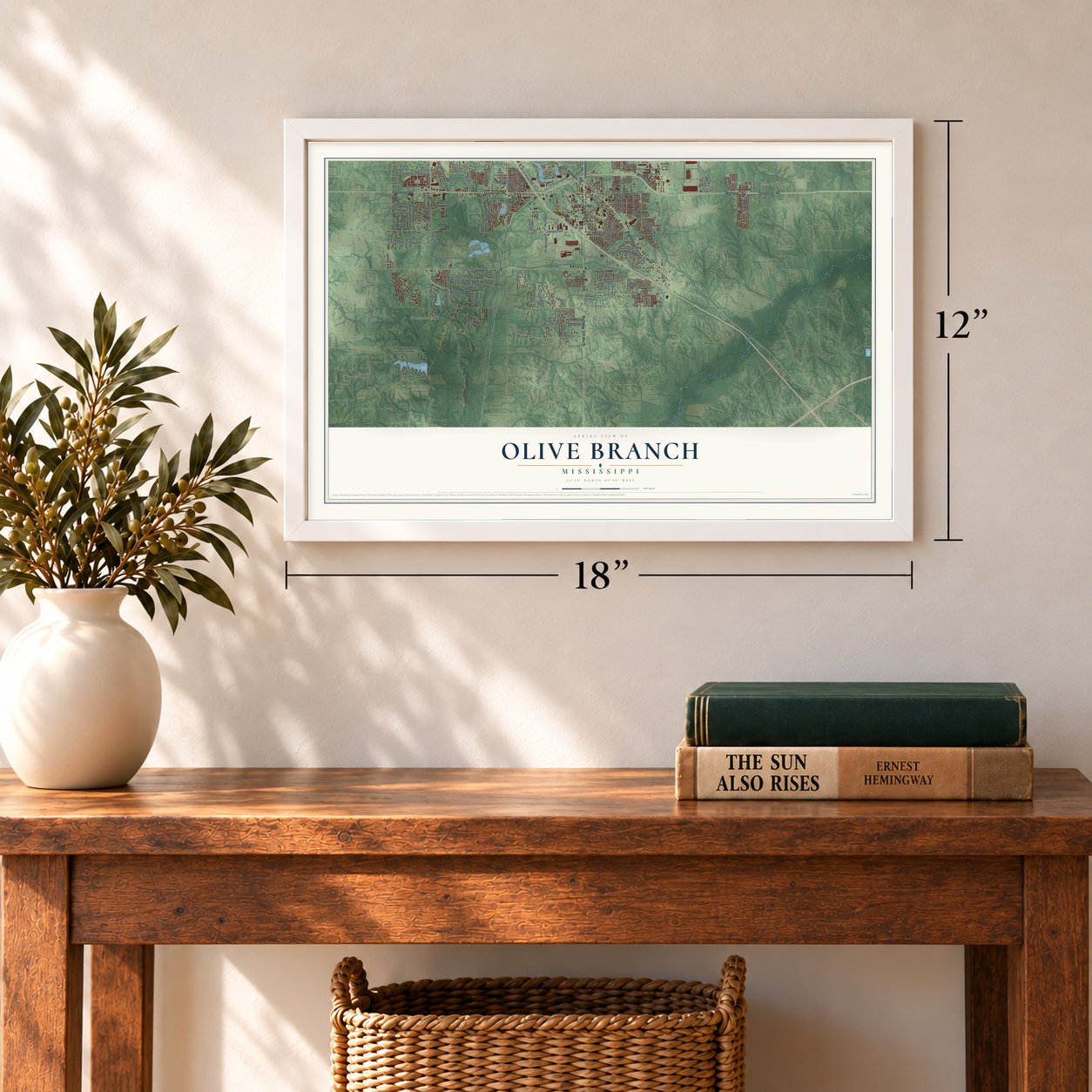
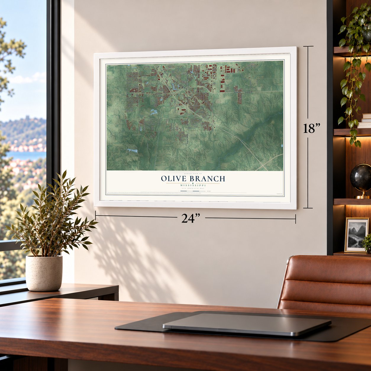
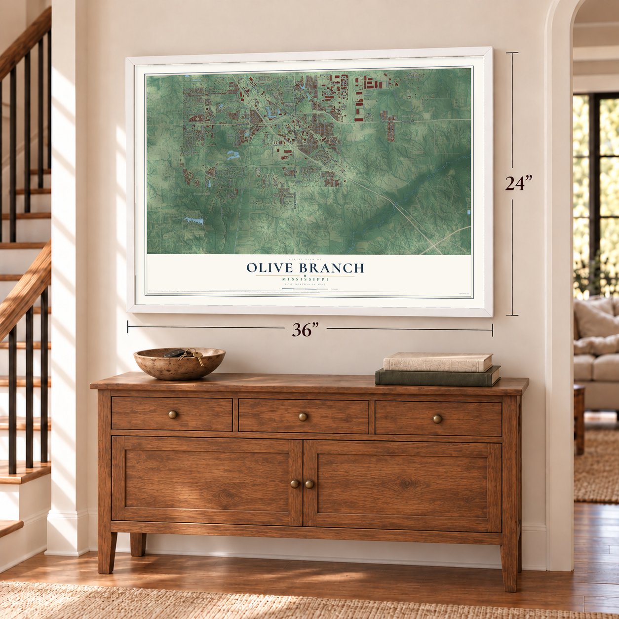
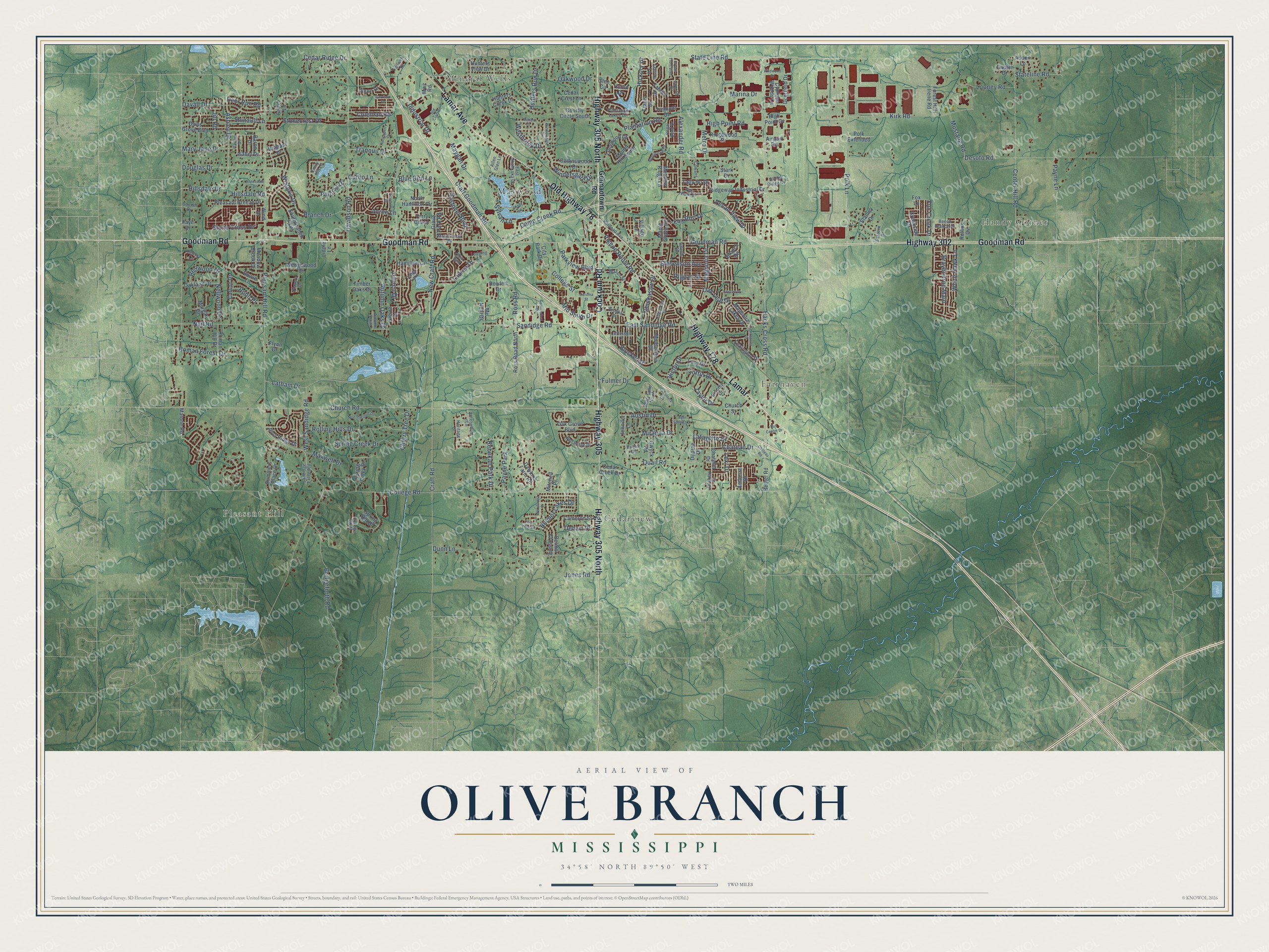
A new map of Olive Branch, Mississippi, made in 2026 and printed to order on thick archival matte paper.
12" x 18" Archival Matte Print
A Map of Home. A Work of Art.
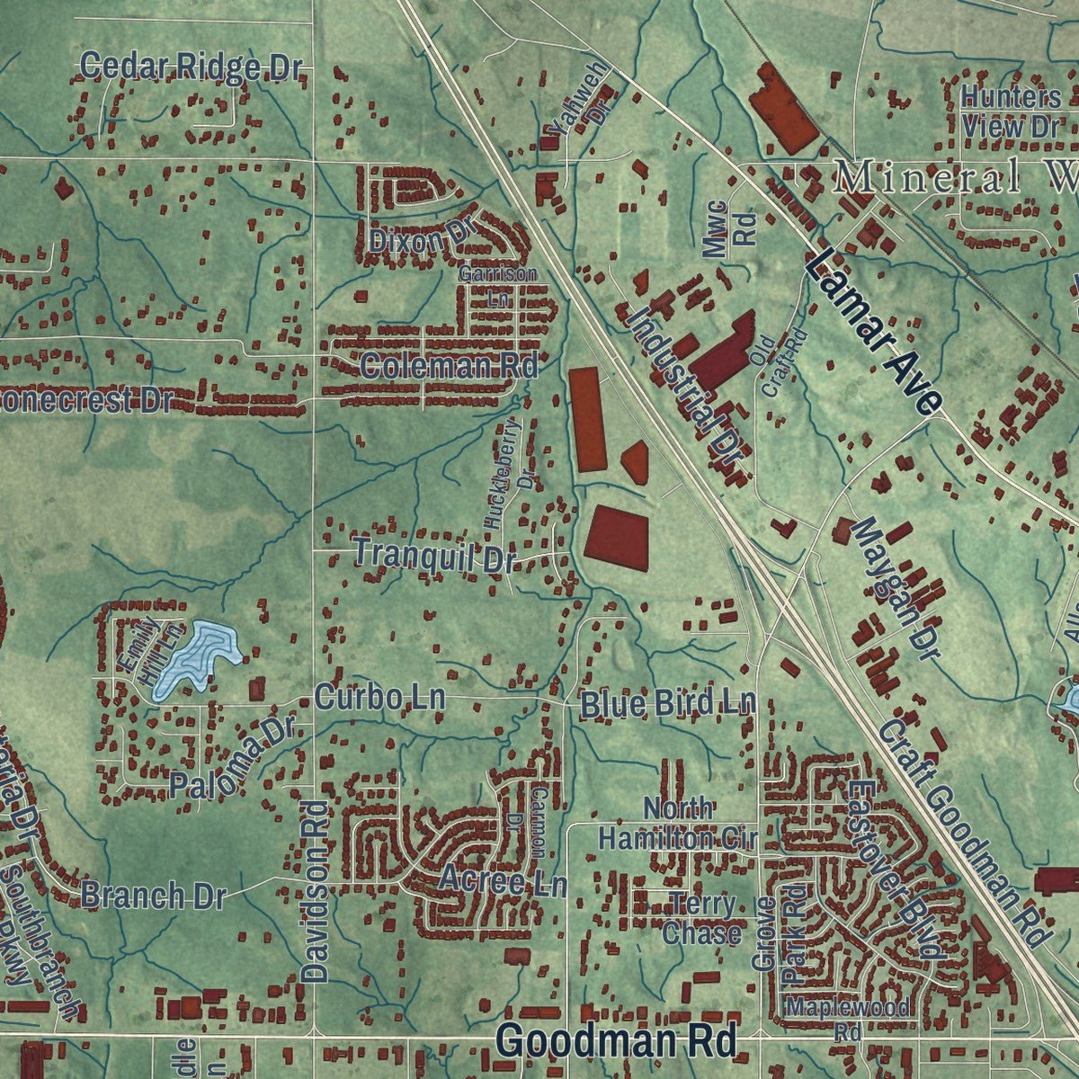
Explore Olive Branch, Mississippi from a whole new perspective. Created using aerial imagery and detailed geographic data, this map captures Olive Branch building by building, with labeled streets, familiar landmarks, and shaded topographical relief that highlights the natural contours of the landscape.
Combining modern data with the timeless character of a vintage atlas, this map is just as interesting up close as it is beautiful on the wall. Whether you grew up in Olive Branch, spent memorable years there, or call it home today, this unique map is a great way to celebrate a place that means something to you. Zoom in on the preview to look for your street, and then order a print to put your memories on the wall.
Three ways to hang it
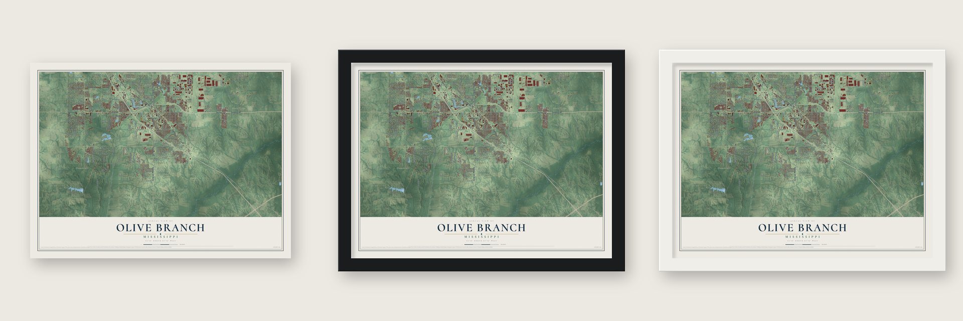
Unframed archival matte, a black wood frame or a white wood frame.
Up close
Geography Worth Displaying
This map was created using accurate cartographic data and authoritative geographic sources, including the U.S. Geological Survey and the Census Bureau. The map brings together terrain, waterways, roads, and building detail. The majority of the streets are labeled, houses are accurately depicted, and the topography is derived from government sources. Combining local data with carefully composed color and shading leads to this beautifully detailed Olive Branch artwork for your wall.
Rather than simply showing street outlines, we’ve included as many of the street names as we could reasonably fit on the map while keeping their names legible. Zoom in on the high resolution preview to see exactly what’s on the map. We truly set out to create a statement piece for anyone who loves Olive Branch. So whether it’s for you, or a gift for someone you love, we hope this map of Olive Branch brings back fond memories.
Read the story behind this map of Olive Branch, Mississippi from 2026.
About Olive Branch, Mississippi
Olive Branch is a city of 39,711 people in DeSoto County, and its northern edge runs along the Tennessee state line just below Memphis. Milton Blocker and Stephen Flinn, related by marriage, settled here in 1836, the same year DeSoto County was formed from land the Chickasaw had given up. In 1840 Flinn sold his share of the land to Blocker for $6,400, and Blocker came to be known as the Father of Olive Branch.
A small settlement called Cowpens grew up in the early 1840s, and in 1842 it was renamed Watson's Crossroads. When the post office opened in 1846, Frances Wilson Blocker, from one of the founding families, proposed the name Olive Branch, after the dove that carried a branch back to Noah. The town was incorporated on April 11, 1873, with J. B. Stamps as its first mayor, and the 1880 census counted 73 residents.
“The only landmark of the early settlement is the MILTON BLOCKER HOME, a one-story double log house, with four rooms and an attached kitchen.”
- The railroad in 1885The Kansas City, Memphis & Birmingham laid its tracks through Olive Branch in 1885, giving the town a direct link to both Memphis and Birmingham. The state made it a village on March 6, 1888, and a 1907 state cyclopedia placed it on that line, 18 miles southeast of Memphis. By about 1900 close to 200 people lived here.
- A school rebuilt on its stonesThe Olive Branch School opened in 1908 to replace a crowded 1873 building, and it held Bethel Township High School as well as the lower grades. Fire damaged the school in 1913, and builders put it back up in 1915 on the original foundation. Architect Charles Insco Williams designed it in the Craftsman style, with field stone, stucco, deep eaves and a low tile roof. Classes went on there until the early 1970s, when it became a district warehouse.
- Cheese, cotton and powerThe village got its first cotton gin in 1910, a public water system in 1922 and electric service in 1927. In 1929 T.H. Norvell opened a cheese plant, the town's first major industry, beside what is now Cadence Bank. Sewers and paved streets followed around 1940, when the census counted 441 people.
- Holiday Inn University, 1971Holiday Inn picked a site a few miles from downtown in 1971 for its Holiday Inn University and Conference Center and began a 3,000-acre industrial park at the same time. Olive Branch Airport opened in January 1973 with a 6,000-foot runway, and U.S. Highway 78 came through in 1974. The jobs and roads drew newcomers, and the city grew from 3,567 people in 1990 to 21,054 in 2000.
Find your street
Names on the Olive Branch map
Every name below is printed on this map. Look for your street, your school, the park where you played, or the pond down the road.
Places and landmarks8
- Handy Corner
- Mineral Wells
- Fairhaven
- Pleasant Hill
- Cedarview
- Maywood
- Payne Park
- Indigo Lake
Streets and roads252
- Lamar
- Goodman Road
- Highway 305 North
- Highway 178
- Old Highway 78
- Highway 305
- Highway 302
- Cockrum Road
- Lamar Avenue
- Plantation Road
- Stone Cross Drive
- Rebekah Park Drive
- Hacks Cross Road
- State Line Road
- Pleasant Hill Road
- College Road
- Craft Road
- Church Road
- Sandidge Road
- Alexander Road
- Polk Lane
- Davidson Road
- Desoto Road
- Center Hill Road
- Bridgeforth Road
- New Craft Road
- West Sandidge Road
- Nail Road
- Dunn Lane
- Coleman Road
Show all 252 streets
- Douglas Drive
- Pigeon Roost Road
- Craft Goodman Road
- Blocker Street
- Kirk Road
- College Street
- Rolling Hills Drive
- Autumn Oaks Drive
- Hillsdale Drive
- East Sandidge Road
- Mustang Road
- Magnolia Drive
- Spring Creek Drive
- Camp Creek Road
- Oak Leaf Drive
- Hillsdale Road
- Stonecrest Drive
- Riggan Drive
- Ashley Drive
- Chateau Drive
- Windersgate Drive
- Quail Road
- Shinault Lane
- Stevenson Avenue
- Roman Forest Drive
- Braybourne Main
- Miranda Drive
- Wisteria Drive
- Victor Drive
- Loftin Drive
- Marina Drive
- High Point Road
- Branch Drive
- Eastover Boulevard
- Chickasaw Drive
- Westbrook Drive
- Mary Jane Drive
- Hunters Run Drive
- Payne Lane
- Parkview Boulevard
- Austin Drive
- Lafayette Drive
- Hickory Drive
- Redwood Drive
- Tranquil Drive
- Industrial Drive
- Acree Lane
- Oakwood Drive
- Stateline Road
- Mid South Drive
- White Hawk Lane
- Belmor Lakes Drive
- Cedar Ridge Drive
- Fox Run Drive
- Metro Drive
- Maxwell Drive
- Curbo Lane
- Darren Drive
- Latham Drive
- Lauren Drive
- Fox Creek Drive
- Pecan View Drive
- Taylor Drive
- Nellwood Drive
- Looney Road
- Cherry Tree Drive
- Jones Road
- Paloma Drive
- Blue Bird Lane
- Bobo Place
- Jill Road
- Maygan Drive
- Deer Run Road
- Ross Road
- Fulmer Drive
- Dehart Drive
- Sylvan Lane
- Lexi Drive
- Davall Drive
- Germantown Road
- Magnolia Lakes Drive
- Laurel Hill South
- Wedgewood Drive
- City Park Drive
- Hamilton Circle
- Ridgeway Industrial Drive
- Davis Grove Boulevard
- Bethel Road
- Malone Road
- North Hamilton Circle
- Dawkins Farm Road
- Timber Oaks Drive
- Hunters Creek Drive
- Summers Place Drive
- Longwood Drive
- Ross Road North
- Pleasant Breeze Drive
- Southbranch Parkway
- Collinswood Drive
- Tahoe Drive
- Creekside Drive
- Oak Grove Boulevard
- Lacy Drive
- Cedar Crest Lane
- Roman Hill Drive
- Forest Hill Irene Road
- Setter Lane
- Chatelet Drive
- Michaelson Drive
- Lexington Drive
- Ridgewood Drive
- Stanley Drive
- Courtly Circle South
- Belmor Crossing
- Spring Valley Drive
- Gwyck Road
- Oakland Drive
- Hunters View Drive
- Cedar Creek Drive
- Spring Hill Drive
- Riva Ridge Drive
- Travis Drive
- Grove Park Road
- Meadow Brook Drive
- Morgan Drive
- Cypress Woods Lane
- Cameron Street
- Deerfield Drive
- Tally Ho Drive
- Dupree Drive
- Carson Drive
- Polk Extended
- Meadow Ridge Lane
- Terry Chase
- Tremont Drive
- Amherst Drive
- Lorrie Lane
- Mc Neal Drive
- Bowie Lane
- Jennifer Lane
- Aspen Lane
- Dixon Drive
- Rollins Cv
- Isabel Drive
- Branch Road
- Village Lane
- Maple Grove Road
- Rowlett Drive
- Braham Drive
- High Point Cv
- Canter Drive
- Glen Circle
- Mitchell Place
- Airport Road
- Wind Drive
- Baron Drive
- Church Street
- Sierra Drive
- Stark Drive
- Flynn Drive
- Fox Lane
- Mwc Road
- Liddle Lane
- Huron Drive
- Faye Drive
- Mary Lane North
- East Shahkoka Drive
- Lodging Lane
- Cherokee Drive
- Montrose Drive
- Valerie Drive
- Bell Ridge Drive
- Northwood Drive
- Dorothy Drive
- Plantation Lakes Drive
- Railroad Avenue
- Eastern Drive
- Antebellum Lane
- Maplewood Road
- Yahweh Drive
- Players Drive
- Brooks Drive
- Mason Street
- Jefferson Drive
- Willow Ridge Cv
- Sandidge Extended
- Dockery Drive
- Regal Bend Drive
- Cowans
- Fox Hunt Drive
- Beech Branch Drive
- Conrad Drive
- Heritage Drive
- College Bluff
- Autumn Point
- Allen Glen Lane
- Caitlin Drive
- Bonner Drive
- Kayley Lane
- Emily Hill Lane
- Brigid Drive
- Cara Bnd
- Old Craft Road
- Chateau Road
- Huckleberry Drive
- Windersgate Circle
- Kristen Drive
- Caroma Street
- Lake View Drive
- Commerical Drive
- Vaughters Cv
- Lancaster Drive
- Bryant Trent Boulevard
- Wildwood Drive
- Woodcrest Drive
- Annesdale Drive
- Mellen Drive
- April Springs Drive
- Carmon Drive
- Garrison Lane
- Bus Center Drive
- Shady Lane
Names are listed as they appear on the printed map. Zoom into the product photos to find them.
The art of mapping a place
How This Map Was Made
Real places. Remarkable detail. Discover the layers that turn geographic data into a map of home.

The view from above
Aerial imagery reveals the character of the land: woodland, open fields, and the patterns of a place.

The shape of the land
Elevation data brings hills, valleys, and subtle changes in the landscape into view.

The details of home
Roads, waterways, and building footprints come together to make the map feel unmistakably local.

Geography becomes art
Considered color, shading, and typography bring the layers together in a map made for your wall.


Process illustrated with Mendon, Massachusetts. Aerial imagery: USDA NAIP. Terrain: USGS 3D Elevation Program. Map details and finished artwork: KNOWOL.
The Details
About This Print
Choose an archival matte print, or a black or white Ayous wood frame. The archival matte print is unframed.
Select your size and finish above to see the matching product image and price.
Materials & Craftsmanship
A contemporary map with the character of a classic atlas, printed on archival matte paper. Optional frames are made from Ayous wood.
Your printed map does not include the watermark shown in the full-map preview.
Shipping & Delivery
Free shipping within the United States. Every print is made to order in the USA.
Buying a gift? Add a note in your cart and we'll include it. We never put prices in the package.
Prints ship within 2 to 3 business days. Allow 7 to 10 days total from ordering for delivery. Timing may vary during holidays or periods of high order volume.
Read our shipping policy.
Returns and damaged prints
Each print is made to order. Change-of-mind refunds are not available after production.
If your print arrives damaged, misprinted or incorrect, contact support@knowol.com within 30 days of receiving it. Include your order number, photos and a description of the issue.
Read our full refund and replacement policy. For questions about your order, email support@knowol.com.
Find your town
Looking for another city?
Find a map of home in our Mississippi collection, or any town in the country.
Nearby
Maps of towns near Olive Branch
Know someone from one of these towns? Their map makes a great gift.
 Bridgetown
, Mississippi
From $39.99See the map
 Southaven
, Mississippi
From $39.99See the map
 Byhalia
, Mississippi
From $39.99See the map
More maps nearby: Hernando, Horn Lake, Lynchburg, Victoria and Lakeview.