
Search for another town





Free U.S. delivery 7 to 10 days after you order
Opelika, Alabama Map Art
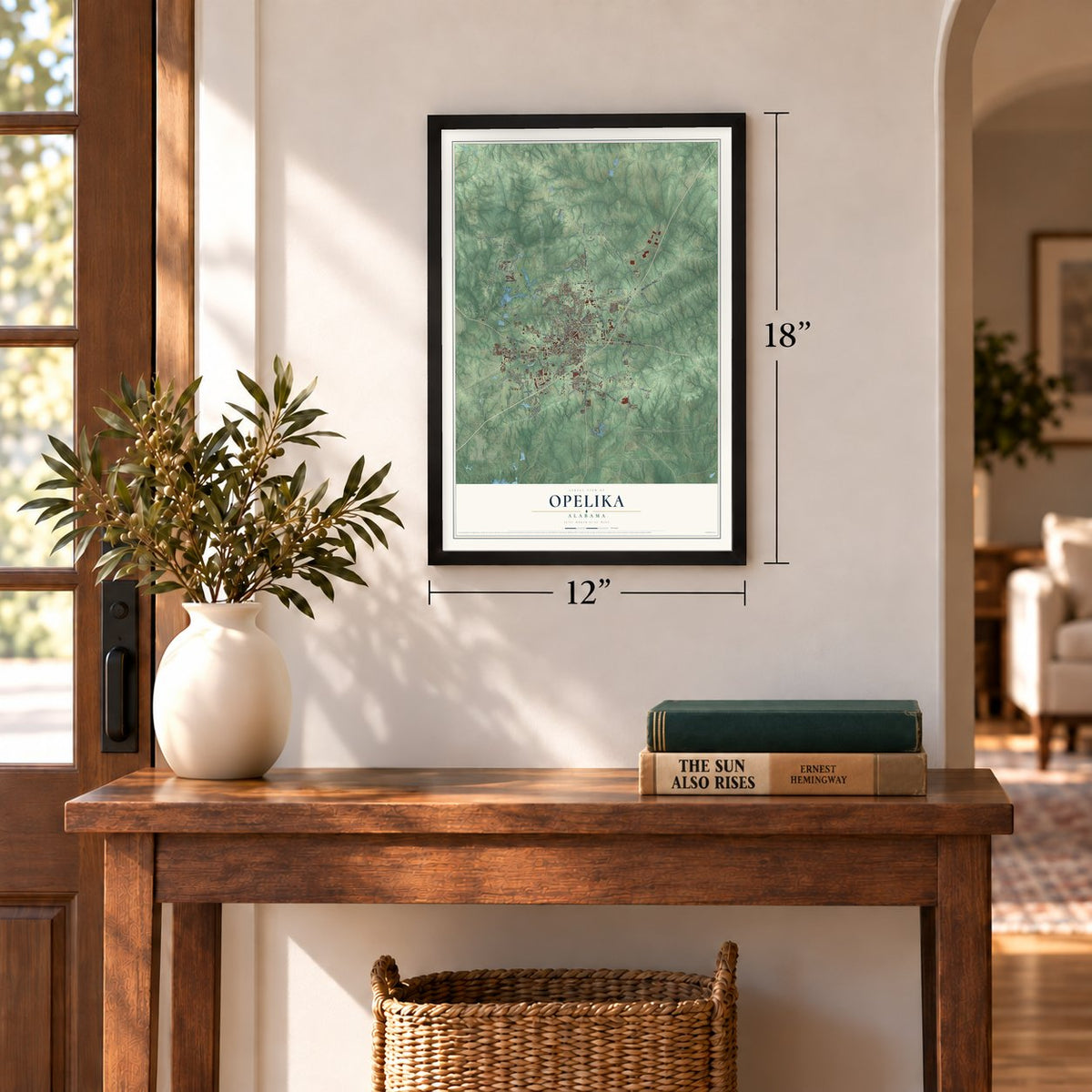
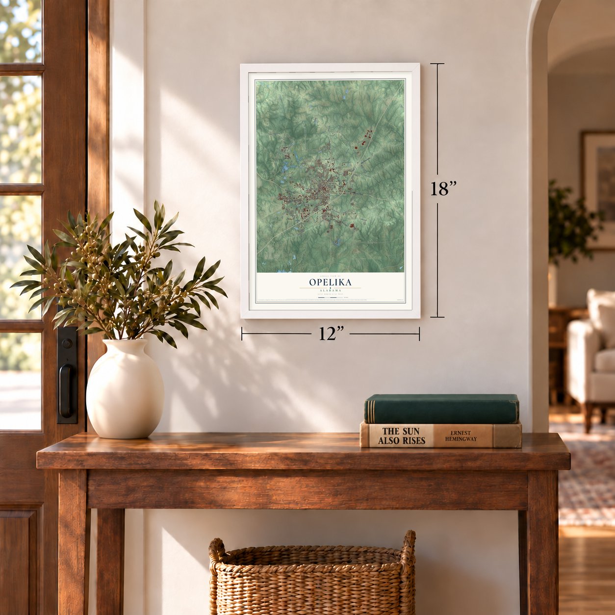
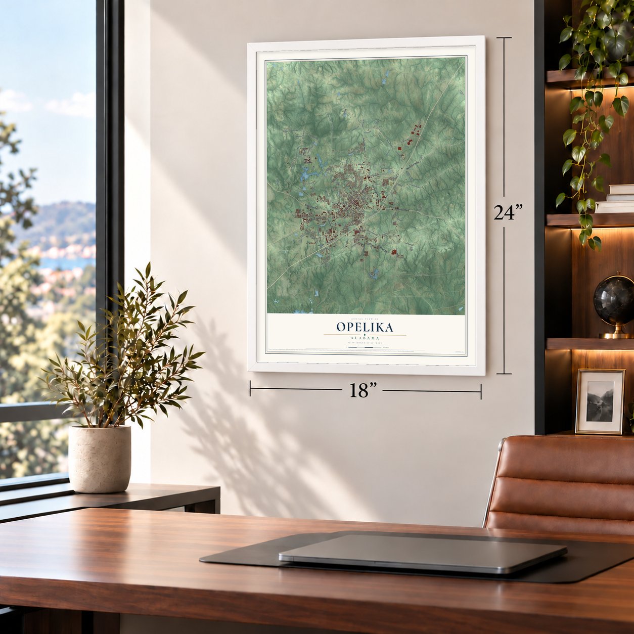
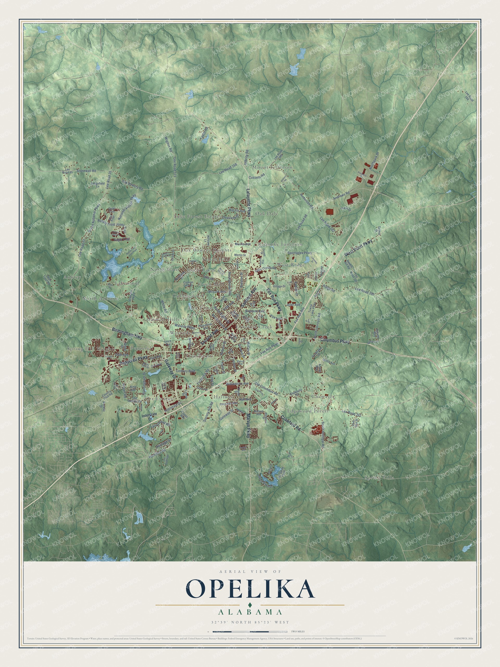
A new map of Opelika, Alabama, made in 2026 and printed to order on thick archival matte paper.
12" x 18" Archival Matte Print
A Map of Home. A Work of Art.
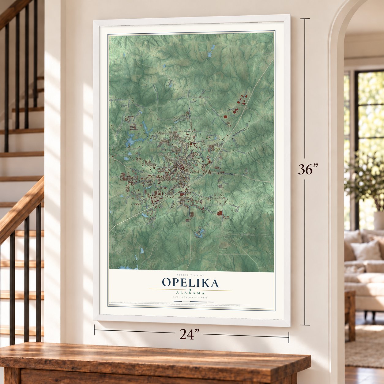
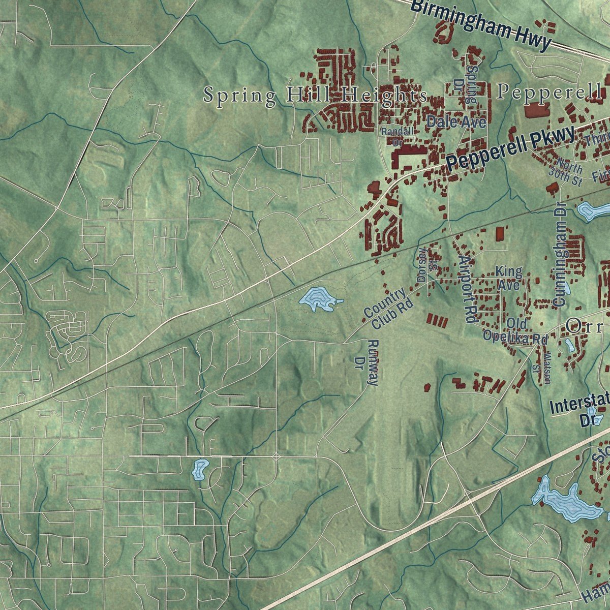
Explore Opelika, Alabama from a whole new perspective. Created using aerial imagery and detailed geographic data, this map captures Opelika building by building, with labeled streets, familiar landmarks, and shaded topographical relief that highlights the natural contours of the landscape.
Combining modern data with the timeless character of a vintage atlas, this map is just as interesting up close as it is beautiful on the wall. Whether you grew up in Opelika, spent memorable years there, or call it home today, this unique map is a great way to celebrate a place that means something to you. Zoom in on the preview to look for your street, and then order a print to put your memories on the wall.
Three ways to hang it
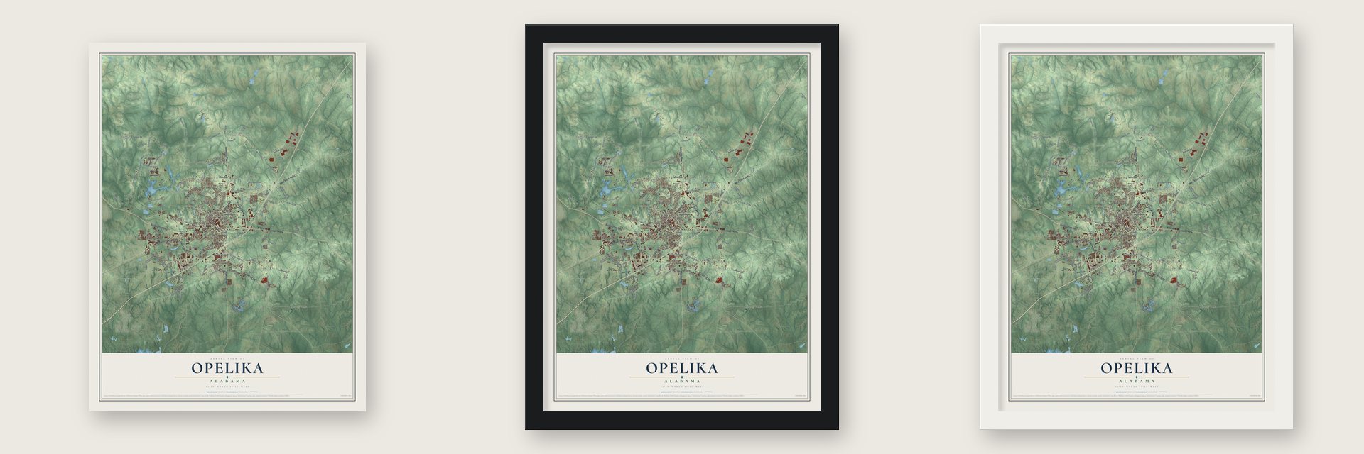
Unframed archival matte, a black wood frame or a white wood frame.
Up close
Geography Worth Displaying
This map was created using accurate cartographic data and authoritative geographic sources, including the U.S. Geological Survey and the Census Bureau. The map brings together terrain, waterways, roads, and building detail. The majority of the streets are labeled, houses are accurately depicted, and the topography is derived from government sources. Combining local data with carefully composed color and shading leads to this beautifully detailed Opelika artwork for your wall.
Rather than simply showing street outlines, we’ve included as many of the street names as we could reasonably fit on the map while keeping their names legible. Zoom in on the high resolution preview to see exactly what’s on the map. We truly set out to create a statement piece for anyone who loves Opelika. So whether it’s for you, or a gift for someone you love, we hope this map of Opelika brings back fond memories.
Read the story behind this map of Opelika, Alabama from 2026.

About Opelika, Alabama
Opelika is a city of 30,995 people and the county seat of Lee County. Its name comes from the Creek words opilwa and lako, meaning a big swamp. White settlers began arriving in the late 1830s, after the Creek Nation gave up the land in the 1832 Treaty of Cusseta. The Montgomery & West Point Railroad reached the spot from Montgomery in 1848, and three years later the tracks ran on to West Point, Georgia. With that link to Atlanta, no other railroad connected New Orleans directly with the Eastern Seaboard, so the town grew fast and was chartered on February 9, 1854.
A line to Columbus, Georgia, followed in 1855. In mid-July 1864, Union general Lovell Rousseau's raiders tore up the tracks and destroyed depots and warehouses holding supplies for the Confederates at Atlanta. After the war the legislature carved Lee County from parts of Macon, Russell, Chambers and Tallapoosa counties, and in 1866 voters picked Opelika as its seat. A fire in 1868 wiped out most of the business district, but the town rebuilt with an opera house and brick streets, and by the 1920s 24 passenger trains stopped there every day.
- A courthouse by Horace KingOpelika's first courthouse as county seat was designed by Horace King, a well-known Black builder. It served until 1896, when the present Lee County Courthouse replaced it. The newer building joined the National Register in 1973.
- Saloons by the tracksSaloons crowded downtown to serve railroad workers, and drunken gunfire grew so common that railroads told passengers to duck below the windows as trains passed through.
- A riot and the militiaIn 1882 two groups each claimed the city government: the "Bar room," led by saloon keeper and Mayor Dunbar, and the "Citizens," who said they had won the election. A riot that November and December wounded a dozen men, and a few died. The legislature revoked the charter, Gov. Edward O'Neal sent the state militia, and five appointed commissioners ran Opelika until its charter came back in 1899.
- Norma Rae's mill townLocal investors opened the Opelika Cotton Mill in 1900 as the city's first textile plant, with 125 workers. It ran until near the end of the twentieth century, and in 1979 the mill, its village and the Golden Cherry Motel served as filming locations for Norma Rae. The Pepperell Manufacturing Company arrived in 1925 and lasted until 2006.
- 2,700 German prisonersDuring World War II the U.S. Army built a prisoner-of-war camp at Opelika. Camp Opelika opened on December 12, 1942, and in time held more than 2,700 German prisoners before it closed on December 8, 1945.
Find your street
Names on the Opelika map
Every name below is printed on this map. Look for your street, your school, the park where you played, or the pond down the road.
Places and landmarks26
- Spring Villa
- Alta Vista
- Aubrey
- Chewacla
- Collingwood
- Crooked Creek
- Edgewood Forest
- Five Points
- Gwen Mill
- Hallway
- Harwell Hills
- India Lakes
Show all 26 places
- Lake Forest Estates
- Lakewood
- Mount Jefferson
- North Auburn
- North Gate
- North Hills
- Oak Bowery Heights
- Oak Dale
- Orr Estates
- Pepperell
- Roanoke Junction
- Spring Hill Heights
- West Ridge
- Westside
Streets and roads167
- Fox Run Parkway
- Birmingham Highway
- Lafayette Parkway
- Gateway Drive
- Samford Avenue
- Second Avenue
- Columbus Parkway
- West Point Parkway
- Pepperell Parkway
- Crawford Road
- Marvyn Parkway
- Oak Bowery Road
- Frederick Road
- McCoy Street
- Geneva Street
- Grand National Parkway
- Lee Road 35
- North Eighth Street
- Hamilton Road
- Lee Road 97
- Stonewall Road
- North Tenth Street
- Andrews Road
- Lee Road 48
- Anderson Road
- Lee Road 162
- Old Columbus Road
- South Uniroyal Road
- Lee Road 390
- Waverly Parkway
Show all 167 streets
- Northpark Drive
- North Uniroyal Road
- Rockybrook Road
- Lee Road 171
- Wigdon Road
- Lee Road 168
- Ridge Road
- Morris Avenue
- Jeter Avenue
- National Village Parkway
- Fox Run Avenue
- Robert Trent Jones Trail
- Cusseta Road
- Sportsplex Parkway
- White Road
- Society Hill Road
- Fifth Avenue
- Lee Road 391
- Fox Trail
- Williamson Avenue
- Lake Condy Road
- Cunningham Drive
- Airport Road
- Preston Street
- Hill Flo Avenue
- Auburn Street
- Long Street
- Hall Avenue
- Stonybrook Road
- McLure Avenue
- Heritage Drive
- Overlook Drive
- Sawyer Drive
- Interstate Drive
- Century Boulevard
- Toomer Street
- Brannon Avenue
- Eagle Trail
- Allbrite Road
- Hurst Street
- Taylor Road
- Dale Avenue
- Pleasant Drive
- South Tenth Street
- Towne Lake Parkway
- Fitzpatrick Avenue
- Bettys Lane
- Veterans Parkway
- First Avenue
- Third Avenue
- Northgate Drive
- India Road
- Lee Road 95
- Lee Road 389
- Pebble Shore Drive
- Chewacla Road
- Spring Drive
- Gwynnes Way
- Deer Tract Road
- Ski Spray Point
- North Fifth Street
- Poplar Street
- King Avenue
- Sedgefield Lane
- Hanson Street
- Cannon Gate Drive
- Village Drive
- Lee Road 161
- Evans Drive
- Country Club Road
- Double Hill Road
- Old Opelika Road
- Ballard Avenue
- Willis Avenue
- Quail Trce
- Southlake Drive
- Lee Road 266
- Deer Run Street
- Runway Drive
- Autumn Way
- Merlin Street
- Linch Avenue
- Fair Street
- Joann Drive
- Hillview Lane
- Park Road
- Sellers Drive
- Capps Way
- Leo Lane
- Archer Way
- Lowes Drive
- Easy Street
- Elm Street
- Beauford Drive
- Lee Road 689
- Lancelot Lane
- North 30th Street
- Troxel Street
- South Third Street
- South Long Street
- Steel Street
- Quail Ridge
- Tatum Avenue
- Matthews Street
- Cherry Avenue
- Dorsey Street
- Center Hills Drive
- Trimble Street
- Indigo Avenue
- Logan Drive
- Water Street
- Edwards Road
- Sanders Creek Drive
- McKinley Drive
- Morning Glory Drive
- Glenn Avenue
- Double Eagle Lane
- Tifton Lane
- Lakeview Drive
- Blackberry Cv
- Industrial Boulevard
- Robert Trent Jones Parkway
- Lankford Street
- Prosperity Drive
- Walker Street
- North First Street
- Watson Street
- Davis Street
- Lizlin Drive
- Shannon Court
- Randall Drive
- Brittany Lane
- Sandray Drive
- Kitchen Road
- High Drive
- North 20th Street
- Alpha Street
Names are listed as they appear on the printed map. Zoom into the product photos to find them.
The art of mapping a place
How This Map Was Made
Real places. Remarkable detail. Discover the layers that turn geographic data into a map of home.

The view from above
Aerial imagery reveals the character of the land: woodland, open fields, and the patterns of a place.

The shape of the land
Elevation data brings hills, valleys, and subtle changes in the landscape into view.

The details of home
Roads, waterways, and building footprints come together to make the map feel unmistakably local.

Geography becomes art
Considered color, shading, and typography bring the layers together in a map made for your wall.


Process illustrated with Mendon, Massachusetts. Aerial imagery: USDA NAIP. Terrain: USGS 3D Elevation Program. Map details and finished artwork: KNOWOL.
The Details
About This Print
Choose an archival matte print, or a black or white Ayous wood frame. The archival matte print is unframed.
Select your size and finish above to see the matching product image and price.
Materials & Craftsmanship
A contemporary map with the character of a classic atlas, printed on archival matte paper. Optional frames are made from Ayous wood.
Your printed map does not include the watermark shown in the full-map preview.
Shipping & Delivery
Free shipping within the United States. Every print is made to order in the USA.
Buying a gift? Add a note in your cart and we'll include it. We never put prices in the package.
Prints ship within 2 to 3 business days. Allow 7 to 10 days total from ordering for delivery. Timing may vary during holidays or periods of high order volume.
Read our shipping policy.
Returns and damaged prints
Each print is made to order. Change-of-mind refunds are not available after production.
If your print arrives damaged, misprinted or incorrect, contact support@knowol.com within 30 days of receiving it. Include your order number, photos and a description of the issue.
Read our full refund and replacement policy. For questions about your order, email support@knowol.com.
Find your town
Looking for another city?
Find a map of home in our Alabama collection, or any town in the country.
Nearby
Maps of towns near Opelika
Know someone from one of these towns? Their map makes a great gift.
 Auburn
, Alabama
From $39.99See the map
 Cusseta
, Alabama
From $39.99See the map
 Waverly
, Alabama
From $39.99See the map
More maps nearby: Loachapoka, Huguley, Valley, La Fayette and Lanett.