
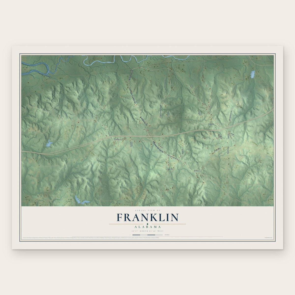


Search for another town





Free U.S. delivery 7 to 10 days after you order
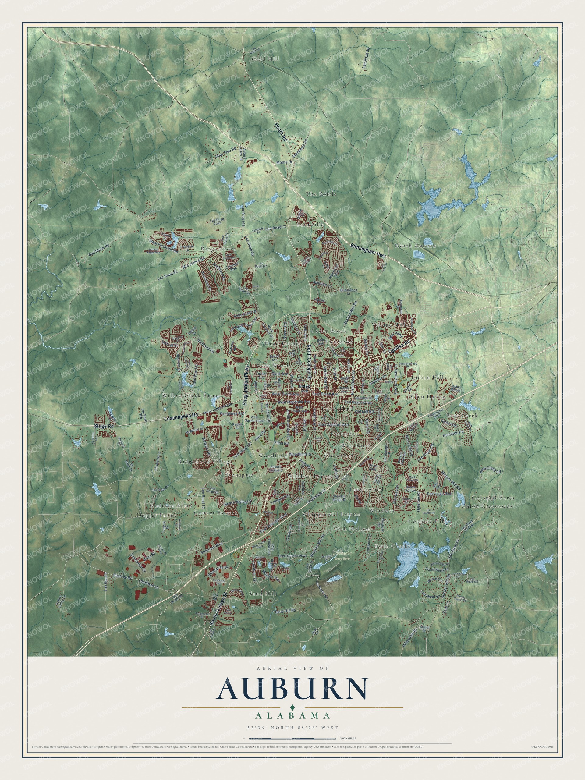
Auburn, Alabama Map Art
Building by building, with labeled streets and shaded relief.
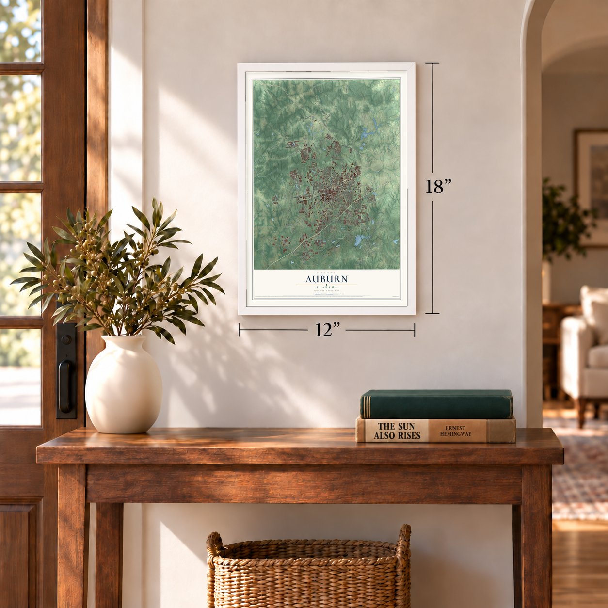
12" x 18" Archival Matte Print
A Map of Home. A Work of Art.
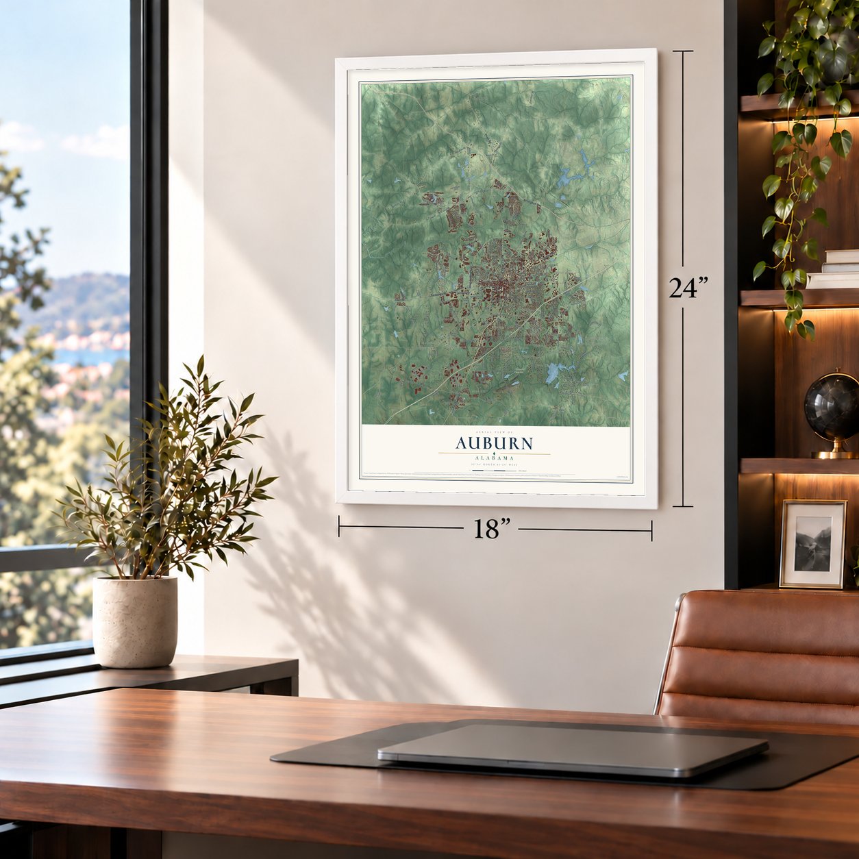
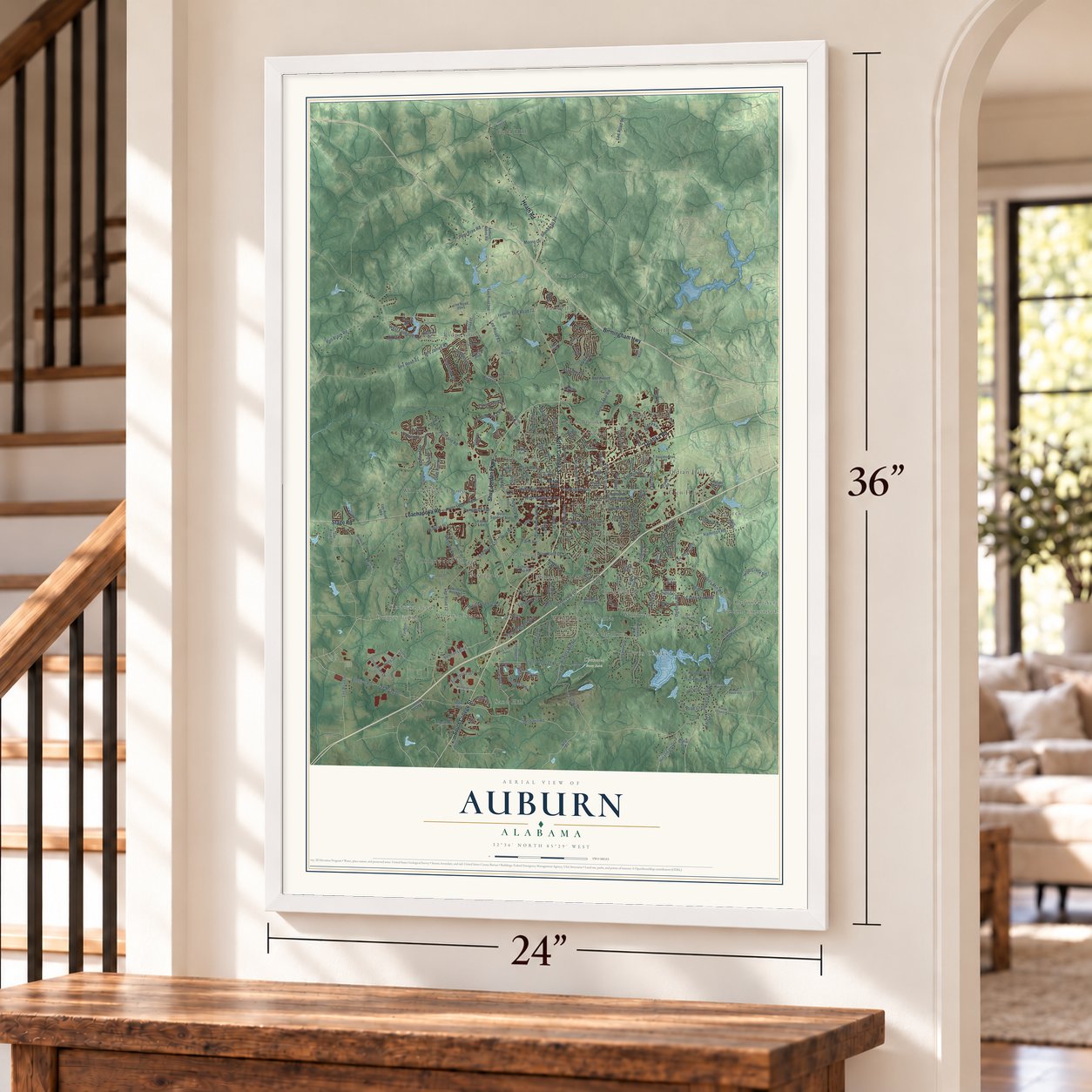
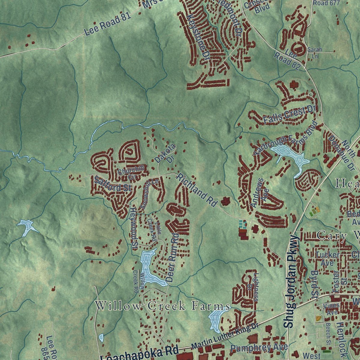
Explore Auburn, Alabama from a whole new perspective. Created using aerial imagery and detailed geographic data, this map captures Auburn building by building, with labeled streets, familiar landmarks, and shaded topographical relief that highlights the natural contours of the landscape.
Combining modern data with the timeless character of a vintage atlas, this map is just as interesting up close as it is beautiful on the wall. Whether you grew up in Auburn, spent memorable years there, or call it home today, this unique map is a great way to celebrate a place that means something to you. Zoom in on the preview to look for your street, and then order a print to put your memories on the wall.
Three ways to hang it
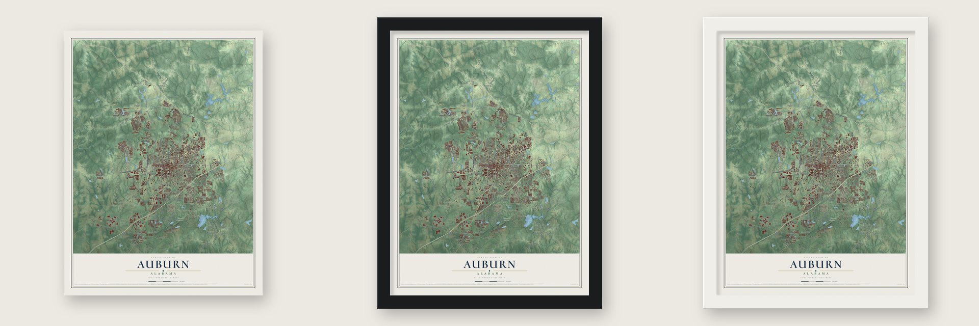
Unframed archival matte, a black wood frame or a white wood frame.
Up close
Geography Worth Displaying
This map was created using accurate cartographic data and authoritative geographic sources, including the U.S. Geological Survey and the Census Bureau. The map brings together terrain, waterways, roads, and building detail. The majority of the streets are labeled, houses are accurately depicted, and the topography is derived from government sources. Combining local data with carefully composed color and shading leads to this beautifully detailed Auburn artwork for your wall.
Rather than simply showing street outlines, we’ve included as many of the street names as we could reasonably fit on the map while keeping their names legible. Zoom in on the high resolution preview to see exactly what’s on the map. We truly set out to create a statement piece for anyone who loves Auburn. So whether it’s for you, or a gift for someone you love, we hope this map of Auburn brings back fond memories.
Read the story behind this map of Auburn, Alabama from 2026.

Find your street
Names on the Auburn map
Every name below is printed on this map. Look for your street, your school, the park where you played, or the pond down the road.
Places and landmarks37
- City Hall
- Chewacla State Park
- Bent Creek
- Cary Woods
- Cedar Brook
- Cloverleaf
- Colonial Acres
- Conner Estates
- Country Hills
- Duggar Farms
- Farmville
- Forestdale
Show all 37 places
- Glen Haven
- Gold Hill
- Head Estates
- Indian Hills
- Kuderna Acres
- North Auburn
- Oak Hollow
- Pickwood
- Ridge Grove
- Ridgewood Village
- Sand Hill
- Stonegate
- Tanglewood
- The Bottle
- Twin Creeks
- Union Crossroads
- Village Hills
- Whipporwill Estates
- Willow Creek Farms
- Windsor Forest
- Windway
- Woodfield
- Woodland
- Grove Park
- Technology Park
Streets and roads227
- South College Street
- Opelika Road
- Birmingham Highway
- Loachapoka Road
- Shug Jordan Parkway
- North College Street
- Heath Road
- Stage Road
- Lee Road 83
- West Longleaf Drive
- Lee Road 72
- Ogletree Road
- Hamilton Road
- East Glenn Avenue
- Shelton Mill Road
- South Gay Street
- West Magnolia Avenue
- Wire Road
- Farm Road
- Lee Road 81
- Stonewall Road
- Lee Road 137
- Lee Road 109
- East University Drive
- Lee Road 10
- Wrights Mill Road
- Moores Mill Road
- Society Hill Road
- Lee Road 54
- Richland Road
Show all 227 streets
- West Farmville Road
- East Samford Avenue
- Sand Hill Road
- South Donahue Drive
- Beehive Road
- North Dean Road
- Veterans Boulevard
- Mrs James Road
- Bud Black Road
- Sanders Street
- Enterprise Drive
- Webster Road
- Lee Road 12
- Deer Run Road
- Piedmont Drive
- Lee Road 47
- West Glenn Avenue
- Annalue Drive
- Green Street
- Pear Tree Road
- Canary Drive
- Nash Creek Road
- Woodfield Drive
- Lee Road 9
- North Ross Street
- Pumphrey Avenue
- Keystone Drive
- Lee Road 22
- Lee Road 96
- Fairway Drive
- East Veterans Boulevard
- East Lake Boulevard
- Southview Drive
- Mimms Trail
- Innovation Drive
- Byrd Street
- Old Mill Road
- Owens Road
- Falls Crest Drive
- Longleaf Drive
- Riley Street
- Gentry Drive
- Mall Parkway
- Mell Street
- Hillandale Drive
- Asheton Lane
- Felton Lane
- Hemlock Drive
- Clark Avenue
- Tara Lane
- Morris Drive
- Salford Street
- Cherry Street
- White Street
- Loftin Drive
- Pitts Street
- Bragg Avenue
- North Gay Street
- East Magnolia Avenue
- Lee Road 91
- Auburn Lakes Road
- North Donahue Drive
- Foster Street
- Watercrest Boulevard
- Cary Drive
- Lee Road 54 East
- Grove Hill Road
- Chadwick Lane
- Yarbrough Farms Boulevard
- West Samford Avenue
- Lee Road 56
- Moores Mill Drive
- Lee Road 82
- West Thach Avenue
- Kimberly Drive
- Crescent Boulevard
- Preserve Drive
- Dekalb Street
- Shell Toomer Parkway
- Lee Road 159
- Burke Place
- Windway Road
- Lee Road 57
- Lee Road 33
- Vfw Road
- Alex Avenue
- Longwood Drive
- Danbury Drive
- Auburn Camp Road
- Harper Avenue
- Rutland Road
- Placid Wood Road
- Cotton Valley Lane
- Lakeview Drive
- McCurry Lane
- Bibb Avenue
- Champions Boulevard
- Lee Road 046
- Heywood Street
- Airport Road
- Automotive Boulevard
- Lois Lane
- Wooden Bridge Drive
- Tamplin Drive
- Stoneridge Drive
- Bridalwood Drive
- Andrews Avenue
- Tacoma Drive
- Lee Road 865
- McMillan Street
- Carter Street
- Tal Hiem Drive
- Lee Road 50
- Reynolds Drive
- Ferndale Avenue
- Boykin Street
- Tallyho Court
- Lee Road 2045
- Dakota Drive
- Lee Road 191
- Goose Hollow
- Sophia Court
- Willers Point Road
- Bedell Avenue
- Duncan Drive
- Tucker Avenue
- Raptor Road
- Indian Hill Road
- Starr Court
- Arnell Lane
- Covey Drive
- Alahill Drive
- Lamb Lane
- Cox Road
- East Lane
- Kipling Lane
- Core Drive
- Alice Street
- Neal Road
- Farmville Road
- Murphy Drive
- Wimberly Road
- Bent Creek Road
- Saugahatchee Road
- Belmonte Drive
- Mimms Lane
- Persimmon Drive
- Pierce Chapel Road
- Rock Fence Road
- Lee Road 93
- Corporate Parkway
- Kirkland Drive
- West Creek Parkway
- Churchill Circle
- Snowshill Lane
- Commerce Drive
- Harmon Drive
- Monticello Drive
- Autumn Ridge Way
- Petrie Road
- Lee Road 19
- Lightness Drive
- River Wood Drive
- Lee Road 415
- Lee Road 677
- Oak Ridge Drive
- Blake Street
- Vines Avenue
- Ivy Lane
- Martin Luther King Drive
- Lee Road 97
- Springwood Drive
- Willow Creek Road
- Whisper Ridge Road
- Lee Road 433
- Oak Street
- West Drake Avenue
- Annabrook Drive
- Barksdale Lane
- Weatherford Street
- Binford Drive
- Kent Street
- Old Country Road
- Payne Street
- Golf Club Drive
- Hummingbird Lane
- Lakewood Place
- Biggio Drive
- Arlington Court
- North Camden Drive
- Little Creek Road
- Tuscany Village Drive
- Beech Street
- Mary Lane
- Virginia Avenue
- Law Drive
- Sarah Lane
Names are listed as they appear on the printed map. Zoom into the product photos to find them.
About Auburn, Alabama
Auburn is a city of 76,143 people in Lee County, in east-central Alabama. The land belonged to the Creeks until their leaders gave it up under the Treaty of Cusseta in 1832, and the last Creeks were forced out of east Alabama in 1836. In 1836 as well, John J. Harper, a Methodist who came from Harris County, Georgia, started the town, which then lay in Macon County. Fellow Methodists, friends and relatives came with him, along with the people they held in slavery. Local lore says a young woman named the town after a line in Oliver Goldsmith's poem The Deserted Village.
Auburn was incorporated on February 2, 1839, and churches, stores and schools soon followed. By 1851 the Montgomery and West Point Railroad, whose planned route may have drawn Harper here, linked the town to Montgomery and to Columbus, Georgia. Auburn Masonic Female College was founded in 1847, and the Methodists' East Alabama Male College, chartered in 1856, opened in 1859. By 1858 about 500 of the town's roughly 1,000 free residents were students. The state took over the college in 1872, and it was renamed Alabama Polytechnic Institute in 1899 and Auburn University in 1960.
- Hospitals and two raidsEvery school in Auburn closed when the Civil War began in 1861, and several hospitals took their place, one of them in the college's Old Main building. Federal troops came twice. In July 1864 General Lovell Rousseau's raiders wrecked the rail lines and the depot, and on April 15, 1865, six days after the surrender at Appomattox, a detachment of General James H. Wilson's soldiers passed through.
- Ebenezer Church, 1868After emancipation, Black families in Auburn began buying land and opening their own businesses and churches. Black Baptists organized Ebenezer Missionary Baptist Church in 1868 and put up its building in the early 1870s, and the church joined the National Register in 1975. From 1928 to 1957 Auburn was also home to the Lee County Training School, the county's first high school for Black students.
- A fraternity in a cornfieldFraternities were banned on campus when John E. D. Shipp arrived as a student, so he worked in secret with Sigma Alpha Epsilon brothers in Georgia. Two members of the Mercer University chapter, William H. Felton and Frank H. Greaves, came to Auburn and installed the Alpha Mu chapter on June 15, 1878, in a cornfield behind Old Main, on the ground where Samford Hall stands today. It was the first fraternity on campus.
- Harold Franklin in 1964Under a court order, university president Ralph Brown Draughon accepted Harold Franklin's application in 1963, and Franklin became Auburn's first African American student. To avoid the trouble seen at other Southern universities, Draughon set registration for Saturday, Jan. 4, 1964, and shut the campus. Officials and FBI agents met Franklin at Auburn Methodist Church, but Governor George Wallace's state troopers blocked them, so Franklin went on alone and entered the library to register.
- The New Deal at ChewaclaDuring the Great Depression, New Deal programs put people to work in Auburn. The Civilian Conservation Corps cleared trails, put up buildings and dug a lake on the land that became Chewacla State Park. The Public Works Administration paid for four women's dormitories, classroom buildings, a house for the president and the football stadium at Alabama Polytechnic Institute.
Keep exploring Alabama
Auburn is one of 675 Alabama towns we've mapped. Every dot on the map is a print of its own.
The search covers every state, Alabama first.
Near Auburn
Order 2 or more town maps and save 10%. Shown in the size and finish you picked above, so they hang as a set.
- Loachapoka 12" x 18" / Archival Matte Print $39.99
- Opelika 12" x 18" / Archival Matte Print $39.99
- Beauregard 12" x 18" / Archival Matte Print $39.99


More maps nearby: Waverly, Notasulga, Camp Hill, Cusseta and Tuskegee.
The art of mapping a place
How This Map Was Made
Real places. Remarkable detail. Discover the layers that turn geographic data into a map of home.

The view from above
Aerial imagery reveals the character of the land: woodland, open fields, and the patterns of a place.

The shape of the land
Elevation data brings hills, valleys, and subtle changes in the landscape into view.

The details of home
Roads, waterways, and building footprints come together to make the map feel unmistakably local.

Geography becomes art
Considered color, shading, and typography bring the layers together in a map made for your wall.


Process illustrated with Mendon, Massachusetts. Aerial imagery: USDA NAIP. Terrain: USGS 3D Elevation Program. Map details and finished artwork: KNOWOL.
The Details
About This Print
Choose an archival matte print, or a black or white Ayous wood frame. The archival matte print is unframed.
Select your size and finish above to see the matching product image and price.
Materials & Craftsmanship
A contemporary map with the character of a classic atlas, printed on archival matte paper. Optional frames are made from Ayous wood.
Your printed map does not include the watermark shown in the full-map preview.
Shipping & Delivery
Free shipping within the United States. Every print is made to order in the USA.
Buying a gift? Add a note in your cart and we'll include it. We never put prices in the package.
Prints ship within 2 to 3 business days. Allow 7 to 10 days total from ordering for delivery. Timing may vary during holidays or periods of high order volume.
Read our shipping policy.
Returns and damaged prints
Each print is made to order. Change-of-mind refunds are not available after production.
If your print arrives damaged, misprinted or incorrect, contact support@knowol.com within 30 days of receiving it. Include your order number, photos and a description of the issue.
Read our full refund and replacement policy. For questions about your order, email support@knowol.com.