


Search for another town





Free U.S. delivery 7 to 10 days after you order
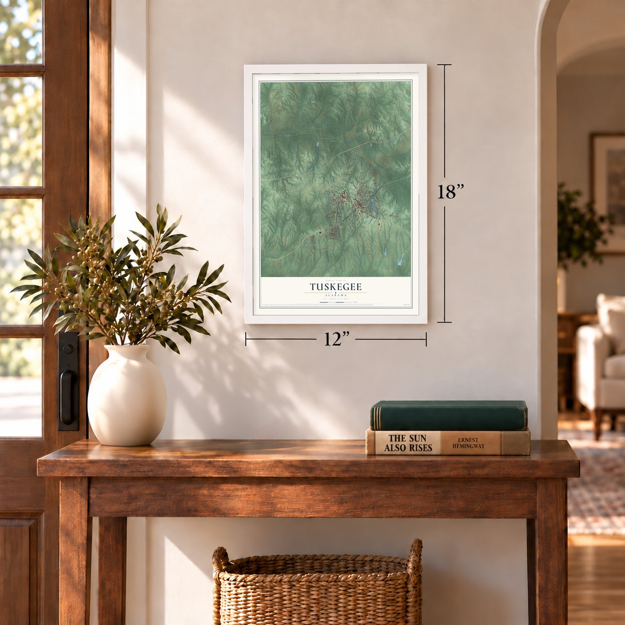
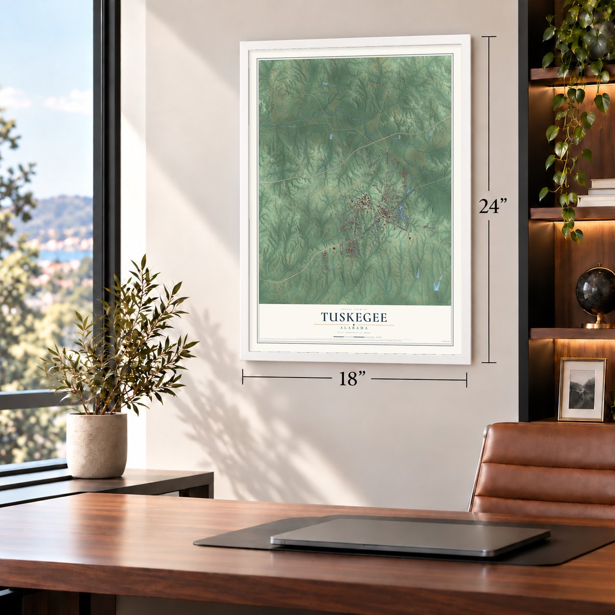
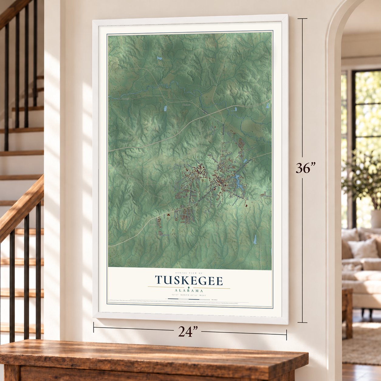
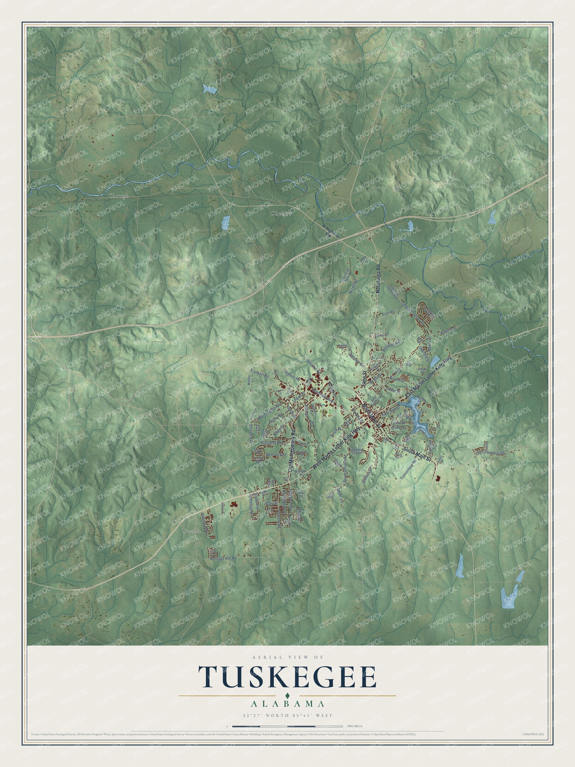
Tuskegee, Alabama Map Art
Building by building, with labeled streets and shaded relief.
12" x 18" Archival Matte Print
A Map of Home. A Work of Art.
Explore Tuskegee, Alabama from a whole new perspective. Created using aerial imagery and detailed geographic data, this map captures Tuskegee building by building, with labeled streets, familiar landmarks, and shaded topographical relief that highlights the natural contours of the landscape.
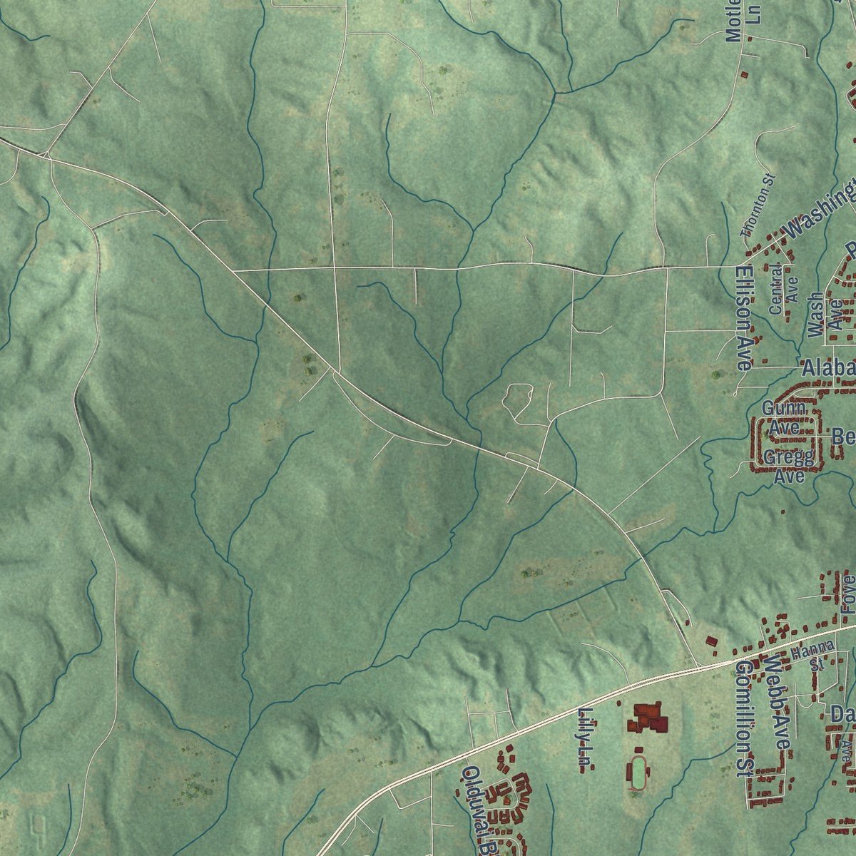
Combining modern data with the timeless character of a vintage atlas, this map is just as interesting up close as it is beautiful on the wall. Whether you grew up in Tuskegee, spent memorable years there, or call it home today, this unique map is a great way to celebrate a place that means something to you. Zoom in on the preview to look for your street, and then order a print to put your memories on the wall.
Three ways to hang it
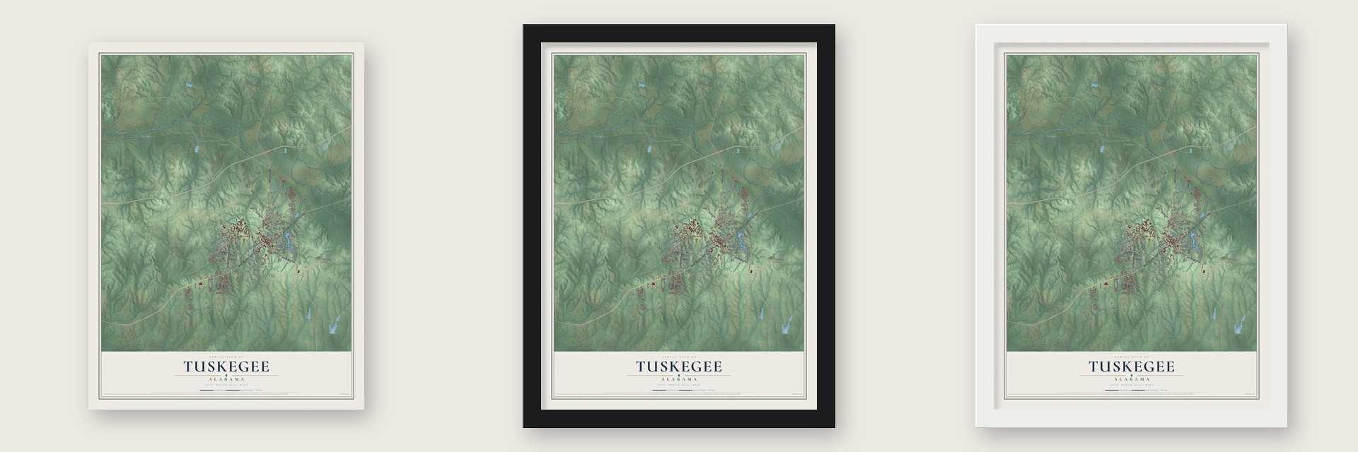
Unframed archival matte, a black wood frame or a white wood frame.
Up close
Geography Worth Displaying
This map was created using accurate cartographic data and authoritative geographic sources, including the U.S. Geological Survey and the Census Bureau. The map brings together terrain, waterways, roads, and building detail. The majority of the streets are labeled, houses are accurately depicted, and the topography is derived from government sources. Combining local data with carefully composed color and shading leads to this beautifully detailed Tuskegee artwork for your wall.
Rather than simply showing street outlines, we’ve included as many of the street names as we could reasonably fit on the map while keeping their names legible. Zoom in on the high resolution preview to see exactly what’s on the map. We truly set out to create a statement piece for anyone who loves Tuskegee. So whether it’s for you, or a gift for someone you love, we hope this map of Tuskegee brings back fond memories.
Read the story behind this map of Tuskegee, Alabama from 2026.

Find your street
Names on the Tuskegee map
Every name below is printed on this map. Look for your street, your school, the park where you played, or the pond down the road.
Places and landmarks3
- Clough
- Seasha
- Chehaw
Streets and roads105
- Lane Street
- North Main Street
- South Main Street
- West Martin Luther King Highway
- East Martin Luther King Highway
- Old Montgomery Road
- Notasulga Road
- Hospital Road
- Ashdale Road
- Old Columbus Road
- Vaughn Street
- Gomillion Street
- East Oak Street
- Auburn Street
- Chappie James Drive
- Franklin Road
- Bibb Street
- Campus Road
- Gautier Street
- Railroad Avenue
- Taylor Street
- Washington Avenue
- Nancy Street
- Mizell Road
- Heritage Hill Road
- South Church Street
- Howard Road
- Alabama Avenue
- University Avenue
- Laslie Street
Show all 105 streets
- Penny Street
- Eich Road
- Benson Avenue
- Washington Street
- Dryer Lane
- Logan Street
- Wright Street
- Brown Street
- Tomorrrow Road
- Patterson Street
- Avant Street
- Payton Drive
- Webb Avenue
- Olduvai Boulevard
- Ridge Street
- Cedar Street
- Ellison Avenue
- Fonville Street
- Georgia Street
- Ethel Street
- Daly Street
- Al Highway 199
- Macon Drive
- Wash Avenue
- East Spring Street
- Chappie James Avenue
- Industrial Park Road
- Hunter Street
- Barrow Street
- Highland Hill Drive
- Brewer Street
- Scott Street
- Anona Street
- Campbell Drive
- Clements Street
- Colvert Street
- Porter Drive
- Motley Lane
- Susie Circle
- Chris Circle
- Lon Street
- Gunn Avenue
- Lilly Lane
- Gregg Avenue
- Ash Lane
- Lula Street
- Foye Avenue
- Omar Drive
- Gail Street
- Mill Drive
- Chanault Drive
- West Outer Drive
- Northeast Brothers Drive
- Gaillard Drive
- Lennard Avenue
- Hanna Street
- Johnson Street
- Haggins Street
- Fords Circle
- Central Avenue
- Hajack Drive
- Sullins Drive
- Gay Street
- Lakeshore Drive
- Thornton Street
- Williams Street
- White Street
- Barrack Street
- Lakeview Drive
- Maywood Street
- Freddie Drive
- Lacey Street
- Pruitt Avenue
- Rush Drive
- Cole Street
Names are listed as they appear on the printed map. Zoom into the product photos to find them.
About Tuskegee, Alabama
Tuskegee is a city of 9,395 people and the seat of Macon County, in central Alabama. Gen. Thomas Simpson Woodward, who had fought under Andrew Jackson in the Creek War of 1813-14, laid out the town in 1833, a year after the county was created. He is said to have picked it as the county seat, and he built its first house. The name came from Taskigi, a nearby Creek town where the Coosa and Tallapoosa rivers meet.
Creek families still lived here when the town began, but after they were forced out of Alabama in 1836, white settlers poured in. Tuskegee was incorporated on February 13, 1843, and the Tuskegee News first came out in April 1865. By 1855 it was one of five Macon County trading towns and the only one without a railroad. Its central spot and the courthouse kept trade coming, and with no tracks to follow, its streets were laid out around the courthouse square.
- A school founded in 1881Lewis Adams, a former slave, founded the Tuskegee Normal School in 1881, and the young Booker T. Washington became its first principal. Classes began on an old plantation, training teachers for Black schools, and Washington had students practice trades as they studied. The school grew into Tuskegee Institute and later Tuskegee University. Its best-known teacher, George Washington Carver, developed hundreds of products from peanuts and sweet potatoes. The campus became the Tuskegee Institute National Historic Site in 1966.
- Alabama's first Black hospitalTuskegee Institute opened Alabama's first Black hospital in 1892 for its students and teachers, at first only to train nurses. A gift in 1902 in honor of Massachusetts governor John A. Andrew let it grow, and it took his name. After World War I the Institute gave 300 acres for a veterans' hospital, which opened in 1923 with 27 buildings to serve Black veterans across the segregated South.
- A 28-sided cityIn 1957, 400 of the city's 1000 registered voters were Black, near the white total, though Black residents outnumbered whites four to one. The legislature's Local Law 140 made the city 28-sided, leaving only ten Black voters inside and no white ones outside. About 3,000 Black residents rallied at a church, starting a "selective buying campaign"; in four years, twenty-six white businesses closed. The Supreme Court voided the law in 1960 in Gomillion v.
- Integration in 1963Under a federal order, Tuskegee was set to be the first Alabama community to desegregate its public schools, with 13 Black students entering the all-white high school. Gov. George Wallace sent state troopers to keep Tuskegee High School closed on September 3, 1963. The school finally opened on September 10, once President John F. Kennedy had put the Alabama National Guard under federal control, and the 13 Black students were among 165 who started the year.
- Sheriff Lucius AmersonIn 1966 Macon County voters elected Lucius Amerson sheriff, making him the first Black sheriff elected in Alabama, or anywhere in the South, since Reconstruction. He was sworn in at the county seat in January 1967.
Keep exploring Alabama
Tuskegee is one of 675 Alabama towns we've mapped. Every dot on the map is a print of its own.
The search covers every state, Alabama first.
Near Tuskegee
Order 2 or more town maps and save 10%. Shown in the size and finish you picked above, so they hang as a set.
- Franklin 12" x 18" / Archival Matte Print $39.99
- Notasulga 12" x 18" / Archival Matte Print $39.99
- Reeltown 12" x 18" / Archival Matte Print $39.99


More maps nearby: Loachapoka, Tallassee, Shorter, Auburn and Fitzpatrick.
The art of mapping a place
How This Map Was Made
Real places. Remarkable detail. Discover the layers that turn geographic data into a map of home.

The view from above
Aerial imagery reveals the character of the land: woodland, open fields, and the patterns of a place.

The shape of the land
Elevation data brings hills, valleys, and subtle changes in the landscape into view.

The details of home
Roads, waterways, and building footprints come together to make the map feel unmistakably local.

Geography becomes art
Considered color, shading, and typography bring the layers together in a map made for your wall.


Process illustrated with Mendon, Massachusetts. Aerial imagery: USDA NAIP. Terrain: USGS 3D Elevation Program. Map details and finished artwork: KNOWOL.
The Details
About This Print
Choose an archival matte print, or a black or white Ayous wood frame. The archival matte print is unframed.
Select your size and finish above to see the matching product image and price.
Materials & Craftsmanship
A contemporary map with the character of a classic atlas, printed on archival matte paper. Optional frames are made from Ayous wood.
Your printed map does not include the watermark shown in the full-map preview.
Shipping & Delivery
Free shipping within the United States. Every print is made to order in the USA.
Buying a gift? Add a note in your cart and we'll include it. We never put prices in the package.
Prints ship within 2 to 3 business days. Allow 7 to 10 days total from ordering for delivery. Timing may vary during holidays or periods of high order volume.
Read our shipping policy.
Returns and damaged prints
Each print is made to order. Change-of-mind refunds are not available after production.
If your print arrives damaged, misprinted or incorrect, contact support@knowol.com within 30 days of receiving it. Include your order number, photos and a description of the issue.
Read our full refund and replacement policy. For questions about your order, email support@knowol.com.