
Search for another town





Free U.S. delivery 7 to 10 days after you order
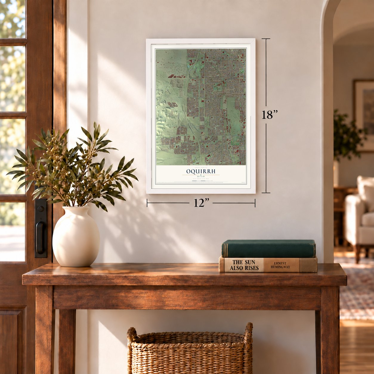
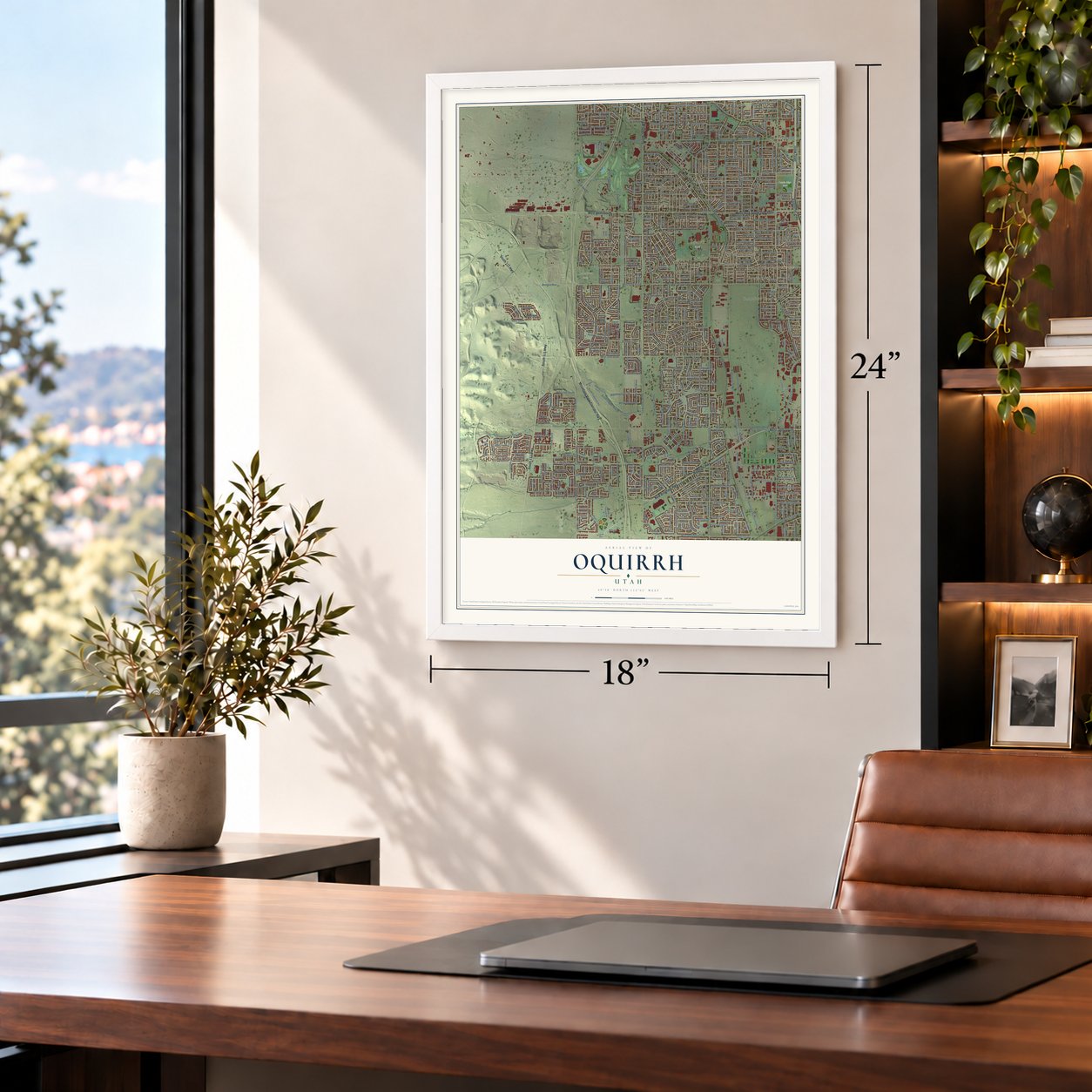
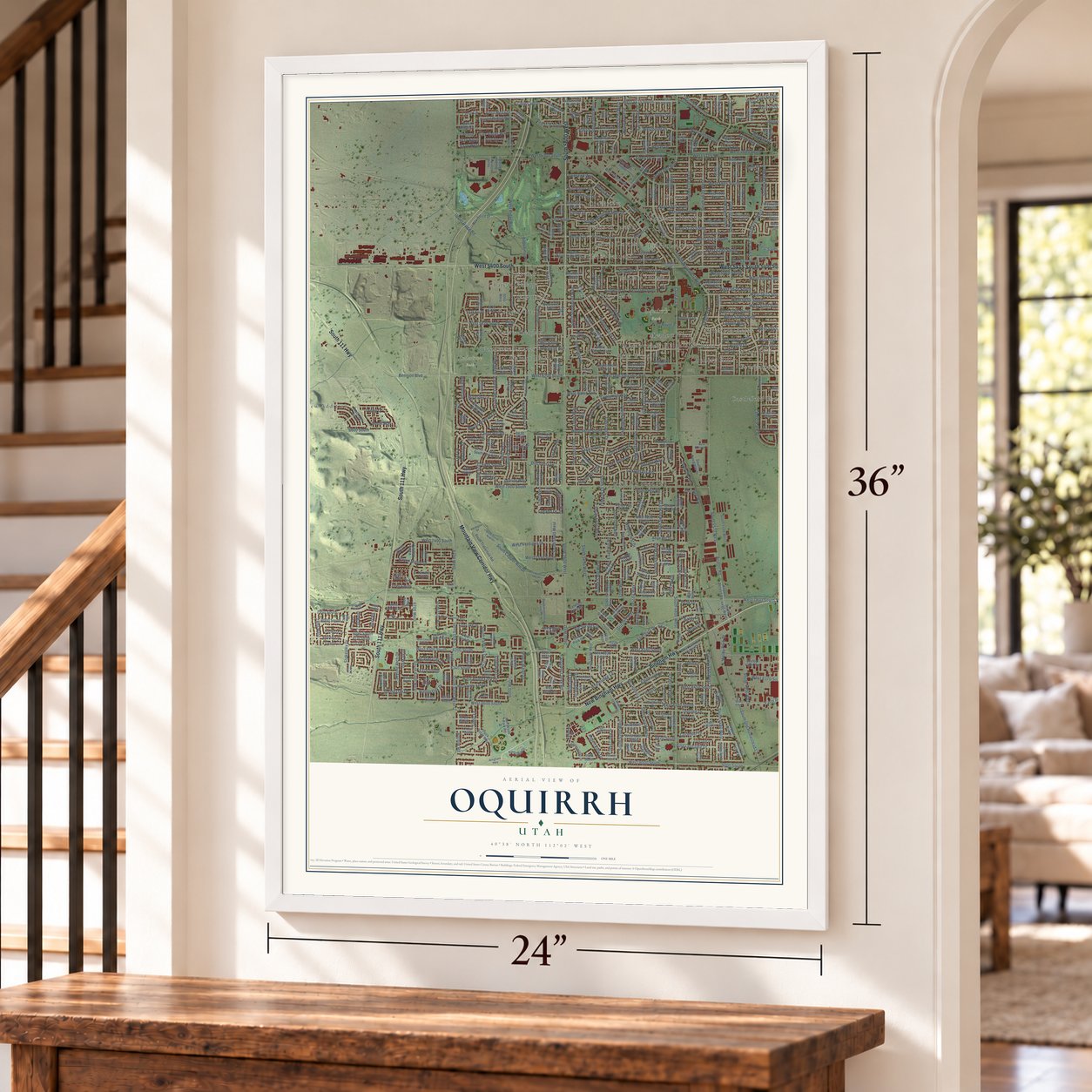
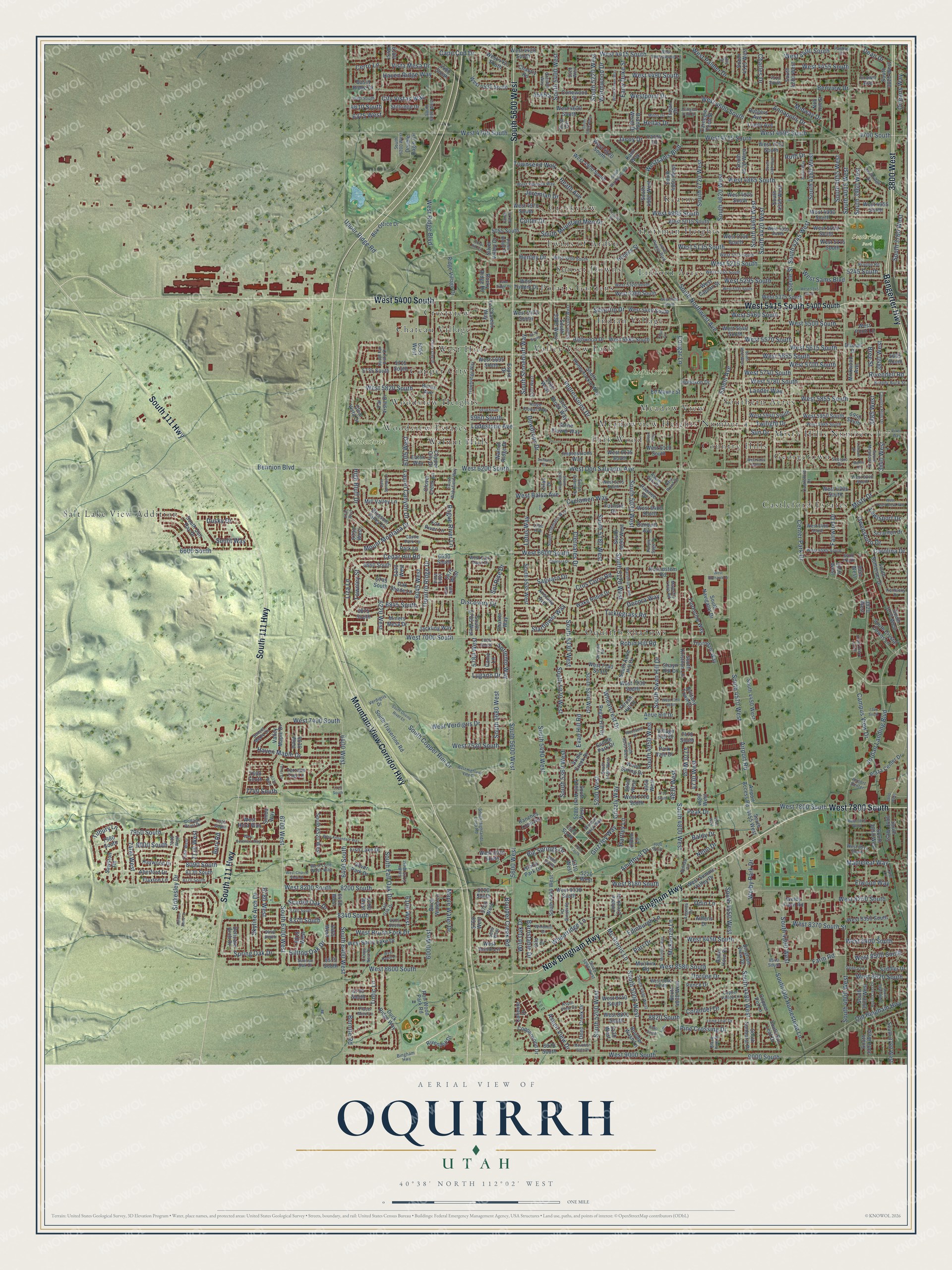
Oquirrh, Utah Map Art
Building by building, with labeled streets and shaded relief.
12" x 18" Archival Matte Print
A Map of Home. A Work of Art.
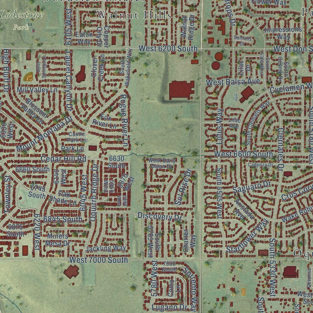
Explore Oquirrh, Utah from a whole new perspective. Created using aerial imagery and detailed geographic data, this map captures Oquirrh building by building, with labeled streets, familiar landmarks, and shaded topographical relief that highlights the natural contours of the landscape.
Combining modern data with the timeless character of a vintage atlas, this map is just as interesting up close as it is beautiful on the wall. Whether you grew up in Oquirrh, spent memorable years there, or call it home today, this unique map is a great way to celebrate a place that means something to you. Zoom in on the preview to look for your street, and then order a print to put your memories on the wall.
Three ways to hang it
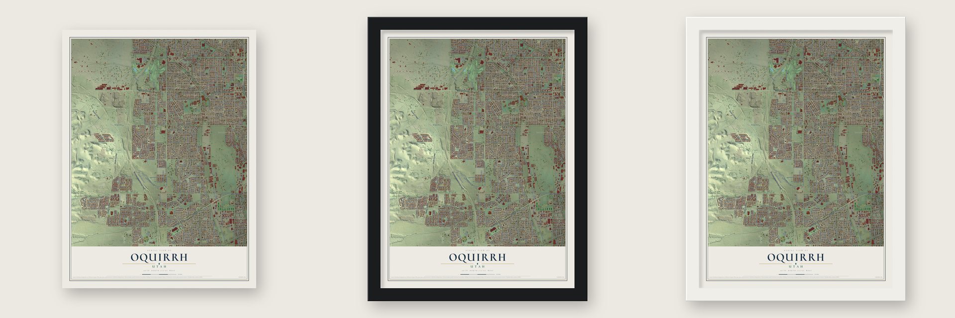
Unframed archival matte, a black wood frame or a white wood frame.
Up close
Geography Worth Displaying
This map was created using accurate cartographic data and authoritative geographic sources, including the U.S. Geological Survey and the Census Bureau. The map brings together terrain, waterways, roads, and building detail. The majority of the streets are labeled, houses are accurately depicted, and the topography is derived from government sources. Combining local data with carefully composed color and shading leads to this beautifully detailed Oquirrh artwork for your wall.
Rather than simply showing street outlines, we’ve included as many of the street names as we could reasonably fit on the map while keeping their names legible. Zoom in on the high resolution preview to see exactly what’s on the map. We truly set out to create a statement piece for anyone who loves Oquirrh. So whether it’s for you, or a gift for someone you love, we hope this map of Oquirrh brings back fond memories.
Read the story behind this map: Detailed Map of Oquirrh, Utah.

Find your street
Names on the Oquirrh map
Every name below is printed on this map. Look for your street, your school, the park where you played, or the pond down the road.
Places and landmarks29
- Lodestone Park
- Oquirrh Park
- Southridge Park
- Salt Lake View Addition
- Oquirrh Shadows
- Copper City
- Hoffman Heights
- Sunset Downs
- Crestview
- Castleford Estates
- Park Wood
- Walnut Hills
Show all 29 places
- Polaris Gardens
- Southern Acres
- Creekview
- West Hills
- Meadowview Heights Number 4
- Woodview Heights
- Indian Village
- Country Hills
- Kearns
- Woodview Estates
- Twins of Arden
- Valley View Park
- Chateau Village
- Linford Acres
- Georgetown
- Meadow View
- Misty Hills Numbers 1-7
Streets and roads600
- West 7800 South
- New Bingham Highway
- Bingham Highway
- Mountain View Corridor Highway
- South 111 Highway
- West 5400 South
- Bangerter Highway
- 3800 West
- South 5600 West
- West 5415 South
- Grizzly Way
- 6700 West
- South 6700 West
- Wheatcrest Drive
- Amethyst Drive
- Cedar Hill Road
- Hilltop Oak Drive
- South Fall Oak Drive
- 8340 South
- Haven Maple Drive
- Big Springs Drive
- Townley Street
- West 7400 South
- South Swan Hill Drive
- Robin Hill Road
- South 4950 West
- South 4015 West
- West 5855 South
- South 6400 West
- 6400 West
Show all 600 streets
- Spring Oak Drive
- 6400 South
- Twilight Drive
- West 5215 South
- 7950 South
- Westsams Boulevard
- South 4300 West
- West 8250 South
- West 8200 South
- South 4000 West
- South 5180 West
- Salem Avenue
- South 5200 West
- West 4695 South
- West Don Salvador Avenue
- Grizzley Way
- South 5220 West
- 5600 West
- High Bluff Drive
- South 4460 West
- Misty Drive
- 6845 South
- Midway Drive
- Liza Lane
- South 4480 West
- South 4245 West
- West 6200 South
- Rogue River Lane
- West 4715 South
- South 4620 West
- South 5000 West
- Benview Drive
- South Northwest Avenue
- West 8180 South
- West 8450 South
- South 5370 West
- Henley Drive
- 4830 West
- Ticklegrass Road
- Jordan Landing Boulevard
- Campus View Drive
- Mc Ginnis Lane
- South 4550 West
- South 3760 West
- Boulder Creek Road
- 6000 West
- Cape Cod Drive
- West 7520 South
- 7400 West
- 6220 West
- 4610 South
- West 5655 South
- 6780 West
- South 4800 West
- West 4700 South
- West 7000 South
- 8200 South
- Airport Road
- Cougar Lane
- West 9000 South
- Center Park Drive
- Bennion Boulevard
- South 5120 West
- West 4865 South
- West 5820 South
- South 4420 West
- Clernates Drive
- West Ridge Boulevard
- South 4570 West
- South 5330 West
- 9000 South
- Heath Avenue
- South 5030 West
- West 5780 South
- West 4985 South
- Saguaro Drive
- South 5490 West
- West 6600 South
- West 4415 South
- Impressions Drive
- Lotus Way
- West 8580 South
- West 8620 South
- South Copper Rim Drive
- West 5500 South
- Cyclamen Way
- Lodestone Avenue
- South 4180 West
- West 5615 South
- Silvertip Drive
- Old Bingham Highway
- Westpoint Drive
- South 5400 West
- South 3960 West
- Sun Drive
- Upper Ridge Road
- South 4720 West
- West 5135 South
- Rivendell Road
- West 8600 South
- South Mountain Men Drive
- Edinburgh Lane
- West Palmer Drive
- Laurel Canyon Drive
- 3840 West
- West 5700 South
- Wormwood Drive
- West 4400 South
- Parr Drive
- City Vistas Way
- West 8400 South
- West 4490 South
- West 5740 South
- Discovery Drive
- Stokesley Drive
- Dorilee Drive
- West Brush Fork Drive
- South Old Homestead Lane
- Tintic Lane
- Aspen View Drive
- 6600 South
- Townsend Way
- Oquirrh Ridge Drive
- Steele Street
- Fairwind Drive
- South 5360 West
- Jeremiah Drive
- Farm Road
- Wild Oak Drive
- 3885 West
- Crus Corvi Road
- Wheatridge Lane
- 8820 South
- West 5460 South
- Dean Drive
- Welby Park Drive
- 6375 West
- 8370 South
- West 4600 South
- Mapleleaf Way
- West 5570 South
- Lander Way
- South 4055 West
- Early Duke Street
- South Stonebluff Way
- South 5680 West
- Annapolis Drive
- West 4455 South
- Mount Montana Drive
- West Verdigris Drive
- 6045 West
- West 8370 South Street
- Haven Ridge Way
- Dusky Drive
- West 5295 South
- 3850 West
- Sorrento Way
- Dewdrops Drive
- Vista Mesa Drive
- Pine Crossing Drive
- Scarlet Oak Drive
- West Sams Boulevard
- 4700 South
- Decora Way
- Skyline Arch Drive
- 5200 West
- Sunlit Way
- Charles Drive
- 4730 West
- West 8500 South
- Ruth Drive
- Owensboro Drive
- Jacoy Drive
- West Balsa Avenue
- 8000 South
- McKenzie Lane
- Maple Water Drive
- Colter Drive
- Barnstable Drive
- Hellas Drive
- Colander Drive
- 4770 West
- Nebo Drive
- Starflower Way
- Elwood Way
- Odin Lane
- Peak Drive
- Tilbury Lane
- Lewisport Drive
- Cerro Lane
- 6105 West
- 5780 West
- Bree Street
- Orleans Way
- 6100 West
- 8090 South
- 5960 South
- 5245 South
- 7740 South
- Carolina Drive
- Evan Hill Road
- Hartley Lane
- Lugano Drive
- 7110 West
- Bornite Road
- Baldy Drive
- Sol Rise Drive
- Bury Road
- 5400 South
- South 5420 West
- Island Park Drive
- Valley Maple Drive
- South Aerie Hill Drive
- 6330 West
- 6745 South
- 5950 South
- 3920 West
- Oak Shade Lane
- 6180 West
- 5310 West
- South 4980 West
- Brittany Town Drive
- Fish Lake Drive
- Welby Farm Road
- West 5950 South
- Aerie Hill Drive
- 6630 South
- 5280 West
- 3955 West
- South Sunburst Place
- 5220 West
- 6140 West
- South 4280 West
- South Sun Leaf Drive
- West 5115 South
- Wood Spring Drive
- Bingham View Drive
- 7920 South
- West 8230 South
- Hoopes Street
- South 5385 West
- 5760 West
- 5870 West
- South 4830 West
- Ron Wood Park Road
- South 5300 West
- Village Dell Drive
- West 6305 South
- Rams Horn Drive
- West 4425 South
- 5460 West
- Brandy Wood Drive
- 5735 South
- 8220 South
- Caliente Drive
- 4050 West
- South 4520 West
- Copper City Drive
- Airport Access Road
- West 4535 South
- West 5015 South
- Bridle Creek Drive
- West 5100 South
- South 5095 West
- Stone Flower Way
- West 8350 South
- South 5535 West
- West 5580 South
- 6430 West
- Wake Robin Drive
- West 5375 South
- West 5540 South
- West 4955 South
- South 5240 West
- West 5440 South
- Banquet Avenue
- Duck Ridge Way
- Highwood Drive
- West 4970 South
- Borax Avenue
- Plaza Center Drive
- West 4745 South
- Copper Pot Lane
- South 3850 West
- South 3780 West
- South Honeysuckle Way
- West 4990 South
- Aberford Drive
- West 7230 South
- Ranches Loop Road
- Thrush Hill Drive
- West 8820 South
- South 3900 West
- Clover Creek Lane
- 6055 West
- South 3820 West
- Mill Valley Lane
- Le Chateau Way
- West 4925 South
- South Sun Ray Drive
- Flaxton Lane
- Jackling Way
- South 4340 West
- Birch Water Lane
- 7980 South
- South 4860 West
- West 5360 South
- West 6135 South
- South 6520 West
- Double Eagle Circle
- Dimrall Drive
- West 8740 South
- West 7140 South
- Silver Valley Drive
- Deep Creek Drive
- South 3920 West
- Rivendell Drive
- West Spray Lake Drive
- Far Vista Drive
- South Travertine Road
- Clear Vista Drive
- West 6110 South
- Lacoy Drive
- Carnegie Tech Street
- West 4620 South
- Muirkirk Road
- Florentine Way
- Stony Brook Way
- South 3800 West
- West 7770 South
- 5700 West
- West 4900 South
- West 5940 South
- Conewood Street
- Silver Park Drive
- Shayn Hill Drive
- Ridge Village Drive
- South Crystal Downs Lane
- South Navigator Drive
- South Somerset Drive
- Saddler Drive
- Thorndale Way
- Copperwood Drive
- Box Office Drive
- West 5050 South
- South 4450 West
- South 3770 West
- 6465 West
- West Summit Valley Drive
- Boulder Wash Lane
- Miners Mesa Drive
- Rocky Ridge Road
- 8575 South
- Stillridge Drive
- 6290 West
- Fuchsia Drive
- South 4515 West
- Pawnee Drive
- 4480 South
- 8720 South
- Roundstem Road
- West 5695 South
- West Trident Drive
- Haywood Drive
- West 8030 South
- West Annie Lane
- Blossom Valley Lane
- 5715 South
- West Caplan Street
- South 5785 West
- Trinity Avenue
- Como Lane
- Mirkwood Avenue
- Cobble Creek Drive
- 6660 South
- West 6400 South
- Aristada Avenue
- Hobbson Drive
- Impressions Way
- 6875 South
- South 4455 West
- Rutgers Avenue
- South Kristilyn Lane
- 8130 South
- Regal Hill Drive
- 8970 South
- Delicate Arch Drive
- Ed Mayne Street
- Silo Drive
- 6630 West
- West Point Lane
- Charter Way
- Basin Ridge Drive
- West 4420 South
- Kami Way
- Athens Drive
- West Hera Way
- Scranton Drive
- Sawston Road
- Nob Hill Street
- 4950 West
- 5055 South
- Walnut Ridge Drive
- Eaton Way
- Saddle Park Drive
- Fox River Lane
- West 4820 South
- West 5470 South
- Crown Avenue
- Chantry Road
- Trojan Drive
- Terrace Top Lane
- Park Vale Drive
- 4690 West
- Esprit Drive
- 6615 West
- Pence Drive
- Simba Way
- 5130 West
- 5040 West
- 7660 South
- Park Lane
- Lilac Drive
- Inca Circle
- Olden Lane
- 5665 South
- 7470 South
- 8060 South
- South 5290 West
- Sunset Maple Drive
- South Wakefield Way
- South Pieper Boulevard
- South 5040 West
- 4510 South
- Castleford Drive
- 5320 West
- Marshrock Road
- West 5055 South
- West 5175 South
- West 5985 South
- Trowbridge Way
- West Cherrywood Lane
- South Highlands Loop Road
- Ridge Flower Way
- South 4990 West
- South 5160 West
- South 6000 West
- Fall Oak Drive
- West 5200 South
- West 8660 South
- Country Hills Drive
- Azure Meadow Drive
- South Clematis Way
- Scorpio Drive
- West 6480 South
- Southridge Drive
- Paskay Drive
- West 5255 South
- Spratling Drive
- 8320 South
- West Planada Way
- West 5320 South
- West 8010 South
- Windmill Drive
- Aspin View Drive
- Copper Valley Lane
- West Early Dawn Drive
- South 6120 West
- Park Point Drive
- South 5340 West
- Sunrise Oak Drive
- Brandy Buck Street
- 4580 South
- West 6585 South
- 7150 West
- Window Rock Way
- Cottage Point Drive
- West Lone Wash Way
- Lilac Avenue
- Crows Nest Drive
- South Cosmo Drive
- Milos Drive
- Piney Ridge Drive
- Placer Mine Lane
- 8375 South
- South Far Vista Drive
- Long Leaf Drive
- Aspen Park Drive
- October Way
- Purple Sage Drive
- 8170 South
- 5510 West
- 8440 South
- South 6200 West
- Majestic Loop Road
- West 6240 South
- West 6275 South
- Brixton Road
- Gentry Lane
- 7030 South
- Castle Park Lane
- Argenta Drive
- Kentucky Drive
- 7895 South
- 6610 South
- Lynn Lane
- Verdigris Drive
- Black Pine Street
- 8540 South
- 5950 West
- 7230 West
- Tuscan Street
- Airport Center
- Belnap Circle
- 5690 West
- Jills Place
- 8020 South
- West 7310 South
- Devonna Road
- 7990 South
- Mountain Vista Drive
- China Clay Drive
- South 4500 West
- Vixen Way
- South 4380 West
- Cadenza Drive
- South 5260 West
- West 5335 South
- West Tuscaloosa Way
- West Annandale Way
- 6730 West
- West 6165 South
- South 3840 West
- Arlington Park Drive
- Allison Bend Drive
- Deer Springs Lane
- McIntyre Way
- White Flower Way
- South Cherry Leaf Drive
- South Warehouse Road
- Royal Crest Drive
- South Olivine River Lane
- Lishawn Drive
- West Highland Vale Drive
- 5930 South
- West 7875 South
- West 5345 South
- West Serenera Way
- Fallen Oak Road
- West Church View Drive
- Aaron Way
- South 5365 West
- Woodacre Drive
- Coral Hill Circle
- West Skyhawk Drive
- West Dahill Lane
- 7340 South
- Filbert Way
- Teflur Drive
- 8890 South
- Lake Ridge Drive
- 5570 South
- 7750 South
- 4640 West
- Sunfalls Court
- 5900 West
- Talon Circle
- 6370 West
- Marlis Circle
- 7725 South
Names are listed as they appear on the printed map. Zoom into the product photos to find them.
Keep exploring Utah
Oquirrh is one of 363 Utah towns we've mapped. Every dot on the map is a print of its own.
The search covers every state, Utah first.
Near Oquirrh
Order 2 or more town maps and save 10%. Shown in the size and finish you picked above, so they hang as a set.
- Kearns 12" x 18" / Archival Matte Print $39.99
- West Jordan 12" x 18" / Archival Matte Print $39.99
- West Valley City 12" x 18" / Archival Matte Print $39.99


More maps nearby: Taylorsville, Copperton, South Jordan, Midvale and Glendale.
The art of mapping a place
How This Map Was Made
Real places. Remarkable detail. Discover the layers that turn geographic data into a map of home.

The view from above
Aerial imagery reveals the character of the land: woodland, open fields, and the patterns of a place.

The shape of the land
Elevation data brings hills, valleys, and subtle changes in the landscape into view.

The details of home
Roads, waterways, and building footprints come together to make the map feel unmistakably local.

Geography becomes art
Considered color, shading, and typography bring the layers together in a map made for your wall.


Process illustrated with Mendon, Massachusetts. Aerial imagery: USDA NAIP. Terrain: USGS 3D Elevation Program. Map details and finished artwork: KNOWOL.
The Details
About This Print
Choose an archival matte print, or a black or white Ayous wood frame. The archival matte print is unframed.
Select your size and finish above to see the matching product image and price.
Materials & Craftsmanship
A contemporary map with the character of a classic atlas, printed on archival matte paper. Optional frames are made from Ayous wood.
Your printed map does not include the watermark shown in the full-map preview.
Shipping & Delivery
Free shipping within the United States. Every print is made to order in the USA.
Buying a gift? Add a note in your cart and we'll include it. We never put prices in the package.
Prints ship within 2 to 3 business days. Allow 7 to 10 days total from ordering for delivery. Timing may vary during holidays or periods of high order volume.
Read our shipping policy.
Returns and damaged prints
Each print is made to order. Change-of-mind refunds are not available after production.
If your print arrives damaged, misprinted or incorrect, contact support@knowol.com within 30 days of receiving it. Include your order number, photos and a description of the issue.
Read our full refund and replacement policy. For questions about your order, email support@knowol.com.