
Search for another town





Free U.S. delivery 7 to 10 days after you order
Orange Mound, Tennessee Map Art
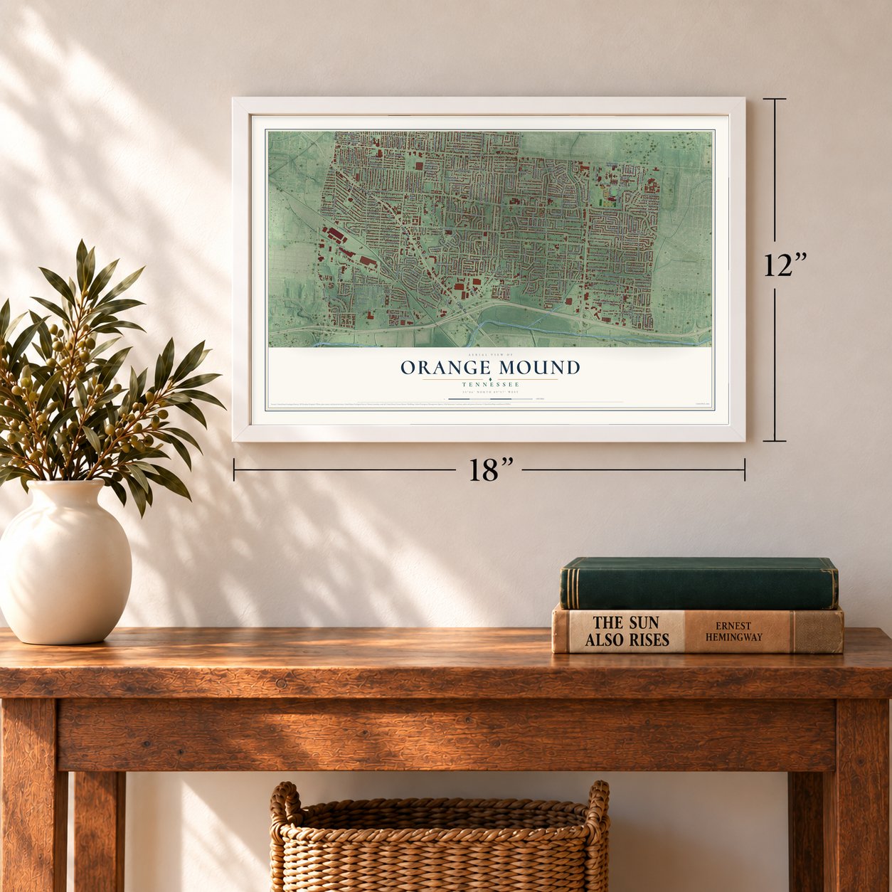
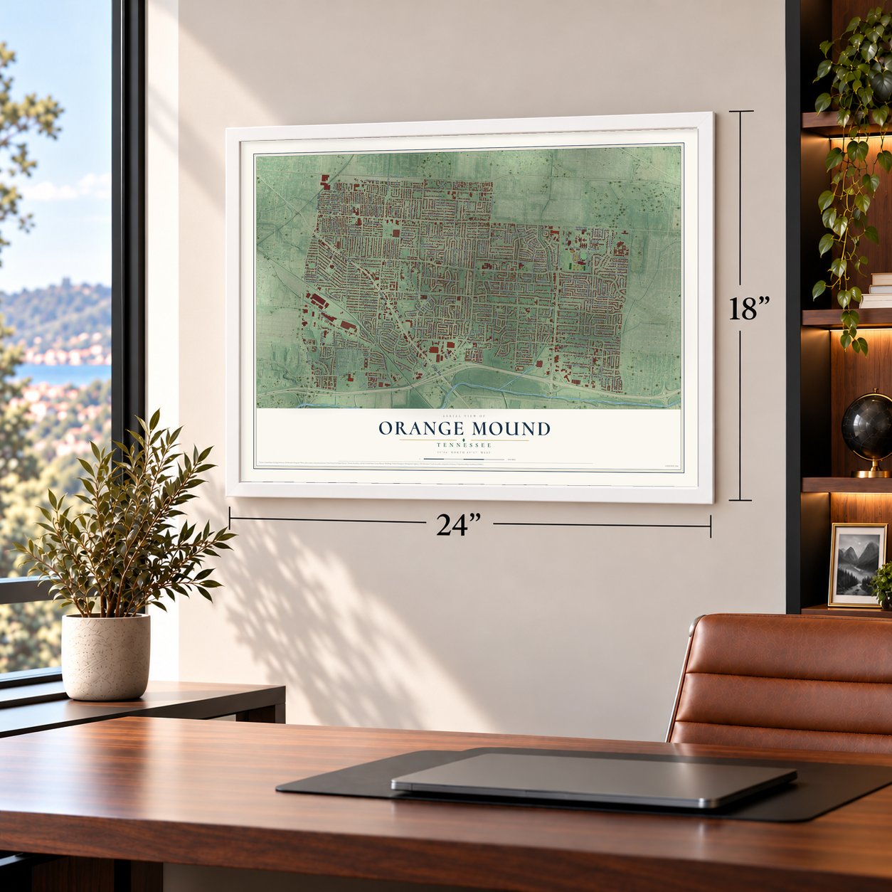
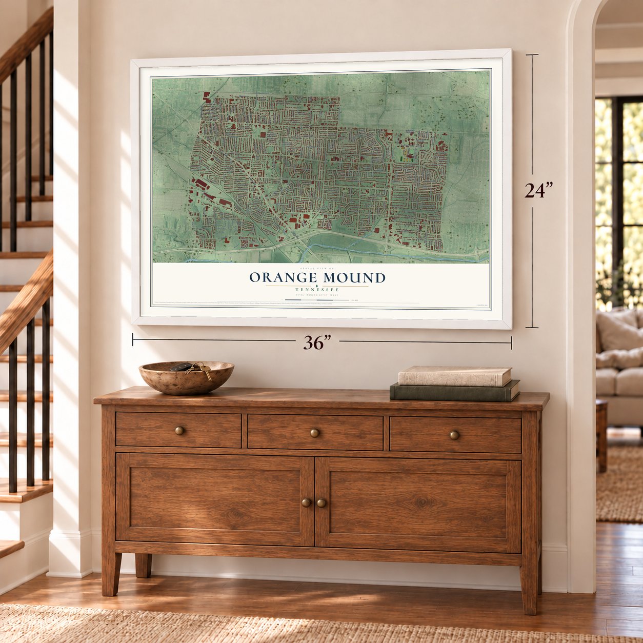
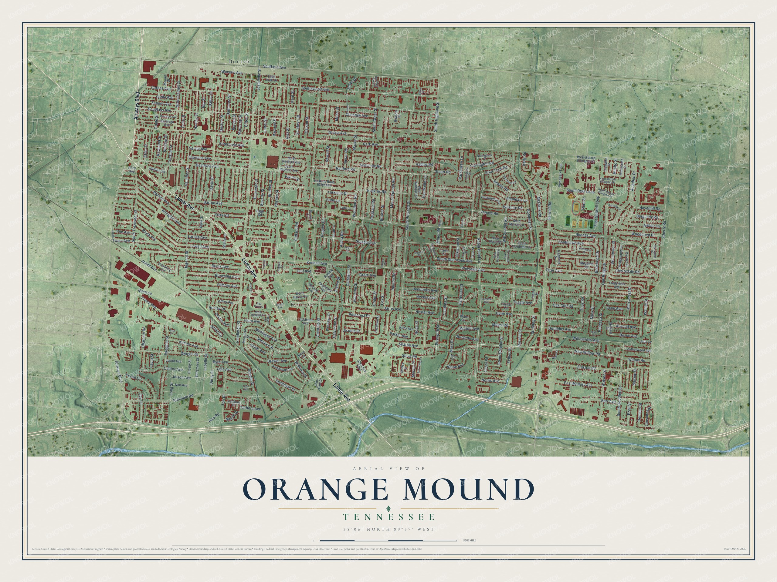
A new map of Orange Mound, Tennessee, made in 2026 and printed to order on thick archival matte paper.
12" x 18" Archival Matte Print
A Map of Home. A Work of Art.
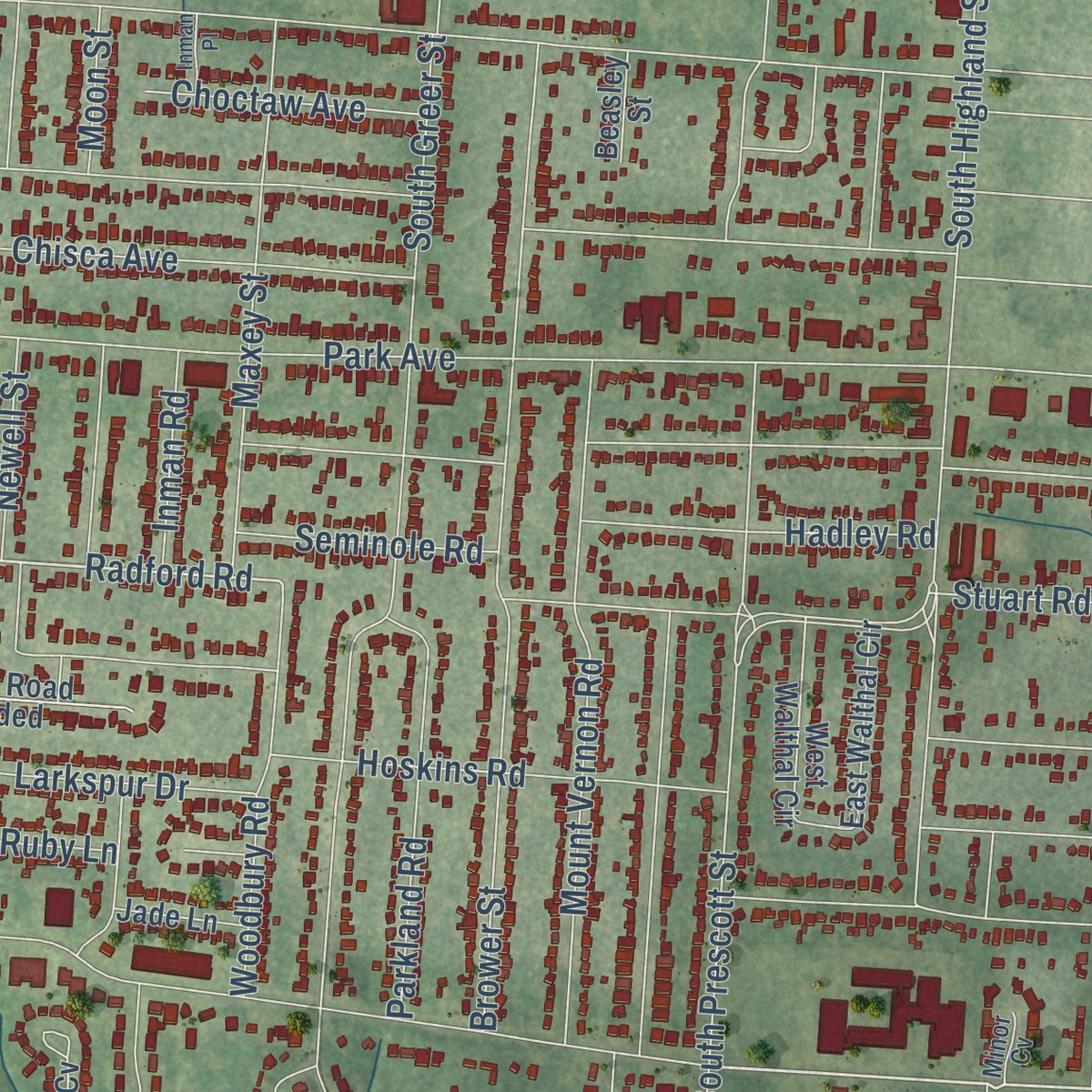
Explore Orange Mound, Tennessee from a whole new perspective. Created using aerial imagery and detailed geographic data, this map captures Orange Mound building by building, with labeled streets, familiar landmarks, and shaded topographical relief that highlights the natural contours of the landscape.
Combining modern data with the timeless character of a vintage atlas, this map is just as interesting up close as it is beautiful on the wall. Whether you grew up in Orange Mound, spent memorable years there, or call it home today, this unique map is a great way to celebrate a place that means something to you. Zoom in on the preview to look for your street, and then order a print to put your memories on the wall.
Three ways to hang it
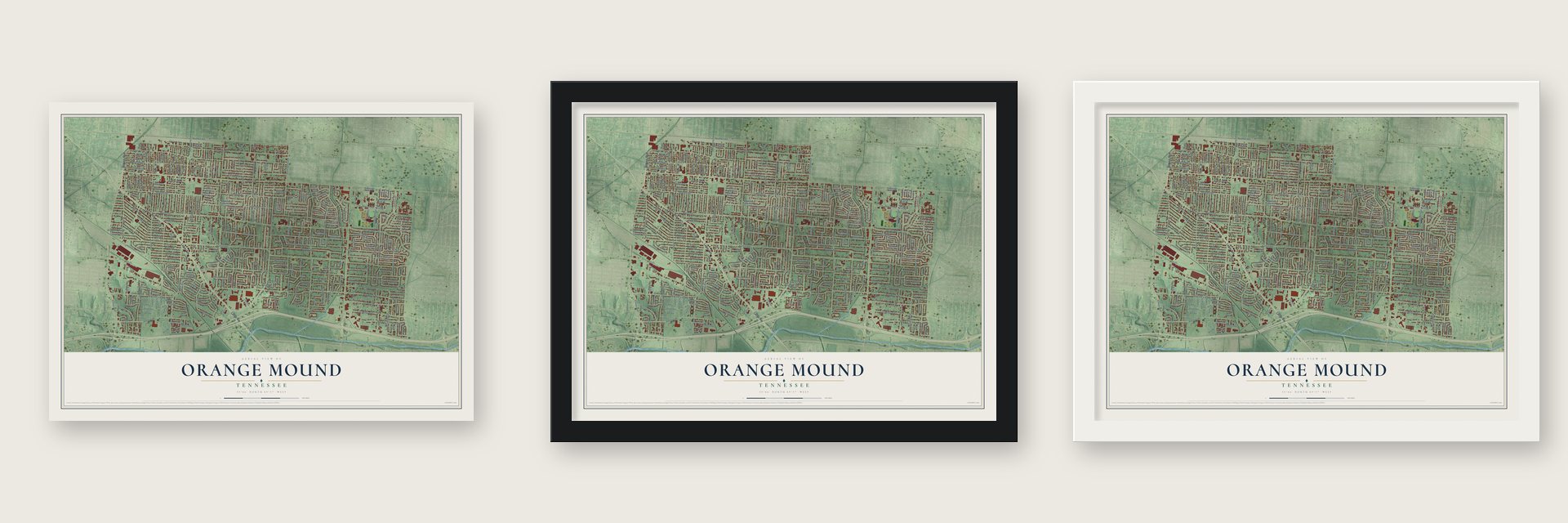
Unframed archival matte, a black wood frame or a white wood frame.
Up close
Geography Worth Displaying
This map was created using accurate cartographic data and authoritative geographic sources, including the U.S. Geological Survey and the Census Bureau. The map brings together terrain, waterways, roads, and building detail. The majority of the streets are labeled, houses are accurately depicted, and the topography is derived from government sources. Combining local data with carefully composed color and shading leads to this beautifully detailed Orange Mound artwork for your wall.
Rather than simply showing street outlines, we’ve included as many of the street names as we could reasonably fit on the map while keeping their names legible. Zoom in on the high resolution preview to see exactly what’s on the map. We truly set out to create a statement piece for anyone who loves Orange Mound. So whether it’s for you, or a gift for someone you love, we hope this map of Orange Mound brings back fond memories.
Read the story behind this map: Detailed Map of Orange Mound, Tennessee.

Find your street
Names on the Orange Mound map
Every name below is printed on this map. Look for your street, your school, the park where you played, or the pond down the road.
Places and landmarks3
- Bellevue
- Cherokee Park
- Buntyn
Streets and roads305
- Airways Boulevard
- Lamar Avenue
- Elliston Road
- Kimball Avenue
- Alamo Street
- Rhodes Avenue
- Robin Hood Lane
- Semmes Street
- Radford Road
- South Goodlett Street
- New Willow Road
- Inman Road
- Hope Street
- Friar Tuck Road
- Echles Street
- Ellsworth Street
- South Deerwood Avenue
- Montague Avenue
- Green Dolphin Street
- Park Avenue
- Barron Avenue
- Dunn Avenue
- South Prescott Street
- Pendleton Street
- Southern Avenue
- Carnes Avenue
- Spottswood Avenue
- Douglass Avenue
- Getwell Road
- South Highland Street
Show all 305 streets
- Labelle Street
- Philsdale Avenue
- South Greer Street
- Carrington Road
- Sharpe Avenue
- Haynes Street
- Hamilton Street
- East Mallory Avenue
- Railton Road
- Hoskins Road
- Fizer Avenue
- Brower Street
- Ketchum Road
- Deadrick Avenue
- Frisco Avenue
- Merrycrest Drive
- Lowell Avenue
- Cherry Road
- Buntyn Street
- Larose Avenue
- Arlington Avenue
- David Street
- Hugenot Street
- Vanuys Road
- Dwight Road
- Harris Avenue
- Hendricks Avenue
- Cella Street
- South Trezevant Street
- Oak Ridge Drive
- Southwall Street
- Marianna Street
- Goodman Street
- Malone Avenue
- Jonah Avenue
- Baltimore Street
- Wilshire Road
- Marechalneil Street
- Allandale Lane
- Imogene Street
- Burns Avenue
- Josephine Street
- Barr Avenue
- Boston Street
- Select Avenue
- Watson Street
- Filmore Avenue
- Waverly Avenue
- Mount Vernon Road
- Dallas Street
- Willowview Avenue
- Standard Drive
- Audubon Drive
- Titus Road
- Crider Street
- Charjean Road
- Grand Street
- Boyle Avenue
- Keating Street
- Jolson Avenue
- Supreme Avenue
- Parkland Road
- East Getwell Loop
- Aubra Road
- Woodbury Road
- Rutland Road
- Goodwyn Street
- Healey Road
- Catalina Street
- Durby Street
- Maxey Street
- Pinecrest Drive
- Patterson Street
- Bradley Street
- Brewer Avenue
- Will Scarlet Road
- Chisca Avenue
- Denison Street
- Joy Lane
- Cherrydale Road
- Joanne Street
- Browning Avenue
- Hanley Street
- Briarwood Drive
- Newell Street
- Long Street
- Poppen Drive
- Steve Road
- McEvers Road
- Woodcrest Drive
- Amarillo Street
- Choctaw Avenue
- Inez Street
- Laurel Street
- Pecan Circle
- Cantor Avenue
- Galveston Street
- Dunmoor Street
- Henley Drive
- Maxine Street
- Twain Avenue
- Sturgeon Avenue
- Wildrose Street
- Southlawn Avenue
- Mary Drive
- Scaper Street
- Enterprise Avenue
- Elkwood Street
- Fizer Road
- Flora Avenue
- Fox Street
- Hadley Road
- Kenner Avenue
- Jeannine Street
- Zanone Avenue
- Catherine Street
- Cable Avenue
- South Park Loop
- Amber Lane
- Oak Cliff Road
- Lola Avenue
- Broadmoor Street
- Stuart Road
- Geraldus Avenue
- Seminole Road
- Haverhill Road
- Byrd Avenue
- Hilton Street
- Mink Street
- Rebecca Street
- Wanda Street
- Beverly Street
- Heckle Avenue
- Burgundy Road
- Baine Avenue
- Third Street
- Carson Street
- Stribling Street
- Ethel Street
- Tunstall Street
- Raymond Street
- Harville Street
- Miami Road
- Atwood Avenue
- Parkhaven Lane
- Parker Avenue
- Larkspur Drive
- Boyce Avenue
- Norris Avenue
- McDuff Avenue
- Kent Street
- Willow Road
- Gulf Avenue
- Heber Avenue
- Minor Road
- Hester Avenue
- Alcy Road
- Vann Avenue
- Tori Drive
- Lausanne Street
- Lamar Circle
- Ezell Street
- Tarbora Avenue
- Bey Street
- Elkins Street
- Durby Circle
- Moryle Place
- Poe Avenue
- Donna Avenue
- Tuggle Avenue
- Metrie Drive
- Laura Street
- Dunn Cv
- Moon Street
- Ruby Lane
- Crete Avenue
- Kelly Road
- Manito Street
- Safari Drive
- West Buford Ellington Drive
- Mourfield Street
- Fredericks Avenue
- Dogwood Drive
- Dickmann Avenue
- Wedgewood Street
- West Park Loop
- Crosby Street
- Saratoga Avenue
- Shelley Street
- Browning Circle
- Morlye Street
- Westlawn Drive
- Cherokee Boulevard
- Maid Marian Lane
- Kirby Avenue
- Hoskins Road Extended
- Armistead Avenue
- Leatherwood Avenue
- Maywood Street
- East Walthal Circle
- North Radford Avenue
- Rienel Street
- South Radford Avenue
- Carolyn Drive
- West Walthal Circle
- Briar Rose Road
- Meadow Drive
- Eden Park Drive
- Huntingdon Lane
- Eastlawn Street
- Inman Cv
- Barrymore Street
- Beaumont Avenue
- North Harris Circle
- South Goodman Circle
- Smythe Avenue
- McCool Avenue
- John Paul Drive
- Minnehaha Street
- Ketchum Place
- Jeffrey Avenue
- Nott Avenue
- Barron Court
- Hiawatha Street
- Judith Avenue
- Coleen Road
- Jade Lane
- Tyne Street
- Mound Street
- Michael Street
- Callis Street
- Beasley Street
- Christy Cv
- Judy Cv
- Riley Avenue
- Fawn Cv
- Miami Cv
- Sage Road
- Neva Lane
- South Buford Ellington Drive
- Deerwood Avenue
- Brooklyn Avenue
- North Buford Ellington Drive
- Willow Cv
- Wildwood Drive
- Steve Way Drive
- Southern Oaks Place
- Jonah
- Redbud Street
- Gamewell Road
- North Redbud Circle
- Nottingham Place
- Patterson Cv
- Foxcroft Street
- Cherrydale Cv
- West Barron Circle
- East Barron Circle
- Freemile Avenue
- Kimball Cv
- Toby Lane
- Harrow Drive
- Gotten Place
- Shultz Avenue
- Partee Cv
- Minor Cv
- Miles Drive
- Mary Cv
- Brandon Circle
- Blue Crane Lane
- Oaksedge Drive
- Alvin Avenue
- Elkwood Cv
- Inman Place
- Mink Circle
- Brian Cv
Names are listed as they appear on the printed map. Zoom into the product photos to find them.
The art of mapping a place
How This Map Was Made
Real places. Remarkable detail. Discover the layers that turn geographic data into a map of home.

The view from above
Aerial imagery reveals the character of the land: woodland, open fields, and the patterns of a place.

The shape of the land
Elevation data brings hills, valleys, and subtle changes in the landscape into view.

The details of home
Roads, waterways, and building footprints come together to make the map feel unmistakably local.

Geography becomes art
Considered color, shading, and typography bring the layers together in a map made for your wall.


Process illustrated with Mendon, Massachusetts. Aerial imagery: USDA NAIP. Terrain: USGS 3D Elevation Program. Map details and finished artwork: KNOWOL.
The Details
About This Print
Choose an archival matte print, or a black or white Ayous wood frame. The archival matte print is unframed.
Select your size and finish above to see the matching product image and price.
Materials & Craftsmanship
A contemporary map with the character of a classic atlas, printed on archival matte paper. Optional frames are made from Ayous wood.
Your printed map does not include the watermark shown in the full-map preview.
Shipping & Delivery
Free shipping within the United States. Every print is made to order in the USA.
Buying a gift? Add a note in your cart and we'll include it. We never put prices in the package.
Prints ship within 2 to 3 business days. Allow 7 to 10 days total from ordering for delivery. Timing may vary during holidays or periods of high order volume.
Read our shipping policy.
Returns and damaged prints
Each print is made to order. Change-of-mind refunds are not available after production.
If your print arrives damaged, misprinted or incorrect, contact support@knowol.com within 30 days of receiving it. Include your order number, photos and a description of the issue.
Read our full refund and replacement policy. For questions about your order, email support@knowol.com.
Find your town
Looking for another city?
Find a map of home in our Tennessee collection, or any town in the country.
Nearby
Maps of towns near Orange Mound
Know someone from one of these towns? Their map makes a great gift.
 Memphis
, Tennessee
From $39.99See the map
 East Memphis
, Tennessee
From $39.99See the map
 Cooper-Young
, Tennessee
From $39.99See the map
More maps nearby: Parkway Village, Midtown, South Memphis, Hickory Hill and North Memphis.