
Search for another town





Free U.S. delivery 7 to 10 days after you order
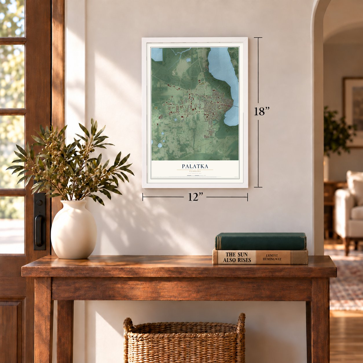
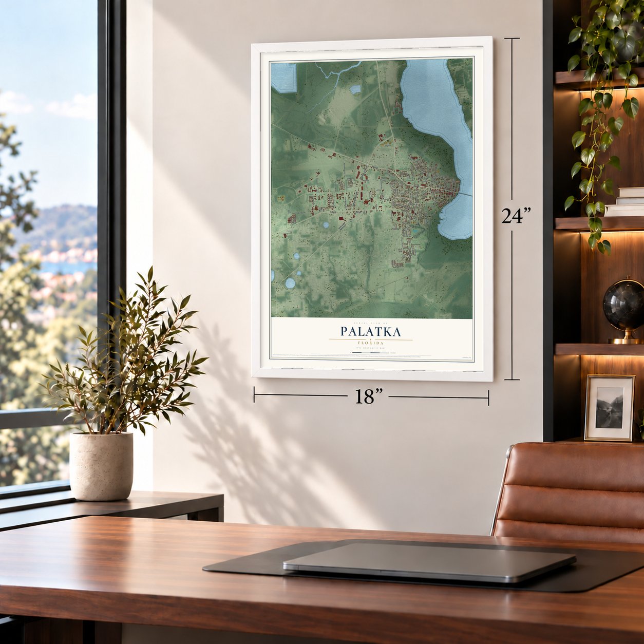
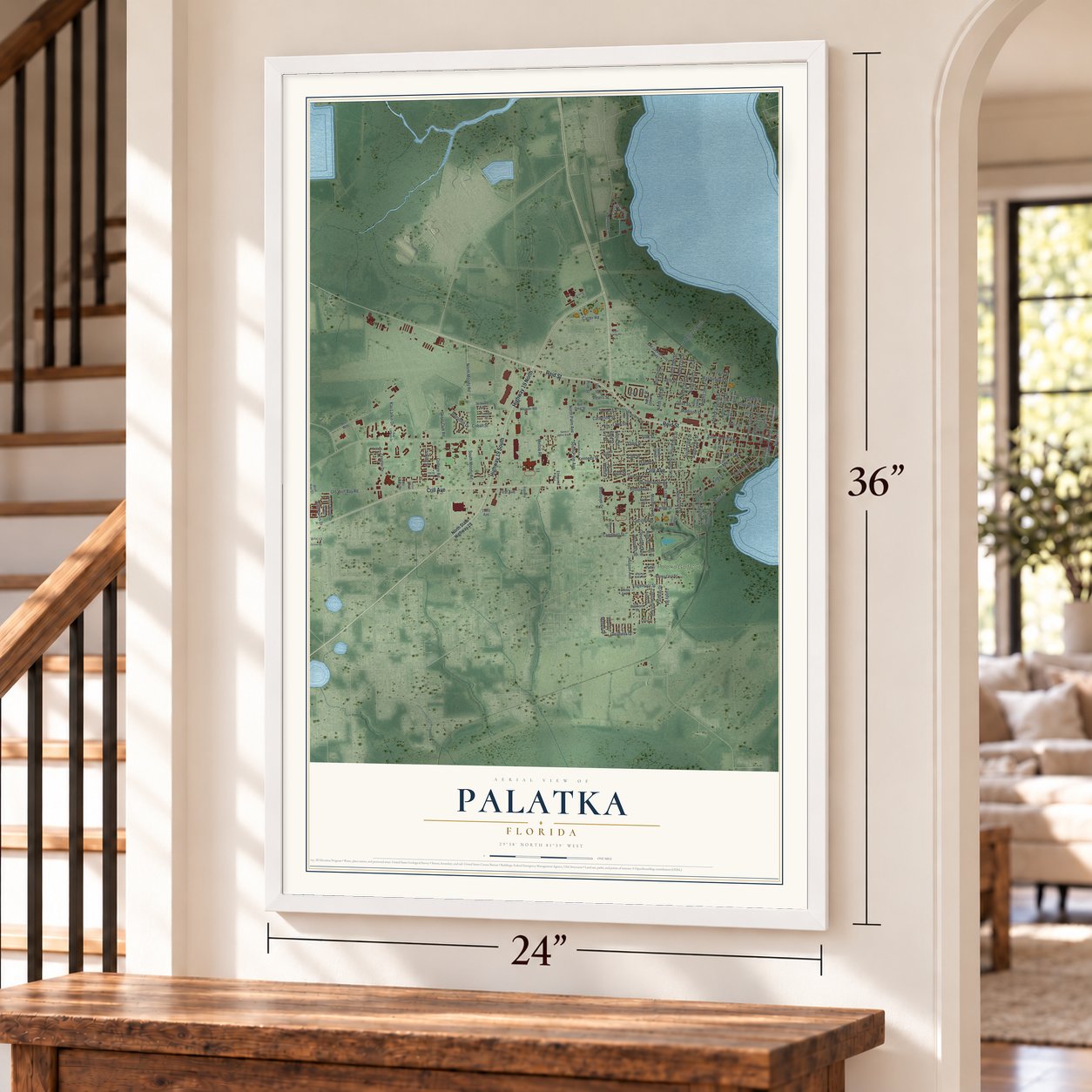
Palatka, Florida Map Art
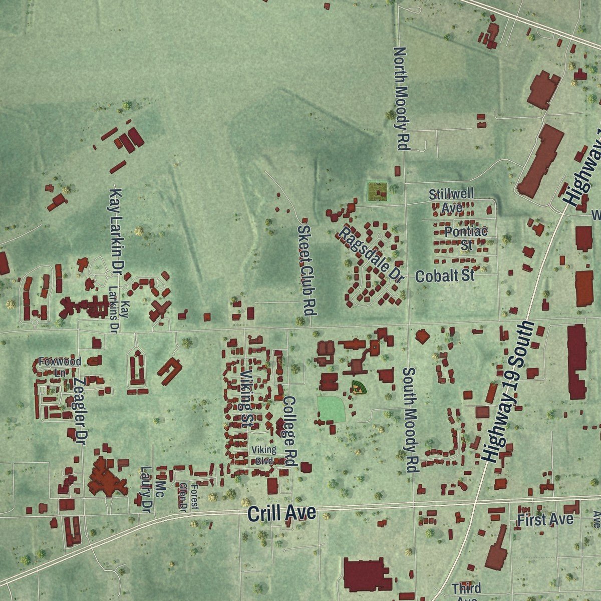
Building by building, with labeled streets and shaded relief.
12" x 18" Archival Matte Print
A Map of Home. A Work of Art.
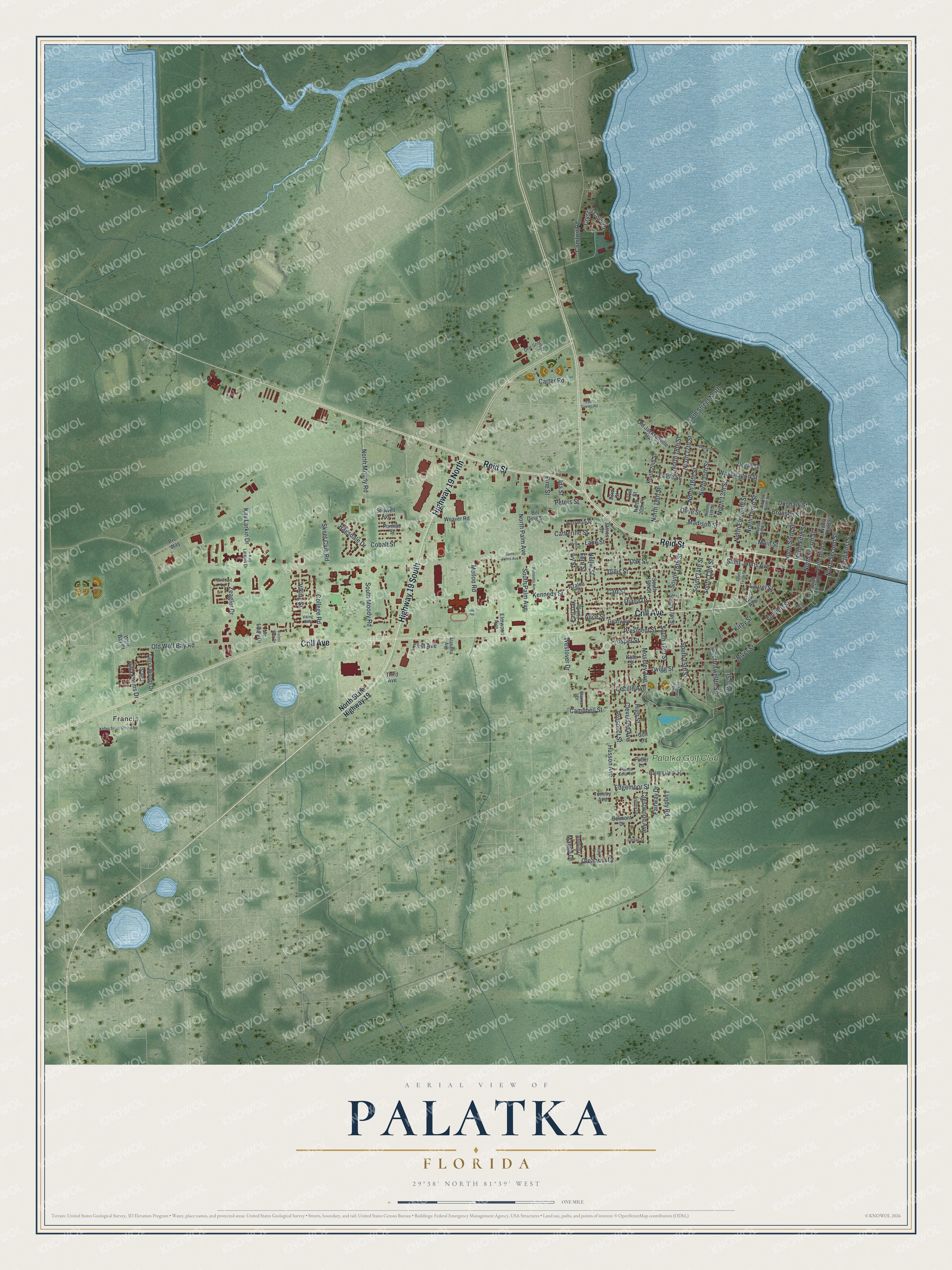
Explore Palatka, Florida from a whole new perspective. Created using aerial imagery and detailed geographic data, this map captures Palatka building by building, with labeled streets, familiar landmarks, and shaded topographical relief that highlights the natural contours of the landscape.
Combining modern data with the timeless character of a vintage atlas, this map is just as interesting up close as it is beautiful on the wall. Whether you grew up in Palatka, spent memorable years there, or call it home today, this unique map is a great way to celebrate a place that means something to you. Zoom in on the preview to look for your street, and then order a print to put your memories on the wall.
Three ways to hang it
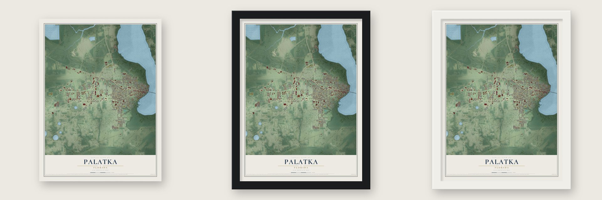
Unframed archival matte, a black wood frame or a white wood frame.
Up close
Geography Worth Displaying
This map was created using accurate cartographic data and authoritative geographic sources, including the U.S. Geological Survey (USGS) and FEMA. The map brings together terrain, waterways, roads, and building detail. The majority of the streets are labeled, houses are accurately depicted, and the topography is derived from government sources. Combining local data with carefully composed color and shading leads to this beautifully detailed Palatka artwork for your wall.
Rather than simply showing street outlines, we’ve included as many of the street names as we could reasonably fit on the map while keeping their names legible. Zoom in on the high resolution preview to see exactly what’s on the map. We truly set out to create a statement piece for anyone who loves Palatka. So whether it’s for you, or a gift for someone you love, we hope this map of Palatka brings back fond memories.
Explore the full map of Palatka, Florida and read about the local places it shows.

Find your street
Names on the Palatka map
Every name below is printed on this map. Look for your street, your school, the park where you played, or the pond down the road.
Places and landmarks2
- Francis
- Palatka Golf Club
Streets and roads142
- Highway 19 South
- Highway 19 North
- Crill Avenue
- Reid Street
- North Second Street
- North First Street
- North 18th Street
- South 15th Street
- North 15th Street
- South 13th Street
- Old Wolf Bay Road
- Zeagler Drive
- South Palm Avenue
- Oleander Drive
- Pine Street
- North 16th Street
- North Tenth Street
- North 13th Street
- Kay Larkin Drive
- Mango Drive
- North Palm Avenue
- North Fourth Street
- South 16th Street
- Saint Johns Avenue
- Husson Avenue
- Madison Street
- Moseley Avenue
- Bronson Street
- Laurel Street
- Olive Street
Show all 142 streets
- Carr Street
- Oak Street
- Cleveland Avenue
- River Street
- Kirby Street
- North Moody Road
- South 14th Street
- President Street
- Main Street
- Dunham Street
- South 18th Street
- Eagle Street
- South Moody Road
- Washington Street
- Diana Drive
- North 19th Street
- North 17th Street
- Crystal Cove Drive
- Gillis Street
- Westover Drive
- North Eleventh Street
- Comfort Road
- Twigg Street
- Mellon Road
- Edgemoor Street
- Prosper Street
- Campbell Street
- Cecille Avenue
- Fern Street
- College Road
- Prospect Street
- Kennedy Street
- Carter Road
- Skeet Club Road
- 18th Street North
- North Sixth Street
- High Street
- Catherine Street
- Viking Street
- Crestwood Avenue
- Emmett Street
- Peters Street
- South Twelfth Street
- Alice Street
- Lane Street
- North Fifth Street
- Villa Farms Drive
- Lundy Road
- Ragsdale Drive
- Ivy Street
- Fairway Drive
- Cobalt Street
- Nellie Street
- First Avenue
- Burns Street
- Ida Street
- North State Highway 19
- Old Jacksonville Highway
- Bill Ding Street
- North Third Street
- Prc Way
- South Third Street
- South 17th Street
- Ocean Street
- Weaver Road
- Tierra Woods Drive
- South 19th Street
- North 20th Street
- Stillwell Avenue
- Kate Street
- Golf Drive
- Geary Avenue
- Palma Ceia Street
- Belmont Drive
- James Street
- East Oak Hill Drive
- Azalea Circle
- Elmwood Avenue
- 23rd Street
- Pontiac Street
- North 20th Place
- Third Avenue
- Mc Laury Drive
- Wolf Bay Court
- Tommy Avenue
- Lee Street
- Putter Lane
- 21st Street
- North Ninth Street
- North 14th Street
- West Main Street
- Kay Larkins Drive
- Foxwood Lane
- Orie Griffin Drive
- Ashley Drive
- Redbud Lane
- Palma Ceia Terrace
- Alabama Avenue
- Glance Drive
- Cedar Street
- Hotel Street
- South Tenth Street
- East Towles Road
- Napoleon Street
- Kelley Smith School Road
- Court of the Flags
- Poinsetta Avenue
- Saylor Street
- Memorial Parkway
- Viking Boulevard
- Holly Lane
- Forest Glen Drive
Names are listed as they appear on the printed map. Zoom into the product photos to find them.
About Palatka, Florida
Palatka is a city of 10,446 people and the seat of Putnam County, on the St. Johns River. The Seminole knew the spot as Pilo-taikita, a name meaning "crossing over" or "cows' crossing," because the river narrows here before it winds shallower toward Lake George. Nehemiah Brush bought land in 1826 and began running a ferry in 1834, and his landing grew into a place where goods were shipped inland.
The Seminole burned the settlement in 1835, during the Second Seminole War, and in 1838 the Army built Fort Shannon there to guard the river. After the fort was abandoned in 1843, settlers moved into its piers and eight blockhouses and built a town around them. Putnam County was formed in 1849 with Pilatka as its seat, and Judge Isaac H. Bronson helped the town incorporate on January 8, 1853. On May 24, 1875, the Post Office switched the town's spelling to Palatka.
- Rollestown in 1767Across the river, the English gentleman Denys Rolle founded Rollestown in 1767 on a 78,000-acre plantation. He paid the passage of about two hundred indentured workers gathered from London's streets, including paupers, vagrants and pickpockets, but most left, worn down by heavy labor and heat. Rolle then used enslaved Africans. In 1770 an overseer sold more than 1,000 of his cattle and disappeared with the money.
- Spared, then warned, in wartimeOn October 7, 1862, the gunboat USS Cimarron saw Confederate cavalry and shelled over the nearly empty town. Mary Boyd pleaded with Commander Maxwell Woodhull to spare Pilatka, saying the riders weren't local, and he stopped firing. Later, Union officers lodged in the home of Lola Sánchez and her sisters. Lola overheard their plans for a raid and alerted the Confederates, and Capt. John Jackson Dickison's men captured the surprised Union troops at the Battle of Horse Landing.
- Rebuilt in brick after 1884Fire swept Palatka on November 7, 1884, and burned most of its hotels. Visitors that winter rode trains farther south, and Jacksonville took much of the town's trade. Downtown was rebuilt in brick to resist fire.
- Sunny Point, built in 1854Judge Isaac H. Bronson, who wrote the city charter and donated land for the courthouse, built his home, Sunny Point, in 1854; it stands at today's 100 Madison Street. In January 1866 Charlotte Henry, a New Yorker backed by the Freedmen's Bureau, opened a school in Palatka, likely in this house, and by that November she taught more than 60 African American children. The Bronson-Mulholland House is now a museum and joined the National Register in 1972.
- A library from the MellonsJames Ross Mellon, a part-time resident whose father was Judge Thomas Mellon of Pittsburgh, gave $100,000 for a library, built in 1929 and named for Rachel Larimer, his wife. Its architect, Henry John Klutho, blended the Prairie School and Art Deco styles, and the words "Ignorance breeds crime" and "Knowledge is power" flank the entrance. Thousands attended its dedication in April 1930. The Larimer Memorial Library on Reid Street is now the Larimer Arts Center.
Keep exploring Florida
Palatka is one of 1,067 Florida towns we've mapped. Every dot on the map is a print of its own.
The search covers every state, Florida first.
Near Palatka
Order 2 or more town maps and save 10%. Shown in the size and finish you picked above, so they hang as a set.
- East Palatka 12" x 18" / Archival Matte Print $39.99
- Hastings 12" x 18" / Archival Matte Print $39.99
- Pomona Park 12" x 18" / Archival Matte Print $39.99

More maps nearby: Welaka, Flagler Estates, Interlachen, Crescent City and Melrose.
The art of mapping a place
How This Map Was Made
Real places. Remarkable detail. Discover the layers that turn geographic data into a map of home.

The view from above
Aerial imagery reveals the character of the land: woodland, open fields, and the patterns of a place.

The shape of the land
Elevation data brings hills, valleys, and subtle changes in the landscape into view.

The details of home
Roads, waterways, and building footprints come together to make the map feel unmistakably local.

Geography becomes art
Considered color, shading, and typography bring the layers together in a map made for your wall.


Process illustrated with Mendon, Massachusetts. Aerial imagery: USDA NAIP. Terrain: USGS 3D Elevation Program. Map details and finished artwork: KNOWOL.
The Details
About This Print
Choose an archival matte print, or a black or white Ayous wood frame. The archival matte print is unframed.
Select your size and finish above to see the matching product image and price.
Materials & Craftsmanship
A contemporary map with the character of a classic atlas, printed on archival matte paper. Optional frames are made from Ayous wood.
Your printed map does not include the watermark shown in the full-map preview.
Shipping & Delivery
Free shipping within the United States. Every print is made to order in the USA.
Buying a gift? Add a note in your cart and we'll include it. We never put prices in the package.
Prints ship within 2 to 3 business days. Allow 7 to 10 days total from ordering for delivery. Timing may vary during holidays or periods of high order volume.
Read our shipping policy.
Returns and damaged prints
Each print is made to order. Change-of-mind refunds are not available after production.
If your print arrives damaged, misprinted or incorrect, contact support@knowol.com within 30 days of receiving it. Include your order number, photos and a description of the issue.
Read our full refund and replacement policy. For questions about your order, email support@knowol.com.