
Search for another town


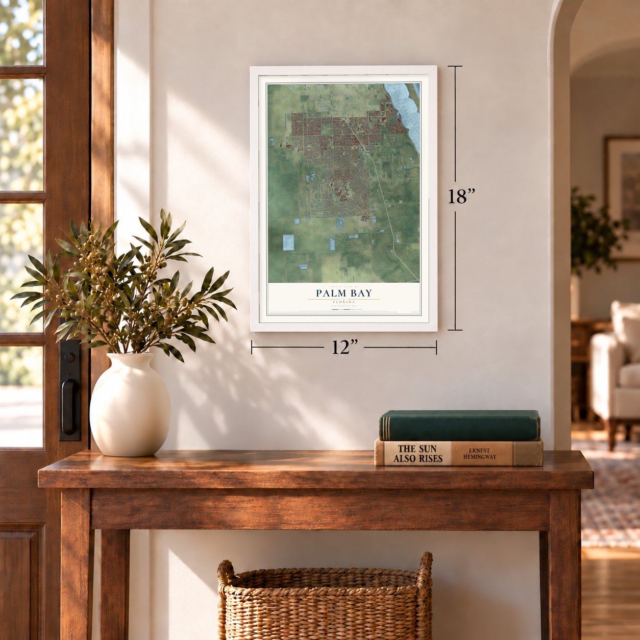

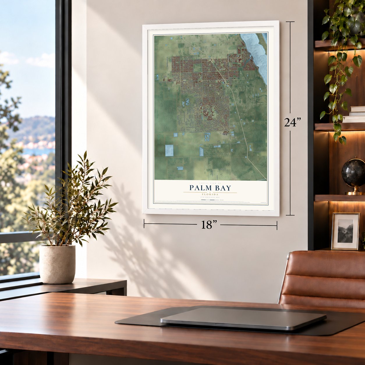
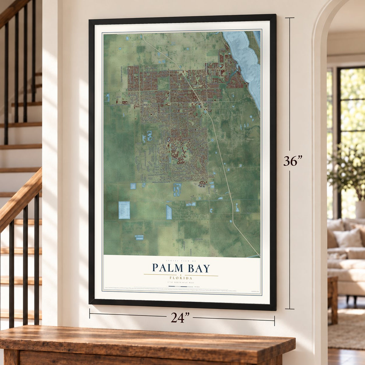
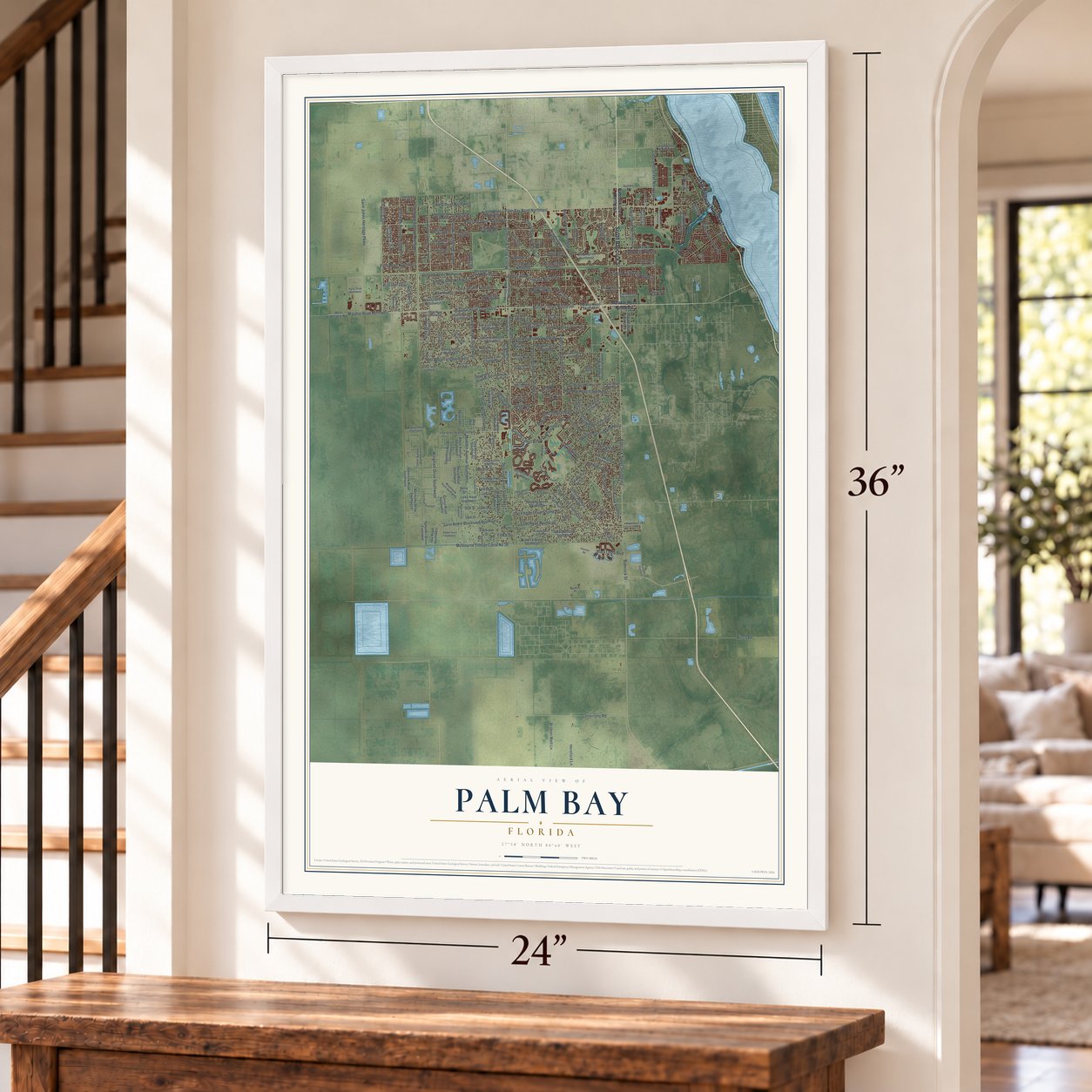
Free U.S. delivery 7 to 10 days after you order
Palm Bay, Florida Map Art
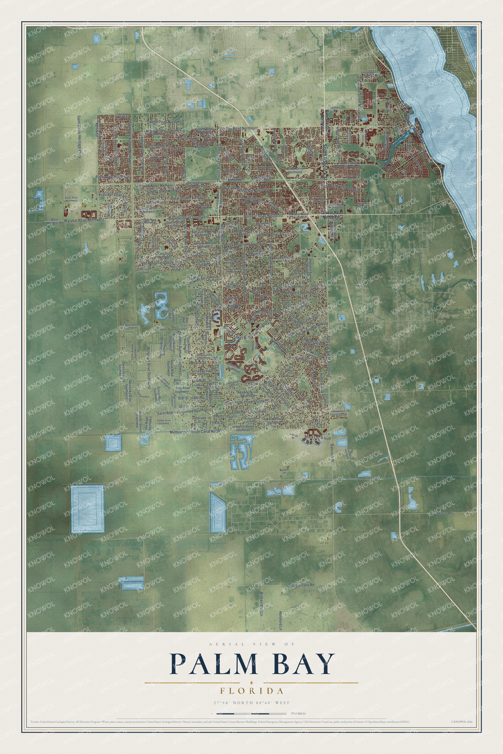
A new map of Palm Bay, Florida, made in 2026 and printed to order on thick archival matte paper.
12" x 18" Archival Matte Print
A Map of Home. A Work of Art.
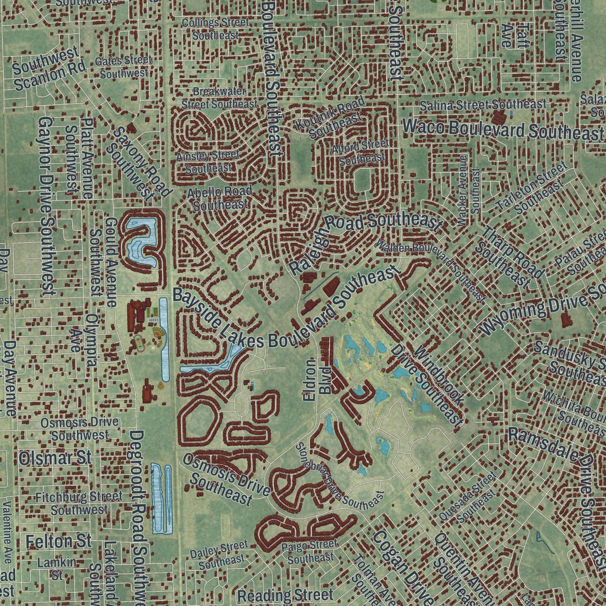
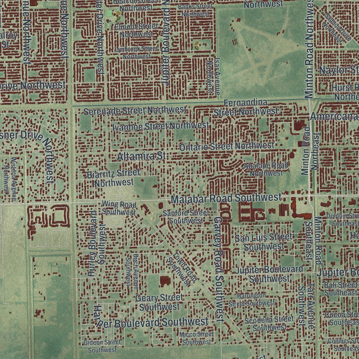
Explore Palm Bay, Florida from a whole new perspective. Created using aerial imagery and detailed geographic data, this map captures Palm Bay building by building, with labeled streets, familiar landmarks, and shaded topographical relief that highlights the natural contours of the landscape.
Combining modern data with the timeless character of a vintage atlas, this map is just as interesting up close as it is beautiful on the wall. Whether you grew up in Palm Bay, spent memorable years there, or call it home today, this unique map is a great way to celebrate a place that means something to you. Zoom in on the preview to look for your street, and then order a print to put your memories on the wall.
Three ways to hang it
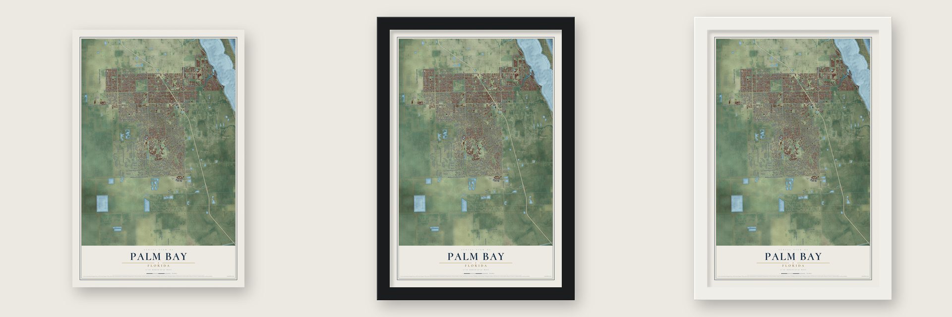
Unframed archival matte, a black wood frame or a white wood frame.
Up close
Geography Worth Displaying
This map was created using accurate cartographic data and authoritative geographic sources, including the U.S. Geological Survey (USGS) and FEMA. The map brings together terrain, waterways, roads, and building detail. The majority of the streets are labeled, houses are accurately depicted, and the topography is derived from government sources. Combining local data with carefully composed color and shading leads to this beautifully detailed Palm Bay artwork for your wall.
Rather than simply showing street outlines, we’ve included as many of the street names as we could reasonably fit on the map while keeping their names legible. Zoom in on the high resolution preview to see exactly what’s on the map. We truly set out to create a statement piece for anyone who loves Palm Bay. So whether it’s for you, or a gift for someone you love, we hope this map of Palm Bay brings back fond memories.
Explore the full map of Palm Bay, Florida and read about the local places it shows.

About Palm Bay, Florida
Palm Bay is a city of 119,760 people in Brevard County, the largest in the county by both population and land area. The Ais people are believed to have lived here first, near the springs where Turkey Creek meets the Indian River. John Tillman arrived in the late 1870s, and his wharf at the creek's mouth became a steamboat landing that brought in more settlers. By the late 1880s his orange and banana grove on the north bank was turning a profit, and the railroad reached the area in 1894.
In the 1920s the town, then known as Tillman, took the name Palm Bay from the palm-lined bay at the creek's mouth. Local businessmen formed the Melbourne-Tillman Drainage District, sold $1.5 million in bonds, and starting in 1922 dug 80 canals stretching 180 miles to drain 40,000 acres of swamp west of town. Farmers planted citrus and truck farms and sent winter vegetables north by rail. Then in 1926 the dredges caught fire and a severe hurricane struck, the local economy slumped, and the drainage district went bankrupt.
- A church from a failed colonyBetween 1910 and 1914 a land company, the Indian River Catholic Colony, set up at Tillman. Its farmers tried to raise two crops each season, wore out the soil, and the colony collapsed. The families who remained put up St. Joseph's Church on Miller Street, and it is now the oldest building still standing in Palm Bay.
- Port Malabar and a new cityGeneral Development Corporation bought and mapped out large tracts here in 1959 for a housing project called Port Malabar. Palm Bay became an incorporated city on January 16, 1960, when 2,808 people lived there. The company laid out streets, built and sold homes, and put up a water treatment plant, which the city bought after the company went bankrupt in 1991.
- A home for engineersL3Harris Technologies employs 3,400 people on its campus on Palm Bay Road. In 2015 the Harris Corporation opened a technology center of 464,000 square feet, close to where Palm Bay Road meets Troutman Boulevard, with room for about 1,400 scientists and engineers.
Find your street
Names on the Palm Bay map
Every name below is printed on this map. Look for your street, your school, the park where you played, or the pond down the road.
Streets and roads206
- Dixie Highway Northeast
- South Babcock Street
- Babcock Street Southeast
- San Filippo Drive Southeast
- Saint Johns Heritage Parkway
- Palm Bay Road Northeast
- Eldron Boulevard Southeast
- Degroodt Road Southwest
- Malabar Road Southwest
- Malabar Road Northwest
- Emerson Drive Northwest
- Cogan Drive Southeast
- Emerson Drive Northeast
- Madden Avenue Southwest
- Riviera Drive Northeast
- Saint Andre Boulevard Southwest
- Emerson Drive Southeast
- Jupiter Boulevard Southeast
- Centerlane Road
- Malabar Road Northeast
- Garvey Road Southwest
- Minton Road Northwest
- Jupiter Boulevard Northwest
- Pace Drive Northwest
- Wingham Drive Southwest
- Melbourne Tillman Canal No 38
- Micco Road
- Glencove Avenue Northwest
- Glendale Avenue Northwest
- Americana Boulevard Northeast
Show all 206 streets
- Harper Boulevard Southwest
- Bayside Lakes Boulevard Southeast
- Waco Boulevard Southeast
- Fallon Boulevard Northeast
- Wyoming Drive Southeast
- Lipscomb Street Northeast
- Hield Road Northwest
- Titan Road Southeast
- Krassner Drive Northwest
- Ramsdale Drive Southeast
- Broken Well Lane
- Hereford Lane
- Raleigh Road Southeast
- Gaynor Drive Southwest
- Mara Loma Boulevard
- Babcock Street
- Olsmar Street
- Altamira Street
- Naylor Street
- Finkle Street
- Felton Street
- Star Street
- Babcock Street Northeast
- Port Malabar Boulevard Northeast
- Minton Road Northeast
- Malabar Road Southeast
- Kentucky Drive Southwest
- Jupiter Boulevard Southwest
- Bianca Drive Northeast
- Sapodilla Road Southwest
- Brickell Street Southeast
- Minton Road Southeast
- Lakeland Avenue Southwest
- Killian Drive Northeast
- Reading Street Southeast
- Lamplighter Drive Northwest
- Grandeur Street Southeast
- Imura Road Southwest
- Knecht Road Northeast
- Serenade Street Northwest
- Hurst Road Northeast
- Glenrock Road Southwest
- Laika Road Southwest
- Hester Avenue Southeast
- Cromey Road Northeast
- Ivanhoe Street Northwest
- Hurley Boulevard Southwest
- Fernandina Street Northwest
- Delmonico Street Northeast
- Krefeld Road Northwest
- Sandusky Street Southeast
- Ontario Street Northwest
- Glenham Drive Northeast
- West Malabar Road
- Spoonbil Street Extended
- Nevada Drive Northeast
- Eldron Boulevard
- Quentin Avenue Southeast
- Amador Avenue Northwest
- Warwick Street Southeast
- Sarasota Drive Southeast
- Rheine Road Northwest
- Biarritz Street Northwest
- Geary Street Southwest
- San Luis Street Southwest
- Windbrook Drive Southeast
- Gould Avenue Southwest
- Ginryo Road Southwest
- Thor Avenue Southeast
- Underhill Avenue Southeast
- Hunan Street Northeast
- Day Avenue Southwest
- Tarr Avenue Southwest
- Tharp Road Southeast
- Hatcher Street Southeast
- Alwar Avenue Southwest
- Albion Street Northwest
- Osmosis Drive Southeast
- Saxony Road Southwest
- Ilex Road Southwest
- Platt Avenue Southwest
- Southwest Scanlon Road
- Olympia Avenue
- Deauville Avenue
- Firebrand Street
- Hallcrest Street
- Tivoli Avenue
- Opal Street
- Day Avenue
- Dalroy Street
- Bitlis Street
- Nele Avenue
- Taft Avenue
- Kylar Drive Northwest
- Woodstock Drive Southwest
- Osmosis Drive Southwest
- Kirby Avenue Northeast
- Elmont Street Northwest
- Beacon Street Northwest
- Salina Street Southeast
- Abello Road Southeast
- Tolman Avenue Southeast
- Wichita Boulevard Southeast
- Abalone Road Northwest
- Wing Road Southwest
- Koutnik Road Southeast
- Fitchburg Street Southwest
- Tarleton Street Southeast
- Scodella Street Southwest
- Sanford Street Southwest
- Bali Street Southeast
- Cocoa Street Southeast
- Flamms Place
- Florida Avenue Northeast
- Hutchins Street Southeast
- Angora Street Southwest
- Town Road Southwest
- Carter Avenue Southwest
- Palau Street Southeast
- Hawser Street Northeast
- Northeast Tropicana Road
- Salazar Street Southeast
- Baca Avenue Northwest
- Biddle Street Northeast
- Sunlake Road
- Isar Avenue Northwest
- Northeast Lichty Street
- Lamkin Street
- Ja Bombardier Boulevard Southwest
- Mariposa Drive Northeast
- Troutman Boulevard Northeast
- Plantation Circle Southeast
- Lynbrook Street Northwest
- Paigo Street Southeast
- Sage Avenue Southwest
- Walden Boulevard Southeast
- Collings Street Southeast
- Banks Street Northwest
- Breakwater Street Southeast
- Stonebriar Drive Southeast
- Capital Drive Southeast
- Weiman Road Southeast
- Harrington Street Southwest
- Lefrak Road Southwest
- Toulon Road Southeast
- Charles Boulevard Northeast
- Ainsley Street Southeast
- Hawthorne Lane Northeast
- Wacker Avenue Southeast
- Furth Road Northwest
- Wisteria Avenue Northwest
- Quesada Street Southeast
- Beekman Street Northeast
- Hallmark Street Southeast
- Salmon Drive Northeast
- Dolphin Street Southeast
- Gates Street Southwest
- Cable Lane Northeast
- Valentine Avenue
- Alford Street Southeast
- Gideon Street Southwest
- Birch Avenue Southwest
- Oaklyn Street Northeast
- Ponder Street Southwest
- Dailey Street Southeast
- August Street Southeast
- Zaffer Street Northwest
- Bottlebrush Drive
- Micco Street Southwest
- Ferguson Street
- James Circle
- Aramore Road
- La Marque Street
- Landry Avenue
- Florala Avenue
- Navajo Avenue
Names are listed as they appear on the printed map. Zoom into the product photos to find them.
The art of mapping a place
How This Map Was Made
Real places. Remarkable detail. Discover the layers that turn geographic data into a map of home.

The view from above
Aerial imagery reveals the character of the land: woodland, open fields, and the patterns of a place.

The shape of the land
Elevation data brings hills, valleys, and subtle changes in the landscape into view.

The details of home
Roads, waterways, and building footprints come together to make the map feel unmistakably local.

Geography becomes art
Considered color, shading, and typography bring the layers together in a map made for your wall.


Process illustrated with Mendon, Massachusetts. Aerial imagery: USDA NAIP. Terrain: USGS 3D Elevation Program. Map details and finished artwork: KNOWOL.
The Details
About This Print
Choose an archival matte print, or a black or white Ayous wood frame. The archival matte print is unframed.
Select your size and finish above to see the matching product image and price.
Materials & Craftsmanship
A contemporary map with the character of a classic atlas, printed on archival matte paper. Optional frames are made from Ayous wood.
Your printed map does not include the watermark shown in the full-map preview.
Shipping & Delivery
Free shipping within the United States. Every print is made to order in the USA.
Buying a gift? Add a note in your cart and we'll include it. We never put prices in the package.
Prints ship within 2 to 3 business days. Allow 7 to 10 days total from ordering for delivery. Timing may vary during holidays or periods of high order volume.
Read our shipping policy.
Returns and damaged prints
Each print is made to order. Change-of-mind refunds are not available after production.
If your print arrives damaged, misprinted or incorrect, contact support@knowol.com within 30 days of receiving it. Include your order number, photos and a description of the issue.
Read our full refund and replacement policy. For questions about your order, email support@knowol.com.
Find your town
Looking for another city?
Find a map of home in our Florida collection, or any town in the country.
Nearby
Maps of towns near Palm Bay
Know someone from one of these towns? Their map makes a great gift.
 Malabar
, Florida
From $39.99See the map
 Grant-Valkaria
, Florida
From $39.99See the map
 West Melbourne
, Florida
From $39.99See the map
More maps nearby: June Park, Melbourne Village, Melbourne Beach, Melbourne and Yeehaw Junction.