
Search for another town





Free U.S. delivery 7 to 10 days after you order
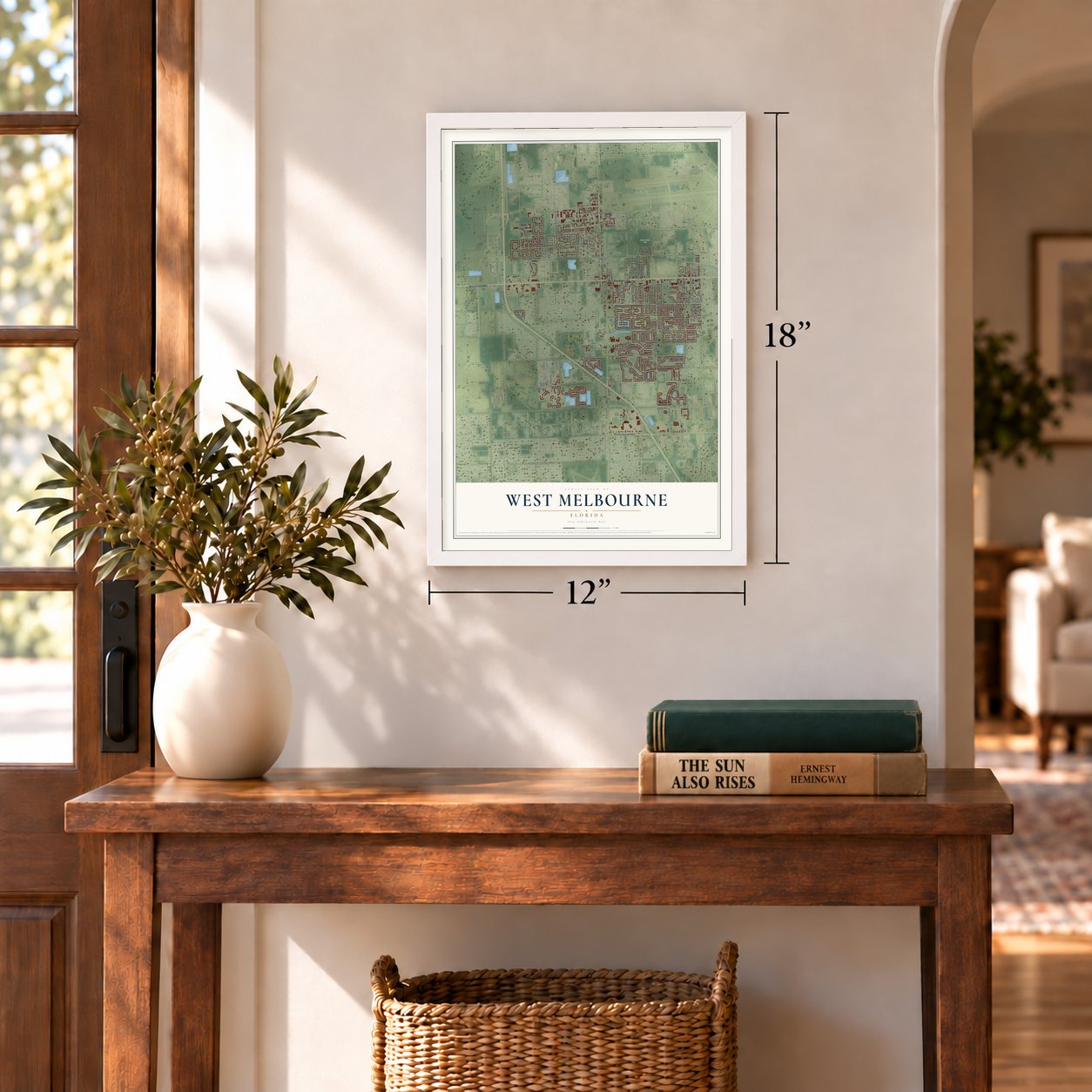
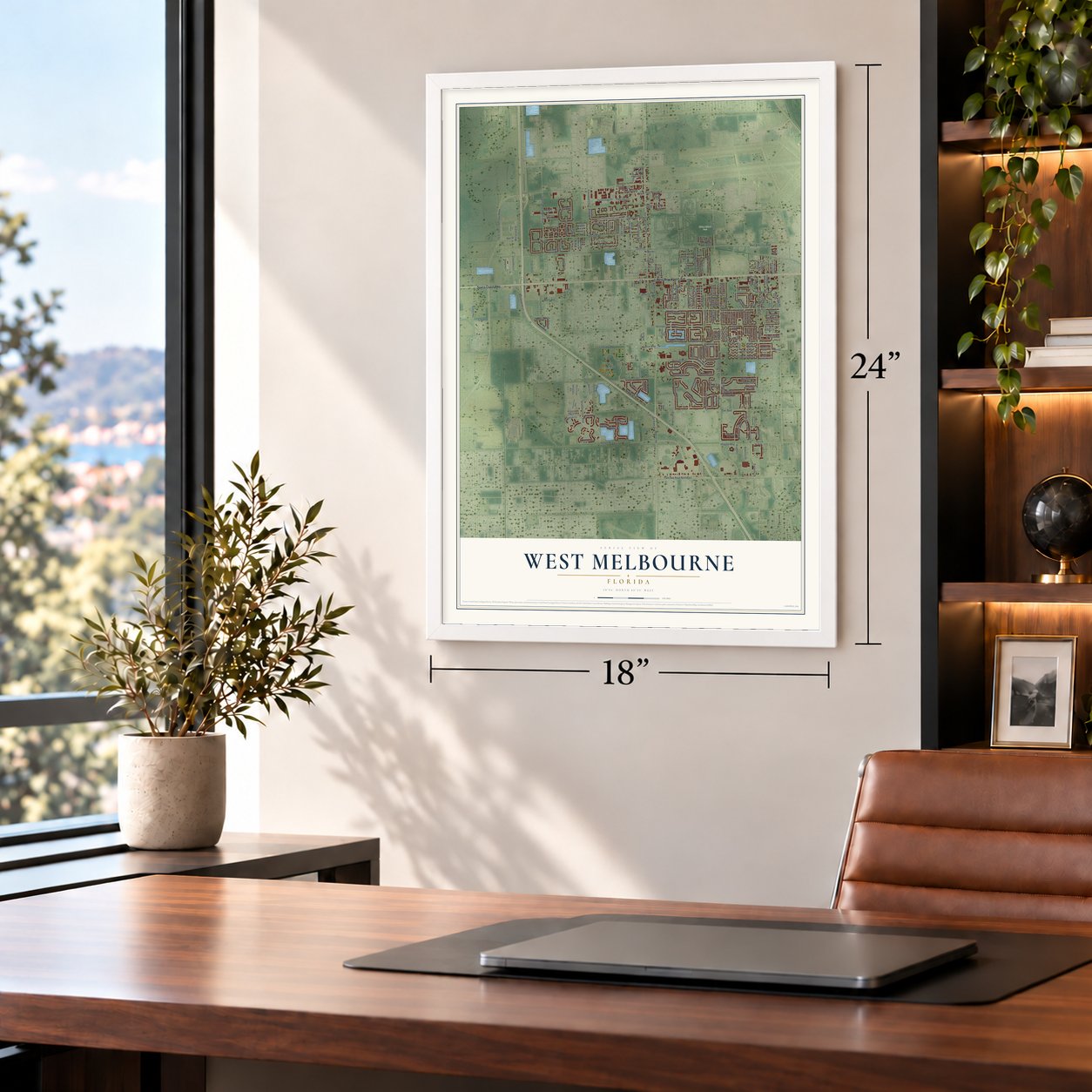
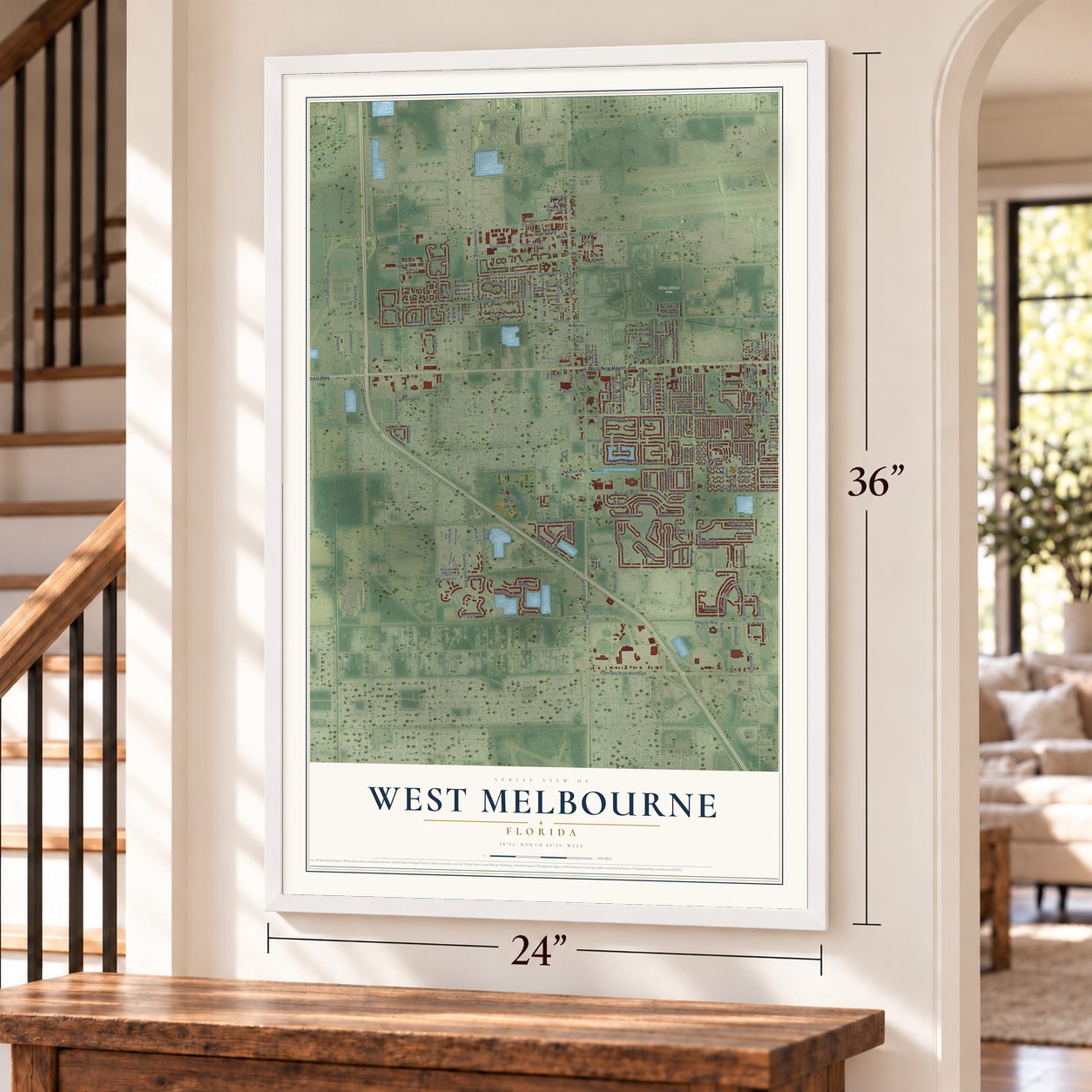
West Melbourne, Florida Map Art
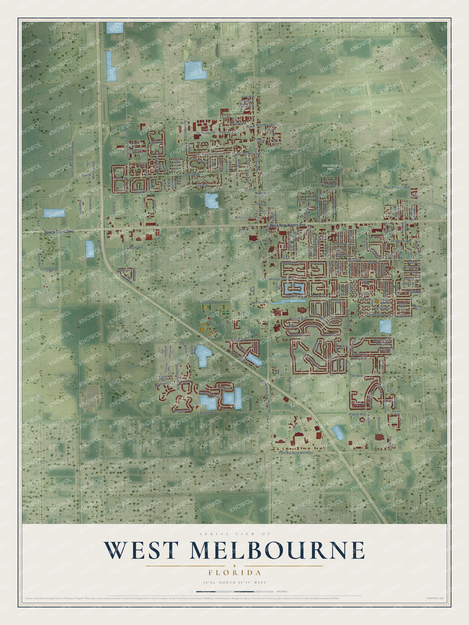
A new map of West Melbourne, Florida, made in 2026 and printed to order on thick archival matte paper.
12" x 18" Archival Matte Print
A Map of Home. A Work of Art.
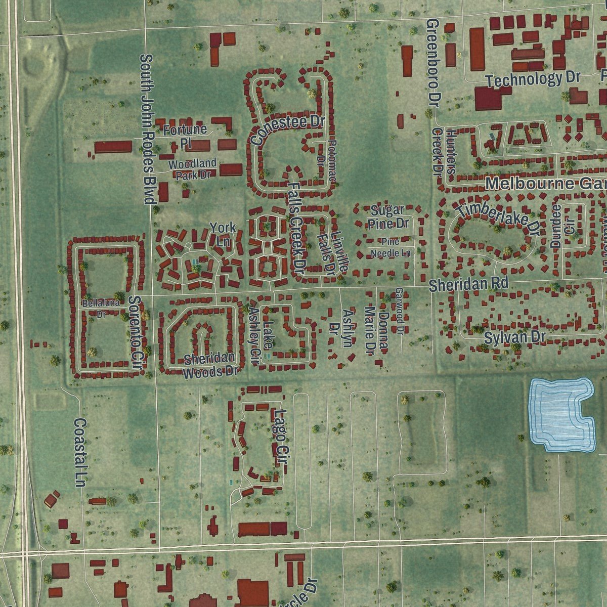
Explore West Melbourne, Florida from a whole new perspective. Created using aerial imagery and detailed geographic data, this map captures West Melbourne building by building, with labeled streets, familiar landmarks, and shaded topographical relief that highlights the natural contours of the landscape.
Combining modern data with the timeless character of a vintage atlas, this map is just as interesting up close as it is beautiful on the wall. Whether you grew up in West Melbourne, spent memorable years there, or call it home today, this unique map is a great way to celebrate a place that means something to you. Zoom in on the preview to look for your street, and then order a print to put your memories on the wall.
Three ways to hang it
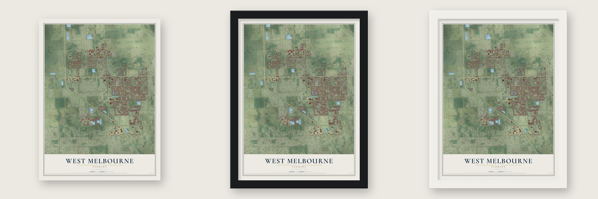
Unframed archival matte, a black wood frame or a white wood frame.
Up close
Geography Worth Displaying
This map was created using accurate cartographic data and authoritative geographic sources, including the U.S. Geological Survey (USGS) and FEMA. The map brings together terrain, waterways, roads, and building detail. The majority of the streets are labeled, houses are accurately depicted, and the topography is derived from government sources. Combining local data with carefully composed color and shading leads to this beautifully detailed West Melbourne artwork for your wall.
Rather than simply showing street outlines, we’ve included as many of the street names as we could reasonably fit on the map while keeping their names legible. Zoom in on the high resolution preview to see exactly what’s on the map. We truly set out to create a statement piece for anyone who loves West Melbourne. So whether it’s for you, or a gift for someone you love, we hope this map of West Melbourne brings back fond memories.
Explore the full map of West Melbourne, Florida and read about the local places it shows.

About West Melbourne, Florida
West Melbourne is a city of 25,924 people in Brevard County, Florida. Its voters formed the city in 1959 so that the neighboring City of Melbourne could not annex their land. By 1970 the new city had roughly 3,050 residents.
Growth sped up after the turn of the century. Since 2000, no other municipality in Brevard County has grown by a larger percentage, and the 2020 census counted 25,924 people in West Melbourne.
- No property tax until 2005For more than four decades after its founding in 1959, West Melbourne collected no property tax at all. Fees alone paid for a city budget of $17 million. That changed in 2005, when the city began taxing property for the first time.
- Seven state spelling bee titlesBetween 2005 and 2014, three home-schooled children from one West Melbourne family won Florida's state spelling bee seven times in all. Each of the three took the championship two or three times.
- Field of Dreams in 2016West Melbourne Community Park became home to the Space Coast Field of Dreams, which first welcomed visitors in January 2016. Three years later, in 2019, the City of West Melbourne took charge of its programs and day-to-day operations.
Find your street
Names on the West Melbourne map
Every name below is printed on this map. Look for your street, your school, the park where you played, or the pond down the road.
Places and landmarks3
- Melbourne Gardens
- Mintons Corner
- Erna Nixon Park
Streets and roads240
- Space Coast Highway
- West New Haven Avenue
- Lago Circle
- West Laila Drive
- Henry Avenue
- Dorchester Avenue
- Shallow Creek Boulevard
- Woodfield Circle
- Isla Street
- Slate Street
- Hollywood Boulevard
- Minton Road
- Saint Johns Heritage Parkway
- Norfolk Parkway
- Eber Boulevard
- Sheridan Road
- South Wickham Road
- Palm Bay Road Northeast
- Ellis Road
- Dairy Road
- Explorer Drive
- Greenboro Drive
- Sedgewood Circle
- Wingate Boulevard
- Salt Marsh Circle
- Sorento Circle
- Fell Road
- Brookshire Circle
- South John Rodes Boulevard
- McClain Drive
Show all 240 streets
- Champion Way
- Tuscarora Court
- Attilburgh Boulevard
- Caladium Circle
- Musgrass Circle
- Burdock Avenue
- Rushing Waters Drive
- Simon Road
- Maeve Circle
- Coastal Lane
- Technology Drive
- Whistler Street
- Timberlake Drive
- Lune Court
- Park Hill Boulevard
- Sylvan Drive
- Del Mar Circle
- Potenza Drive
- Whitman Drive
- Glasbern Circle
- Flanagan Avenue
- Heritage Oaks Boulevard
- Gail Boulevard
- Chica Circle
- Alaqua Way
- Joslin Way
- Sumter Lane
- Trovita Circle
- Ventura Circle
- Brandywine Lane
- Durham Drive
- Evans Road
- Colorado Avenue
- Doherty Drive
- Lemon Grove Avenue
- McFarland Drive
- Bossieux Boulevard
- West Hibiscus Boulevard
- Stephenson Drive
- Sylvia Road
- Samuel Chase Lane
- Conestee Drive
- Danville Circle
- Hailey Street
- Bry Lynn Drive
- Cattle Drive
- Ruth Circle
- Jean Circle
- Tropicana Avenue
- Industrial Road
- Woodland Drive
- Hollister Drive
- Campbell Drive
- Carriage Gate Drive
- Meadowlane Avenue
- Columbia Lane
- Haven Drive
- Payette Lane
- Lee Road
- Monaco Road
- Merlin Drive
- Vining Street
- Rocket Lane
- Wekiva Lane
- Tortuga Way
- Falls Creek Drive
- Sutton Avenue
- Madrigal Lane
- Crane Road
- Suapres Lane
- East Haven Drive
- Barr Street
- Trend Road
- West Nasa Boulevard
- Westover Drive
- Lake Ibis
- Miami Avenue
- Walker Avenue
- Imagine Way
- Helen Street
- Dorset Drive
- Circle Drive
- Sunset Drive
- Nancy Street
- Irene Street
- Griffith Lane
- Bryce Lane
- Parker Road
- Morton Way
- Progress Circle
- Grace Street
- Athey Court
- Alice Street
- Arrowood Street
- American Drive
- Elizabeth Street
- Buffalo Street
- West Court
- Wyeth Street
- East Court
- Manor Place
- Dione Street
- Coral Drive
- Susan Drive
- South Drive
- Bj Lane
- Brig Street
- Rodes Place
- Mark Drive
- Stratford Pointe Drive
- Alligator Flag Circle
- Hunters Creek Drive
- Botanica Circle
- Soft Breeze Circle
- Bradfordt Drive
- Watergrass Street
- Sheridan Woods Drive
- Tamango Drive
- John Carroll Lane
- Lake Ashley Circle
- Brockton Way
- Dundee Circle
- Orange Grove Avenue
- Jennifer Circle
- Marnie Circle
- Bobby Jones Street
- Olde Bailey Lane
- John Adams Lane
- Linville Falls Drive
- Sugar Pine Drive
- Talona Drive
- Beth Lane
- Osborne Court
- Lady Hawk Way
- Southwest Irwin Avenue
- Laurel Oak Street
- Cocoanut Grove Avenue
- Vickie Circle
- Keystone Avenue
- Academic Court
- Radley Drive
- Murano Drive
- Boughton Way
- Secret Road
- Sephia Street
- York Lane
- Fortune Place
- Northwest Carolina Street
- Snicole Avenue
- Belmont Way
- Naylor Drive
- Adamo Way
- Natures Way
- Balsam Avenue
- Bainbury Lane
- Tropic Drive
- Donna Marie Drive
- Emerald Drive
- Pinecrest Street
- Martin Lane
- Virginia Road
- Snowy Egret Drive
- Wiregrass Avenue
- Peaceful Place
- Kelly Drive
- Ashlyn Drive
- Feast Road
- Lake Court
- Broomsedge Circle
- Fiddleleaf Circle
- Potomac Drive
- East Laila Drive
- John Hancock Lane
- Amasa Circle
- Robert Norris Lane
- Frederick Avenue
- Triple Crown Lane
- Horsemint Avenue
- Thomas Jefferson Lane
- Woodland Park Drive
- Idlewylde Circle
- Imogene Boulevard
- Nikon Road
- Sirius Court
- Music Row Lane
- North Laila Drive
- San Paulo Court
- Kelly Lane
- Shannon Avenue
- Buffett Lane
- Laila Court
- Anchor Lane
- Tallwood Circle
- Mary Street
- Northwest Pine Street
- Weatherly Avenue
- Serene Place
- Lee Court
- Bellaluna Drive
- Livingstone Lane
- Garwood Drive
- Pine Needle Lane
- Frank Lane
- Fellwood Lane
- Crystal Oaks Lane
- Crockett Street
- Shinn Avenue
- Wawa Way
- Hield Road
- Ellis Drive
Names are listed as they appear on the printed map. Zoom into the product photos to find them.
The art of mapping a place
How This Map Was Made
Real places. Remarkable detail. Discover the layers that turn geographic data into a map of home.

The view from above
Aerial imagery reveals the character of the land: woodland, open fields, and the patterns of a place.

The shape of the land
Elevation data brings hills, valleys, and subtle changes in the landscape into view.

The details of home
Roads, waterways, and building footprints come together to make the map feel unmistakably local.

Geography becomes art
Considered color, shading, and typography bring the layers together in a map made for your wall.


Process illustrated with Mendon, Massachusetts. Aerial imagery: USDA NAIP. Terrain: USGS 3D Elevation Program. Map details and finished artwork: KNOWOL.
The Details
About This Print
Choose an archival matte print, or a black or white Ayous wood frame. The archival matte print is unframed.
Select your size and finish above to see the matching product image and price.
Materials & Craftsmanship
A contemporary map with the character of a classic atlas, printed on archival matte paper. Optional frames are made from Ayous wood.
Your printed map does not include the watermark shown in the full-map preview.
Shipping & Delivery
Free shipping within the United States. Every print is made to order in the USA.
Buying a gift? Add a note in your cart and we'll include it. We never put prices in the package.
Prints ship within 2 to 3 business days. Allow 7 to 10 days total from ordering for delivery. Timing may vary during holidays or periods of high order volume.
Read our shipping policy.
Returns and damaged prints
Each print is made to order. Change-of-mind refunds are not available after production.
If your print arrives damaged, misprinted or incorrect, contact support@knowol.com within 30 days of receiving it. Include your order number, photos and a description of the issue.
Read our full refund and replacement policy. For questions about your order, email support@knowol.com.
Find your town
Looking for another city?
Find a map of home in our Florida collection, or any town in the country.
Nearby
Maps of towns near West Melbourne
Know someone from one of these towns? Their map makes a great gift.
 June Park
, Florida
From $39.99See the map
 Melbourne Village
, Florida
From $39.99See the map
 Melbourne
, Florida
From $39.99See the map
More maps nearby: Indialantic, Melbourne Beach, Malabar, Palm Bay and Indian Harbour Beach.