
Search for another town



Free U.S. delivery 7 to 10 days after you order
Paradise, California Map Art
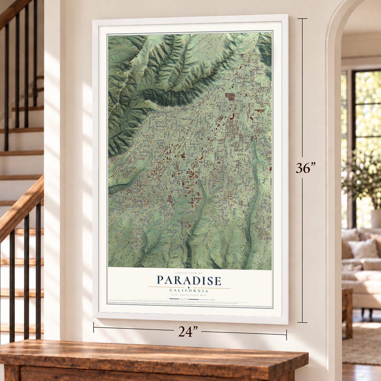
A new map of Paradise, California, made in 2026 and printed to order on thick archival matte paper.
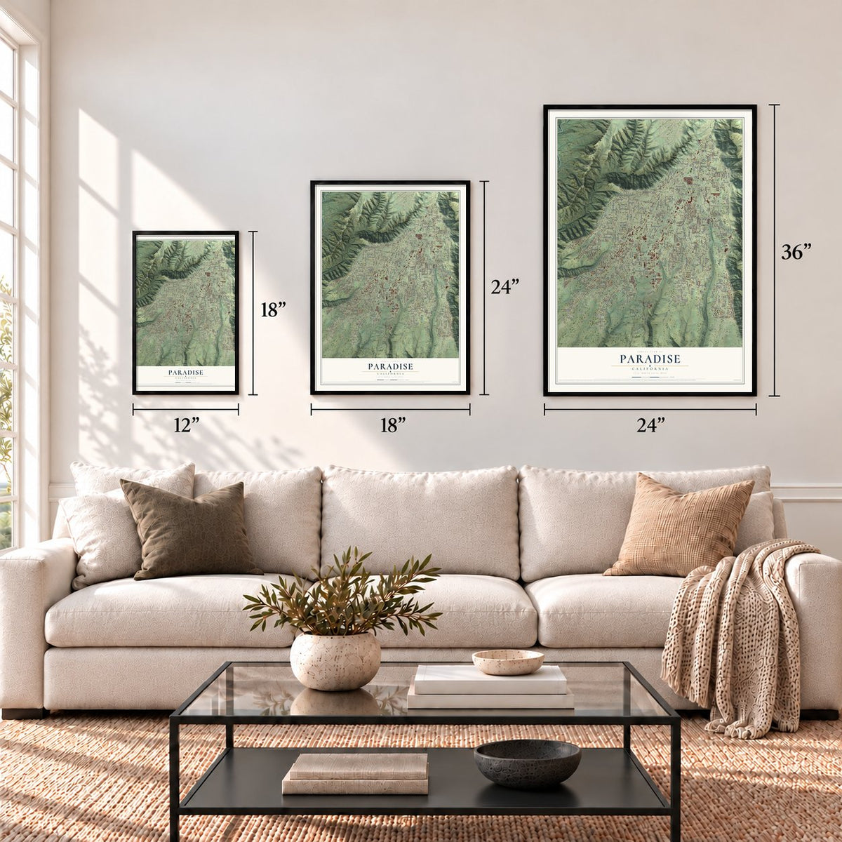
12" x 18" Archival Matte Print
A Map of Home. A Work of Art.
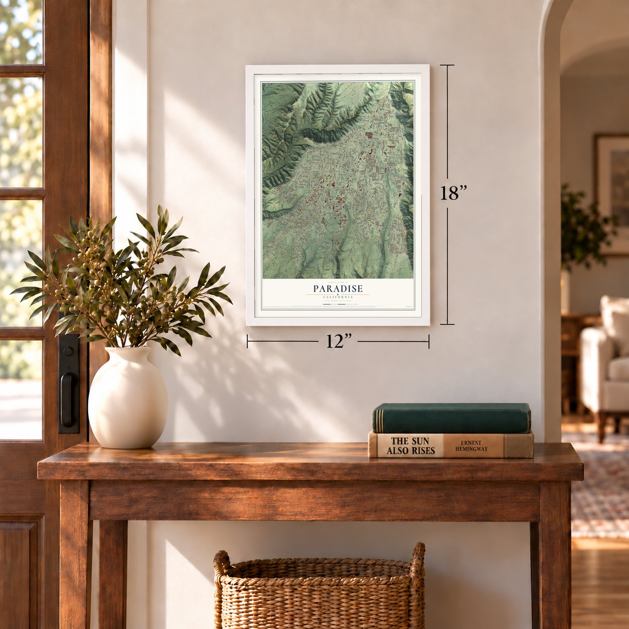
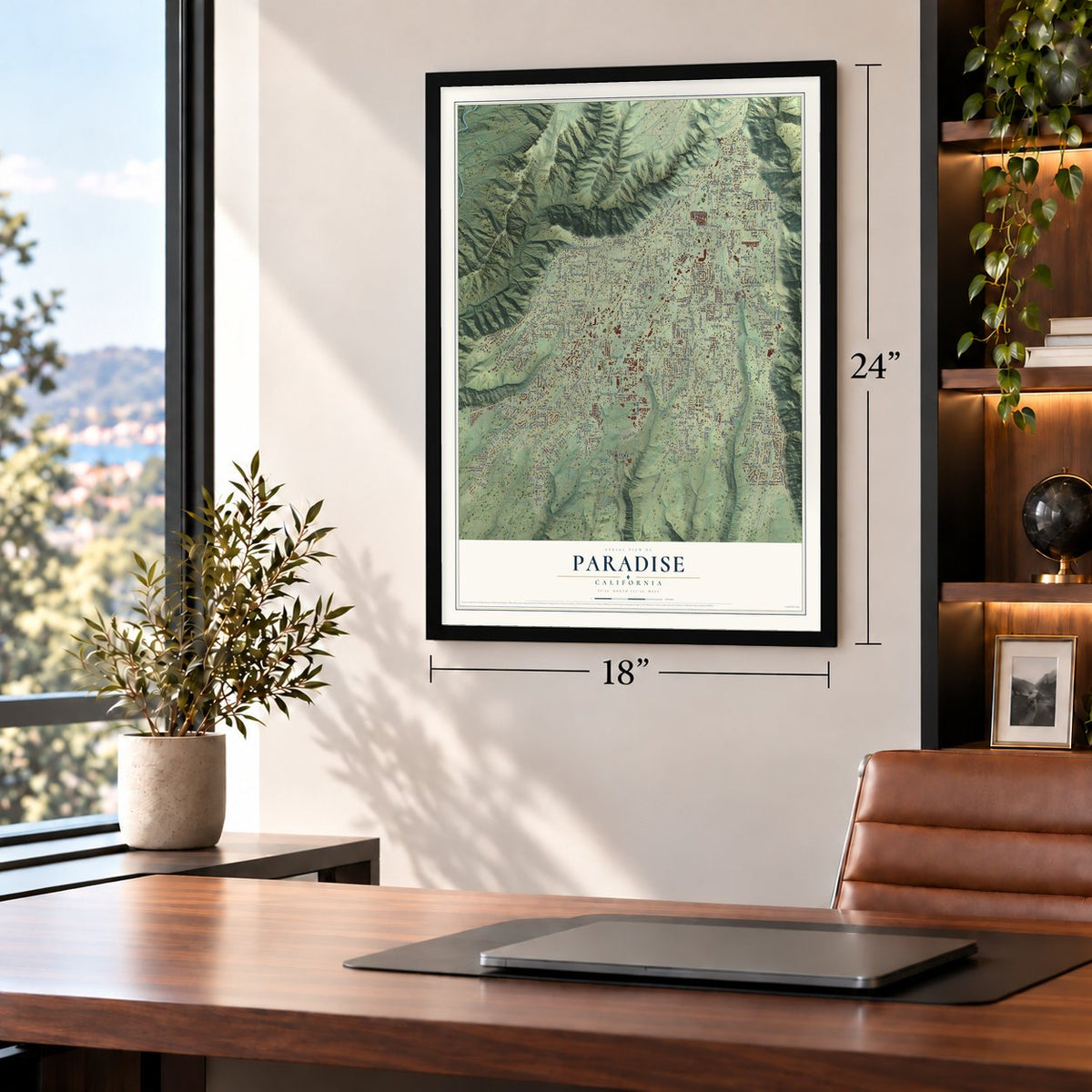
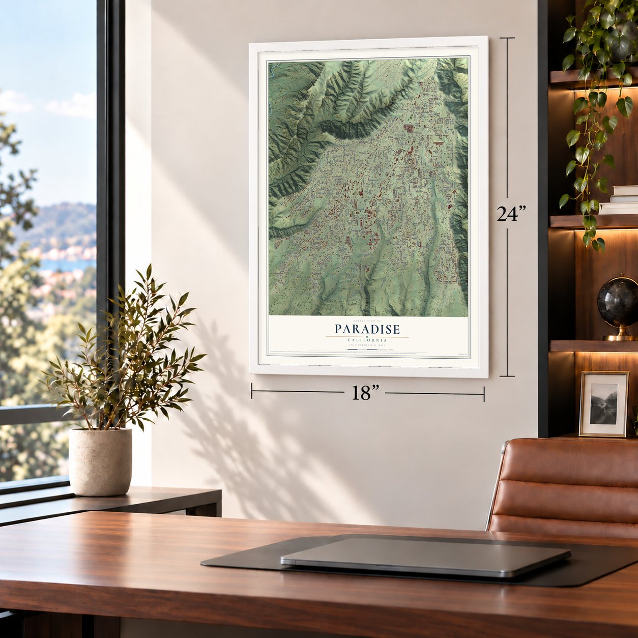
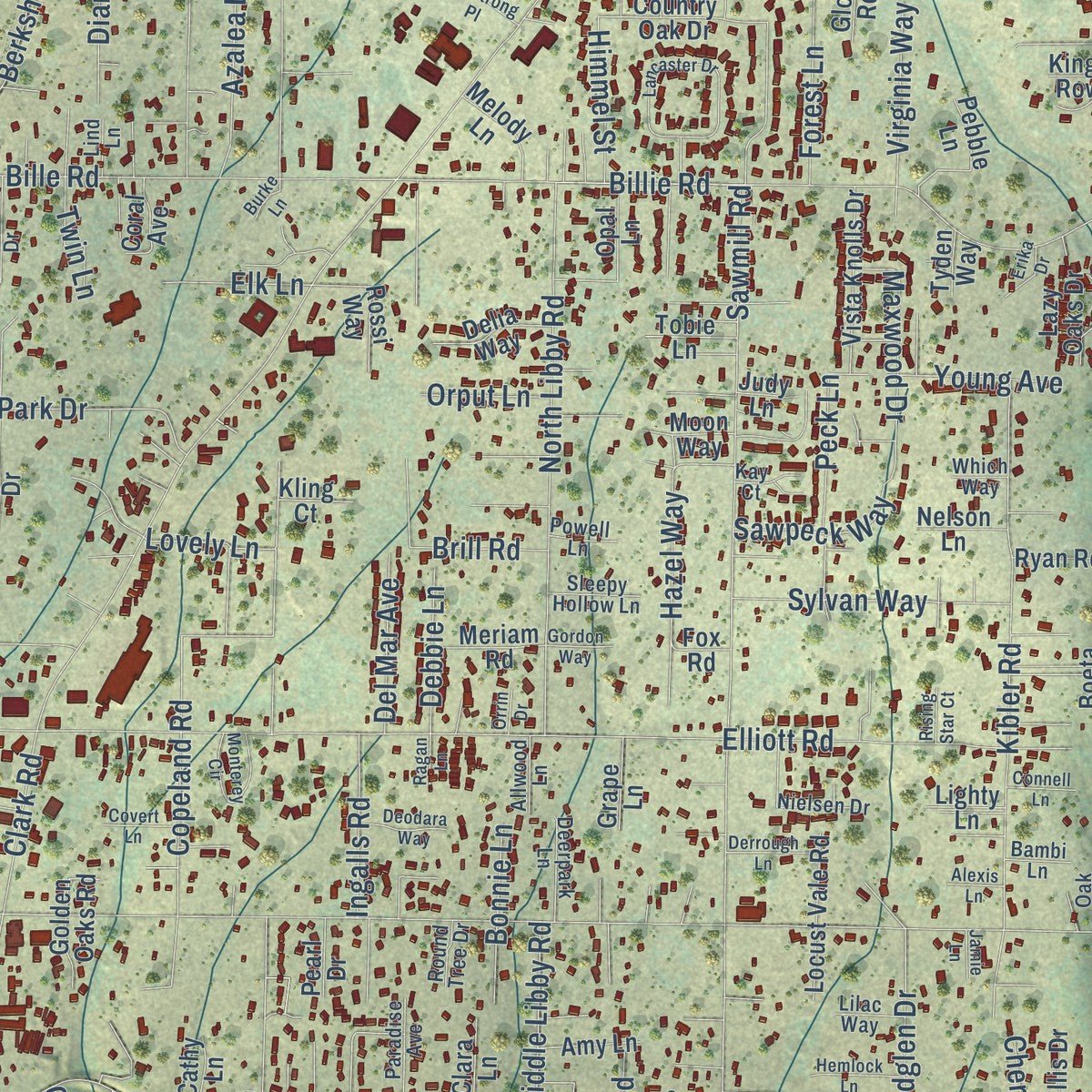
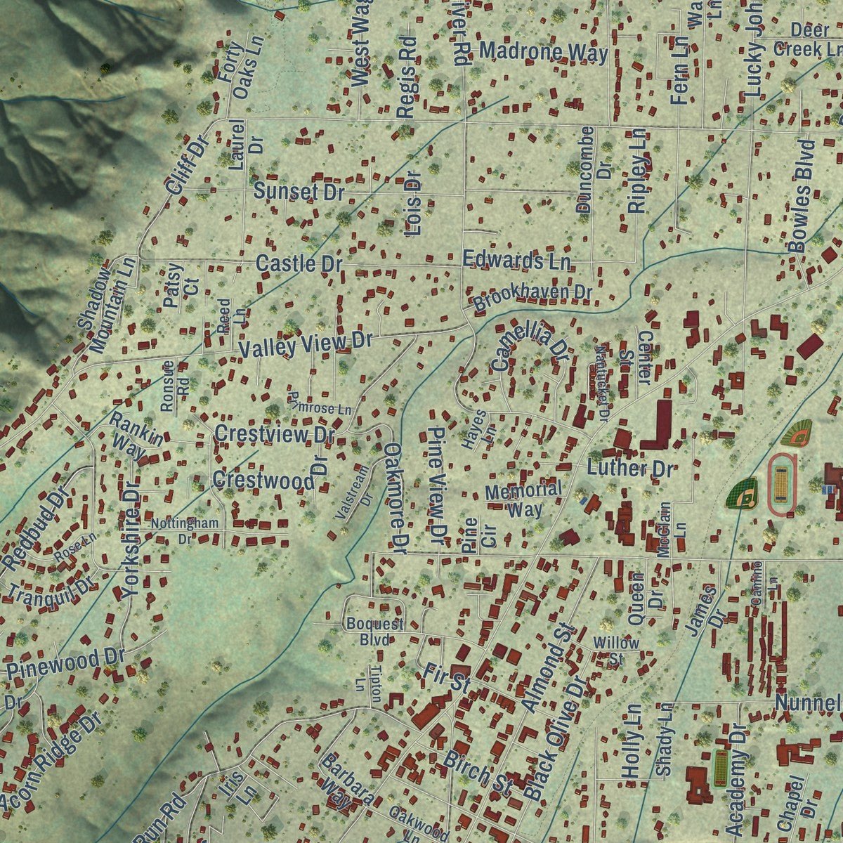
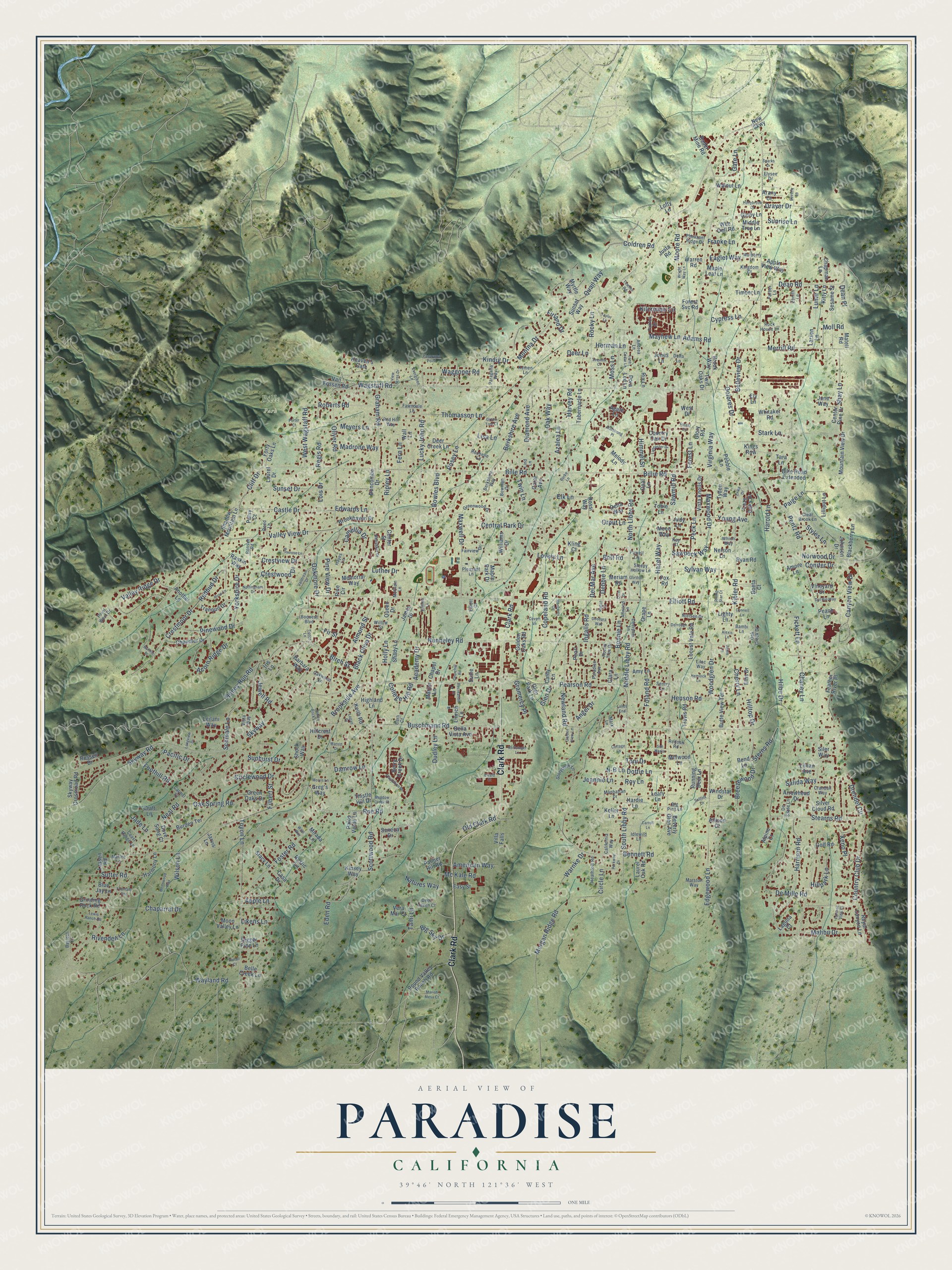
Explore Paradise, California from a whole new perspective. Created using aerial imagery and detailed geographic data, this map captures Paradise building by building, with labeled streets, familiar landmarks, and shaded topographical relief that highlights the natural contours of the landscape.
Combining modern data with the timeless character of a vintage atlas, this map is just as interesting up close as it is beautiful on the wall. Whether you grew up in Paradise, spent memorable years there, or call it home today, this unique map is a great way to celebrate a place that means something to you. Zoom in on the preview to look for your street, and then order a print to put your memories on the wall.
Three ways to hang it
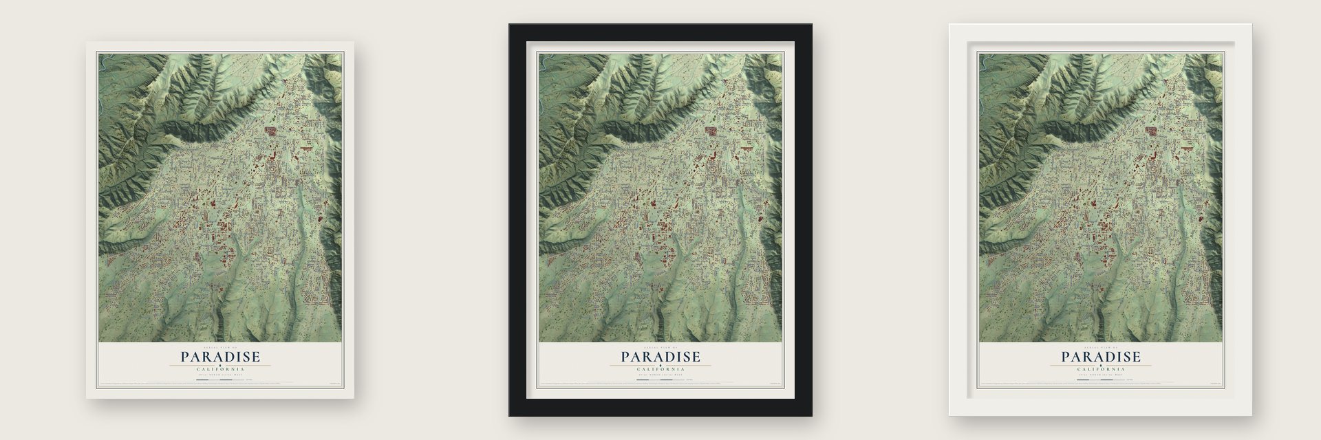
Unframed archival matte, a black wood frame or a white wood frame.
Up close
Geography Worth Displaying
This map was created using accurate cartographic data and authoritative geographic sources, including the U.S. Geological Survey and the Census Bureau. The map brings together terrain, waterways, roads, and building detail. The majority of the streets are labeled, houses are accurately depicted, and the topography is derived from government sources. Combining local data with carefully composed color and shading leads to this beautifully detailed Paradise artwork for your wall.
Rather than simply showing street outlines, we’ve included as many of the street names as we could reasonably fit on the map while keeping their names legible. Zoom in on the high resolution preview to see exactly what’s on the map. We truly set out to create a statement piece for anyone who loves Paradise. So whether it’s for you, or a gift for someone you love, we hope this map of Paradise brings back fond memories.
Read the story behind this map of Paradise, California from 2026.

About Paradise, California
From the Historical Marker Database: "The Paradise post office was established and a Sunday school organized in 1877."
Find your street
Names on the Paradise map
Every name below is printed on this map. Look for your street, your school, the park where you played, or the pond down the road.
Places and landmarks1
- Bille Park
Streets and roads464
- Clark Road
- Skyway
- Pentz Road
- Pearson Road
- Wagstaff Road
- Bille Road
- Elliott Road
- Roe Road
- Foster Road
- Sawmill Road
- Nunneley Road
- Honey Run Road
- Valley View Drive
- Neal Road
- Stearns Road
- Wayland Road
- Oliver Road
- Bennett Road
- Scottwood Road
- Skyway Road
- Lucky John Road
- Crestmoor Drive
- Newland Road
- Edgewood Lane
- South Libby Road
- Buschmann Road
- Circlewood Drive
- Old Clark Road
- Kibler Road
- Redbud Drive
Show all 464 streets
- Copeland Road
- Country Club Drive
- De Mille Road
- Kilcrease Circle
- North Libby Road
- Valley Ridge Drive
- Merrill Road
- Black Olive Drive
- Crestview Drive
- Canyon View Drive
- Sunset Drive
- Fickett Lane
- Dean Road
- Harrison Road
- Morgan Ridge Road
- Rocky Lane
- Malibu Drive
- Quail Way
- Montna Drive
- Graham Road
- Almond Street
- Oak Way
- Maxwell Drive
- Pinewood Drive
- Castle Drive
- Berkshire Avenue
- Filbert Street
- Central Park Drive
- Middle Libby Road
- Forest Lane
- Stark Lane
- Harvey Road
- Drendel Circle
- Thomasson Lane
- Acorn Ridge Drive
- Gate Lane
- Sterns Road
- Toyon Lane
- Moore Road
- Eden Road
- Chaparral Drive
- Circle Lane
- Fern Lane
- Roberts Road
- Sylvan Way
- Apple Lane
- Oak Spring Road
- Big Sky Drive
- Camellia Drive
- Sutter Road
- Yorkshire Drive
- Edwards Lane
- West Wagstaff Road
- Hazel Way
- Cherry Lane
- Chaney Lane
- Styles Lane
- Fir Street
- Foland Road
- Shay Lane
- Breezewood Drive
- Dolores Drive
- Azalea Lane
- Waggoner Road
- Woodglen Drive
- Rivendell Lane
- Cypress Lane
- Maxwood Drive
- Henson Road
- Dudley Lane
- Brill Road
- Diamond Avenue
- Peck Lane
- Belleview Drive
- Angel Drive
- Cliff Drive
- Foothill Road
- Young Avenue
- Virginia Way
- Sawpeck Way
- Bowles Boulevard
- Brookside Avenue
- Paige Lane
- American Way
- Schmale Lane
- Crestwood Drive
- Meyers Lane
- Jewell Road
- Madrone Way
- Billie Road
- Damrow Lane
- Dottie Lane
- Academy Drive
- Jeannie Lane
- Ingalls Road
- College Hill Road
- Drayer Drive
- Hilbe Drive
- Bonnie Lane
- Del Mar Avenue
- Oakmore Drive
- Natures Way
- Herman Lane
- Posey Lane
- Glen Drive
- Hillpark Lane
- Harold Lane
- Himmel Street
- Pine View Drive
- Birch Street
- Debbie Lane
- Norwood Drive
- Sunrise Lane
- Mc Kale Road
- Warnke Drive
- Kindig Drive
- Eaglet Way
- Conifer Drive
- Sunburst Drive
- Gramercy Place
- Lunar Lane
- Likens Lane
- Pacific Drive
- Elk Lane
- Mayhew Lane
- Salida Way
- Hilltop Drive
- Moss Lane
- Tami Lane
- Coldren Road
- Lovely Lane
- Wilson Lane
- Orput Lane
- Franke Lane
- Twin Lane
- Adams Road
- Ripley Lane
- Firland Drive
- Regis Road
- Luther Drive
- Xeno Place
- Lisa Lane
- Deer Lane
- Roy Lane
- Dean Place
- Moll Road
- Jade Lane
- Holly Lane
- Toni Drive
- N-B Lane
- Lois Drive
- Feather River Place
- Maple Park Drive
- Forest Svc Road
- Berry Creek Drive
- Round Valley Ranch Road
- Grinding Rock Road
- Chandler Drive
- Hillcrest Drive
- Seneca Drive
- Williams Drive
- Mountain View Drive
- Laurel Drive
- Bille Road Extended
- Brook Way
- Keller Lane
- Butte View Terrace
- Sunset Way
- Wall Lane
- Burden Terrace
- Vista Knolls Drive
- Royal Canyon Lane
- Shadow Mountain Lane
- Blackberry Lane
- Brookhaven Drive
- Barbara Way
- Green Oaks Drive
- Country Oak Drive
- Locust Vale Road
- Deer Creek Lane
- Tabernacle Lane
- Van Fossen Road
- Maple Leaf Lane
- Running Deer Lane
- Tara Lane
- Tranquil Drive
- Beverly Glen Avenue
- Skyway Crossroad Road
- Moon Valley Lane
- Pebble Lane
- Rossi Way
- Golden Oaks Road
- Tobie Lane
- Russell Drive
- Travis Road
- Thistle Hill Drive
- Villa Falls
- Harmony Lane
- Mirada Lane
- Laurel Oak Road
- Arrowhead Drive
- Bella Vista Avenue
- Lazy Oaks Drive
- Bader Mine Road
- Duncombe Drive
- Shock Way
- Twin Oaks Drive
- Delia Way
- Windstar Drive
- Warren Road
- Craft Lane
- Chapman Lane
- Sesame Street
- Center Pine Drive
- Apple View Way
- Forty Oaks Lane
- Kinsey Way
- Palmer Hill Road
- Timber Lane
- Melody Lane
- Rankin Way
- Meriam Road
- Memorial Way
- Glen Park Lane
- Highland Lane
- Wee Dell Road
- Silver Cloud Road
- Belle Creek Lane
- Lofty Lane
- Heaven's Gate
- Millwood Lane
- James Drive
- Ellis Drive
- Johnson Drive
- Lilliput Lane
- Walnut Lane
- Rustic Lane
- Dove Song Court
- Myrtle Way
- June Way
- Hardie Lane
- Ginny Lane
- Amy Lane
- Leilani Way
- Shady Lane
- Coral Avenue
- Digger Pine Lane
- Opal Lane
- Vineyard Drive
- Whitaker Road
- Chapel Drive
- Keith Road
- Peach Lane
- Center Street
- Blue Jay Lane
- Larsen Lane
- Middle Tree Lane
- Palos Verde Lane
- Lassen Road
- Stacy Lane
- Lillian Avenue
- Another Lane
- Moon Way
- Grape Lane
- Ryan Road
- Nelson Lane
- Vera Mar Court
- Casa Drive
- Golf Road
- Arany Court
- Easy Street
- Alpine Court
- Matell Road
- Linrich Lane
- Queen Drive
- Justa Road
- Allison Court
- Clara Lane
- Dora Lee Lane
- Kitty Lane
- Mallan Lane
- Jones Lane
- Bend Lane
- Leafy Lane
- Jarvis Lane
- Lighty Lane
- Glory Road
- Pearl Drive
- Laguna Court
- Greg's Way
- Amore Lane
- Kling Court
- West Drive
- Rix Lane
- Patsy Court
- Susie Lane
- Boeta Court
- Cathy Lane
- Tyden Way
- Fox Road
- Judy Lane
- Siler Way
- Agate Lane
- Kings Row
- New Skwy
- Ely Lane
- Pine Circle
- Iris Lane
- Boquest Boulevard
- Greenwood Drive
- Fairview Drive
- Patrick Drive
- McClain Lane
- Crandall Way
- Nielsen Drive
- Storybook Lane
- Manhattan Drive
- Mulberry Lane
- Paragalia Way
- Pheasant Ridge Drive
- Heathrow Road
- Clear Brook Lane
- De Sante Lane
- Berkshire Way
- Pleasant Lane
- Oakwood Lane
- Point West Drive
- Bowman Drive
- Paradise Avenue
- Rock House Lane
- Deerpark Lane
- Willow Street
- Kay Court
- Vista Way
- Idlewild Lane
- Fawndale Lane
- Andrea Lane
- Coast Range Lane
- Marston Way
- Sleepy Hollow Lane
- California Way
- Red Hill Way
- Kingdom Court
- Oak Creek Drive
- Rochelle Lane
- Zenith Lane
- Deer Haven Court
- Allwood Lane
- Ronsue Road
- Bayleaf Lane
- Redoak Road
- Big Pine Lane
- Elysee Drive
- Lilac Way
- Powell Lane
- Reed Lane
- Round Tree Drive
- Kemen Lane
- Bambi Lane
- Carmel Court
- Farber Lane
- Marlee Lane
- Elliott Court
- Lind Lane
- Sentry Lane
- Which Way
- Hayes Lane
- Mark Lane
- Della Lane
- Carli Court
- Lancaster Drive
- Plantation Drive
- Carroll Lane
- Armstrong Place
- Mellowood Way
- Monterey Circle
- Recreation Drive
- Indian Rock Lane
- Mariah Mesa Court
- Nottingham Drive
- Noffsinger Lane
- Parkway Drive
- Valstream Drive
- Taylor Lane
- Rose Lane
- Nantucket Drive
- Primrose Lane
- Lone Cedar Lane
- Del Rio Way
- Hemlock Lane
- Derrough Lane
- View Acres Drive
- Deodara Way
- Hollybrook Drive
- Evergreen Lane
- Panarama Point
- Bartels Place
- Lands End
- Beverly Lane
- Churchill Road
- Meadow Creek Place
- Longview Drive
- Fountain Avenue
- Suffolk Lane
- Lewis Ranch Road
- Covert Lane
- Morris Lane
- Porter Court
- Wright Way Lane
- Ewald Court
- Connell Lane
- Sequoia Court
- Gordon Way
- Towhee Road
- Garden View Lane
- Erika Drive
- Falcons View Court
- Sun Manor
- Cottage Lane
- Camino Lane
- Alexis Lane
- Green Tree Court
- Rising Star Court
- Ragan Lane
- Tipton Lane
- Sparks Drive
- Logan Drive
- Forest Circle
- Marvin Drive
- Burke Lane
- Pintail Court
- Jamie Lane
- Orrin Drive
- Wills Way
Names are listed as they appear on the printed map. Zoom into the product photos to find them.
The art of mapping a place
How This Map Was Made
Real places. Remarkable detail. Discover the layers that turn geographic data into a map of home.

The view from above
Aerial imagery reveals the character of the land: woodland, open fields, and the patterns of a place.

The shape of the land
Elevation data brings hills, valleys, and subtle changes in the landscape into view.

The details of home
Roads, waterways, and building footprints come together to make the map feel unmistakably local.

Geography becomes art
Considered color, shading, and typography bring the layers together in a map made for your wall.


Process illustrated with Mendon, Massachusetts. Aerial imagery: USDA NAIP. Terrain: USGS 3D Elevation Program. Map details and finished artwork: KNOWOL.
The Details
About This Print
Choose an archival matte print, or a black or white Ayous wood frame. The archival matte print is unframed.
Select your size and finish above to see the matching product image and price.
Materials & Craftsmanship
A contemporary map with the character of a classic atlas, printed on archival matte paper. Optional frames are made from Ayous wood.
Your printed map does not include the watermark shown in the full-map preview.
Shipping & Delivery
Free shipping within the United States. Every print is made to order in the USA.
Buying a gift? Add a note in your cart and we'll include it. We never put prices in the package.
Prints ship within 2 to 3 business days. Allow 7 to 10 days total from ordering for delivery. Timing may vary during holidays or periods of high order volume.
Read our shipping policy.
Returns and damaged prints
Each print is made to order. Change-of-mind refunds are not available after production.
If your print arrives damaged, misprinted or incorrect, contact support@knowol.com within 30 days of receiving it. Include your order number, photos and a description of the issue.
Read our full refund and replacement policy. For questions about your order, email support@knowol.com.
Find your town
Looking for another city?
Find a map of home in our California collection, or any town in the country.
Nearby
Maps of towns near Paradise
Know someone from one of these towns? Their map makes a great gift.
 Magalia
, California
From $39.99See the map
 Concow
, California
From $39.99See the map
 Butte Creek Canyon
, California
From $39.99See the map
More maps nearby: Yankee Hill, Butte Valley, Cherokee, Forest Ranch and Stirling City.