
Search for another town

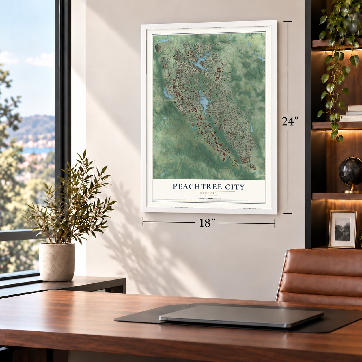
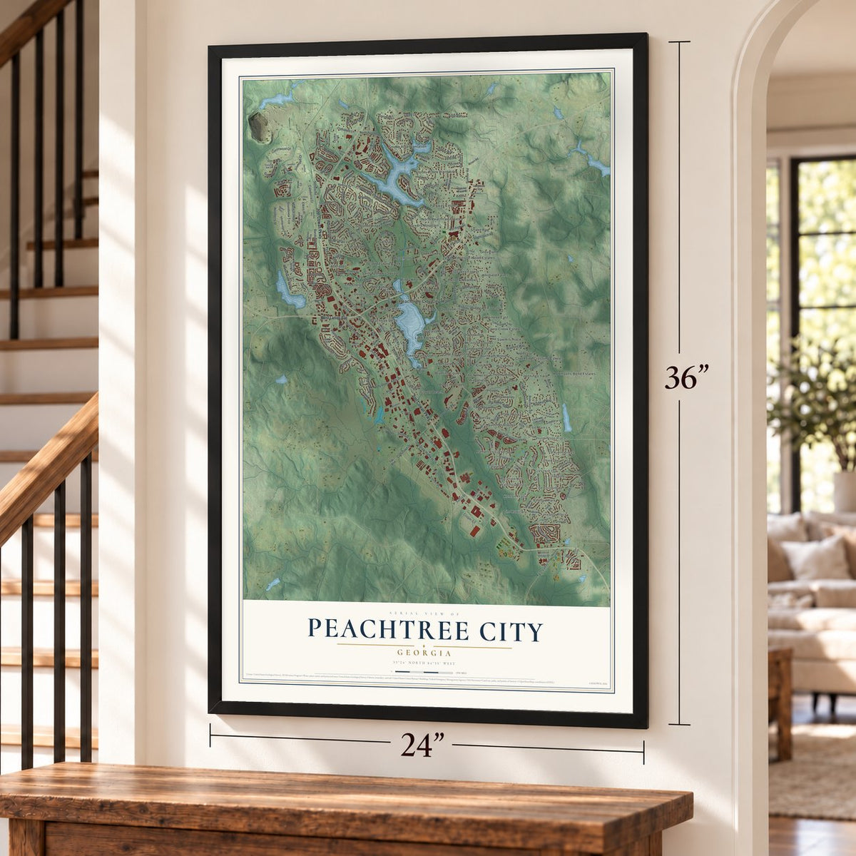
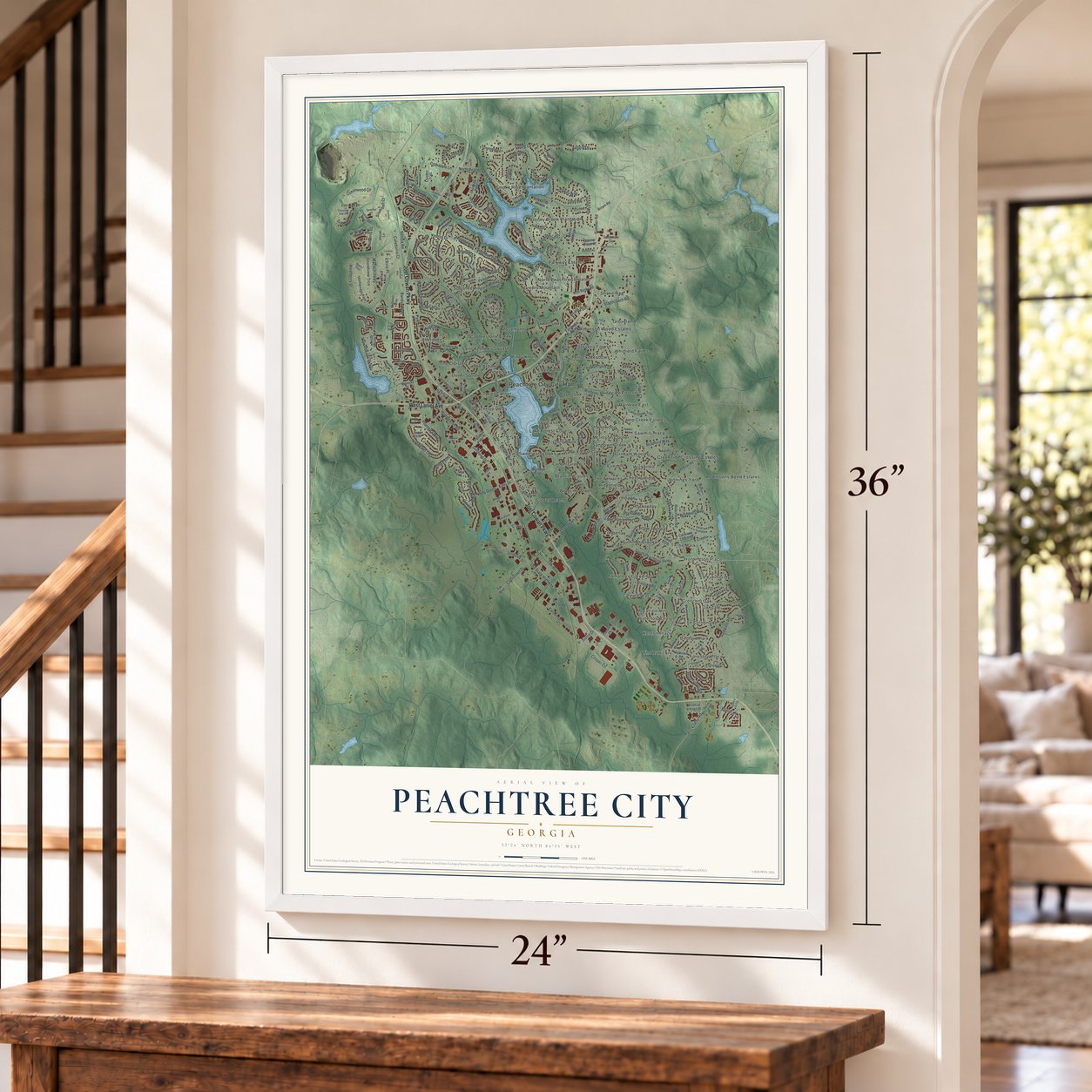

Free U.S. delivery 7 to 10 days after you order
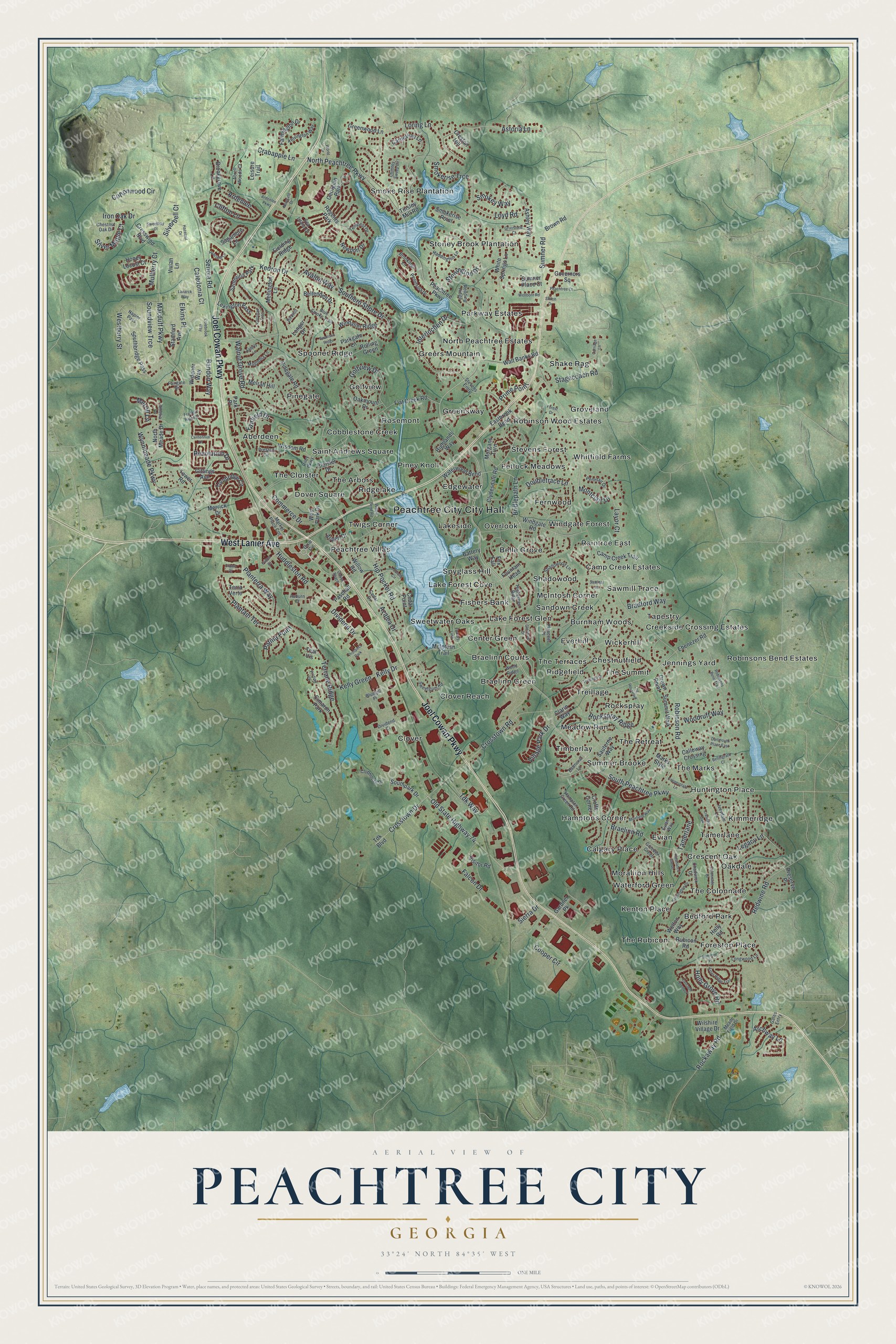
Peachtree City, Georgia Map Art
Building by building, with labeled streets and shaded relief.
12" x 18" Archival Matte Print
A Map of Home. A Work of Art.
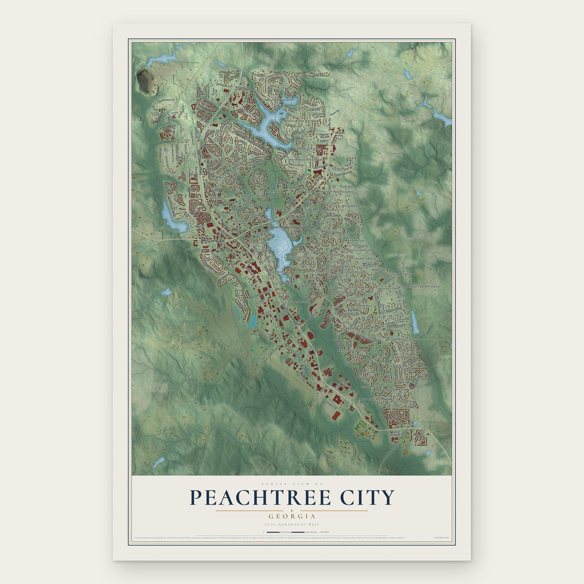
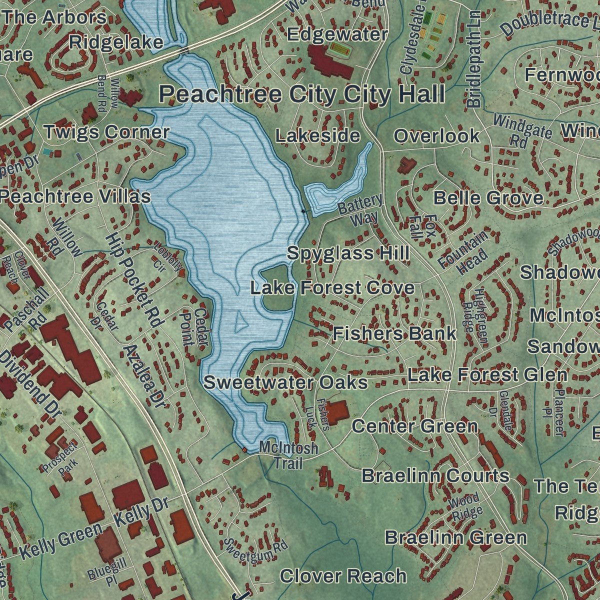
Explore Peachtree City, Georgia from a whole new perspective. Created using aerial imagery and detailed geographic data, this map captures Peachtree City building by building, with labeled streets, familiar landmarks, and shaded topographical relief that highlights the natural contours of the landscape.
Combining modern data with the timeless character of a vintage atlas, this map is just as interesting up close as it is beautiful on the wall. Whether you grew up in Peachtree City, spent memorable years there, or call it home today, this unique map is a great way to celebrate a place that means something to you. Zoom in on the preview to look for your street, and then order a print to put your memories on the wall.
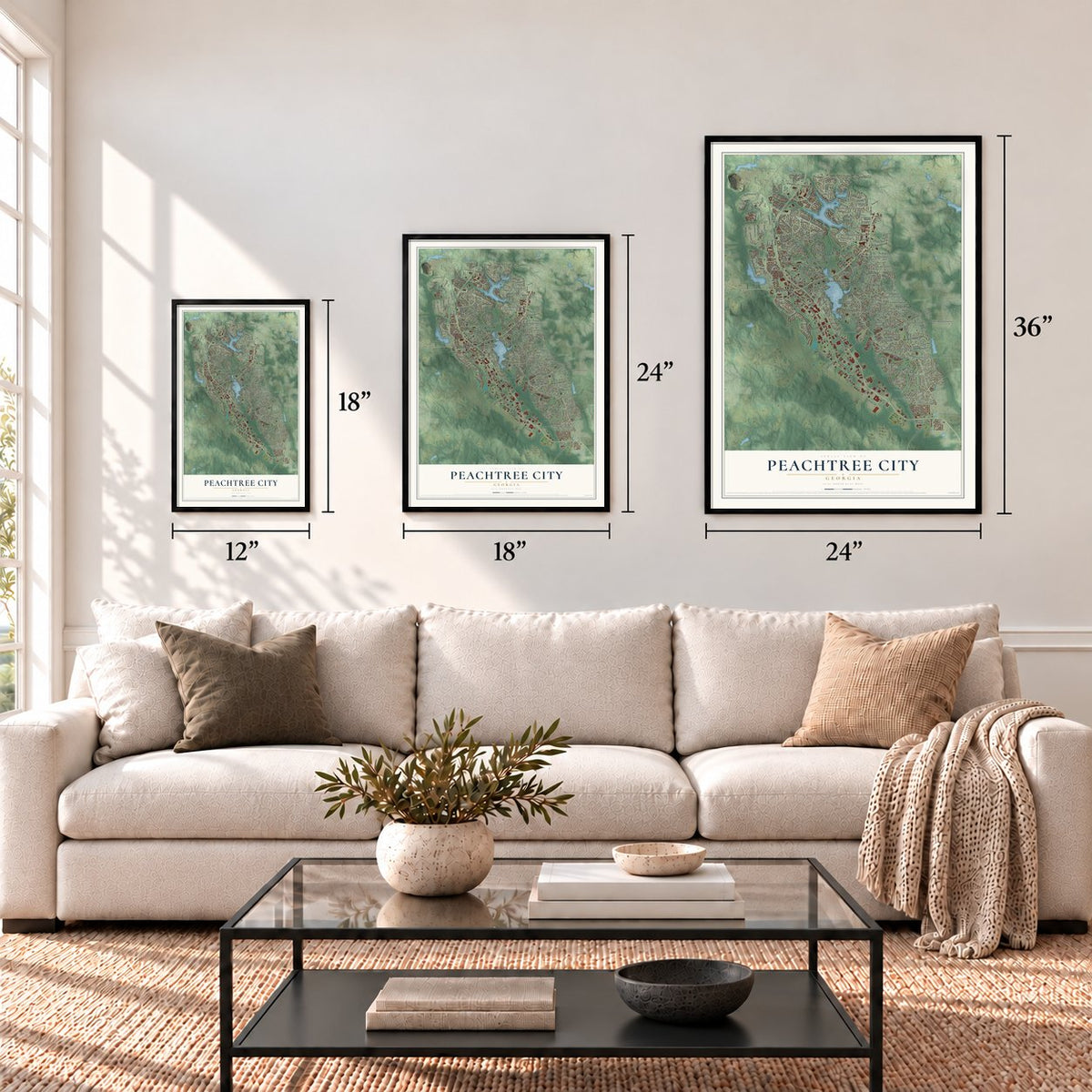
Three ways to hang it
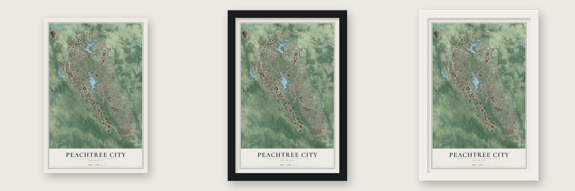
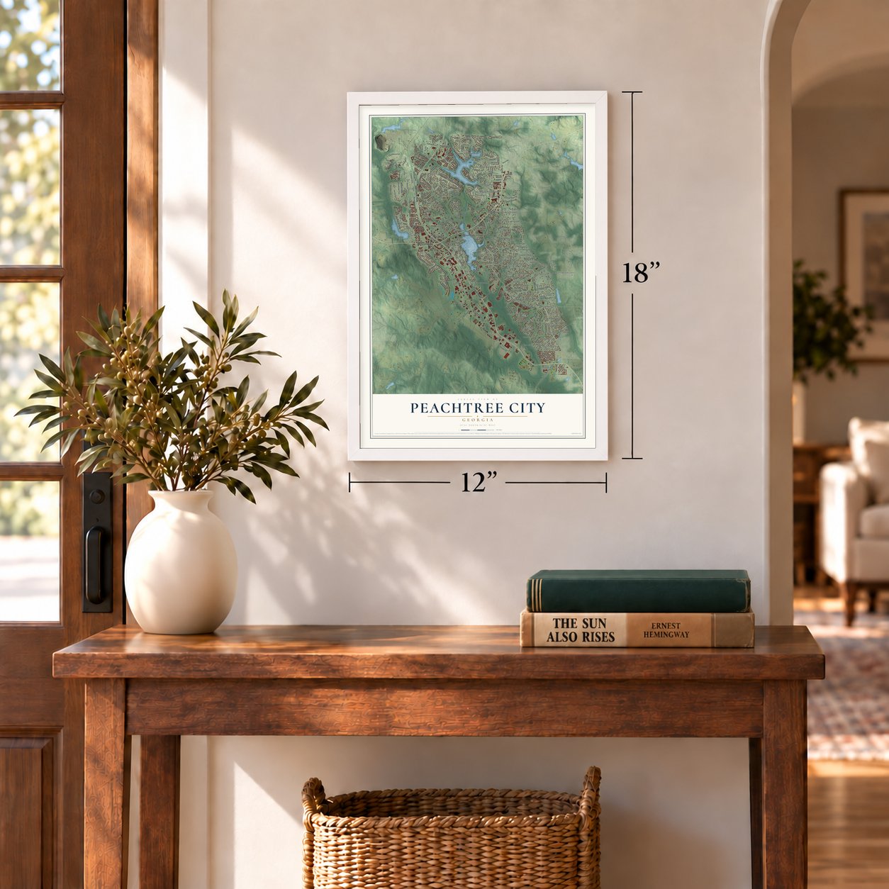
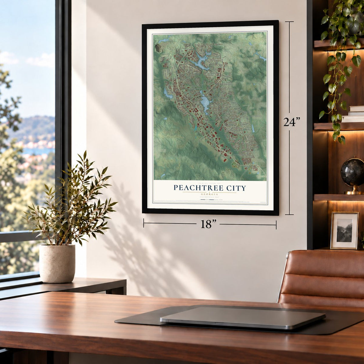
Unframed archival matte, a black wood frame or a white wood frame.
Up close
Geography Worth Displaying
This map was created using accurate cartographic data and authoritative geographic sources, including the U.S. Geological Survey (USGS) and FEMA. The map brings together terrain, waterways, roads, and building detail. The majority of the streets are labeled, houses are accurately depicted, and the topography is derived from government sources. Combining local data with carefully composed color and shading leads to this beautifully detailed Peachtree City artwork for your wall.
Rather than simply showing street outlines, we’ve included as many of the street names as we could reasonably fit on the map while keeping their names legible. Zoom in on the high resolution preview to see exactly what’s on the map. We truly set out to create a statement piece for anyone who loves Peachtree City. So whether it’s for you, or a gift for someone you love, we hope this map of Peachtree City brings back fond memories.
Explore the full map of Peachtree City, Georgia and read about the local places it shows.

Find your street
Names on the Peachtree City map
Every name below is printed on this map. Look for your street, your school, the park where you played, or the pond down the road.
Places and landmarks87
- Peachtree City City Hall
- Aberdeen
- Bedford Park
- Belle Grove
- Braelinn Courts
- Braelinn Green
- Burnham Woods
- Calgary Place
- Camp Creek Estates
- Center Green
- Chestnutfield
- Clover
Show all 87 places
- Clover Reach
- Cobblestone Creek
- Creekside Crossing Estates
- Crescent Oak
- Dover Square
- Edgewater
- Everhill
- Evian
- Fernwood
- Fetlock Meadows
- Fishers Bank
- Foreston Place
- Golfview
- Greensway
- Greers Mountain
- Groveland
- Hamptons Corner
- Huntington Place
- Jennings Yard
- Kenton Place
- Kimmeridge
- Lake Forest Cove
- Lake Forest Glen
- Lakeside
- McIntosh Corner
- Meadow Run
- Morallion Hills
- North Peachtree Estates
- Oakdale
- Overlook
- Parkway Estates
- Peachtree Villas
- Pinegate
- Piney Knoll
- Raintree East
- Ridgefield
- Ridgelake
- Robinson Wood Estates
- Robinsons Bend Estates
- Rockspray
- Rosemont
- Saint Andrews Square
- Sandown Creek
- Sawmill Trace
- Shadowood
- Shake Rag
- Smoke Rise Plantation
- Spooner Ridge
- Spyglass Hill
- Stevens Forest
- Stoney Brook Plantation
- Summer Brooke
- Sweetwater Oaks
- Tamerlane
- Tapestry
- The Arbors
- The Cloister
- The Colonnade
- The Marks
- The Retreat
- The Rubicon
- The Summit
- The Terraces
- Timberlay
- Treillage
- Twigs Corner
- Waterford Green
- Whitfield Farms
- Wickerhill
- Windgate Forest
- Georgian Park
- Santolina Park
- Cimaron Park
- Regents Park
- Prospect Park
Streets and roads230
- Joel Cowan Parkway
- West Lanier Avenue
- South Peachtree Parkway
- North Peachtree Parkway
- Bridlepath Lane
- Fairfield Drive
- Holly Grove Road
- Interlochen Drive
- Crabapple Lane
- Kelly Drive
- Robinson Road
- Macduff Parkway
- Dividend Drive
- Crosstown Road
- Kedron Drive
- Terrane Ridge
- Smokerise Trce
- Braelinn Road
- Hip Pocket Road
- Loring Lane
- Westberry Street
- Wynnmeade Parkway
- Redwine Road
- Golfview Drive
- Rockspray Ridge
- Old State Highway 74
- Cooper Circle
- Walnut Grove Road
- Senoia Road
- Cottonwood Circle
Show all 230 streets
- Southern Shore Drive
- Astoria Lane
- Sumner Road
- Doubletrace Lane
- Bandon Way
- Huddleston Road
- Planterra Way
- Plantain Terrace
- Mulberry Court
- Tdk Way
- Archway Lane
- Crosstown Drive
- Caledonia Court
- Stagecoach Road
- Soundview Trce
- Falcon Drive
- Legacy Lane
- Clifton Lane
- Elkins Place
- Rockaway Road
- Commerce Drive
- Loyd Road
- Village Park Drive
- Montclair Drive
- Woodruff Way
- Stonington Drive
- Revolution Drive
- Ardenlee
- Silverbell Court
- Silver Maple Court
- Iron Oak Drive
- Prime Point
- Kelly Green
- Bradford Way
- Smokey Way
- Patina Point
- Azalea Drive
- Avalon Way
- Layor Court
- Merrill Lane
- Sierra Drive
- Peachtree Parkway
- McIntosh Trail
- Holly Road
- Wisdom Road
- Flat Creek Road
- Pinegate Road
- Smokerise Point
- Windgate Road
- Walt Banks Road
- Waterwood Bend
- Camp Creek Trail
- Cloister Drive
- Longer Drive
- Calloway Crossing
- Tdk Boulevard
- West Park Drive
- Turnbridge Circle
- Battery Way
- Summit Walk
- Willow Road
- Cresswind Boulevard
- Melrah Hill
- Ebenezer Road
- Stamford Avenue
- Merrick Drive
- Paschall Road
- Morgans Turn
- Welton Way
- Windalier Ridge
- Farmington Drive
- White Springs Lane
- Southbridge Pass
- Bellenden Drive
- Marks Style
- Cedar Point
- North Meade Drive
- Clydesdale Road
- Lexington Pass
- Carnellian Lane
- Mellington Lane
- Southpark Drive
- Newport Drive
- Rolling Green
- Greenwood Lane
- Ashley Way
- Leisure Trail
- Rubicon Road
- Fielding Ridge
- Crofts Corner
- Widener Way
- Wilshire Village Drive
- Terra Verte
- Honey Locust Court
- Oakmount Drive
- Parkgate Lane
- Sagamore Lane
- Brookgrove Lane
- Highlands Way
- Eastbrook Bend
- Sauterne Way
- Visitor Road
- Governors Square
- Sumner Place Court
- Gardner Pk
- Brown Road
- Tower Road
- Preserve Place
- Gittings Avenue
- Aspen Drive
- Vivian Lane
- Fountain Head
- Creston Hill
- Tinsley Mill Road
- Crown Point
- Clarin Way
- Teal Vis
- Park Place
- Fox Fall
- Balmoral Lane
- Stevens Entry
- Riley Parkway
- Blue Smoke Trail
- Grecken Green
- Shadowood Lane
- Planceer Place
- Hampton Green Road
- Sweetgum Road
- Chadwick Drive
- Haddington Lane
- Highgreen Ridge
- Gates Entry
- Cedar Drive
- Redding Ridge
- Peninsula Drive
- Kelvington Way
- Clubhouse Drive
- Pennfair Drive
- Napier Pass
- Magnolia Lane
- Wood Ridge
- Chestnut Oak Drive
- Market Place Con
- Longwood Lane
- Amelia Lane
- Evian Way
- Brookings Lane
- Tempest Drive
- Meade Field Drive
- Sea Island Drive
- Dividend Court
- Preston Circle
- Iveydale Lane
- Abrell Woods Court
- Fairgate Drive
- Bluegill Place
- Auburn Court
- Birkhill
- Dixie Circle
- Log House Road
- Fishers Luck
- Aster Ridge Trail
- Carriage Lane
- Colonnade Drive
- Willow Bend Road
- Centennial Drive
- Robinsons Bend Trail
- Summer Place
- Chimney Sweep Circle
- Colebrook Way
- Kensington Drive
- Corrigan Trce
- Loblolly Circle
- Muirfield Way
- Hazelnut Drive
- Crown Court
- Treillage Lane
- Ardenlee Parkway
- Viridian Vw
- Bellingrath Court
- Hyacinth Lane
- Copperplate Lane
- Glendale Drive
- Wellborn Road
- World Drive
- Peachtree Court
- Cascade Overlook
- Dartmouth Place East
- Pleasance Grove
- Lanarck Way
- Sweetbay Court
- Graystone Court
- Alderly Lane
- Forest Drive
- Fulton Court
- Franklin Ridge Drive
- Swanson Ridge
- Newgate Drive
- Sawleaf Lane
- Shiloh Drive
Names are listed as they appear on the printed map. Zoom into the product photos to find them.
About Peachtree City, Georgia
Peachtree City is a community in Fayette County, Georgia, where the 2020 census recorded 38,244 residents.
- 38,244 residentsCounted in the 2020 census.
- Fayette CountyPeachtree City is located in Fayette County, Georgia.
- Founded 2013Peachtree City was founded in 2013.
Keep exploring Georgia
Peachtree City is one of 1,042 Georgia towns we've mapped. Every dot on the map is a print of its own.
The search covers every state, Georgia first.
Near Peachtree City
Order 2 or more town maps and save 10%. Shown in the size and finish you picked above, so they hang as a set.
- Whitewater 12" x 18" / Archival Matte Print $39.99
- Starrs Mill 12" x 18" / Archival Matte Print $39.99
- Senoia 12" x 18" / Archival Matte Print $39.99

More maps nearby: Tyrone, Sharpsburg, Turin, Thomas Crossroads and Fayetteville.
The art of mapping a place
How This Map Was Made
Real places. Remarkable detail. Discover the layers that turn geographic data into a map of home.

The view from above
Aerial imagery reveals the character of the land: woodland, open fields, and the patterns of a place.

The shape of the land
Elevation data brings hills, valleys, and subtle changes in the landscape into view.

The details of home
Roads, waterways, and building footprints come together to make the map feel unmistakably local.

Geography becomes art
Considered color, shading, and typography bring the layers together in a map made for your wall.


Process illustrated with Mendon, Massachusetts. Aerial imagery: USDA NAIP. Terrain: USGS 3D Elevation Program. Map details and finished artwork: KNOWOL.
The Details
About This Print
Choose an archival matte print, or a black or white Ayous wood frame. The archival matte print is unframed.
Select your size and finish above to see the matching product image and price.
Materials & Craftsmanship
A contemporary map with the character of a classic atlas, printed on archival matte paper. Optional frames are made from Ayous wood.
Your printed map does not include the watermark shown in the full-map preview.
Shipping & Delivery
Free shipping within the United States. Every print is made to order in the USA.
Buying a gift? Add a note in your cart and we'll include it. We never put prices in the package.
Prints ship within 2 to 3 business days. Allow 7 to 10 days total from ordering for delivery. Timing may vary during holidays or periods of high order volume.
Read our shipping policy.
Returns and damaged prints
Each print is made to order. Change-of-mind refunds are not available after production.
If your print arrives damaged, misprinted or incorrect, contact support@knowol.com within 30 days of receiving it. Include your order number, photos and a description of the issue.
Read our full refund and replacement policy. For questions about your order, email support@knowol.com.