
Search for another town





Free U.S. delivery 7 to 10 days after you order
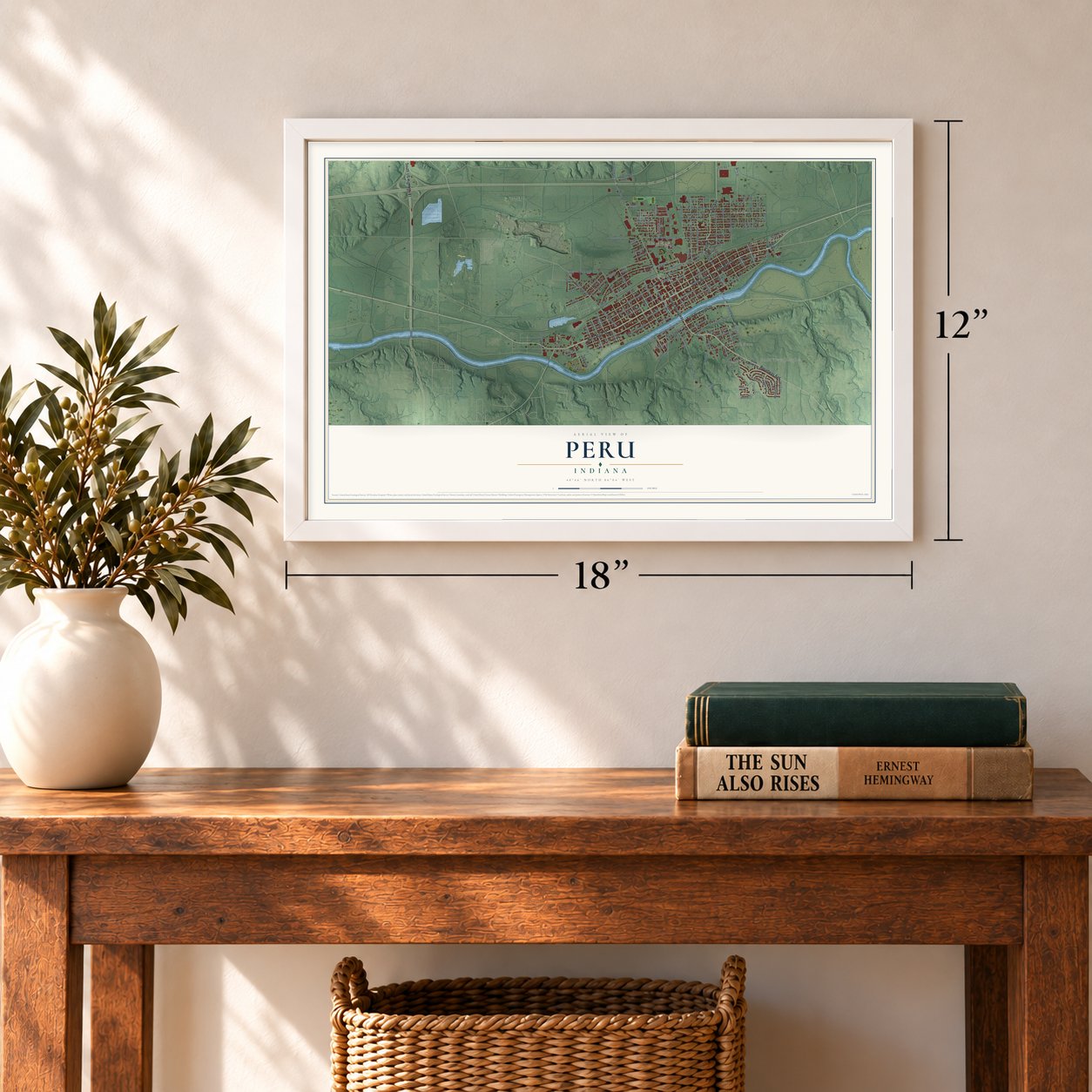
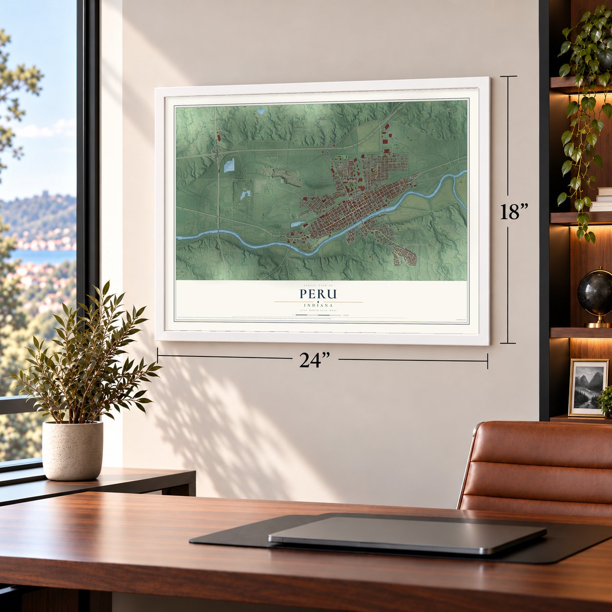
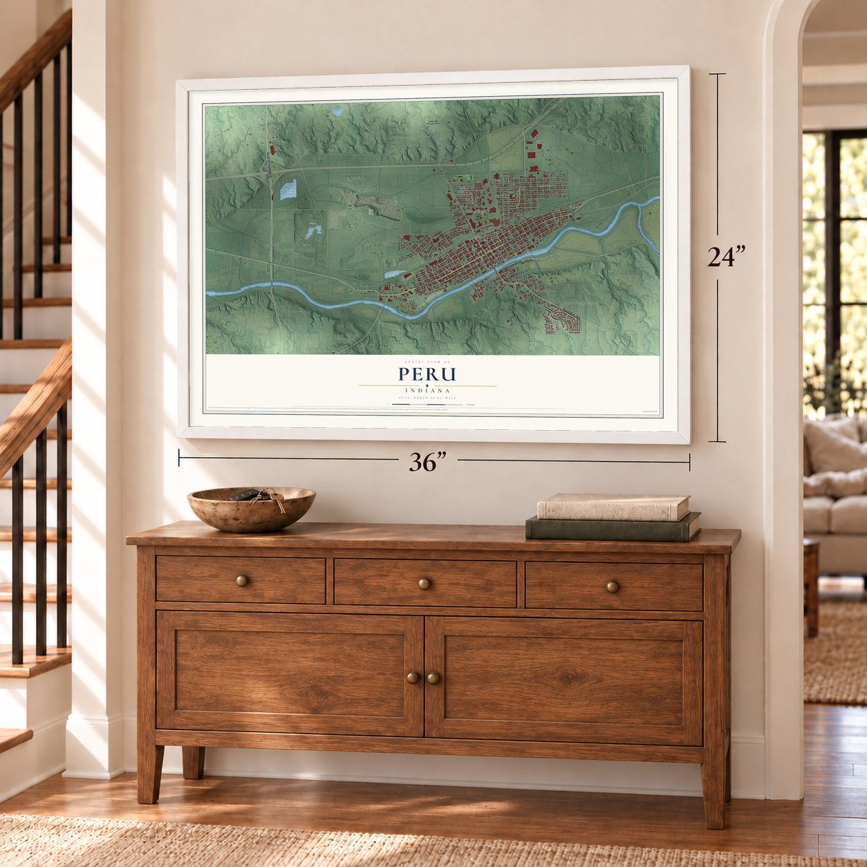
Peru, Indiana Map Art
Building by building, with labeled streets and shaded relief.
12" x 18" Archival Matte Print
A Map of Home. A Work of Art.
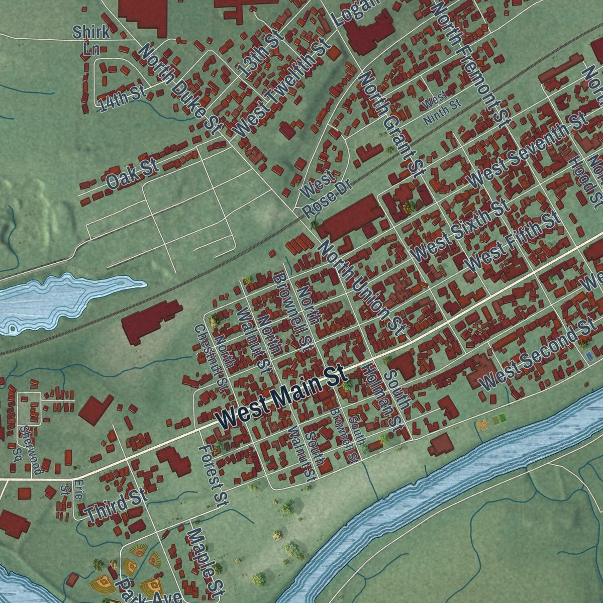
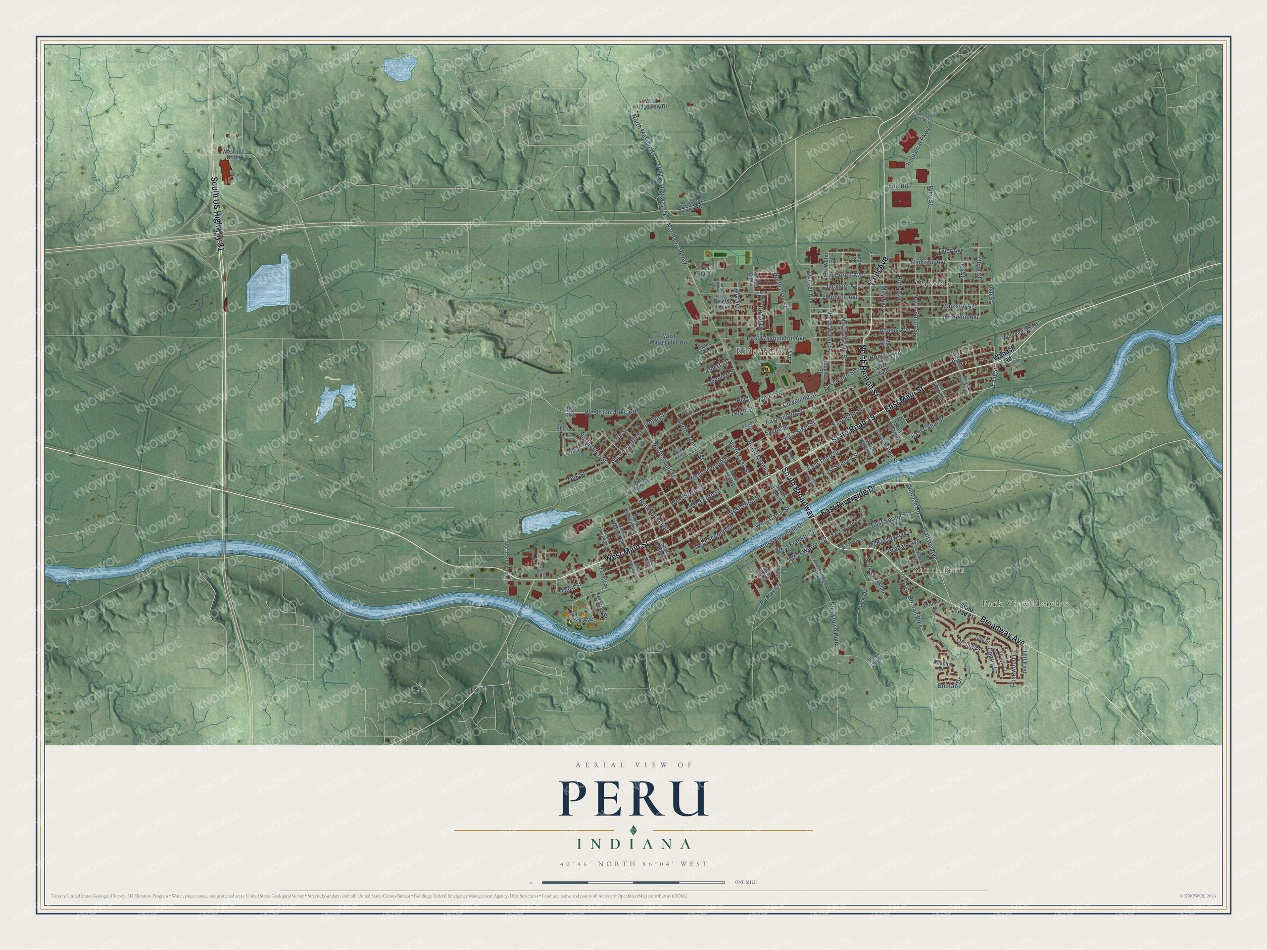
Explore Peru, Indiana from a whole new perspective. Created using aerial imagery and detailed geographic data, this map captures Peru building by building, with labeled streets, familiar landmarks, and shaded topographical relief that highlights the natural contours of the landscape.
Combining modern data with the timeless character of a vintage atlas, this map is just as interesting up close as it is beautiful on the wall. Whether you grew up in Peru, spent memorable years there, or call it home today, this unique map is a great way to celebrate a place that means something to you. Zoom in on the preview to look for your street, and then order a print to put your memories on the wall.
Three ways to hang it
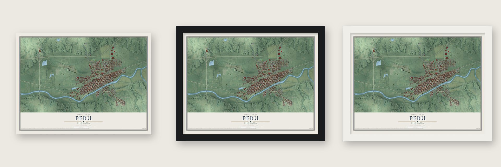
Unframed archival matte, a black wood frame or a white wood frame.
Up close
Geography Worth Displaying
This map was created using accurate cartographic data and authoritative geographic sources, including the U.S. Geological Survey and the Census Bureau. The map brings together terrain, waterways, roads, and building detail. The majority of the streets are labeled, houses are accurately depicted, and the topography is derived from government sources. Combining local data with carefully composed color and shading leads to this beautifully detailed Peru artwork for your wall.
Rather than simply showing street outlines, we’ve included as many of the street names as we could reasonably fit on the map while keeping their names legible. Zoom in on the high resolution preview to see exactly what’s on the map. We truly set out to create a statement piece for anyone who loves Peru. So whether it’s for you, or a gift for someone you love, we hope this map of Peru brings back fond memories.

Find your street
Names on the Peru map
Every name below is printed on this map. Look for your street, your school, the park where you played, or the pond down the road.
Places and landmarks4
- Park View Heights
- South Peru
- Ridgeview
- Oakdale
Streets and roads151
- South Broadway
- West Main Street
- East Main Street
- Broadway Avenue
- North Benton Street
- East Riverside Drive
- State Road 19
- South US Highway 31
- Chili Avenue
- Wallace Avenue
- North Wayne Street
- East Eighth Street
- North Broadway
- 150 East
- East Street
- East Canal Street
- West Canal Street
- East Second Street
- North Miami Street
- Maple Street
- West Second Street
- West Riverside Drive
- Ash Street
- East Sixth Street
- West Blair Pike Road
- North Water Street
- North Smith Street
- Bobtail Pike
- McKinstry Avenue
- Madison Avenue
Show all 151 streets
- Jefferson Avenue
- East Fifth Street
- Park Drive
- East Third Street
- Monroe Avenue
- West Third Street
- East Washington Avenue
- West Sixth Street
- Harrison Avenue
- West Seventh Street
- West Fifth Street
- Jackson Avenue
- Pine Street
- Van Buren Avenue
- Boulevard
- Strawtown Pike
- Adams Avenue
- Wallace Road
- North Mexico Road
- Old US Highway 31
- Tyler Avenue
- North Grant Street
- Rosewood Drive
- Tenth Street
- North Fremont Street
- Logan Street
- North Clay Street
- North Duke Street
- East Ninth Street
- East Spring Street
- Ruth Avenue
- Denver Avenue
- Lee Street
- West Twelfth Street
- May Avenue
- Cherry Lane
- Orchid Place
- Industrial Parkway
- West Warren Street
- West Franklin Street
- Olive Street
- North Union Street
- Hay Avenue
- 13th Street
- Daniel Street
- North Cass Street
- Oak Street
- Ewing Street
- Park Avenue
- Graham Avenue
- Cleveland Street
- Donat Drive
- Life Road
- Bobtail Drive
- York Street
- Hoover Avenue
- George Street
- Third Street
- Albert Street
- Pearcy Lane
- Lacy
- Wabash Road
- South Wayne Street
- West Lovers Lane Road
- North Kelly Avenue
- Coles Lane
- 100 East
- Garfield Street
- Blair Pike
- Armstrong Avenue
- Lindy Street
- North Hood Street
- Shields Avenue
- West Washington Avenue
- East Warren Street
- 14th Street
- N&W Yard
- Wooburn Green
- North Brownell Street
- North Walnut Street
- Forest Street
- West Ridgeview Drive
- South Benton Street
- South Miami Street
- South Water Street
- Apache Drive
- West 100 North
- Miller
- Abraham Lane
- West Rose Drive
- South Holman Street
- South Smith Street
- Nellies Alley
- Alley Sp03
- May Street
- Van Buren
- Water Street
- Shirk Lane
- Denver Street
- Jean Avenue
- Peru Golf 1
- Hill Street
- State Road 21
- Bayless Street
- Jean Drive
- North Chestnut Street
- Wilson Avenue
- Veachs Court
- Broadway Drive
- South Walnut Street
- Tulip Drive
- South Garfield Street
- Court Street
- East Lovers Lane Road
- South Wabash Street
- Sherwood Square
- West Ninth Street
- South Brownell Street
- Davenport Avenue
- Sewage Place
- Erie Street
Names are listed as they appear on the printed map. Zoom into the product photos to find them.
About Peru, Indiana
Peru is a city of 11,073 people and the county seat of Miami County, on the Wabash River. On August 18, 1827, Joseph Holman bought land close to where the Mississinewa flows into the Wabash from Jean Baptiste Richardville, chief of the Miami people. President John Quincy Adams approved the sale on March 3, 1828, and on March 12, 1829, Holman had the ground surveyed and laid out a town he called Miamisport.
That same year William N. Hood bought 210 acres from Holman, and in 1834 he founded Peru on them. By 1835 the court sat in Peru instead of Miamisport. As Peru grew into the leading town of the area, the older name slowly dropped out of use.
- Circus CitySeveral well-known shows wintered in Peru, among them the Hagenbeck-Wallace Circus and Buffalo Bill's Wild West Show. The town holds the International Circus Hall of Fame and the last company in the world still making steam calliopes. Every July, during its third week, performers aged 7 to 21 stage a full week of shows in the Peru Amateur Circus, which ends with the Circus City Festival and Parade.
- The flood of 1913Before 1913, Peru was a busy place of 15,000 people with 100 factories, a trolley line, railroads, Duke's new hospital and a circus that kept 1,000 people on the road. Then, from March 24 to March 27, 6 inches of rain fell. The Wabash and Mississinewa poured through town at 20 miles per hour and wrecked whatever stood in the way. Many people died, along with many circus animals, and the damage was put at $3,000,000.
- Dillinger raids the armoryOn October 21, 1933, John Dillinger's gang broke into the armory of the Peru police department. They carried off a Thompson submachine gun, two Winchester rifles and two shotguns, plus four .38 revolvers and half a dozen bulletproof vests.
- Ransom in a soybean fieldMartin J. McNally hijacked American Airlines Flight 119, flying from St. Louis to Tulsa, on June 23, 1972. He collected a $502,500 ransom and jumped with a parachute from the rear of the Boeing 727. Near Peru, farmer Lowell Elliott later found all of the money in his soybean field, inside a sealed canvas mail bag that weighed 45 pounds.
- Home of the Miami NationPeru is the site of the Miami Nation's tribal headquarters. After the city built new schools between 1970 and 1990, the old high school buildings and their grounds stood empty, and in 1990 the Miami Nation bought them. The Peru High School Historic District joined the National Register in 2013.
Keep exploring Indiana
Peru is one of 1,023 Indiana towns we've mapped. Every dot on the map is a print of its own.
The search covers every state, Indiana first.
Near Peru
Order 2 or more town maps and save 10%. Shown in the size and finish you picked above, so they hang as a set.
- Mexico 12" x 18" / Archival Matte Print $39.99
- Bunker Hill 12" x 18" / Archival Matte Print $39.99
- Denver 12" x 18" / Archival Matte Print $39.99
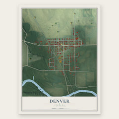
More maps nearby: Chili, Onward, Grissom AFB, Miami and Twelve Mile.
The art of mapping a place
How This Map Was Made
Real places. Remarkable detail. Discover the layers that turn geographic data into a map of home.

The view from above
Aerial imagery reveals the character of the land: woodland, open fields, and the patterns of a place.

The shape of the land
Elevation data brings hills, valleys, and subtle changes in the landscape into view.

The details of home
Roads, waterways, and building footprints come together to make the map feel unmistakably local.

Geography becomes art
Considered color, shading, and typography bring the layers together in a map made for your wall.


Process illustrated with Mendon, Massachusetts. Aerial imagery: USDA NAIP. Terrain: USGS 3D Elevation Program. Map details and finished artwork: KNOWOL.
The Details
About This Print
Choose an archival matte print, or a black or white Ayous wood frame. The archival matte print is unframed.
Select your size and finish above to see the matching product image and price.
Materials & Craftsmanship
A contemporary map with the character of a classic atlas, printed on archival matte paper. Optional frames are made from Ayous wood.
Your printed map does not include the watermark shown in the full-map preview.
Shipping & Delivery
Free shipping within the United States. Every print is made to order in the USA.
Buying a gift? Add a note in your cart and we'll include it. We never put prices in the package.
Prints ship within 2 to 3 business days. Allow 7 to 10 days total from ordering for delivery. Timing may vary during holidays or periods of high order volume.
Read our shipping policy.
Returns and damaged prints
Each print is made to order. Change-of-mind refunds are not available after production.
If your print arrives damaged, misprinted or incorrect, contact support@knowol.com within 30 days of receiving it. Include your order number, photos and a description of the issue.
Read our full refund and replacement policy. For questions about your order, email support@knowol.com.