
Search for another town





Free U.S. delivery 7 to 10 days after you order
Pickerington, Ohio Map Art
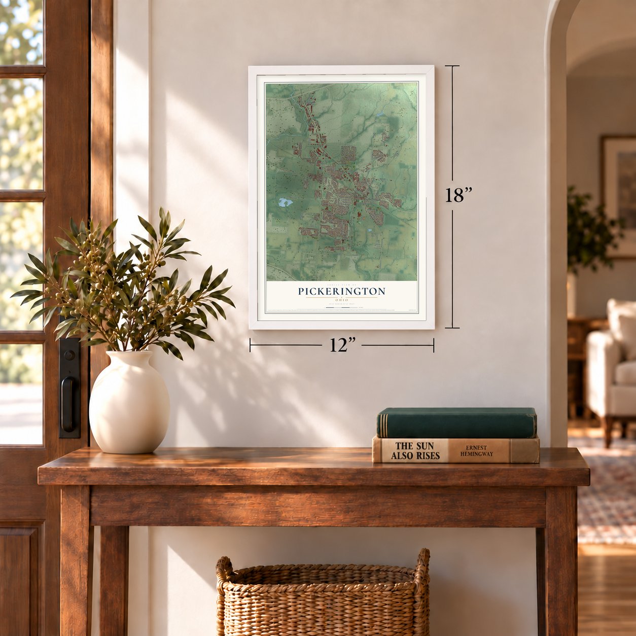
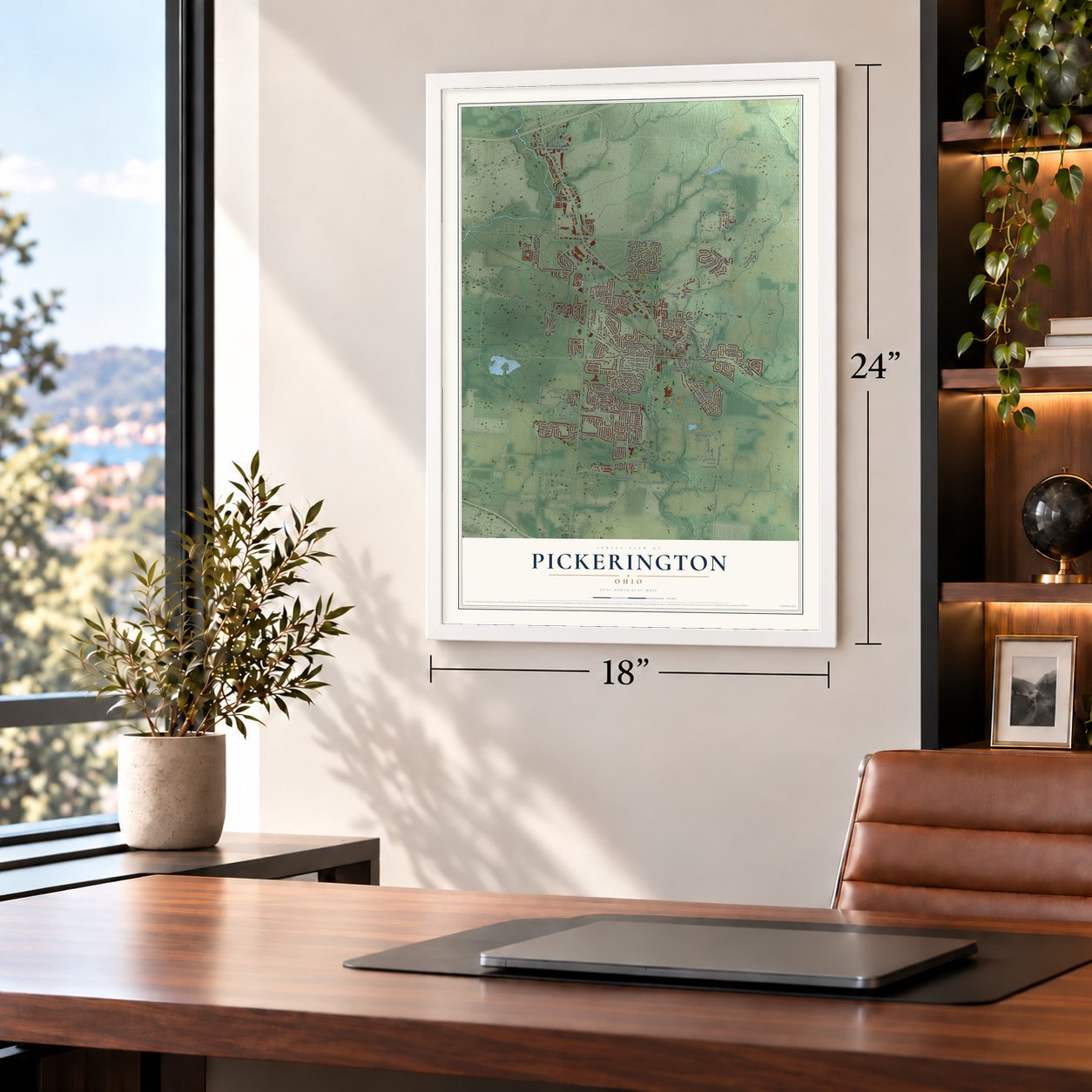
A new map of Pickerington, Ohio, made in 2026 and printed to order on thick archival matte paper.
12" x 18" Archival Matte Print
A Map of Home. A Work of Art.
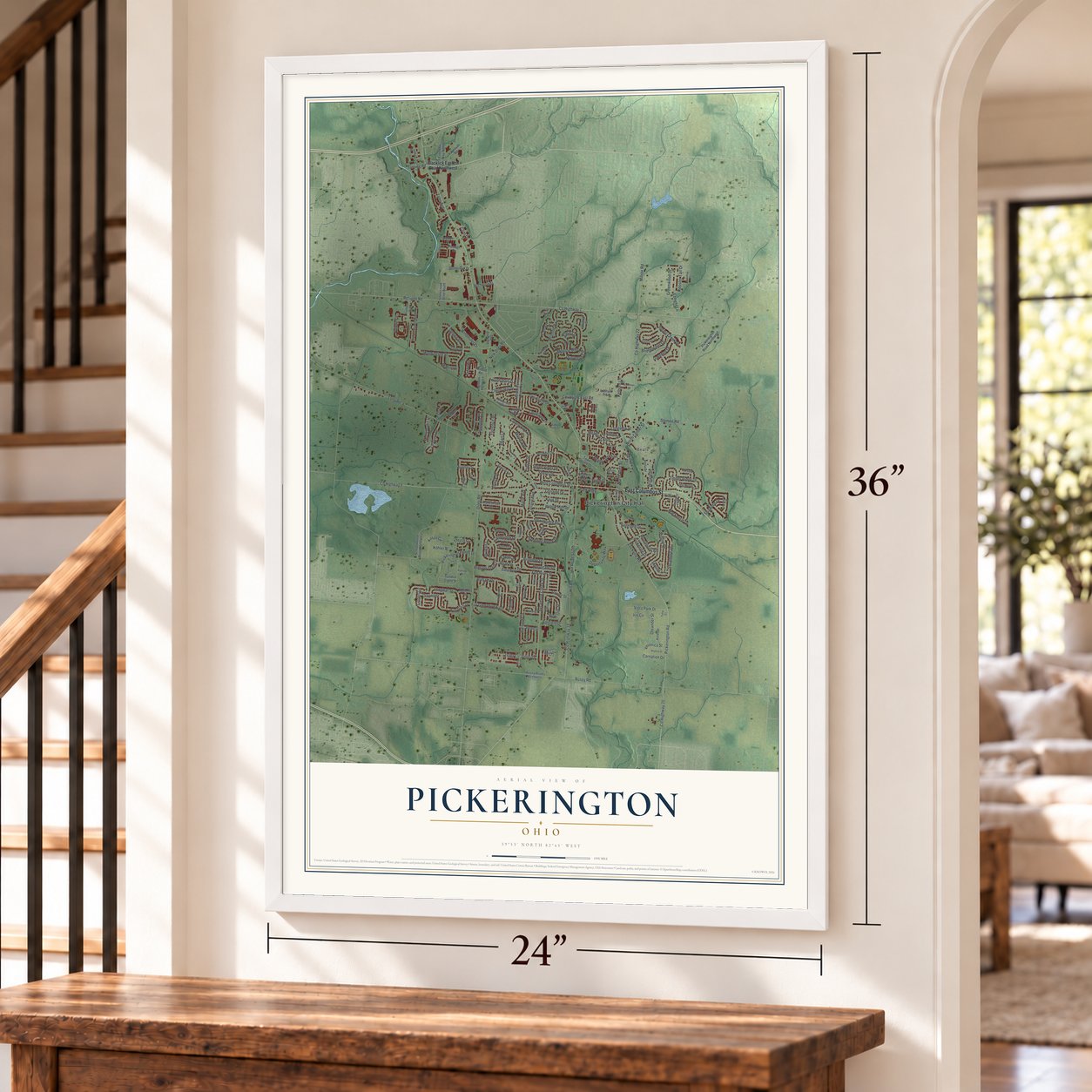
This beautifully detailed map of Pickerington, Ohio was created in 2026 using aerial imagery combined with modern topographical, census, street and landmark data. It's a modern aerial view of Pickerington in Fairfield County, Ohio, that combines modern data with a vintage aesthetic. Zoom in on the preview and look for your block.

Three ways to hang it
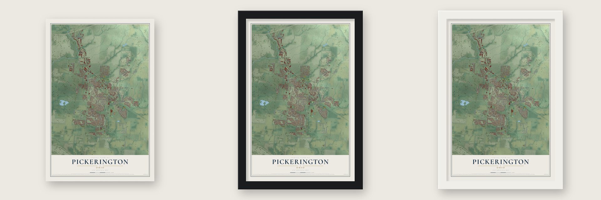
Unframed archival matte, a black wood frame or a white wood frame.
Up close
Real geography. Art worth displaying.
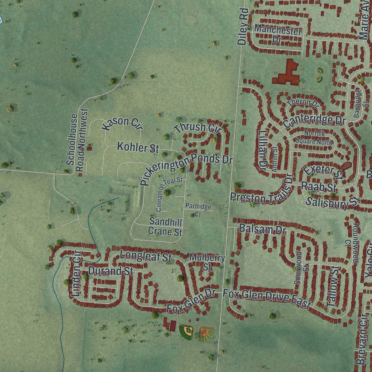
This map was created using accurate cartographic data and authoritative geographic sources, including the U.S. Geological Survey and the Census Bureau. The map brings together terrain, waterways, roads, and building detail. The majority of the streets are labeled, houses are accurately depicted, and the topography is derived from government sources. Combining local data with carefully composed color and shading leads to this beautifully detailed Pickerington artwork for your wall.
Rather than simply showing street outlines, we’ve included as many of the street names as we could reasonably fit on the map while keeping their names legible. Zoom in on the high resolution preview to see exactly what’s on the map. We truly set out to create a statement piece for anyone who loves Pickerington. So whether it’s for you, or a gift for someone you love, we hope this map of Pickerington brings back fond memories.
Read the story behind this map of Pickerington, Ohio from 2026.

About Pickerington, Ohio
Pickerington is a central Ohio city spanning Fairfield and Franklin counties, just east of Columbus. Founded as Jacksonville in 1815, it received its present name in 1827 to honor founder Abraham Pickering. The 2020 census counted 23,094 residents.
- Violet CapitalThe Ohio Legislature designated Pickerington the "Violet Capital of Ohio" in 1996.
- Railroad ArrivalThe first Toledo and Ohio Central Railroad train reached Pickerington in 1879, beginning a period when the town's population rose from 150 to 290.
- Historic LandmarksNational Register records identify six local buildings, including the Pickerington Depot, Pickerington Carnegie Library, and four houses or farms.
- Motorcycle HeritagePickerington is home to the Motorcycle Hall of Fame, located near Interstate 70.
Find your street
Names on the Pickerington map
Every name below is printed on this map. Look for your street, your school, the park where you played, or the pond down the road.
Places and landmarks2
- Pickerington City Hall
- Beals
Streets and roads198
- East Columbus Street
- Refugee Road
- West Columbus Street
- County Highway 7
- North Center Street
- Gray Drive
- Raab Street
- County Highway 9
- Herrogate Square
- Diley Road
- Long Road
- Pickerington Road
- County Highway 20
- County Highway 22
- Milnor Road
- Sycamore Creek Street
- Hill Road South
- Fox Glen Drive East
- County Highway 18
- Hill Road
- Lockville Road
- Kohler Street
- McLeod Parc
- Opportunity Way
- Melrose Boulevard
- Viola Park Drive
- Stonebridge Boulevard
- Windmiller Drive
- Busey Road
- Preston Trails Drive
Show all 198 streets
- Pickering Drive
- Brevard Circle
- Evergreen Circle
- Rambling Brook Drive
- Sycamore Drive
- Meadows Boulevard
- Flat River Street
- Fullers Circle
- Zeller Circle
- Willow Run Drive
- Yale Circle
- Courtland Lane
- Timber Ridge Drive
- Pruden Drive
- Colony Park Drive
- Delong Street
- Pickerington Ponds Drive
- Balsam Drive
- Tyler Avenue
- Stemen Road
- Ebright Lane
- Longleaf Street
- Brighton Street
- Mackenzie Drive
- Fox Glen Drive
- Fairfield Drive
- Washington Street
- Linden Circle
- Seven Pines Drive
- Lilac Circle
- Spring Creek Drive
- Park Alley
- Courtright Drive
- Leasure Drive
- Courtright East Road
- Hilltop Drive
- Bridgewater Drive
- North Starr Drive
- Sheryl Drive
- Peggy Green Lane
- Carver Street
- North East Street
- Longview Street
- Thrush Circle
- Florence Drive
- Oleander Street
- Dunvegan Circle
- Cherry Hill Drive
- Wooster Street
- Kelburn Lane
- Rooster Tail Drive
- Salisbury Street
- Willard Drive
- Kason Circle
- Lorraine Drive
- Lillian Drive
- Daventry Drive
- Hereford Drive
- Pearl Lane
- Marie Avenue
- Greenwood Drive
- West Church Street
- Kaye Drive
- Shawnee Drive
- Durand Street
- Veronica Street
- Canteridge Drive
- Alyssa Drive
- Monebrake Drive
- Iris Circle
- New Diley Road
- Avalon Drive
- Maple Avenue
- Carnation Drive
- Exeter Street
- Urich Drive
- Tussing Road
- Skyline Lane
- Penn Street
- Poplar Street
- Elgin Circle
- Clint Drive
- Tallow Street
- Zeller Drive
- Janice Lane
- Blacklick Eastern Road Northwest
- Pioneer Circle
- Town Square Drive
- Pickerington Road Northwest
- Lorraine Boulevard
- Busey Road Northwest
- Pickerington Ridge Drive
- Manchester Drive
- Lands End Circle
- Stonecreek Drive
- Stonecreek Drive South
- Milford Drive
- Old Diley Road
- Montmorency Drive East
- Yarmouth Road
- Carron Circle
- Morningview Avenue
- Freedom Way North
- Albion Street
- McMunn Street
- Roxbury Drive
- William Henry Lane
- Schoolhouse Road Northwest
- Birchwood Street
- Ludham Trail
- Winderly Lane
- Lakeview Drive
- Fullers Way
- Sandhill Crane Street
- Anita Drive
- Aster Street
- Hillview Street
- Mulberry Street
- Postage Drive
- Redbud Road
- Autumn Ridge Circle
- Olde Mound Lane
- Brandy Hill Drive
- Theron Drive
- Langtree Drive
- Sourwood Street
- Roundwood Court
- Lake Point Court
- Lanning Street
- Oakview Court
- Shannon Drive
- Brookside Drive
- Bristo Street
- West Borland Street
- South East Street
- Hobart Street
- Overlook Court
- Stone Mill Road
- Jericho Road
- Violet Drive
- Tulip Court
- Banbridge Street
- Blue Jacket Circle
- Georges Creek Drive
- Postage Circle
- Montmorency Drive South
- Commerce Drive
- Selkirk Way
- Chanticleer Terrace
- Cinnamon Teal Street
- Parkview Drive
- Columbia Drive
- Norfolk Square North
- Elliott Lee Way
- Vanderbuilt Street
- Wisteria Street
- Antrim Street
- Bretforton Street
- Grisby Lane
- Fresno Street
- Reynolds Avenue
- Inverness Glen
- Splashtail Court
- Partridge Court
- Gnarled Oak Street
- Ione Court
- Melody Lane
- Kaye
Names are listed as they appear on the printed map. Zoom into the product photos to find them.
The art of mapping a place
How This Map Was Made
Real places. Remarkable detail. Discover the layers that turn geographic data into a map of home.

The view from above
Aerial imagery reveals the character of the land: woodland, open fields, and the patterns of a place.

The shape of the land
Elevation data brings hills, valleys, and subtle changes in the landscape into view.

The details of home
Roads, waterways, and building footprints come together to make the map feel unmistakably local.

Geography becomes art
Considered color, shading, and typography bring the layers together in a map made for your wall.


Process illustrated with Mendon, Massachusetts. Aerial imagery: USDA NAIP. Terrain: USGS 3D Elevation Program. Map details and finished artwork: KNOWOL.
The Details
About This Print
Choose an archival matte print, or a black or white Ayous wood frame. The archival matte print is unframed.
Select your size and finish above to see the matching product image and price.
Materials & Craftsmanship
A contemporary map with the character of a classic atlas, printed on archival matte paper. Optional frames are made from Ayous wood.
Your printed map does not include the watermark shown in the full-map preview.
Shipping & Delivery
Free shipping within the United States. Every print is made to order in the USA.
Buying a gift? Add a note in your cart and we'll include it. We never put prices in the package.
Prints ship within 2 to 3 business days. Allow 7 to 10 days total from ordering for delivery. Timing may vary during holidays or periods of high order volume.
Read our shipping policy.
Returns and damaged prints
Each print is made to order. Change-of-mind refunds are not available after production.
If your print arrives damaged, misprinted or incorrect, contact support@knowol.com within 30 days of receiving it. Include your order number, photos and a description of the issue.
Read our full refund and replacement policy. For questions about your order, email support@knowol.com.
Find your town
Looking for another city?
Find a map of home in our Ohio collection.
Nearby
Maps of towns near Pickerington
Know someone from one of these towns? Their map makes a great gift.


