
Search for another town





Free U.S. delivery 7 to 10 days after you order
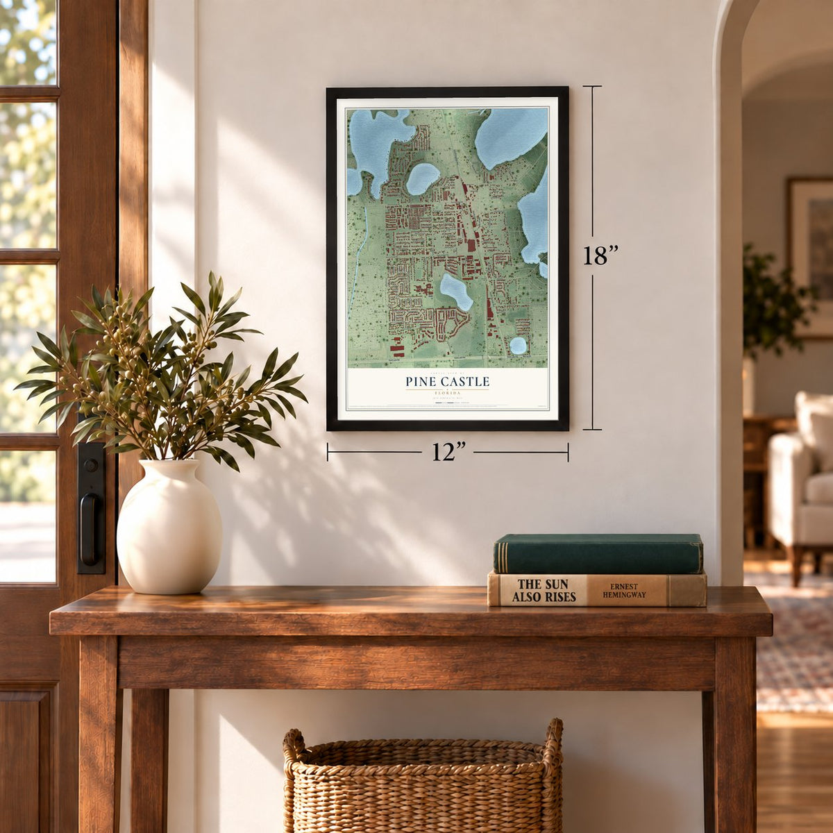
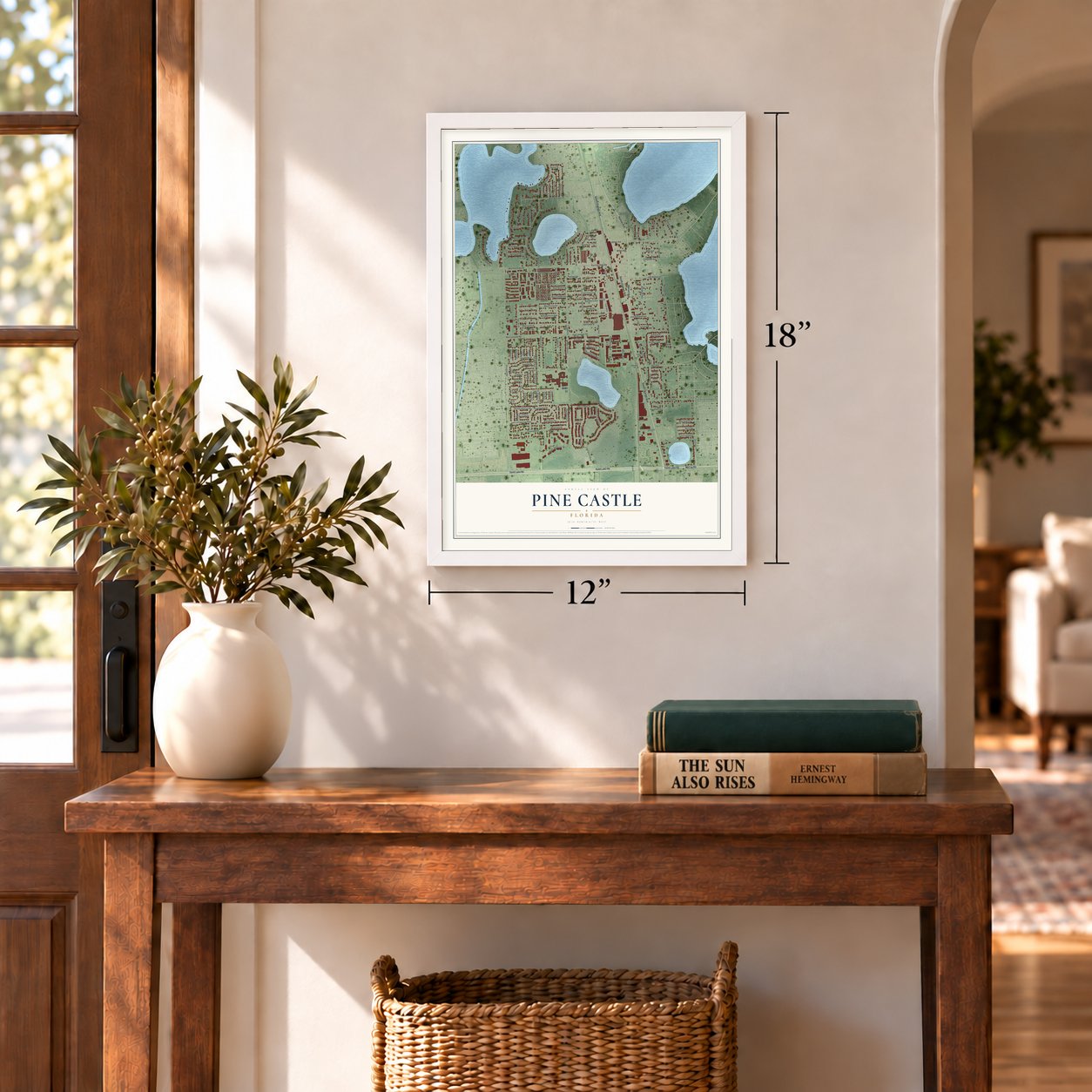
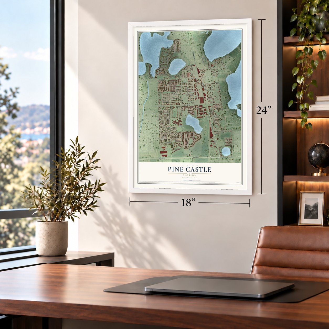
Pine Castle, Florida Map Art
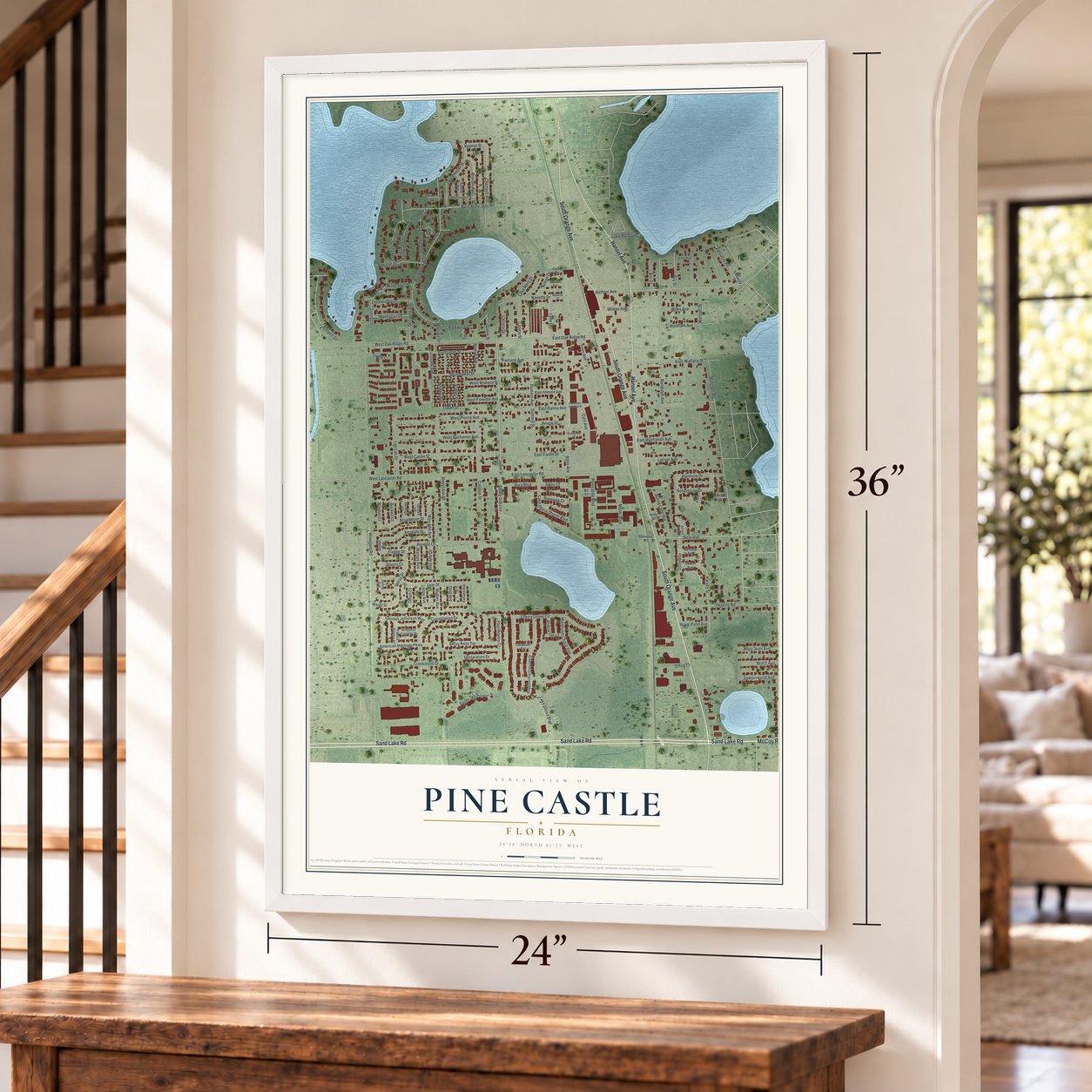
Building by building, with labeled streets and shaded relief.
12" x 18" Archival Matte Print
A Map of Home. A Work of Art.
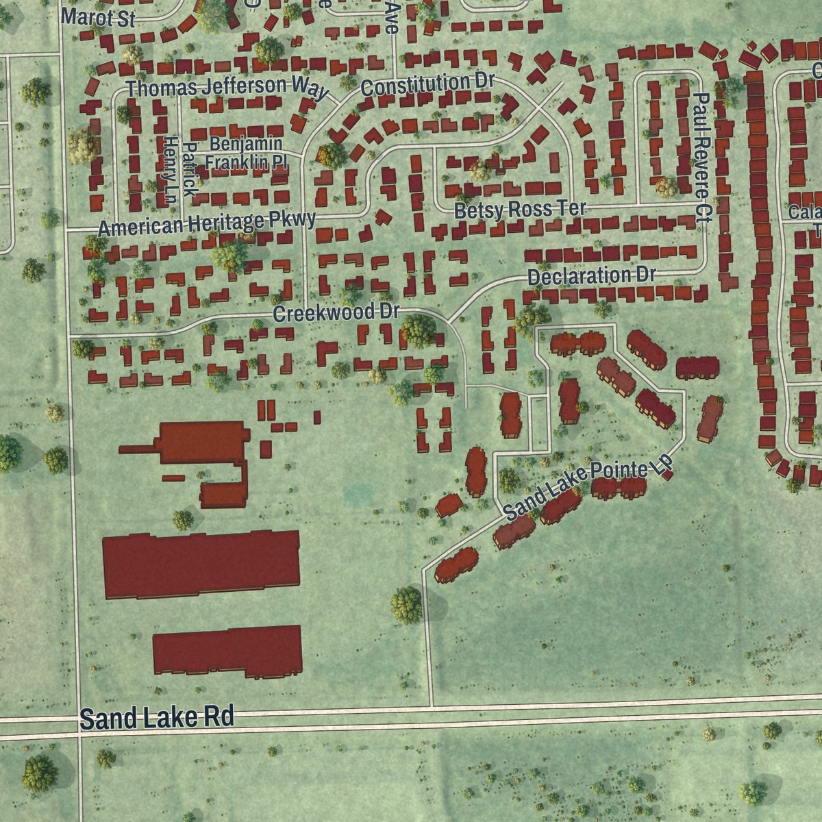
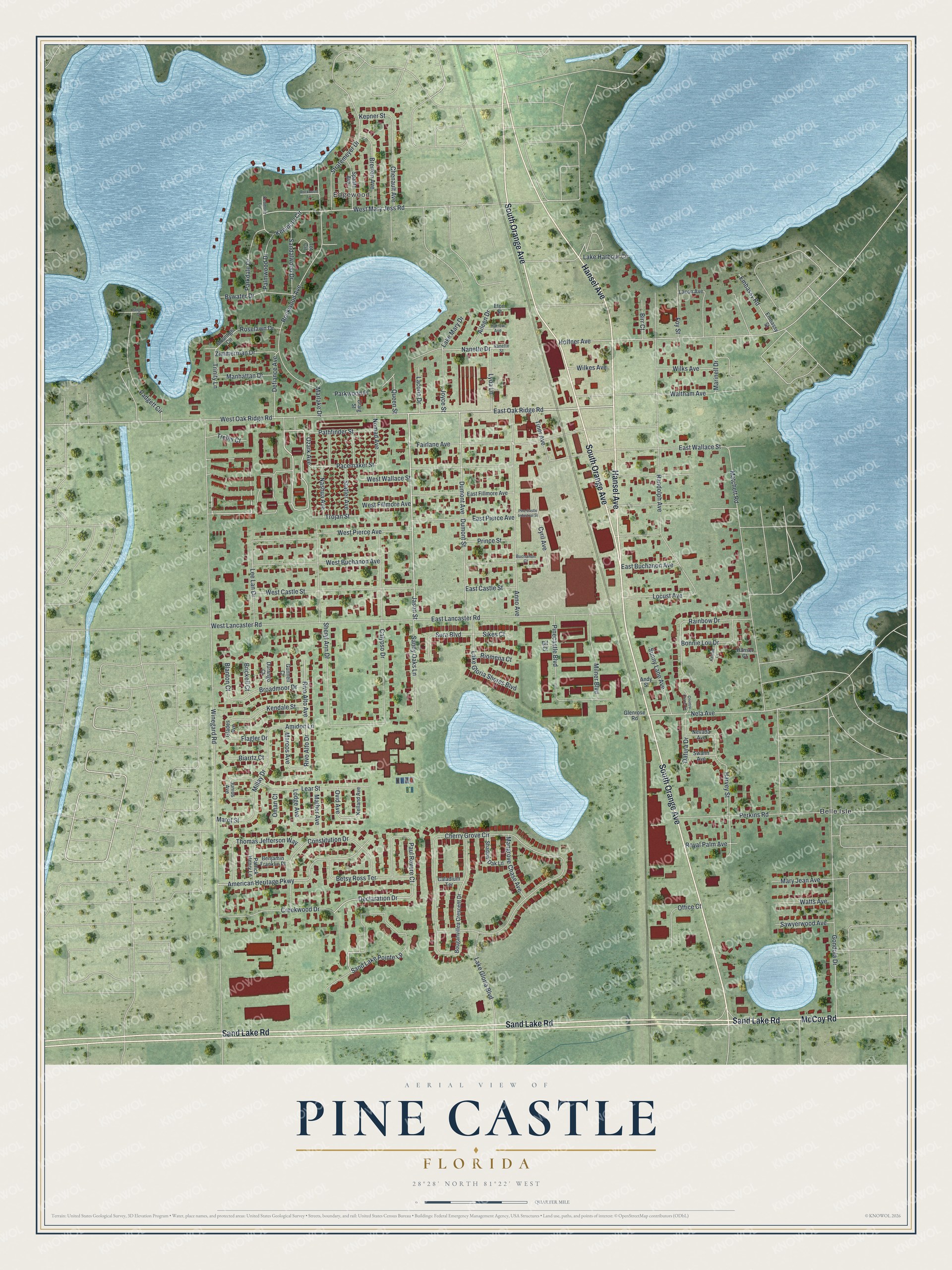
Explore Pine Castle, Florida from a whole new perspective. Created using aerial imagery and detailed geographic data, this map captures Pine Castle building by building, with labeled streets, familiar landmarks, and shaded topographical relief that highlights the natural contours of the landscape.
Combining modern data with the timeless character of a vintage atlas, this map is just as interesting up close as it is beautiful on the wall. Whether you grew up in Pine Castle, spent memorable years there, or call it home today, this unique map is a great way to celebrate a place that means something to you. Zoom in on the preview to look for your street, and then order a print to put your memories on the wall.
Three ways to hang it
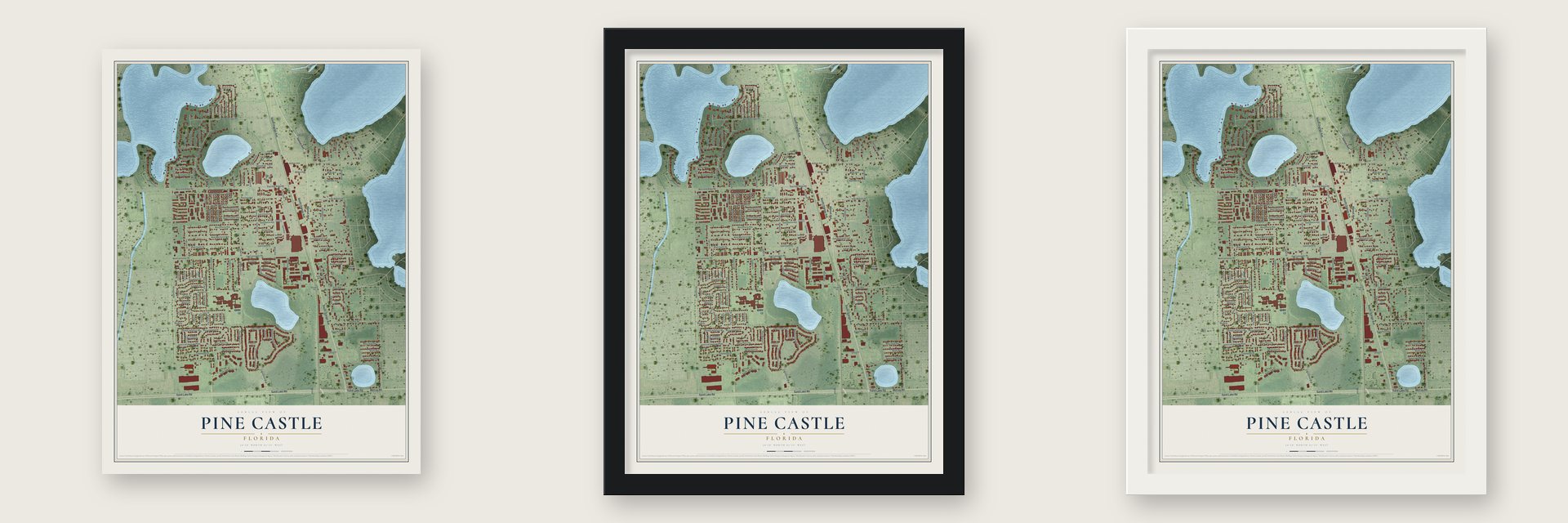
Unframed archival matte, a black wood frame or a white wood frame.
Up close
Geography Worth Displaying
This map was created using accurate cartographic data and authoritative geographic sources, including the U.S. Geological Survey and the Census Bureau. The map brings together terrain, waterways, roads, and building detail. The majority of the streets are labeled, houses are accurately depicted, and the topography is derived from government sources. Combining local data with carefully composed color and shading leads to this beautifully detailed Pine Castle artwork for your wall.
Rather than simply showing street outlines, we’ve included as many of the street names as we could reasonably fit on the map while keeping their names legible. Zoom in on the high resolution preview to see exactly what’s on the map. We truly set out to create a statement piece for anyone who loves Pine Castle. So whether it’s for you, or a gift for someone you love, we hope this map of Pine Castle brings back fond memories.
Read the story behind this map of Pine Castle, Florida from 2026.

Find your street
Names on the Pine Castle map
Every name below is printed on this map. Look for your street, your school, the park where you played, or the pond down the road.
Places and landmarks2
- Edgewood
- Belle Isle
Streets and roads156
- South Orange Avenue
- Sand Lake Road
- Hansel Avenue
- McCoy Road
- Jason Street
- East Oak Ridge Road
- Lake Mary Drive
- Declaration Drive
- Sand Lake Pointe Lp
- Marot Street
- Ozark Avenue
- West Mary Jess Road
- Nela Avenue
- Pacemaker Street
- American Heritage Parkway
- Amidon Lane
- Winegard Road
- Cherry Grove Circle
- Matchett Road
- East Wallace Street
- Randolph Avenue
- Rockwood Avenue
- West Oak Ridge Road
- Hoffner Avenue
- Sheryl Ann Drive
- Anno Avenue
- East Lancaster Road
- Dumont Avenue
- Dumont Street
- Gondola Drive
Show all 156 streets
- West Lancaster Road
- Calypso Drive
- East Pierce Avenue
- Fairlane Avenue
- Constitution Drive
- West Pierce Avenue
- West Castle Street
- Perkins Road
- Lear Street
- Pinecastle Boulevard
- West Buchanon Avenue
- Harvey Street
- Padgett Circle
- Paul Revere Court
- Creekwood Drive
- Stratemeyer Drive
- Thomas Jefferson Way
- East Buchanon Avenue
- Rivo Alto Avenue
- Rivo Alto Drive
- Marinell Drive
- Betsy Ross Terrace
- Prince Street
- Lake Gloria Shores Boulevard
- Millay Drive
- Wilks Avenue
- Lake Gloria Boulevard
- Sandy Oaks Lane
- Broadmoor Drive
- Chenault Avenue
- Milner Boulevard
- Nashua Avenue
- Statler Avenue
- Lee Lan Drive
- Waltham Avenue
- Brerton Avenue
- Locust Avenue
- Kendale Street
- Bywater Drive
- Cyril Avenue
- Bonnie Lou Drive
- Parkdale Drive
- Rainbow Drive
- Sandalwood Drive
- Sunny Lane Avenue
- Embassy Road
- Mangrove Chase Avenue
- Defiance Avenue
- Nanette Drive
- Sura Boulevard
- Pathfinder Street
- Office Court
- Lyda Lane
- Joyce Street
- Zimmerman Drive
- Kenmore Circle
- Mary Jean Avenue
- Palmwood Drive
- Watts Avenue
- Manhattan Drive
- Sawyerwood Avenue
- Parkwood Place
- Foy Street
- Tiner Avenue
- Royal Palm Avenue
- Marlake Drive
- Datura Drive
- East Castle Street
- Nomad Avenue
- Mather Avenue
- Lake Harbour Circle
- West Wallace Street
- West Fillmore Avenue
- Trojan Street
- Lacona Drive
- Aileen Drive
- Wilkes Avenue
- Trellis Court
- Roselawn Drive
- Marcos Avenue
- Trinity Lane
- Birr Court
- Biarrtz Court
- Riomena Court
- Queen Street
- Flagler Drive
- Sikes Court
- Blanton Court
- Brickell Court
- Kepner Street
- Lodge Avenue
- Oman Court
- Ovid Avenue
- Glades Avenue
- East Fillmore Avenue
- Bouganvillea Crescent Drive
- Embassy Street
- Spaatz Avenue
- Moonlight Circle
- Shadow Oak Lane
- Tot Circle
- Patrick Henry Lane
- Benjamin Franklin Place
- Swann Avenue
- Nevada Avenue
- Caladium Terrace
- Kelland Avenue
- Lacon Avenue
- Durango Court
- Gunnell Court
- Glenrose Road
- Craig Street
- Junius Avenue
- Andy Street
- Hansel Court
- Eton Street
- Bif Court
- Nanette Street
- Harrow Avenue
- Buchanon Court
- Kenmore Lane
- Country Corner Lane
- Pine Castle Industrial Street
- Kasbon Lane
- Rockwood Lane
- Padgett Court
Names are listed as they appear on the printed map. Zoom into the product photos to find them.
About Pine Castle, Florida
Pine Castle is an unincorporated community of 11,122 people in Orange County, about 5 miles south of Orlando on Lake Conway. Right after the Civil War, the poet Will Wallace Harney came from Ohio, claimed land beside the lake and built himself an eight-sided house of native pine, which he called Pinecastle. Settlers who came later had their mail delivered to Harney's place, so when a post office opened, it took the name of his home, and before long the whole neighborhood was known as Pine Castle.
Settlement began in 1870, and the town grew up in Orlando's shadow. From just before 1882 the South Florida Railroad ran its main line through, bringing regular passenger and freight trains. Pine Castle incorporated as a town in 1925 but later went back to being unincorporated, and in 1939 it had 421 people. Passenger trains eventually bypassed the local depot, until SunRail opened its Sand Lake Road station in 2014.
- A school since 1877Pine Castle Elementary School was founded in 1877, when the settlement on Lake Conway was still young.
- Boats built here from 1925The boat maker Correct Craft opened its first factory in Pine Castle in 1925, the same year the town incorporated. The company later built a larger plant in 2006.
- The X-1 rocket planeDuring the mid-1940s, Bell Aircraft Corporation used Pinecastle Army Airfield, 2 miles southeast of town, to test the X-1, a rocket plane built to fly faster than sound. The company picked the field because the area was remote and the runway ran 10,000 feet. That airfield has since become Orlando International Airport.
- Pioneer Days since 1974Residents launched Pioneer Days in 1974, a two-day festival held each year to honor the spirit of the people who settled Pine Castle.
Keep exploring Florida
Pine Castle is one of 1,047 Florida towns we've mapped. Every dot on the map is a print of its own.
The search covers every state, Florida first.
Near Pine Castle
Order 2 or more town maps and save 10%. Shown in the size and finish you picked above, so they hang as a set.
- Belle Isle 12" x 18" / Archival Matte Print $39.99
- Sky Lake 12" x 18" / Archival Matte Print $39.99
- Taft 12" x 18" / Archival Matte Print $39.99


More maps nearby: Edgewood, Oak Ridge, Holden Lakes, Orlando and Conway.
The art of mapping a place
How This Map Was Made
Real places. Remarkable detail. Discover the layers that turn geographic data into a map of home.

The view from above
Aerial imagery reveals the character of the land: woodland, open fields, and the patterns of a place.

The shape of the land
Elevation data brings hills, valleys, and subtle changes in the landscape into view.

The details of home
Roads, waterways, and building footprints come together to make the map feel unmistakably local.

Geography becomes art
Considered color, shading, and typography bring the layers together in a map made for your wall.


Process illustrated with Mendon, Massachusetts. Aerial imagery: USDA NAIP. Terrain: USGS 3D Elevation Program. Map details and finished artwork: KNOWOL.
The Details
About This Print
Choose an archival matte print, or a black or white Ayous wood frame. The archival matte print is unframed.
Select your size and finish above to see the matching product image and price.
Materials & Craftsmanship
A contemporary map with the character of a classic atlas, printed on archival matte paper. Optional frames are made from Ayous wood.
Your printed map does not include the watermark shown in the full-map preview.
Shipping & Delivery
Free shipping within the United States. Every print is made to order in the USA.
Buying a gift? Add a note in your cart and we'll include it. We never put prices in the package.
Prints ship within 2 to 3 business days. Allow 7 to 10 days total from ordering for delivery. Timing may vary during holidays or periods of high order volume.
Read our shipping policy.
Returns and damaged prints
Each print is made to order. Change-of-mind refunds are not available after production.
If your print arrives damaged, misprinted or incorrect, contact support@knowol.com within 30 days of receiving it. Include your order number, photos and a description of the issue.
Read our full refund and replacement policy. For questions about your order, email support@knowol.com.