
Search for another town



Free U.S. delivery 7 to 10 days after you order
Pittsfield, Massachusetts Map Art
Building by building, with labeled streets and shaded relief.
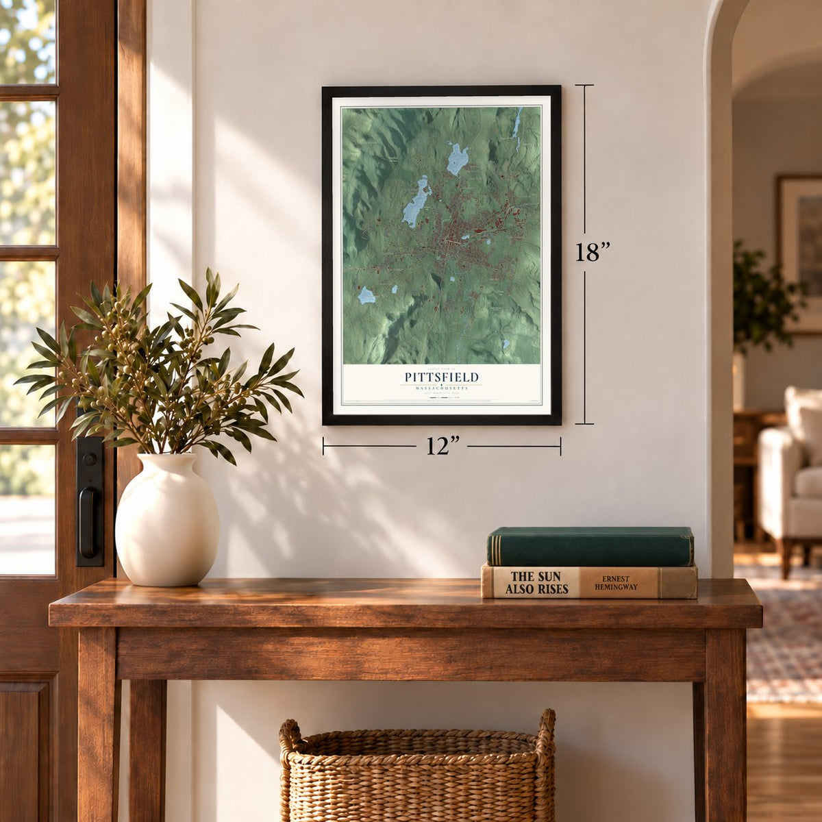
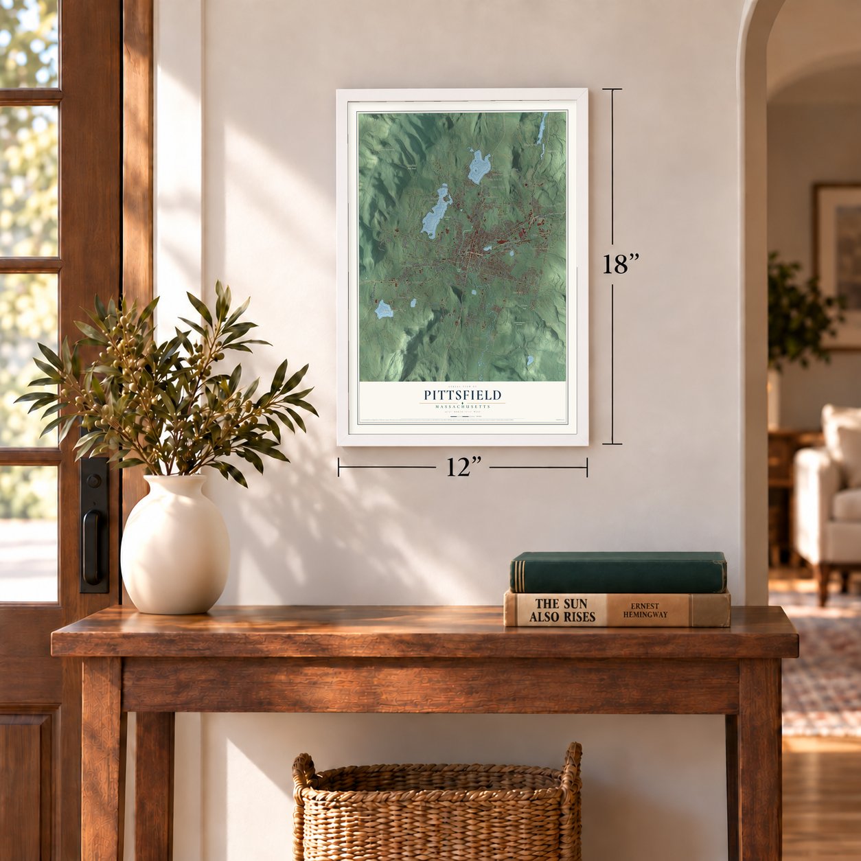
12" x 18" Archival Matte Print
A Map of Home. A Work of Art.
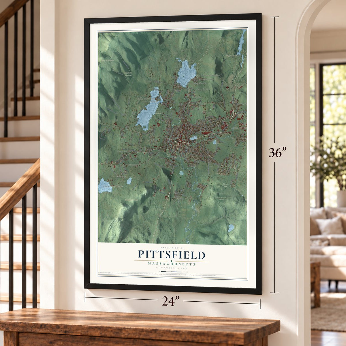
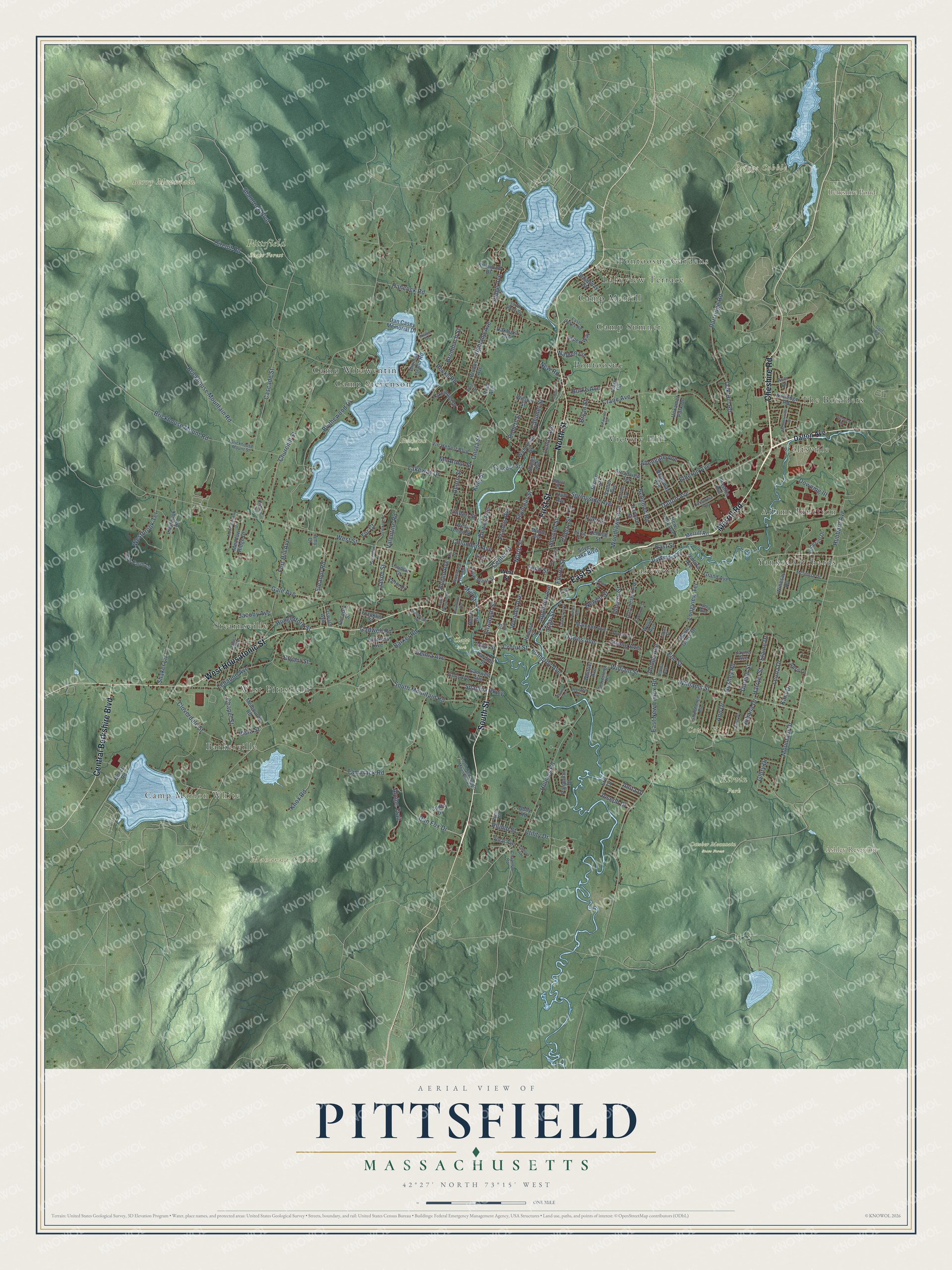
Explore Pittsfield, Massachusetts from a whole new perspective. Created using aerial imagery and detailed geographic data, this map captures Pittsfield building by building, with labeled streets, familiar landmarks, and shaded topographical relief that highlights the natural contours of the landscape.
Combining modern data with the timeless character of a vintage atlas, this map is just as interesting up close as it is beautiful on the wall. Whether you grew up in Pittsfield, spent memorable years there, or call it home today, this unique map is a great way to celebrate a place that means something to you. Zoom in on the preview to look for your street, and then order a print to put your memories on the wall.
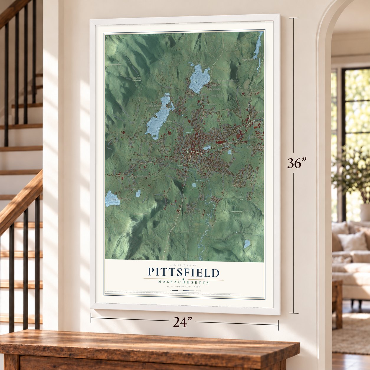
Three ways to hang it
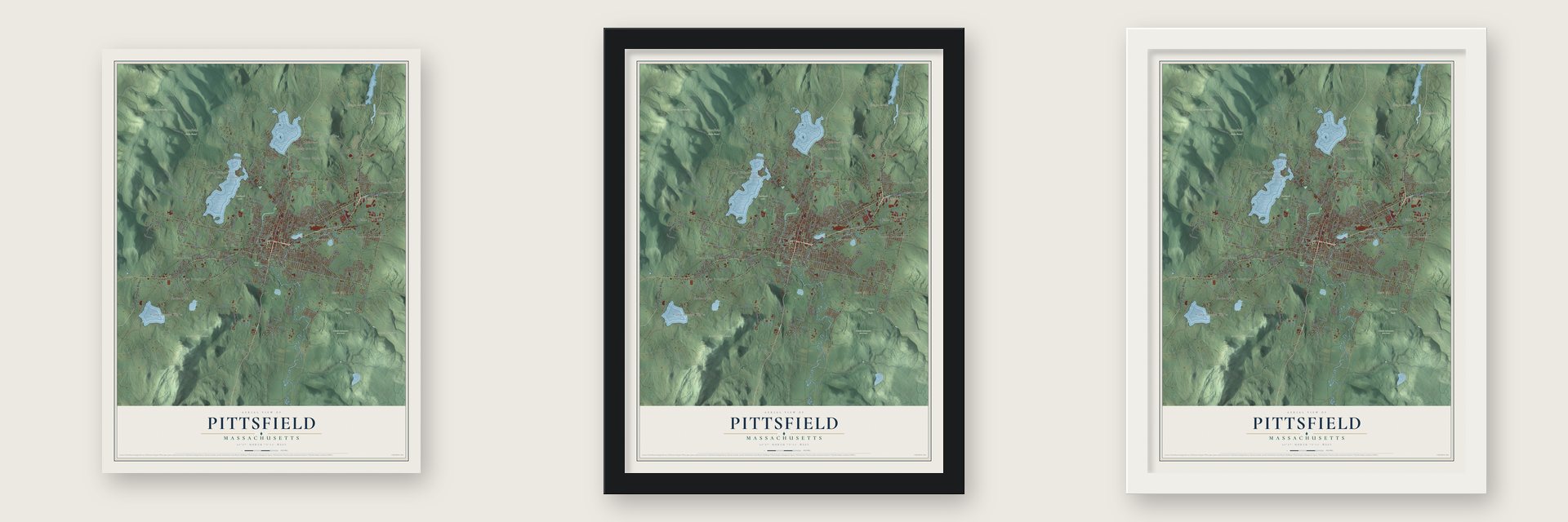
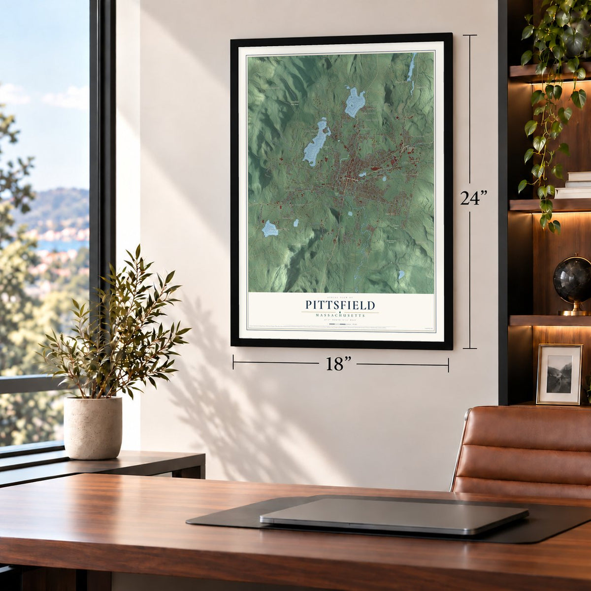
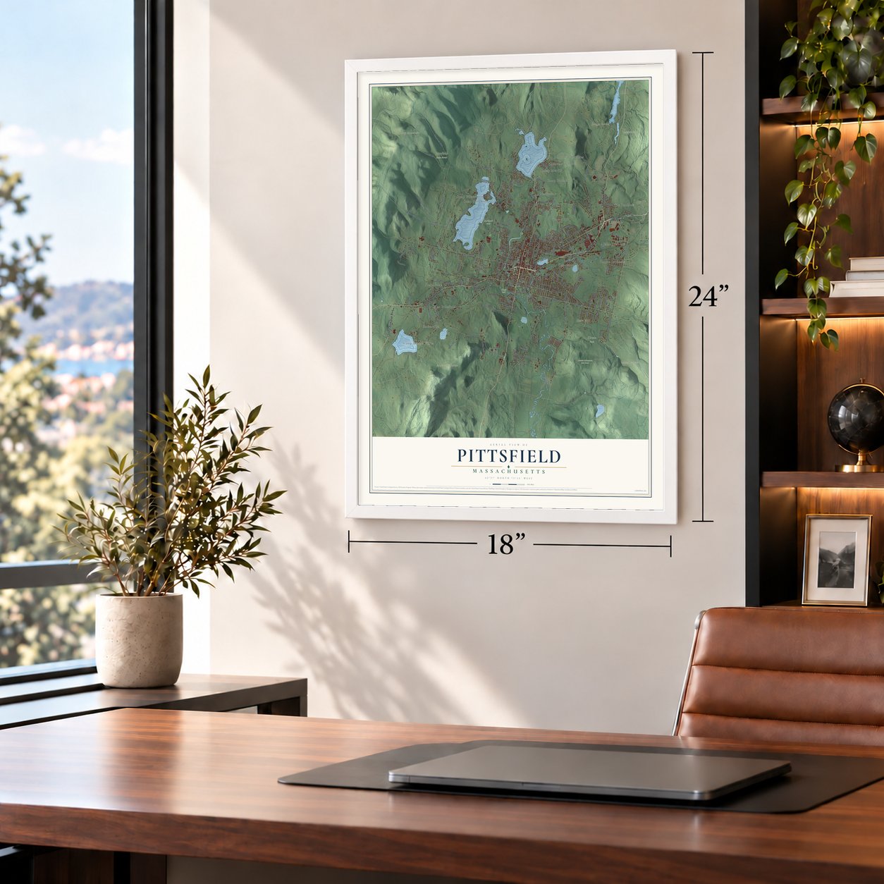
Unframed archival matte, a black wood frame or a white wood frame.
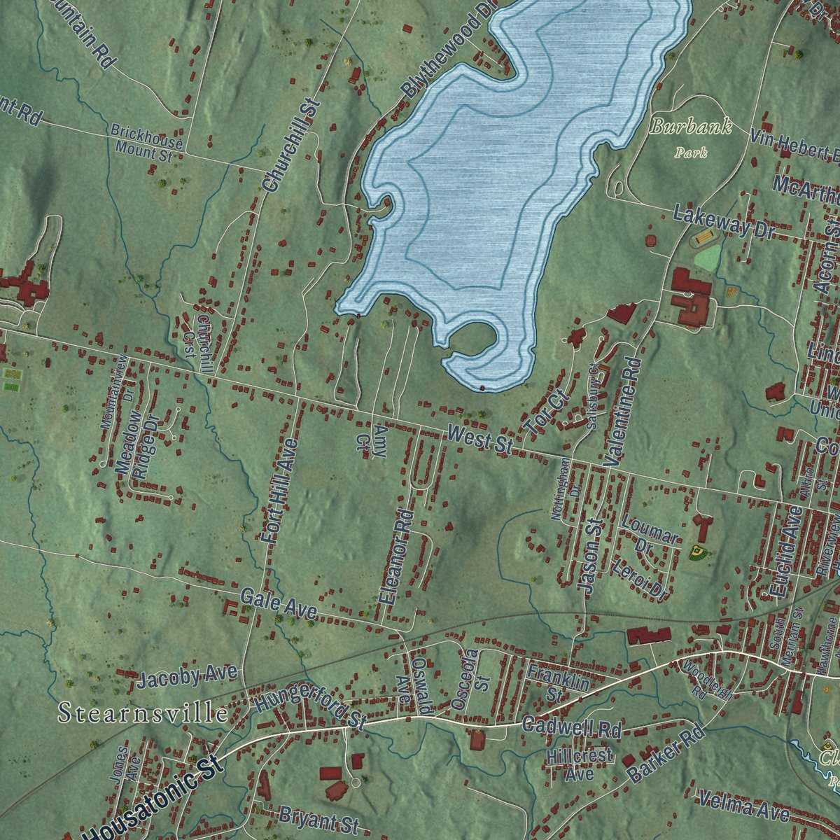
Up close
Geography Worth Displaying
This map was created using accurate cartographic data and authoritative geographic sources, including the U.S. Geological Survey (USGS) and FEMA. The map brings together terrain, waterways, roads, and building detail. The majority of the streets are labeled, houses are accurately depicted, and the topography is derived from government sources. Combining local data with carefully composed color and shading leads to this beautifully detailed Pittsfield artwork for your wall.
Rather than simply showing street outlines, we’ve included as many of the street names as we could reasonably fit on the map while keeping their names legible. Zoom in on the high resolution preview to see exactly what’s on the map. We truly set out to create a statement piece for anyone who loves Pittsfield. So whether it’s for you, or a gift for someone you love, we hope this map of Pittsfield brings back fond memories.
Explore the full map of Pittsfield, Massachusetts and read about the local places it shows.
Find your street
Names on the Pittsfield map
Every name below is printed on this map. Look for your street, your school, the park where you played, or the pond down the road.
Places and landmarks28
- Camp Marion White
- Berry Mountain
- Briggs Cobble
- Court Hill
- Mahanna Cobble
- Ashley Reservoir
- Berkshire Pond
- Burbank Park
- Clapp Park
- Kirvin Park
- October Mountain State Forest
- Pittsfield State Forest
Show all 28 places
- Coltsville
- Pontoosuc Gardens
- Stearnsville
- Pontoosuc
- Yankee Orchards
- West Pittsfield
- Lakewood
- Camp Merrill
- The Boulders
- Victory Hill
- Barkerville
- Camp Stevenson
- Adams Junction
- Lakeview Terrace
- Camp Witawentin
- Camp Sumner
Streets and roads225
- South Street
- Merrill Road
- East Street
- Cheshire Road
- North Street
- West Housatonic Street
- Central Berkshire Boulevard
- First Street
- William Street
- Center Street
- Dalton Avenue
- Dewey Avenue
- Bushey Road
- Elm Street
- Calumet Street
- West Street
- Churchill Street
- Barker Road
- Holmes Road
- Pecks Road
- Crane Avenue
- Tamarack Road
- Williams Street
- East New Lenox Road
- Gale Avenue
- Cascade Street
- Hancock Road
- Lakeway Drive
- Valentine Road
- Shamrock Boulevard
Show all 225 streets
- Onota Street
- South Mountain Road
- Pomeroy Avenue
- Brickhouse Mountain Road
- Blythewood Drive
- Hubbard Avenue
- Benedict Road
- Tyler Street
- Circuit Road
- Partridge Road
- Lebanon Avenue
- Dan Fox Drive
- Cloverdale Street
- Mountain Drive
- Fort Hill Avenue
- Springside Avenue
- Newell Street
- Lenox Avenue
- Hungerford Street
- Highland Avenue
- Alpine Trail
- Longview Terrace
- Brickhouse Mount Road
- Allengate Avenue
- Elberon Avenue
- Doreen Street
- Linden Street
- Westbrook Terrace
- Harryel Street
- Leona Drive
- Dawes Avenue
- Appleton Avenue
- Francis Avenue
- Second Street
- Columbus Avenue
- High Street
- Jason Street
- Eleanor Road
- Fenn Street
- Woodlawn Avenue
- Knox Road
- Fourth Street
- Cadwell Road
- Spadina Parkway
- Chapel Street
- Velma Avenue
- Wendell Avenue
- Ann Drive
- Oak Hill Road
- Burke Avenue
- King Street
- Shaker Lane
- Glory Drive
- Brombach Street
- Elizabeth Street
- Elaine Drive
- Ridge Avenue
- Bryant Street
- Seymour Street
- Strong Avenue
- Downing III
- Anita Drive
- Plumb Street
- McArthur Street
- Joseph Drive
- Juliana Drive
- Tor Court
- Bryan Street
- Jacoby Avenue
- Walden Lane
- Dodge Avenue
- Ontario Street
- Crofut Street
- Euclid Avenue
- Cherry Street
- Vista Street
- Robert Street
- Mill Street
- New Road
- Acorn Street
- Utility Drive
- Kara Drive
- New West Street
- Whittier Avenue
- Wahconah Street
- Brown Street
- Melbourne Road
- Meadow Ridge Drive
- Maple Grove Drive
- Dan Casey Memorial Drive
- Clark Road
- Winesap Road
- Campbell Street
- Cole Avenue
- Silver Lake Boulevard
- Ridgeway Avenue
- Vin Hebert Boulevard
- Kittredge Road
- Broadway Street
- Dorchester Avenue
- Howard Street
- Plastics Avenue
- Parkside Avenue
- Lillybrook Road
- Wilson Street
- Leroi Drive
- Gamwell Avenue
- New York Avenue
- Thomas Island Road
- Brooks Avenue
- Conte Drive
- Broadview Terrace
- Lakewood Drive
- Malcolm Avenue
- Federico Drive
- Old Farm Lane
- Unkamet Park Drive
- Sadler Avenue
- Aspen Way
- Ventura Avenue
- Grand Avenue
- Palomino Drive
- Kellogg Street
- Briggs Avenue
- Asci Drive
- Vinal Avenue
- West Union Street
- Harvard Street
- Osceola Street
- Oakhurst Avenue
- Taylor Street
- Maple Avenue
- Kirkwood Drive
- Abby Road
- Hillcrest Avenue
- Loumar Drive
- Harding Street
- Paul Avenue
- Franklin Street
- Wood Avenue
- Oswald Avenue
- Hull Avenue
- April Lane
- Beach Road
- Eric Drive
- Jayne Avenue
- Harris Street
- Amy Court
- McIntosh Drive
- South New South Mountain Road
- Jones Avenue
- Kathy Way
- Gravesleigh Terrace
- Stonehenge Road
- Colt Road
- California Avenue
- East Acres Road
- Foote Avenue
- Donna Avenue
- Brickhouse Mount Street
- Third Street
- Chapman Road
- Preston Avenue
- Lillian Street
- Riverview Homes
- Alma Street
- Perrine Avenue
- Churchill Crst
- Joan Drive
- Pine Street
- South Shore Street
- Kellie Drive
- Abbott Street
- Root Place
- Curtis Street
- Gulf Road
- Salisbury Court
- Mountainview Drive
- Highview Drive
- Meadowview Drive
- Pollock Avenue
- Hawthorne Avenue
- Lyman Street
- Nottingham Drive
- Chickering Street
- Woodleigh Road
- Kenwood Street
- Lathers Avenue
- Albro Street
- South Merriam Street
- Taconic Is
- Lafayette Street
- Division Street
- Vivian Avenue
- Revilla Terrace
Names are listed as they appear on the printed map. Zoom into the product photos to find them.
About Pittsfield, Massachusetts
Pittsfield is the county seat of Berkshire County, a city of 43,927 people at the spot where the Housatonic River's east and west branches meet. In 1738 Colonel Jacob Wendell of Boston bought 24,000 acres here, a tract called Pontoosuck, hoping to sell it off in pieces. Young militiamen started clearing it in 1743, but fear of attack during King George's War drove them away. Families from Westfield came later, and their village became Pontoosuck Plantation in 1753.
By 1761 the plantation had 200 residents, and that year it was incorporated as a town. Royal Governor Sir Francis Bernard chose its name, honoring the British statesman William Pitt. Mills grew up along the brooks feeding the Housatonic, and after Merino sheep came from Spain in 1807, Pittsfield led the nation in woolen manufacturing for almost a century. It became a city in 1891. General Electric took control of William Stanley Jr.'s electric company in 1903, and by 1930 the city had passed 50,000 people.
“I can never pay my debt to Pittsfield for giving my children their mother, and myself seven blessed seasons, and seventy times seven granaries full of hoarded reminiscences.”
- The elm saved in 1790In 1790 the town picked a spot for its new meeting house, and a tall elm the first settlers had spared was set to be cut. The axe had already struck it when Mrs. Williams stepped between the blade and the tree. Her husband, John Chandler Williams, who owned the house beside the square, then gave the town land for a common, now the park.
- Moby-Dick at ArrowheadIn 1850 Herman Melville bought Arrowhead, a farm of 160 acres, and lived there twelve years, farming and writing. Oliver Wendell Holmes, descended from Jacob Wendell, built a summer home east of town and spent seven summers in Pittsfield.
- Baseball since 1791A 1791 bylaw banned "baseball" closer than 80 yards to the town's new meeting house, and in 2004 a librarian turned up that record at the Berkshire Athenaeum. Here in 1859, Amherst defeated Williams 73 to 32 in the first intercollegiate game. Frank Grant, a Pittsfield native born in 1865, ranked among his century's great players and was inducted into the Hall of Fame in 2006.
- A president thrown in 1902On September 3, 1902, a trolley struck the carriage carrying President Theodore Roosevelt through Pittsfield. Roosevelt and Governor Winthrop Murray Crane were thrown into the street, and bodyguard William Craig was killed, the first Secret Service agent to die guarding a president. The motorman, Euclid Madden, pleaded guilty to manslaughter and served six months in jail.
- Music on South MountainIn 1918 Elizabeth Sprague Coolidge built South Mountain Concert Hall on her estate for chamber music, framing it with timbers from an old textile mill and filling it with church pews. Works by Bartók, Stravinsky, Ravel and Schoenberg were first performed there.
Keep exploring Massachusetts
Pittsfield is one of 470 Massachusetts towns we've mapped. Every dot on the map is a print of its own.
The search covers every state, Massachusetts first.
Near Pittsfield
Order 2 or more town maps and save 10%. Shown in the size and finish you picked above, so they hang as a set.
- Dalton 12" x 18" / Archival Matte Print $39.99
- Lenox 12" x 18" / Archival Matte Print $39.99
- Lanesborough 12" x 18" / Archival Matte Print $39.99


More maps nearby: Hancock, Richmond, Hinsdale, Washington and Lenox Dale.
The art of mapping a place
How This Map Was Made
Real places. Remarkable detail. Discover the layers that turn geographic data into a map of home.

The view from above
Aerial imagery reveals the character of the land: woodland, open fields, and the patterns of a place.

The shape of the land
Elevation data brings hills, valleys, and subtle changes in the landscape into view.

The details of home
Roads, waterways, and building footprints come together to make the map feel unmistakably local.

Geography becomes art
Considered color, shading, and typography bring the layers together in a map made for your wall.


Process illustrated with Mendon, Massachusetts. Aerial imagery: USDA NAIP. Terrain: USGS 3D Elevation Program. Map details and finished artwork: KNOWOL.
The Details
About This Print
Choose an archival matte print, or a black or white Ayous wood frame. The archival matte print is unframed.
Select your size and finish above to see the matching product image and price.
Materials & Craftsmanship
A contemporary map with the character of a classic atlas, printed on archival matte paper. Optional frames are made from Ayous wood.
Your printed map does not include the watermark shown in the full-map preview.
Shipping & Delivery
Free shipping within the United States. Every print is made to order in the USA.
Buying a gift? Add a note in your cart and we'll include it. We never put prices in the package.
Prints ship within 2 to 3 business days. Allow 7 to 10 days total from ordering for delivery. Timing may vary during holidays or periods of high order volume.
Read our shipping policy.
Returns and damaged prints
Each print is made to order. Change-of-mind refunds are not available after production.
If your print arrives damaged, misprinted or incorrect, contact support@knowol.com within 30 days of receiving it. Include your order number, photos and a description of the issue.
Read our full refund and replacement policy. For questions about your order, email support@knowol.com.