


Search for another town





Free U.S. delivery 7 to 10 days after you order
Porter Ranch, California Map Art
Building by building, with labeled streets and shaded relief.
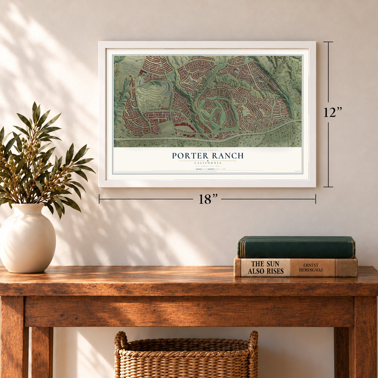
12" x 18" Archival Matte Print
A Map of Home. A Work of Art.
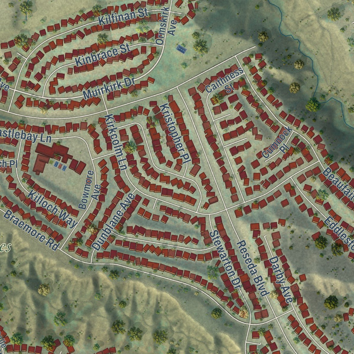
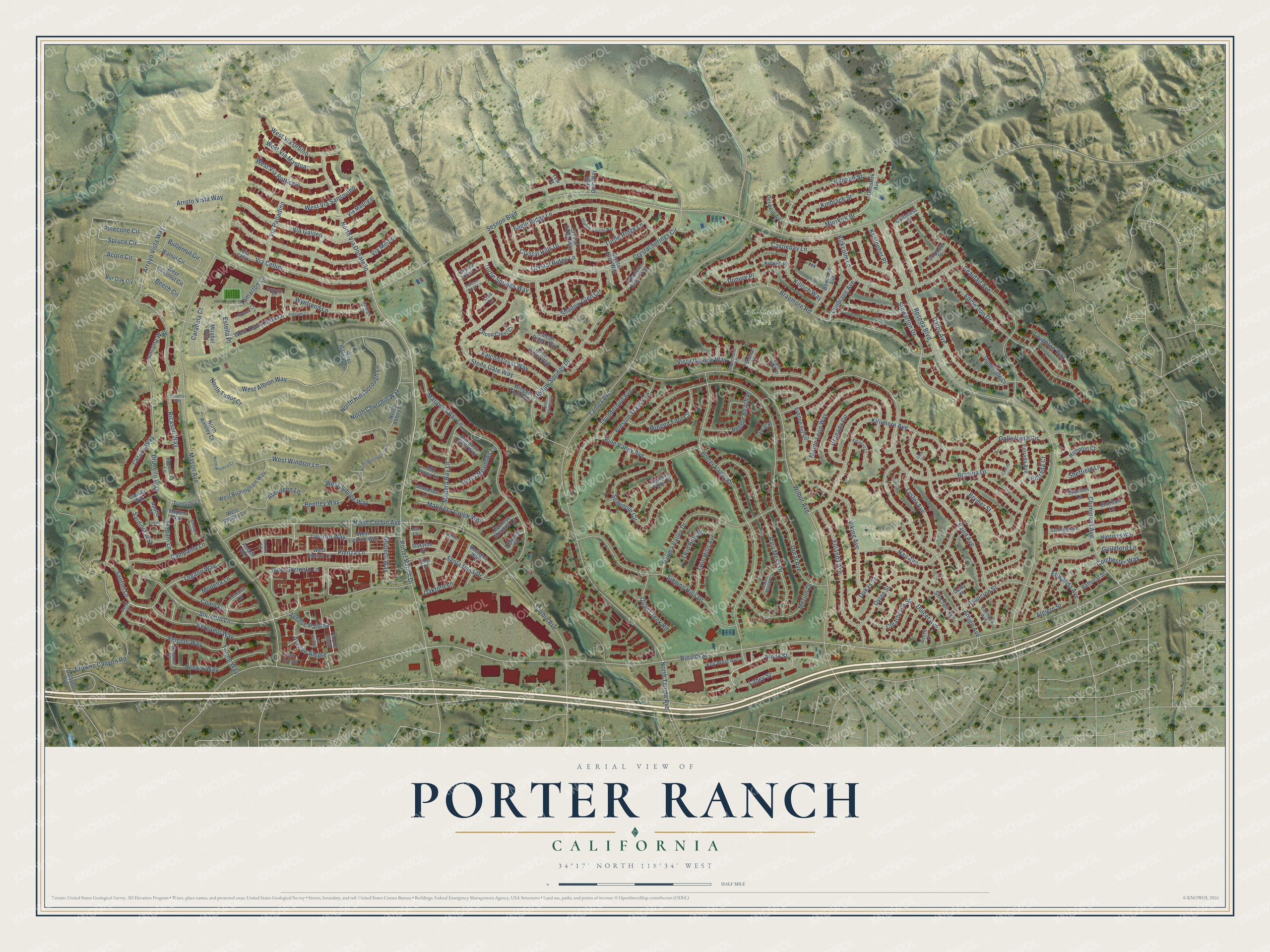
Explore Porter Ranch, California from a whole new perspective. Created using aerial imagery and detailed geographic data, this map captures Porter Ranch building by building, with labeled streets, familiar landmarks, and shaded topographical relief that highlights the natural contours of the landscape.
Combining modern data with the timeless character of a vintage atlas, this map is just as interesting up close as it is beautiful on the wall. Whether you grew up in Porter Ranch, spent memorable years there, or call it home today, this unique map is a great way to celebrate a place that means something to you. Zoom in on the preview to look for your street, and then order a print to put your memories on the wall.
Three ways to hang it
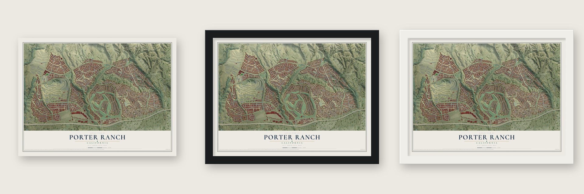
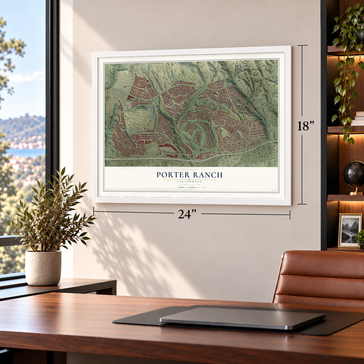
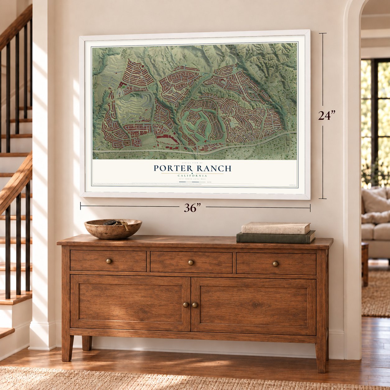
Unframed archival matte, a black wood frame or a white wood frame.
Up close
Geography Worth Displaying
This map was created using accurate cartographic data and authoritative geographic sources, including the U.S. Geological Survey and the Census Bureau. The map brings together terrain, waterways, roads, and building detail. The majority of the streets are labeled, houses are accurately depicted, and the topography is derived from government sources. Combining local data with carefully composed color and shading leads to this beautifully detailed Porter Ranch artwork for your wall.
Rather than simply showing street outlines, we’ve included as many of the street names as we could reasonably fit on the map while keeping their names legible. Zoom in on the high resolution preview to see exactly what’s on the map. We truly set out to create a statement piece for anyone who loves Porter Ranch. So whether it’s for you, or a gift for someone you love, we hope this map of Porter Ranch brings back fond memories.
Read the story behind this map of Porter Ranch, California from 2026.

Find your street
Names on the Porter Ranch map
Every name below is printed on this map. Look for your street, your school, the park where you played, or the pond down the road.
Places and landmarks2
- Palisades Park
- Viking Park
Streets and roads224
- Index Street
- West Esmerelda Lane
- Porter Ranch Drive
- Falcon Crest Way
- Pienza Lane
- Muirkirk Drive
- Crystal Hills Drive
- Spruce Circle
- Rinaldi Street
- Sesnon Boulevard
- Tampa Avenue
- Reseda Boulevard
- Mason Avenue
- Wilbur Avenue
- Doral Avenue
- Brasilia Drive
- Porter Valley Drive
- Ricasoli Way
- Darby Avenue
- Braemore Road
- Kilfinan Street
- Corbin Avenue
- Crystal Springs Circle
- Beaufait Avenue
- Mariposa Bay Lane
- Sorrento Lane
- Killimore Avenue
- Hollow Springs Drive
- Eddleston Drive
- Browns Canyon Road
Show all 224 streets
- Stewarton Drive
- Stone Gate Way
- Amigo Avenue
- Baird Avenue
- Eagle Ridge Lane
- Pine Valley Avenue
- Crystal Ridge Lane
- Singing Hills Drive
- Via Cellini
- Pala Mesa Drive
- Chimineas Avenue
- North Corbin Avenue
- Seminole Circle
- Kirkcolm Lane
- Livorno Way
- West Sorrento Lane
- Via Medici
- Dylan Street
- Via Galileo
- Calle Vista Circle
- Pauma Valley Drive
- Vista Grande Way
- Yolanda Avenue
- Viking Avenue
- Castlebay Lane
- Turtle Springs Way
- Killoch Way
- North Churchill Way
- Brymer Street
- North Via Donatello
- Granada Circle
- Nau Avenue
- West Albion Way
- Bergamo Way
- Via Palladino
- Shadow Glen Circle
- West Via Sansovino
- Santa Rosa Drive
- Vercelli Way
- Lugano Way
- Tamarron Lane
- Monte Leon Way
- West Windsor Lane
- Mariposa Creek Way
- Cetona Way
- Pesaro Way
- Merion Drive
- North Hillsborough Lane
- Santini Lane
- Como Lane
- Asuncion Street
- Madera Bay Lane
- Thunderbird Avenue
- Kinbrace Street
- Guildford Lane
- Lyster Avenue
- West Via Urbino
- Wynfreed Lane
- West Via Botticelli
- Twin Hills Avenue
- Arroto Vista Way
- Turtle Ridge Lane
- Campania Lane
- Preston Trails Avenue
- Arroyo Vista Way
- Pebble Beach Place
- Dulcet Avenue
- Oakford Lane
- Winged Foot Circle
- North Tampa Avenue
- Ghiberti Way
- Sierra Meadows Lane
- Brunello Way
- West Jubilee Way
- Quail Creek Road
- Lahey Street
- Laughton Way
- Clearbrook Street
- Pinecone Circle
- Algiers Street
- Butternut Circle
- Avenue Alegre
- Carabela Court
- West Via Mantua
- Acorn Circle
- Trapani Lane
- Colchester Way
- Ancona Way
- Sardinia Way
- Dunblane Avenue
- Sinclair Avenue
- Bentley Way
- Aberdeen Lane
- Etiwanda Avenue
- Dunure Place
- Twin Hills Place
- Kristopher Place
- Modena Lane
- Beech Circle
- Avenue Paloma
- Torino Way
- Sheffield Lane
- North Tudor Court
- Estella Place
- Dukas Street
- Entrada Court
- Pso del Cielo
- West Pienza Lane
- West Livorno Way
- Shadow Ridge Way
- Hastings Way
- Falcon Ridge Way
- Avenue del Sol
- Pine Valley Way
- Ahwanee Lane
- West Chestnut Circle
- Chatham Lane
- Bowmore Avenue
- West Birmingham Way
- West Galway Lane
- Bur Oak Circle
- Via Celini
- Winged Foot Way
- High Glen Way
- Crystal Hills Lane
- Charlton Lane
- Walnut Circle
- Entrada Avenue
- Crystal Glen Way
- Crystal Ridge Way
- Via Madrigal
- North Abbey Lane
- Falcon Crest Court
- North Ainsley Court
- Bathurst Street
- Ferrara Lane
- Dunnicliffe Court
- Florencia Lane
- Yosemite Circle
- Buckeye Meadow Lane
- Daosta Way
- Derwent Avenue
- Key West Avenue
- Mariposa Pines Way
- Hampton Court
- Ormskirk Avenue
- Beringer Way
- Amalfi Way
- West Shelley Lane
- Trentino Lane
- Mirabel Way
- Mid Pines Lane
- De Soto Avenue
- Oakville Court
- Caithness Street
- Accra Street
- Cumnock Place
- Killoch Place
- Cypress Point Drive
- Apulia Court
- Mopena Way
- Doral Place
- Pso Cresta
- Sierra Lane
- Lisa Lane
- Daisy Place
- Elm Place
- Yew Court
- Sandringham Court
- Edenberg Avenue
- Pala Mesa Place
- Capistrano Lane
- Ravenna Lane
- Arabella Place
- Lantana Court
- Sassari Lane
- Calle Vista Court
- Falcon Crest Lane
- Raleigh Court
- Carrara Lane
- Verdi Lane
- Ash Lane
- North Manchester Way
- Turtle Springs Lane
- Shadow Springs Way
- North Wisteria Court
- Androwe Lane
- Killimore Court
- Castillo Lane
- Trieste Lane
- Pso Dorado
- Calabria Way
- Selene Court
- Casa Lane
Names are listed as they appear on the printed map. Zoom into the product photos to find them.
About Porter Ranch, California
From the Los Angeles City Council District 12: "As with the rest of the San Fernando Valley, suburban development eventually came to Porter Ranch."
Keep exploring California
Porter Ranch is one of 1,990 California towns we've mapped. Every dot on the map is a print of its own.
The search covers every state, California first.
Near Porter Ranch
Order 2 or more town maps and save 10%. Shown in the size and finish you picked above, so they hang as a set.
- Winnetka 12" x 18" / Archival Matte Print $39.99
- Reseda 12" x 18" / Archival Matte Print $39.99
- Mission Hills 12" x 18" / Archival Matte Print $39.99


More maps nearby: Sylmar, Santa Susana, Pico, West Hills and San Fernando.
The art of mapping a place
How This Map Was Made
Real places. Remarkable detail. Discover the layers that turn geographic data into a map of home.

The view from above
Aerial imagery reveals the character of the land: woodland, open fields, and the patterns of a place.

The shape of the land
Elevation data brings hills, valleys, and subtle changes in the landscape into view.

The details of home
Roads, waterways, and building footprints come together to make the map feel unmistakably local.

Geography becomes art
Considered color, shading, and typography bring the layers together in a map made for your wall.


Process illustrated with Mendon, Massachusetts. Aerial imagery: USDA NAIP. Terrain: USGS 3D Elevation Program. Map details and finished artwork: KNOWOL.
The Details
About This Print
Choose an archival matte print, or a black or white Ayous wood frame. The archival matte print is unframed.
Select your size and finish above to see the matching product image and price.
Materials & Craftsmanship
A contemporary map with the character of a classic atlas, printed on archival matte paper. Optional frames are made from Ayous wood.
Your printed map does not include the watermark shown in the full-map preview.
Shipping & Delivery
Free shipping within the United States. Every print is made to order in the USA.
Buying a gift? Add a note in your cart and we'll include it. We never put prices in the package.
Prints ship within 2 to 3 business days. Allow 7 to 10 days total from ordering for delivery. Timing may vary during holidays or periods of high order volume.
Read our shipping policy.
Returns and damaged prints
Each print is made to order. Change-of-mind refunds are not available after production.
If your print arrives damaged, misprinted or incorrect, contact support@knowol.com within 30 days of receiving it. Include your order number, photos and a description of the issue.
Read our full refund and replacement policy. For questions about your order, email support@knowol.com.