
Search for another town



Free U.S. delivery 7 to 10 days after you order
Porterville, California Map Art
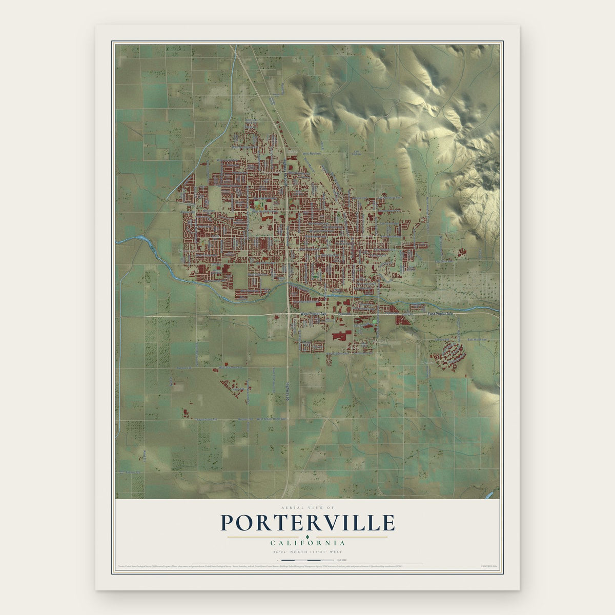
A new map of Porterville, California, made in 2026 and printed to order on thick archival matte paper.
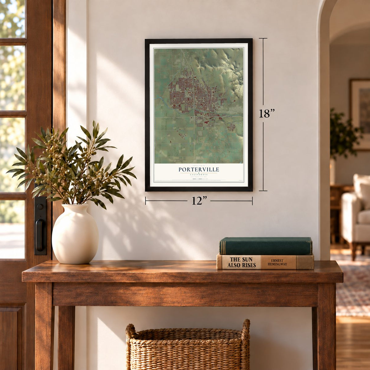
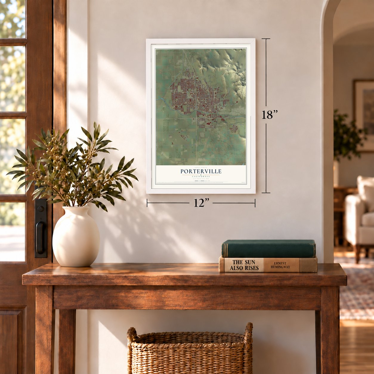
12" x 18" Archival Matte Print
A Map of Home. A Work of Art.
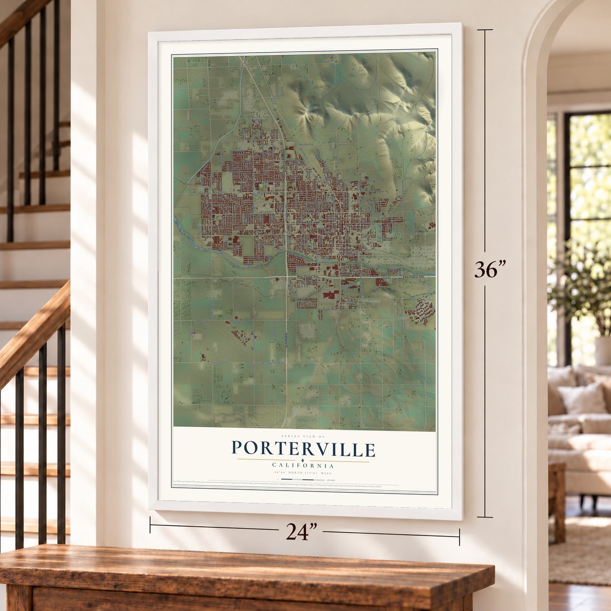
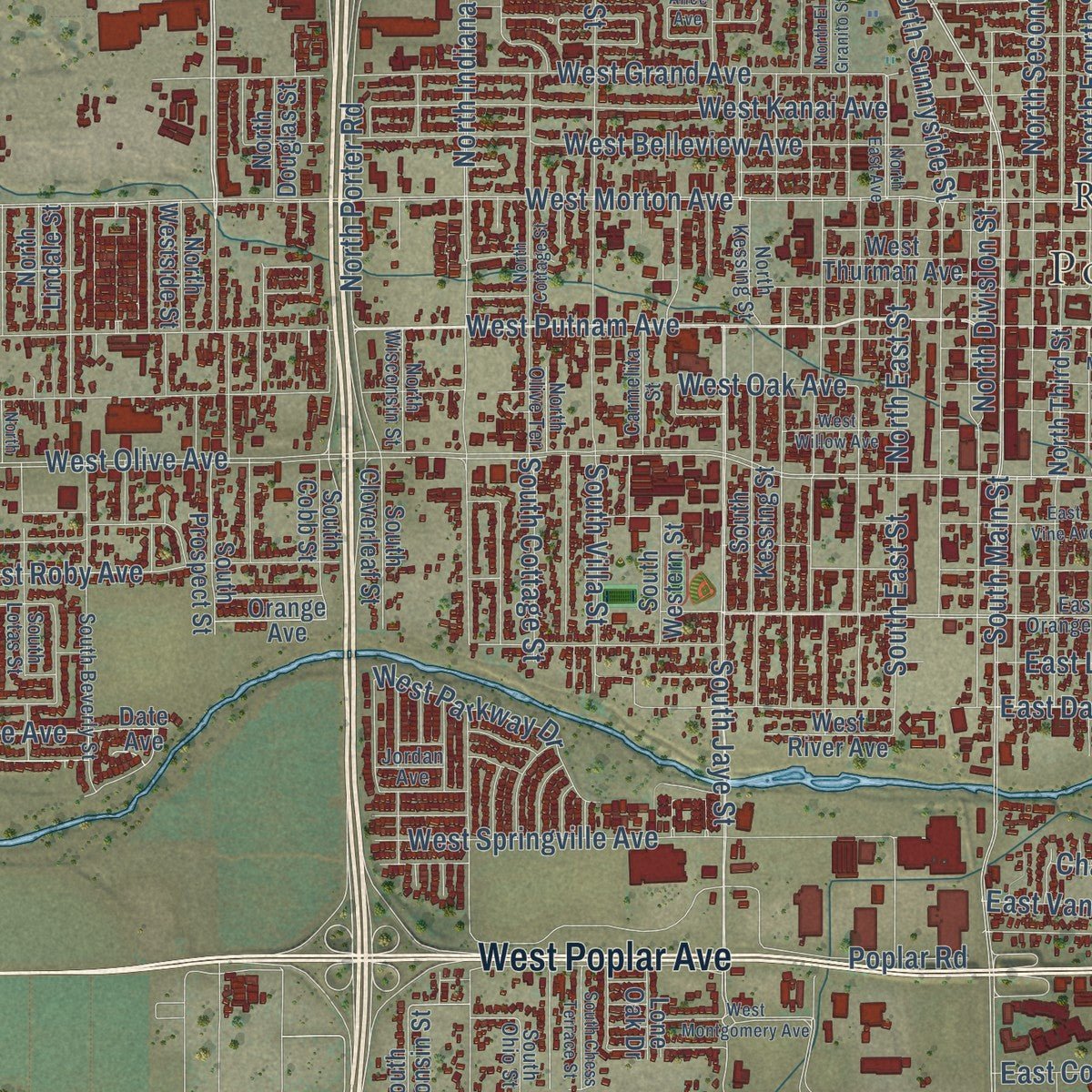
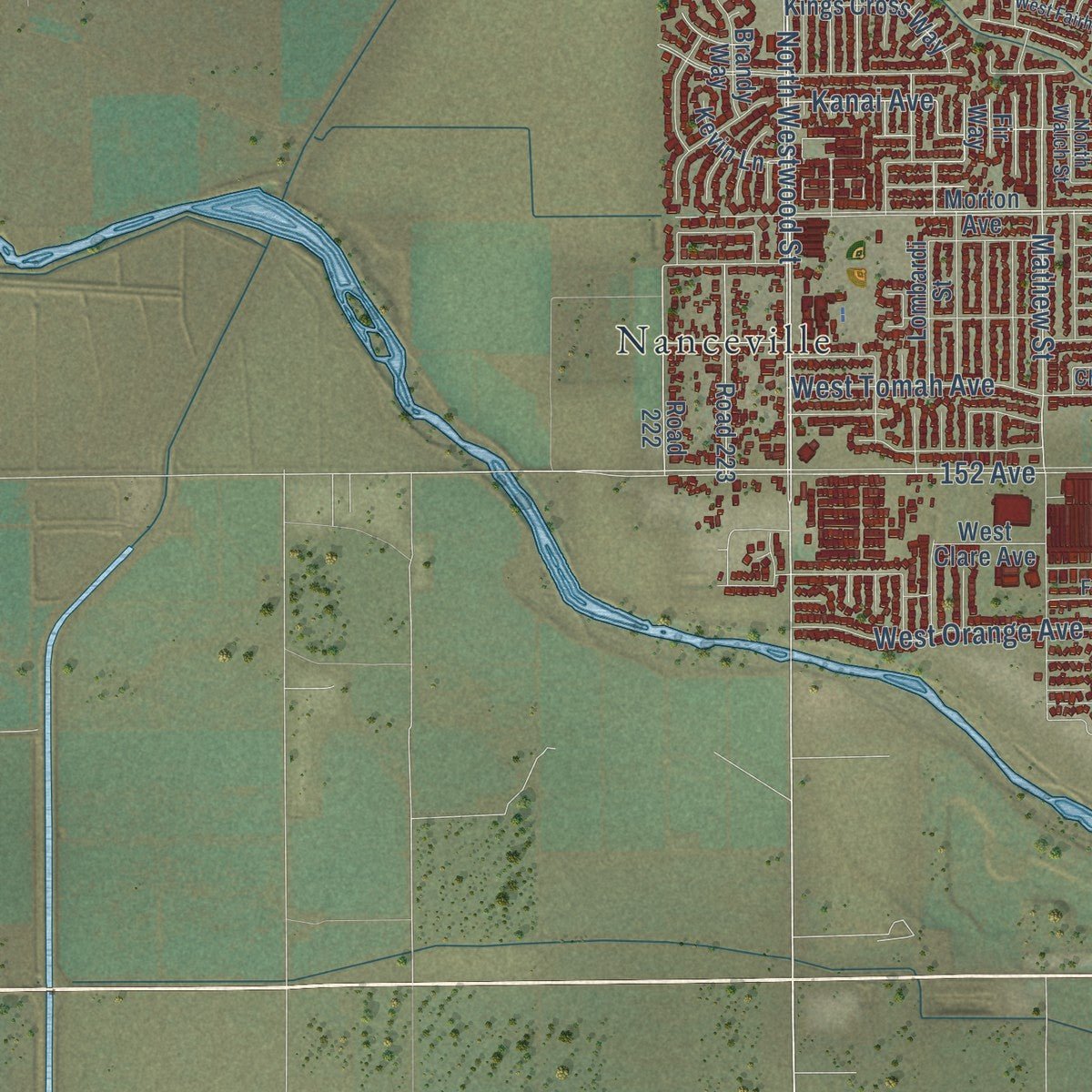
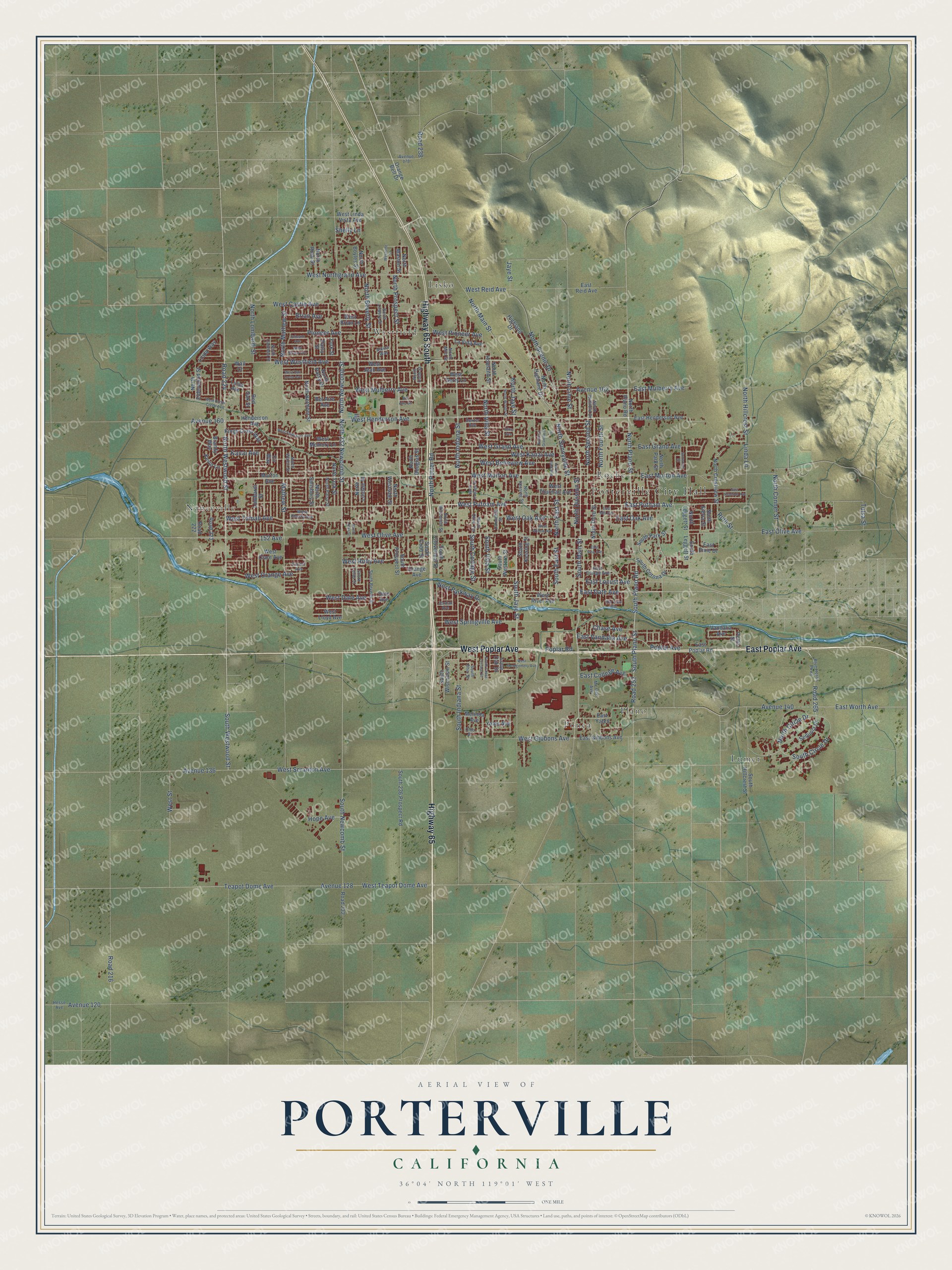
Explore Porterville, California from a whole new perspective. Created using aerial imagery and detailed geographic data, this map captures Porterville building by building, with labeled streets, familiar landmarks, and shaded topographical relief that highlights the natural contours of the landscape.
Combining modern data with the timeless character of a vintage atlas, this map is just as interesting up close as it is beautiful on the wall. Whether you grew up in Porterville, spent memorable years there, or call it home today, this unique map is a great way to celebrate a place that means something to you. Zoom in on the preview to look for your street, and then order a print to put your memories on the wall.
Three ways to hang it
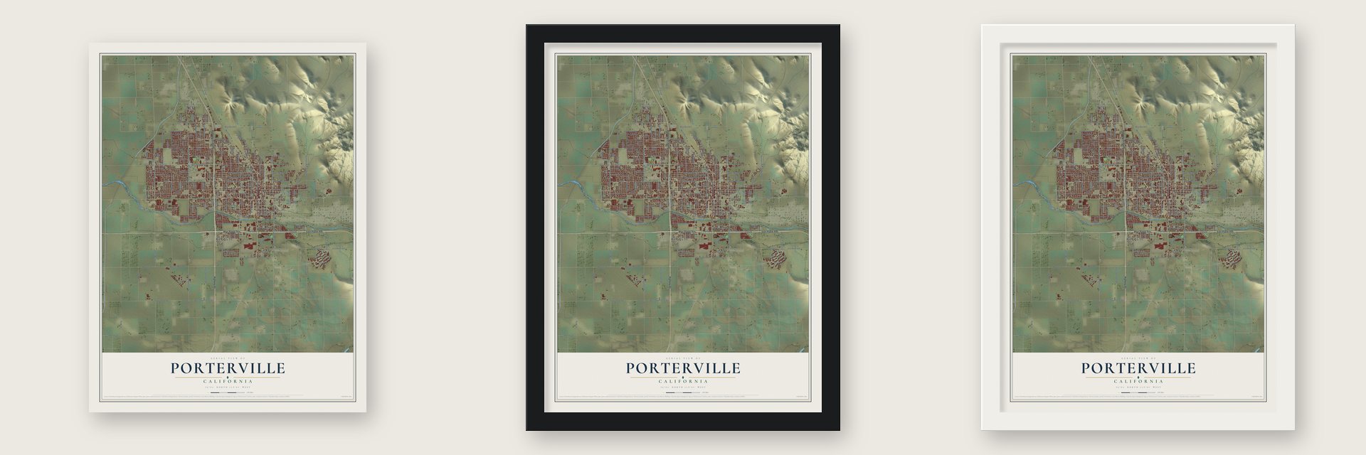
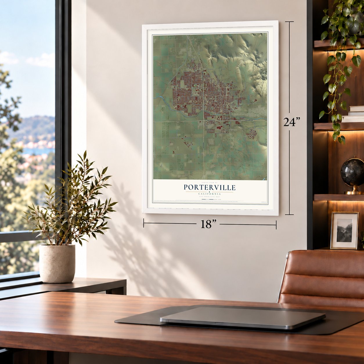
Unframed archival matte, a black wood frame or a white wood frame.
Up close
Geography Worth Displaying
This map was created using accurate cartographic data and authoritative geographic sources, including the U.S. Geological Survey and the Census Bureau. The map brings together terrain, waterways, roads, and building detail. The majority of the streets are labeled, houses are accurately depicted, and the topography is derived from government sources. Combining local data with carefully composed color and shading leads to this beautifully detailed Porterville artwork for your wall.
Rather than simply showing street outlines, we’ve included as many of the street names as we could reasonably fit on the map while keeping their names legible. Zoom in on the high resolution preview to see exactly what’s on the map. We truly set out to create a statement piece for anyone who loves Porterville. So whether it’s for you, or a gift for someone you love, we hope this map of Porterville brings back fond memories.
Read the story behind this map of Porterville, California from 2026.
About Porterville, California
Porterville is a city of 62,623 people in Tulare County, on the Tule River where the Sierra Nevada foothills meet the San Joaquin Valley. Wagons full of gold seekers rolled through here after 1849, and in 1854 Peter Goodhue opened a stopping place on the riverbank, along the road between Stockton and Los Angeles. From 1858 to 1861 the spot served the Butterfield Overland Mail as its Tule River Station.
Royal Porter Putnam arrived in 1860 and ranched cattle, horses and hogs. He bought out Goodhue that year and turned the stop into a busy hotel called Porter Station. On the highest ground of his 40 swampy acres, today the corner of Oak and Main, he built a two-story store and a hotel, and the town was founded there in 1864. Another Putnam family already lived south of town, so the new town was named for his given name, Porter.
“Thus ended the Tule River war of 1856; a war that might have been prevented had there been an honest desire on the part of the white settlers to do so, and one that brought little glory to those who participated therein.”
- The flood of 1862In 1862 the area got 20.8 inches of rain, and the Tule River shifted its course. With the water gone, Putnam's land dried out, so he had it surveyed, staked out lots and laid out streets. To draw people in, he gave settlers a second lot free with each lot they bought.
- The Tule River War of 1856An 1851 treaty promised local tribes a reservation and 200 cattle a year, but the U.S. Senate never ratified it. In spring 1856 a rumor said Native people had stolen 500 cattle, but only one yearling calf was gone, a wedding gift. Armed settlers raided Native camps, and defenders turned back mobs under Capt. Foster DeMasters and Sheriff W.G. Poindexter. Army troops under LaRhett Livingston took the camp in May 1856, ending about six weeks of war.
- Railroad, magnesite and a charterThe Southern Pacific ran a branch line down from Fresno in 1888, and businessmen from San Francisco built the Pioneer Hotel and Bank. Miners came to dig magnesite ore, and Porterville incorporated in 1902. A Chamber of Commerce followed in 1907, and in 1926 the city adopted a charter with a city manager and council.
- Citrus and livestockPorterville had about 5,000 people in 1920 and kept growing as farming spread across the east side of the valley. Water from the Central Valley Project fed that growth, and the city became the center of a large farm region best known for citrus and livestock.
Find your street
Names on the Porterville map
Every name below is printed on this map. Look for your street, your school, the park where you played, or the pond down the road.
Places and landmarks8
- Porterville City Hall
- Lisko
- Lumer
- Nanceville
- Plano
- Ponca
- Roche
- Westfield
Streets and roads218
- East Poplar Avenue
- West Poplar Avenue
- Highway 65
- Highway 65 South
- North Newcomb Street
- Road 224
- North Westwood Street
- South Newcomb Street
- West Northgrand Avenue
- North 232 Newcomb Street
- North Division Street
- South Plano Road
- South Westwood Street
- East Date Avenue
- West Mulberry Avenue
- South Plano Street
- North Prospect Street
- North Main Street
- East Putnam Avenue
- West Putnam Avenue
- Road 265
- East Olive Avenue
- North Plano Street
- West Henderson Avenue
- South Jaye Street
- North Jaye Street
- North Scenic Drive
- South Circle Drive
- North Circle Drive
- South Main Street
Show all 218 streets
- West Orange Avenue
- West Date Avenue
- West Olive Avenue
- Jaye Street
- North Indiana Street
- West Teapot Dome Avenue
- West Morton Avenue
- West Westfield Avenue
- Avenue 128
- East Morton Avenue
- West Belleview Avenue
- West Tomah Avenue
- North Mathew Street
- Avenue 136
- West Scranton Avenue
- South Indiana Street
- West Kanai Avenue
- West Grand Avenue
- Teapot Dome Avenue
- 152 Avenue
- North Villa Street
- West Roby Avenue
- North Beverly Street
- North Second Street
- Avenue 140
- East Worth Avenue
- Poplar Road
- East Grand Avenue
- West Pioneer Avenue
- Avenue 162
- North Lime Street
- West Springville Avenue
- North Porter Road
- West Gibbons Avenue
- North Hillcrest Street
- West Castle Avenue
- Road 216
- East Mulberry Avenue
- North Fourth Street
- Mathew Street
- South Cottage Street
- North East Street
- East Oak Avenue
- South East Street
- West Street
- Linda Lane
- East Vandalia Avenue
- West Parkway Drive
- Road 252
- Pioneer Avenue
- Poplar Avenue
- North Lombardi Street
- North Conner Street
- Avenue 120
- East Locust Avenue
- East College Avenue
- South Villa Street
- West Oak Avenue
- North Sunnyside Street
- West Reid Avenue
- Hope Avenue
- Avenue 160
- Chase Avenue
- Brian Avenue
- Kanai Avenue
- Tulsa Street
- Road 238
- Shelly Lane
- Ruth Street
- Orange Avenue
- North Westside Street
- North Leggett Street
- East Henderson Avenue
- North Highland Drive
- West Linda Vista Avenue
- West Jean Avenue
- North Patsy Drive
- Orange Belt Drive
- South Corona Drive
- North Plano Road
- Sequoia Drive
- North Sierra Street
- North Belmont Street
- Lombardi Street
- North Lindale Street
- Highland Drive
- North Salisbury Street
- North Crestview Street
- Red Oak Street
- West Thurman Avenue
- North Third Street
- Road 232
- West River Avenue
- West Memory Lane
- North Maston Street
- South Kessing Street
- South Wisconsin Street
- North Elderwood Street
- North Douglas Street
- South Park Street
- La Vida Avenue
- North Park Street
- North York Street
- South Cloverleaf Street
- South 236 Prospect Road
- South Hillcrest Street
- West Lloyd Avenue
- Melinda Avenue
- West Clare Avenue
- South Prospect Street
- Road 223
- Road 222
- Kings Cross Way
- East Gibbons Avenue
- Brandy Way
- North Boyles Street
- South Western Street
- North Rose Street
- North Howland Street
- Patsy Street
- East Yates
- Vandalia Avenue
- Kevin Lane
- Date Avenue
- South Leggett Street
- West Gerry Lane
- Henderson Avenue
- East Dixie Drive
- Bel Aire Avenue
- East Reid Avenue
- East Poplar Road
- Linda Way
- Yates Avenue
- Luisa Avenue
- Morton Avenue
- South Cobb Street
- York Street
- Lone Oak Drive
- West Brian Lane
- Pettis Street
- Wall Court
- Fir Way
- East Orange Avenue
- Blue Heron Parkway
- Atkins Way
- West Cherry Avenue
- South Beverly Street
- North Lowery Street
- North Cobb Street
- North Walch Street
- South Ohio Street
- North Kessing Street
- North Patsy Street
- Hesse Avenue
- South Lotas Street
- Ohio Street
- North Wisconsin Street
- Carmelita Street
- Dexter Avenue
- Mc Gee Avenue
- North Williford Drive
- North Milo Street
- Avenue 178
- Forest Avenue
- North Carmelo Street
- North Olive Terrace
- Jordan Avenue
- Westside Street
- West San Lucia Avenue
- North Cottage Street
- East Thurman Avenue
- South Chess Terrace Street
- East Mill Avenue
- North Lotas Street
- West Montgomery Avenue
- West Nancy Avenue
- North El Granito Street
- West Porter Creek Avenue
- Julieann Avenue
- West Fairhaven Avenue
- West Willow Avenue
- North East Avenue
- North Woods Street
- Sunwood Street
- East Vine Avenue
- Rio Vista Avenue
- Bel Aire Circle
- Alice Avenue
Names are listed as they appear on the printed map. Zoom into the product photos to find them.
The art of mapping a place
How This Map Was Made
Real places. Remarkable detail. Discover the layers that turn geographic data into a map of home.

The view from above
Aerial imagery reveals the character of the land: woodland, open fields, and the patterns of a place.

The shape of the land
Elevation data brings hills, valleys, and subtle changes in the landscape into view.

The details of home
Roads, waterways, and building footprints come together to make the map feel unmistakably local.

Geography becomes art
Considered color, shading, and typography bring the layers together in a map made for your wall.


Process illustrated with Mendon, Massachusetts. Aerial imagery: USDA NAIP. Terrain: USGS 3D Elevation Program. Map details and finished artwork: KNOWOL.
The Details
About This Print
Choose an archival matte print, or a black or white Ayous wood frame. The archival matte print is unframed.
Select your size and finish above to see the matching product image and price.
Materials & Craftsmanship
A contemporary map with the character of a classic atlas, printed on archival matte paper. Optional frames are made from Ayous wood.
Your printed map does not include the watermark shown in the full-map preview.
Shipping & Delivery
Free shipping within the United States. Every print is made to order in the USA.
Buying a gift? Add a note in your cart and we'll include it. We never put prices in the package.
Prints ship within 2 to 3 business days. Allow 7 to 10 days total from ordering for delivery. Timing may vary during holidays or periods of high order volume.
Read our shipping policy.
Returns and damaged prints
Each print is made to order. Change-of-mind refunds are not available after production.
If your print arrives damaged, misprinted or incorrect, contact support@knowol.com within 30 days of receiving it. Include your order number, photos and a description of the issue.
Read our full refund and replacement policy. For questions about your order, email support@knowol.com.
Find your town
Looking for another city?
Find a map of home in our California collection, or any town in the country.
Nearby
Maps of towns near Porterville
Know someone from one of these towns? Their map makes a great gift.
 East Porterville
, California
From $39.99See the map
 Strathmore
, California
From $39.99See the map
 Poplar-Cotton Center
, California
From $39.99See the map
More maps nearby: Woodville Farm Labor Camp, Terra Bella, Plainview, Woodville and Lindsay.