
Search for another town




Free U.S. delivery 7 to 10 days after you order
Portsmouth, Rhode Island Map Art
Building by building, with labeled streets and shaded relief.
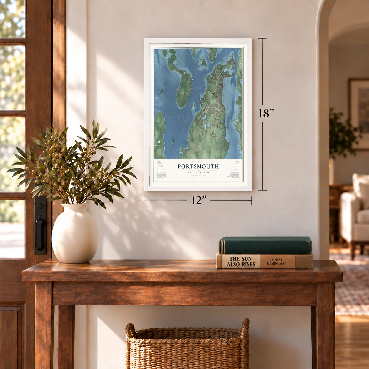
12" x 18" Archival Matte Print
A Map of Home. A Work of Art.
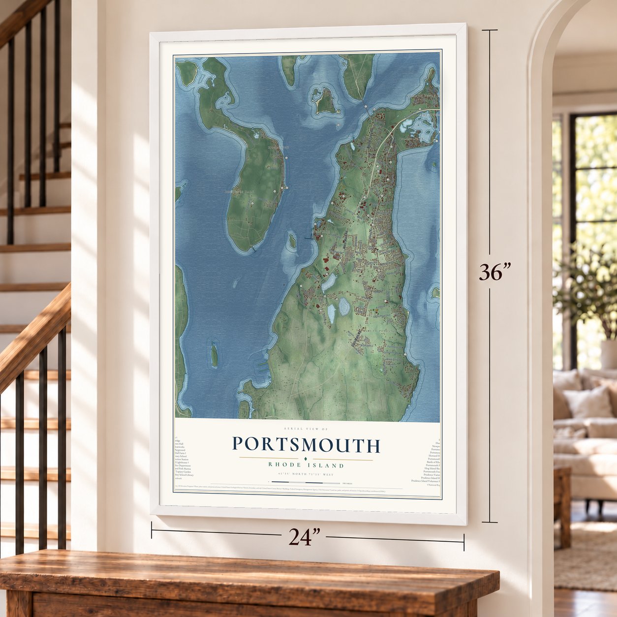
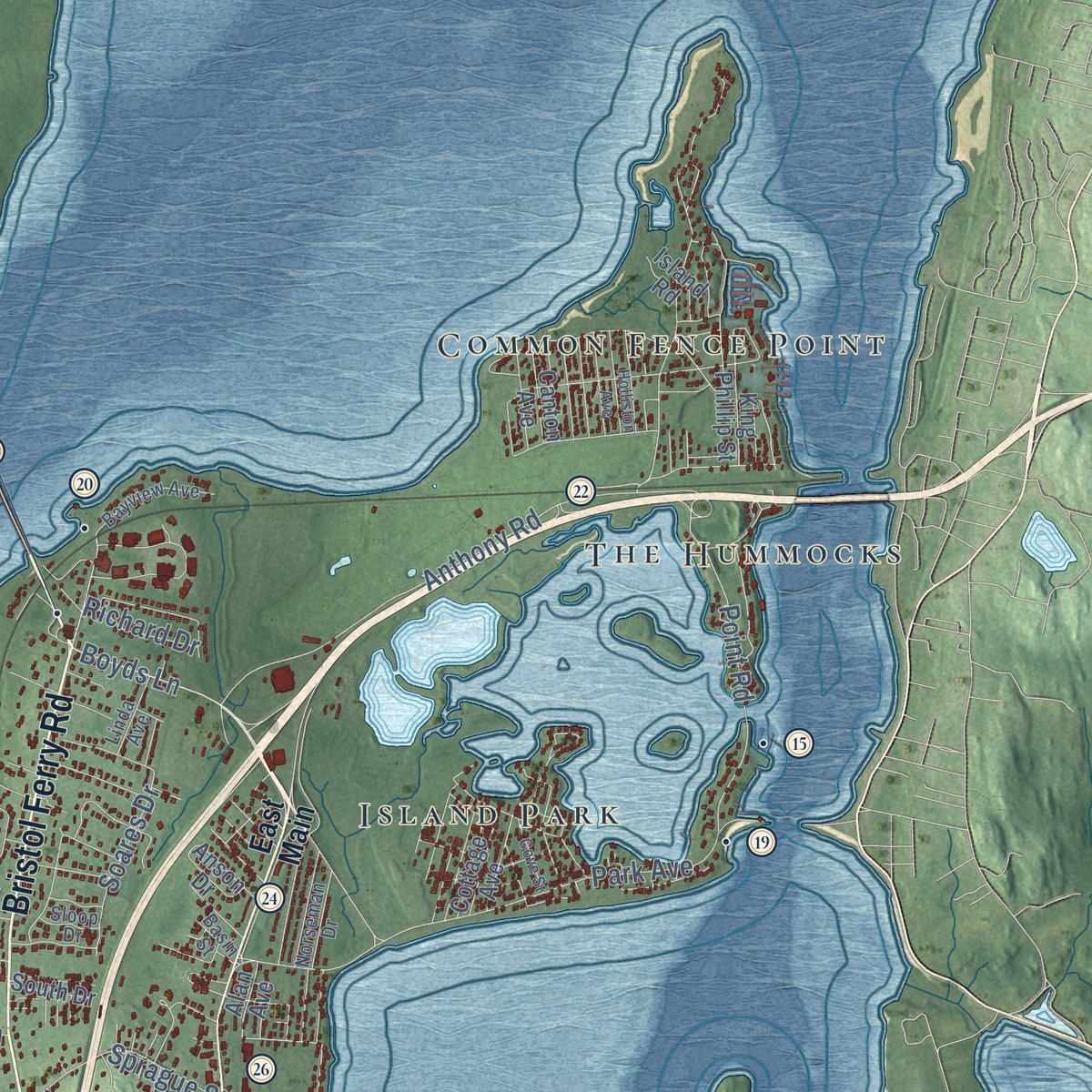
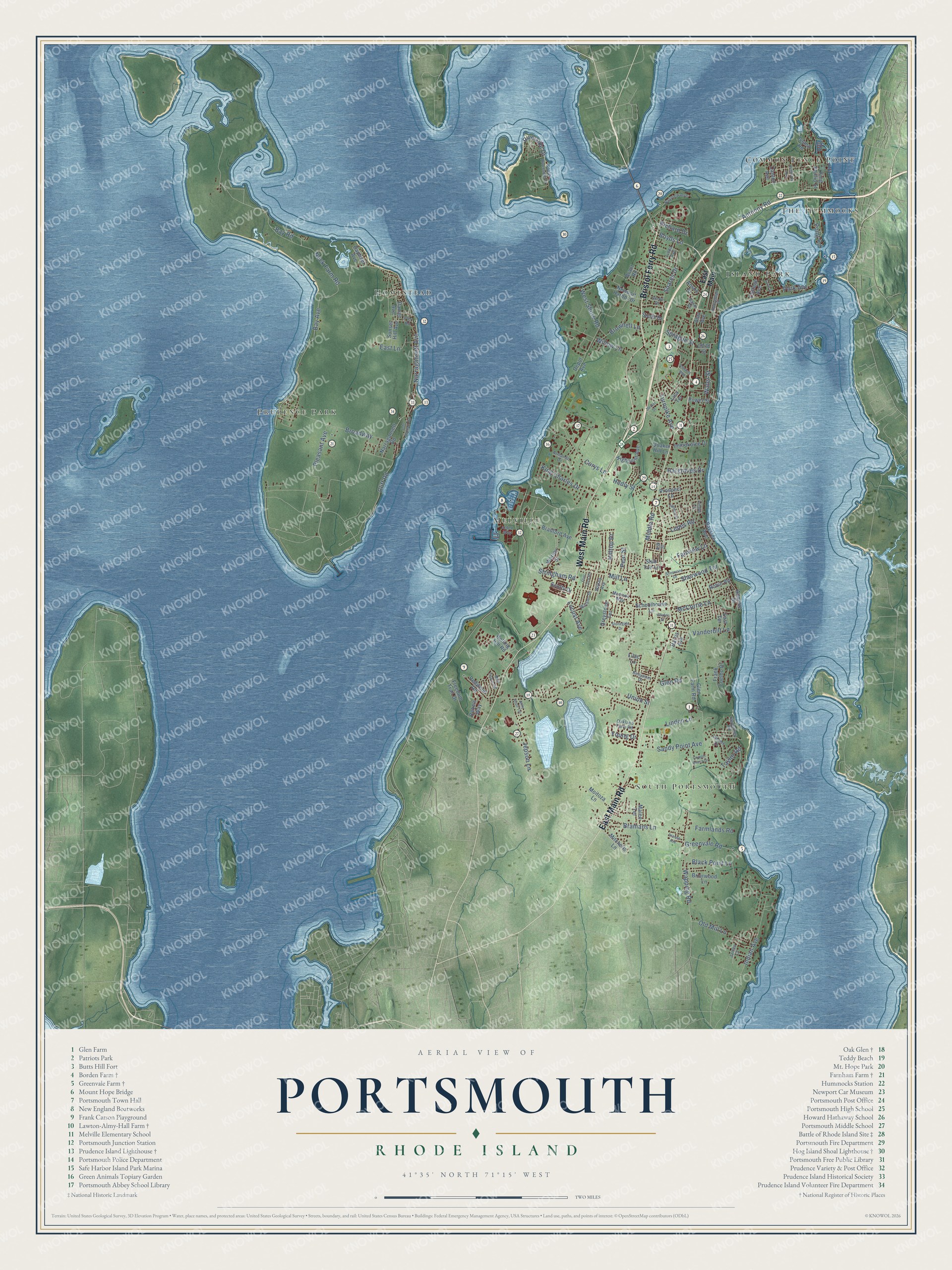
Explore Portsmouth, Rhode Island from a whole new perspective. Created using aerial imagery and detailed geographic data, this map captures Portsmouth building by building, with labeled streets, familiar landmarks, and shaded topographical relief that highlights the natural contours of the landscape.
Combining modern data with the timeless character of a vintage atlas, this map is just as interesting up close as it is beautiful on the wall. Whether you grew up in Portsmouth, spent memorable years there, or call it home today, this unique map is a great way to celebrate a place that means something to you. Zoom in on the preview to look for your street, and then order a print to put your memories on the wall.
Three ways to hang it
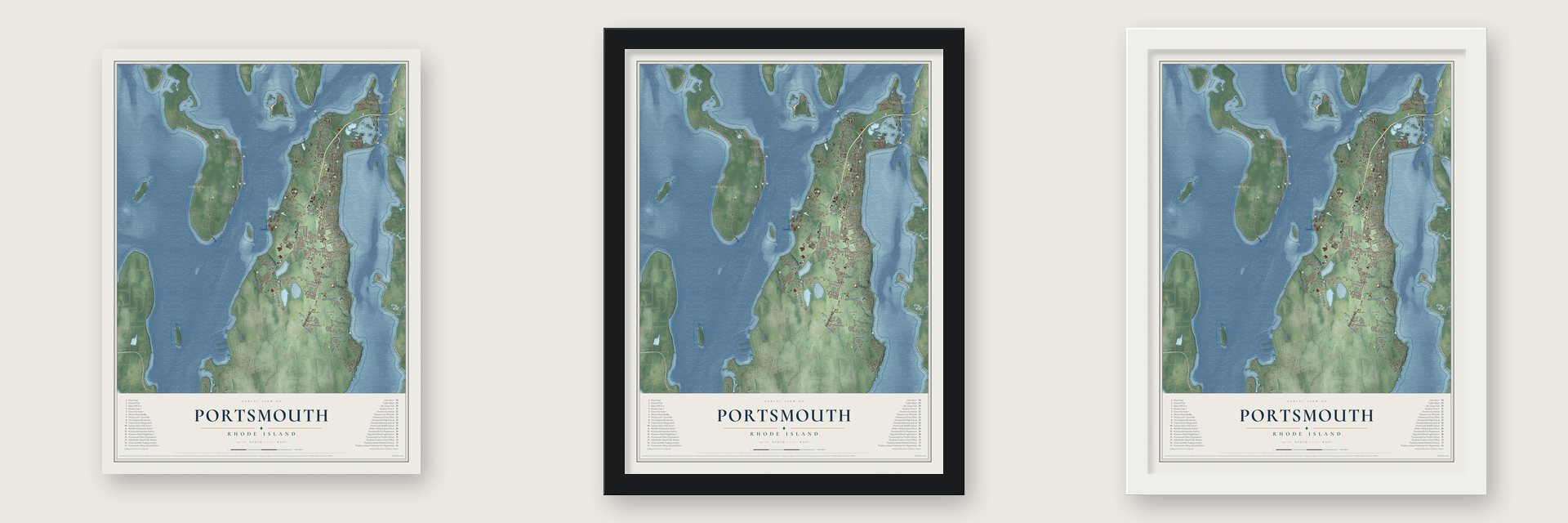
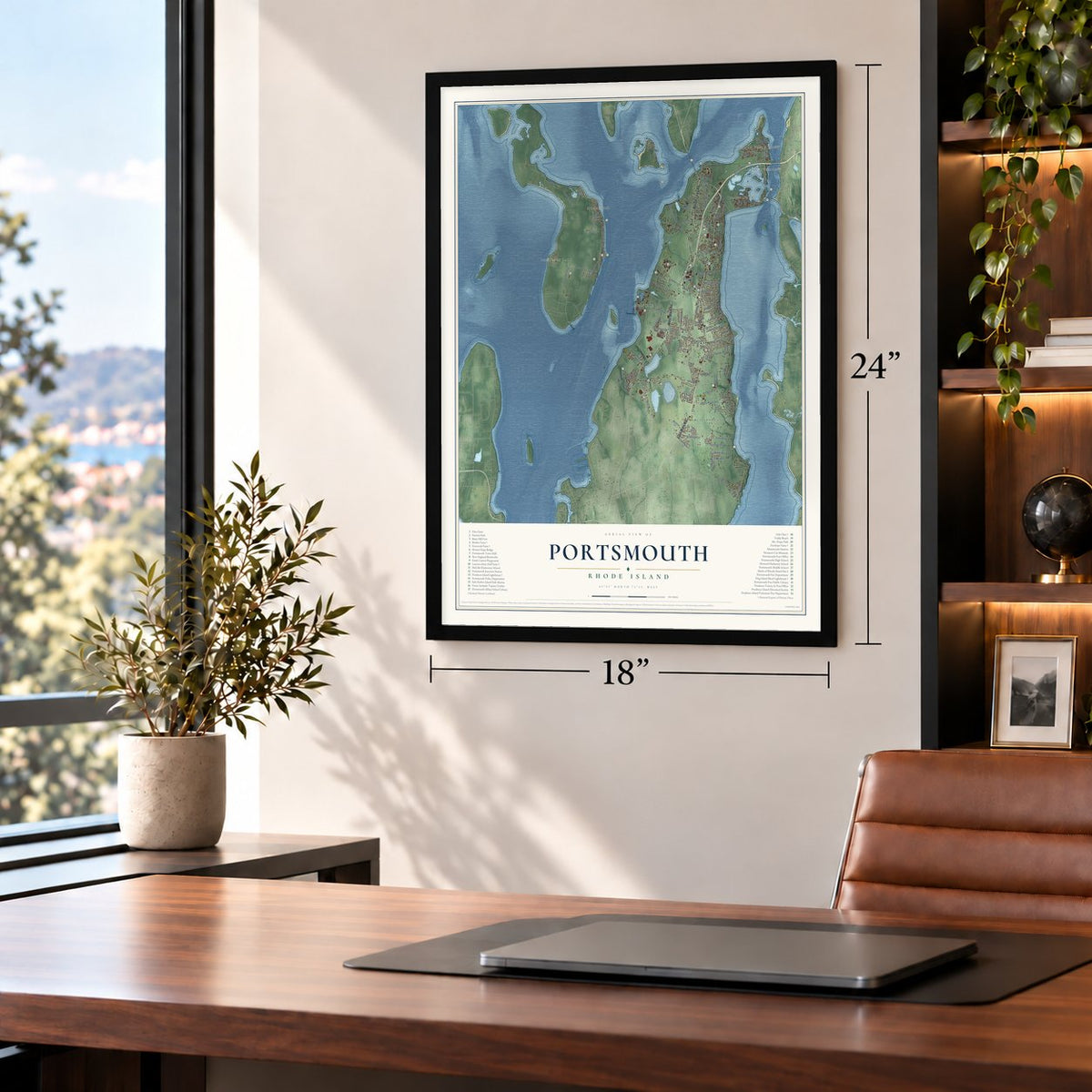
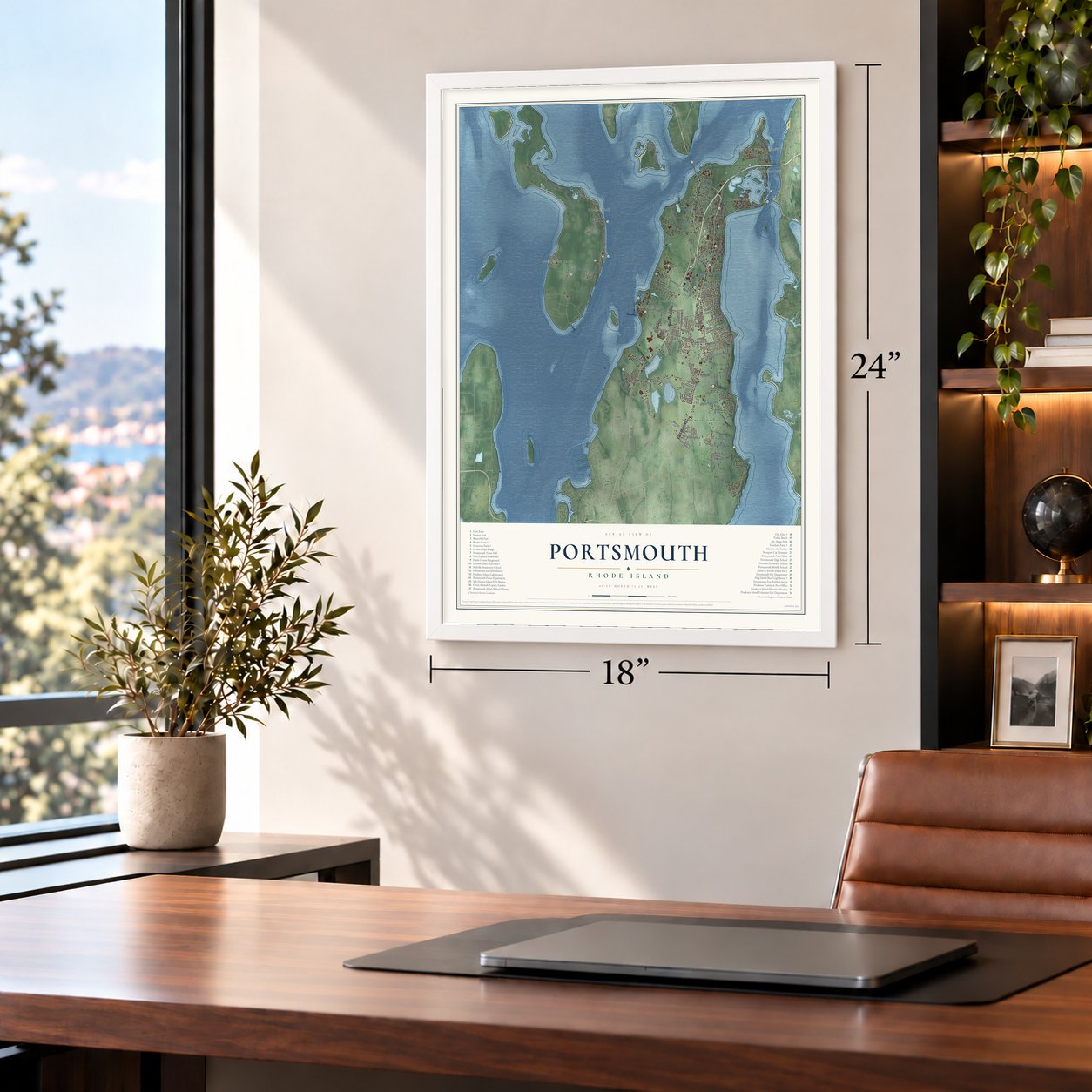
Unframed archival matte, a black wood frame or a white wood frame.
Up close
Geography Worth Displaying
This map was created using accurate cartographic data and authoritative geographic sources, including the U.S. Geological Survey (USGS) and FEMA. The map brings together terrain, waterways, roads, and building detail. The majority of the streets are labeled, houses are accurately depicted, and the topography is derived from government sources. Combining local data with carefully composed color and shading leads to this beautifully detailed Portsmouth artwork for your wall.
Rather than simply showing street outlines, we’ve included as many of the street names as we could reasonably fit on the map while keeping their names legible. Zoom in on the high resolution preview to see exactly what’s on the map. We truly set out to create a statement piece for anyone who loves Portsmouth. So whether it’s for you, or a gift for someone you love, we hope this map of Portsmouth brings back fond memories.
Explore the full map of Portsmouth, Rhode Island and read about the local places it shows.

Find your street
Names on the Portsmouth map
Every name below is printed on this map. Look for your street, your school, the park where you played, or the pond down the road.
Places and landmarks7
- Common Fence Point
- South Portsmouth
- Prudence Park
- Homestead
- Melville
- Island Park
- The Hummocks
Streets and roads130
- Bristol Ferry Road
- East Main Road
- West Main Road
- Boyds Lane
- Bay Avenue
- Water Street
- Narragansett Avenue
- Riverside Drive
- Anthony Road
- Middle Road
- Neck Farm Road
- Wapping Road
- Union Street
- Park Avenue
- Broadway
- Black Point Lane
- Vanderbilt Lane
- Sandy Point Avenue
- Cliff Road
- Turnpike Avenue
- Bramans Lane
- Jepson Lane
- Pleasant Avenue
- Indian Avenue
- Glen Road
- Corys Lane
- McCorrie Lane
- Willow Lane
- Hilltop Drive
- King Charles Drive
Show all 130 streets
- Old Mill Lane
- Point Road
- Hedly Street
- Sprague Street
- Fairview Lane
- Stringham Road
- Taylor Road
- Mill Lane
- Greenvale Road
- West Shore Road
- Sherwood Terrace
- Linden Lane
- Brownell Lane
- Farmlands Road
- Lepes Road
- Soares Drive
- Hargraves Drive
- Bay Road
- Young Drive
- Locust Avenue
- Pear Street
- Richard Drive
- East Lane
- East Main
- Freedom Trail Drive
- Glen Farm Road
- Narragansett Road
- Rolling Hill Road
- Bradford Avenue
- Daniel Avenue
- Frank Coelho Drive
- Newport Harbor Drive
- Greystone Terrace
- Highpoint Avenue
- Prospect Lane
- Redwood Road
- Schoolhouse Lane
- Immokolee Drive
- Warley Street
- Briarwood Lane
- Moitoza Lane
- King Phillip Street
- Mitchells Lane
- Sunset Hill Avenue
- Lilac Lane
- Rebels Way
- Cottage Avenue
- Power Street
- Canton Avenue
- Malee Terrace
- Scotty Drive
- Island Road
- Bayside Avenue
- Robin Road
- Raphael Avenue
- South Drive
- Depot Avenue
- Anson Drive
- Quaker Hill Lane
- Stub Toe Lane
- East Terrace
- Annette Drive
- Alan Avenue
- Harris Avenue
- Child Street
- Brant Road
- Lisa Terrace
- South Riverside Drive
- Oakland Farm Road
- Bayview Avenue
- Adams Drive
- Watson Drive
- Norseman Drive
- Armando Drive
- Sigourney Road
- Linda Avenue
- Benjamin Drive
- Pier Road
- Madison Way
- Wilkey Avenue
- Alden Way
- Sloop Drive
- James Court
- Basin Street
- Ash Street
- Dexter Street
- Mail Coach Road
- Lambie Circle
- Stonegate Drive
- Sherwood Drive
- Holman Street
- Holliston Avenue
- Almy Knoll Terrace
- John Oldham Road
- Cove Street
- Flint Corn Road
- Dianne Avenue
- Copper Beech Drive
- Patriots Way
- Garden Street
Names are listed as they appear on the printed map. Zoom into the product photos to find them.
About Portsmouth, Rhode Island
Portsmouth is a town of 17,871 people in Newport County, at the north end of Aquidneck Island in Narragansett Bay. Religious dissenters from the Massachusetts Bay Colony settled it in 1638, and their leaders included Anne Hutchinson, William Coddington and Dr. John Clarke. They had meant to go to New Jersey, but Roger Williams talked them into settling on the island.
The group signed the Portsmouth Compact on March 7, 1638, creating a Christian colony whose government belonged to no single church. The settlement was first called Pocasset, and on May 12, 1639, it took the name of Portsmouth in Hampshire, England. Within a year some founders had left for the island's south end to start Newport, and Portsmouth later became one of four colonies that merged into Rhode Island. Only Providence is an older municipality in the state.
- A stand on West Main RoadThe 1st Rhode Island Regiment, made up mostly of Black soldiers, defended a redoubt on West Main Road under Major Samuel Ward Jr. and threw back three Hessian charges. Their stand let the army pull back safely the next night.
- Borden Farm since the 1700sBorden descendants have owned this farm on East Main Road since the early 1700s. William Borden built its Second Empire farmhouse around 1865. An English barn followed about 1890, and a workshop, granary and wellhouse were added about 1900. The farm was added to the National Register in 2007.
- Prudence Island's lighthouseRoger Williams and John Winthrop bought Prudence Island from the Narragansett in 1637. Williams gave it its name, and he also named nearby Patience and Hope islands. The island's lighthouse, which islanders call Sandy Point, stood off Goat Island in Newport from 1823 until 1851, when it was moved to Prudence. It is the oldest lighthouse tower in Rhode Island and still keeps the bird-cage lantern it was built with. It was added to the National Register in 1988.
- The Beach Boys in 1971The Beach Boys played a concert in Portsmouth on September 22, 1971. That night Ricky Fataar, from South Africa, took the stage for the first time as a full member, and Billy Hinsche, who was Filipino, played his first show as a touring member. In 2017 Roger Williams University unveiled plaques at the Baypoint Inn & Conference Center to mark the show.
Keep exploring Rhode Island
Portsmouth is one of 85 Rhode Island towns we've mapped. Every dot on the map is a print of its own.
The search covers every state, Rhode Island first.
Near Portsmouth
Order 2 or more town maps and save 10%. Shown in the size and finish you picked above, so they hang as a set.
- Melville 12" x 18" / Archival Matte Print $39.99
- Middletown 12" x 18" / Archival Matte Print $39.99
- Newport East 12" x 18" / Archival Matte Print $39.99
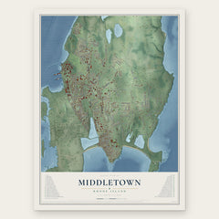

More maps nearby: Tiverton, Bristol, Jamestown, Newport and Little Compton.
The art of mapping a place
How This Map Was Made
Real places. Remarkable detail. Discover the layers that turn geographic data into a map of home.

The view from above
Aerial imagery reveals the character of the land: woodland, open fields, and the patterns of a place.

The shape of the land
Elevation data brings hills, valleys, and subtle changes in the landscape into view.

The details of home
Roads, waterways, and building footprints come together to make the map feel unmistakably local.

Geography becomes art
Considered color, shading, and typography bring the layers together in a map made for your wall.


Process illustrated with Mendon, Massachusetts. Aerial imagery: USDA NAIP. Terrain: USGS 3D Elevation Program. Map details and finished artwork: KNOWOL.
The Details
About This Print
Choose an archival matte print, or a black or white Ayous wood frame. The archival matte print is unframed.
Select your size and finish above to see the matching product image and price.
Materials & Craftsmanship
A contemporary map with the character of a classic atlas, printed on archival matte paper. Optional frames are made from Ayous wood.
Your printed map does not include the watermark shown in the full-map preview.
Shipping & Delivery
Free shipping within the United States. Every print is made to order in the USA.
Buying a gift? Add a note in your cart and we'll include it. We never put prices in the package.
Prints ship within 2 to 3 business days. Allow 7 to 10 days total from ordering for delivery. Timing may vary during holidays or periods of high order volume.
Read our shipping policy.
Returns and damaged prints
Each print is made to order. Change-of-mind refunds are not available after production.
If your print arrives damaged, misprinted or incorrect, contact support@knowol.com within 30 days of receiving it. Include your order number, photos and a description of the issue.
Read our full refund and replacement policy. For questions about your order, email support@knowol.com.