
Search for another town






Free U.S. delivery 7 to 10 days after you order
Powder Springs, Georgia Map Art
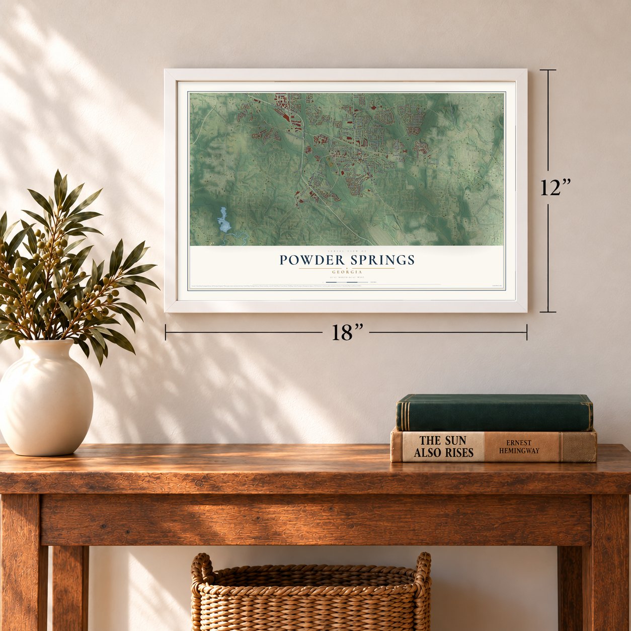
A new map of Powder Springs, Georgia, made in 2026 and printed to order on thick archival matte paper.
12" x 18" Archival Matte Print
A Map of Home. A Work of Art.
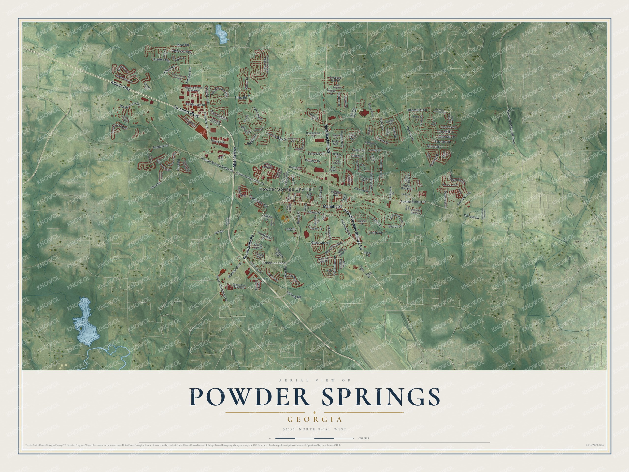
Explore Powder Springs, Georgia from a whole new perspective. Created using aerial imagery and detailed geographic data, this map captures Powder Springs building by building, with labeled streets, familiar landmarks, and shaded topographical relief that highlights the natural contours of the landscape.
Combining modern data with the timeless character of a vintage atlas, this map is just as interesting up close as it is beautiful on the wall. Whether you grew up in Powder Springs, spent memorable years there, or call it home today, this unique map is a great way to celebrate a place that means something to you. Zoom in on the preview to look for your street, and then order a print to put your memories on the wall.
Three ways to hang it
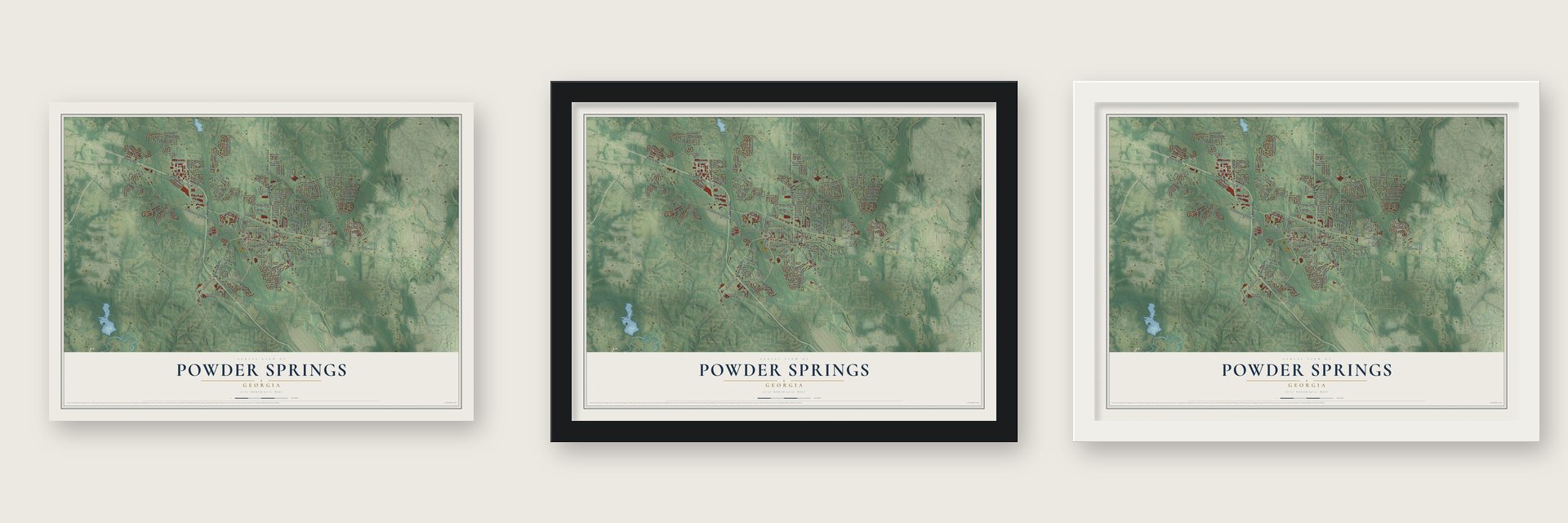
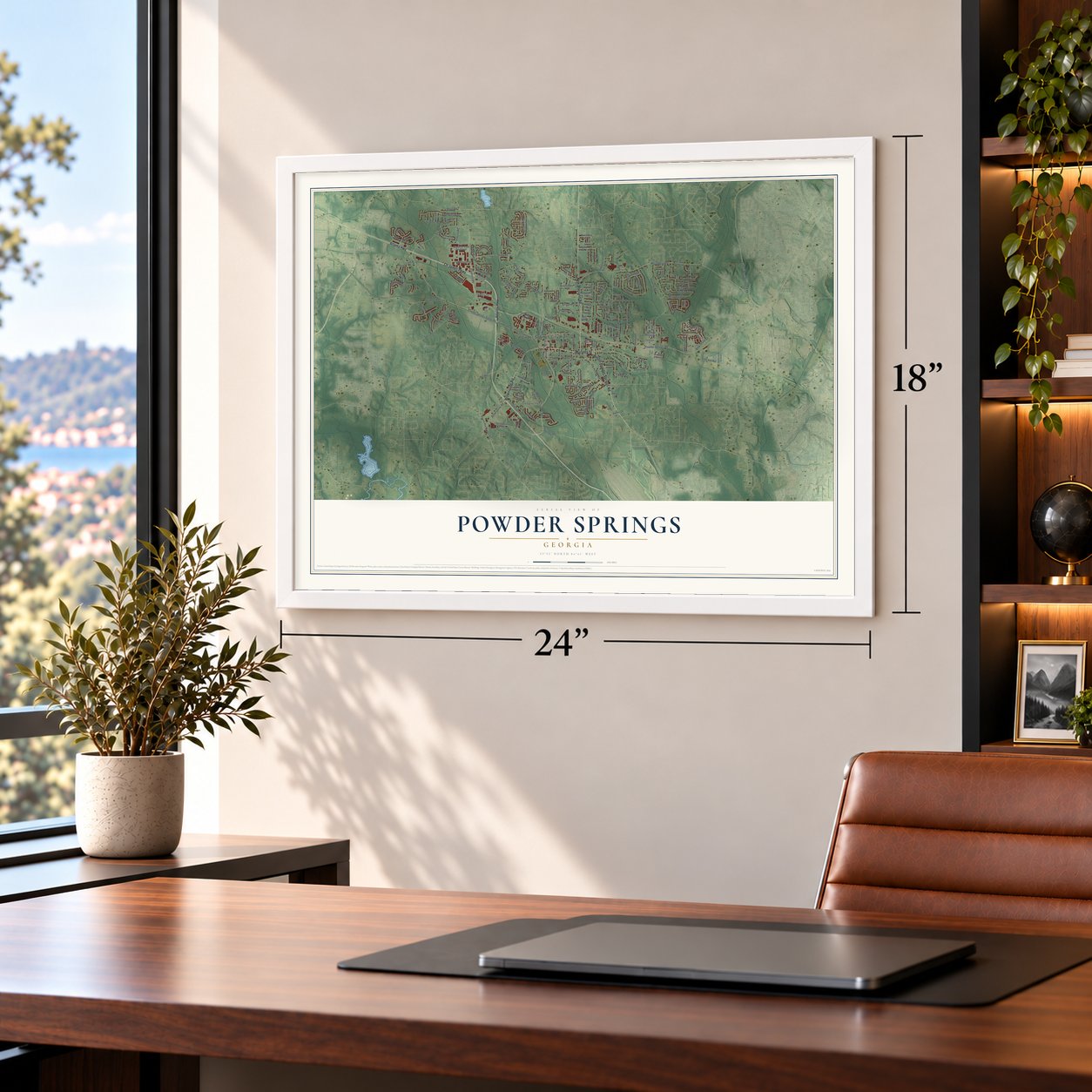
Unframed archival matte, a black wood frame or a white wood frame.
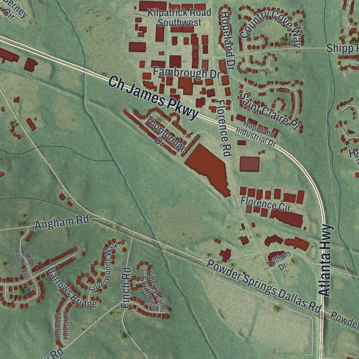
Up close
Geography Worth Displaying
This map was created using accurate cartographic data and authoritative geographic sources, including the U.S. Geological Survey (USGS) and FEMA. The map brings together terrain, waterways, roads, and building detail. The majority of the streets are labeled, houses are accurately depicted, and the topography is derived from government sources. Combining local data with carefully composed color and shading leads to this beautifully detailed Powder Springs artwork for your wall.
Rather than simply showing street outlines, we’ve included as many of the street names as we could reasonably fit on the map while keeping their names legible. Zoom in on the high resolution preview to see exactly what’s on the map. We truly set out to create a statement piece for anyone who loves Powder Springs. So whether it’s for you, or a gift for someone you love, we hope this map of Powder Springs brings back fond memories.
Explore the full map of Powder Springs, Georgia and read about the local places it shows.
About Powder Springs, Georgia
Powder Springs is a city of 16,887 people in southwestern Cobb County. Its first settlers came looking for gold, which had been found in Georgia a decade before the town was incorporated as Springville in 1838, on land that had belonged to two Cherokee leaders. The mines they worked at Lost Mountain and off Brownsville Road turned up very little of it. In those same years the Cherokee were forced off their land and removed to country beyond the Mississippi River along the Trail of Tears.
The town took its present name in 1859 from the seven springs inside the city limits. Their water carries some 26 minerals that stain the nearby sand black, and that dark sand had earlier given the place the name Gunpowder Springs.
- A skirmish in June 1864On June 20, 1864, troops clashed at Lattermore's Mills in a skirmish that was part of the Battle of Kennesaw Mountain, during General Sherman's campaign to take Atlanta. As the armies passed through, many enslaved people fled the plantations around Powder Springs and joined Sherman's forces, which gave them their freedom.
- Senator Russell's old schoolMcEachern High School stands on ground that was once a Native American burial ground and later the home of the Seventh District A&M School. Richard B. Russell, who went on to serve as a U.S. Senator from Georgia, was a student at the A&M school, and McEachern's administrative building now bears his name.
- Cobb County's first Black mayorIn 2015 Powder Springs voters chose Al Thurman as the city's first Black mayor. He was also the first African-American elected mayor of any town in Cobb County, in a year when several small Georgia towns elected Black mayors.
- A 12,000-seat stadiumWalter H. Cantrell Stadium in Powder Springs holds 12,000 people. It is used mostly for football and soccer.
Find your street
Names on the Powder Springs map
Every name below is printed on this map. Look for your street, your school, the park where you played, or the pond down the road.
Places and landmarks2
- Powder Springs City Hall
- Steeplechase
Streets and roads172
- Austell Powder Springs Road
- Marietta Street
- Atlanta Highway
- New Macland Road
- Ch James Parkway
- Brownsville Road
- Powder Springs Road
- Powder Springs Dallas Road
- Oglesby Road
- Sharon Drive
- Elliott Road
- Lewis Road
- Macedonia Road
- Falls Avenue
- Kathy Circle
- Hopkins Road
- Florence Road
- Forest Hill Road
- Mustang Drive
- Country Walk Drive
- Ernest West Barrett Parkway
- Lancer Drive
- Shipp Road
- Atlanta Street
- Dogwood Drive
- Evelyn Drive
- Lindley Circle
- Caley Mill Drive
- Nectar Drive
- Frank Aiken Road
Show all 172 streets
- Hopeland Drive
- Paddocks Way
- Old Austell Road
- Ponderosa Lane
- Palomino Drive
- Grady Grier Drive
- Sweetwater Avenue
- Moon Road
- Tommy Drive
- Country Cove Way
- Parks Drive
- Warren Farm Road
- Hill Road
- Silvercrest Court
- Mistymorn Way
- Lockerbie Lane
- Kipling Drive
- Flint Hill Road
- Lindley Drive
- Quarters Way
- Brooks Lane
- Dillard Street
- Long Street
- Creek Trce West
- Deercreek Drive
- Deer Chase
- Angham Road
- Pinetree Drive
- Finch Road
- Pinto Drive
- Fambrough Drive
- Caley Mill Lane
- Delhi Drive
- Saint Claire Place
- Pine Grove Drive
- Kilpatrick Road
- Hopkins Court
- Lagrone Street
- Hickory Lane
- Story Road
- Hillside Drive
- Glenn Street
- Butner Street
- Lynn Drive
- Powder Springs-Dallas Road
- Hiram Lithia Springs Road
- Murray Avenue
- Old Lost Mountain Road
- Lost Lakes Way Southwest
- Shelleydale Drive
- Brown Parkway
- Ashley Woods Drive
- Sharon Woods Drive
- Silver Mist Circle
- Akins Ridge Lane
- Sweetbriar Lane
- Compton Circle
- Bengal Drive
- Buck Road
- Mistymorn Lane
- Springdale Circle
- Kilpatrick Road Southwest
- Brickyard Way
- Valley Drive
- Weston Drive
- Integrity Way
- Woodbridge Drive
- Mooring Drive
- Thornbridge Drive
- Pinecrest Road
- Springtide Lane
- Spring Azalea Court
- Bartows Bridge
- North Avenue
- Akins Ridge Court
- Rose Petal Lane
- Misty Bleau Drive
- Lilly Brook Court
- Spring Gate Drive
- Caleb Crossing
- Berney Circle
- Old Villa Rica Road
- Morning Dew Drive
- Florence Circle
- Commodore Road
- Lafayette Drive
- Walton Street
- Groveland Park Drive
- Smith Drive
- Red Rose Drive
- Poplar Trail
- Louise Street
- Frances Drive
- Preston Place Lane
- Dilmus Drive
- Hickory Drive
- Sinaird Street
- Furlong Way
- Red Oak Drive
- Christian Drive
- Pony Lane
- Evelyn Way
- Port Lane
- Abney Drive
- Chrys Street
- Pineview Drive
- Villa Springs Circle
- Steeplechase Drive
- Blue Heron Pass
- Hopeland Industrial Drive
- Warren Creek Drive
- Oglesby Road Southwest
- Silverwoods Walk
- Blythewood Circle
- Vine Ridge Drive
- Bradford Lane
- Liberty Lane Southwest
- Dugger Drive
- Hubert Drive
- Pine Valley Drive
- Winding Lane
- Quarters Lane
- Flowering Springs
- Fairhaven Drive
- Maple Lane
- Calcutta Court
- Wylie Lane
- Trillium Drive
- Acorn Drive
- Mobley Drive
- Sanders Road Southwest
- Macedonia Road Southwest
- Silvery Way
- Yoshino Terrace Southwest
- Oakview Drive
- Birch Haven Trce
- Redwood Forest Lane
- Hopkins Cts
- Pembrooke Way
- Abbott Lane
- Beaumont Wood
- Caley Mill Court
Names are listed as they appear on the printed map. Zoom into the product photos to find them.
The art of mapping a place
How This Map Was Made
Real places. Remarkable detail. Discover the layers that turn geographic data into a map of home.

The view from above
Aerial imagery reveals the character of the land: woodland, open fields, and the patterns of a place.

The shape of the land
Elevation data brings hills, valleys, and subtle changes in the landscape into view.

The details of home
Roads, waterways, and building footprints come together to make the map feel unmistakably local.

Geography becomes art
Considered color, shading, and typography bring the layers together in a map made for your wall.


Process illustrated with Mendon, Massachusetts. Aerial imagery: USDA NAIP. Terrain: USGS 3D Elevation Program. Map details and finished artwork: KNOWOL.
The Details
About This Print
Choose an archival matte print, or a black or white Ayous wood frame. The archival matte print is unframed.
Select your size and finish above to see the matching product image and price.
Materials & Craftsmanship
A contemporary map with the character of a classic atlas, printed on archival matte paper. Optional frames are made from Ayous wood.
Your printed map does not include the watermark shown in the full-map preview.
Shipping & Delivery
Free shipping within the United States. Every print is made to order in the USA.
Buying a gift? Add a note in your cart and we'll include it. We never put prices in the package.
Prints ship within 2 to 3 business days. Allow 7 to 10 days total from ordering for delivery. Timing may vary during holidays or periods of high order volume.
Read our shipping policy.
Returns and damaged prints
Each print is made to order. Change-of-mind refunds are not available after production.
If your print arrives damaged, misprinted or incorrect, contact support@knowol.com within 30 days of receiving it. Include your order number, photos and a description of the issue.
Read our full refund and replacement policy. For questions about your order, email support@knowol.com.
Find your town
Looking for another city?
Find a map of home in our Georgia collection, or any town in the country.
Nearby
Maps of towns near Powder Springs
Know someone from one of these towns? Their map makes a great gift.
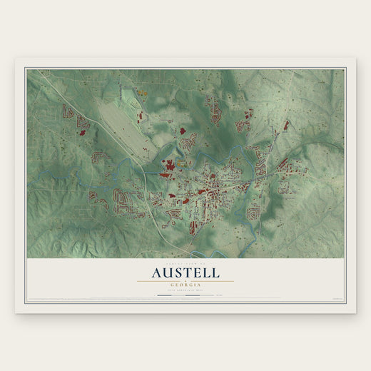 Austell
, Georgia
From $39.99See the map
 Hiram
Hiram, Georgia
From $39.99See the map
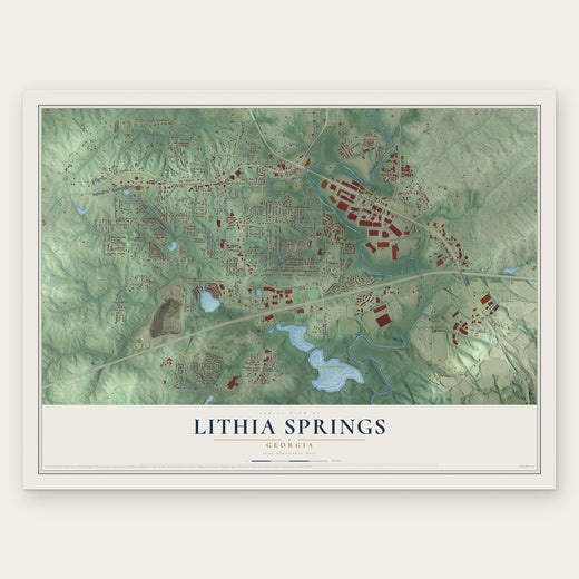 Lithia Springs
, Georgia
From $39.99See the map
More maps nearby: Mableton, Fair Oaks, Douglasville, Smyrna and Dallas.