
Search for another town





Free U.S. delivery 7 to 10 days after you order
Rocky Point, New York Map Art
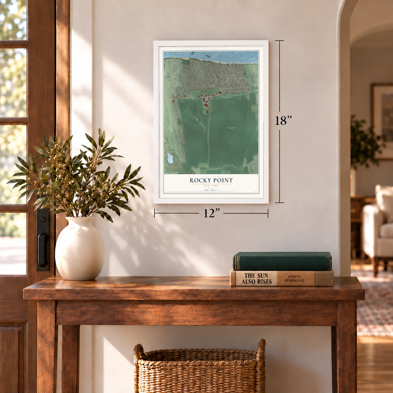
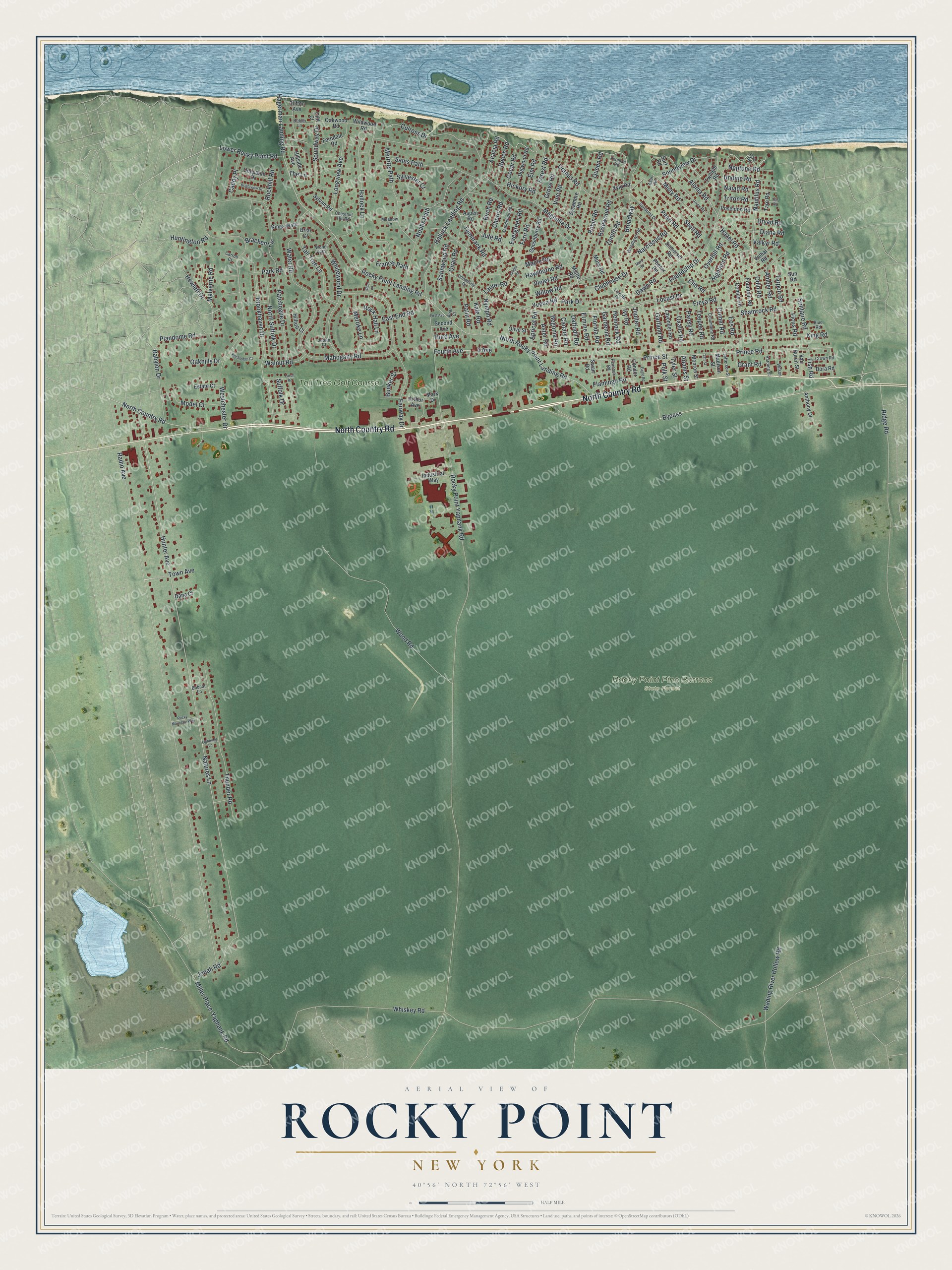
A new map of Rocky Point, New York, made in 2026 and printed to order on thick archival matte paper.
12" x 18" Archival Matte Print
A Map of Home. A Work of Art.
Bring a piece of Rocky Point home. Whether it’s where you grew up, your current home, or simply a moment in your life, this Rocky Point, New York map print brings those memories to your wall. Antique-inspired styling and modern geographic detail combine to create artwork that’s beautiful from across the room, with plenty to study and explore when you get up close.
Three ways to hang it
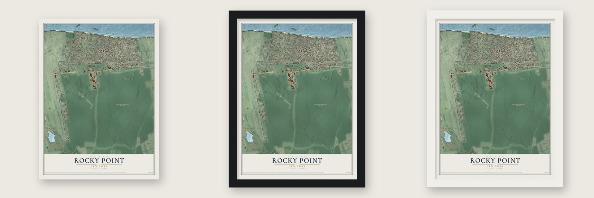
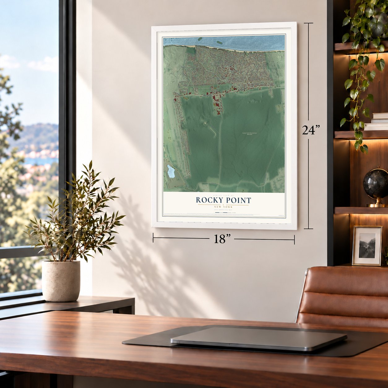
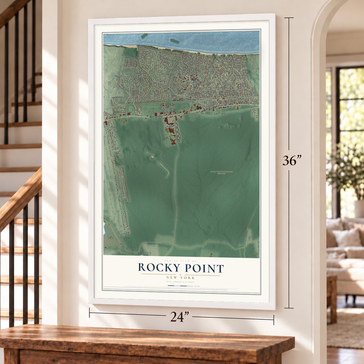
Unframed archival matte, a black wood frame or a white wood frame.
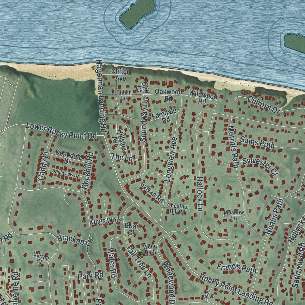
Up close
Real geography. Art worth displaying.
This map was created using accurate cartographic data and authoritative geographic sources, including the U.S. Geological Survey (USGS) and FEMA. The map brings together terrain, waterways, roads, and building detail. The majority of the streets are labeled, houses are accurately depicted, and the topography is derived from government sources. Combining local data with carefully composed color and shading leads to this beautifully detailed Rocky Point artwork for your wall.
Rather than simply showing street outlines, we’ve included as many of the street names as we could reasonably fit on the map while keeping their names legible. Zoom in on the high resolution preview to see exactly what’s on the map. We truly set out to create a statement piece for anyone who loves Rocky Point. So whether it’s for you, or a gift for someone you love, we hope this map of Rocky Point brings back fond memories.
Explore the full map of Rocky Point, New York and read about the local places it shows.

About Rocky Point, New York
New York State records Rocky Point as a hamlet and census-designated place. The 2020 census recorded 13,633 residents. Together, those details place Rocky Point within the everyday geography and public life of its part of New York.
- 13,633 residentsThe 2020 census recorded this population for Rocky Point.
- New York StateRocky Point is identified as a New York community.
Find your street
Names on the Rocky Point map
Every name below is printed on this map. Look for your street, your school, the park where you played, or the pond down the road.
Places and landmarks2
- Rocky Point Pine Barrens State Forest
- Tall Tree Golf Course
Streets and roads225
- North Country Road
- Bypass
- Nautilus Road
- Brookhaven Drive
- Locust Drive
- Soundview Drive
- Hunter Avenue
- Odin Road
- Acacia Road
- Natures Lane
- Aloma Road
- Rocky Point Yaphank Road
- Radio Avenue
- Whiskey Road
- Rocky Point Landing Road
- North Rocky Point Landing Road
- Ridge Road
- Westchester Drive
- Hallock Landing Road
- King Road
- Hallock Lane
- Patchogue Drive
- Prince Road
- Broadway
- Prince Street
- Mahogany Road
- Wood Road
- Magnolia Drive
- Friendship Drive
- Thunder Road
Show all 225 streets
- Dawn Road
- Freya Road
- Noahs Path
- Whitewood Drive
- Culross Drive
- Hawthorne Road
- Miller Place-Yaphank Road
- Water Road
- Cherry Road
- Tall Tree Lane
- Hewlett Drive
- Merritts Path
- Maple Road
- Longview Avenue
- Rosewood Road
- Narcissus Road
- Palm Road
- Walnut Road
- Shell Road
- Sams Path
- Robin Road
- North Suffolk Drive
- Wading River Hollow Road
- Uranus Road
- Soundway Drive
- Pearl Road
- Hickory Road
- Queen Road
- Ficus Road
- Fairway Drive
- Kale Road
- Town Avenue
- Tarpon Road
- Clubhouse Drive
- Misty Road
- Babylon Drive
- Zenith Road
- Jute Road
- Quail Road
- Amber Road
- Willow Road
- Elm Road
- Oakhills Drive
- Lower Rocky Point Road
- Meroke Lane
- Jonah Road
- Plandome Road
- Hagerman Landing Road
- Rock Hall Lane
- Shamrock Road
- Park Drive
- Highland Road
- Vine Road
- Eos Road
- Violet Road
- Satinwood Road
- 4 Avenue
- Fourth Avenue
- Laurel Road
- Tamarack Road
- Model Court
- Naiad Road
- Overhill Road
- Garland Road
- Neptune Road
- Hazel Road
- Undine Road
- Dryad Road
- Evergreen Road
- Caddy Place
- Teepee Road
- Forest Road
- Diana Road
- Beech Road
- Fern Road
- Sylvester Court
- Park Road
- Huntington Road
- Comet Road
- Flamingo Road
- Nymph Road
- Apricot Road
- Malverne Road
- Jupiter Road
- Birch Road
- Cedar Road
- East End Road
- Solitaire Road
- Ivy Road
- Grove Road
- Bunker Street
- Hemlock Road
- Suffolk Drive
- Aster Road
- Pansy Road
- Begonia Road
- Third Avenue
- Rockhill Road
- Canary Road
- Yucca Road
- Daffodil Road
- Francis Path
- Gardenia Road
- Oxalis Road
- Ermine Road
- Florida Road
- Triton Road
- Valkyr Road
- Bracken Lane
- Grant Road
- Clio Road
- Fish Road
- Polk Street
- Tyler Street
- Adams Street
- The Lane
- Twilight Road
- Somerset Road
- Sycamore Road
- Fountain Road
- Poseidon Road
- Comus Road
- Gooseberry Road
- Phenix Road
- Aspen Road
- Dogwood Road
- Industrial Way
- Anthony Drive
- Deepdale Drive
- Lavender Road
- Valhal Road
- Oakwood Road
- Condor Road
- Van Buren Street
- Wildwood Road
- Hillside Avenue
- Kings Walk
- Estate Court
- Monroe Street
- Dora Road
- Clifton Avenue
- Second Avenue
- Madison Street
- Ferndale Road
- Sylvan Road
- Hilltop Court
- Arthur Avenue
- Mistle Road
- Tarn Road
- Moss Road
- Mark Drive
- Dana Court
- Xylo Road
- Olive Street
- Surf Road
- Swan Road
- Briar Court
- Cliff Court
- Sun Road
- Lyre Road
- Sunburst Drive
- Woodlawn Road
- Dandelion Road
- Lincoln Drive
- Columbine Road
- University Drive
- Peacock Road
- Harding Street
- Crown Road
- Jefferson Street
- Chestnut Hill Road
- Wood Path
- Blue Road
- Meadow Lane
- Yeoman Road
- Bobcat Lane
- Carroll Court
- Judith Court
- Wilson
- Boblin Lane
- Ariel Court
- Azur Road
- Ozone Road
- Juniper Road
- Brightview Drive
- Larch Road
- Eagle Road
- Rocky Mountain Way
- Rockledge Court
- Lightning Lane
- Short Lane
- Mars Road
- First Avenue
- Taft Street
- Isis Road
Names are listed as they appear on the printed map. Zoom into the product photos to find them.
The art of mapping a place
How This Map Was Made
Real places. Remarkable detail. Discover the layers that turn geographic data into a map of home.

The view from above
Aerial imagery reveals the character of the land: woodland, open fields, and the patterns of a place.

The shape of the land
Elevation data brings hills, valleys, and subtle changes in the landscape into view.

The details of home
Roads, waterways, and building footprints come together to make the map feel unmistakably local.

Geography becomes art
Considered color, shading, and typography bring the layers together in a map made for your wall.


Process illustrated with Mendon, Massachusetts. Aerial imagery: USDA NAIP. Terrain: USGS 3D Elevation Program. Map details and finished artwork: KNOWOL.
The Details
About This Print
Choose an archival matte print, or a black or white Ayous wood frame. The archival matte print is unframed.
Select your size and finish above to see the matching product image and price.
Materials & Craftsmanship
A contemporary map with the character of a classic atlas, printed on archival matte paper. Optional frames are made from Ayous wood.
Your printed map does not include the watermark shown in the full-map preview.
Shipping & Delivery
Free shipping within the United States. Every print is made to order in the USA.
Buying a gift? Add a note in your cart and we'll include it. We never put prices in the package.
Prints ship within 2 to 3 business days. Allow 7 to 10 days total from ordering for delivery. Timing may vary during holidays or periods of high order volume.
Read our shipping policy.
Returns and damaged prints
Each print is made to order. Change-of-mind refunds are not available after production.
If your print arrives damaged, misprinted or incorrect, contact support@knowol.com within 30 days of receiving it. Include your order number, photos and a description of the issue.
Read our full refund and replacement policy. For questions about your order, email support@knowol.com.
Find your town
Looking for another city?
Find a map of home in our New York collection.
Nearby
Maps of towns near Rocky Point
Know someone from one of these towns? Their map makes a great gift.
 Shoreham
, New York
From $39.99See the map
 Sound Beach
, New York
From $39.99See the map
 Miller Place
, New York
From $39.99See the map
More maps nearby: East Shoreham, Middle Island, Ridge, Mount Sinai and Gordon Heights.