
Search for another town



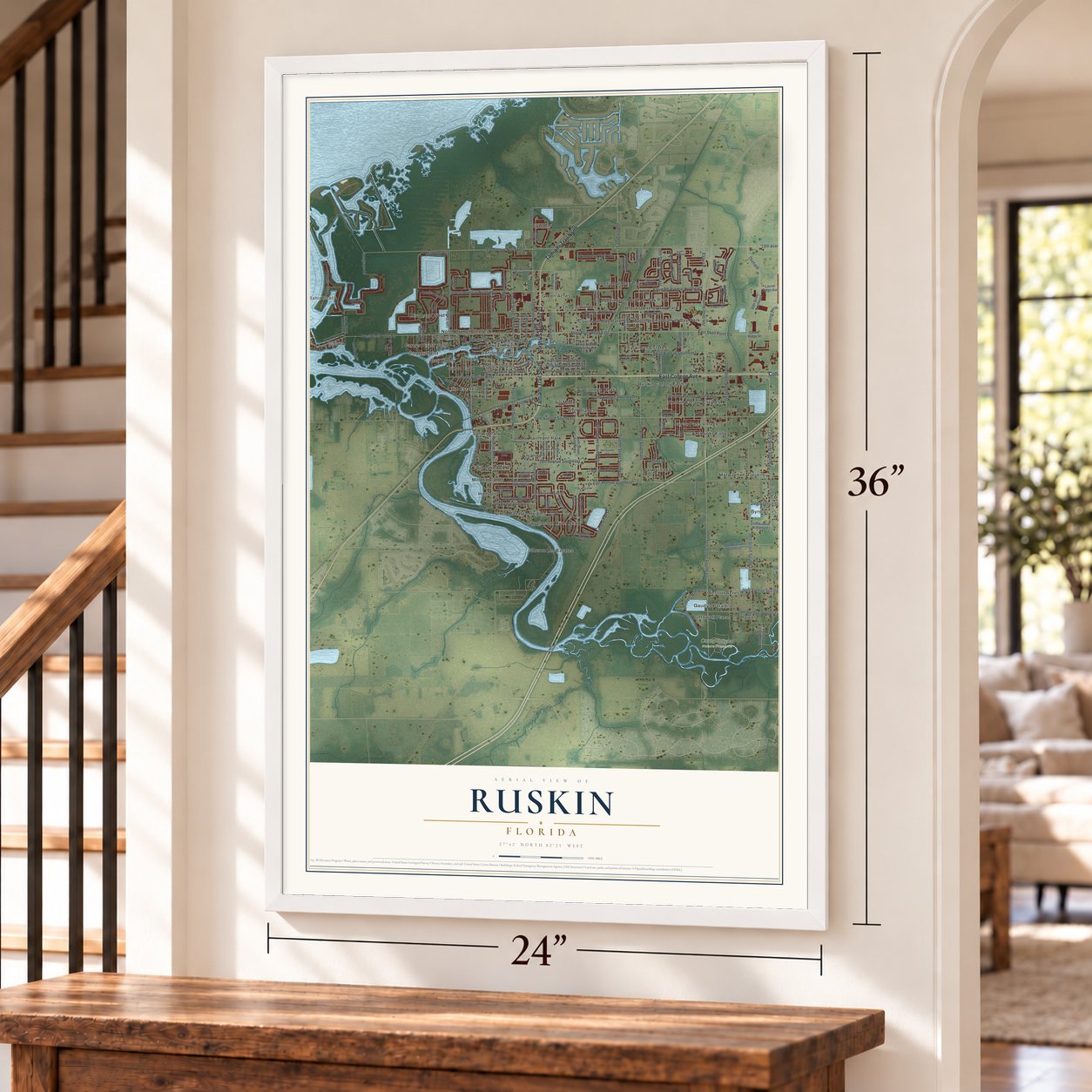

Free U.S. delivery 7 to 10 days after you order
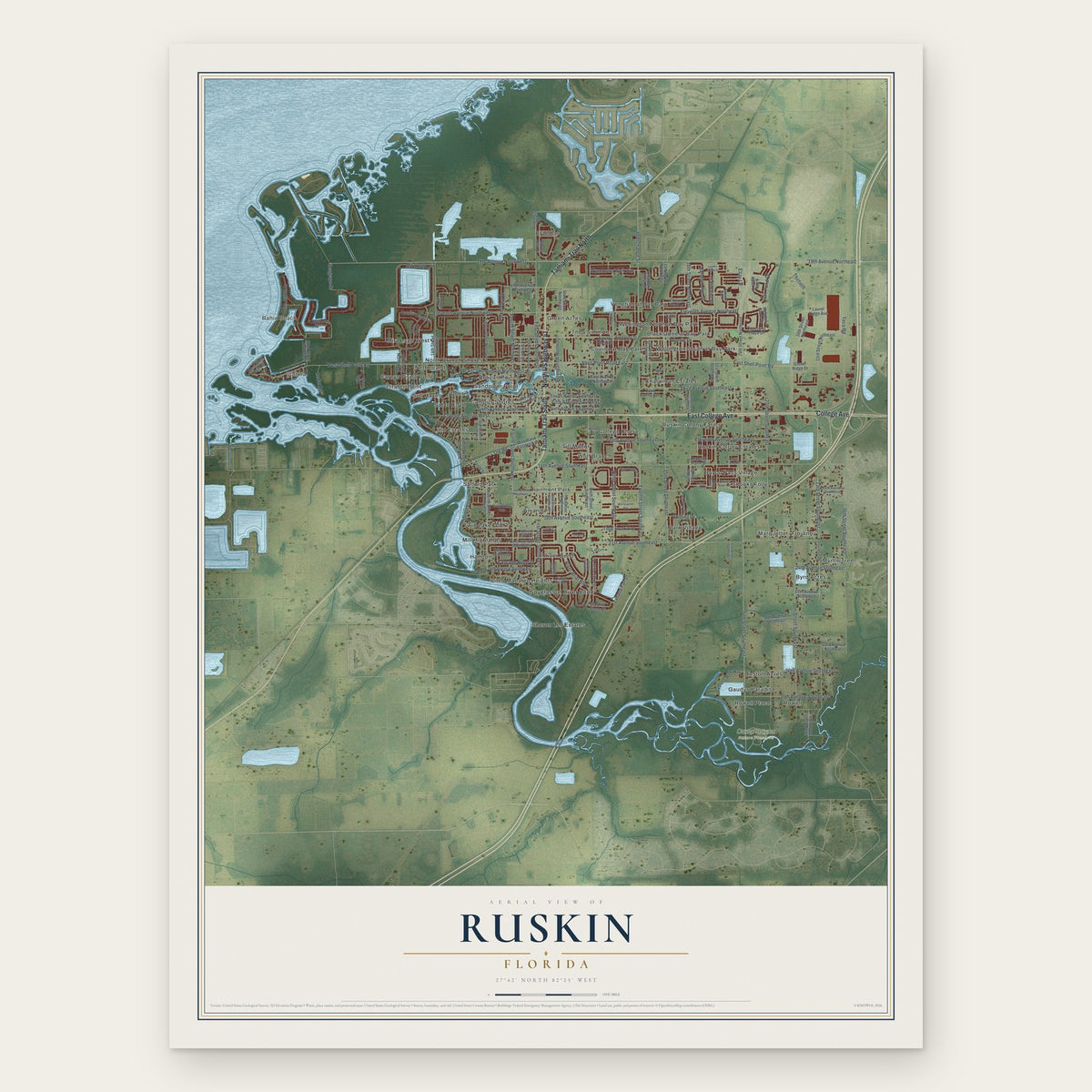
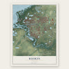
Ruskin, Florida Map Art
Building by building, with labeled streets and shaded relief.
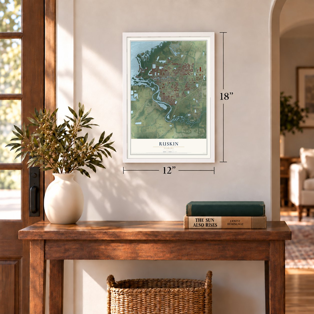
12" x 18" Archival Matte Print
A Map of Home. A Work of Art.
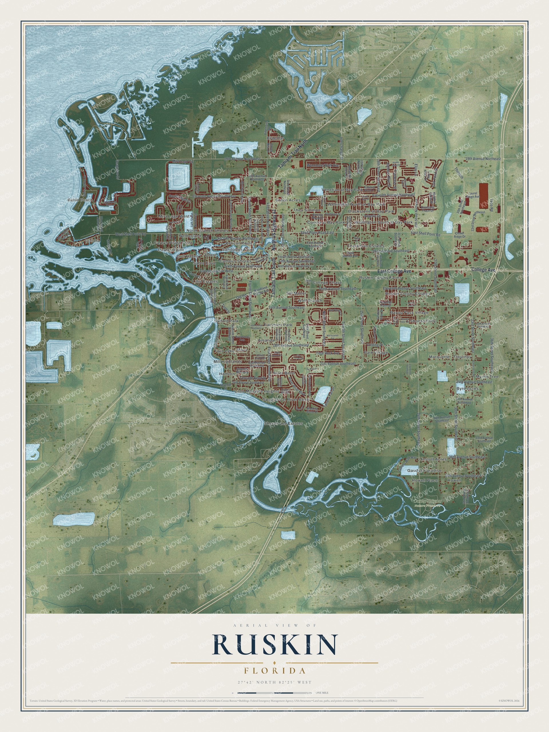
Explore Ruskin, Florida from a whole new perspective. Created using aerial imagery and detailed geographic data, this map captures Ruskin building by building, with labeled streets, familiar landmarks, and shaded topographical relief that highlights the natural contours of the landscape.
Combining modern data with the timeless character of a vintage atlas, this map is just as interesting up close as it is beautiful on the wall. Whether you grew up in Ruskin, spent memorable years there, or call it home today, this unique map is a great way to celebrate a place that means something to you. Zoom in on the preview to look for your street, and then order a print to put your memories on the wall.
Three ways to hang it
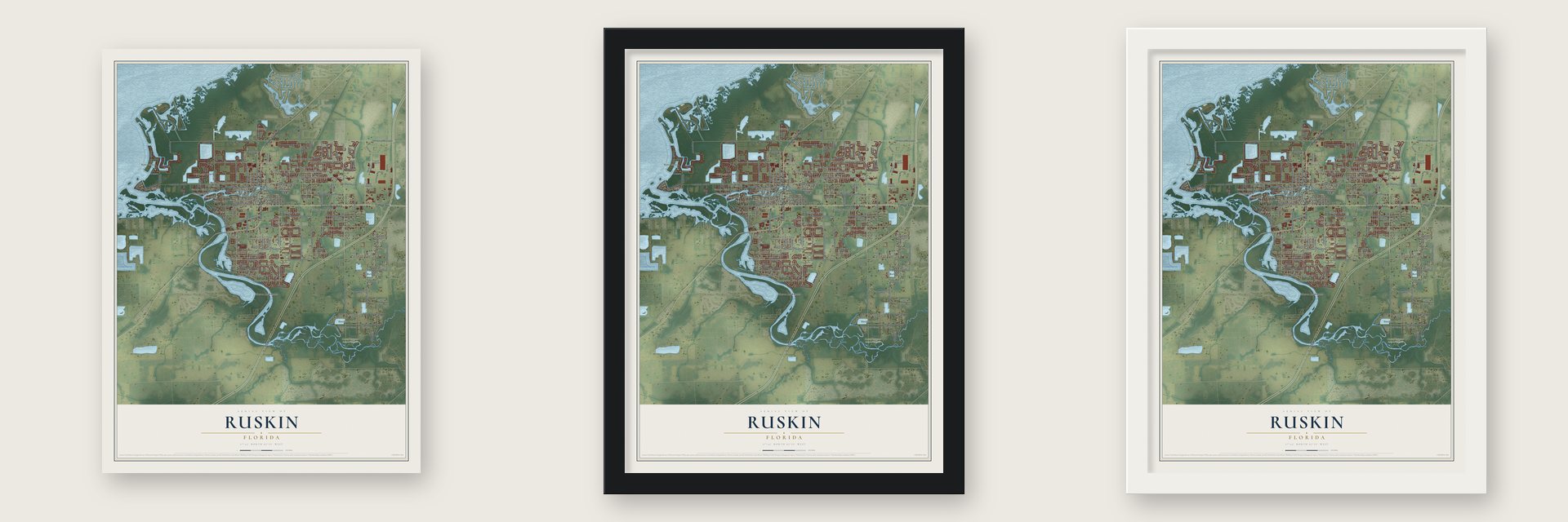
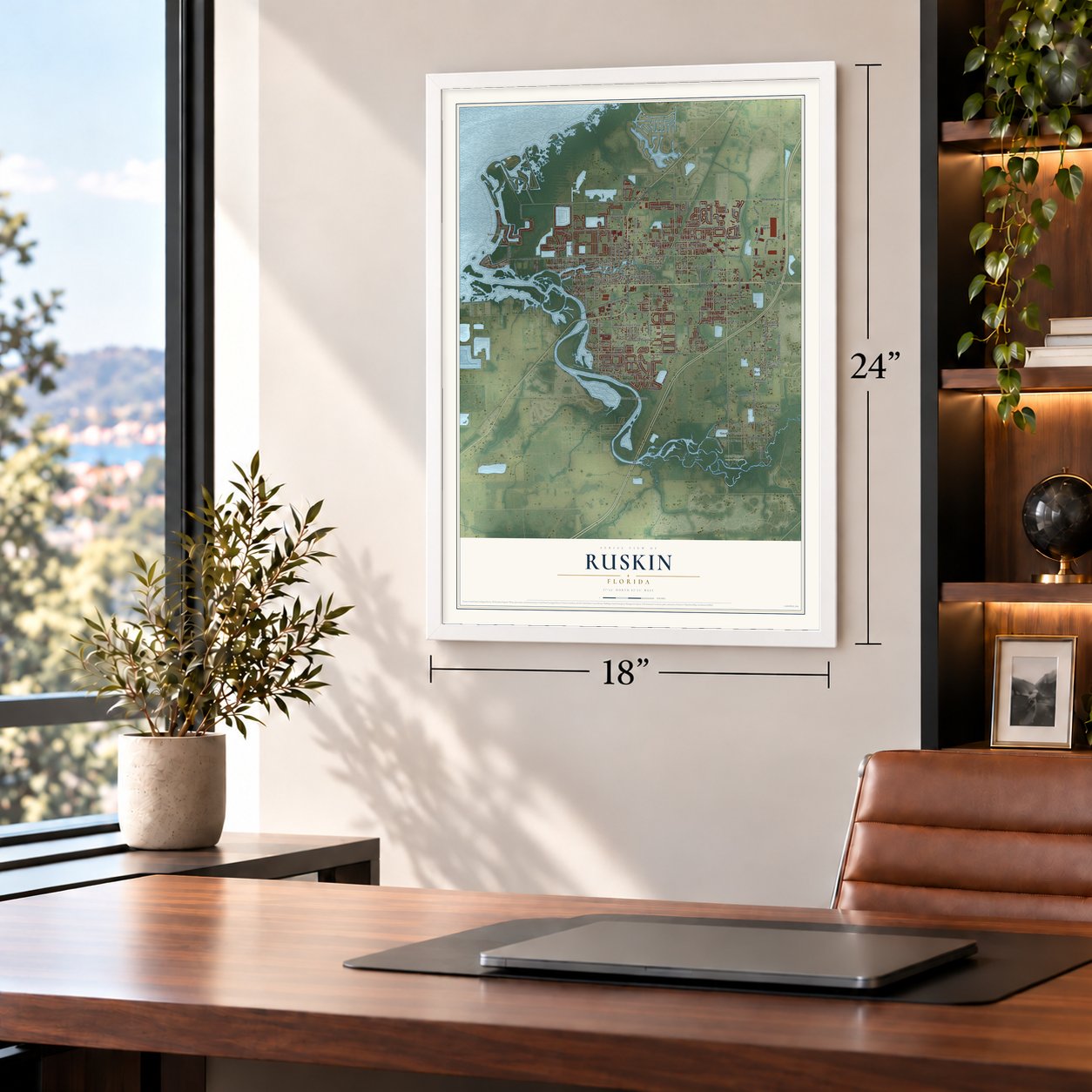
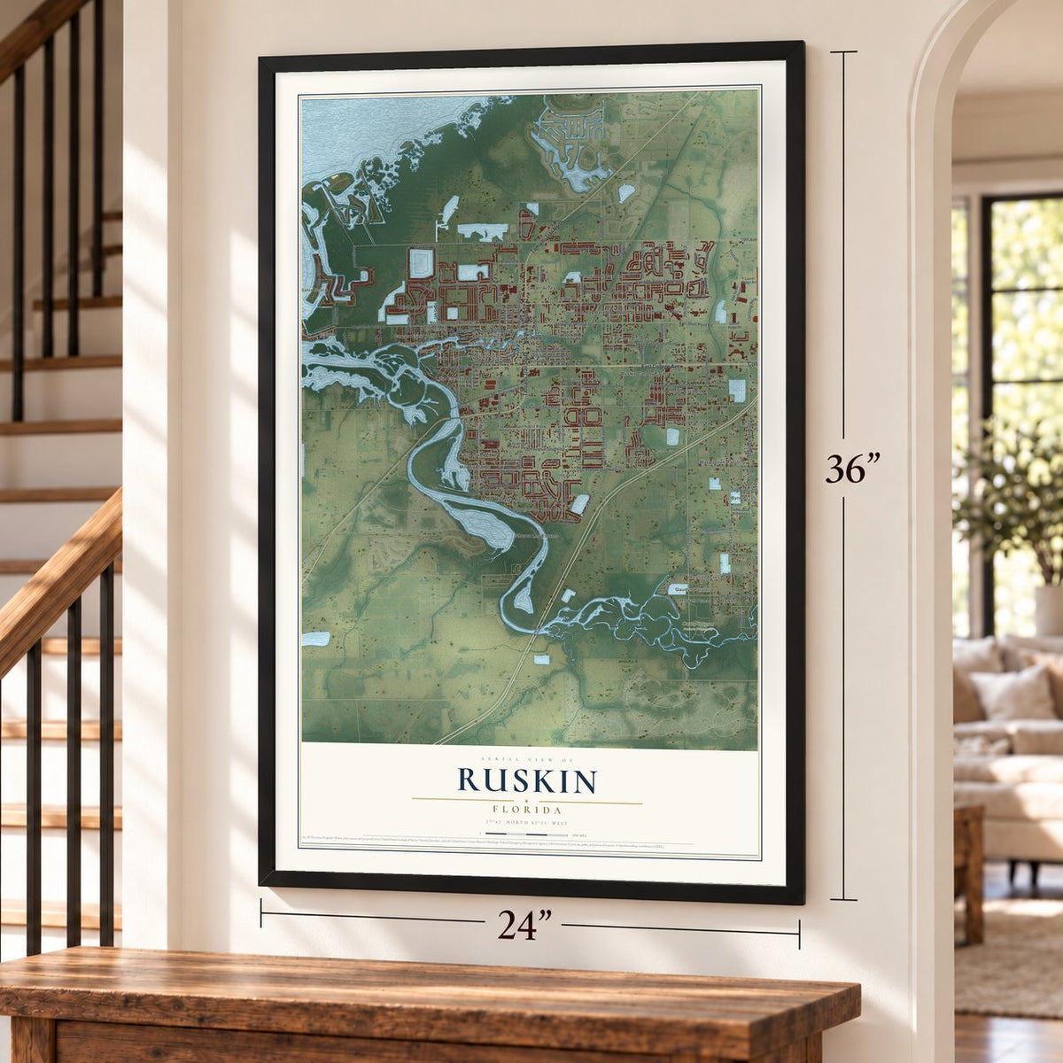
Unframed archival matte, a black wood frame or a white wood frame.
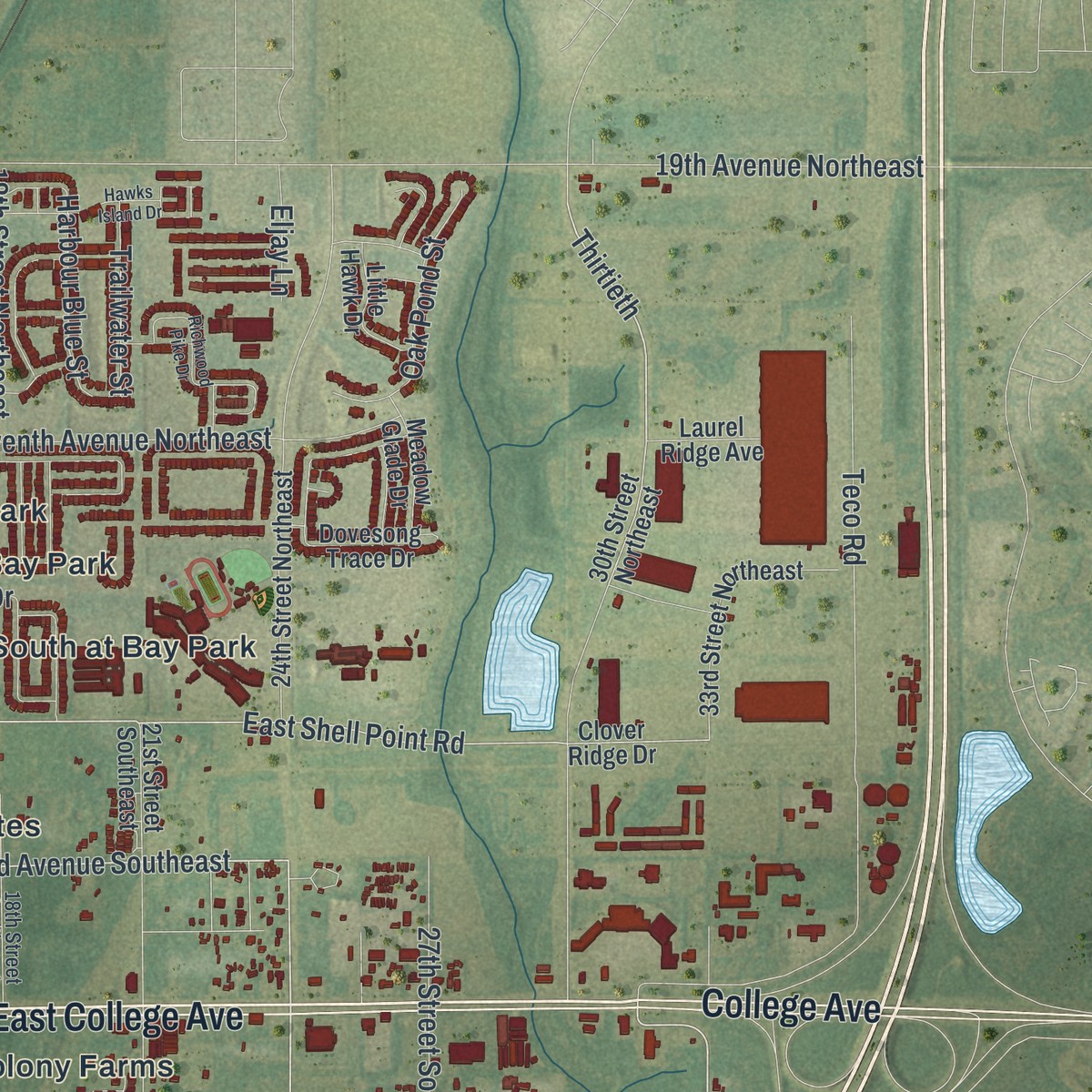
Up close
Geography Worth Displaying
This map was created using accurate cartographic data and authoritative geographic sources, including the U.S. Geological Survey and the Census Bureau. The map brings together terrain, waterways, roads, and building detail. The majority of the streets are labeled, houses are accurately depicted, and the topography is derived from government sources. Combining local data with carefully composed color and shading leads to this beautifully detailed Ruskin artwork for your wall.
Rather than simply showing street outlines, we’ve included as many of the street names as we could reasonably fit on the map while keeping their names legible. Zoom in on the high resolution preview to see exactly what’s on the map. We truly set out to create a statement piece for anyone who loves Ruskin. So whether it’s for you, or a gift for someone you love, we hope this map of Ruskin brings back fond memories.
Read the story behind this map of Ruskin, Florida from 2026.
Find your street
Names on the Ruskin map
Every name below is printed on this map. Look for your street, your school, the park where you played, or the pond down the road.
Places and landmarks52
- Bahia Beach
- Collura
- Camp Bayou Nature Preserve
- Wellington South at Bay Park
- Byrd Acres
- Fairmont Park
- Sheron Lee Estates
- Braemar
- Pelican Point
- Bayou Pass Village
- Gull Haven
- Twin Lake
Show all 52 places
- Park Village
- Green Acres
- College Chase
- River Bend
- Rowell
- Mira Lago West
- Chalaiman Estates
- Sill Manor
- Venetian at Bay Park
- Saffold Park
- Little Manatee Heights
- Marquette
- Covina at Bay Park
- Leon
- Myrtle Tree
- Ruskin Colony Farms
- Amanda
- Wolf Branch
- Lillie Estates
- Hamton
- Gaudys Paradise
- Spyglass at River Bend
- Campus Shores
- Ruskin Colony Estates
- Doerr
- Netherland
- Mays
- Thea Simmons
- Wellington North at Bay Park
- Careys Pirate Point
- Sable Cove
- Sandpiper Point
- Blackstone at Bay Park
- Shooks Folly
- Mill Highlands
- Pirates Point
- Onstott Acres
- Rowell Place
- North Branch Shores
- Flournoy
Streets and roads146
- East College Avenue
- North US Highway 41
- Tamiami Trail South
- Tamiami Trail North
- College Avenue
- 24th Street Southeast
- 33rd Street Southeast
- Third Avenue Southeast
- Fourth Street Northwest
- West Shell Point Road
- Shell Point Road East
- Thirtieth
- 19th Avenue Northwest
- East Shell Point Road
- Fourth Street Southwest
- Seagrape Drive
- Old Road
- 30th Street Southeast
- 14th Avenue Southeast
- 19th Avenue Northeast
- 21st Avenue Southeast
- 27th Street Southeast
- 36th Street Southeast
- 15th Street Southeast
- Eleventh Avenue Northeast
- First Street Southwest
- Teco Road
- Twelfth Street Southeast
- Mira Lago Circle
- 18th Avenue Southeast
Show all 146 streets
- Interchange Street
- Ninth Street Southeast
- Eleventh Avenue Northwest
- College Avenue West
- First Street Northwest
- Bonita Bluff Court
- Eleventh Avenue Southeast
- 39th Avenue Southeast
- Atlantic Drive
- Cascade Bend Drive
- Fifth Avenue Southeast
- Tenth Avenue Southeast
- 36th Avenue Southeast
- Second Avenue Northwest
- Parker Den Drive
- Harbour Blue Street
- Sixth Avenue Southwest
- 18th Street Northeast
- Tanana Fall Drive
- Oak Pond Street
- Tidal Rock Avenue
- 24th Avenue Southeast
- Colding Drive
- River Briar Boulevard
- Wynnmere Walk Avenue
- Trailwater Street
- Cedar Road
- Eljay Lane
- Emerson Street
- Third Street Northeast
- 15th Avenue Northwest
- Seventh Street Southwest
- Tenth Street Southwest
- First Avenue Northeast
- 30th Street Northeast
- Clover Ridge Drive
- Woodland Estates Avenue
- 21st Avenue Southwest
- Villemaire Road
- Sixth Street Southeast
- 21st Street Southeast
- 24th Street Northeast
- 14th Street Northwest
- 19th Street Northwest
- Clover Mist Drive
- 15th Street Northeast
- Saffold Park Drive
- Dakota Rock Drive
- 33rd Avenue Southeast
- Sixth Avenue Southeast
- Dovesong Trace Drive
- 30th Avenue Southeast
- Barclay Wood Drive
- Bahia del Sol Drive
- Fourth Avenue Southeast
- 24th Avenue Southwest
- Eighth Street Northwest
- Serenity Mill Loop
- 33rd Street Northeast
- Golden Glow Drive
- Alhambra Crest Drive
- Second Street Northeast
- Cypress Walk Way
- Peaceful Palm Street
- 32nd Street Southeast
- Circle Drive
- Washita Stone Drive
- 32nd Street Northwest
- Meadow Glade Drive
- Fred Ives Street
- Little Hawk Drive
- West Shell Point Drive
- 27th Avenue Southeast
- Casa Bonita Avenue
- Laurel Ridge Avenue
- Villa Maria Drive
- Tenth Street
- Seventh Street
- Yost Drive
- Seminole Sky Drive
- Fourth Avenue Southwest
- 16th Avenue Southeast
- Riverbreeze Ests
- Third Street Southeast
- Eighth Street Southwest
- Blue Bayou Circle
- 18th Street Southeast
- Second Street Northwest
- Lawrence Hall Street
- Redmond Brook Lane
- Orange Mill Avenue
- Stone Briar Drive
- Third Street Northwest
- Blue Rose Drive
- First Street Southeast
- 13th Street Northeast
- River Drive
- Potomac Mark Place
- Orca Court
- Sumner Acres Road
- Ninth Street Northeast
- York Dale Drive
- Yukon Cliff Drive
- Pine Terrace Drive
- Domino Drive North
- Richwood Pike Drive
- 16th Avenue Southwest
- Will Scarlett Avenue
- Christophers Watch Lane
- 23rd Street Southeast
- Eagle Summit Drive
- Bayou Pass Drive
- Delano Trent Street
- Hawks Island Drive
- Pleasant View Avenue
- Moon Cactus Court
Names are listed as they appear on the printed map. Zoom into the product photos to find them.
About Ruskin, Florida
Ruskin is a community of 28,620 people in Hillsborough County, on the north bank of the Little Manatee River. In 1907 Dr. George McAnelly Miller moved his family here. He was a former Chicago prosecutor who had led Ruskin College in Trenton, Missouri, and his brother-in-law, Albert Peter Dickman, brought his family too. They bought land and built homes, a sawmill and a school. The town counts August 7, 1908, as its birthday, the day Addie Dickman Miller opened a post office.
The town took its name from John Ruskin, the English writer whose ideas shaped the Arts and Crafts movement. The Ruskin Commongood Society platted the town on February 19, 1910. It set aside lots for a college, a business district, two parks and the founding families, and it let only white people buy or lease land. That year the Millers opened a new Ruskin College, where students worked part of each day to pay their way. It grew to 160 students, but most left to fight in World War I and the college closed. A fire destroyed it in 1918, and Dr. Miller died in August 1919.
- A town that outlived its collegeWhen the college burned in 1918, Ruskin had 200 residents, called Ruskinites, and most of them were truck growers. The town kept a syrup factory, a sawmill, a turpentine still, a blacksmith, a newspaper and three general stores. The railroad had linked Ruskin to the Seaboard Air Line in 1913, and by 1930 the town had grown to 709 people.
- Tomato Festival since 1935Ruskin's muck land rests on marl, which keeps fertilizer from soaking too deep, so the soil suits tomatoes. Farmers worked together and the town thrived through the Depression. In 1935 it started the Ruskin Tomato Festival, with vegetable displays and a queen voted the most popular woman. The festival is still held every May. By 1982 Ruskin grew about 3,000 acres of tomatoes a year.
- The Big Draw since 2008Ruskin began its yearly Big Draw in 2008 to mark the town's 100th anniversary. That year artist Michael Parker led local teens and adults in drawing the Ruskin Community Mural. Its design came from John Ruskin's belief that happiness needs the head, the heart and the hand.
Keep exploring Florida
Ruskin is one of 1,039 Florida towns we've mapped. Every dot on the map is a print of its own.
The search covers every state, Florida first.
Near Ruskin
Order 2 or more town maps and save 10%. Shown in the size and finish you picked above, so they hang as a set.
- Apollo Beach 12" x 18" / Archival Matte Print $39.99
- Sun City Center 12" x 18" / Archival Matte Print $39.99
- Wimauma 12" x 18" / Archival Matte Print $39.99


More maps nearby: Balm, Gibsonton, Parrish, Riverview and Palm View.
The art of mapping a place
How This Map Was Made
Real places. Remarkable detail. Discover the layers that turn geographic data into a map of home.

The view from above
Aerial imagery reveals the character of the land: woodland, open fields, and the patterns of a place.

The shape of the land
Elevation data brings hills, valleys, and subtle changes in the landscape into view.

The details of home
Roads, waterways, and building footprints come together to make the map feel unmistakably local.

Geography becomes art
Considered color, shading, and typography bring the layers together in a map made for your wall.


Process illustrated with Mendon, Massachusetts. Aerial imagery: USDA NAIP. Terrain: USGS 3D Elevation Program. Map details and finished artwork: KNOWOL.
The Details
About This Print
Choose an archival matte print, or a black or white Ayous wood frame. The archival matte print is unframed.
Select your size and finish above to see the matching product image and price.
Materials & Craftsmanship
A contemporary map with the character of a classic atlas, printed on archival matte paper. Optional frames are made from Ayous wood.
Your printed map does not include the watermark shown in the full-map preview.
Shipping & Delivery
Free shipping within the United States. Every print is made to order in the USA.
Buying a gift? Add a note in your cart and we'll include it. We never put prices in the package.
Prints ship within 2 to 3 business days. Allow 7 to 10 days total from ordering for delivery. Timing may vary during holidays or periods of high order volume.
Read our shipping policy.
Returns and damaged prints
Each print is made to order. Change-of-mind refunds are not available after production.
If your print arrives damaged, misprinted or incorrect, contact support@knowol.com within 30 days of receiving it. Include your order number, photos and a description of the issue.
Read our full refund and replacement policy. For questions about your order, email support@knowol.com.