


Search for another town


Free U.S. delivery 7 to 10 days after you order
Santa Rosa, California Map Art
Building by building, with labeled streets and shaded relief.
12" x 18" Archival Matte Print
A Map of Home. A Work of Art.
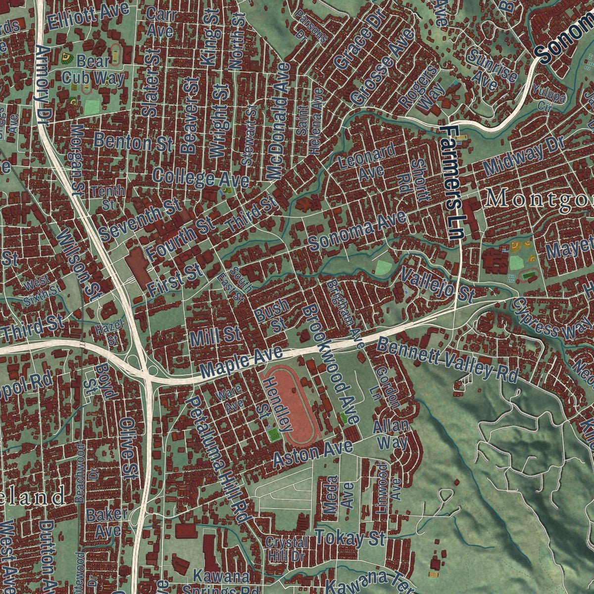
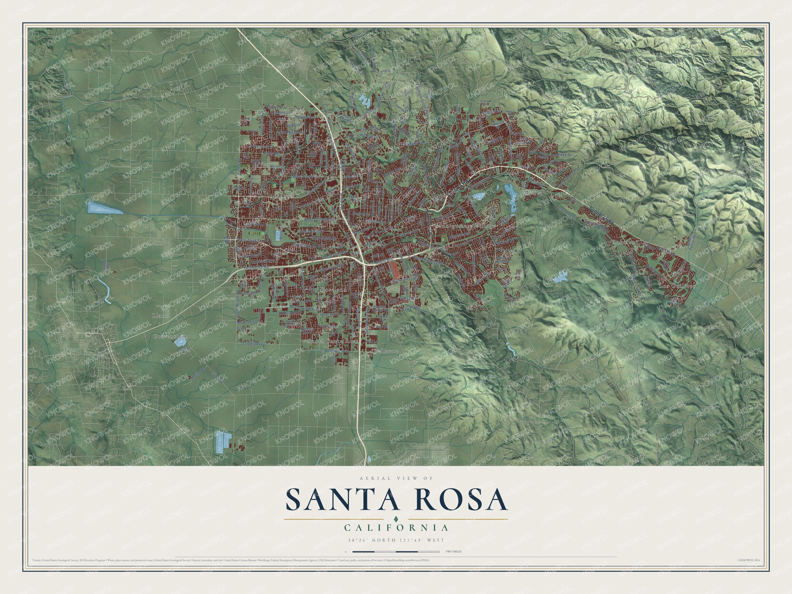
Explore Santa Rosa, California from a whole new perspective. Created using aerial imagery and detailed geographic data, this map captures Santa Rosa building by building, with labeled streets, familiar landmarks, and shaded topographical relief that highlights the natural contours of the landscape.
Combining modern data with the timeless character of a vintage atlas, this map is just as interesting up close as it is beautiful on the wall. Whether you grew up in Santa Rosa, spent memorable years there, or call it home today, this unique map is a great way to celebrate a place that means something to you. Zoom in on the preview to look for your street, and then order a print to put your memories on the wall.
Three ways to hang it

Unframed archival matte, a black wood frame or a white wood frame.
Up close
Geography Worth Displaying
This map was created using accurate cartographic data and authoritative geographic sources, including the U.S. Geological Survey and the Census Bureau. The map brings together terrain, waterways, roads, and building detail. The majority of the streets are labeled, houses are accurately depicted, and the topography is derived from government sources. Combining local data with carefully composed color and shading leads to this beautifully detailed Santa Rosa artwork for your wall.
Rather than simply showing street outlines, we’ve included as many of the street names as we could reasonably fit on the map while keeping their names legible. Zoom in on the high resolution preview to see exactly what’s on the map. We truly set out to create a statement piece for anyone who loves Santa Rosa. So whether it’s for you, or a gift for someone you love, we hope this map of Santa Rosa brings back fond memories.
Read the story behind this map of Santa Rosa, California from 2026.

Find your street
Names on the Santa Rosa map
Every name below is printed on this map. Look for your street, your school, the park where you played, or the pond down the road.
Places and landmarks10
- Bellevue
- Gravenstein
- Llano
- Los Guilicos
- Melita
- Monroe
- Montgomery Village
- Oakmont
- Roseland
- South Santa Rosa
Streets and roads279
- Sonoma Highway
- Farmers Lane
- Fulton Road
- West Third Street
- Guerneville Road
- Sebastopol Road
- Santa Rosa Avenue
- Fourth Street
- West Eighth Street
- West Steele Lane
- Steele Lane
- Northpoint Parkway
- White Oak Drive
- Knolls Drive
- West Ninth Street
- Fountaingrove Parkway
- Bennett Valley Road
- Fountain Grove Parkway
- Stony Point Road
- Oakmont Drive
- Occidental Road
- Cleveland Avenue
- Mendocino Avenue
- Sonoma Avenue
- Hoen Avenue
- Yulupa Avenue
- Montecito Boulevard
- Dutton Avenue
- Chanate Road
- West College Avenue
Show all 279 streets
- Parker Hill Road
- Piner Road
- Coffey Lane
- Corby Avenue
- Brookwood Avenue
- Peterson Lane
- Llano Road
- Jennings Avenue
- Skyfarm Drive
- Brush Creek Road
- Humboldt Street
- Hearn Avenue
- Melita Road
- Escalero Road
- Calistoga Road
- Range Avenue
- Stone Bridge Road
- Bellevue Avenue
- Petaluma Hill Road
- Channel Drive
- Marlow Road
- San Miguel Road
- South Wright Road
- College Avenue
- Middle Rincon Road
- Oak Leaf Drive
- Pinercrest Drive
- Badger Road
- Slater Street
- Cross Creek Road
- Vallejo Street
- West Avenue
- Beaver Street
- Midway Drive
- Hopper Avenue
- Mission Boulevard
- Great Heron Drive
- Los Olivos Road
- Francisco Avenue
- Pythian Road
- Alta Vista Avenue
- King Street
- Waltzer Road
- Ludwig Avenue
- Wright Street
- Maple Avenue
- Armory Drive
- Kawana Terrace
- Mayette Avenue
- Los Alamos Road
- Fresno Avenue
- Benton Street
- Aston Avenue
- Bethards Drive
- Olive Street
- Crown Hill Drive
- Glenbrook Drive
- Valley West Drive
- Tokay Street
- Marino Road
- Hardies Lane
- Airway Drive
- Grosse Avenue
- Wild Oak Drive
- Dennis Lane
- Grace Drive
- Stonehedge Drive
- Seventh Street
- Slate Drive
- Donahue Avenue
- McDonald Avenue
- Dowd Drive
- Lake Park Drive
- Parktrail Drive
- Hexem Avenue
- Burt Street
- Sunhawk Drive
- Wilson Street
- Brandee Lane
- Elliott Avenue
- Boas Drive
- Canyon Drive
- Tuxhorn Drive
- Acacia Lane
- First Street
- Mill Street
- Morgan Street
- Hall Road
- Baker Avenue
- Third Street
- Corporate Center Parkway
- Montgomery Drive
- Summerfield Road
- Montecito Avenue
- Kawana Springs Road
- Thomas Lake Harris Drive
- Round Barn Boulevard
- Yerba Buena Road
- Hidden Valley Drive
- Neotomas Avenue
- Saint Andrews Drive
- North Street
- Hendley Street
- Ridley Avenue
- Copperfield Drive
- Benicia Drive
- Fairfield Drive
- Old Redwood Highway
- Link Lane
- Baird Road
- North Pythian Road
- Owls Nest Drive
- County Center Drive
- Newanga Avenue
- West Hearn Avenue
- Meda Avenue
- Brittain Lane
- Carr Avenue
- Montclair Drive
- Lombardi Lane
- Cypress Way
- Giffen Avenue
- Annadel Heights Drive
- Jack London Drive
- Marsh Road
- Woodview Drive
- Oak Mesa Drive
- Dogwood Drive
- Edgewater Drive
- Sunrise Avenue
- Finley Avenue
- Buena Vista Drive
- Leonard Avenue
- Yolanda Avenue
- Edwards Avenue
- Bear Cub Way
- Contra Costa Avenue
- Leete Avenue
- Yeager Drive
- Madera Avenue
- McBride Lane
- Parkview Drive
- Rogers Way
- Kerry Lane
- Marit Drive
- Shortt Road
- Sanford Road
- Ditty Avenue
- Halyard Drive
- Allan Way
- Raters Drive
- Bellevue Ranch
- Crest Drive
- Victoria Drive
- Boyd Street
- Pfister Road
- Hoyal Drive
- Terry Road
- Leddy Avenue
- Rose Avenue
- Pyle Avenue
- Apache Street
- Jeremy Court
- Floral Way
- De Meo Street
- Butte Drive
- Elsa Drive
- Doyle Road
- Tracy Avenue
- Bush Street
- Golf View Court
- Nyla Place
- Brey Road
- Vera Drive
- Linwood Avenue
- Industrial Drive
- Sleepy Hollow Drive
- Lance Drive
- Rincon Ridge
- Altruria Drive
- Valley Oaks Drive
- Fir Ridge Drive
- McMinn Avenue
- Gordon Lane
- Stewart Street
- Carissa Avenue
- Tenth Street
- Cunningham Way
- Donna Maria Way
- Appletree Drive
- Kelsey Knolls
- Leo Drive
- Saint Helena Avenue
- Brigham Avenue
- Jacqueline Drive
- Surrey Drive
- Adobe Drive
- Juniper Avenue
- Crystal Hill Drive
- Springs Road
- Cass Road
- Rincon Avenue
- Zurlo Way
- Apollo Way
- Round Barn Circle
- Burbank Avenue
- Hillsboro Circle
- Sequoia Circle
- Lomitas Avenue
- South East Street
- Hadley Hill Drive
- Yulupa Circle
- Lakeview Drive
- Beachwood Drive
- Arroyo Sierra Circle
- Poppy Drive
- Silva Avenue
- Orchard Blossom Drive
- Oak Trail Drive
- Brand Road
- Gardner Avenue
- Campbell Drive
- Trail Ridge Place
- Wren Drive
- Iroquois Street
- Orleans Street
- Wall Place
- Bancroft Drive
- West Sixth Street
- Bock Street
- Whitewood Drive
- Ware Avenue
- Mountain Hawk Drive
- Skycrest Way
- Parsons Drive
- Charro Drive
- Velma Avenue
- Wallace Road
- Parker Hill Lane
- Lake Park Court
- Long Leaf Court
- Fistor Drive
- Amy Avenue
- Briggs Avenue
- Hazel Street
- Miller Drive
- Maria Lane
- Lane Lane
- Gold Drive
Names are listed as they appear on the printed map. Zoom into the product photos to find them.
About Santa Rosa, California
Santa Rosa is a city of 178,127 people and the seat of Sonoma County, on the Santa Rosa Plain about 55 miles north of San Francisco. Before Europeans came, the plain belonged to a Pomo tribe, the Bitakomtara, who met for ceremonies on Santa Rosa Creek and let no one cross their land without permission. Mexican colonists founded Santa Rosa in 1833 and named it for Saint Rose of Lima. María López de Carrillo and her relatives put up an adobe there in the 1830s, on their land grant, Rancho Cabeza de Santa Rosa.
The United States won California in the Mexican-American War. Soon a general store and a Wells Fargo post opened on the ground that is downtown today. In the mid-1850s Julio Carrillo, María's son, and other leading residents laid out a street grid around a public square, today's Old Courthouse Square, and downtown still follows that plan. The county recognized Santa Rosa as a city in 1867, and the state confirmed it in 1868. By the 1870 census it was California's eighth-largest city.
- La Matanza on the creekBy the 1820s, settlers from Sonoma and other places to the south already grazed livestock here. They butchered their animals where Matanzas Creek meets Santa Rosa Creek, near today's Santa Rosa and Sonoma avenues. The spot came to be called La Matanza, the slaughtering place, which is most likely how Matanzas Creek got its name.
- Downtown lost in 1906The 1906 San Francisco earthquake wrecked nearly all of downtown Santa Rosa, though the population held up and grew slowly afterward. A U.S. Geological Survey map released on November 21, 2005, found that the shaking was strongest between Santa Rosa and today's Sebastopol. For its size, Santa Rosa took more damage than any other city the quake struck.
- A civil defense headquartersIn 1958 the federal Office of Civil and Defense Mobilization made Santa Rosa one of its eight regional headquarters. It ran Region 7, which covered California, Arizona, Nevada, Utah, Hawaii, Guam and American Samoa. The city stayed a major civil defense center until 1979, when FEMA took over that work.
- The Tubbs Fire of 2017On the night of October 8, 2017, the Tubbs Fire swept in from Napa County, where it started near Tubbs Lane and Highway 128. The 45,000-acre fire killed at least 19 people in Sonoma County. It destroyed five percent of the city's homes, including most of the houses in Coffey Park and Fountain Grove.
Keep exploring California
Santa Rosa is one of 1,990 California towns we've mapped. Every dot on the map is a print of its own.
The search covers every state, California first.
Near Santa Rosa
Order 2 or more town maps and save 10%. Shown in the size and finish you picked above, so they hang as a set.
- Fulton 12" x 18" / Archival Matte Print $39.99
- Larkfield-Wikiup 12" x 18" / Archival Matte Print $39.99
- Rohnert Park 12" x 18" / Archival Matte Print $39.99
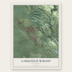
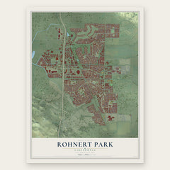
More maps nearby: Sebastopol, Sonoma State University, Cotati, Windsor and Graton.
The art of mapping a place
How This Map Was Made
Real places. Remarkable detail. Discover the layers that turn geographic data into a map of home.

The view from above
Aerial imagery reveals the character of the land: woodland, open fields, and the patterns of a place.

The shape of the land
Elevation data brings hills, valleys, and subtle changes in the landscape into view.

The details of home
Roads, waterways, and building footprints come together to make the map feel unmistakably local.

Geography becomes art
Considered color, shading, and typography bring the layers together in a map made for your wall.


Process illustrated with Mendon, Massachusetts. Aerial imagery: USDA NAIP. Terrain: USGS 3D Elevation Program. Map details and finished artwork: KNOWOL.
The Details
About This Print
Choose an archival matte print, or a black or white Ayous wood frame. The archival matte print is unframed.
Select your size and finish above to see the matching product image and price.
Materials & Craftsmanship
A contemporary map with the character of a classic atlas, printed on archival matte paper. Optional frames are made from Ayous wood.
Your printed map does not include the watermark shown in the full-map preview.
Shipping & Delivery
Free shipping within the United States. Every print is made to order in the USA.
Buying a gift? Add a note in your cart and we'll include it. We never put prices in the package.
Prints ship within 2 to 3 business days. Allow 7 to 10 days total from ordering for delivery. Timing may vary during holidays or periods of high order volume.
Read our shipping policy.
Returns and damaged prints
Each print is made to order. Change-of-mind refunds are not available after production.
If your print arrives damaged, misprinted or incorrect, contact support@knowol.com within 30 days of receiving it. Include your order number, photos and a description of the issue.
Read our full refund and replacement policy. For questions about your order, email support@knowol.com.