
Search for another town





Free U.S. delivery 7 to 10 days after you order
Savannah, Georgia Map Art
Building by building, with labeled streets and shaded relief.
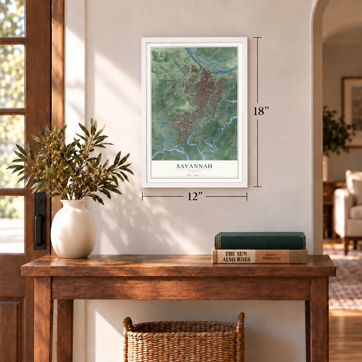
12" x 18" Archival Matte Print
A Map of Home. A Work of Art.
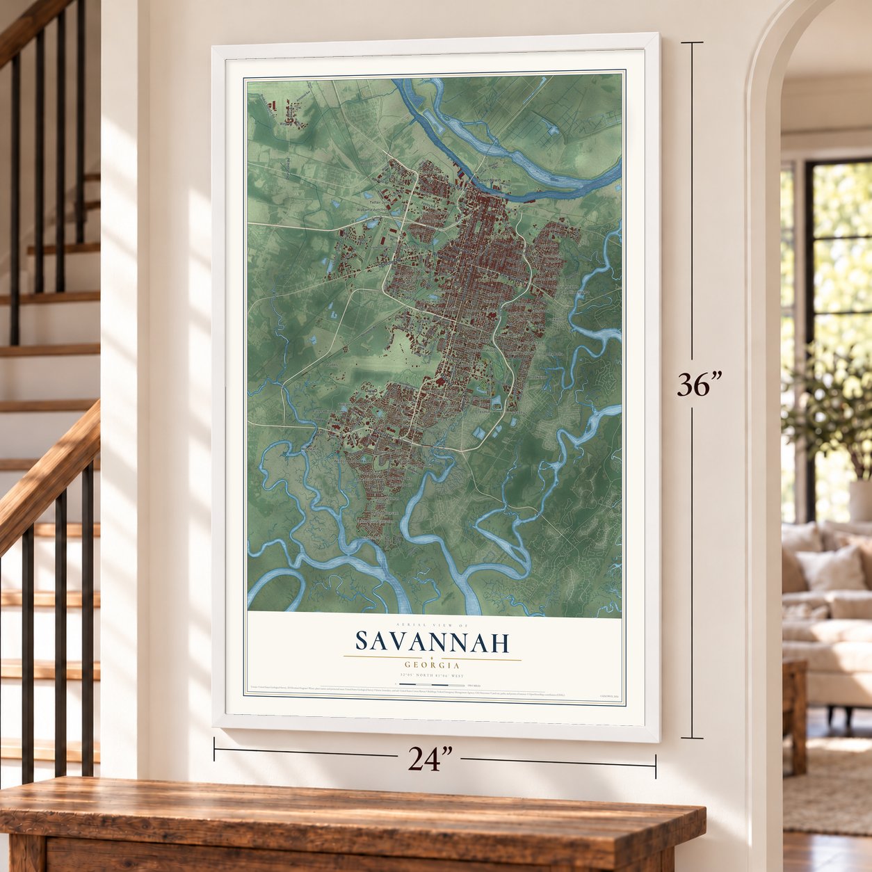
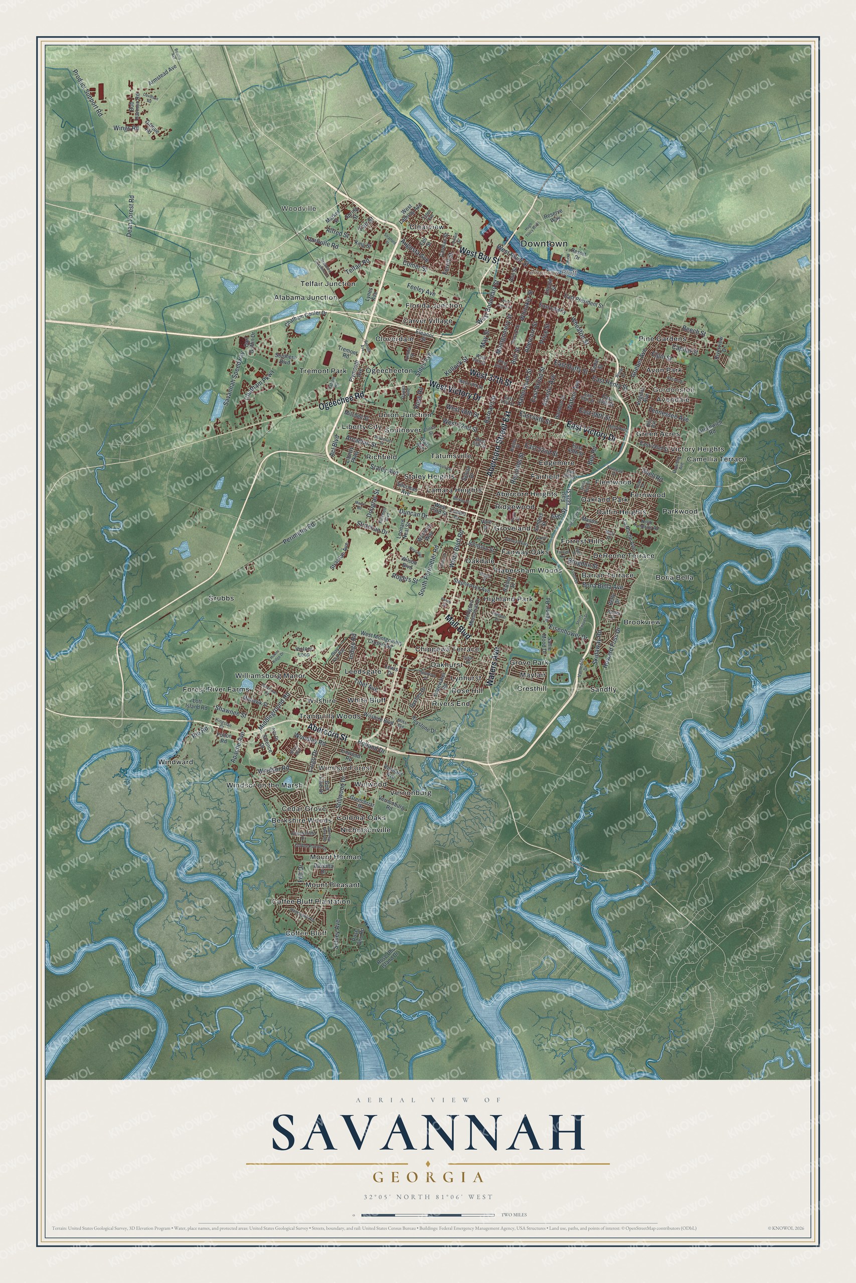
Explore Savannah, Georgia from a whole new perspective. Created using aerial imagery and detailed geographic data, this map captures Savannah building by building, with labeled streets, familiar landmarks, and shaded topographical relief that highlights the natural contours of the landscape.
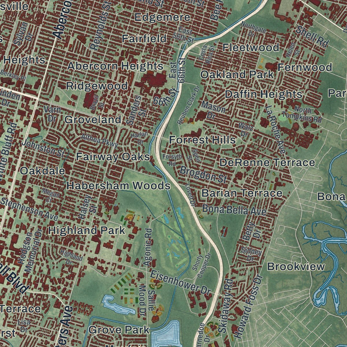
Combining modern data with the timeless character of a vintage atlas, this map is just as interesting up close as it is beautiful on the wall. Whether you grew up in Savannah, spent memorable years there, or call it home today, this unique map is a great way to celebrate a place that means something to you. Zoom in on the preview to look for your street, and then order a print to put your memories on the wall.
Three ways to hang it
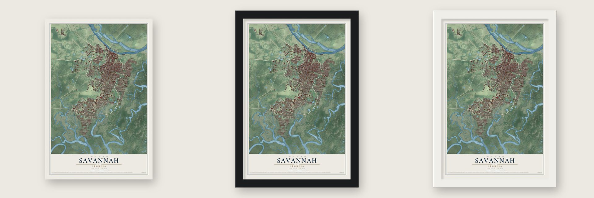
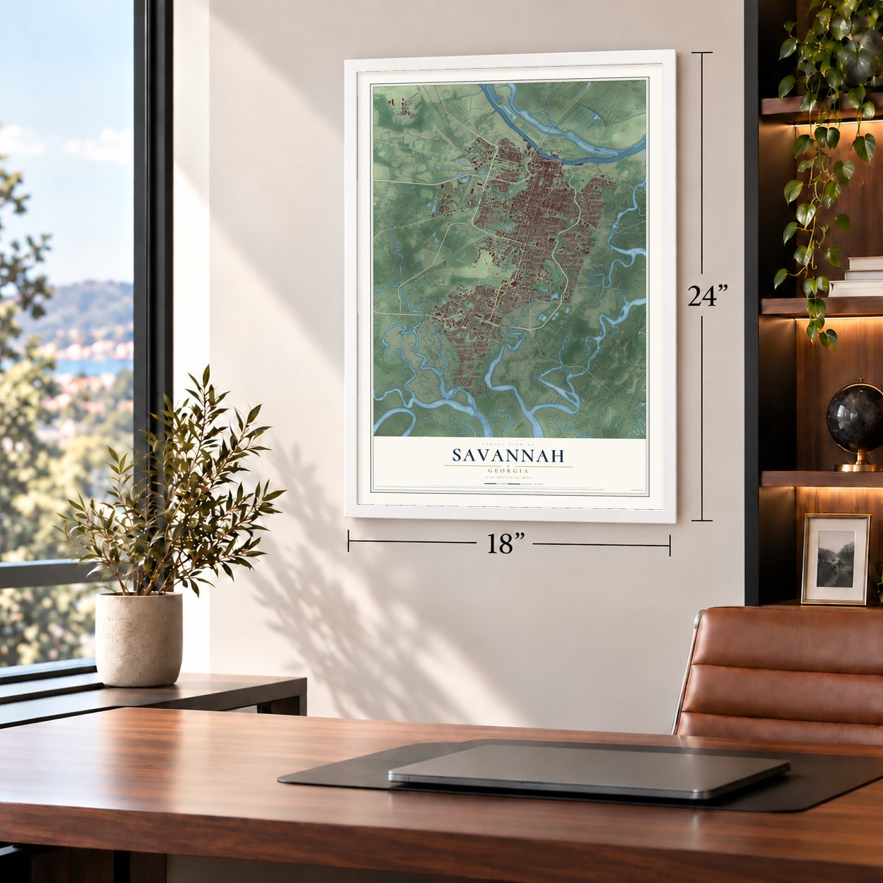
Unframed archival matte, a black wood frame or a white wood frame.
Up close
Geography Worth Displaying
This map was created using accurate cartographic data and authoritative geographic sources, including the U.S. Geological Survey (USGS) and FEMA. The map brings together terrain, waterways, roads, and building detail. The majority of the streets are labeled, houses are accurately depicted, and the topography is derived from government sources. Combining local data with carefully composed color and shading leads to this beautifully detailed Savannah artwork for your wall.
Rather than simply showing street outlines, we’ve included as many of the street names as we could reasonably fit on the map while keeping their names legible. Zoom in on the high resolution preview to see exactly what’s on the map. We truly set out to create a statement piece for anyone who loves Savannah. So whether it’s for you, or a gift for someone you love, we hope this map of Savannah brings back fond memories.
Explore the full map of Savannah, Georgia and read about the local places it shows.
Find your street
Names on the Savannah map
Every name below is printed on this map. Look for your street, your school, the park where you played, or the pond down the road.
Places and landmarks75
- Woodville
- Gordonston
- Coffee Bluff
- Downtown
- Yamacraw Bluff
- Forsyth Park
- Daffin Park
- Windsor Forest
- Abercorn Heights
- Alabama Junction
- Avon Park
- Avondale
Show all 75 places
- Barian Terrace
- Berkshire Woods
- Bona Bella
- Brookview
- Camellia Terrace
- Carver Village
- Cedar Grove
- Chippewa Terrace
- Clearview
- Cloverdale
- Coffee Bluff Plantation
- Colonial Oaks
- Cresthill
- Daffin Heights
- DeRenne Terrace
- Edgemere
- Fairfield
- Fairway Oaks
- Fernwood
- Fleetwood
- Florida Junction
- Forest River Farms
- Forrest Hills
- Green Acres
- Grove Park
- Groveland
- Grubbs
- Habersham Woods
- Highland Park
- Lamara Heights
- Leedsgate
- Liberty City
- Lynhurst
- Mayfair
- Mount Herman
- Mount Pleasant
- Nicholsonville
- Oakdale
- Oakhurst
- Oakland Park
- Ogeecheeton
- Parkwood
- Pine Gardens
- Richfield
- Ridgewood
- Rivers End
- Rose Hill
- Sandfly
- Southover
- Staley Heights
- Tatumsville
- Telfair Junction
- Tranquilla Woods
- Tremont Park
- Union Junction
- Vernonburg
- Victory Heights
- Welwood
- White Bluff
- Williamsburg Manor
- Wilshire
- Windsor on the Marsh
- Windward
Streets and roads218
- Ogeechee Road
- West Victory Drive
- Waters Avenue
- Abercorn Street
- Abercorn Street Extension
- East Victory Drive
- West Bay Street
- West 37th Street
- Mall Boulevard
- White Bluff Road
- Bull Street
- Holland Drive
- Shawnee Street
- West River Street
- Atlantic Avenue
- 66th Street
- Stiles Avenue
- West 52nd Street
- Montgomery Street
- Skidaway Road
- Habersham Street
- Dean Forest Road
- South Perimeter Road
- Middleground Road
- Perimeter Road
- Largo Drive
- Louisville Road
- Barnard Street
- Reynolds Street
- Rio Road
Show all 218 streets
- Windsor Road
- East 38th Street
- Stillwood Drive
- East 52nd Street
- Eisenhower Drive
- Whitaker Street
- East Henry Street
- East Broad Street
- Chatham Parkway
- Price Street
- Staley Avenue
- East Duffy Street
- Bee Road
- Duncan Drive
- Tibet Avenue
- Savannah Speedway
- Product Support Road
- Howard Foss Drive
- Apache Avenue
- Woodley Road
- Augusta Avenue
- Wheaton Street
- Rogers Street
- Strachan Drive
- Goebel Avenue
- Acl Boulevard
- Capital Street
- Douglas Street
- East 44th Street
- West Boundary Street
- Schley Avenue
- Arcadian Street
- Bona Bella Avenue
- Feeley Avenue
- Felt Drive
- Telfair Road
- Brogdon Street
- Alfred Street
- West 48th Street
- Tennessee Avenue
- Fair Street
- Comer Street
- Ross Road
- Beech Street
- Kollock Street
- Elgin Street
- Ferrill Street
- Indigo Road
- Wings Road
- Shell Road
- May Street
- Reserve Way
- Riverview Drive
- La Roche Avenue
- East 66th Street
- Fulton Road
- West Montgomery Crossroad
- Harmon Street
- Tremont Road
- Lincoln Street
- Cedar Street
- East 34th Street
- East 49th Street
- East 42nd Street
- Dyches Drive
- East President Street
- Mohawk Street
- Rose Dhu Road
- Liberty Parkway
- Rose Dhu Island Drive
- Hodgson Memorial Drive
- Bob Harmon Road
- Strachan Avenue
- Chatham Center Drive
- Eleanor Street
- Wilson Boulevard
- Stephenson Avenue
- Wilshire Boulevard
- Johnston Street
- Sallie Mood Drive
- Mitchell Street
- Lott Island Road
- Armstead Avenue
- Leonard Neal Street
- Sherman Avenue
- Carl Griffin Drive
- Keystone Drive
- Science Drive
- Victory Loop
- Betty Drive
- Rendant Avenue
- Agonic Road
- Mason Drive
- Golf Club Drive
- Edgewater Road
- Plymouth Avenue
- East Liberty
- West Lathrop Avenue
- Sylvan Drive
- Carolan Street
- Halsey Street
- Lewis Drive
- King Street
- Greenwich Road
- Vernonburg Road
- Southern Boulevard
- Virginia Avenue
- Greenbriar Drive
- Fell Street
- Varn Drive
- Darque Road
- Market Street
- Linwood Road
- Warriors Way
- Stark Avenue
- Resort Drive
- Lynes Avenue
- Sanders Street
- Daveitta Drive
- West 73rd Street
- Ann Street
- Spring Street
- Linden Drive
- West 55th Street
- East 41st Street
- East 56th Street
- East 35th Street
- Battey Street
- Coffee Pointe Drive
- Ramsgate Road
- Mitchell Boulevard
- West 40th Street
- Clinch Street
- Kingslan Court
- Ohio Avenue
- Varnedoe Drive
- Downing Avenue
- Althea Parkway
- Howard Street
- West 34th Street
- North Tompkins Road
- Walz Drive
- Gray Fox Way
- Chesterfield Drive
- Tuten Avenue
- Cynthia Street
- Holly Avenue
- West 33rd Street
- Patton Road
- Arts Drive
- Bliss Avenue
- Sidney Drive
- Dawes Avenue
- Lisa Drive
- Reuben Clark Drive
- Mercy Boulevard
- Dutchtown Road
- Second Avenue
- Stuyvesant Street
- Stratford Street
- West Jones Street
- Speir Street
- Inglewood Drive
- Bourne Avenue
- Harlan Drive
- Hugh Tracy Boulevard
- Kimball Avenue
- Moore Road
- Shorty Cooper Drive
- Seaboard Coastline Drive
- Spanish Moss Road
- Neal Boulevard
- Helen Street
- Lovett Drive
- Hanson Street
- Highland Drive
- Costa Rica Street
- Darby Drive
- Davidson Road
- Berkley Place
- Brazil Street
- Northgate Drive
- Hunter Ridge Drive
- Winter Drive
- Lehwald Street
- Forsyth Road
- Posey Street
- Megan Court
Names are listed as they appear on the printed map. Zoom into the product photos to find them.
About Savannah, Georgia
Savannah was settled in 1733 by a colony of English settlers under James Oglethorpe. They were soon joined by a few Germans, Jews, French, and Scotch Highlanders. Later newcomers were mostly English and Scotch-Irish.
Downtown Savannah still keeps most of the street plan drawn by its founder, James Oglethorpe. Its 22 park-like squares lie within a federal landmark district, among the biggest of its kind in the nation. The government gave the district that status in 1966.
Keep exploring Georgia
Savannah is one of 1,042 Georgia towns we've mapped. Every dot on the map is a print of its own.
The search covers every state, Georgia first.
Near Savannah
Order 2 or more town maps and save 10%. Shown in the size and finish you picked above, so they hang as a set.
- Georgetown 12" x 18" / Archival Matte Print $39.99
- Henderson 12" x 18" / Archival Matte Print $39.99
- Garden City 12" x 18" / Archival Matte Print $39.99
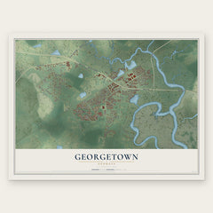

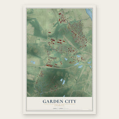
More maps nearby: Vernonburg, Montgomery, Pooler, Isle of Hope and Thunderbolt.
The art of mapping a place
How This Map Was Made
Real places. Remarkable detail. Discover the layers that turn geographic data into a map of home.

The view from above
Aerial imagery reveals the character of the land: woodland, open fields, and the patterns of a place.

The shape of the land
Elevation data brings hills, valleys, and subtle changes in the landscape into view.

The details of home
Roads, waterways, and building footprints come together to make the map feel unmistakably local.

Geography becomes art
Considered color, shading, and typography bring the layers together in a map made for your wall.


Process illustrated with Mendon, Massachusetts. Aerial imagery: USDA NAIP. Terrain: USGS 3D Elevation Program. Map details and finished artwork: KNOWOL.
The Details
About This Print
Choose an archival matte print, or a black or white Ayous wood frame. The archival matte print is unframed.
Select your size and finish above to see the matching product image and price.
Materials & Craftsmanship
A contemporary map with the character of a classic atlas, printed on archival matte paper. Optional frames are made from Ayous wood.
Your printed map does not include the watermark shown in the full-map preview.
Shipping & Delivery
Free shipping within the United States. Every print is made to order in the USA.
Buying a gift? Add a note in your cart and we'll include it. We never put prices in the package.
Prints ship within 2 to 3 business days. Allow 7 to 10 days total from ordering for delivery. Timing may vary during holidays or periods of high order volume.
Read our shipping policy.
Returns and damaged prints
Each print is made to order. Change-of-mind refunds are not available after production.
If your print arrives damaged, misprinted or incorrect, contact support@knowol.com within 30 days of receiving it. Include your order number, photos and a description of the issue.
Read our full refund and replacement policy. For questions about your order, email support@knowol.com.