
Search for another town




Free U.S. delivery 7 to 10 days after you order
Scituate, Rhode Island Map Art
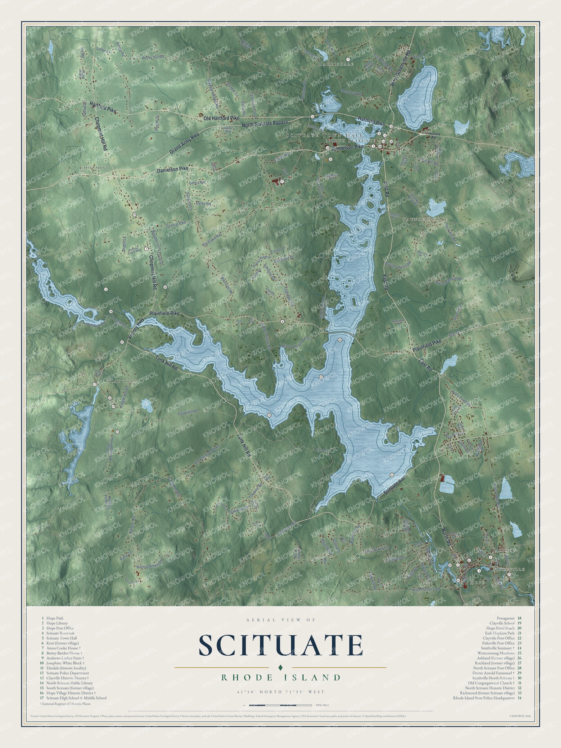
A beautifully detailed map of Scituate, Rhode Island, made from modern sources and satellite imagery, printed to order on archival matte paper.
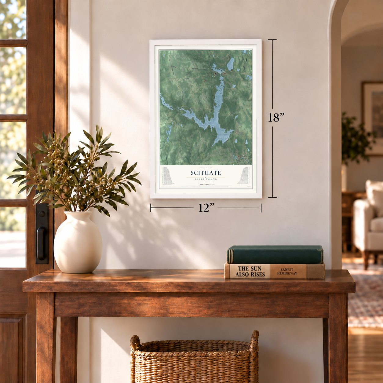
12" x 18" Archival Matte Print
A Map of Home. A Work of Art.
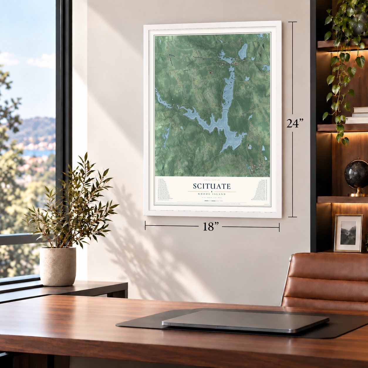
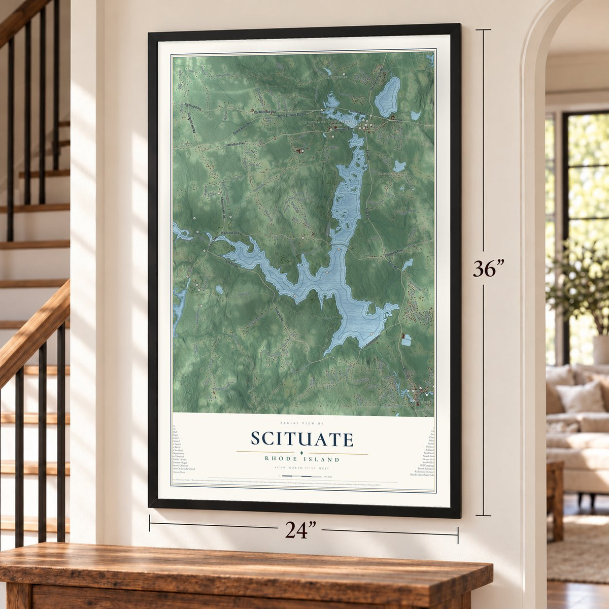
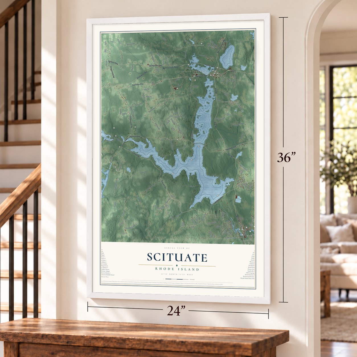
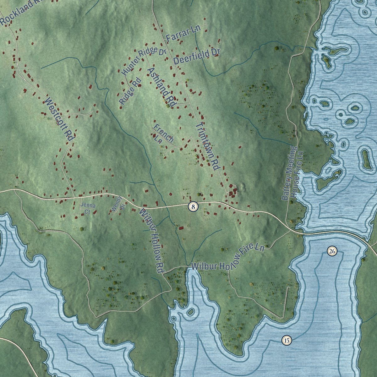
Explore Scituate, Rhode Island from a whole new perspective. Created using aerial imagery and detailed geographic data, this map captures Scituate building by building, with labeled streets, familiar landmarks, and shaded topographical relief that highlights the natural contours of the landscape.
Combining modern data with the timeless character of a vintage atlas, this map is just as interesting up close as it is beautiful on the wall. Whether you grew up in Scituate, spent memorable years there, or call it home today, this unique map is a great way to celebrate a place that means something to you. Zoom in on the preview to look for your street, and then order a print to put your memories on the wall.
Three ways to hang it
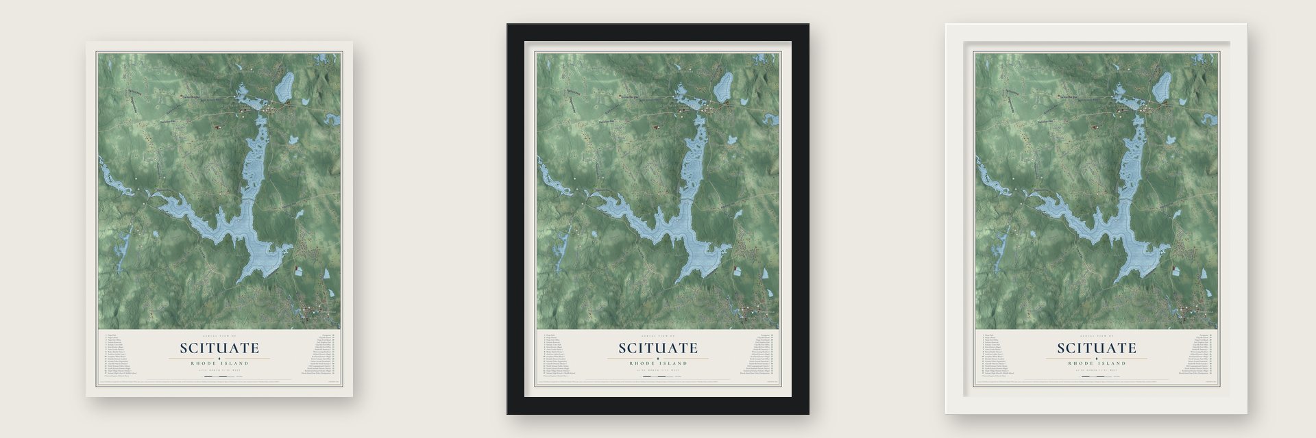
Unframed archival matte, a black wood frame or a white wood frame.
Up close
Geography Worth Displaying
This map was created using accurate cartographic data and authoritative geographic sources, including the U.S. Geological Survey (USGS) and FEMA. The map brings together terrain, waterways, roads, and building detail. The majority of the streets are labeled, houses are accurately depicted, and the topography is derived from government sources. Combining local data with carefully composed color and shading leads to this beautifully detailed Scituate artwork for your wall.
Rather than simply showing street outlines, we’ve included as many of the street names as we could reasonably fit on the map while keeping their names legible. Zoom in on the high resolution preview to see exactly what’s on the map. We truly set out to create a statement piece for anyone who loves Scituate. So whether it’s for you, or a gift for someone you love, we hope this map of Scituate brings back fond memories.
Explore the full map of Scituate, Rhode Island and read about the local places it shows.

Find your street
Names on the Scituate map
Every name below is printed on this map. Look for your street, your school, the park where you played, or the pond down the road.
Places and landmarks10
- North Scituate
- Hope
- Clayville
- Jackson
- Fiskeville
- Harrisdale
- Saundersville
- Scituate Reservoir
- Chopmist Hill
- Field Hill
Streets and roads13
- Quaker Ln
- Hartford Pike
- Ide Rd
- Field Hill Rd
- Ashland Rd
- Victory Hwy
- Tunk Hill Rd
- William Henry Rd
- Shun Pike
- Old Plainfield Pike
- Washington Hwy
- Carpenter Ct
- Hope Furnace Rd
Names are listed as they appear on the printed map. Zoom into the product photos to find them.
About Scituate, Rhode Island
Scituate is a town of 10,384 people in Providence County, west of Providence. Families from Scituate, Massachusetts, settled here in 1710 and carried their old town's name with them. It was first written "Satuit," a Native word for a cold brook or cold river. The land belonged to Providence until 1731. Voters held their first town meeting at the Angell Tavern in South Scituate and chose Stephen Hopkins to run it. Hopkins later governed Rhode Island and signed the Declaration of Independence. In 1781 Foster broke away as a town of its own, taking the western half.
For most of its history Scituate was a cluster of small villages, from North Scituate and Hope to Kent, Rockland and Ponaganset. In 1915 Rhode Island's General Assembly claimed 14,800 acres, 38 percent of the town, so a reservoir could supply greater Providence. Crews dammed the Pawtuxet River at Kent, and the water began rising on November 10, 1925. Kent, Richmond, Rockland, South Scituate, Ashland, Saundersville and Ponaganset vanished, along with parts of North Scituate and Clayville. The reservoir is now the biggest man-made lake in Rhode Island. With six smaller reservoirs feeding it, it gives drinking water to over 60 percent of Rhode Islanders.
“1,195 buildings, including 375 houses, seven schools, six churches, six mills, thirty dairy farms, eleven ice houses, post offices, and an electric railway system, the Providence and Danielson Railway system”
- Cannons from Hope FurnaceIron ore turned up near the village of Hope in 1765, and a furnace followed a year later. Besides pig iron and household goods, the Hope Furnace forged 76 cannons for the Revolution. A wooden cotton mill came in 1806. After it burned, Brown and Ives of Providence built a four-story stone mill in 1844, with thirteen double tenements on Mill Street for workers. It made cloth until 2007, and in August 2023 the town voted to demolish it.
- An art festival since 1967The Old Congregational Church on Greenville Road was built in 1834 to a design by Clark Sayles, and it passed to the town in 1940. In 1967 local people started an art festival on its grounds to pay for restoring the inside of the church. It is still held every Columbus Day weekend in North Scituate, with more than 300 artists and craftspeople and 200,000 to 350,000 visitors.
- The Smithville SeminaryFreewill Baptists founded the Smithville Seminary in 1839 on a knoll above Lake Moswansicut. In 1845 Henry Barnard chose it for his first Rhode Island Teachers Institute. The school was renamed the Lapham Institute in 1863 and closed for good in 1876. The Pentecostal Collegiate Institute moved in from Saratoga Springs, New York, in 1902 and left in 1919 as Eastern Nazarene College. The Greek Revival buildings now hold the Scituate Commons apartments.
- The Supreme Court's first caseIn 1788 William West, a militia general and Scituate's representative, led an armed crowd of farmers into Providence to protest the new U.S. Constitution. Three years later, in 1791, the U.S. Supreme Court decided the first case it ever heard. That case, West v. Barnes, was about a farm in Scituate.
- Listening post on Chopmist HillDuring World War II, a Federal Communications Commission station on Darby Road near Chopmist Hill listened in on German radio traffic. Because of that station, the Chopmist Hill area was weighed in 1946 as a site for the headquarters of the United Nations.
Keep exploring Rhode Island
Scituate is one of 85 Rhode Island towns we've mapped. Every dot on the map is a print of its own.
The search covers every state, Rhode Island first.
Near Scituate
Order 2 or more town maps and save 10%. Shown in the size and finish you picked above, so they hang as a set.
- North Scituate 12" x 18" / Archival Matte Print $39.99
- Clayville 12" x 18" / Archival Matte Print $39.99
- Hope 12" x 18" / Archival Matte Print $39.99


More maps nearby: Foster Center, Foster, Johnston, Harmony and Greenville.
The art of mapping a place
How This Map Was Made
Real places. Remarkable detail. Discover the layers that turn geographic data into a map of home.

The view from above
Aerial imagery reveals the character of the land: woodland, open fields, and the patterns of a place.

The shape of the land
Elevation data brings hills, valleys, and subtle changes in the landscape into view.

The details of home
Roads, waterways, and building footprints come together to make the map feel unmistakably local.

Geography becomes art
Considered color, shading, and typography bring the layers together in a map made for your wall.


Process illustrated with Mendon, Massachusetts. Aerial imagery: USDA NAIP. Terrain: USGS 3D Elevation Program. Map details and finished artwork: KNOWOL.
The Details
About This Print
Choose an archival matte print, or a black or white Ayous wood frame. The archival matte print is unframed.
Select your size and finish above to see the matching product image and price.
Materials & Craftsmanship
A contemporary map with the character of a classic atlas, printed on archival matte paper. Optional frames are made from Ayous wood.
Your printed map does not include the watermark shown in the full-map preview.
Shipping & Delivery
Free shipping within the United States. Every print is made to order in the USA.
Buying a gift? Add a note in your cart and we'll include it. We never put prices in the package.
Prints ship within 2 to 3 business days. Allow 7 to 10 days total from ordering for delivery. Timing may vary during holidays or periods of high order volume.
Read our shipping policy.
Returns and damaged prints
Each print is made to order. Change-of-mind refunds are not available after production.
If your print arrives damaged, misprinted or incorrect, contact support@knowol.com within 30 days of receiving it. Include your order number, photos and a description of the issue.
Read our full refund and replacement policy. For questions about your order, email support@knowol.com.