
Search for another town




Free U.S. delivery 7 to 10 days after you order
Selah, Washington Map Art
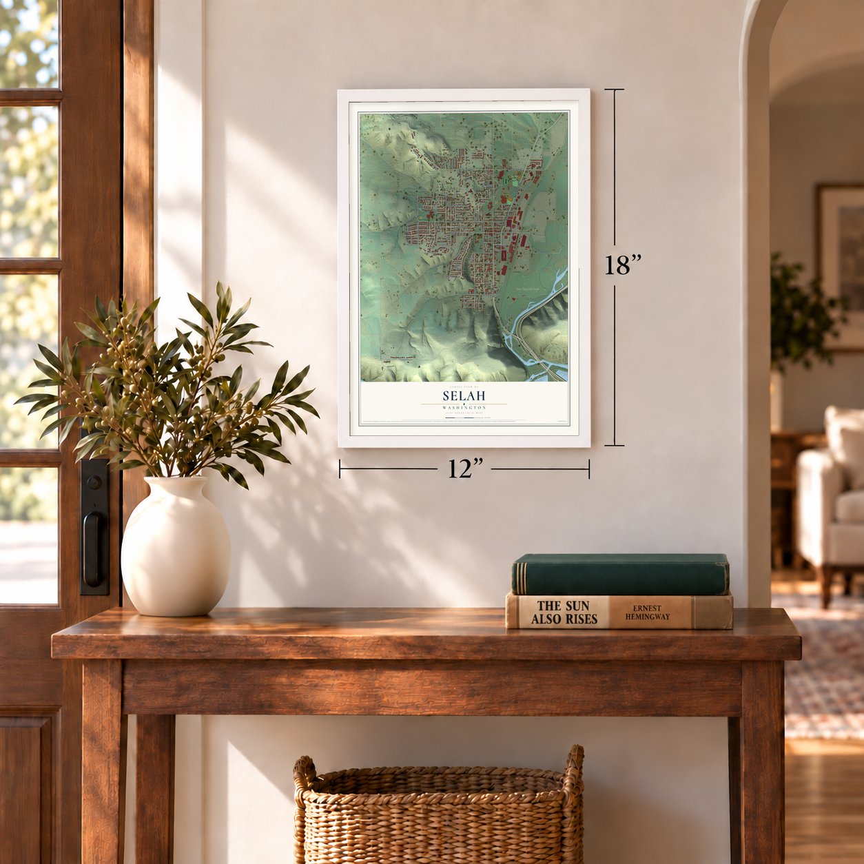
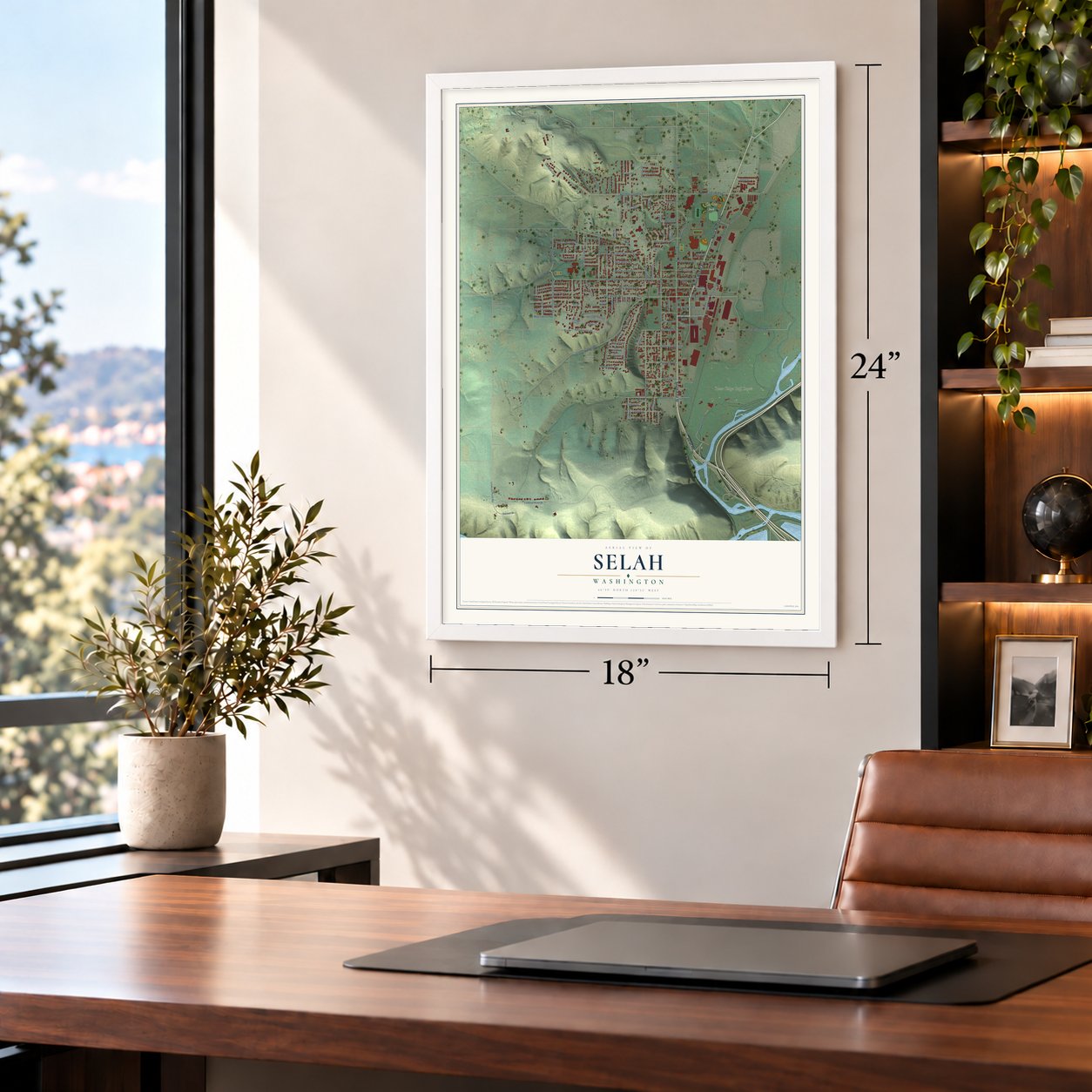
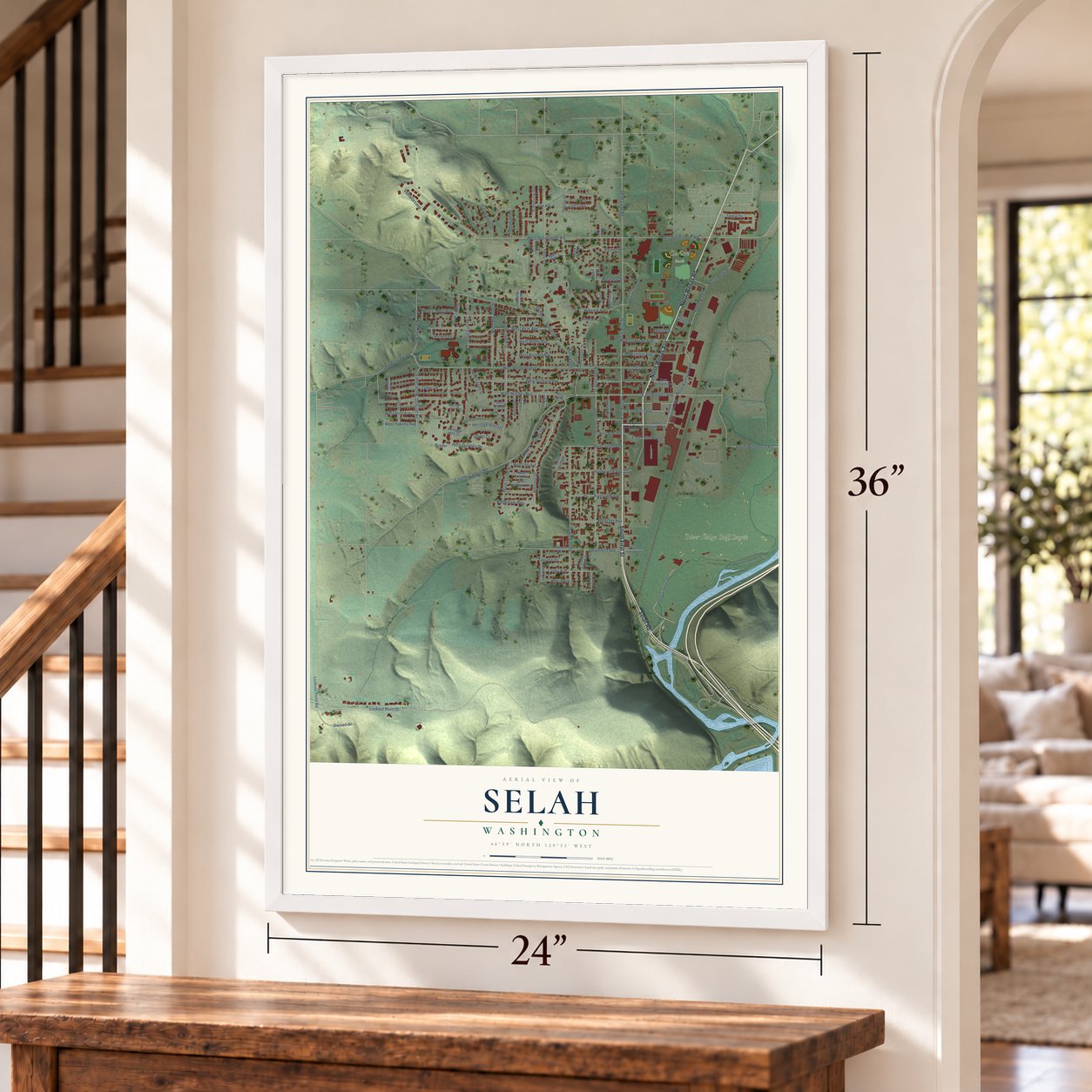
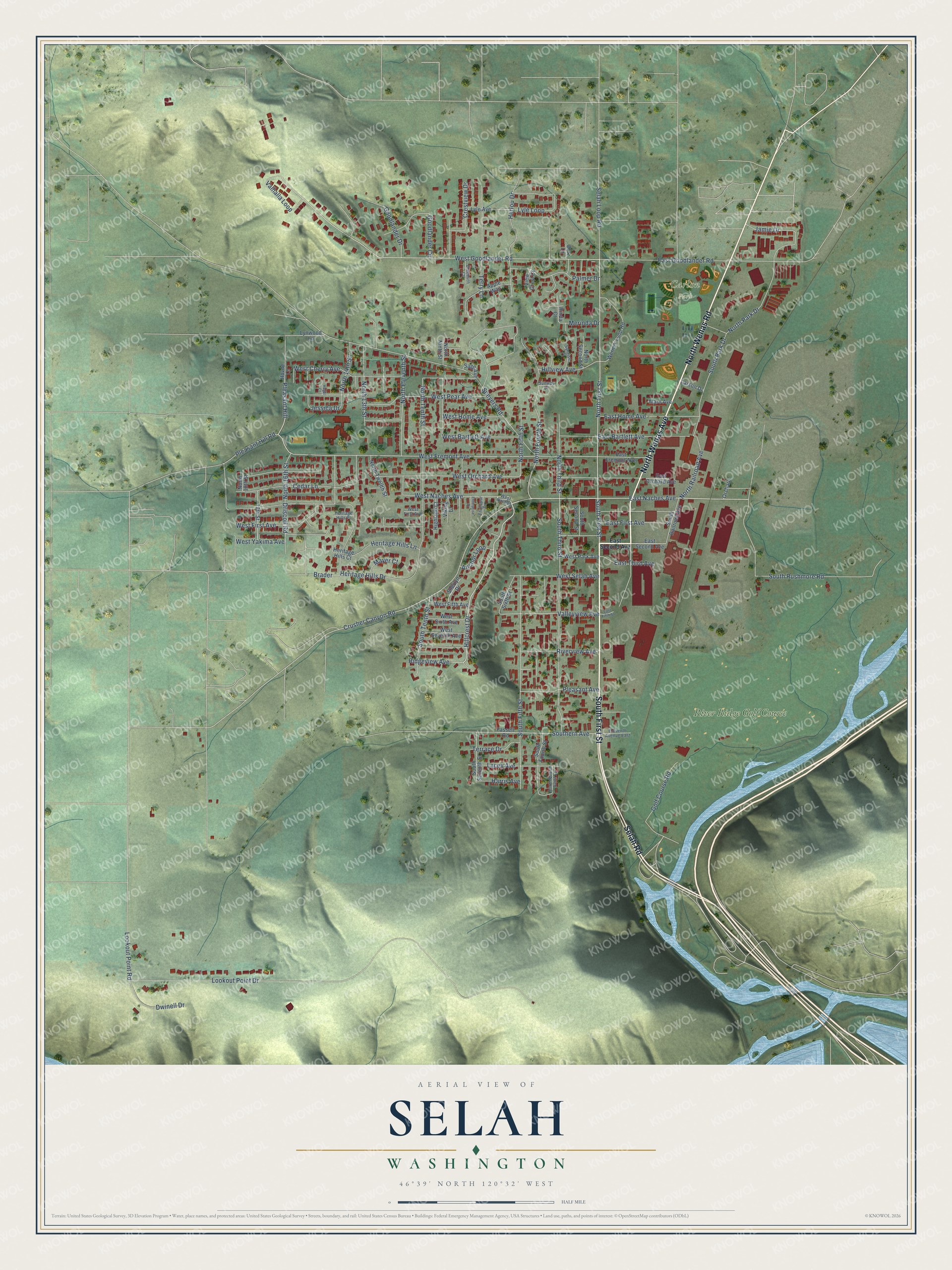
A new map of Selah, Washington, made in 2026 and printed to order on thick archival matte paper.
12" x 18" Archival Matte Print
A Map of Home. A Work of Art.
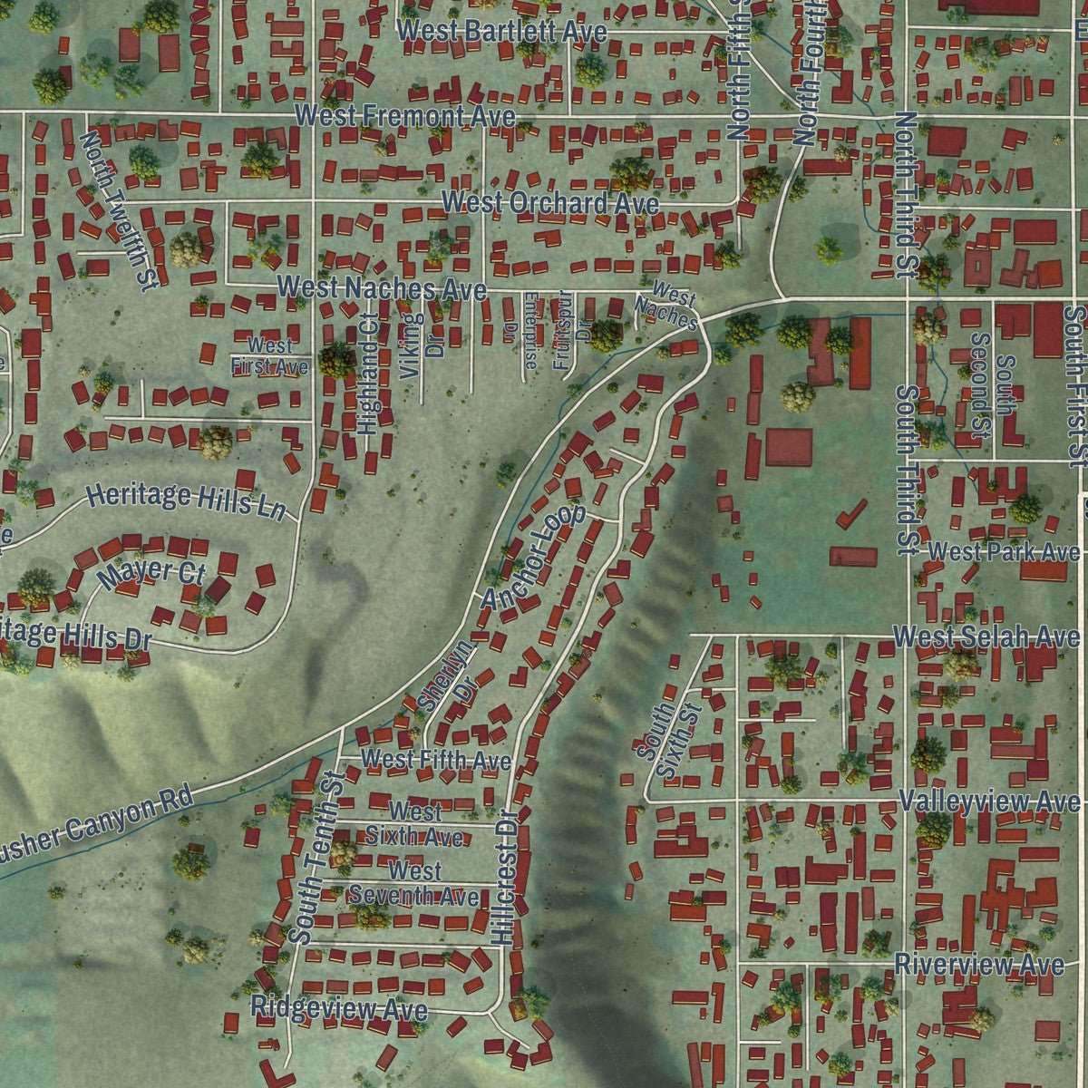
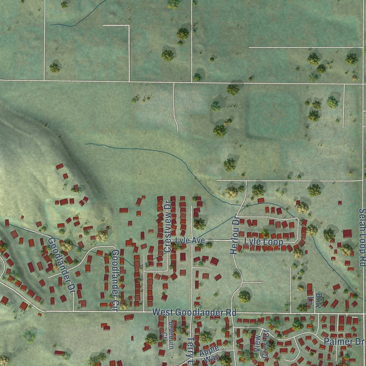
Explore Selah, Washington from a whole new perspective. Created using aerial imagery and detailed geographic data, this map captures Selah building by building, with labeled streets, familiar landmarks, and shaded topographical relief that highlights the natural contours of the landscape.
Combining modern data with the timeless character of a vintage atlas, this map is just as interesting up close as it is beautiful on the wall. Whether you grew up in Selah, spent memorable years there, or call it home today, this unique map is a great way to celebrate a place that means something to you. Zoom in on the preview to look for your street, and then order a print to put your memories on the wall.
Three ways to hang it
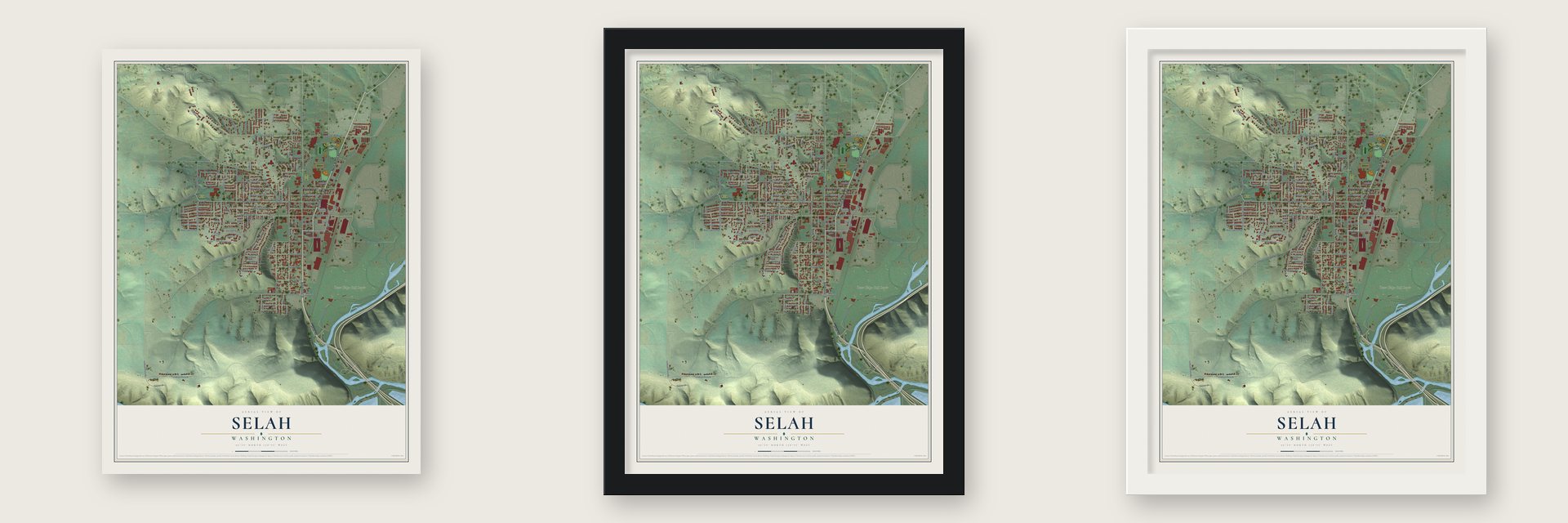
Unframed archival matte, a black wood frame or a white wood frame.
Up close
Geography Worth Displaying
This map was created using accurate cartographic data and authoritative geographic sources, including the U.S. Geological Survey and the Census Bureau. The map brings together terrain, waterways, roads, and building detail. The majority of the streets are labeled, houses are accurately depicted, and the topography is derived from government sources. Combining local data with carefully composed color and shading leads to this beautifully detailed Selah artwork for your wall.
Rather than simply showing street outlines, we’ve included as many of the street names as we could reasonably fit on the map while keeping their names legible. Zoom in on the high resolution preview to see exactly what’s on the map. We truly set out to create a statement piece for anyone who loves Selah. So whether it’s for you, or a gift for someone you love, we hope this map of Selah brings back fond memories.
Read the story behind this map of Selah, Washington from 2026.

About Selah, Washington
Selah is a city of 8,153 people in Yakima County, just north of Yakima, above the spot where the Naches River joins the Yakima. Its name comes from an Indian word for still or smooth water. Alfred Henson became its first settler in 1865, staking a claim on land the Elks Golf and Country Club would later occupy, and after Yakima County was formed in 1867 he was elected one of its commissioners.
A real town began in 1907, when two Swedish immigrants, Gus Remington and Olaf Larson, opened the Selah Trading Company and followed it with a feed store and a hotel. Fire destroyed most of the businesses in 1908, so the partners built the Selah Mercantile Company, and Remington advertised in Swedish papers in the Midwest to draw new farmers. By 1912 Selah had a newspaper, a bank, a drug store, a meat market and a livery stable.
“After riots broke out in the Yakima Valley between farmers and striking workers, the State Patrol and the National Guard were called in to protect local crops, and it was not uncommon to see machinegun-toting guardsmen patrolling Selah's streets.”
- Ditches that greened the valleyIn 1880 George Taylor, who had homesteaded here in 1866, dug a small ditch to carry Yakima River water into the Selah Valley, and farmers began trading sheep and cattle for hops, orchards and alfalfa. In 1888 two men, B. F. Young and John Stone, organized the Selah Ditch Company and dug a bigger canal. By 1895 more landowners picked Selah than Wenas, and dry sage had turned to green fields.
- Incorporated March 17, 1919In 1918 Selah had nearly 200 people, but state law required 300 before a town could incorporate. Boosters waited for the fall harvest, signed up orchard and alfalfa workers, and counted 310 residents. After a caucus in February 1919, all 63 voters at the March election said yes, and on March 17, 1919, the county commissioners made Selah a municipality of the fourth class.
- Yakima County's first court caseWilliam McCallister, the second settler in Selah, arrived a few months after Henson and never got along with him. When McCallister threatened to kill Henson, the dispute became the first court case in Yakima County history. Nobody knows how it went, because the records burned with the county courthouse in 1882.
- Community Day since 1926Selah opened a new high school in 1926 with 154 students, and the opening started the town's first Community Day. At the end of the school year, floats, autos covered in flowers and children on decorated bikes paraded to the school grounds for a picnic. Selah still holds a town-wide summer gathering.
- The Apple Juice CapitalApple juice took hold in Selah during the Great Depression, when a small processing plant opened and kept growing through the 1950s. The grower-owned Tree Top co-operative took it over in 1960 and keeps its headquarters and two processing plants in town. A brewery that opened after Prohibition ended in 1933 also made Selah Springs beer popular in Central Washington until it closed in the 1950s.
Find your street
Names on the Selah map
Every name below is printed on this map. Look for your street, your school, the park where you played, or the pond down the road.
Places and landmarks2
- Carlon Park
- River Ridge Golf Course
Streets and roads119
- South First Street
- North Wenas Road
- Selah Road
- North Wenas Avenue
- West Naches Avenue
- Hillcrest Drive
- North First Street
- East Naches Avenue
- West Goodlander Road
- North Fourth Street
- Pleasant Hill Road
- Lookout Point Road
- Crusher Canyon Road
- West Fremont Avenue
- Pleasant Hill
- Driscoll Road
- West Cherry Avenue
- North Tenth Street
- Valleyview Avenue
- South Third Street
- South Tenth Street
- Lookout Point Drive
- Speyers Road
- West Orchard Avenue
- Heritage Hills Drive
- South Fifth Street
- East Goodlander Road
- West Pear Avenue
- North Park Drive
- South Rushmore Road
Show all 119 streets
- North 13th Street
- Southern Avenue
- West Yakima Avenue
- Riverview Avenue
- Cedar Lane
- North Eleventh Street
- West Bartlett Avenue
- Terry Lane
- Golf Course Road
- North 14th Street
- Lyle Loop
- East Home Avenue
- West Home Avenue
- Selah Loop Road
- East Bartlett Avenue
- Palmer Drive
- West First Avenue
- Crestview Drive
- North Railroad Avenue
- Lacey Avenue
- West Selah Avenue
- South Park Drive
- North Third Street
- Heritage Hills Lane
- Goodlander Circle
- Pleasant Avenue
- North Fifth Street
- Valhalla Loop
- North 16th Street
- Goodlander Drive
- East First Avenue
- Dwinell Drive
- Hillview Avenue
- Jessica Drive
- East Third Avenue
- Ridgeview Avenue
- Brader
- Terrace Drive
- Anchor Loop
- Harris Avenue
- Herlou Drive
- Merinda Drive
- Mayer Court
- Jamie Drive
- East Second Avenue
- South Sixth Street
- Rinda Court
- East Orchard Avenue
- North Twelfth Street
- Fassett Road
- Wernex Loop Road
- North Ninth Street
- South Fourth Street
- Apple Way
- East Fremont Avenue
- South Seventh Street
- North Second Street
- South Railroad Avenue
- West Seventh Avenue
- West Sixth Avenue
- West Fifth Avenue
- West Park Avenue
- 17th Street
- Highland Court
- South Second Street
- Heritage Hills Court
- Sherlyn Drive
- Viking Drive
- Lyle Avenue
- Sage Avenue
- Lynwood Lane
- Larson Drive
- Maru Avenue
- North 18th Street
- Orchard
- View Crest Court
- Hovde Lane
- Blitz Lane
- West Naches
- South Fourth Saint Lp
- Eleventh Avenue East
- Braeburn Court
- Sunrise Place
- Fruitspur Drive
- Heritage Hills Place
- Sunway Drive
- Enterprise Drive
- East Fifth Street
- Hegel Court
Names are listed as they appear on the printed map. Zoom into the product photos to find them.
The art of mapping a place
How This Map Was Made
Real places. Remarkable detail. Discover the layers that turn geographic data into a map of home.

The view from above
Aerial imagery reveals the character of the land: woodland, open fields, and the patterns of a place.

The shape of the land
Elevation data brings hills, valleys, and subtle changes in the landscape into view.

The details of home
Roads, waterways, and building footprints come together to make the map feel unmistakably local.

Geography becomes art
Considered color, shading, and typography bring the layers together in a map made for your wall.


Process illustrated with Mendon, Massachusetts. Aerial imagery: USDA NAIP. Terrain: USGS 3D Elevation Program. Map details and finished artwork: KNOWOL.
The Details
About This Print
Choose an archival matte print, or a black or white Ayous wood frame. The archival matte print is unframed.
Select your size and finish above to see the matching product image and price.
Materials & Craftsmanship
A contemporary map with the character of a classic atlas, printed on archival matte paper. Optional frames are made from Ayous wood.
Your printed map does not include the watermark shown in the full-map preview.
Shipping & Delivery
Free shipping within the United States. Every print is made to order in the USA.
Buying a gift? Add a note in your cart and we'll include it. We never put prices in the package.
Prints ship within 2 to 3 business days. Allow 7 to 10 days total from ordering for delivery. Timing may vary during holidays or periods of high order volume.
Read our shipping policy.
Returns and damaged prints
Each print is made to order. Change-of-mind refunds are not available after production.
If your print arrives damaged, misprinted or incorrect, contact support@knowol.com within 30 days of receiving it. Include your order number, photos and a description of the issue.
Read our full refund and replacement policy. For questions about your order, email support@knowol.com.
Find your town
Looking for another city?
Find a map of home in our Washington collection, or any town in the country.
Nearby
Maps of towns near Selah
Know someone from one of these towns? Their map makes a great gift.
 Gleed
Gleed, Washington
From $39.99See the map
 Yakima
, Washington
From $39.99See the map
 Eschbach
, Washington
From $39.99See the map
More maps nearby: Terrace Heights, Summitview, Union Gap, Ahtanum and Cowiche.