
Search for another town



Free U.S. delivery 7 to 10 days after you order
Yakima, Washington Map Art
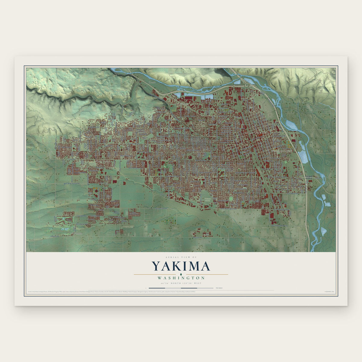
A new map of Yakima, Washington, made in 2026 and printed to order on thick archival matte paper.
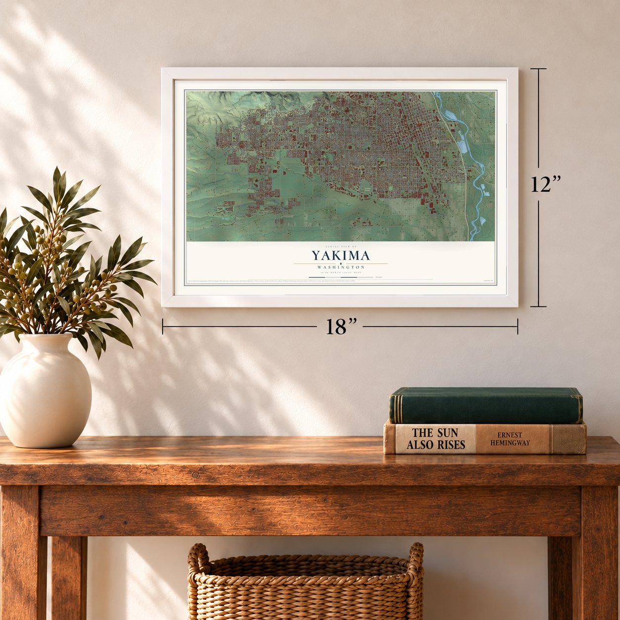
12" x 18" Archival Matte Print
A Map of Home. A Work of Art.
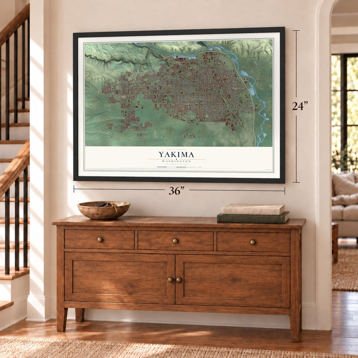
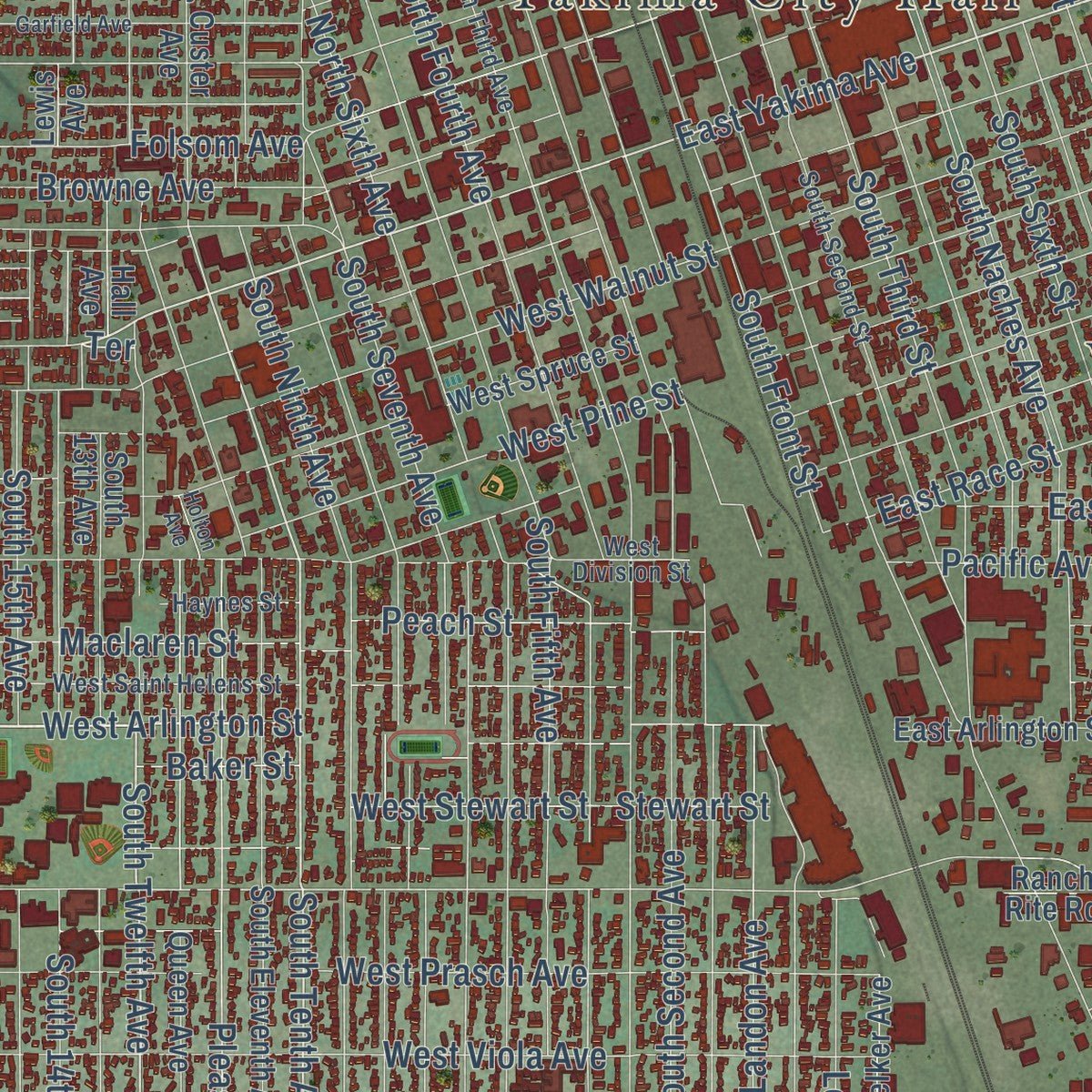
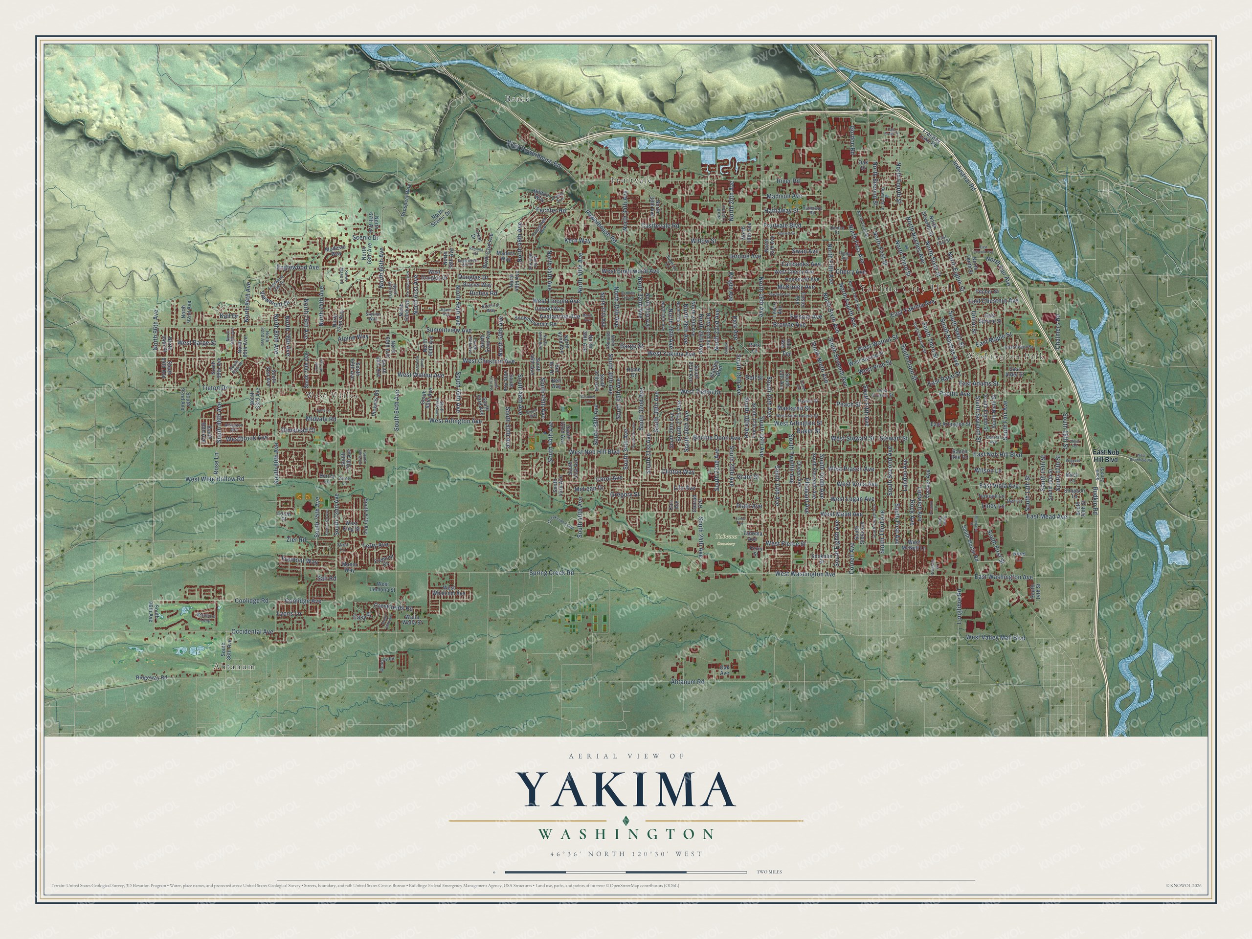
Explore Yakima, Washington from a whole new perspective. Created using aerial imagery and detailed geographic data, this map captures Yakima building by building, with labeled streets, familiar landmarks, and shaded topographical relief that highlights the natural contours of the landscape.
Combining modern data with the timeless character of a vintage atlas, this map is just as interesting up close as it is beautiful on the wall. Whether you grew up in Yakima, spent memorable years there, or call it home today, this unique map is a great way to celebrate a place that means something to you. Zoom in on the preview to look for your street, and then order a print to put your memories on the wall.
Three ways to hang it
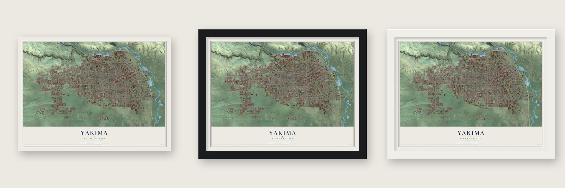
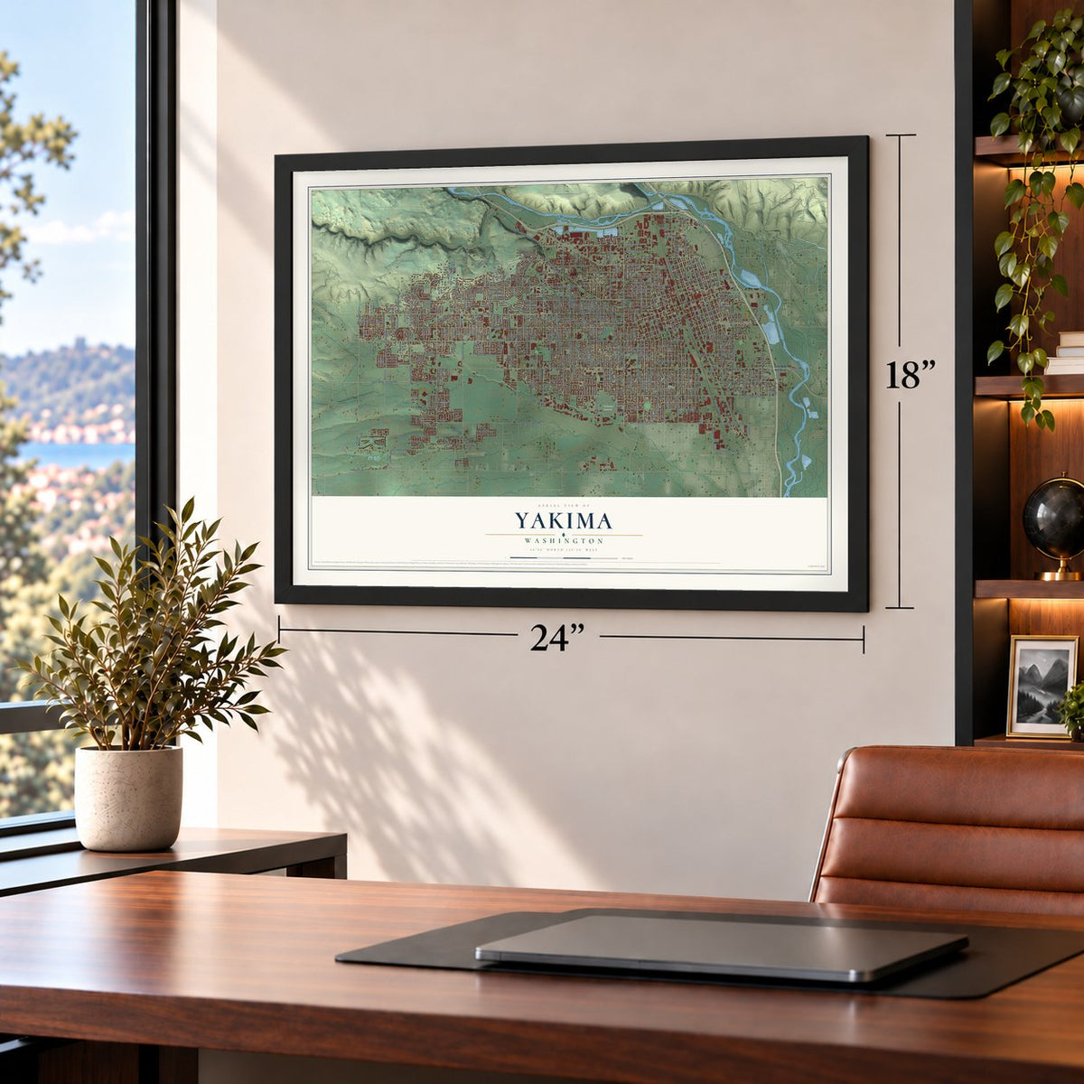
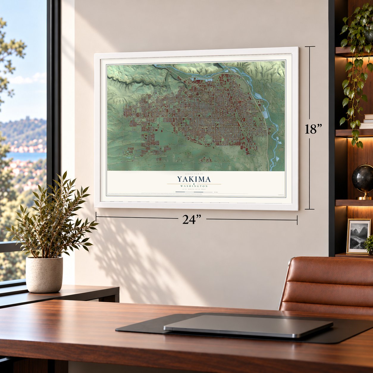
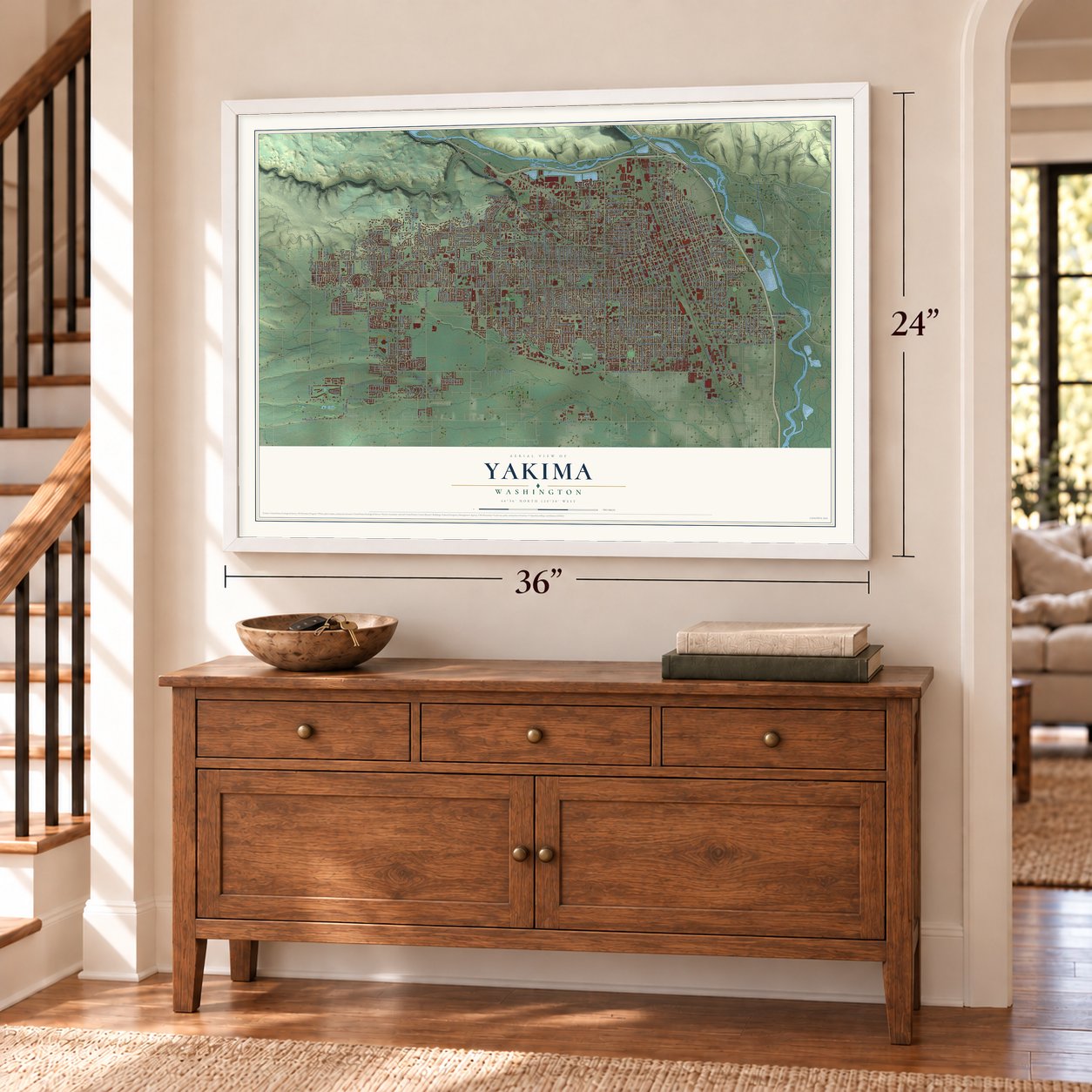
Unframed archival matte, a black wood frame or a white wood frame.
Up close
Geography Worth Displaying
This map was created using accurate cartographic data and authoritative geographic sources, including the U.S. Geological Survey and the Census Bureau. The map brings together terrain, waterways, roads, and building detail. The majority of the streets are labeled, houses are accurately depicted, and the topography is derived from government sources. Combining local data with carefully composed color and shading leads to this beautifully detailed Yakima artwork for your wall.
Rather than simply showing street outlines, we’ve included as many of the street names as we could reasonably fit on the map while keeping their names legible. Zoom in on the high resolution preview to see exactly what’s on the map. We truly set out to create a statement piece for anyone who loves Yakima. So whether it’s for you, or a gift for someone you love, we hope this map of Yakima brings back fond memories.
Read the story behind this map of Yakima, Washington from 2026.

About Yakima, Washington
Yakima is a city of 96,968 people and the seat of Yakima County, on the Yakima River just below where the Naches River joins it. The first town of that name was a village near the mouth of Ahtanum Creek, four miles south, and settlers were calling it Yakima City by 1870. That year it became the county seat, and by around 1880 it had a courthouse, a busy main street and close to 2,000 people.
Its future depended on the Northern Pacific railroad, which judged the site too swampy and too boxed in by ridges. In early 1885 the railroad filed plats for a new town, North Yakima, and offered lots to anyone in Yakima City who would move. By midyear it was also paying the moving costs for businesses. Teams of horses and mules hauled whole buildings north, and by the end of 1885 North Yakima had 1,200 people. It was incorporated in 1886, took the county seat, and dropped the "North" from its name in 1918. The old site took the name Union Gap.
“A farmer wishing to buy something at a store would hitch his team to the latter end of a moving building, transact his business, come out with his purchases, load his wagon, while the team followed slowly along with the building”
- Dynamite at the SignalNot everyone in Yakima City wanted to go. When the Yakima City Signal's building was raised onto blocks for the trip north, someone who would rather see it destroyed than lost to the rival town slipped in at night and set off dynamite. The owner gathered up the lumber and rebuilt the paper in North Yakima anyway.
- Streets on a German planPaul Schulze, the Northern Pacific's land manager, is said to have laid out North Yakima roughly on the plan of his home city, Baden-Baden, Germany, with Naches Avenue patterned after Berlin's Unter den Linden. Canals ran beside some main streets, and shade trees lined the avenues. Other accounts say the model was Salt Lake City.
- State Fair since 1894The legislature picked North Yakima as the home of the Washington State Fair, which drew thousands of visitors each year starting in 1894. Hard times canceled the 1895 fair, but it came back the next year. The Central Washington State Fair is still held every late September at State Fair Park.
- Coxey's Army in 1894That same year, a Northwest group of the jobless men called Coxey's Army rode a freight train into North Yakima on their way east to march on Washington. When they tried to board a train for Spokane, police and marshals fought them. Shots were fired, two marshals were wounded and forty-nine men were arrested. Two days later another clash nearby ended with more than 120 arrests.
- Salmon for a string of beadsF. Mortimer Thorp's family, among the first ranchers, reached the Moxee Valley just outside today's city in 1861. His son Leonard remembered rye grass twelve feet high on the bottom lands. That fall the local tribes traded salmon to the newcomers so cheaply that a ten-cent string of beads bought a thirty-pound fish.
Find your street
Names on the Yakima map
Every name below is printed on this map. Look for your street, your school, the park where you played, or the pond down the road.
Places and landmarks7
- Yakima City Hall
- Washington Park
- Tahoma Cemetery
- Ahtanum
- Brace
- Fruitvale
- West Valley
Streets and roads365
- West Chestnut Avenue
- West Yakima Avenue
- West Arlington Street
- West Arlington Avenue
- South Tenth Avenue
- South Twelfth Avenue
- East Yakima Avenue
- North Sixth Street
- Spring Creek Road
- Stewart Street
- South 17th Street
- North 16th Avenue
- Willow Street
- South 32nd Avenue
- West Walnut Avenue
- South 18th Street
- North Eighth Street
- Plath Avenue
- West Washington Avenue
- Summitview Avenue
- West Nob Hill Boulevard
- West Lincoln Avenue
- West Tieton Drive
- Englewood Avenue
- West Walnut Street
- West Viola Avenue
- South First Street
- West Mead Avenue
- South 16th Avenue
- Occidental Avenue
Show all 365 streets
- South 64th Avenue
- Fruitvale Boulevard
- South 72nd Avenue
- Scenic Drive
- West Prasch Avenue
- West Logan Avenue
- South Third Avenue
- River Road
- South 24th Avenue
- South Eighth Avenue
- South Fair Avenue
- Coolidge Road
- Barge Street
- South Second Avenue
- North First Street
- North Sixth Avenue
- South Ninth Avenue
- North 40th Avenue
- South 40th Avenue
- South First Avenue
- North Naches Avenue
- South Seventh Avenue
- South Naches Avenue
- South Fifth Avenue
- Ahtanum Road
- South 36th Avenue
- South 80th Avenue
- South Sixth Street
- Pleasant Avenue
- Coolidge Avenue
- Richey Road
- Cornell Avenue
- South Seventh Street
- Tieton Drive
- South 18th Avenue
- North Fourth Street
- South 26th Avenue
- West Pierce Street
- Douglas Drive
- South 34th Avenue
- East Nob Hill Boulevard
- South 48th Avenue
- South 15th Avenue
- North Second Street
- North Third Street
- Castlevale Road
- West Englewood Avenue
- South 14th Avenue
- Powerhouse Road
- Maclaren Street
- South 44th Avenue
- East Mead Avenue
- South 75th Avenue
- East Maple Street
- East Viola Avenue
- North 34th Avenue
- East Race Street
- West Powerhouse Road
- East Chestnut Avenue
- Midvale Road
- South 38th Avenue
- South 31st Avenue
- West Valley Mall Boulevard
- North 20th Avenue
- Jerome Avenue
- North 66th Avenue
- North 26th Avenue
- Bonnie Doon Avenue
- Pacific Avenue
- Fairbanks Avenue
- South 13th Street
- Swan Avenue
- McKinley Avenue
- North 24th Avenue
- Landon Avenue
- Rock Avenue
- South Third Street
- North Fifth Avenue
- Zier Road
- North Fourth Avenue
- South 22nd Avenue
- South 15th Street
- South 30th Avenue
- North 48th Avenue
- South 19th Avenue
- South 20th Avenue
- North First Avenue
- West Stewart Street
- Gordon Road
- South 27th Avenue
- North 80th Avenue
- North 32nd Avenue
- North 56th Avenue
- North 28th Avenue
- Wright Avenue
- Industrial Road
- Cherry Avenue
- Clinton Way
- East Adams Street
- North 22nd Avenue
- South 45th Avenue
- North 74th Avenue
- Ledwich Avenue
- South 88th Avenue
- Browne Avenue
- Viewmont Drive
- Crestfields Road
- Avalanche Avenue
- West Pine Street
- Alpine Way
- Hathaway Street
- Westbrook Avenue
- North 44th Avenue
- South 56th Avenue
- South Front Street
- South 50th Avenue
- West Barge Street
- North 50th Avenue
- North 35th Avenue
- Fechter Road
- North 78th Avenue
- Folsom Avenue
- Peach Street
- Baker Street
- East Washington Avenue
- North 76th Avenue
- Longfibre Road
- Madison Avenue
- West Wide Hollow Road
- South 35th Avenue
- Fremont Way
- North Fair Avenue
- North 96th Avenue
- Lila Avenue
- North 84th Avenue
- Terry Avenue
- Kern Way
- Park Avenue
- Carol Avenue
- Union Street
- Easy Street
- McLean Drive
- North 61st Avenue
- Bell Street
- Chalmers Road
- Lyons Lane
- Olmstead Court
- Rose Lane
- Kail Drive
- Rudkin Road
- Wilson Lane
- Grant Street
- Gregory Street
- Lindy Lane
- Sali Road
- Terrace
- South 76th Avenue
- South Martin Road
- Oak Avenue
- North 37th Avenue
- South 96th Avenue
- South Sixth Avenue
- South Eleventh Avenue
- South 69th Avenue
- West King Street
- South Eighth Street
- South 28th Avenue
- Queen Avenue
- East Spruce Street
- South 13th Avenue
- North 25th Avenue
- South 25th Avenue
- South 70th Avenue
- South Ninth Street
- West Spruce Street
- North 18th Avenue
- West Cherry Avenue
- North 23rd Avenue
- South 46th Avenue
- South 60th Avenue
- South 17th Avenue
- South 67th Avenue
- Roosevelt Avenue
- South 66th Avenue
- North 30th Avenue
- North 58th Avenue
- North 42nd Avenue
- North 39th Avenue
- East Arlington Street
- North Seventh Street
- Spokane Street
- South 14th Street
- Custer Avenue
- South 42nd Avenue
- Glacier Way
- North 52nd Avenue
- Simpson Lane
- Snowmountain Road
- North 72nd Avenue
- South 90th Avenue
- South 53rd Avenue
- North 53rd Avenue
- South 92nd Avenue
- North 88th Avenue
- South 37th Avenue
- South 16th Street
- North 31st Avenue
- North 15th Avenue
- South 41st Avenue
- Voelker Avenue
- Lewis Avenue
- South 49th Avenue
- North 92nd Avenue
- North 63rd Avenue
- Modesto Way
- North 67th Avenue
- West Douglas Drive
- North 60th Avenue
- North 85th Avenue
- Hilltop Way
- South 86th Avenue
- Prospect Way
- North 68th Avenue
- Tahoma Avenue
- West Whatcom Avenue
- North 65th Avenue
- South 43rd Avenue
- Perry Street
- Freeway Lake Road
- West McNeff Lane
- North 49th Avenue
- Fremont Drive
- Reed Lane
- Karr Avenue
- Borley Lane
- Madera Way
- Ridgeway Road
- North Tenth Street
- South 83rd Avenue
- West Lemona Street
- North Scenic Drive
- Walla Walla Street
- Upland Way
- Tennant Lane
- East Alder Street
- South 81st Avenue
- Stanley Boulevard
- Pickens Road
- Hall Avenue
- Pitcher Street
- Loren Place
- North 94th Place
- South 20th Street
- Iler Lane
- South 94th Avenue
- Crest Drive
- Conrad Avenue
- Manor Way
- Ranch Rite Road
- Bell Avenue
- Park Lane
- Bel Air Drive
- Home Drive
- Oak Street
- Birch Lane
- South Fourth Avenue
- East Beech Street
- North Front Street
- West Saint Helens Street
- South Second Street
- North 27th Avenue
- Creekside Loop
- North 46th Avenue
- East East Street
- North Third Avenue
- South 58th Avenue
- Hathaway Road
- North 36th Avenue
- North 21st Avenue
- North 29th Avenue
- Conestoga Boulevard
- West Division Street
- Central Avenue
- South 22nd Street
- Braeburn Loop
- Poplar Avenue
- Bitteroot Way
- Skyline Way
- Lower Scn
- North 45th Avenue
- North 54th Avenue
- Buwalda Lane
- North 64th Avenue
- North 82nd Avenue
- Woolsey Road
- Haynes Street
- Arlington Avenue
- Quince Street
- North 87th Avenue
- Snow Mass Lane
- Presson Place
- Superior Lane
- South 85th Place
- Borely Lane
- Streif Lane
- South 68th Avenue
- East Lincoln Avenue
- South 74th Avenue
- Englewood Crest Drive
- South 73rd Avenue
- South 33rd Avenue
- Bristol Way
- Garfield Avenue
- South 65th Avenue
- West Birchfield Road
- Garrett Street
- South 51st Avenue
- North 62nd Avenue
- Meadow Lane
- South 61st Avenue
- Maryland Street
- Gilbert Drive
- East South Street
- Englewood Hill Drive
- Ramona Road
- Presson Lane
- Burning Tree Drive
- Haven Way
- Mavis Avenue
- Boggess Lane
- Sliger Road
- Holly Lane
- Holton Avenue
- Loren Avenue
- Blade Way
Names are listed as they appear on the printed map. Zoom into the product photos to find them.
The art of mapping a place
How This Map Was Made
Real places. Remarkable detail. Discover the layers that turn geographic data into a map of home.

The view from above
Aerial imagery reveals the character of the land: woodland, open fields, and the patterns of a place.

The shape of the land
Elevation data brings hills, valleys, and subtle changes in the landscape into view.

The details of home
Roads, waterways, and building footprints come together to make the map feel unmistakably local.

Geography becomes art
Considered color, shading, and typography bring the layers together in a map made for your wall.


Process illustrated with Mendon, Massachusetts. Aerial imagery: USDA NAIP. Terrain: USGS 3D Elevation Program. Map details and finished artwork: KNOWOL.
The Details
About This Print
Choose an archival matte print, or a black or white Ayous wood frame. The archival matte print is unframed.
Select your size and finish above to see the matching product image and price.
Materials & Craftsmanship
A contemporary map with the character of a classic atlas, printed on archival matte paper. Optional frames are made from Ayous wood.
Your printed map does not include the watermark shown in the full-map preview.
Shipping & Delivery
Free shipping within the United States. Every print is made to order in the USA.
Buying a gift? Add a note in your cart and we'll include it. We never put prices in the package.
Prints ship within 2 to 3 business days. Allow 7 to 10 days total from ordering for delivery. Timing may vary during holidays or periods of high order volume.
Read our shipping policy.
Returns and damaged prints
Each print is made to order. Change-of-mind refunds are not available after production.
If your print arrives damaged, misprinted or incorrect, contact support@knowol.com within 30 days of receiving it. Include your order number, photos and a description of the issue.
Read our full refund and replacement policy. For questions about your order, email support@knowol.com.
Find your town
Looking for another city?
Find a map of home in our Washington collection, or any town in the country.
Nearby
Maps of towns near Yakima
Know someone from one of these towns? Their map makes a great gift.
 Union Gap
, Washington
From $39.99See the map
 Selah
Selah, Washington
From $39.99See the map
 Ahtanum
, Washington
From $39.99See the map
More maps nearby: Summitview, Gleed, Terrace Heights, Eschbach and Parker.