
Search for another town





Free U.S. delivery 7 to 10 days after you order
Shakopee, Minnesota Map Art
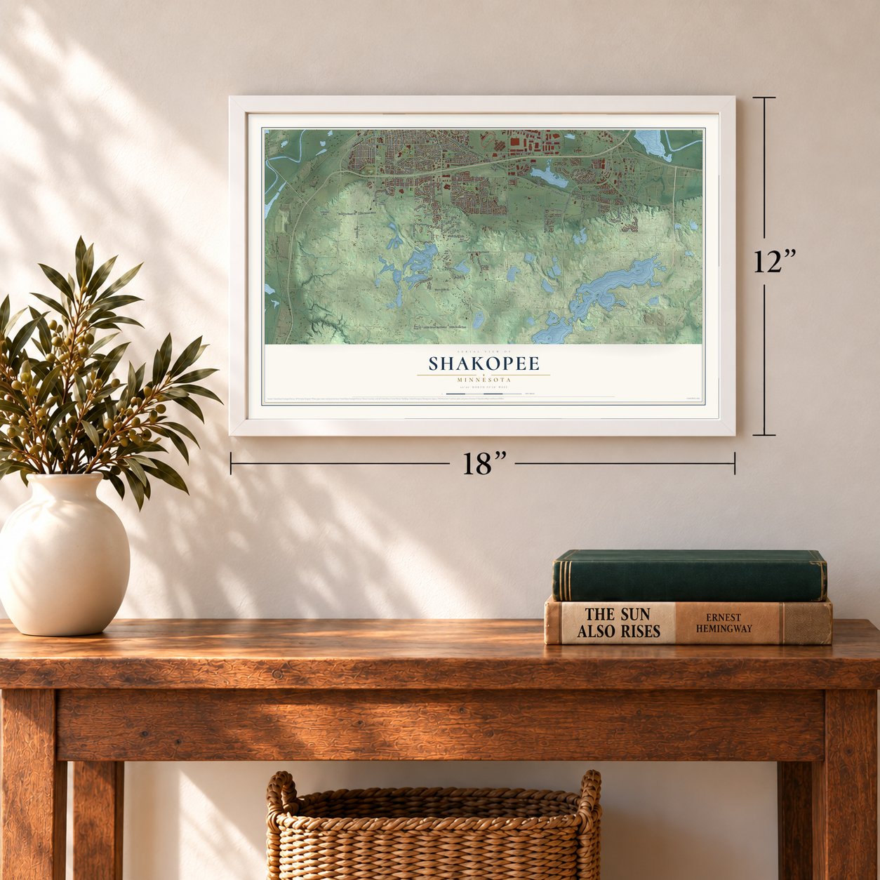
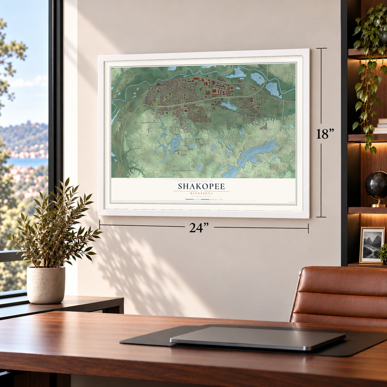
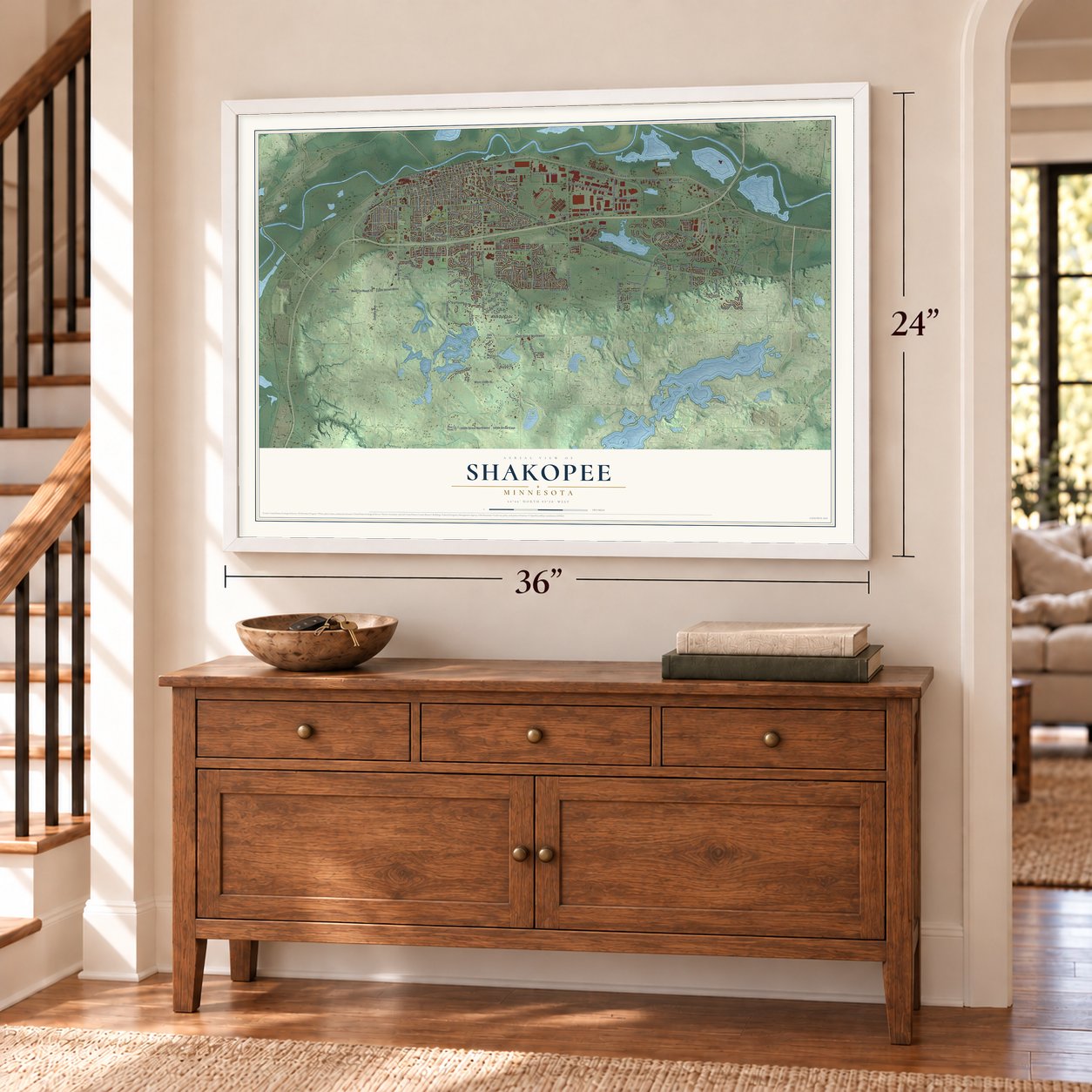
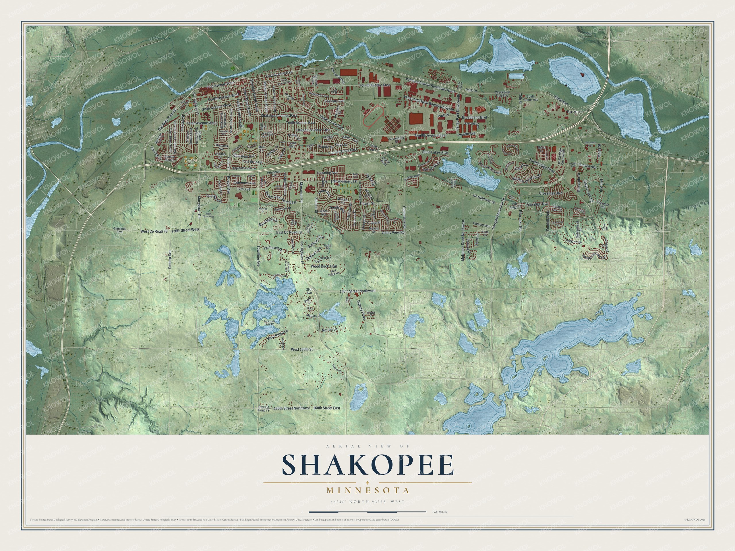
A new map of Shakopee, Minnesota, made in 2026 and printed to order on thick archival matte paper.
12" x 18" Archival Matte Print
A Map of Home. A Work of Art.
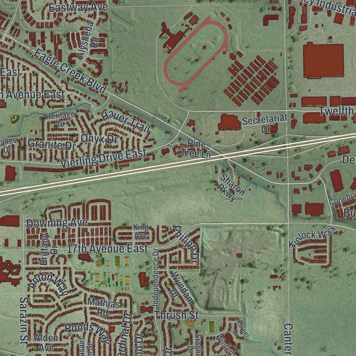
Explore Shakopee, Minnesota from a whole new perspective. Created using aerial imagery and detailed geographic data, this map captures Shakopee building by building, with labeled streets, familiar landmarks, and shaded topographical relief that highlights the natural contours of the landscape.
Combining modern data with the timeless character of a vintage atlas, this map is just as interesting up close as it is beautiful on the wall. Whether you grew up in Shakopee, spent memorable years there, or call it home today, this unique map is a great way to celebrate a place that means something to you. Zoom in on the preview to look for your street, and then order a print to put your memories on the wall.
Three ways to hang it
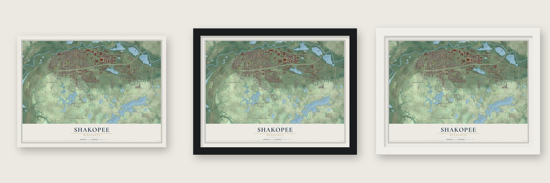
Unframed archival matte, a black wood frame or a white wood frame.
Up close
Geography Worth Displaying
This map was created using accurate cartographic data and authoritative geographic sources, including the U.S. Geological Survey and the Census Bureau. The map brings together terrain, waterways, roads, and building detail. The majority of the streets are labeled, houses are accurately depicted, and the topography is derived from government sources. Combining local data with carefully composed color and shading leads to this beautifully detailed Shakopee artwork for your wall.
Rather than simply showing street outlines, we’ve included as many of the street names as we could reasonably fit on the map while keeping their names legible. Zoom in on the high resolution preview to see exactly what’s on the map. We truly set out to create a statement piece for anyone who loves Shakopee. So whether it’s for you, or a gift for someone you love, we hope this map of Shakopee brings back fond memories.
Read the story behind this map of Shakopee, Minnesota from 2026.

About Shakopee, Minnesota
Shakopee is a city of 43,698 people and the county seat of Scott County, on the south bank of a bend in the Minnesota River. During the 18th century, the Mdewakanton Dakota leader Chief Shakopee II set up his village near the water at the east end of this ground. The explorer Nicollet heard the place called tinta ottonwe, the "village of the prairie," where the band lived in bark lodges in summer and tipis in winter and planted cornfields as the seasons turned.
In 1851, the year of the Treaty of Traverse des Sioux, Thomas A. Holmes opened a trading post west of the Dakota village. In 1854 he platted Shakopee Village and named it for the chief. The town grew fast and incorporated in 1857, but the Dakota War led it to give up its charter in 1861. Once tensions eased, Shakopee incorporated again in 1870, while its western end stayed a township and became Jackson Township.
- Mounds on the bluffPrehistoric peoples built burial mounds on the bluff above the Minnesota River between 500 and 2,000 years ago. They sit inside today's Veterans Memorial Park, part of the Shakopee Historic District along the riverbank.
- First school in 1854Miss Mary Jane Turner taught Shakopee's first school in 1854, the same year Holmes laid out the village streets and lots.
- River meets railShakopee boomed as a trading stop where goods moved between riverboats and the railroad at Murphy's Landing. Along the river today, The Landing is an 88-acre historic village that shows how Minnesotans lived from 1840 to 1890.
- A new bridge in 1996For a long time Shakopee stood apart in the valley, but by the 1960s the town's living depended on the growing Twin Cities. In 1996 U.S. Highway 169 was moved to run toward the newly built Bloomington Ferry Bridge, and the city grew quickly as a bedroom community. Today people know it for two big draws: the Canterbury Park racetrack and Valleyfair, an amusement park.
Find your street
Names on the Shakopee map
Every name below is printed on this map. Look for your street, your school, the park where you played, or the pond down the road.
Places and landmarks3
- Barden
- Lions Park
- Tahpah Park
Streets and roads205
- County Highway 16
- Old Brick Yard Road
- First Avenue West
- First Avenue East
- Twelfth Avenue East
- Fourth Avenue West
- Twelfth Avenue
- Vierling Drive East
- West County Road 78
- Townline Avenue
- East County Road 78
- Tenth Avenue West
- Foothill Trail
- Sarazin Street
- County Highway 17
- Southbridge Parkway
- 130th Street West
- Marschall Road
- Pike Lake Road
- Fourth Avenue East
- Valley Park Drive South
- Eagle Creek Boulevard
- Harrgott Memorial Drive
- 17th Avenue East
- Canterbury Road
- County Highway 15
- Stagecoach Road
- Valley View Road
- Marystown Road
- Sixth Avenue West
Show all 205 streets
- Crossings Boulevard
- 160th Street East
- 160th Street Northwest
- Shakopee Avenue East
- Crest Avenue
- Broadband Boulevard
- Vierling Drive
- Tenth Avenue East
- McKenna Road Northwest
- Horizon Drive
- West 150th Street
- Eleventh Avenue East
- Koeper Avenue
- Fuller Street South
- Harrison Street South
- 140th Street Northwest
- Wood Duck Trail
- Valley Industrial Boulevard North
- Valley View Road East
- Valley Industrial Boulevard South
- Market Street South
- Lewis Street South
- Dakota Parkway
- Thrush Street
- Spencer Street South
- Zumbro Avenue
- Windsor Drive South
- Ponds Way
- Dean Lakes Boulevard
- 16th Avenue
- Cardinal Drive
- Omega Drive
- Tinta Lane
- Fairhaven Drive
- Park Place
- 70th Street
- Vista Ridge Lane
- Bulrush Boulevard
- Barrington Drive
- Hauer Trail
- Dominion Avenue
- Jackson Street
- 17th Avenue
- Danube Avenue
- Crane Street
- Downing Avenue
- Countryside Drive
- Oakridge Trail
- Norton Drive
- Ormond Drive
- Bluestem Avenue
- Thistle Lane
- Sage Lane
- Ardennes Avenue
- Eastway Avenue
- Maras Street
- Chateau Avenue
- Fuller Street
- Anton Way
- Onyx Drive
- Riverside Drive
- Hansen Avenue
- Granite Drive
- Park Drive
- Prairie Lane
- Sussex Lane
- Philipp Drive
- Eleventh Avenue
- Jennifer Lane
- Shenandoah Drive
- Chestnut Boulevard
- Veirling Drive
- Halli Road
- Whispering Oaks Trail
- Gorman Street
- East County Road 72
- Dakota Street South
- Adams Street South
- Scott Street South
- Marcia Lane
- Mathias Road
- Muhlenhardt Road
- Molina Street
- Shumway Street South
- Madison Street South
- Oxford Road South
- Spring Lake Drive
- Tintaocanku
- Secretariat Drive
- Redwing Drive
- Tyler Street South
- Checkered Flag Boulevard
- Harvest Lane
- Patterson Drive
- Old Carriage Court North
- Caspian Lane
- Boulder Pointe
- Alysheba Road
- Appleblossom Lane
- Greenway Avenue
- Wyndam Drive
- Preserve Trail
- East Mound Street
- Tasha Boulevard
- Main Street
- Princeton Avenue
- Wildwood Drive
- South Cretex Avenue
- Oak Ridge Court
- Viking Steel Road
- Kinlock Way
- Pine Tree Lane
- Alden Avenue
- Monnens Avenue
- Brittany Drive
- Sharon Parkway
- Liberty Circle
- Tinta Circle
- Derby Lane
- Kelly Circle
- 29th Avenue
- Mark Court
- Ash Street
- Mint Circle
- Independence Drive
- Third Avenue East
- Heritage Drive
- Leavitt Woods Lane
- Pheasant Run Street
- Peninsula Point Road
- Shakopee Town Square
- Winterberry Lane
- Coneflower Lane
- Portage Lane
- Staghorn Drive
- Deans Lake Road
- Wolf Ridge Avenue
- Peace Avenue
- Thomas Avenue
- Windsor Lane
- Westridge Drive
- King Avenue
- Pottok Lane
- Wacipi Drive
- Bass Court
- Weston Lane
- Dalles Drive
- Valley Fair Drive
- Mike Court
- Lakeview Drive South
- Third Avenue West
- Stonebrooke Drive
- Minnesota Street South
- Oxford Road North
- 13th Avenue East
- 128th Street West
- Whitetail Drive
- Roundhouse Street
- Eaglewood Lane
- Falmouth Curve
- Carlisle Curv
- 21st Avenue East
- Columbine Lane
- Dongola Lane
- Hillside Drive South
- Hickory Lane
- Yorkshire Lane
- Newport Avenue
- Hansen Boulevard
- Hillwood Drive
- Karner Drive
- Shawnee Trail
- Aster Lane
- Sunset Court
- Sakpe Circle
Names are listed as they appear on the printed map. Zoom into the product photos to find them.
The art of mapping a place
How This Map Was Made
Real places. Remarkable detail. Discover the layers that turn geographic data into a map of home.

The view from above
Aerial imagery reveals the character of the land: woodland, open fields, and the patterns of a place.

The shape of the land
Elevation data brings hills, valleys, and subtle changes in the landscape into view.

The details of home
Roads, waterways, and building footprints come together to make the map feel unmistakably local.

Geography becomes art
Considered color, shading, and typography bring the layers together in a map made for your wall.


Process illustrated with Mendon, Massachusetts. Aerial imagery: USDA NAIP. Terrain: USGS 3D Elevation Program. Map details and finished artwork: KNOWOL.
The Details
About This Print
Choose an archival matte print, or a black or white Ayous wood frame. The archival matte print is unframed.
Select your size and finish above to see the matching product image and price.
Materials & Craftsmanship
A contemporary map with the character of a classic atlas, printed on archival matte paper. Optional frames are made from Ayous wood.
Your printed map does not include the watermark shown in the full-map preview.
Shipping & Delivery
Free shipping within the United States. Every print is made to order in the USA.
Buying a gift? Add a note in your cart and we'll include it. We never put prices in the package.
Prints ship within 2 to 3 business days. Allow 7 to 10 days total from ordering for delivery. Timing may vary during holidays or periods of high order volume.
Read our shipping policy.
Returns and damaged prints
Each print is made to order. Change-of-mind refunds are not available after production.
If your print arrives damaged, misprinted or incorrect, contact support@knowol.com within 30 days of receiving it. Include your order number, photos and a description of the issue.
Read our full refund and replacement policy. For questions about your order, email support@knowol.com.
Find your town
Looking for another city?
Find a map of home in our Minnesota collection, or any town in the country.
Nearby
Maps of towns near Shakopee
Know someone from one of these towns? Their map makes a great gift.
 Prior Lake
, Minnesota
From $39.99See the map
 Eden Prairie
, Minnesota
From $39.99See the map
 Savage
, Minnesota
From $39.99See the map
More maps nearby: Chanhassen, Chaska, Carver, Bloomington and Credit River.