
Search for another town




Free U.S. delivery 7 to 10 days after you order
Eden Prairie, Minnesota Map Art
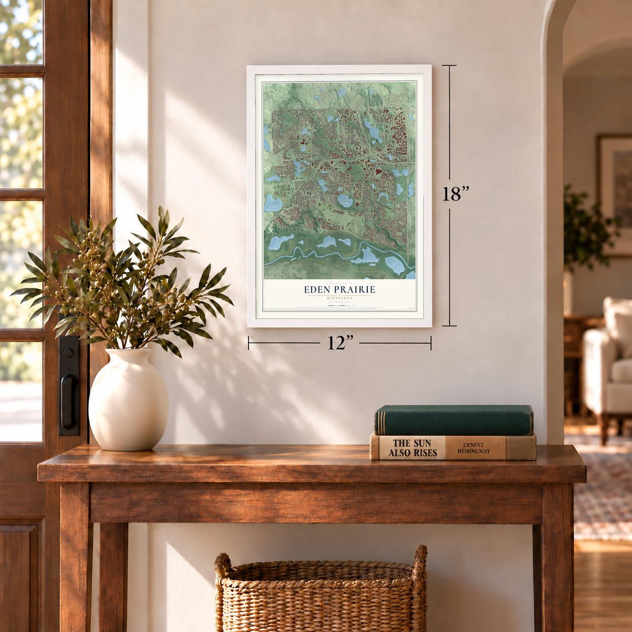
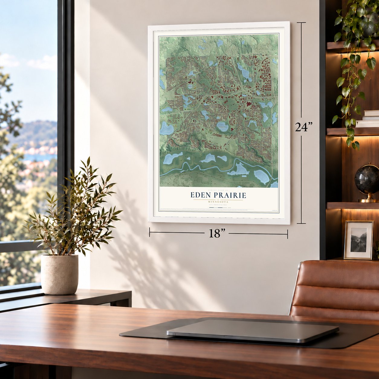
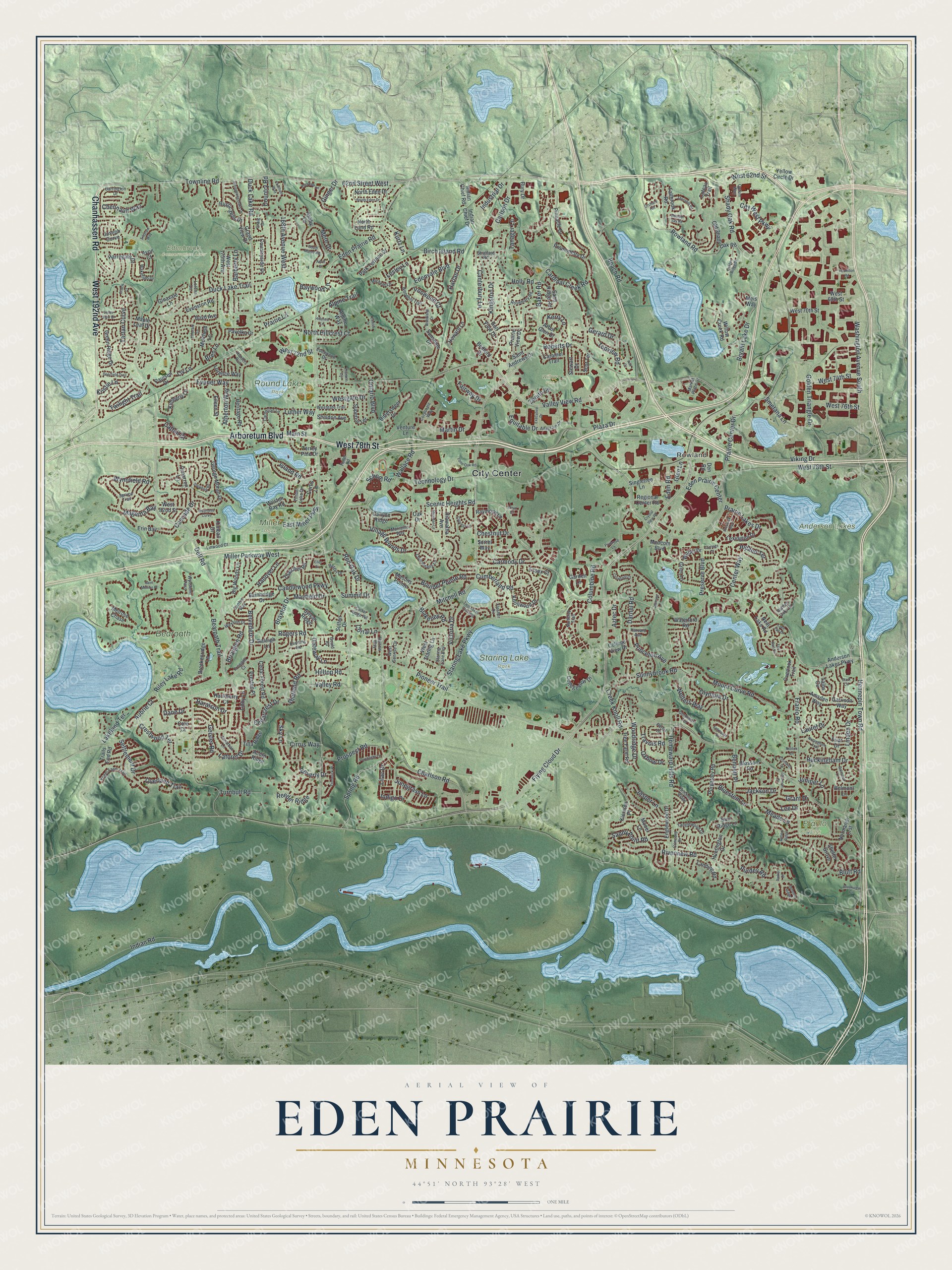
A new map of Eden Prairie, Minnesota, made in 2026 and printed to order on thick archival matte paper.
12" x 18" Archival Matte Print
A Map of Home. A Work of Art.
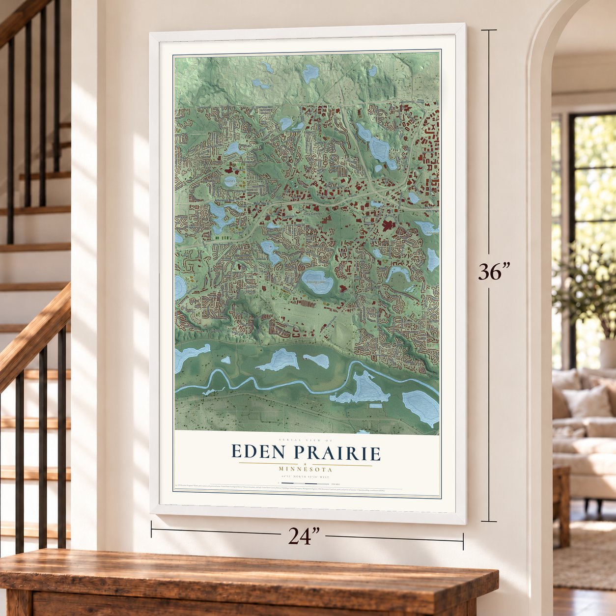
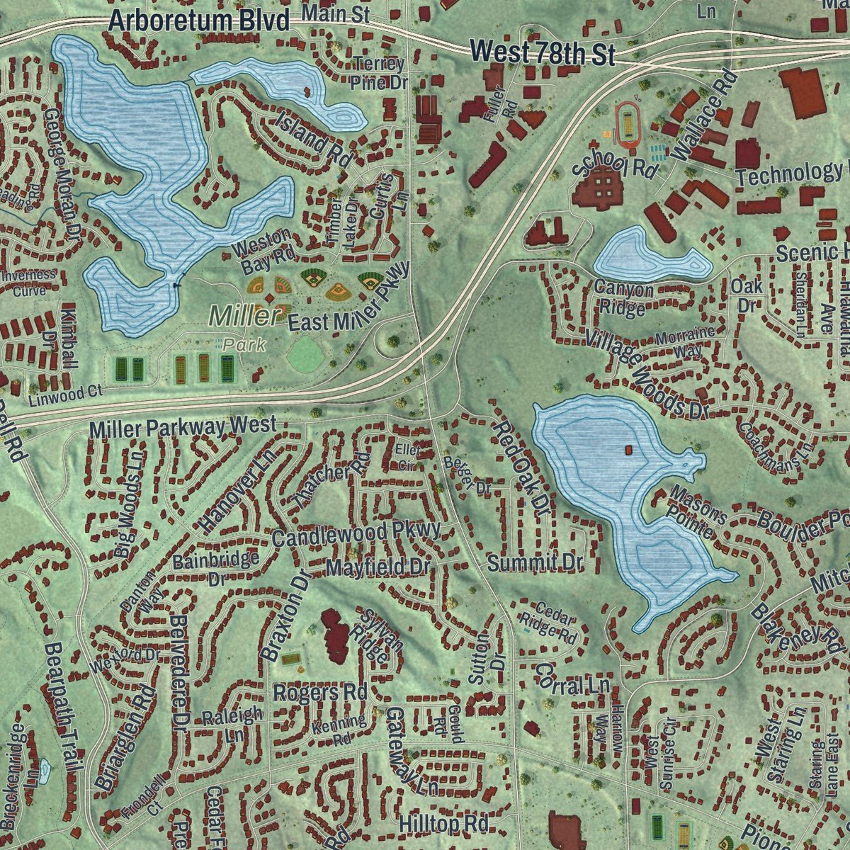
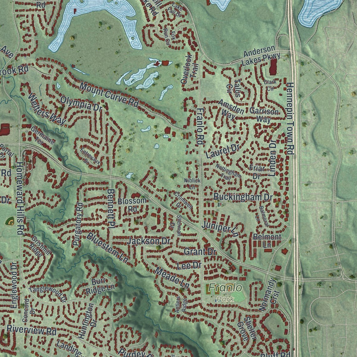
Explore Eden Prairie, Minnesota from a whole new perspective. Created using aerial imagery and detailed geographic data, this map captures Eden Prairie building by building, with labeled streets, familiar landmarks, and shaded topographical relief that highlights the natural contours of the landscape.
Combining modern data with the timeless character of a vintage atlas, this map is just as interesting up close as it is beautiful on the wall. Whether you grew up in Eden Prairie, spent memorable years there, or call it home today, this unique map is a great way to celebrate a place that means something to you. Zoom in on the preview to look for your street, and then order a print to put your memories on the wall.
Three ways to hang it
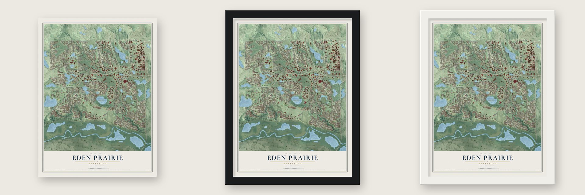
Unframed archival matte, a black wood frame or a white wood frame.
Up close
Geography Worth Displaying
This map was created using accurate cartographic data and authoritative geographic sources, including the U.S. Geological Survey and the Census Bureau. The map brings together terrain, waterways, roads, and building detail. The majority of the streets are labeled, houses are accurately depicted, and the topography is derived from government sources. Combining local data with carefully composed color and shading leads to this beautifully detailed Eden Prairie artwork for your wall.
Rather than simply showing street outlines, we’ve included as many of the street names as we could reasonably fit on the map while keeping their names legible. Zoom in on the high resolution preview to see exactly what’s on the map. We truly set out to create a statement piece for anyone who loves Eden Prairie. So whether it’s for you, or a gift for someone you love, we hope this map of Eden Prairie brings back fond memories.
Read the story behind this map of Eden Prairie, Minnesota from 2026.

About Eden Prairie, Minnesota
Eden Prairie is a city of 64,198 people in Hennepin County, on the north side of the Minnesota River. A treaty in 1851 opened the land west of the Mississippi, and pioneers soon came to farm here. In 1853 the writer Elizabeth F. Ellet called the place Eden, because she admired the open prairie across the south end of town. The town board met for the first time on May 11, 1858, in a log schoolhouse, on the very day Minnesota became a state.
For about a century the farm town grew slowly. It had about 739 people in 1880 and only 2,000 by 1960. The first big development came in 1946 with Flying Cloud Airport. Eden Prairie became a village in 1962. Interstate 494 and the Eden Prairie Center mall arrived in the mid-1970s, and it became a statutory city in 1974.
- A battle at Murphy's FerryOn May 25, 1858, Ojibwe and Dakota warriors fought near Murphy's Ferry, just north of the Minnesota River in the south of Eden Prairie. The Ojibwe came to avenge one of their people, killed by the Dakota the fall before. They had 200 warriors to the Dakota's 60 to 70, but the Dakota won the fight and wounded the young Ojibwe chief.
- Chief Shoto's last homeShoto, born into Chief Wabash's band, led the Red Wing Dakota for 15 years and then became chief of the Little Six band. After the uprising of 1862 he scouted for Governor Sibley until 1870. In 1872 he rejoined the Little Six band. He spent his final years in Eden Prairie, where he died in 1899, aged 99.
- A farmhouse from 1880John Cummins, an immigrant from Ireland, built his farmhouse with his wife Mattie in 1880. He was a respected horticulturist who tested strains of apples and grapes on his land, hoping to find ones hardy enough for Minnesota's harsh climate. His family sold the farm to the Phipps family in 1908, and the John R. Cummins Farmhouse joined the National Register in 1982.
- Hennepin, the lost river townJohn H. McKenzie and Alexander Wilkins, secretary of Minnesota Territory, laid out a town called Hennepin beside the Minnesota River, in the southeastern corner of today's Eden Prairie. For several years it shipped grain. The lay of the land made hauling crops there hard, though, and other towns took its trade, so Hennepin disappeared from the maps.
- Staring LakeStaring Lake takes its name from Jonas Platt Staring, who lived from 1809 to 1894 and built the first house beside it.
Find your street
Names on the Eden Prairie map
Every name below is printed on this map. Look for your street, your school, the park where you played, or the pond down the road.
Places and landmarks10
- City Center
- Rowland
- Anderson Lakes
- Edenbrook Conservation Area
- Franlo Park
- Miller Park
- Round Lake Park
- Staring Lake Park
- Willow Park
- Bearpath
Streets and roads377
- Arboretum Boulevard
- West 78th Street
- Chanhassen Road
- West 192nd Avenue
- Dell Road
- Mitchell Road
- Darnel Road
- Carmody Drive
- Spring Road
- Hennepin Town Road
- Baker Road
- City West Parkway
- Bearpath Trail
- Scenic Heights Road
- Tartan Curve
- Evener Way
- Twilight Trail
- Kristie Lane
- Washington Avenue South
- Flying Cloud Drive
- Pioneer Trail
- Valley View Road
- Eden Prairie Road
- Prairie Center Drive
- Riverview Road
- Townline Road
- Technology Drive
- Indian Road
- Homeward Hills Road
- Franlo Road
Show all 377 streets
- Edenvale Boulevard
- Duck Lake Trail
- Riley Lake Road
- Shady Oak Road
- Miller Parkway West
- Staring Lake Parkway
- Duck Lake Road
- Columbine Road
- Beach Road
- Viking Drive
- Eden Prairie Center
- Village Woods Drive
- Bryant Lake Drive
- Preserve Boulevard
- Braxton Drive
- Boulder Pointe Road
- Cascade Drive
- Rowland Road
- Mount Curve Road
- North Hillcrest Court
- Martin Drive
- Candlewood Parkway
- Plaza Drive
- Charlson Road
- Roberts Drive
- Olympia Drive
- Golden Triangle Drive
- Bennett Place
- Prospect Road
- Gerard Drive
- Bluff Road
- Linden Drive
- West 62nd Street
- Prairie Lakes Drive
- Sunnybrook Road
- Lee Drive
- Island Road
- Cumberland Road
- Beverly Drive
- Crestwood Terrace
- Center Way
- Ontario Boulevard
- Buckingham Drive
- Magenta Bay
- Cardinal Creek Road
- Chennault Way
- Valley Road
- Rogers Road
- Purdey Road
- Mere Drive
- Kerry Lane
- Haralson Drive
- Indigo Drive
- Geisler Road
- 168th Avenue West
- Bluestem Lane
- Belvedere Drive
- Chestnut Drive
- 62nd Street West
- Kingston Drive
- Woodridge Drive
- Liv Lane
- Laforet Drive
- Barberry Lane
- School Road
- Kurtz Lane
- Jasper Lane
- Topview Road
- Welters Way
- Victoria Drive
- Meade Lane
- Birch Island Road
- Canterbury Lane
- Eden Road
- Alpine Trail
- Holly Road
- Red Oak Drive
- Shetland Road
- East Miller Parkway
- Sky Lane
- Junegrass Lane
- Equitable Drive
- Westgate Drive
- Wallace Road
- Carlson Drive
- West 74th Street
- Main Street
- Fairway Drive
- Turnbull Road
- Reeder Ridge
- Grant Drive
- Baywood Lane
- Lakeland Terrace
- West 76th Street
- Overland Trail
- Wynnfield Road
- Briarglen Road
- Creek Knoll Road
- Juniper Lane
- Tanager Lane
- Princeton Avenue
- Cedarcrest Drive
- Gateway Lane
- Cattail Court
- Summit Drive
- Mayfield Drive
- Hilltop Road
- Country Road
- Oxbow Drive
- Jackson Drive
- Hanover Lane
- Sandy Point Road
- Laurel Drive
- Blakeney Road
- Harlan Drive
- Atherton Way
- Settlement Drive
- Smetana Lane
- Lesley Lane
- Ironwood Court
- Cirrus Way
- Ginger Drive
- Aubrie Court
- Prairie Lane
- Travois Road
- West 72nd Street
- Bren Lane
- Lilac Drive
- Industrial Drive
- Luther Way
- Hyland Terrace
- Aztec Drive
- Zenith Lane
- Dane Drive
- Corral Lane
- Glen Lane
- Anderson Lakes Parkway
- Collegeview Drive
- West 175th Avenue
- Neill Lake Road
- Terrey Pine Drive
- Boyd Avenue
- George Moran Drive
- Howard Lane
- Landing Road
- Hiawatha Avenue
- Willow Creek Road
- Garrison Way
- Amsden Way
- Venture Lane
- Maple Leaf Drive
- Promontory Drive
- Golf View Drive
- Purgatory Road
- Old Shady Oak Road
- Knollwood Drive
- Lorence Way
- Singletree Lane
- Countryside Drive
- Green Ridge Drive
- Park Terrace Drive
- Harrogate Drive
- Paulsen Drive
- North Eden Drive
- Kimberly Lane
- Curtis Lane
- Bittersweet Drive
- Englewood Drive
- Kiersten Place
- Sand Ridge Road
- Saint Andrews Drive
- Bainbridge Drive
- Cedar Forest Road
- Rustic Hills Drive
- Kimball Drive
- Joseph Curve
- Superior Terrace
- Fallbrook Road
- Thatcher Road
- Lexington Drive
- Big Woods Lane
- Belmont Lane
- Sunshine Drive
- Stewart Drive
- Essex Court
- Prairie View Drive
- Alpine Way
- Grier Lane
- Regional Center Road
- Talus Circle
- Sutton Drive
- Erin Bay
- Pavelka Drive
- Heritage Road
- Breckenridge Lane
- Coteau Trail
- Eileen Street
- Ginavale Lane
- Mooer Lane
- Pinnacle Drive
- Weston Bay Road
- West Staring Lane
- Grand View Drive
- Tree Farm Road
- West 82nd Street
- Arbor Glen Drive
- Caramel Trail
- Burr Ridge Lane
- Canyon Ridge
- Evenston Road
- Waterford Road
- Sheldon Avenue
- Shelter Grove
- Overlook Trail
- Scot Terrace
- West 70th Street
- Medcom Boulevard
- Raymond Lane
- North Lund Road
- West 69th Street
- Indian Chief Drive
- Sylvan Ridge
- Hackberry Court
- Blossom Road
- Cimarron Lane
- Huntington Drive
- Garden Lane
- Acorn Ridge
- Normandy Crst
- Tilla Ridge
- Trails End Road
- Raleigh Lane
- Libby Lane
- Preston Place
- Wilder Drive
- Friar Drive
- Ashby Lane
- Melrose Chase
- Indian Chief Road
- Yellow Circle Drive
- Muirfield Lane
- Bedford Drive
- Masons Pointe
- College View Drive
- Bury Drive
- Sorrel Way
- Den Road
- Cole Court
- Mels Way
- Avon Court
- Oak Drive
- Vogel Farm Trail
- Carnelian Lane
- Gould Road
- Rosemary Road
- Barrington Drive
- Gristmill Ridge
- Northrup Trail
- Staring Lane East
- Anagram Drive
- Linwood Court
- Timber Lake Drive
- Hidden Oaks Drive
- Hunters Run
- Cedar Ridge Road
- Flesher Circle
- Woodhill Trail
- West Sunrise Circle
- Coachmans Lane
- Westgate Trail
- Fuller Road
- Danton Way
- Portal Drive
- Spruce Trail
- Tanglewood Drive
- Jonathan Lane
- Wexford Drive
- Morraine Way
- Optum Way
- Germaine Terrace
- Wakefield Drive
- Michele Lane
- Kenning Road
- Berger Drive
- Frondell Court
- Harvard Avenue
- Concord Drive
- Corporate Way
- Edenwood Drive
- Market Place Drive
- Wynstone Pass
- Harrow Way
- Stratford Road
- Lorena Lane
- Craig Drive
- Erwin Court
- Woodland Drive
- Tristram Way
- Nottingham Trail
- Frederick Place
- South Manor Road
- Entrevaux Drive
- Sonoma Ridge
- Whispering Oaks Drive
- Chatham Way
- Hamilton Road
- Balmoral Lane
- Antlers Ridge
- Steading Road
- Twin Lakes Crossing
- Franklin Circle
- South Eden Drive
- Sherman Drive
- Ellet Circle
- Hillcrest Lane
- Thornhill Road
- Golden Ridge Drive
- Cromwell Drive
- Porchlight Lane
- Ellerdale Lane
- Cypress Lane
- Sheridan Lane
- Inverness Curve
- Deerfield Trail
- Preswick Boulevard
- Executive Drive
- Lone Oak Road
- Jasmine Lane
- Crowfoot Court
- Lake Fall Drive
- Lotus View Drive
- Fox Run Circle
- Brookview Circle
- Saint Mellion Place
- Carriage Court
- Primrose Lane
- Emerald Lane
- Crystal View Road
- Boulder Bay Road
- Orchard Hill
- Niblick Lane
- Parker Drive
- Center Drive
- Charis Court
- Adret Court
- Clark Circle
- Ann Court
Names are listed as they appear on the printed map. Zoom into the product photos to find them.
The art of mapping a place
How This Map Was Made
Real places. Remarkable detail. Discover the layers that turn geographic data into a map of home.

The view from above
Aerial imagery reveals the character of the land: woodland, open fields, and the patterns of a place.

The shape of the land
Elevation data brings hills, valleys, and subtle changes in the landscape into view.

The details of home
Roads, waterways, and building footprints come together to make the map feel unmistakably local.

Geography becomes art
Considered color, shading, and typography bring the layers together in a map made for your wall.


Process illustrated with Mendon, Massachusetts. Aerial imagery: USDA NAIP. Terrain: USGS 3D Elevation Program. Map details and finished artwork: KNOWOL.
The Details
About This Print
Choose an archival matte print, or a black or white Ayous wood frame. The archival matte print is unframed.
Select your size and finish above to see the matching product image and price.
Materials & Craftsmanship
A contemporary map with the character of a classic atlas, printed on archival matte paper. Optional frames are made from Ayous wood.
Your printed map does not include the watermark shown in the full-map preview.
Shipping & Delivery
Free shipping within the United States. Every print is made to order in the USA.
Buying a gift? Add a note in your cart and we'll include it. We never put prices in the package.
Prints ship within 2 to 3 business days. Allow 7 to 10 days total from ordering for delivery. Timing may vary during holidays or periods of high order volume.
Read our shipping policy.
Returns and damaged prints
Each print is made to order. Change-of-mind refunds are not available after production.
If your print arrives damaged, misprinted or incorrect, contact support@knowol.com within 30 days of receiving it. Include your order number, photos and a description of the issue.
Read our full refund and replacement policy. For questions about your order, email support@knowol.com.
Find your town
Looking for another city?
Find a map of home in our Minnesota collection, or any town in the country.
Nearby
Maps of towns near Eden Prairie
Know someone from one of these towns? Their map makes a great gift.
 Chanhassen
, Minnesota
From $39.99See the map
 Shakopee
, Minnesota
From $39.99See the map
 Edina
Edina, Minnesota
From $39.99See the map
More maps nearby: Minnetonka, Hopkins, Greenwood, Excelsior and Deephaven.