
Search for another town





Free U.S. delivery 7 to 10 days after you order
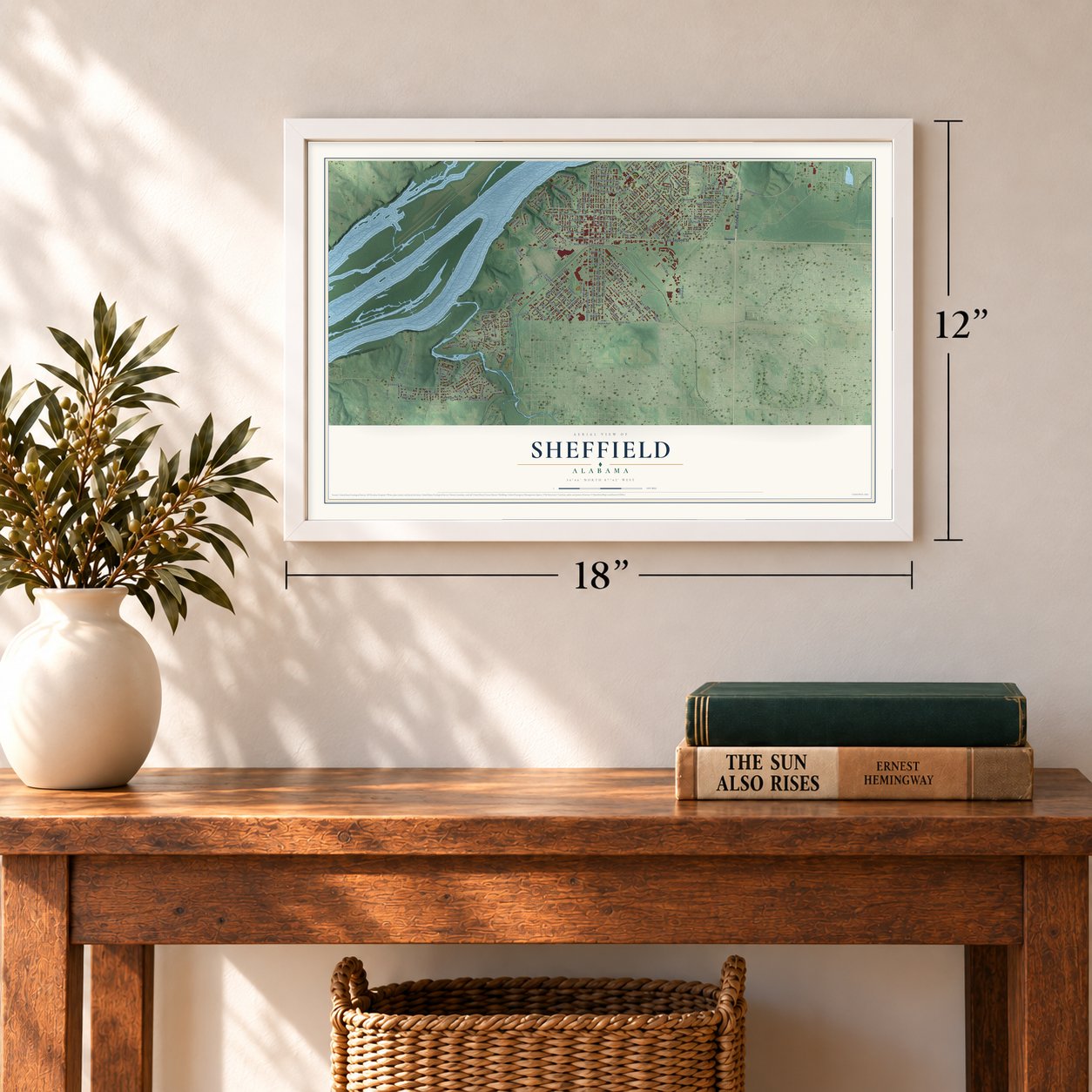
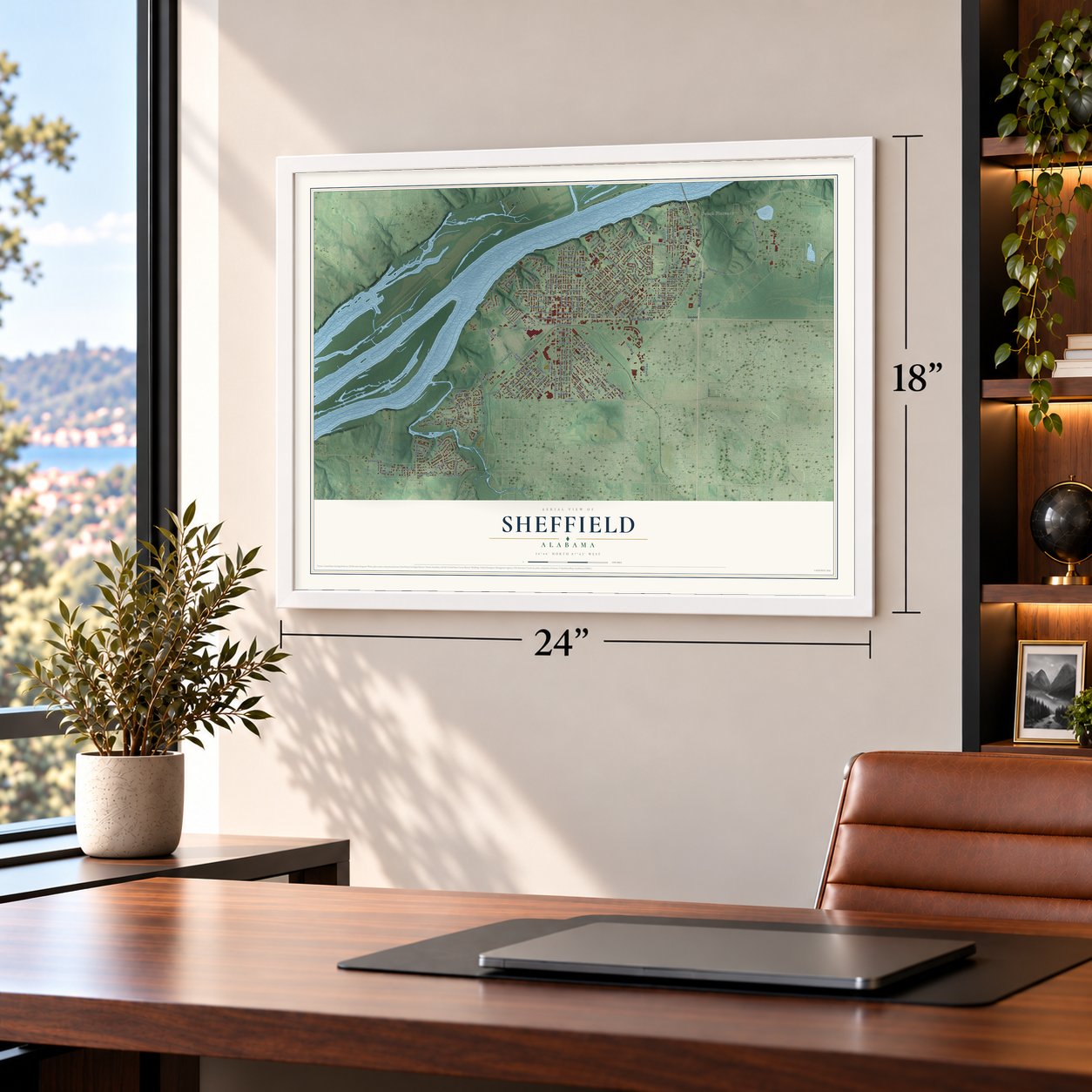
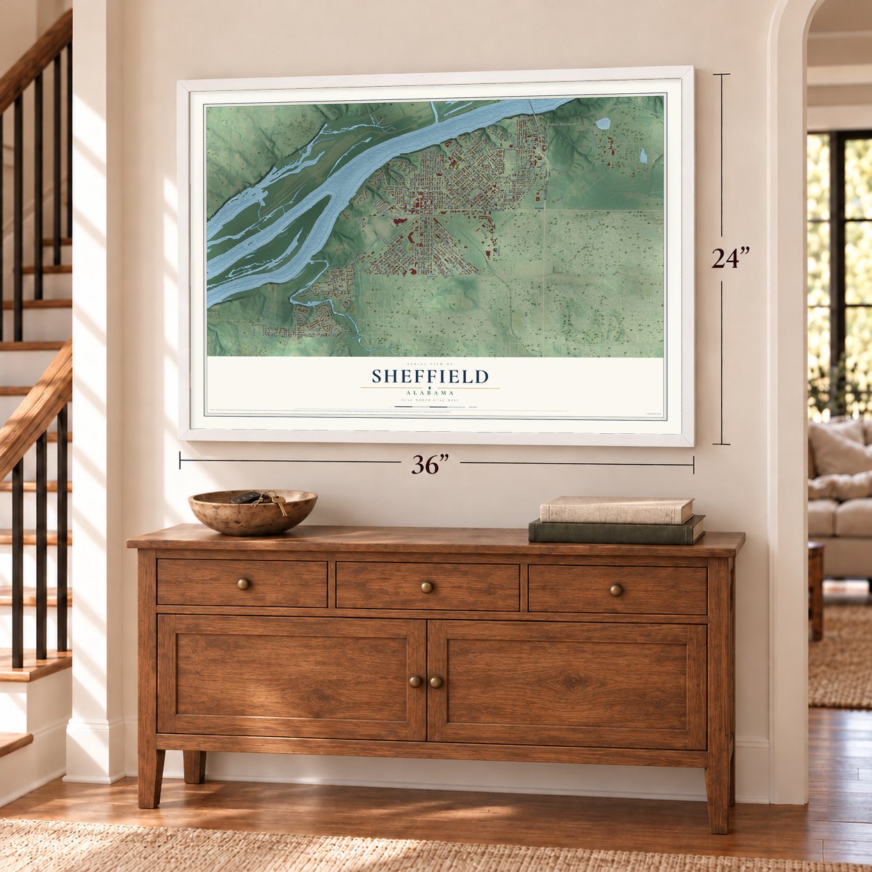
Sheffield, Alabama Map Art
A new map of Sheffield, Alabama, made in 2026 and printed to order on thick archival matte paper.
12" x 18" Archival Matte Print
A Map of Home. A Work of Art.
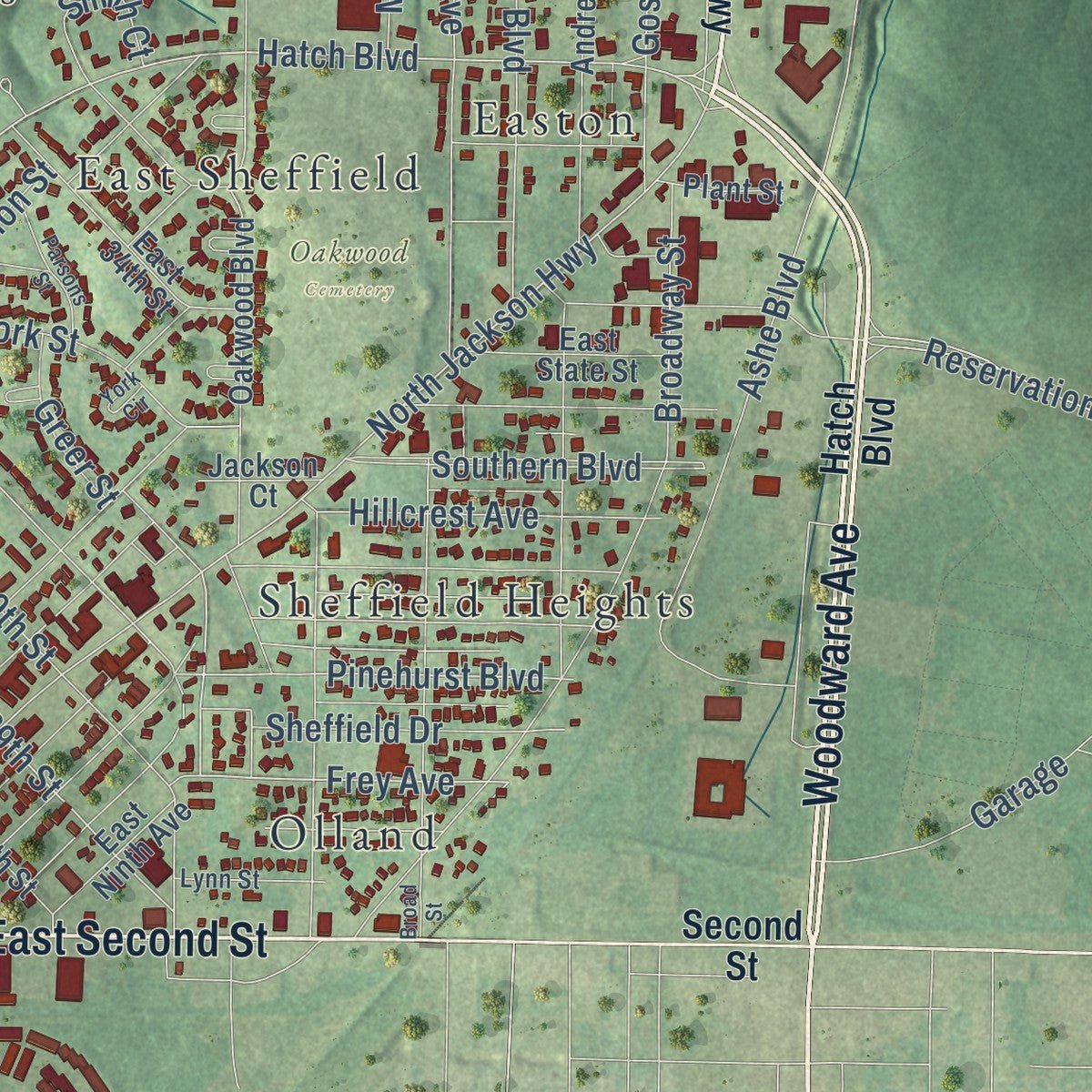
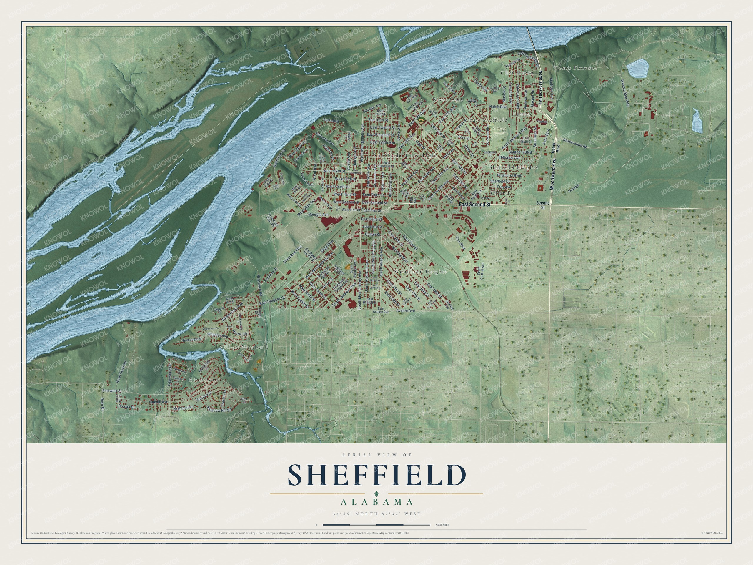
Explore Sheffield, Alabama from a whole new perspective. Created using aerial imagery and detailed geographic data, this map captures Sheffield building by building, with labeled streets, familiar landmarks, and shaded topographical relief that highlights the natural contours of the landscape.
Combining modern data with the timeless character of a vintage atlas, this map is just as interesting up close as it is beautiful on the wall. Whether you grew up in Sheffield, spent memorable years there, or call it home today, this unique map is a great way to celebrate a place that means something to you. Zoom in on the preview to look for your street, and then order a print to put your memories on the wall.
Three ways to hang it
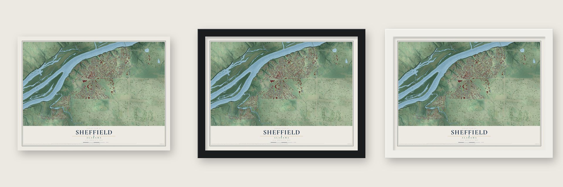
Unframed archival matte, a black wood frame or a white wood frame.
Up close
Geography Worth Displaying
This map was created using accurate cartographic data and authoritative geographic sources, including the U.S. Geological Survey and the Census Bureau. The map brings together terrain, waterways, roads, and building detail. The majority of the streets are labeled, houses are accurately depicted, and the topography is derived from government sources. Combining local data with carefully composed color and shading leads to this beautifully detailed Sheffield artwork for your wall.
Rather than simply showing street outlines, we’ve included as many of the street names as we could reasonably fit on the map while keeping their names legible. Zoom in on the high resolution preview to see exactly what’s on the map. We truly set out to create a statement piece for anyone who loves Sheffield. So whether it’s for you, or a gift for someone you love, we hope this map of Sheffield brings back fond memories.
Read the story behind this map of Sheffield, Alabama from 2026.

About Sheffield, Alabama
Sheffield is a city of 9,403 people in Colbert County, on the south bank of the Tennessee River. Gen. Andrew Jackson and his men came through this ground during the Creek War of 1813-14, and in 1816 Jackson and John Coffee bought land here through their Cypress Land Company. The federal government finished a military road named for Jackson in 1820, and a town called York Bluff grew up beside it, but it soon faded away.
After Reconstruction, the discovery of iron ore and limestone brought new investors. In 1883 Capt. Alfred H. Moses, a Montgomery banker, joined the brothers Walter Gordon and C. E. Gordon in buying 2,700 acres. They formed the Sheffield Land, Iron & Coal Co. the next year and paid for it by selling lots in the planned town. Sheffield was incorporated on February 17, 1885, taking its name from England's great industrial city, and Gov. Edward A. O'Neal appointed Moses the first mayor.
- Five blast furnacesThe Sheffield Furnace Company fired its first blast furnace in 1887. Enoch Ensley built a second one in 1888 and also bought another furnace from the company, and before long five furnaces were running in the city. The Sheffield Furnace Company finally shut down in 1926.
- A war plant and a damIn October 1917 President Woodrow Wilson picked Sheffield for an ammonium nitrate plant for explosives, and Village Number 1 housed its workers. In 1918 the Army Corps of Engineers started Wilson Dam about five miles upriver, and up to 20,000 people worked on the projects. The war ended in November 1918 with the plants unfinished, and the boom faded. The dam was completed in 1924, and in the 1930s the new TVA took it over for fertilizer and electricity.
- Village One and its schoolTVA owned Village One from 1933 to 1949, and its employees lived in the houses. From 1934 to 1941 their children went to a progressive school in the old barracks building. In 1949 TVA auctioned off the houses and gave the school and the parks to the City of Sheffield, the same year the city annexed TVA housing.
- Professor Sterling's schoolSheffield's black children started public school in 1889 under Henry Hopkins, in a frame schoolhouse at E. 20th St. and S. Atlanta Ave. Benjamin J. Sterling, born into slavery, became principal in 1896 and taught until 1936. A high school opened in 1920 with 13 students, and P.B. Swoopes and Marion C. McDaniel graduated first, in 1921. In 1923 the Board of Education built a $20,227.50 brick school on E. 19th St. for all 12 grades.
- Muscle Shoals Sound StudioMembers of the Muscle Shoals Rhythm Section opened their own studio at 3614 Jackson Highway and began turning out hit records there in 1969. Aretha Franklin, The Rolling Stones, The Staple Singers, Lynyrd Skynyrd and Bob Seger all recorded in the small building. The studio moved to 1000 Alabama Avenue in 1978, and the Jackson Highway building joined the National Register in 2006.
Find your street
Names on the Sheffield map
Every name below is printed on this map. Look for your street, your school, the park where you played, or the pond down the road.
Places and landmarks12
- Sheffield City Hall
- Rivermont
- South Florence
- Oakwood Cemetery
- Cliff Haven
- East Sheffield
- Easton
- Olland
- River Oaks
- Sheffield Heights
- Village Number 1
- Woodlawn Heights
Streets and roads176
- Woodward Avenue
- East Second Street
- Avalon Avenue
- North Montgomery Avenue
- South Montgomery Avenue
- South Atlanta Avenue
- Atlanta Avenue
- Gordon Avenue
- East First Street
- 14th Avenue
- South Jackson Highway
- Park Boulevard
- Hatch Boulevard
- East 19th Street
- Sterling Boulevard
- East 15th Avenue
- West Montgomery Avenue
- River Bluff Drive
- Frey Avenue
- Forest Avenue
- West Second Street
- East 29th Street
- Dover Avenue
- West Tenth Street
- East Douglas Street
- North Jackson Highway
- Pinehurst Boulevard
- West Third Street
- East Tenth Avenue
- East Third Street
Show all 176 streets
- Wood Avenue
- Wilson Dam Highway
- East 31st Street
- East 17th Avenue
- Gospel Road
- Pickwick Street
- West 20th Avenue
- Oakhill Avenue
- East 30th Street
- Reservation Road
- Cox Boulevard
- Shop Pike
- East 17th Street
- East Twelfth Avenue
- Nashville Avenue
- Edgewood Drive
- Broadway Street
- South Columbia Avenue
- Ashe Boulevard
- Blackwell Road
- Columbia Avenue
- East 18th Street
- East 14th Avenue
- Annapolis Avenue
- South Nashville Avenue
- Southern Boulevard
- River Bend Road
- Fontana Street
- Meadow Hill Road
- West Eighth Street
- Crestline Avenue
- Alabama Avenue
- East 20th Street
- East 18th Avenue
- East 19th Avenue
- East 13th Avenue
- Robertson Boulevard
- Raleigh Avenue
- Austin Avenue
- West Ninth Street
- West Sixth Street
- Terrace Street
- Wilson Dam Avenue
- East 16th Street
- East 21st Street
- Wheeler Avenue
- York Street
- East Twelfth Street
- Union Street
- Darby Avenue
- Georgia Avenue
- Riverfront Drive
- Highland Place
- West Fifth Street
- West Fourth Street
- East 13th Street
- Garage
- Hillcrest Avenue
- Norris Circle
- East Eleventh Street
- Lake Pickwick Drive
- Brooks Drive
- Sheffield Drive
- Cherokee Pike
- Hiwassee Street
- Alabama Court
- East 15th Street
- Cohen Street
- Tressie Street
- High Street
- River Drive
- Smith Court
- Madison Avenue
- Greer Street
- East Ashe Street
- Musick Street
- Almon Street
- Second Street
- West First Street
- 13th Avenue
- 31st Street
- East Avalon Avenue
- 15th Avenue
- Southwest Twelfth Avenue
- Southwest Twelfth Street
- Oakwood Boulevard
- East 21st Avenue
- East 28th Street
- East 27th Street
- South Raleigh Avenue
- East Ninth Avenue
- Rivermont Drive
- Southwest 14th Avenue
- Sterling Avenue
- Watts Bar Street
- East 14th Street
- West 17th Street
- East 35th Street
- East 34th Street
- Andrews Avenue
- East Seventh Street
- Village Drive
- Treatment Plant Road
- West 15th Street
- East State Street
- East Blake Street
- Chestnut Lane
- East Wilholt Street
- East 24th Street
- East 20th Avenue
- Elmwood Drive
- South Central Avenue
- Pine Court
- West Hill Street
- Jackson Court
- Clear View Drive
- Plant Street
- Mabel Street
- East 26th Street
- East 32nd Street
- Southwest 13th Street
- Chickamauga Street
- Park Terrace Court
- Woodland Drive
- Edgehill Drive
- Lynn Street
- Burton Hill Drive
- Riverview Drive
- First Street
- East 25th Street
- Sixth Street West
- Broad Street
- East Sixth Avenue
- Little Rock Avenue
- East Fourth Avenue
- East Saywell Street
- East Moses Street
- Fountain Avenue
- Parsons Street
- Wilson Dam Circle
- West Manning Drive
- Shawnee Lane
- Little Rock Court
- Ridge Point
- York Circle
- Norris Street
Names are listed as they appear on the printed map. Zoom into the product photos to find them.
The art of mapping a place
How This Map Was Made
Real places. Remarkable detail. Discover the layers that turn geographic data into a map of home.

The view from above
Aerial imagery reveals the character of the land: woodland, open fields, and the patterns of a place.

The shape of the land
Elevation data brings hills, valleys, and subtle changes in the landscape into view.

The details of home
Roads, waterways, and building footprints come together to make the map feel unmistakably local.

Geography becomes art
Considered color, shading, and typography bring the layers together in a map made for your wall.


Process illustrated with Mendon, Massachusetts. Aerial imagery: USDA NAIP. Terrain: USGS 3D Elevation Program. Map details and finished artwork: KNOWOL.
The Details
About This Print
Choose an archival matte print, or a black or white Ayous wood frame. The archival matte print is unframed.
Select your size and finish above to see the matching product image and price.
Materials & Craftsmanship
A contemporary map with the character of a classic atlas, printed on archival matte paper. Optional frames are made from Ayous wood.
Your printed map does not include the watermark shown in the full-map preview.
Shipping & Delivery
Free shipping within the United States. Every print is made to order in the USA.
Buying a gift? Add a note in your cart and we'll include it. We never put prices in the package.
Prints ship within 2 to 3 business days. Allow 7 to 10 days total from ordering for delivery. Timing may vary during holidays or periods of high order volume.
Read our shipping policy.
Returns and damaged prints
Each print is made to order. Change-of-mind refunds are not available after production.
If your print arrives damaged, misprinted or incorrect, contact support@knowol.com within 30 days of receiving it. Include your order number, photos and a description of the issue.
Read our full refund and replacement policy. For questions about your order, email support@knowol.com.
Find your town
Looking for another city?
Find a map of home in our Alabama collection, or any town in the country.
Nearby
Maps of towns near Sheffield
Know someone from one of these towns? Their map makes a great gift.
 Tuscumbia
, Alabama
From $39.99See the map
 Muscle Shoals
, Alabama
From $39.99See the map
 Florence
, Alabama
From $39.99See the map
More maps nearby: Underwood-Petersville, St. Florian, Leighton, Littleville and Killen.