
Search for another town





Free U.S. delivery 7 to 10 days after you order
Silver Spring, Maryland Map Art
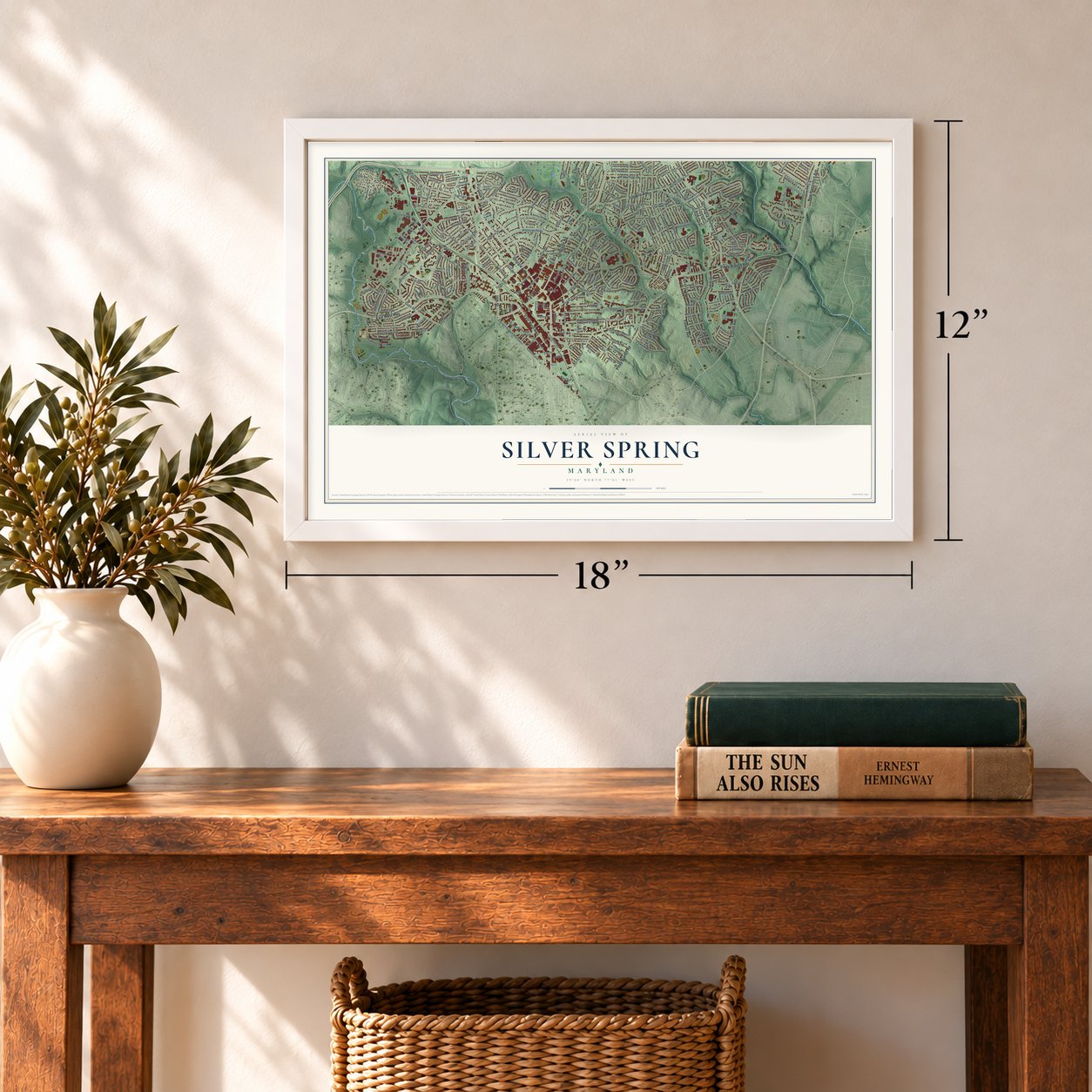
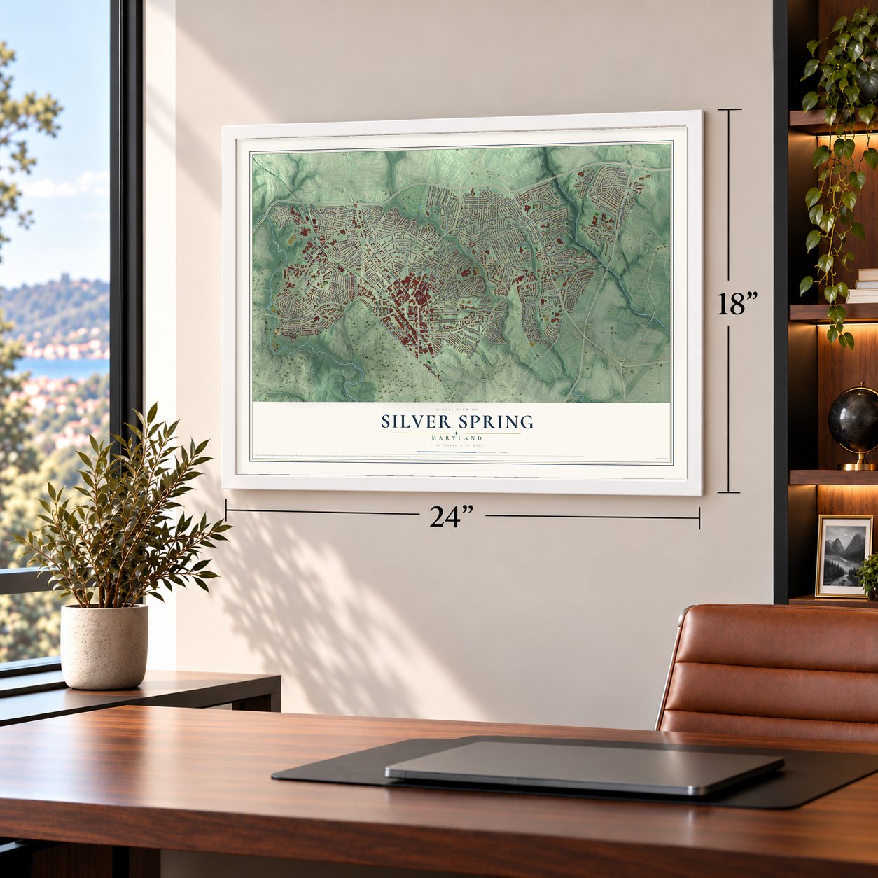
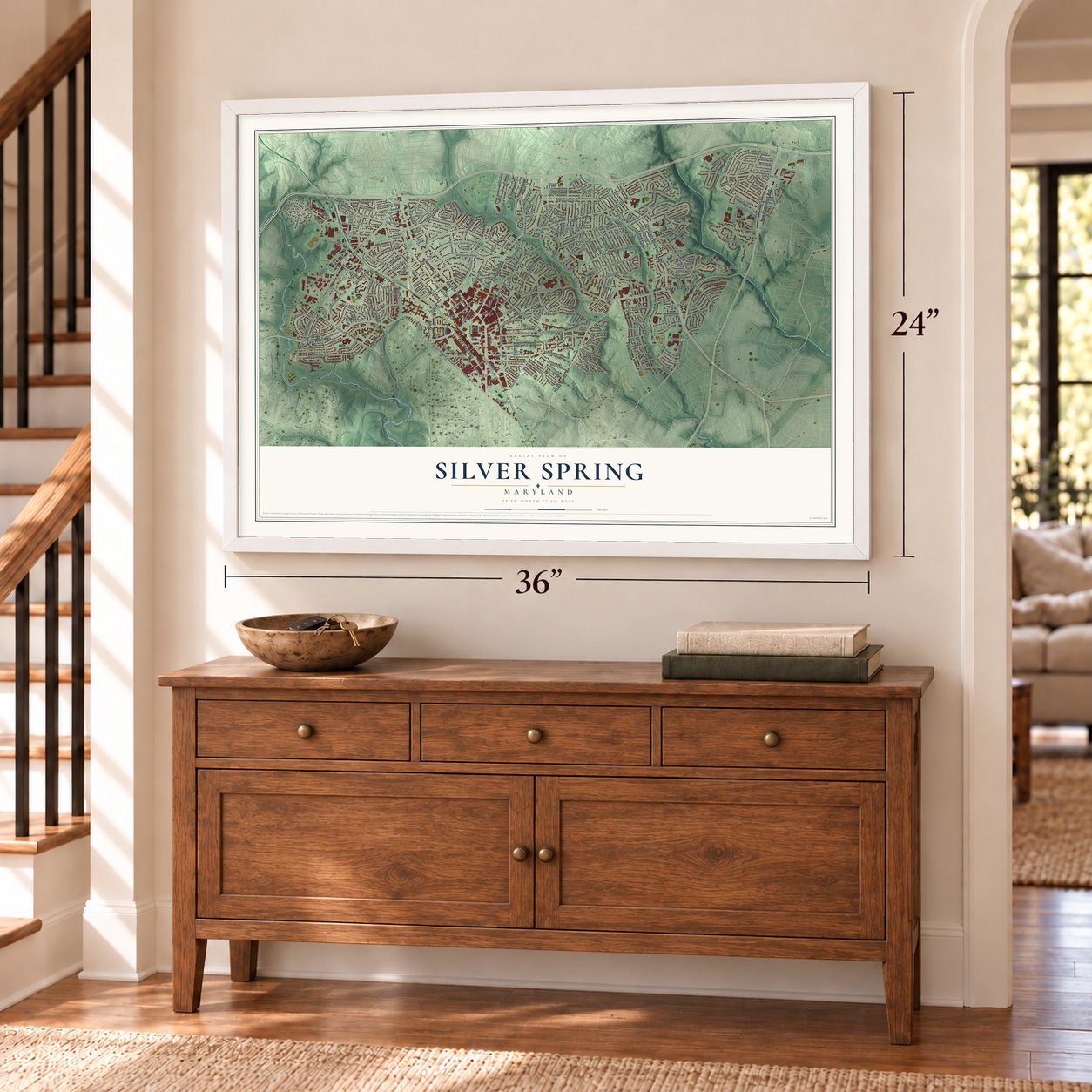
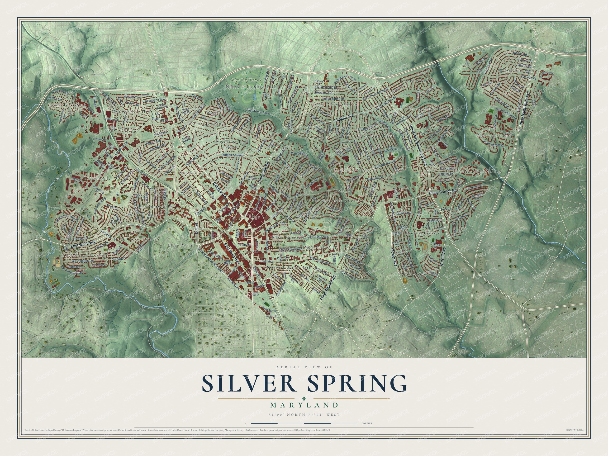
A new map of Silver Spring, Maryland, made in 2026 and printed to order on thick archival matte paper.
12" x 18" Archival Matte Print
A Map of Home. A Work of Art.
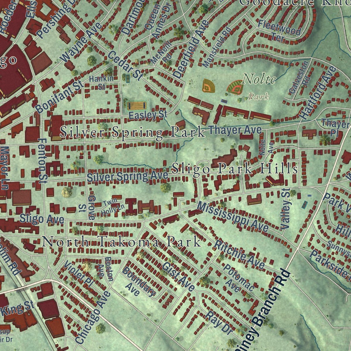
Explore Silver Spring, Maryland from a whole new perspective. Created using aerial imagery and detailed geographic data, this map captures Silver Spring building by building, with labeled streets, familiar landmarks, and shaded topographical relief that highlights the natural contours of the landscape.
Combining modern data with the timeless character of a vintage atlas, this map is just as interesting up close as it is beautiful on the wall. Whether you grew up in Silver Spring, spent memorable years there, or call it home today, this unique map is a great way to celebrate a place that means something to you. Zoom in on the preview to look for your street, and then order a print to put your memories on the wall.
Three ways to hang it
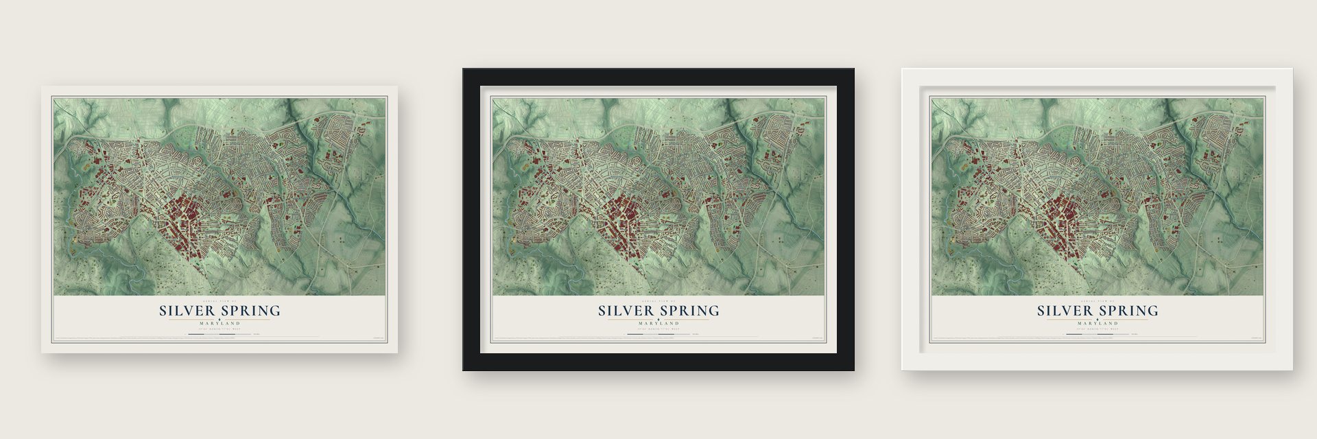
Unframed archival matte, a black wood frame or a white wood frame.
Up close
Geography Worth Displaying
This map was created using accurate cartographic data and authoritative geographic sources, including the U.S. Geological Survey and the Census Bureau. The map brings together terrain, waterways, roads, and building detail. The majority of the streets are labeled, houses are accurately depicted, and the topography is derived from government sources. Combining local data with carefully composed color and shading leads to this beautifully detailed Silver Spring artwork for your wall.
Rather than simply showing street outlines, we’ve included as many of the street names as we could reasonably fit on the map while keeping their names legible. Zoom in on the high resolution preview to see exactly what’s on the map. We truly set out to create a statement piece for anyone who loves Silver Spring. So whether it’s for you, or a gift for someone you love, we hope this map of Silver Spring brings back fond memories.
Read the story behind this map of Silver Spring, Maryland from 2026.
About Silver Spring, Maryland
From the 1882 History of Western Maryland: "The Silver Spring farm, the estate of the late F. P. Blair, and the residence of the Hon. Montgomery Blair, includes a portion of this tract; also the Silver Spring Station and Sligo."
Find your street
Names on the Silver Spring map
Every name below is printed on this map. Look for your street, your school, the park where you played, or the pond down the road.
Places and landmarks30
- Oakview
- Nolte Park
- Blair Portal
- Brookside Forest
- Browns Corner
- Clifton Park Village
- Forest Glen Park
- Franklin Knolls
- Goodacre Knolls
- Highland View
- Indian Spring Terrace
- Kilmarock
Show all 30 places
- Linden
- Lyttonsville
- Montgomery Hills
- Montgomery Knolls
- North Hills Sligo Park
- North Takoma Park
- Northwest Park
- Rock Creek Forest
- Rock Creek Gardens
- Rosemary Hills
- Seven Oaks
- Silver Spring Park
- Sligo
- Sligo Park Hills
- Woodside
- Woodside Forest
- Woodside Park
- Sligo Golf Course
Streets and roads307
- Colesville Road
- East West Highway
- Georgia Avenue
- New Hampshire Avenue
- Flower Avenue
- University Boulevard East
- Piney Branch Road
- 16th Street
- Carroll Avenue
- Franklin Avenue
- Eastern Avenue
- Eastern Avenue Northwest
- Blair Road
- Fairway Avenue
- Seminary Road
- Leighton Avenue
- Bruce Drive
- Second Avenue
- Woodland Drive
- Southampton Drive
- Quebec Terrace
- Long Branch Parkway
- Quebec Street
- Wayne Avenue
- Linden Lane
- East Wayne Avenue
- Dale Drive
- Sligo Creek Parkway
- Brookville Road
- Woodside Parkway
Show all 307 streets
- Ellsworth Drive
- Fenton Street
- Garland Avenue
- Silver Spring Avenue
- Highland Drive
- Thayer Avenue
- Spring Street
- Dilston Road
- Sligo Avenue
- Ross Road
- Bradford Road
- Spencer Road
- East Franklin Avenue
- Bonifant Street
- Glenville Road
- Greenwood Avenue
- Pershing Drive
- Washington Avenue
- Columbia Boulevard
- Cottrell Terrace
- Luzerne Avenue
- Avenel Road
- Grace Church Road
- Gist Avenue
- East Indian Spring Drive
- Walden Road
- Oakview Drive
- Grubb Road
- Colston Drive
- Noyes Drive
- Mississippi Avenue
- First Avenue
- Sudbury Road
- Blaine Drive
- Crosby Road
- Lanier Drive
- Meadowbrook Lane
- Third Avenue
- East Light Drive
- Barron Street
- Hedin Drive
- Wire Avenue
- East Granville Drive
- Dartmouth Avenue
- Flora Lane
- Cedar Street
- Brunett Avenue
- Park Crest Drive
- Indian Spring Drive
- Normandy Drive
- Greenbrier Drive
- Lyttonsville Road
- Dallas Avenue
- Fairview Road
- Sundale Drive
- Chicago Avenue
- Plymouth Street
- Beacon Road
- Saybrook Avenue
- Michigan Avenue
- Moffet Road
- Hilltop Road
- Langley Drive
- Leonard Drive
- Ruatan Street
- Lansdowne Way
- Linton Street
- Smith Drive
- Hanover Street
- Cameron Street
- Harvey Road
- Domer Avenue
- Hartford Avenue
- Schuyler Road
- Malibu Drive
- Parkside Road
- Eton Road
- Ritchie Avenue
- Freyman Drive
- Patton Drive
- Osborn Drive
- Deerfield Avenue
- Glen Ross Road
- Donnybrook Drive
- Forsythe Avenue
- Curran Road
- King Street
- Daleview Drive
- Arliss Street
- Heron Drive
- Geren Road
- Lorain Avenue
- Watson Road
- Sutherland Road
- Stateside Drive
- Reading Road
- Bayfield Street
- Midwood Road
- Porter Road
- Westview Drive
- Clement Road
- Fenwick Lane
- Seek Lane
- High Park Lane
- Saint Camillus Drive
- Kingsbury Drive
- Windsor Street
- Wilmer Street
- Ashboro Drive
- Park Valley Road
- Pin Oak Drive
- Osage Street
- Bennington Drive
- Richland Street
- Ripley Street
- Lawndale Drive
- Selim Road
- Malcolm Drive
- Elkhart Street
- Seminary Place
- Abilene Drive
- Paula Drive
- Farrell Drive
- Ray Drive
- Wessex Road
- Mayor Lane
- Louis Avenue
- 13th Street
- Hale Place
- Peggy Lane
- Parham Road
- Fidler Lane
- Kansas Avenue
- Baden Street
- Burton Street
- Tenth Avenue
- Moss Avenue
- Roeder Road
- Ament Street
- Valley Street
- Corwin Drive
- Caroline Avenue
- Glenside Drive
- Hume Drive
- Rosemary Hills Drive
- East Melbourne Avenue
- Stephen Sitter Avenue
- Eleventh Avenue
- Ellingson Drive
- Braddock Road
- East Schuyler Road
- Warren Street
- Fleetwood Terrace
- Easley Street
- Alton Parkway
- Biltmore Drive
- Saint Andrews Way
- Worth Avenue
- Bristol Avenue
- Grove Street
- Ocala Street
- Lowander Lane
- Milford Avenue
- Queen Annes Drive
- Terrace Drive
- Buckingham Drive
- Three Oaks Drive
- Woodstock Avenue
- White Oak Drive
- Talbot Avenue
- Blair Mill Road
- Navarre Drive
- Ramsey Avenue
- Springvale Road
- Mayfair Place
- Haddon Drive
- Kimes Street
- Pittman Drive
- East Hamilton Avenue
- Newcastle Avenue
- Derby Ridge Lane
- Maywood Avenue
- Larry Place
- Potomac Avenue
- Talbot Road
- Newell Street
- Lyttonsville Place
- Hood Street
- Kennett Street
- Boundary Avenue
- Providence Avenue
- Miles Street
- Clayborn Avenue
- Gilbert Street
- Cedar View Court
- Chester Street
- Locust Grove Road
- Forney Road
- Violet Place
- Graham Road
- Manchester Place
- Highview Avenue
- Rookwood Road
- Stewart Avenue
- Dilston Place
- Research Drive
- Hudson Avenue
- Wabash Avenue
- Erie Avenue
- Thayer Place
- Vance Place
- Draper Lane
- Argyle Road
- Esther Court
- Summit Road
- Seek Court
- Shorey Road
- Dixon Avenue
- Apple Avenue
- Ballard Street
- Mount Pisgah Road
- Red Oak Drive
- Mansfield Road
- Thornhill Road
- Whitney Street
- Evergreen Street
- Crestridge Drive
- Weaver Street
- Sunnyside Road
- McNeill Road
- Neely Road
- North Noyes Drive
- Ashford Road
- Torrington Place
- Devon Road
- South Noyes Drive
- Oldham Road
- Clearview Place
- Galveston Road
- Fraser Avenue
- Cloverfield Road
- Noyes Lane
- Quinton Road
- Riley Place
- Juniper Street
- Hankin Street
- Mark Court
- Salter Road
- Boyer Place
- Croydon Court
- Boston Avenue
- Wayne Place
- Barron
- Devon Court
- Ross Court
- Marshall Avenue
- Granville
- Hampshire Green Lane
- Manchester Road
- Melbourne Avenue
- Forston Street
- Pinecrest Circle
- Houston Avenue
- Corliss Street
- Hartwell Road
- Arbor Hill Drive
- Cahart Place
- Midwood Place
- Gilbert Place
- Twin Holly Lane
- Sierra Street
- Westview Terrace
- Nolte Avenue
- Grayson Avenue
- Jesup Blair Drive
- Perkins Place
- Fox Street
Names are listed as they appear on the printed map. Zoom into the product photos to find them.
The art of mapping a place
How This Map Was Made
Real places. Remarkable detail. Discover the layers that turn geographic data into a map of home.

The view from above
Aerial imagery reveals the character of the land: woodland, open fields, and the patterns of a place.

The shape of the land
Elevation data brings hills, valleys, and subtle changes in the landscape into view.

The details of home
Roads, waterways, and building footprints come together to make the map feel unmistakably local.

Geography becomes art
Considered color, shading, and typography bring the layers together in a map made for your wall.


Process illustrated with Mendon, Massachusetts. Aerial imagery: USDA NAIP. Terrain: USGS 3D Elevation Program. Map details and finished artwork: KNOWOL.
The Details
About This Print
Choose an archival matte print, or a black or white Ayous wood frame. The archival matte print is unframed.
Select your size and finish above to see the matching product image and price.
Materials & Craftsmanship
A contemporary map with the character of a classic atlas, printed on archival matte paper. Optional frames are made from Ayous wood.
Your printed map does not include the watermark shown in the full-map preview.
Shipping & Delivery
Free shipping within the United States. Every print is made to order in the USA.
Buying a gift? Add a note in your cart and we'll include it. We never put prices in the package.
Prints ship within 2 to 3 business days. Allow 7 to 10 days total from ordering for delivery. Timing may vary during holidays or periods of high order volume.
Read our shipping policy.
Returns and damaged prints
Each print is made to order. Change-of-mind refunds are not available after production.
If your print arrives damaged, misprinted or incorrect, contact support@knowol.com within 30 days of receiving it. Include your order number, photos and a description of the issue.
Read our full refund and replacement policy. For questions about your order, email support@knowol.com.
Find your town
Looking for another city?
Find a map of home in our Maryland collection, or any town in the country.
Nearby
Maps of towns near Silver Spring
Know someone from one of these towns? Their map makes a great gift.
 Four Corners
, Maryland
From $39.99See the map
 Forest Glen
, Maryland
From $39.99See the map
 Takoma Park
, Maryland
From $39.99See the map
More maps nearby: Langley Park, Burnt Mills, South Kensington, Kemp Mill and North Chevy Chase.