
Search for another town





Free U.S. delivery 7 to 10 days after you order
Snellville, Georgia Map Art
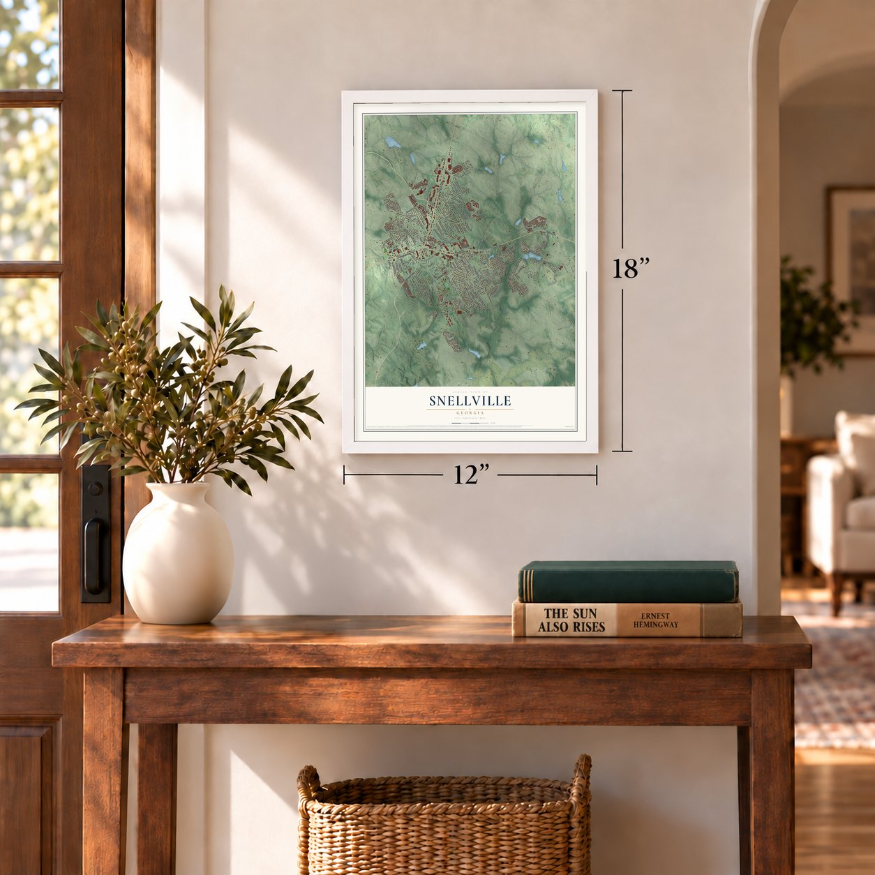
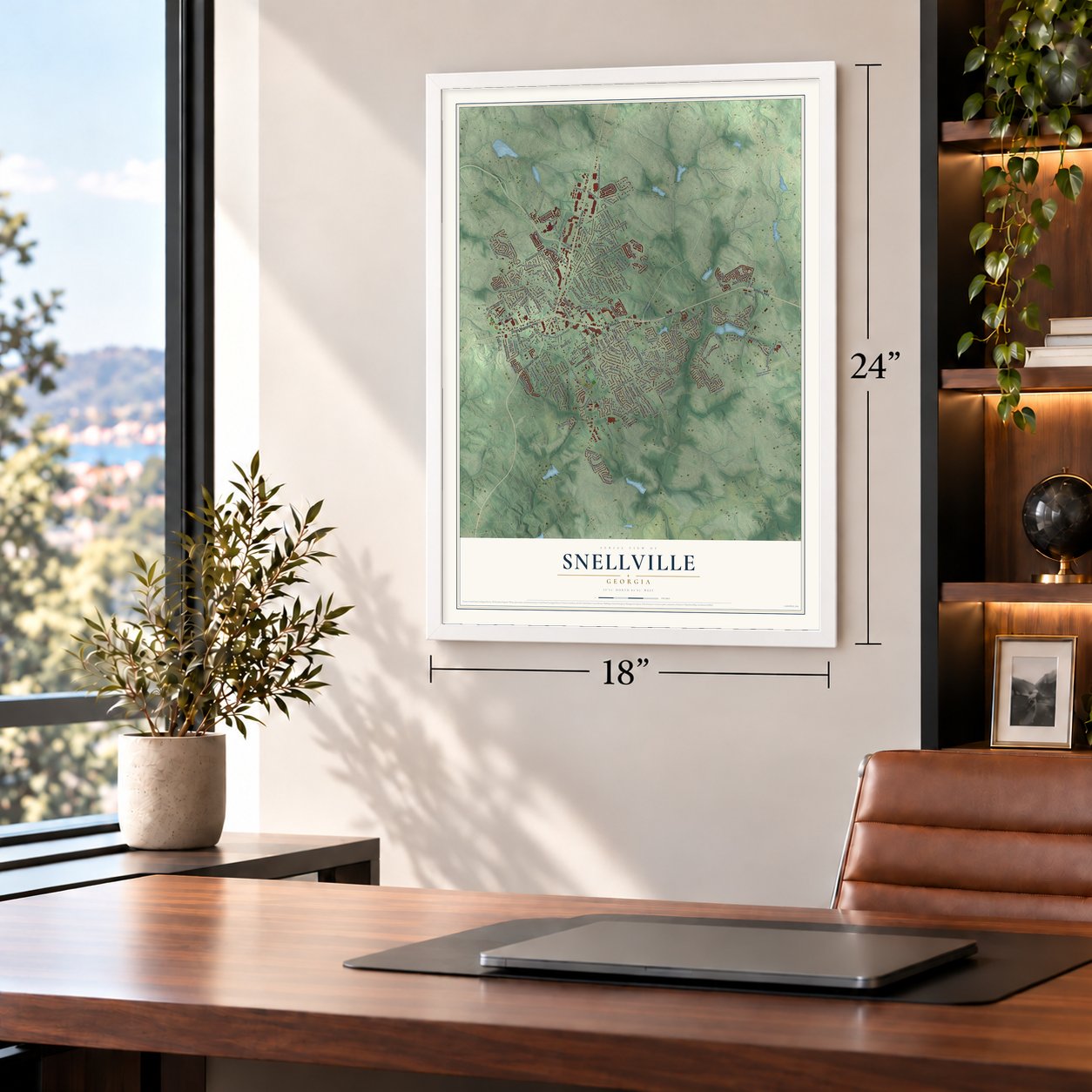
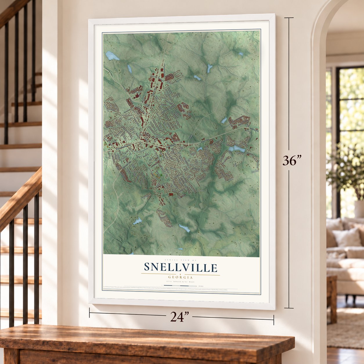
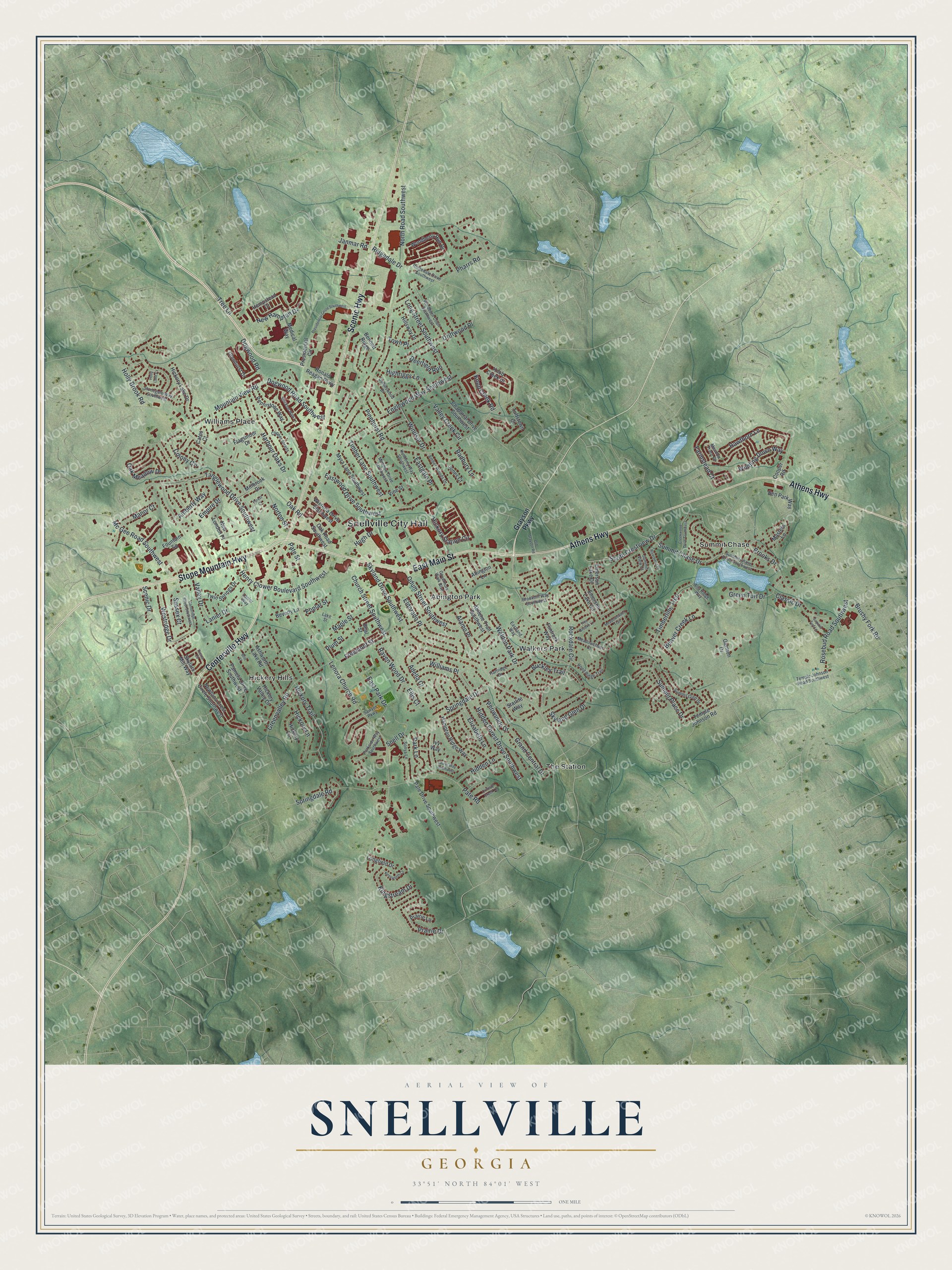
A new map of Snellville, Georgia, made in 2026 and printed to order on thick archival matte paper.
18" x 24" Black Wood Frame
A Map of Home. A Work of Art.
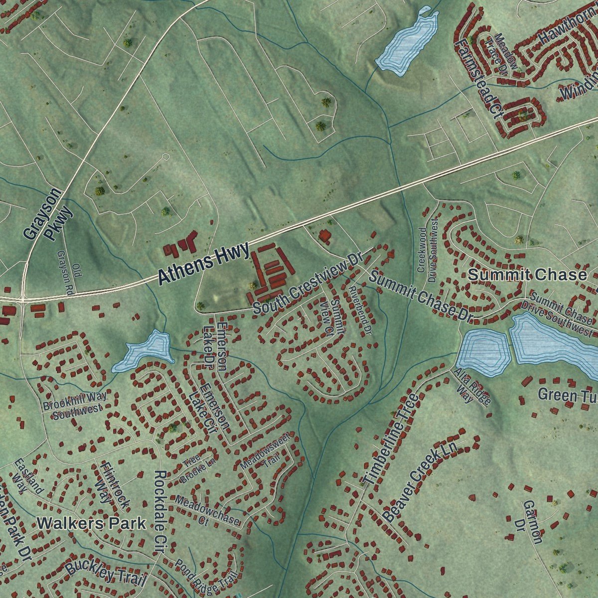
Explore Snellville, Georgia from a whole new perspective. Created using aerial imagery and detailed geographic data, this map captures Snellville building by building, with labeled streets, familiar landmarks, and shaded topographical relief that highlights the natural contours of the landscape.
Combining modern data with the timeless character of a vintage atlas, this map is just as interesting up close as it is beautiful on the wall. Whether you grew up in Snellville, spent memorable years there, or call it home today, this unique map is a great way to celebrate a place that means something to you. Zoom in on the preview to look for your street, and then order a print to put your memories on the wall.
Three ways to hang it
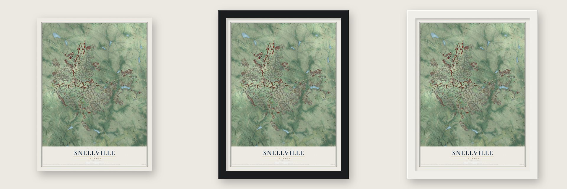
Unframed archival matte, a black wood frame or a white wood frame.
Up close
Geography Worth Displaying
This map was created using accurate cartographic data and authoritative geographic sources, including the U.S. Geological Survey (USGS) and FEMA. The map brings together terrain, waterways, roads, and building detail. The majority of the streets are labeled, houses are accurately depicted, and the topography is derived from government sources. Combining local data with carefully composed color and shading leads to this beautifully detailed Snellville artwork for your wall.
Rather than simply showing street outlines, we’ve included as many of the street names as we could reasonably fit on the map while keeping their names legible. Zoom in on the high resolution preview to see exactly what’s on the map. We truly set out to create a statement piece for anyone who loves Snellville. So whether it’s for you, or a gift for someone you love, we hope this map of Snellville brings back fond memories.
Explore the full map of Snellville, Georgia and read about the local places it shows.

About Snellville, Georgia
Snellville is a city of 20,573 people in Gwinnett County, east of Atlanta, on land where Creek Indians once lived. Its name comes from Thomas Snell, a young man from London who followed his friend James Sawyer to America and went to work on Georgia farms. In August 1879 Sawyer tracked Snell down at a small settlement called New London, near Stone Mountain, and the two opened a wood-frame shop together, Snell and Sawyer's Store.
The partners had clerked in a similar store back in London, and their new one did well. By the end of 1879 it was serving shoppers from Lawrenceville and Loganville. Many travelers bought supplies there and slept in the oak groves nearby, because the journey took longer than a day. The store's ads gave its address as Snellville, and that name replaced New London. The General Assembly chartered the city of Snellville in 1923.
“five years, four elections, three architectural firms, and two lawsuits”
- Store money with Snell's faceLike many small mill towns of the day, early Snellville ran partly on store money. Snell and Sawyer printed their own notes, each showing its trade value and a picture of Snell, and regular customers spent them on goods at the store.
- A wooden store wrapped in graniteWhen the partnership broke up, Sawyer kept the original shop. He built granite walls up and around the old frame, then took the wood apart from the inside, while Snell put up a new store of granite. Sawyer's building passed through several merchants after his eyesight failed, and it was torn down in 1960 to make way for a service station.
- First post office in 1885In 1885 James Sawyer became Snellville's first postmaster, handling the town's mail from the back room of his store. He lived to 91, dying in 1948, and lies in the old Baptist Cemetery, now called Snellville Historical Cemetery. Thomas Snell died much younger, in 1896, at age 39.
- City hall on a dead mallEmpty big-box stores became a campaign issue in 1999, and in November 2000 Mayor Brett Harrell began working on a trade: the city would give its old city hall to a church and take over a failing shopping center with an abandoned Kroger. The council approved it 3 to 1 in March 2001. Lawsuits, a soil scare and buried granite slowed the work, but the new city hall was dedicated on March 12, 2006.
Find your street
Names on the Snellville map
Every name below is printed on this map. Look for your street, your school, the park where you played, or the pond down the road.
Places and landmarks7
- Snellville City Hall
- Abington Park
- Hickory Hills
- Summit Chase
- The Station
- Walkers Park
- Williams Place
Streets and roads184
- Scenic Highway
- Athens Highway
- East Main Street
- Stone Mountain Highway
- Centerville Highway
- North Road Southwest
- Lenora Church Road
- Rockdale Circle
- Skyland Drive Southwest
- Pinehurst Road
- Tree Lane
- Oak Road
- Summit Chase Drive
- Pharrs Road
- Mountain View Road
- Tanglewood Drive Southwest
- Brooks Drive
- Rosebud Road Southwest
- Henry Clower Boulevard Southwest
- Springdale Drive
- South Crestview Drive
- Eastwood Drive Southwest
- Harbour Oaks Drive
- Elizabeth Lane
- Hickory Trail
- Timberline Trce
- Skyland Glen Drive
- Valley Creek Circle
- Hickory Station Circle
- Greenvalley Road
Show all 184 streets
- Pate Road
- Hidden Forest Drive Southwest
- Springdale Road
- Hawthorn Lane
- Dogwood Road Southwest
- Eastgate Place
- Farmstead Court
- Englewood Way Southwest
- Mc Gee Road Southwest
- Church Street Southwest
- Eldorado Place
- Long Street Southwest
- Odum Street Southwest
- Oak Meadow Drive
- Driftwood Place
- Summit Place Drive
- Windsor Drive
- Ridgedale Drive
- New Hampton Drive
- Buckley Trail
- Prairie Drive
- East Park Drive
- Freemont Street
- Kingstream Drive
- Timber Lane Southwest
- Colony Circle
- Raven Wood Drive
- Green Turf Drive
- Grand Central Drive
- Poplar Street
- Maple Street
- Brushy Fork Road
- Manor Court
- Classic Drive
- Westridge Drive
- Lanier Drive
- Hickory Lane
- Highriggs Lane
- Holly Brook Road
- Winding Down Way
- Hidden Lane
- Ellis Court
- Walden Park Drive
- Valley Drive
- Beaver Creek Lane
- Snell Drive
- Adella Court
- Dogwood Road
- Periwinkle Drive
- Park Lane
- Alamo Place
- Town Place
- Amberly Way
- Knob Creek Road
- Radbury Lane
- Deerfield Run
- Empire Drive
- Janmar Road
- Sussex Court
- Plum Street
- Norton Street
- Scenic Drive
- Hugh Drive
- Pate Street
- Grayson Parkway
- Newtons Crest Circle Southwest
- Temple Johnson Road
- Knob Creek Drive
- Ashworth Lake Road
- Wisteria Drive Southwest
- Abilene Trail Southwest
- Woodberry Run Drive
- Chaparral Drive Southwest
- Emerson Lake Circle
- Masters Lane
- Pamela Drive Southwest
- Ronald Reagan Parkway
- Glenhurst Drive
- Hickory Lake Drive
- Vine Street
- Myra Lane Southwest
- Hampton Ridge Way
- Emerson Lake Drive
- Oak Road Southwest
- Pennistone Way
- Pate Drive Southwest
- Twin Springs Drive
- Cooper Road
- Tuftstown Court
- Ben Park Way
- Medical Way
- Skylars Mill Way
- Abington Lane
- Millbrook Drive
- Hickory Valley Drive
- Flagsmoor Drive
- Beal Street
- Presidential Circle
- Hickory Circle
- Fountain Square
- Hempstead Court
- Bennett Ridge
- Longfield Drive
- Junes Court
- Hillsway Drive
- Flintrock Way
- New London Place
- Beverly Lane
- Prairie Lane
- Garmon Drive
- Starlite Way
- Ivy Way
- Cates Court
- Summit Chase Drive Southwest
- Temple Johnson Road Southwest
- Meadowchase Court
- Eastland Way
- Meadow Drive Southwest
- Summit Glen Drive
- Windburn Court Southwest
- Kimberly Way Southwest
- Pond Ridge Trail
- Meadow Trace Drive
- Summit View Court
- Ridgedale Drive Southwest
- Stonegate Way Southwest
- Collinswood Drive
- Governors Walk Boulevard
- Parkside Way Southwest
- Amber Woods Drive
- Clipper Straits
- Brookhill Way Southwest
- Lake Street
- Sonya Lane
- Alta Ridge Way
- Hartridge Drive
- Sawyer Parkway
- Lanier Way
- Cambridge Street Southwest
- Stockton Walk Lane
- Presidential Circle Southwest
- Old Grayson Road
- Meadowsweet Trail
- Creekwood Drive Southwest
- Riverbend Drive
- Pierce Circle
- Summit Turf Lane
- Kenilworth Court
- Tree Brooke Lane
- Crimson Creek Lane
- Laurel Way Southwest
- Forest Court
- Britt Street
- Holly Lake Cv
Names are listed as they appear on the printed map. Zoom into the product photos to find them.
The art of mapping a place
How This Map Was Made
Real places. Remarkable detail. Discover the layers that turn geographic data into a map of home.

The view from above
Aerial imagery reveals the character of the land: woodland, open fields, and the patterns of a place.

The shape of the land
Elevation data brings hills, valleys, and subtle changes in the landscape into view.

The details of home
Roads, waterways, and building footprints come together to make the map feel unmistakably local.

Geography becomes art
Considered color, shading, and typography bring the layers together in a map made for your wall.


Process illustrated with Mendon, Massachusetts. Aerial imagery: USDA NAIP. Terrain: USGS 3D Elevation Program. Map details and finished artwork: KNOWOL.
The Details
About This Print
Choose an archival matte print, or a black or white Ayous wood frame. The archival matte print is unframed.
Select your size and finish above to see the matching product image and price.
Materials & Craftsmanship
A contemporary map with the character of a classic atlas, printed on archival matte paper. Optional frames are made from Ayous wood.
Your printed map does not include the watermark shown in the full-map preview.
Shipping & Delivery
Free shipping within the United States. Every print is made to order in the USA.
Buying a gift? Add a note in your cart and we'll include it. We never put prices in the package.
Prints ship within 2 to 3 business days. Allow 7 to 10 days total from ordering for delivery. Timing may vary during holidays or periods of high order volume.
Read our shipping policy.
Returns and damaged prints
Each print is made to order. Change-of-mind refunds are not available after production.
If your print arrives damaged, misprinted or incorrect, contact support@knowol.com within 30 days of receiving it. Include your order number, photos and a description of the issue.
Read our full refund and replacement policy. For questions about your order, email support@knowol.com.
Find your town
Looking for another city?
Find a map of home in our Georgia collection, or any town in the country.
Nearby
Maps of towns near Snellville
Know someone from one of these towns? Their map makes a great gift.
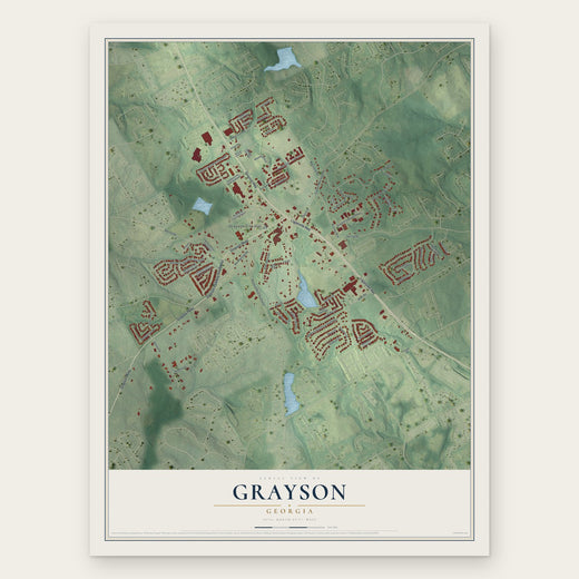 Grayson
, Georgia
From $39.99See the map
 Lawrenceville
, Georgia
From $39.99See the map
 Loganville
, Georgia
From $39.99See the map
More maps nearby: Lilburn, Stone Mountain, Dacula, Lakeview Estates and Tucker.