
Search for another town



Free U.S. delivery 7 to 10 days after you order
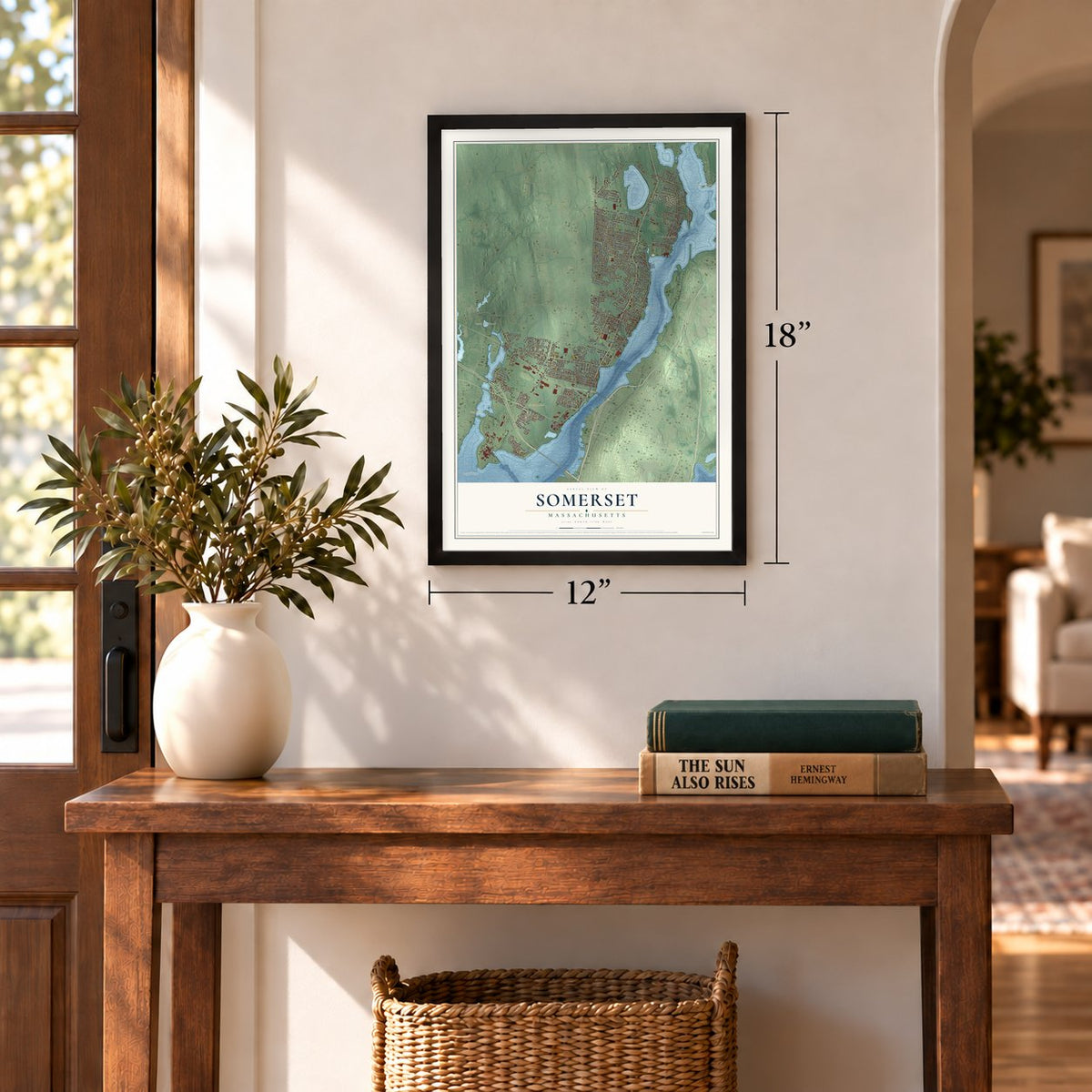
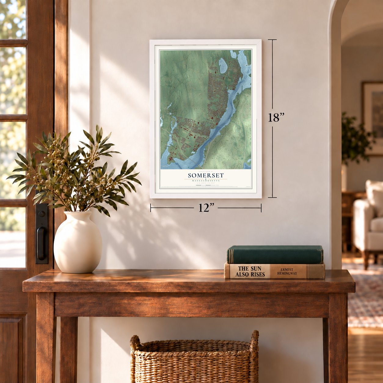
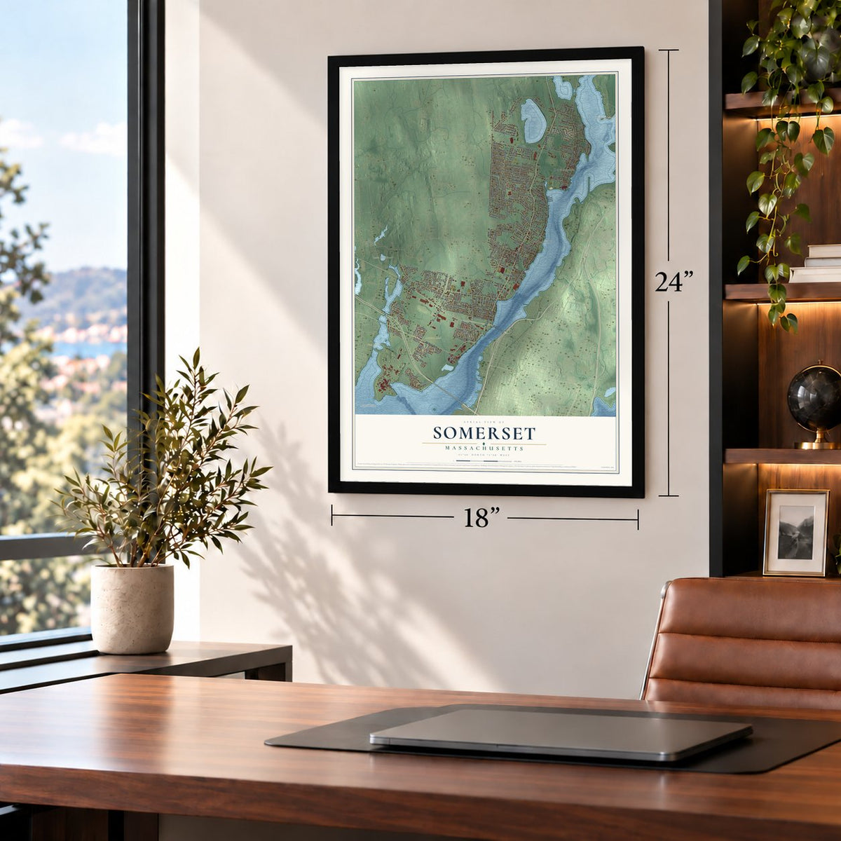
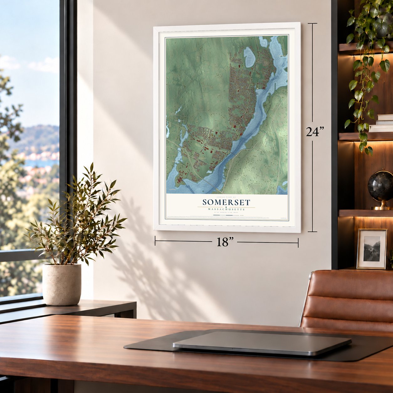
Somerset, Massachusetts Map Art
Building by building, with labeled streets and shaded relief.
12" x 18" Archival Matte Print
A Map of Home. A Work of Art.
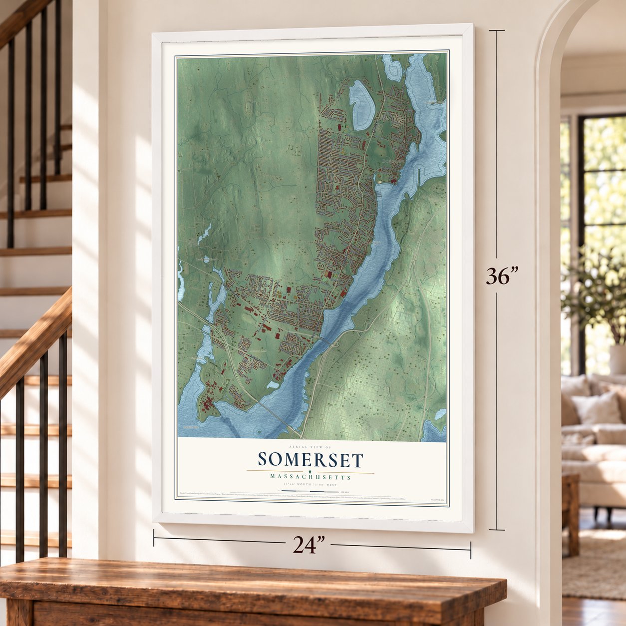
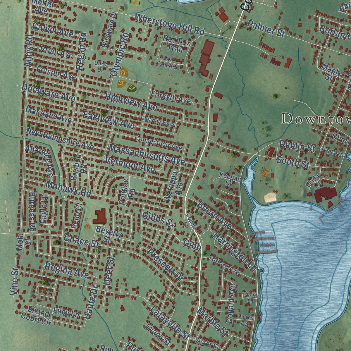
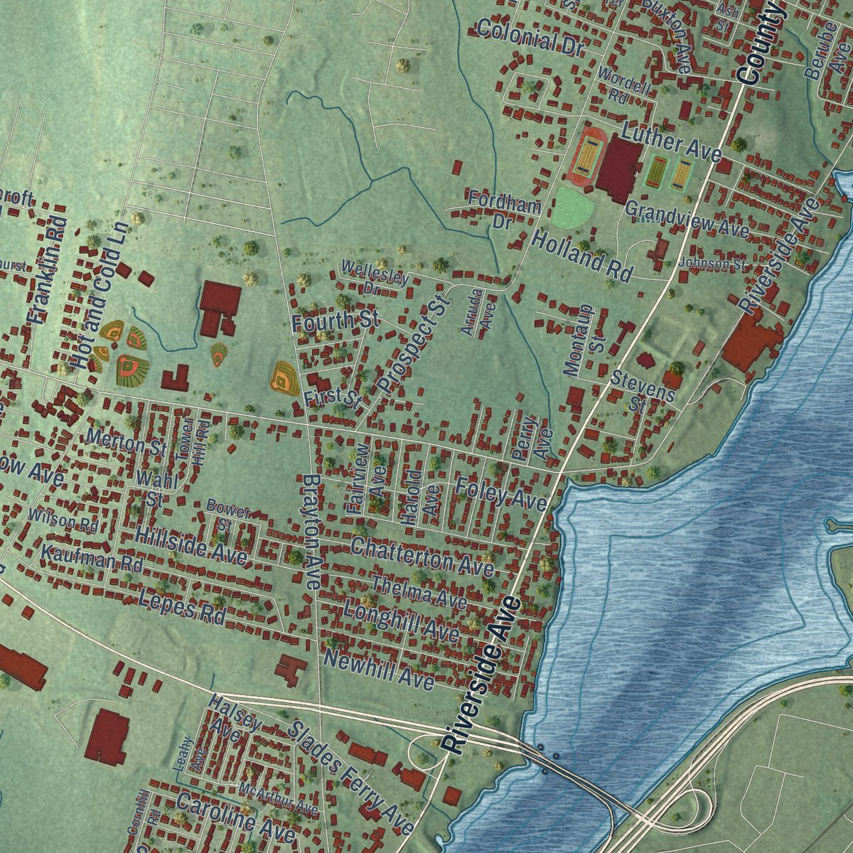
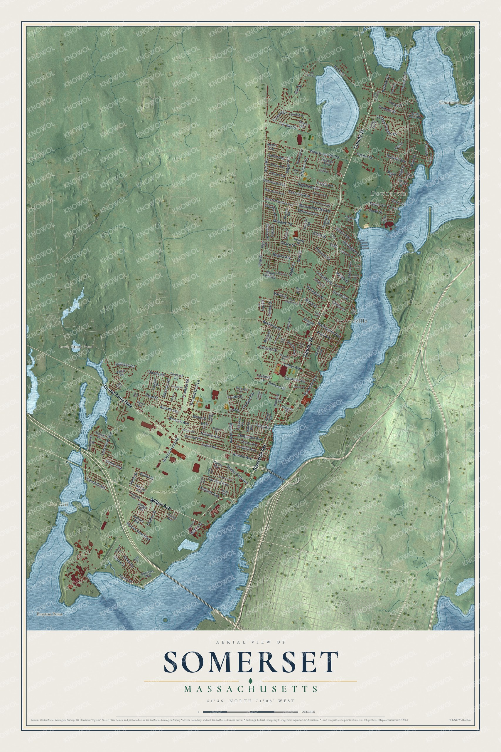
Explore Somerset, Massachusetts from a whole new perspective. Created using aerial imagery and detailed geographic data, this map captures Somerset building by building, with labeled streets, familiar landmarks, and shaded topographical relief that highlights the natural contours of the landscape.
Combining modern data with the timeless character of a vintage atlas, this map is just as interesting up close as it is beautiful on the wall. Whether you grew up in Somerset, spent memorable years there, or call it home today, this unique map is a great way to celebrate a place that means something to you. Zoom in on the preview to look for your street, and then order a print to put your memories on the wall.
Three ways to hang it
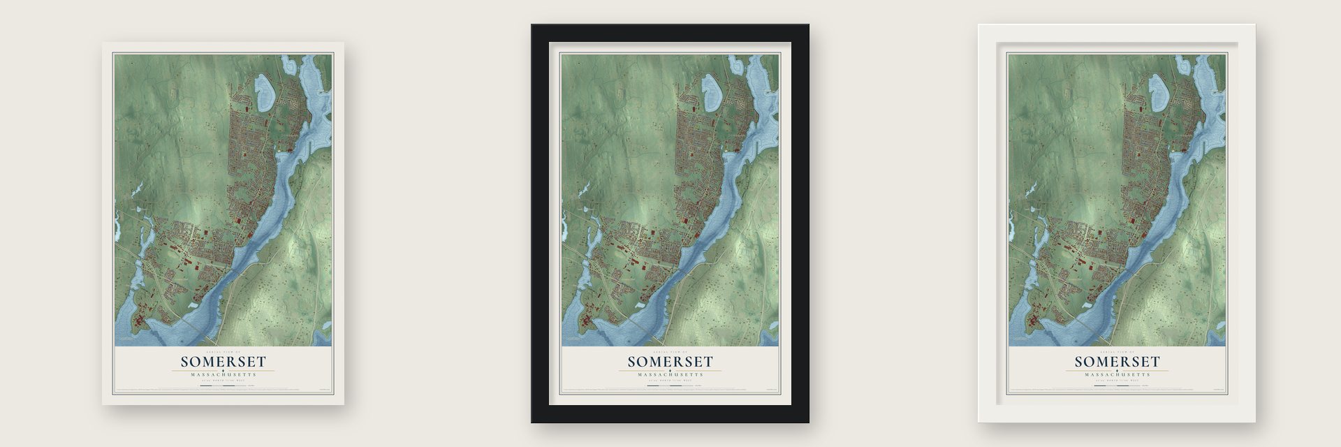
Unframed archival matte, a black wood frame or a white wood frame.
Up close
Geography Worth Displaying
This map was created using accurate cartographic data and authoritative geographic sources, including the U.S. Geological Survey (USGS) and FEMA. The map brings together terrain, waterways, roads, and building detail. The majority of the streets are labeled, houses are accurately depicted, and the topography is derived from government sources. Combining local data with carefully composed color and shading leads to this beautifully detailed Somerset artwork for your wall.
Rather than simply showing street outlines, we’ve included as many of the street names as we could reasonably fit on the map while keeping their names legible. Zoom in on the high resolution preview to see exactly what’s on the map. We truly set out to create a statement piece for anyone who loves Somerset. So whether it’s for you, or a gift for someone you love, we hope this map of Somerset brings back fond memories.
Explore the full map of Somerset, Massachusetts and read about the local places it shows.

Find your street
Names on the Somerset map
Every name below is printed on this map. Look for your street, your school, the park where you played, or the pond down the road.
Places and landmarks7
- Downtown
- Brayton Point
- Conspiracy Island
- Fox Hill
- Lewin Brook Pond
- Montaup Land
- Pottersville
Streets and roads188
- County Street
- Grand Army Highway
- Riverside Avenue
- Wilbur Avenue
- Read Street
- Elm Street
- Dublin Street
- Pilot Drive
- Gibb
- Purington Street
- Regina Avenue
- Brayton Point Road
- Brayton Avenue
- North Street
- Pleasant Street
- Prospect Street
- Almy Road
- Lees River Avenue
- Whetstone Hill Road
- Wood Street
- Regan Road
- Buffinton Street
- Chace Street
- Lafayette Street
- Main Street
- Highview Avenue
- Mohawk Road
- Eastview Avenue
- South Street
- High Street
Show all 188 streets
- Lepes Road
- Yankee Peddler Drive
- Palmer Street
- Washington Avenue
- Vermont Avenue
- Oneil Road
- Luther Avenue
- Foley Avenue
- Fairway Drive
- Winslow Avenue
- Slades Ferry Avenue
- Massachusetts Avenue
- Longhill Avenue
- Chatterton Avenue
- Hillside Avenue
- Bourn Avenue
- Alberta Avenue
- Harrington Lane
- Harbor View Boulevard
- Gibbs Street
- Newhill Avenue
- Dwelly Road
- Hot and Cold Lane
- Compos Street
- Sherman Road
- Olympic Road
- Caroline Avenue
- Franklin Road
- Pratt Avenue
- Marble Street
- Prescott Drive
- Lawton Street
- Borland Avenue
- Highland Road
- Holland Road
- Walker Street
- Grove Avenue
- Centre Street
- Kenneth Avenue
- Delaware Avenue
- Sullivan Avenue
- Colonial Drive
- Kenmar Drive
- Fourth Street
- Calvin Avenue
- Haute Drive
- Carey Street
- Country Drive
- Ripley Street
- Slade Street
- Statler Avenue
- Butler Street
- Deer Street
- Vine Street
- Fatima Drive
- Varao Street
- Fair Drive
- Wahl Street
- Kaufman Road
- Grandview Avenue
- Folsom Avenue
- New Hampshire Avenue
- Thelma Avenue
- Watuppa Avenue
- Enterprise Drive
- Hinchey Lane
- Lynch Avenue
- Chateau Drive
- Cherry Street
- Allardice Avenue
- Maple Street
- Forsyth Avenue
- Feno Court
- Donald Avenue
- Brian Avenue
- Burgess Road
- Maryland Avenue
- Marigold Avenue
- Jackson Avenue
- Buxton Avenue
- Ferncroft Road
- Briggs Avenue
- Mercier Avenue
- Sandy Point Road
- Montaup Street
- Beverly Street
- Halsey Avenue
- Admirals Way
- Fordham Drive
- Linden Drive
- Merton Street
- Brisbon Road
- Sunset Drive
- Cheryl Lane
- Harold Avenue
- Lucy Lane
- Moffitt Avenue
- Roberge Street
- Fairview Avenue
- Berube Avenue
- Shand Court Circle
- Stevens Street
- Evans Street
- Valley Road
- Pontiac Road
- Eagle Lane
- Carol Street
- First Street
- Shirley Avenue
- Red Fox Trail
- Church Street
- Mayes Avenue
- Perry Avenue
- Mota Court
- Gay Street
- Ray Street
- Windward Drive
- Connecticut Avenue
- Mason Avenue
- Gifford Avenue
- Spruce Street
- Victor Street
- Wellesley Drive
- Crestview Avenue
- Tower Hill Road
- Wilson Road
- Trolley Car Drive
- Sarah Avenue
- Clark Street
- Keegan Court
- Wordell Road
- Hebb Street
- Bower Street
- Arruda Avenue
- Linda Lane
- Atlas Avenue
- Clearview Avenue
- McArthur Avenue
- Island Heights Avenue
- Anchor Drive
- Hazelhurst Road
- Francis Street
- Johnson Street
- Cusick Lane
- Jon Ester Road
- Leahy Avenue
- Perkins Street
- Cornhill Road
- Kennedy Terrace
- Flores Avenue
- East County Street
- Poplar Street
- Old North Street
- Duke Street
- Ash Street
- Forest Avenue
- Dias Terrace
- Park Avenue
Names are listed as they appear on the printed map. Zoom into the product photos to find them.
About Somerset, Massachusetts
Somerset is a town of 18,303 people in Bristol County, running about eight miles along the west bank of the Taunton River. Its land began as the Shawomet section of Swansea, and in 1677 the men who bought it met at Plymouth and split it into 31 shares, setting one aside for the ministry. Shawomet asked to become its own town in 1720 and again four years later, but Swansea voted both requests down. Somerset finally separated on February 20, 1790, and on December 15 of that year its voters gathered for their first town meeting in the schoolhouse that stood near Capt. Robert Gibbs.
The town center grew at Bowers Shore, named for Jonathan Bowers, who opened its first shipyard in 1705. Shipbuilding lasted until 1854, when a nearly finished vessel burned in James M. Hood's yard, in a fire people believed was set. Iron took its place. Albert Field and J. M. Leonard founded the Mount Hope Iron Company in 1855, rebuilt the mill larger after an 1866 fire, and by 1883 the town's two nail mills had about 500 men at work.
- Slade's Ferry for nearly 200 yearsWilliam Slade, born in Wales, settled on the Shawomet lands about 1680 and started ferrying people over the Taunton toward today's Fall River. His sons and grandsons kept it running for nearly two hundred years. In 1826 a later William Slade added a horse-powered boat that could carry stagecoaches, and a steamboat came in 1846.
- The bridge that ended the ferryFive workers died on December 4, 1874, when an air chamber burst as crews built a new bridge across the Taunton. The 955-foot span opened to everyone on January 4, 1876, which put the Slade ferry out of business, and the bridge stood until 1970.
- Seven potteries in 1848The Chase family started a pottery making earthenware and stoneware half a mile north of Egypt, an old shipbuilding spot, and the neighborhood became Pottersville. By 1848 Somerset had seven potteries in all. The Somerset Pottery Company, with $25,000 of stock, was incorporated there in 1847, and in 1896 Synan Bros. opened a new stoneware works at Pottersville.
- A Quaker meetinghouse from 1702The oldest part of the Swansea Friends Meetinghouse on Prospect Street went up in 1702, while Somerset still belonged to Swansea, and the Quakers settled a Monthly Meeting here in 1732. The building gained side bays and a gallery in 1746. It is believed to be the oldest standing Quaker meetinghouse in the state, joined the National Register in 2014, and in 2026 was named one of America's 11 Most Endangered Historic Places.
- The Brayton HomesteadPreserved Brayton bought more than 130 acres here in the 1710s, when the land was still part of Swansea. About 1796 his grandson John Brayton built a house on Brayton Avenue on what remained of that farm. Braytons and a family foundation kept it until 1946, and as one of Somerset's oldest surviving houses it joined the National Register in 2020.
Keep exploring Massachusetts
Somerset is one of 461 Massachusetts towns we've mapped. Every dot on the map is a print of its own.
The search covers every state, Massachusetts first.
Near Somerset
Order 2 or more town maps and save 10%. Shown in the size and finish you picked above, so they hang as a set.
- Ocean Grove 12" x 18" / Archival Matte Print $39.99
- Swansea 12" x 18" / Archival Matte Print $39.99
- Fall River 12" x 18" / Archival Matte Print $39.99


More maps nearby: Dighton, Freetown, Berkley, Rehoboth and Seekonk.
The art of mapping a place
How This Map Was Made
Real places. Remarkable detail. Discover the layers that turn geographic data into a map of home.

The view from above
Aerial imagery reveals the character of the land: woodland, open fields, and the patterns of a place.

The shape of the land
Elevation data brings hills, valleys, and subtle changes in the landscape into view.

The details of home
Roads, waterways, and building footprints come together to make the map feel unmistakably local.

Geography becomes art
Considered color, shading, and typography bring the layers together in a map made for your wall.


Process illustrated with Mendon, Massachusetts. Aerial imagery: USDA NAIP. Terrain: USGS 3D Elevation Program. Map details and finished artwork: KNOWOL.
The Details
About This Print
Choose an archival matte print, or a black or white Ayous wood frame. The archival matte print is unframed.
Select your size and finish above to see the matching product image and price.
Materials & Craftsmanship
A contemporary map with the character of a classic atlas, printed on archival matte paper. Optional frames are made from Ayous wood.
Your printed map does not include the watermark shown in the full-map preview.
Shipping & Delivery
Free shipping within the United States. Every print is made to order in the USA.
Buying a gift? Add a note in your cart and we'll include it. We never put prices in the package.
Prints ship within 2 to 3 business days. Allow 7 to 10 days total from ordering for delivery. Timing may vary during holidays or periods of high order volume.
Read our shipping policy.
Returns and damaged prints
Each print is made to order. Change-of-mind refunds are not available after production.
If your print arrives damaged, misprinted or incorrect, contact support@knowol.com within 30 days of receiving it. Include your order number, photos and a description of the issue.
Read our full refund and replacement policy. For questions about your order, email support@knowol.com.