
Search for another town




Free U.S. delivery 7 to 10 days after you order
Swansea, Massachusetts Map Art
Building by building, with labeled streets and shaded relief.
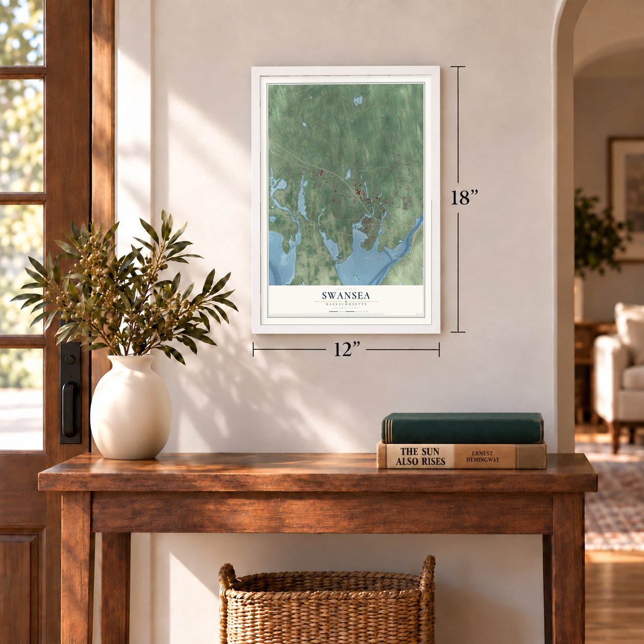
12" x 18" Archival Matte Print
A Map of Home. A Work of Art.
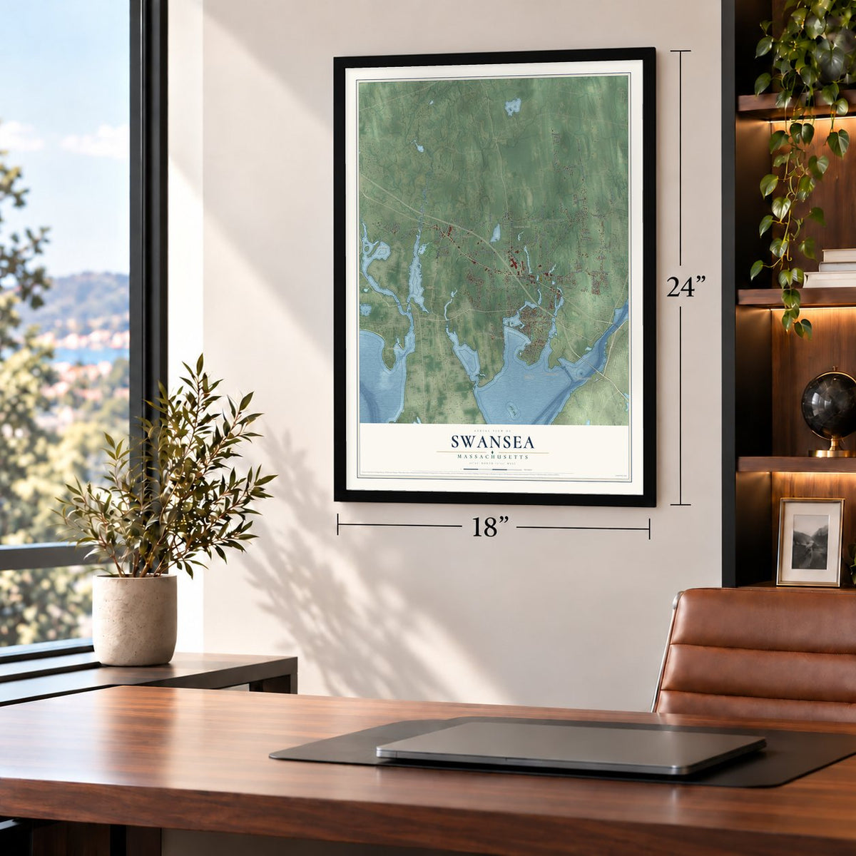
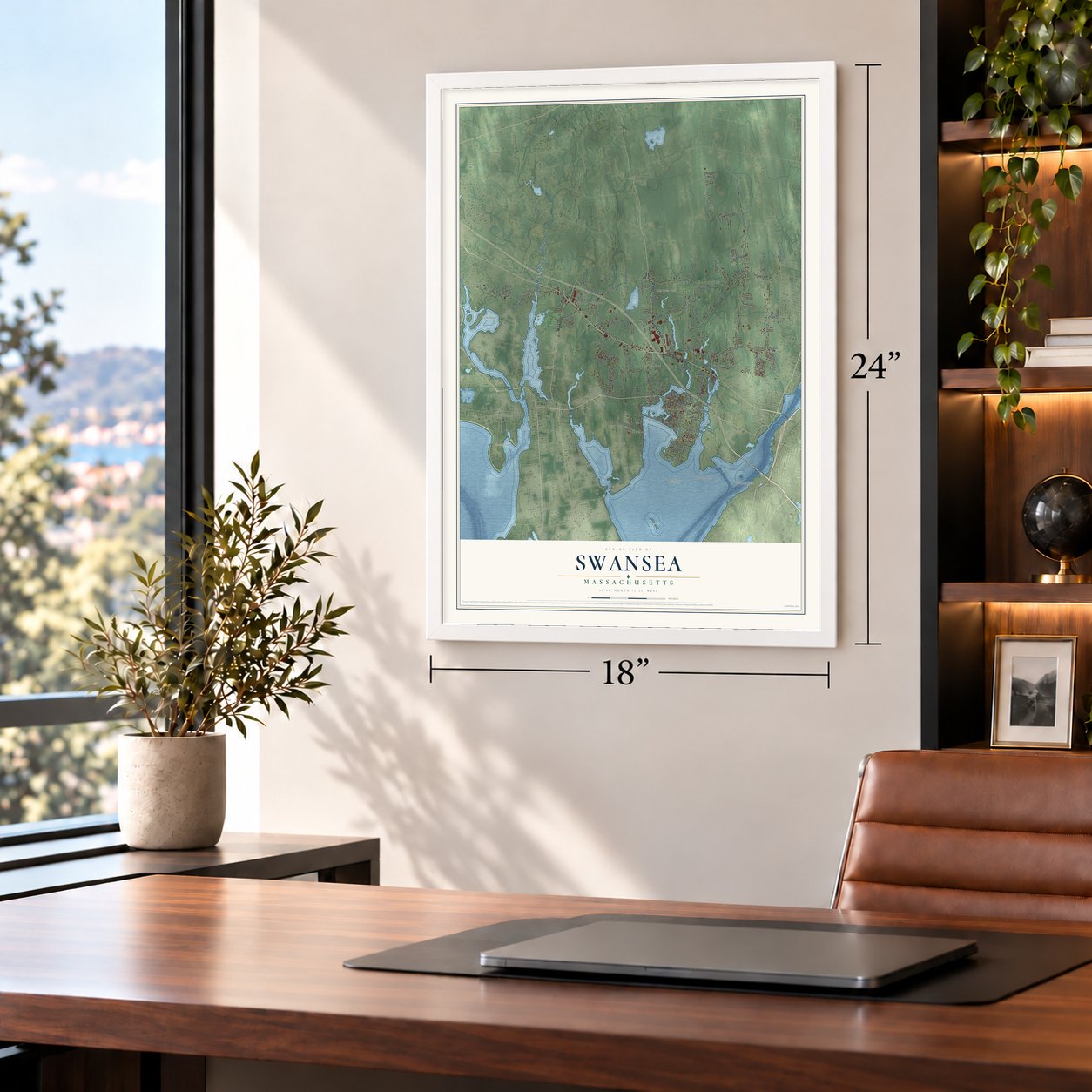
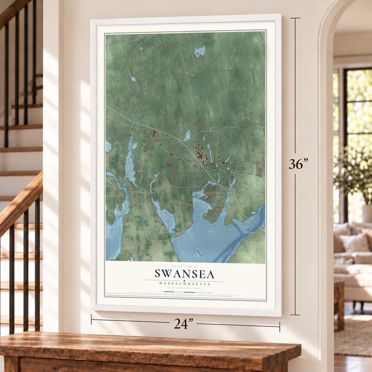
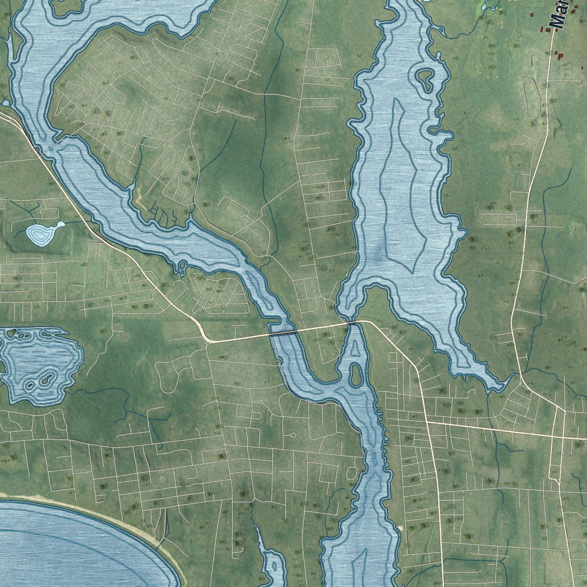
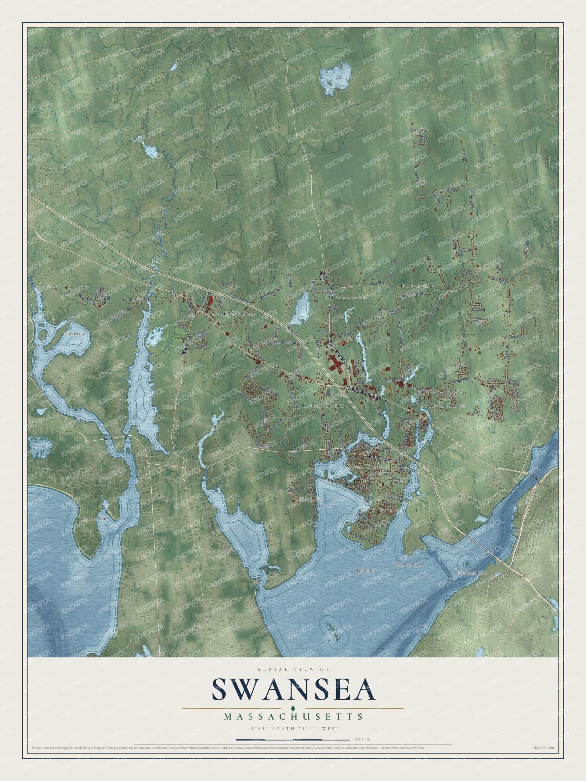
Explore Swansea, Massachusetts from a whole new perspective. Created using aerial imagery and detailed geographic data, this map captures Swansea building by building, with labeled streets, familiar landmarks, and shaded topographical relief that highlights the natural contours of the landscape.
Combining modern data with the timeless character of a vintage atlas, this map is just as interesting up close as it is beautiful on the wall. Whether you grew up in Swansea, spent memorable years there, or call it home today, this unique map is a great way to celebrate a place that means something to you. Zoom in on the preview to look for your street, and then order a print to put your memories on the wall.
Three ways to hang it
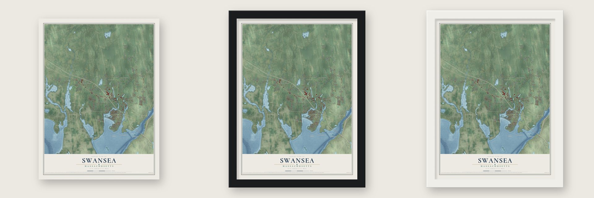
Unframed archival matte, a black wood frame or a white wood frame.
Up close
Geography Worth Displaying
This map was created using accurate cartographic data and authoritative geographic sources, including the U.S. Geological Survey (USGS) and FEMA. The map brings together terrain, waterways, roads, and building detail. The majority of the streets are labeled, houses are accurately depicted, and the topography is derived from government sources. Combining local data with carefully composed color and shading leads to this beautifully detailed Swansea artwork for your wall.
Rather than simply showing street outlines, we’ve included as many of the street names as we could reasonably fit on the map while keeping their names legible. Zoom in on the high resolution preview to see exactly what’s on the map. We truly set out to create a statement piece for anyone who loves Swansea. So whether it’s for you, or a gift for someone you love, we hope this map of Swansea brings back fond memories.
Explore the full map of Swansea, Massachusetts and read about the local places it shows.
Find your street
Names on the Swansea map
Every name below is printed on this map. Look for your street, your school, the park where you played, or the pond down the road.
Places and landmarks16
- Downtown
- Adams Point
- Bay Point
- Brayton Point
- Crab Island
- Cole River Pond
- Firestone Pond
- North Swansea
- Luther Corner
- Hortonville
- Ocean Grove
- Touisset
Show all 16 places
- Barneyville
- Monroes
- South Swansea
- Swansea Center
Streets and roads123
- Wilbur Avenue
- Oak Street
- Market Street
- Grand Army Highway
- Swansea Mall Drive
- Hortonville Road
- Locust Street
- Main Street
- Gardners Neck Road
- Stevens Road
- Sharps Lot Road
- Bark Street
- Wood Street
- Old Warren Road
- Pearse Road
- Marvel Street
- Reed Road
- Reed Street
- Purchase Street
- Ocean Grove Avenue
- Hailes Hill Road
- Vinnicum Road
- Old Fall River Road
- Maple Avenue
- Bushee Road
- Warren Avenue
- Lewis Street
- Dillon Lane
- Milford Road
- Baker Road
Show all 123 streets
- Cummings Road
- Cedar Avenue
- Millers Lane
- Warhurst Avenue
- Stephen French Road
- Seaview Avenue
- Barneyville Road
- Hilton Lane
- Swansom Road
- High Hill Road
- Burnside Drive
- Cypress Drive
- Barton Avenue
- Spring Street
- Hornbine Road
- Bay Point Road
- Sears Road
- Evergreen Drive
- Baptist Street
- Calef Avenue
- Shaylee Place
- Ledge Road
- Harbor Road
- Alsada Road
- Chace Street
- Louis Street
- Pine Street
- Plain Street
- Buffington Street
- Clark Lane
- Mount Fair Circle
- Smoke Rise Circle
- Stoney Hill Road
- Keiths Circle
- Wolf Hill Drive
- Sawyer Avenue
- Walker Street
- Taft Avenue
- Collins Avenue
- Breslin Path
- Reservoir Avenue
- Cliff Avenue
- Bluff Avenue
- Nike Site Road
- Paradise Lane
- Peters Road
- Eschol Street
- Palmer River Road
- Hollister Road
- Midwood Drive
- Andrew Court
- Merritt Street
- Coolidge Street
- Fawn Road
- Regent Court
- Kings Court
- Quaker Lane
- Mason Street
- Ronald Drive
- Brook Road
- Joanne Lane
- Cove Street
- Jette Street
- Milne Avenue
- Ryans Way
- Front Street
- Ian Street
- Earl Lane
- Delmage Road
- Buckingham Drive
- Cortland Court
- Luther Avenue
- Oxford Lane
- Merlin Drive
- Susan Drive
- James Reynolds Road
- Bettencourt Lane
- Kispert Court
- Bryants Way
- Glenwood Drive
- Kensington Court
- Wilder Street
- Laurie Lane
- Rowley Street
- George Street
- Francis Drive
- Boule Street
- Arcadia Road
- Morin Avenue
- Brito Circle
- Eliza Court
- Zoar Avenue
- Dyer Street
Names are listed as they appear on the printed map. Zoom into the product photos to find them.
About Swansea, Massachusetts
Swansea is a town of 17,144 people in Bristol County, on Mount Hope Bay. Baptists founded it. John Myles had been pastor of a Baptist congregation in Swansea, Wales, until a 1662 law drove dissenting ministers out of their pulpits. He crossed to Rehoboth, and in 1663 he gathered the first Baptist church in Massachusetts there. The colony's court fined the church's leaders and told them to leave, so they moved to Wannamoisett. In 1667 the new town was incorporated and named for the Welsh town Myles had left behind.
Capt. Thomas Willett, who later served as mayor of New York, was the second founder, and the town opened its doors to Baptists and others. In 1673 the voters set up a school in Latin, Greek and Hebrew and made Pastor Myles the teacher. In 1717 some residents wanted a tax to pay a Puritan minister, but town meeting voted instead that everyone should keep liberty of conscience. Barrington split off from Swansea that year, and Shawomet became the separate town of Somerset in 1790.
“The sails of the good substantial vessels, which in the course of a half a century he built, whitened almost every sea.”
- Where King Philip's War beganWhen King Philip's War broke out at Swansea in June 1675, some seventy people, mostly women and children, crowded into Jared Bourne's stone house on the Mattapoisett neck. Six men who left to fetch corn from a barn were killed or fatally wounded, and the 1917 town history calls that the war's first blood. Soldiers then took the whole group by water down Mount Hope Bay to Rhode Island.
- 149 vessels at BarneyvilleAcross fifty years he launched 149 vessels, from fishing smacks up to a 1,060-ton ship, sometimes with 250 men on the payroll.
- The brick store of 1815John Brown Luther built his brick store in 1815 at Luther's Corner, then the town's business center, where stagecoaches running between Fall River and Providence stopped along Old Warren Road. His family ran it until 1903, and it also housed the post office and library. The mahogany counters are still inside, and the Swansea Historical Society has kept it as a museum since 1941. The Luther Store joined the National Register in 1978.
- The oldest house, from 1690Built in 1690 on Old Warren Road, the Benjamin Cole House is Swansea's oldest documented building. Benjamin Cole was a grandson of James Cole, the namesake of Cole's Hill in Plymouth, and for many years the Wilbur family worked the farm. The house joined the National Register in 1990.
- A first in the nation, 1985In 1985 Swansea allowed Mark Hoyle, a student with AIDS, to attend its public schools. No other town in the country had done that before.
Keep exploring Massachusetts
Swansea is one of 467 Massachusetts towns we've mapped. Every dot on the map is a print of its own.
The search covers every state, Massachusetts first.
Near Swansea
Order 2 or more town maps and save 10%. Shown in the size and finish you picked above, so they hang as a set.
- Ocean Grove 12" x 18" / Archival Matte Print $39.99
- Somerset 12" x 18" / Archival Matte Print $39.99
- Dighton 12" x 18" / Archival Matte Print $39.99


More maps nearby: Rehoboth, Fall River, Seekonk, Berkley and Freetown.
The art of mapping a place
How This Map Was Made
Real places. Remarkable detail. Discover the layers that turn geographic data into a map of home.

The view from above
Aerial imagery reveals the character of the land: woodland, open fields, and the patterns of a place.

The shape of the land
Elevation data brings hills, valleys, and subtle changes in the landscape into view.

The details of home
Roads, waterways, and building footprints come together to make the map feel unmistakably local.

Geography becomes art
Considered color, shading, and typography bring the layers together in a map made for your wall.


Process illustrated with Mendon, Massachusetts. Aerial imagery: USDA NAIP. Terrain: USGS 3D Elevation Program. Map details and finished artwork: KNOWOL.
The Details
About This Print
Choose an archival matte print, or a black or white Ayous wood frame. The archival matte print is unframed.
Select your size and finish above to see the matching product image and price.
Materials & Craftsmanship
A contemporary map with the character of a classic atlas, printed on archival matte paper. Optional frames are made from Ayous wood.
Your printed map does not include the watermark shown in the full-map preview.
Shipping & Delivery
Free shipping within the United States. Every print is made to order in the USA.
Buying a gift? Add a note in your cart and we'll include it. We never put prices in the package.
Prints ship within 2 to 3 business days. Allow 7 to 10 days total from ordering for delivery. Timing may vary during holidays or periods of high order volume.
Read our shipping policy.
Returns and damaged prints
Each print is made to order. Change-of-mind refunds are not available after production.
If your print arrives damaged, misprinted or incorrect, contact support@knowol.com within 30 days of receiving it. Include your order number, photos and a description of the issue.
Read our full refund and replacement policy. For questions about your order, email support@knowol.com.