
Search for another town





Free U.S. delivery 7 to 10 days after you order
South Burlington, Vermont Map Art
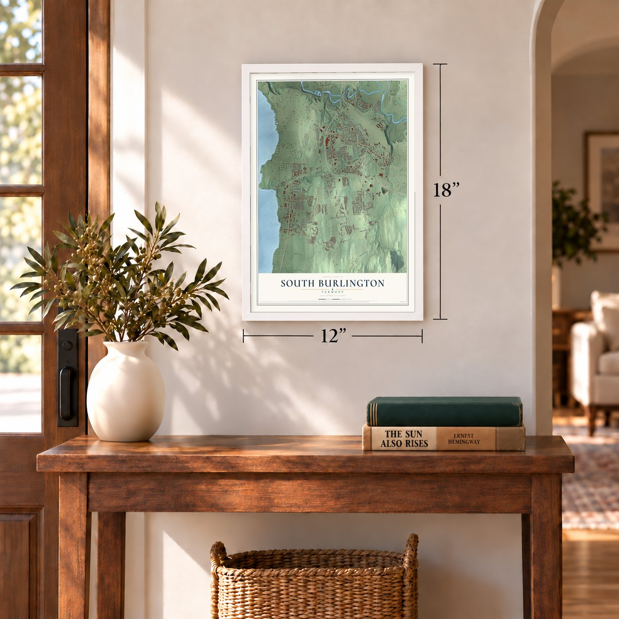
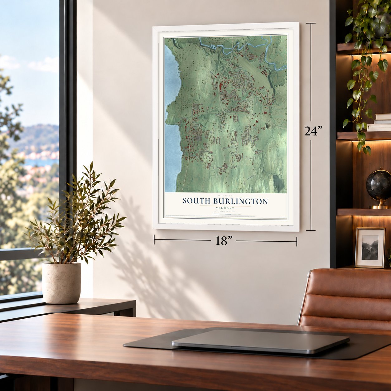
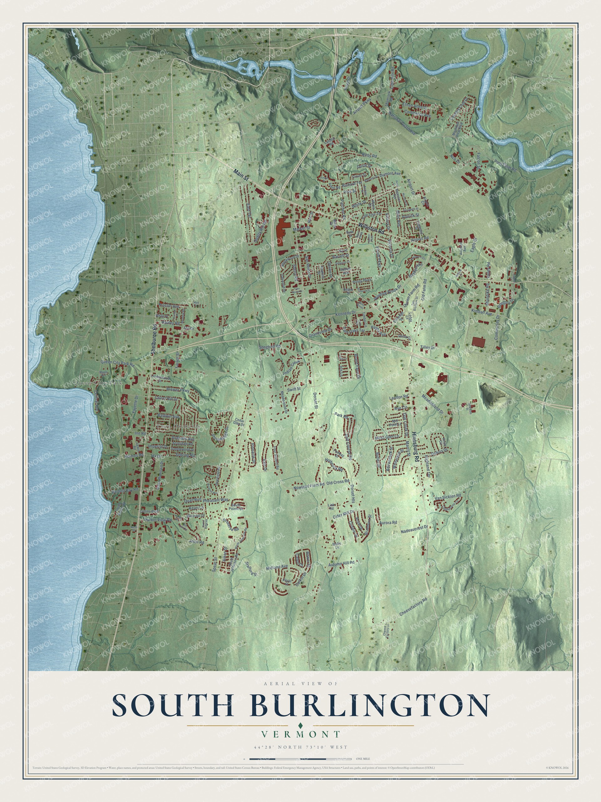
A new map of South Burlington, Vermont, made in 2026 and printed to order on thick archival matte paper.
12" x 18" Archival Matte Print
A Map of Home. A Work of Art.
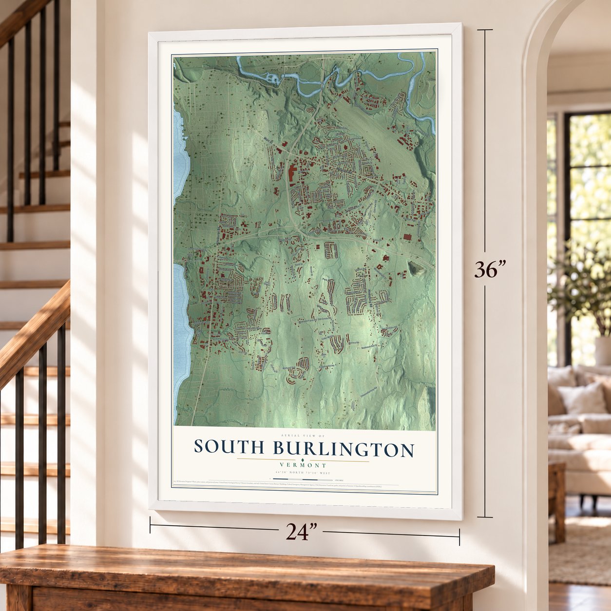
Explore South Burlington, Vermont from a whole new perspective. Created using aerial imagery and detailed geographic data, this map captures South Burlington building by building, with labeled streets, familiar landmarks, and shaded topographical relief that highlights the natural contours of the landscape.
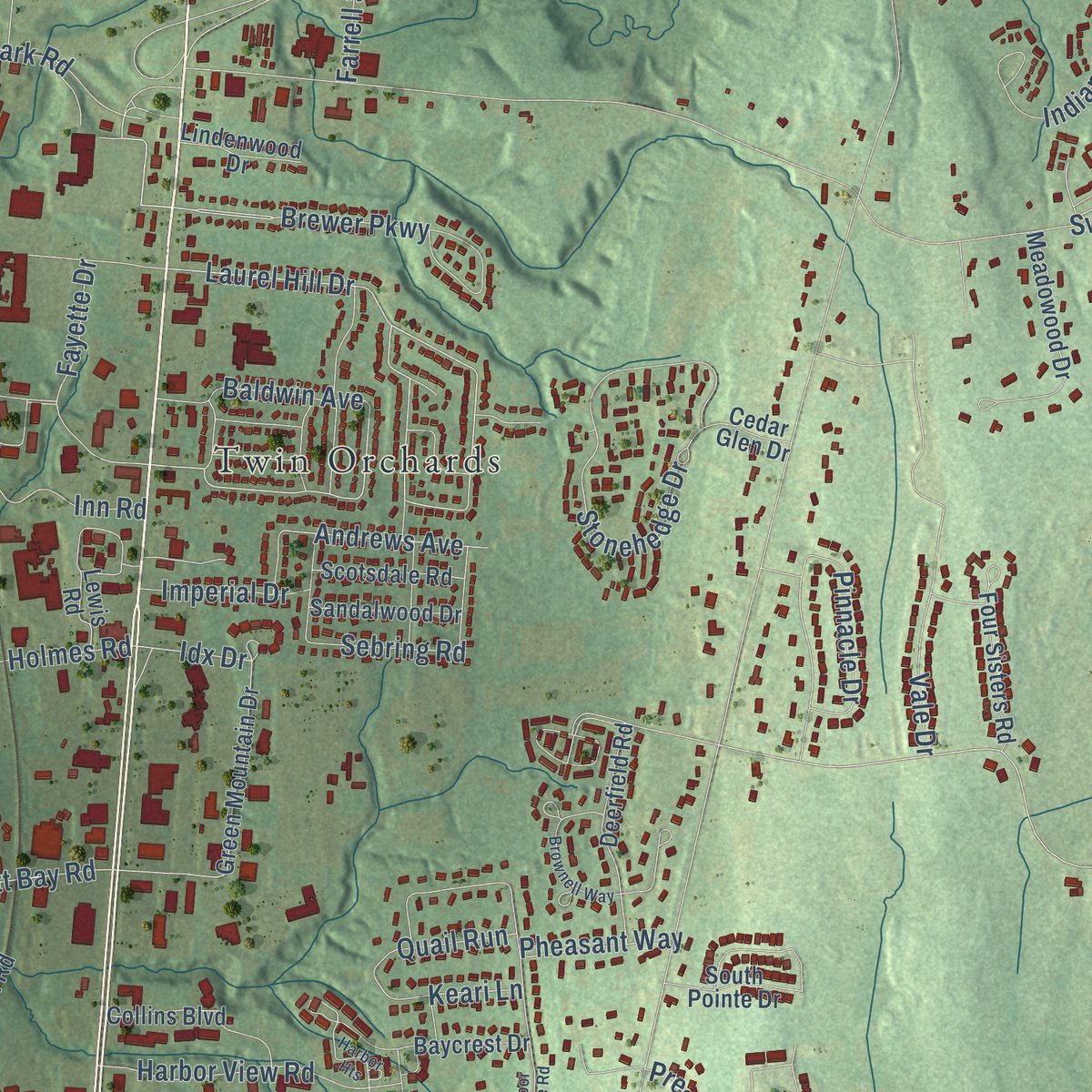
Combining modern data with the timeless character of a vintage atlas, this map is just as interesting up close as it is beautiful on the wall. Whether you grew up in South Burlington, spent memorable years there, or call it home today, this unique map is a great way to celebrate a place that means something to you. Zoom in on the preview to look for your street, and then order a print to put your memories on the wall.
Three ways to hang it
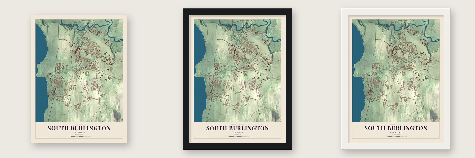
Unframed archival matte, a black wood frame or a white wood frame.
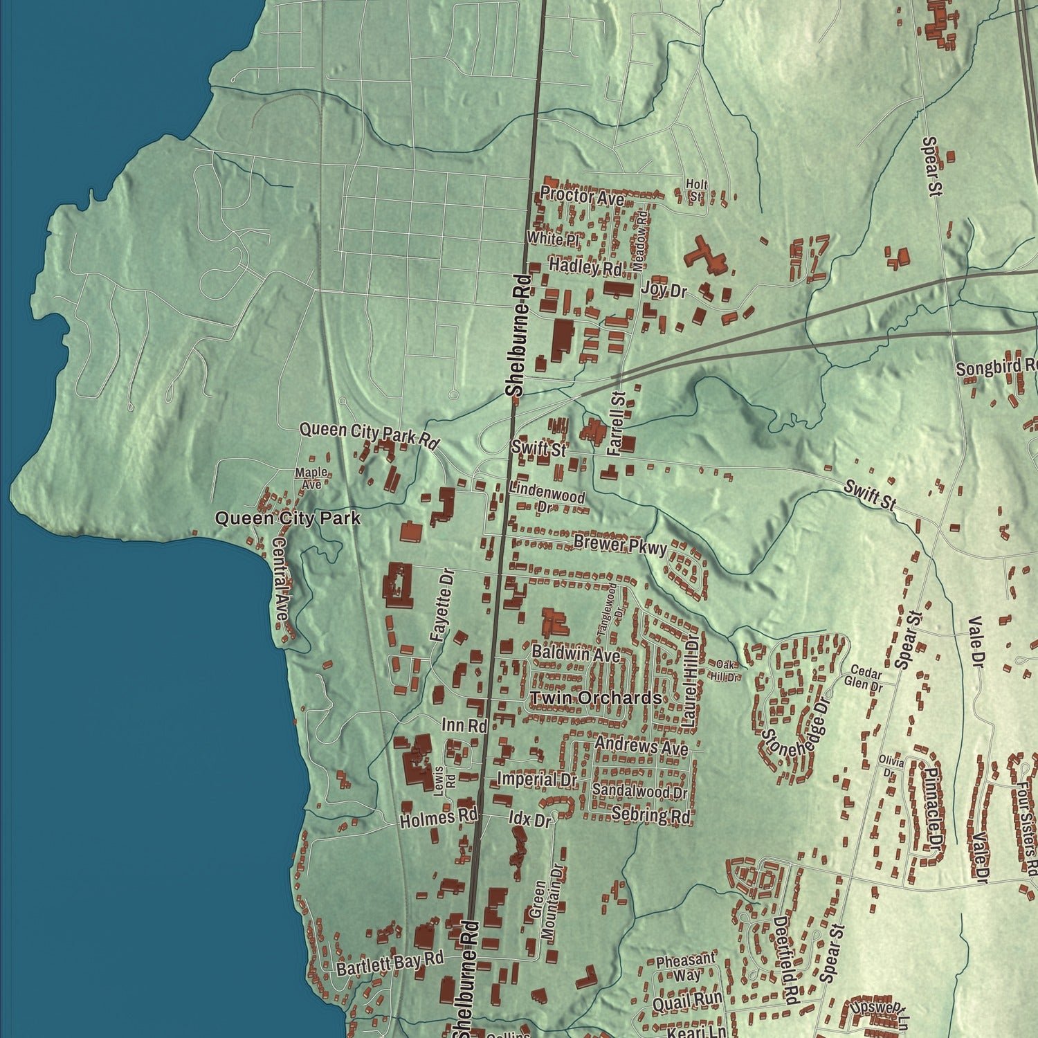
Up close
Geography Worth Displaying
This map was created using accurate cartographic data and authoritative geographic sources, including the U.S. Geological Survey (USGS) and FEMA. The map brings together terrain, waterways, roads, and building detail. The majority of the streets are labeled, houses are accurately depicted, and the topography is derived from government sources. Combining local data with carefully composed color and shading leads to this beautifully detailed South Burlington artwork for your wall.
Rather than simply showing street outlines, we’ve included as many of the street names as we could reasonably fit on the map while keeping their names legible. Zoom in on the high resolution preview to see exactly what’s on the map. We truly set out to create a statement piece for anyone who loves South Burlington. So whether it’s for you, or a gift for someone you love, we hope this map of South Burlington brings back fond memories.
Explore the full map of South Burlington, Vermont and read about the local places it shows.

About South Burlington, Vermont
South Burlington is a city of 20,292 people in Chittenden County, stretching from the shore of Shelburne Bay to the banks of the Winooski River. It is the second-largest city in Vermont by population, behind only Burlington. In 1763, on June 7, the Province of New Hampshire made this land part of its grant for Burlington township, and the Town of Burlington was organized around 1785.
In 1864 the village of Burlington became a city, so the rest of the old town had to stand on its own. That land was incorporated on November 22, 1864, under the name South Burlington, and Asa R. Slocum went to the legislature in 1865 as its first representative. The town later changed its standing, and in 1971 South Burlington became a city.
- First landing in 1920Patrick Leahy Burlington International Airport sits in South Burlington, although the City of Burlington owns it. The first aircraft touched down on the field on August 14, 1920. It has since grown into Vermont's busiest airport and the home base of the Vermont Air National Guard's 158th Fighter Wing.
- Ben & Jerry's headquartersBen & Jerry's started in Burlington in 1978 and keeps its headquarters in South Burlington. In the fall of 2019 the television station WPTZ moved its main studio into the same building.
- University Mall, 1979The University Mall was finished in 1979 and took its name from the nearby University of Vermont. It is the largest shopping mall in the state.
- Louvenia Bright in the HouseFrom 1988 to 1994, South Burlington voters sent Louvenia Bright to the Vermont House of Representatives. No Black woman had served in Vermont's General Assembly before her, and while in office she helped pass the state's first parental and family leave law.
Find your street
Names on the South Burlington map
Every name below is printed on this map. Look for your street, your school, the park where you played, or the pond down the road.
Places and landmarks2
- Queen City Park
- Twin Orchards
Streets and roads181
- Main Street
- Shelburne Road
- Williston Road
- Hinesburg Road
- Kennedy Drive
- Airport Drive
- Twin Oaks Terrace
- Spear Street
- Laurel Hill Drive
- Brewer Parkway
- Farrell Street
- Nowland Farm Road
- Gregory Drive
- Patchen Road
- Old Cross Road
- Idx Drive
- Kimball Avenue
- Poor Farm Road
- Country Club Drive
- Andrews Avenue
- Dorset Street
- Swift Street
- Airport Parkway
- Butler Drive
- Community Drive
- Midland Avenue
- White Street
- Allen Road
- Nco Drive
- Cheesefactory Road
Show all 181 streets
- Stonehedge Drive
- Baycrest Drive
- Old Farm Road
- Moss Glen Lane
- Meadowland Drive
- Vale Drive
- Golf Course Road
- National Guard Avenue
- Pinnacle Drive
- Catkin Drive
- East Terrace
- Park Road
- Kirby Road
- Indian Creek
- Barrett Street
- Inn Road
- Songbird Road
- Bartlett Bay Road
- Ethan Allen Drive
- Joy Drive
- Central Avenue
- Deerfield Road
- Bower Street
- Holmes Road
- Queen City Park Road
- Harbor View Road
- Quarry Hill Road
- Van Sicklen Road
- Dubois Drive
- Elsom Parkway
- Proctor Avenue
- San Remo Drive
- Market Street
- Fayette Drive
- Hayes Avenue
- Commerce Avenue
- Braeburn Street
- Nadeaucrest Drive
- Winding Brook Drive
- Adirondack Street
- Falcon Street
- Holbrook Road
- Cider Mill Drive
- Rye Circle
- Obrien Drive
- Baldwin Avenue
- Oakwood Drive
- Highland Terrace
- Dumont Avenue
- Tilley Drive
- Whiteface Street
- Lime Kiln Road
- Crispin Drive
- Mills Avenue
- Obrien Farm Road
- Cabot Court
- Preserve Road
- Hadley Road
- Autumn Hill Road
- Grandview Drive
- Oak Creek Drive
- Iris Lane
- Imperial Drive
- Sherry Road
- Duval Street
- Stafford Street
- Aurora Road
- Keari Lane
- Eagle Drive
- Sebring Road
- Quail Run
- Dorset Heights
- Victoria Drive
- Richard Terrace
- Patrick Street
- Landon Road
- Airport Road
- Aiken Street
- Timber Lane
- Green Mountain Drive
- Pine Tree Terrace
- Brand Farm Drive
- Pheasant Way
- Floral Street
- South Beach Road
- Meadowood Drive
- South Jefferson Road
- Berard Drive
- Eldredge Street
- Knoll Circle
- Derby Circle
- Four Sisters Road
- Shunpike Road
- Mountain View Boulevard
- Aviation Avenue
- Collins Boulevard
- Fairway Drive
- Airport Circle
- Royal Drive
- Victory Drive
- Brookwood Drive
- Mill Pond Lane
- Shamrock Road
- Sandalwood Drive
- Upswept Lane
- Clover Street
- Prouty Parkway
- Lindenwood Drive
- Valley Road
- Peterson Terrace
- Sadie Lane
- Forest Street
- Hopkins Street
- Pine Street
- White Place
- Mary Street
- Midas Drive
- Landfill Road
- Sunset Avenue
- Ledge Lane
- Deane Street
- Two Brothers Drive
- Cobblestone Circle
- Juniper Drive
- North Jefferson Road
- Cedar Glen Drive
- Southview Drive
- Elizabeth Street
- Simpson Court
- Marcy Street
- Meadow Road
- Myers Court
- Cheese Factory Lane
- Lewis Road
- Bowdoin Street
- Link Road
- Maple Avenue
- Pump Lane
- Nesti Drive
- Holt Street
- Harbor Ridge Road
- Davis Parkway
- Berkley Street
- Tanglewood Drive
- Lupine Lane
- Irish Cove Road
- Hayden Parkway
- Town Square Drive
- Oak Hill Drive
- Millham Court
- Olivia Drive
Names are listed as they appear on the printed map. Zoom into the product photos to find them.
The art of mapping a place
How This Map Was Made
Real places. Remarkable detail. Discover the layers that turn geographic data into a map of home.

The view from above
Aerial imagery reveals the character of the land: woodland, open fields, and the patterns of a place.

The shape of the land
Elevation data brings hills, valleys, and subtle changes in the landscape into view.

The details of home
Roads, waterways, and building footprints come together to make the map feel unmistakably local.

Geography becomes art
Considered color, shading, and typography bring the layers together in a map made for your wall.


Process illustrated with Mendon, Massachusetts. Aerial imagery: USDA NAIP. Terrain: USGS 3D Elevation Program. Map details and finished artwork: KNOWOL.
The Details
About This Print
Choose an archival matte print, or a black or white Ayous wood frame. The archival matte print is unframed.
Select your size and finish above to see the matching product image and price.
Materials & Craftsmanship
A contemporary map with the character of a classic atlas, printed on archival matte paper. Optional frames are made from Ayous wood.
Your printed map does not include the watermark shown in the full-map preview.
Shipping & Delivery
Free shipping within the United States. Every print is made to order in the USA.
Buying a gift? Add a note in your cart and we'll include it. We never put prices in the package.
Prints ship within 2 to 3 business days. Allow 7 to 10 days total from ordering for delivery. Timing may vary during holidays or periods of high order volume.
Read our shipping policy.
Returns and damaged prints
Each print is made to order. Change-of-mind refunds are not available after production.
If your print arrives damaged, misprinted or incorrect, contact support@knowol.com within 30 days of receiving it. Include your order number, photos and a description of the issue.
Read our full refund and replacement policy. For questions about your order, email support@knowol.com.
Find your town
Looking for another city?
Find a map of home in our Vermont collection, or any town in the country.
Nearby
Maps of towns near South Burlington
Know someone from one of these towns? Their map makes a great gift.
 Winooski
, Vermont
From $39.99See the map
 Williston
, Vermont
From $39.99See the map
 Shelburne
, Vermont
From $39.99See the map
More maps nearby: Burlington, Essex Junction, St. George, Malletts Bay and East Charlotte.