
Search for another town





Free U.S. delivery 7 to 10 days after you order
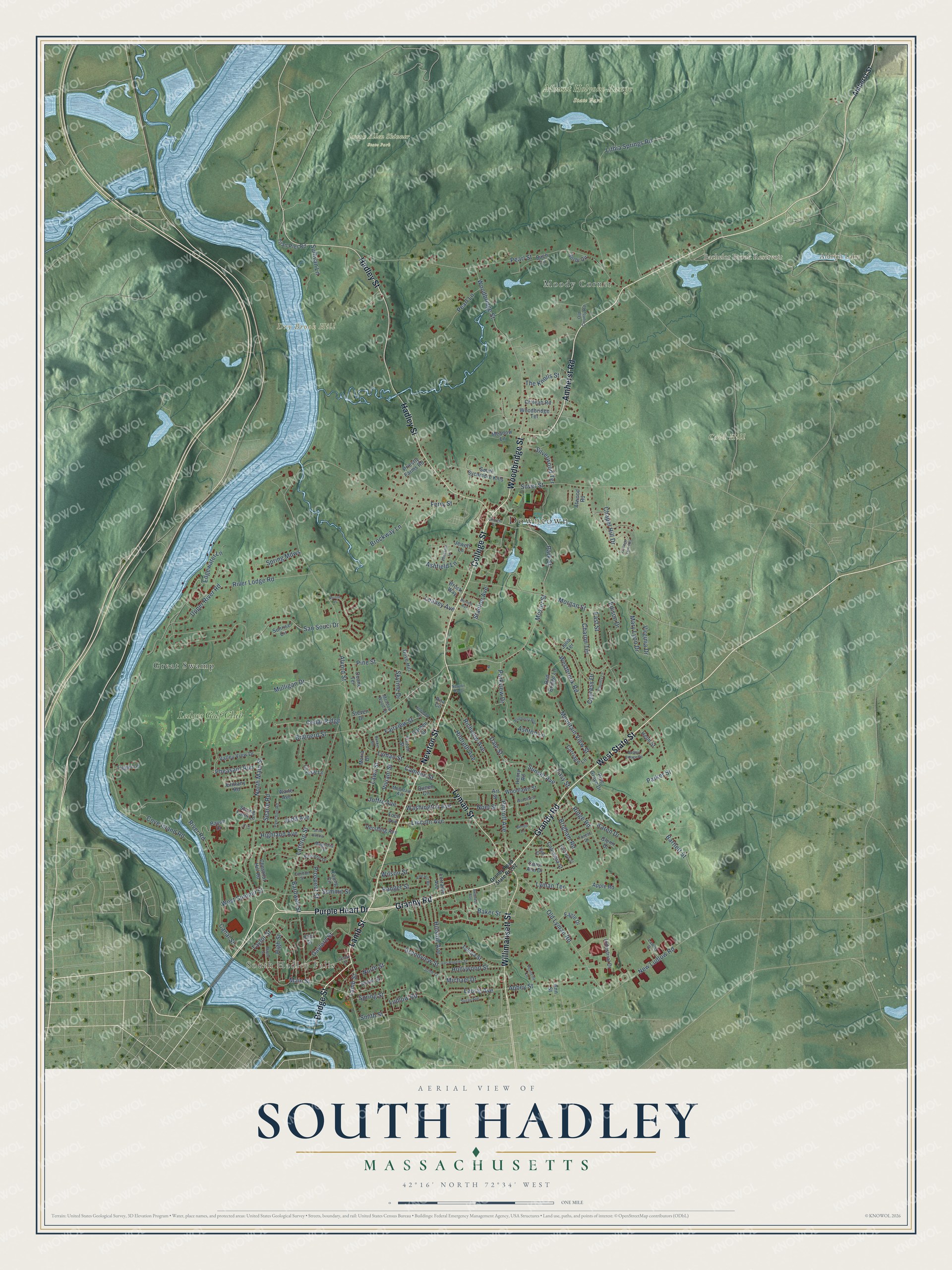
South Hadley, Massachusetts Map Art
Building by building, with labeled streets and shaded relief.
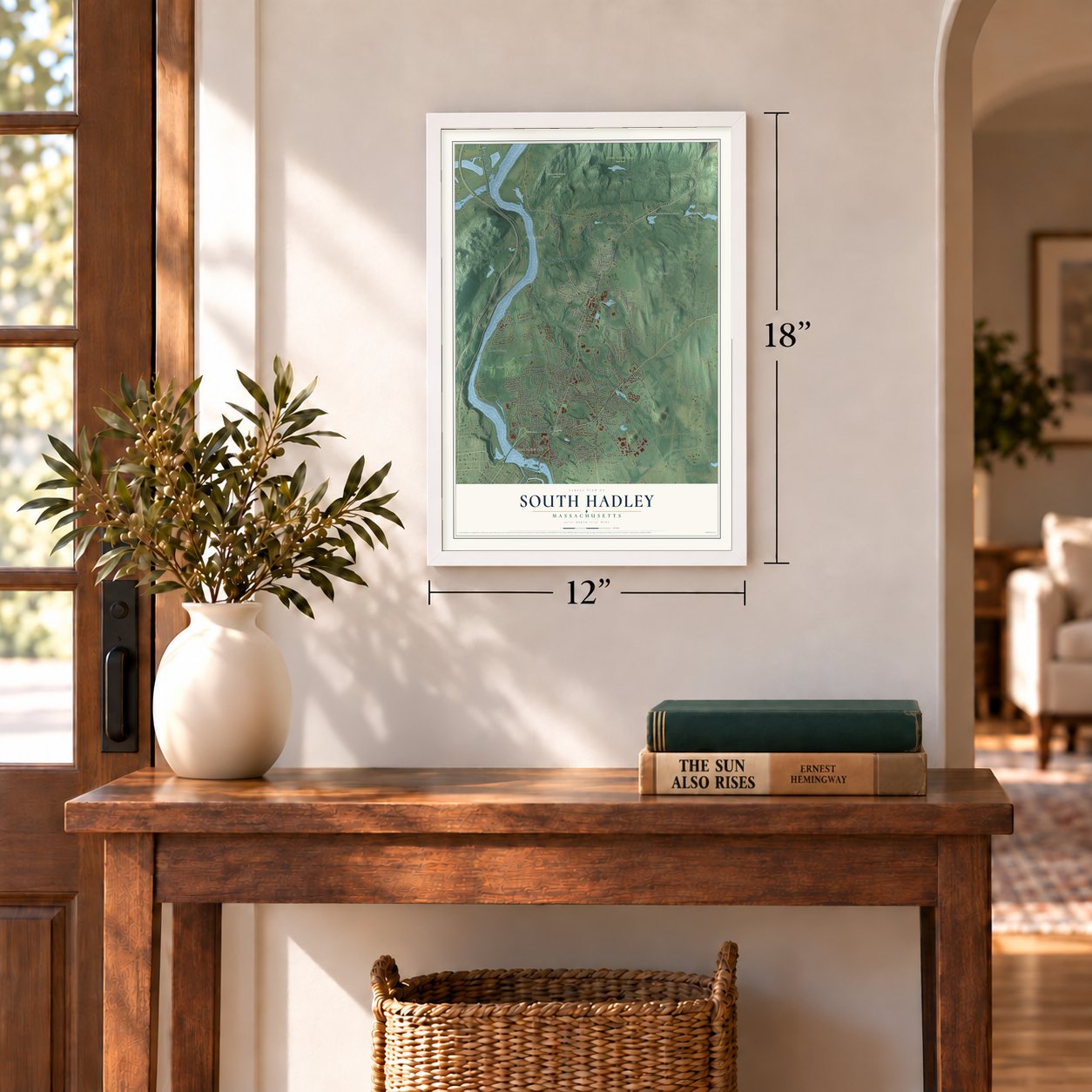
12" x 18" Archival Matte Print
A Map of Home. A Work of Art.
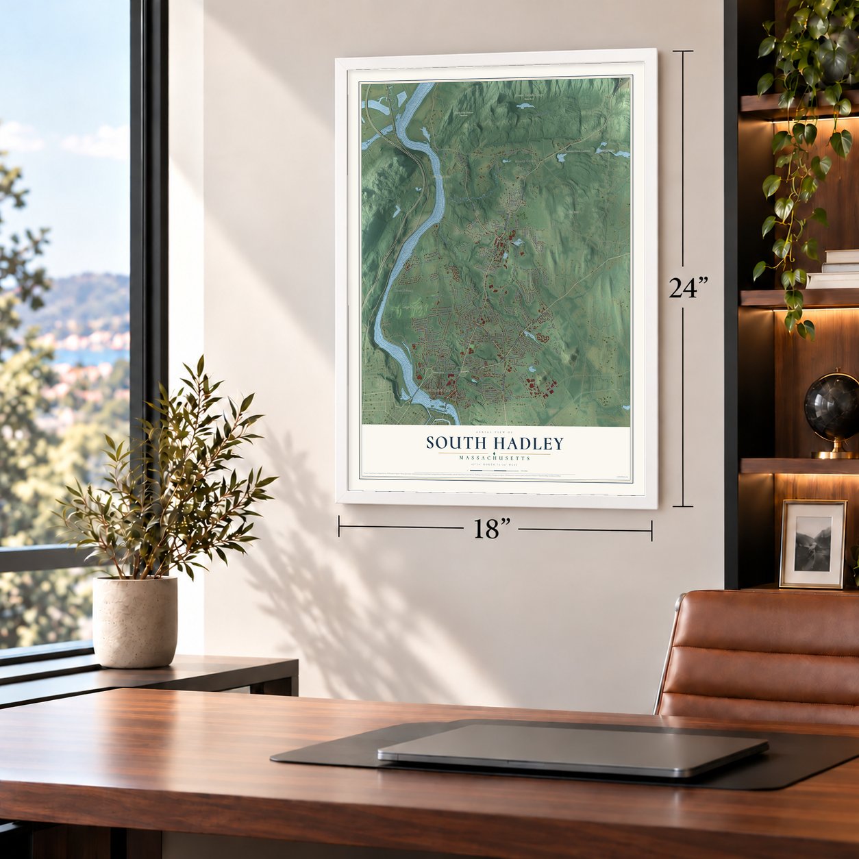
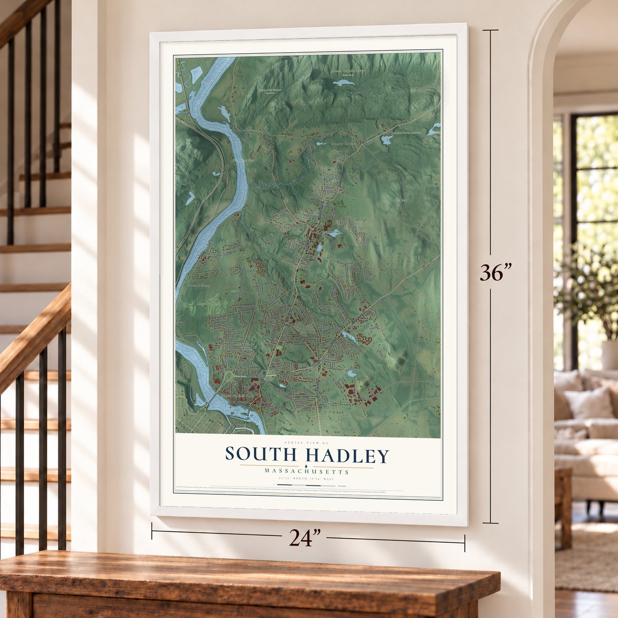
Explore South Hadley, Massachusetts from a whole new perspective. Created using aerial imagery and detailed geographic data, this map captures South Hadley building by building, with labeled streets, familiar landmarks, and shaded topographical relief that highlights the natural contours of the landscape.
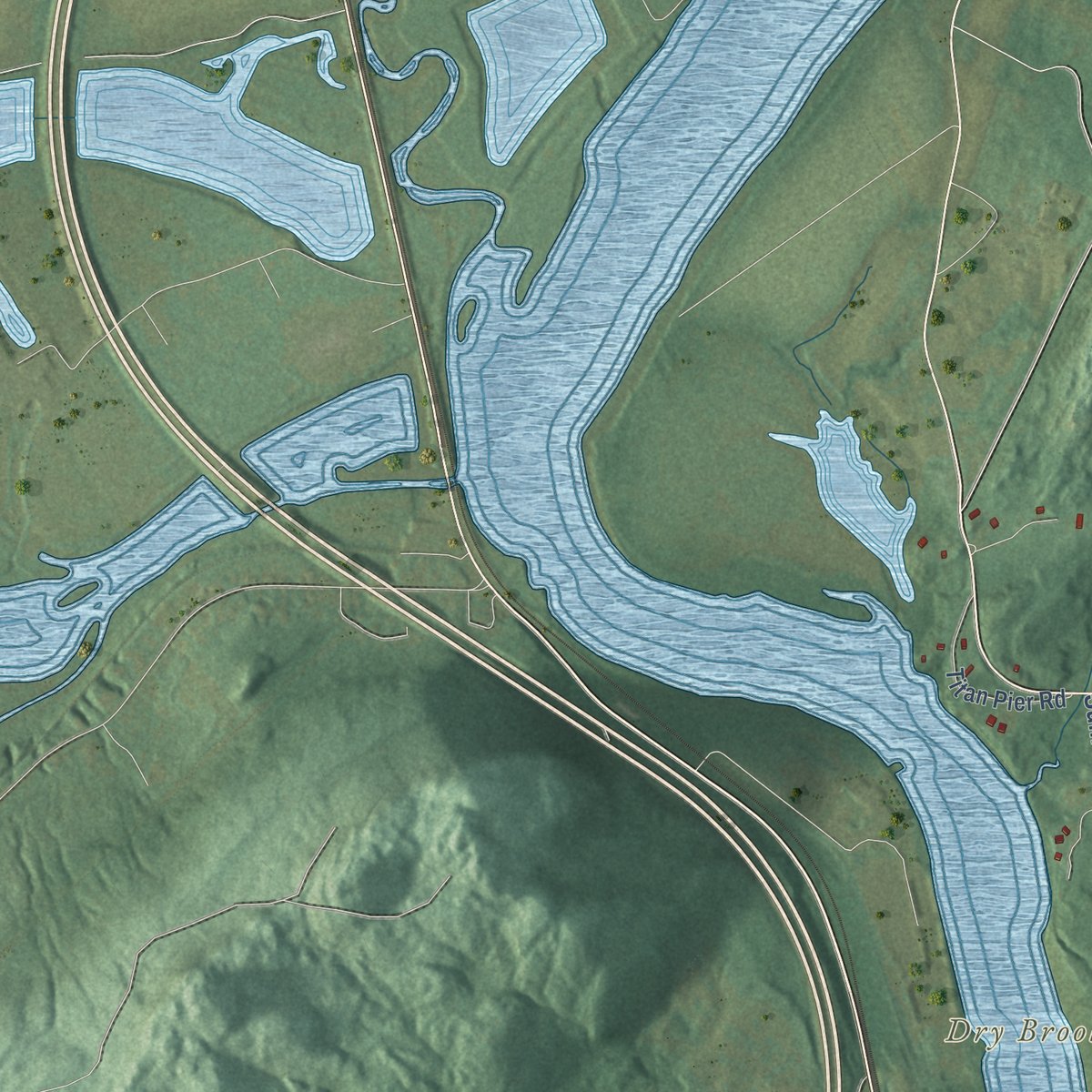
Combining modern data with the timeless character of a vintage atlas, this map is just as interesting up close as it is beautiful on the wall. Whether you grew up in South Hadley, spent memorable years there, or call it home today, this unique map is a great way to celebrate a place that means something to you. Zoom in on the preview to look for your street, and then order a print to put your memories on the wall.
Three ways to hang it
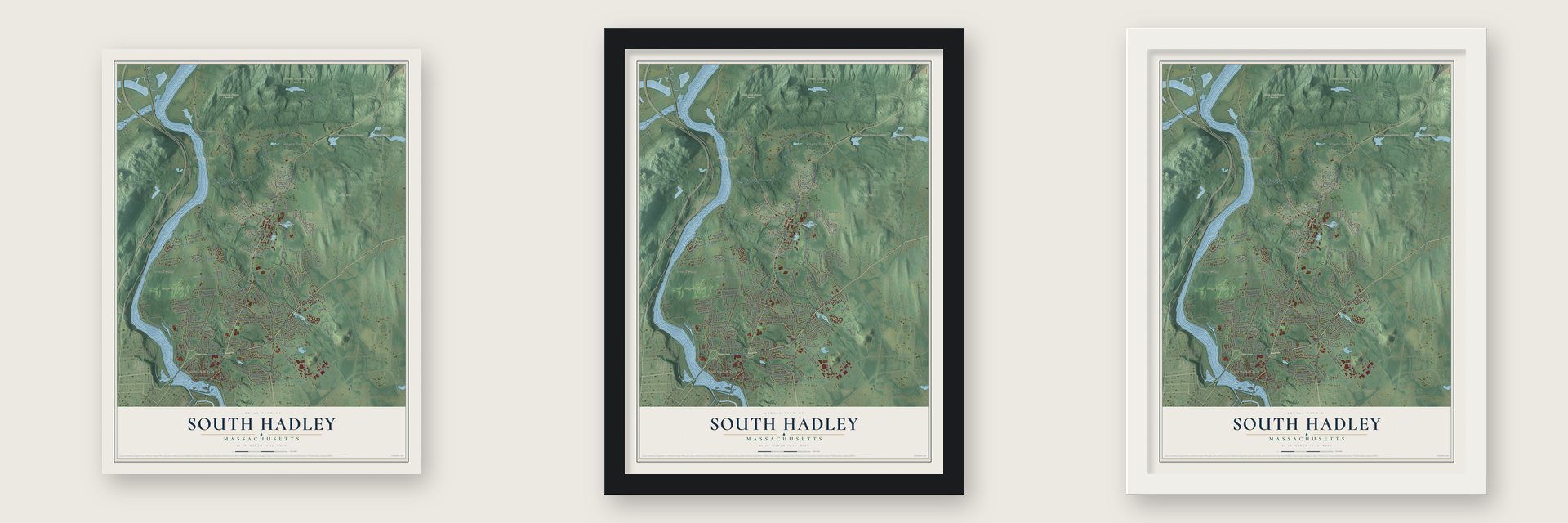
Unframed archival matte, a black wood frame or a white wood frame.
Up close
Geography Worth Displaying
This map was created using accurate cartographic data and authoritative geographic sources, including the U.S. Geological Survey (USGS) and FEMA. The map brings together terrain, waterways, roads, and building detail. The majority of the streets are labeled, houses are accurately depicted, and the topography is derived from government sources. Combining local data with carefully composed color and shading leads to this beautifully detailed South Hadley artwork for your wall.
Rather than simply showing street outlines, we’ve included as many of the street names as we could reasonably fit on the map while keeping their names legible. Zoom in on the high resolution preview to see exactly what’s on the map. We truly set out to create a statement piece for anyone who loves South Hadley. So whether it’s for you, or a gift for someone you love, we hope this map of South Hadley brings back fond memories.
Explore the full map of South Hadley, Massachusetts and read about the local places it shows.

Find your street
Names on the South Hadley map
Every name below is printed on this map. Look for your street, your school, the park where you played, or the pond down the road.
Places and landmarks11
- Downtown
- South Hadley Falls
- Cold Hill
- Dry Brook Hill
- Aldrich Lake
- Bachelor Brook Reservoir
- Joseph Allen Skinner State Park
- Mount Holyoke Range State Park
- Great Swamp
- Moody Corner
- Ledges Golf Club
Streets and roads187
- Purple Heart Drive
- West State Street
- Newton Street
- Bridge Street
- Lamb Street
- College Street
- Woodbridge Street
- Willimansett Street
- Amherst Road
- Lyman Street
- Hadley Street
- Grandy Road
- Granby Road
- North Main Street
- Mosier Street
- Main Street
- Park Street
- Brainerd Street
- Old Lyman Road
- Hollywood Street
- Hillside Avenue
- San Souci Drive
- River Road
- Pearl Street
- Alvord Street
- Lathrop Street
- East Street
- Lithia Springs Road
- Morgan Street
- Ferry Street
Show all 187 streets
- Silver Street
- Canal Street
- Bardwell Street
- Upper River Road
- River Lodge Road
- New Ludlow Road
- Pittroff Avenue
- Abbey Street
- Westbrook Road
- Bartlett Street
- Pine Street
- Mulligan Drive
- Ashton Lane
- The Knolls Street
- Charon Terrace
- Cove Island Road
- Chapel Hill Drive
- West Summit Street
- Hildreth Avenue
- Lincoln Avenue
- Ridge Road
- Mountain View Street
- Sunset Avenue
- Cedar Ridge
- Lyman Terrace
- Prospect Street
- Gaylord Street
- Michael Drive
- Ludlow Road
- Camden Street
- Mary Lyon Drive
- Dale Street
- Brockway Lane
- Pearl Lane
- Richview Avenue
- Washington Avenue
- Silverwood Terrace
- Laurie Avenue
- Judd Avenue
- Sullivan Lane
- Fairview Street
- Summit Street
- Edison Drive
- Grandview Street
- Stanton Avenue
- Spring Mdws
- Pheasant Run
- Highland Avenue
- High Street
- Parkview Drive
- Edgewater Lane
- Viviani Street
- Brigham Road
- Ashfield Lane
- Searle Road
- Virginia Drive
- Karen Drive
- Parker Street
- Cypress Drive
- Leahey Avenue
- Joffre Avenue
- Taylor Street
- Lawn Street
- Noel Street
- Ranger Street
- Skyline Drive
- Baker Street
- Spring Street
- North Street
- Easy Street
- Wilson Street
- Smith Street
- Amherst Street
- Columbia Street
- Jewett Lane
- Industrial Drive
- Priestly Farms Road
- Chestnut Hill Road
- Woodbridge Terrace
- Tampa Street
- Bach Lane
- Valley View Drive
- Bayon Drive
- Titan Pier Road
- Red Bridge Lane
- South Sycamore Knls
- Pine Grove Drive
- Apple Road
- Waite Avenue
- Fulton Street
- Woodlawn Street
- Meadow Lane
- Carriage Lane
- Garden Street
- Pershing Avenue
- Eagle Drive
- Doane Terrace
- Chileab Road
- South Street
- Henry Road
- Crystal Lane
- Tigger Lane
- Dove Hill
- Brittany Road
- Helm Street
- Sunrise Circle
- Sorbi Circle
- Strong Farm Lane
- Brock Way
- Queen Circle
- Lorraine Avenue
- Atwood Road
- Young Circle
- Glenn Drive
- Steven Drive
- Foch Avenue
- Elm Street
- Carol Ann Drive
- Maria Drive
- Julia Terrace
- Rita Circle
- Ann Street
- Art Street
- Magnolia Terrace
- Pynchon Road
- Meadow Wood Drive
- Old County Road
- Kimberly Drive
- Mountain Avenue
- Yale Street
- Forest Drive
- Harvard Street
- Lawler Drive
- Carlton Street
- John Lane
- Church Street
- Alvord Place
- College View Heights
- Pine Hill Road
- School Street
- Los Angeles Street
- Hadley Village Road
- Blueberry Bnd
- Hillcrest Avenue
- Susan Avenue
- Country Lane
- Maple Street
- Kendrick Street
- Plainville Circle
- Benoit Lane
- Pheasant Lane
- Burnett Avenue
- Scott Hollow
- Woodcrest Lane
- Bunker Hill
- Newton Manor
- Ivy Lane
Names are listed as they appear on the printed map. Zoom into the product photos to find them.
About South Hadley, Massachusetts
South Hadley is a town of 18,150 people in Hampshire County, set between the Holyoke Range and the Connecticut River. It started as the southern precinct of Hadley, which granted Thomas Selden six acres at the mouth of Dry Brook in 1675. On January 25, 1720, Hadley's proprietors agreed to share out among themselves the ground below Mount Holyoke, and English families moved in the next year. The settlement held its own town meeting as a district from 1753 and became a town in 1775.
The parish ordained Grindall Rawson as its first minister in 1733, but by 1740 it wanted him gone. When he began to pray in the pulpit anyway in 1741, a committee took hold of him and removed him from the meetinghouse. A bitter fight over where to build a larger meetinghouse came next, with vote after vote for about ten years. In 1761 opponents from the east hid three posts of the new frame in Pichawamiche Swamp and toppled its southern end. The eastern families won their own parish in 1762, and in 1768 it became the town of Granby.
“Almost all rode on horses. No other place in the old county of Hampshire drew so many people by novel and interesting sights.”
- Boats on an inclined planeWork on a canal around the Great Falls began in 1792, and about 250 men were on the job in 1793; one, Moses Gaylord, died when a rock fell on him. On a December day in 1794 the town celebrated by lowering men and women down the inclined plane in a boat and hauling them back up. The canal opened in April 1795 as the country's first canal that boats could navigate, and it closed in 1862.
- Mary Lyon's seminary, 1837The state granted Mount Holyoke Female Seminary its charter on February 11, 1836, and that October workers laid the cornerstone of its four-story brick building. Mary Lyon opened it on November 8, 1837, with space for 80 pupils, and every student spent an hour each day on housework. At the school's fiftieth anniversary in 1887, teachers knocked on doors around town to find beds for returning alumnae, and several families offered to lodge forty each.
- Dinosaur tracks in 1802Pliny Moody was plowing his land in 1802 when his plow turned up a slab of sandstone marked with the footprints of dinosaurs.
- A church from 1895The congregation first gathered in 1733 got a new red brick and sandstone church in the Romanesque Revival style in 1895. Henry J. Preston, a Boston architect who had once been a member of the parish, designed it, and bricks saved from the earlier church, which burned, went into the new building.
Keep exploring Massachusetts
South Hadley is one of 470 Massachusetts towns we've mapped. Every dot on the map is a print of its own.
The search covers every state, Massachusetts first.
Near South Hadley
Order 2 or more town maps and save 10%. Shown in the size and finish you picked above, so they hang as a set.
- Granby 12" x 18" / Archival Matte Print $39.99
- Holyoke 12" x 18" / Archival Matte Print $39.99
- Easthampton 12" x 18" / Archival Matte Print $39.99


More maps nearby: Chicopee, Northampton, Hadley, Ludlow and Southampton.
The art of mapping a place
How This Map Was Made
Real places. Remarkable detail. Discover the layers that turn geographic data into a map of home.

The view from above
Aerial imagery reveals the character of the land: woodland, open fields, and the patterns of a place.

The shape of the land
Elevation data brings hills, valleys, and subtle changes in the landscape into view.

The details of home
Roads, waterways, and building footprints come together to make the map feel unmistakably local.

Geography becomes art
Considered color, shading, and typography bring the layers together in a map made for your wall.


Process illustrated with Mendon, Massachusetts. Aerial imagery: USDA NAIP. Terrain: USGS 3D Elevation Program. Map details and finished artwork: KNOWOL.
The Details
About This Print
Choose an archival matte print, or a black or white Ayous wood frame. The archival matte print is unframed.
Select your size and finish above to see the matching product image and price.
Materials & Craftsmanship
A contemporary map with the character of a classic atlas, printed on archival matte paper. Optional frames are made from Ayous wood.
Your printed map does not include the watermark shown in the full-map preview.
Shipping & Delivery
Free shipping within the United States. Every print is made to order in the USA.
Buying a gift? Add a note in your cart and we'll include it. We never put prices in the package.
Prints ship within 2 to 3 business days. Allow 7 to 10 days total from ordering for delivery. Timing may vary during holidays or periods of high order volume.
Read our shipping policy.
Returns and damaged prints
Each print is made to order. Change-of-mind refunds are not available after production.
If your print arrives damaged, misprinted or incorrect, contact support@knowol.com within 30 days of receiving it. Include your order number, photos and a description of the issue.
Read our full refund and replacement policy. For questions about your order, email support@knowol.com.