


Search for another town



Free U.S. delivery 7 to 10 days after you order
Chicopee, Massachusetts Map Art
Building by building, with labeled streets and shaded relief.
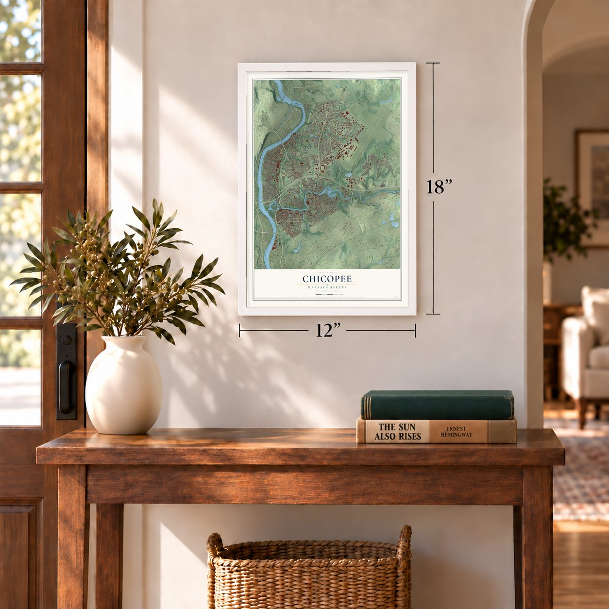
12" x 18" Archival Matte Print
A Map of Home. A Work of Art.
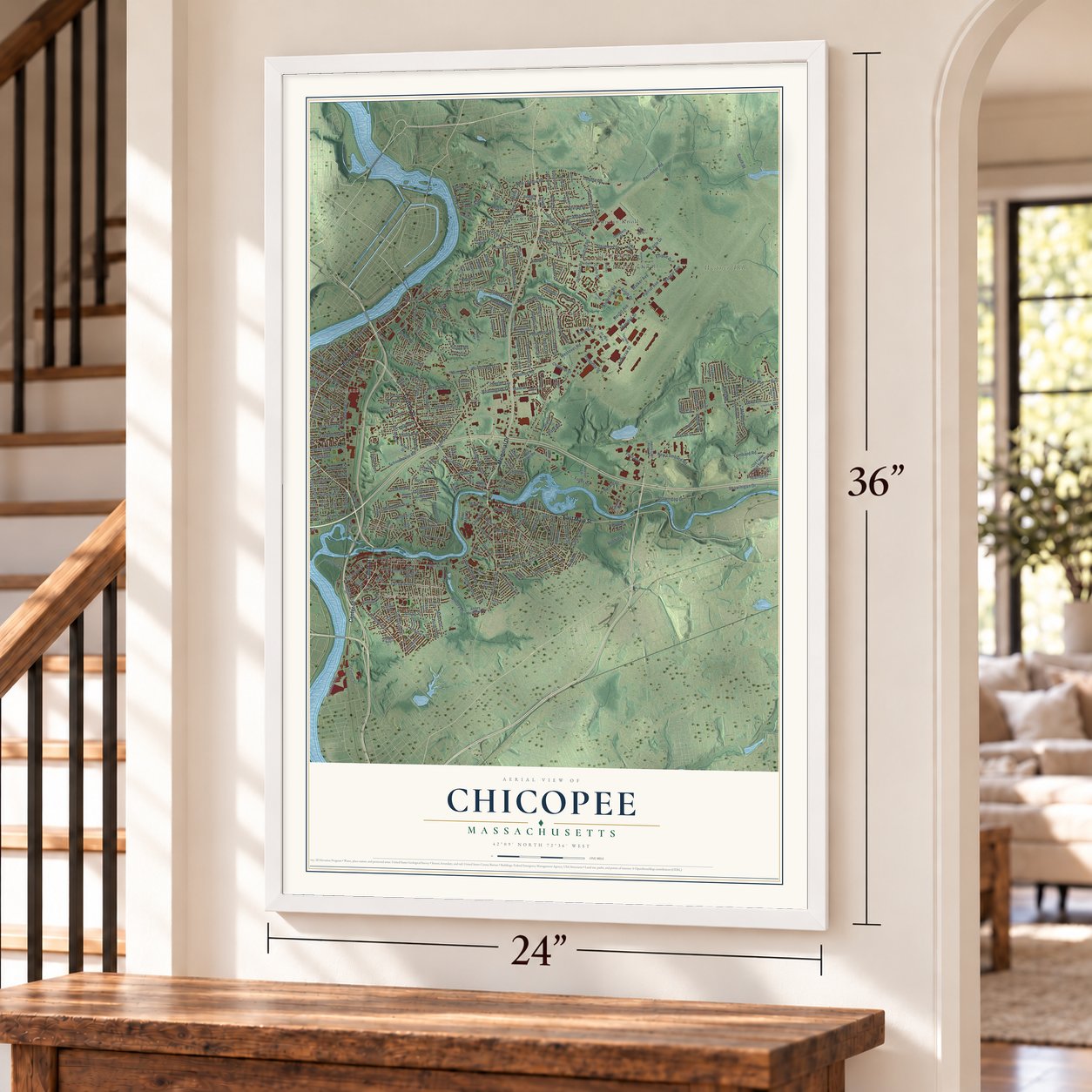
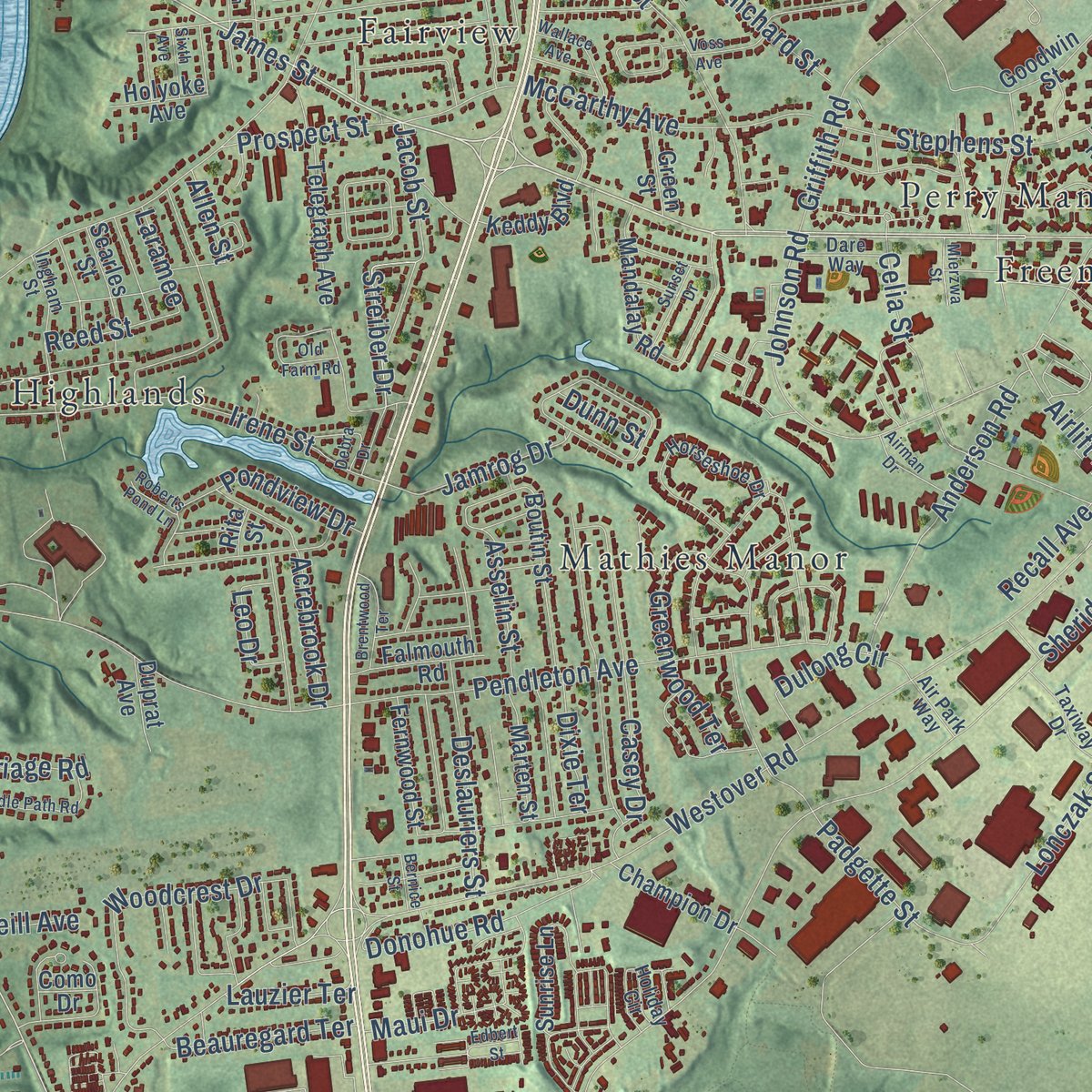
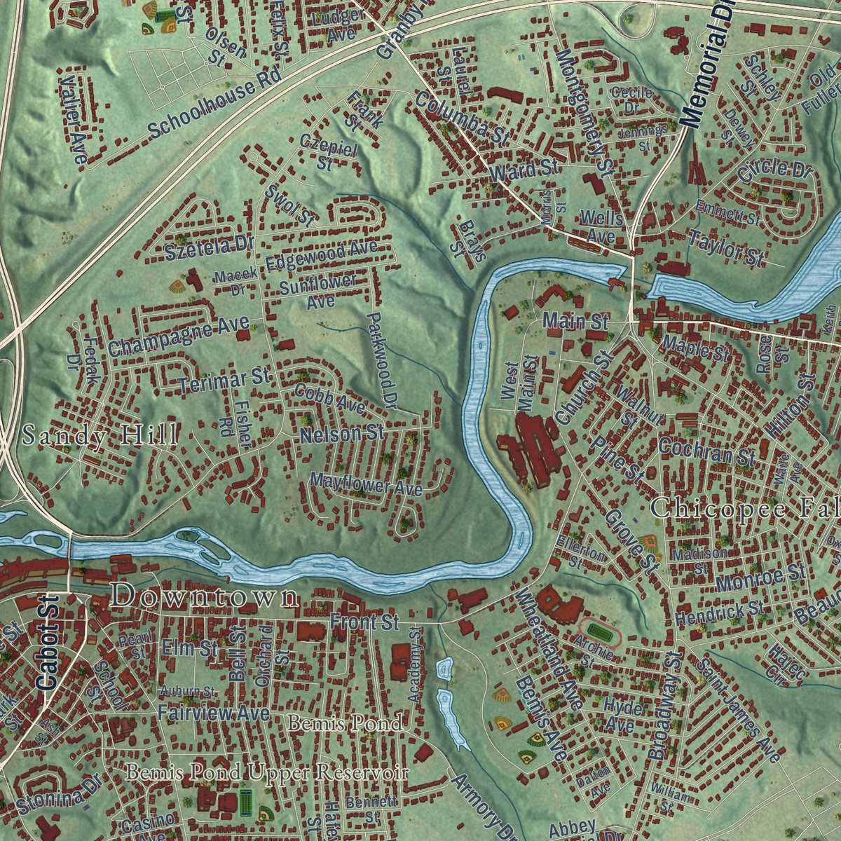
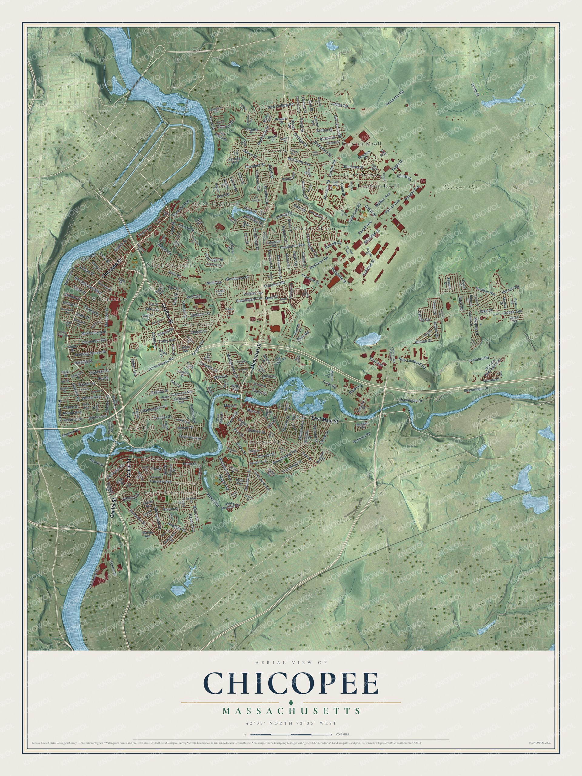
Explore Chicopee, Massachusetts from a whole new perspective. Created using aerial imagery and detailed geographic data, this map captures Chicopee building by building, with labeled streets, familiar landmarks, and shaded topographical relief that highlights the natural contours of the landscape.
Combining modern data with the timeless character of a vintage atlas, this map is just as interesting up close as it is beautiful on the wall. Whether you grew up in Chicopee, spent memorable years there, or call it home today, this unique map is a great way to celebrate a place that means something to you. Zoom in on the preview to look for your street, and then order a print to put your memories on the wall.
Three ways to hang it
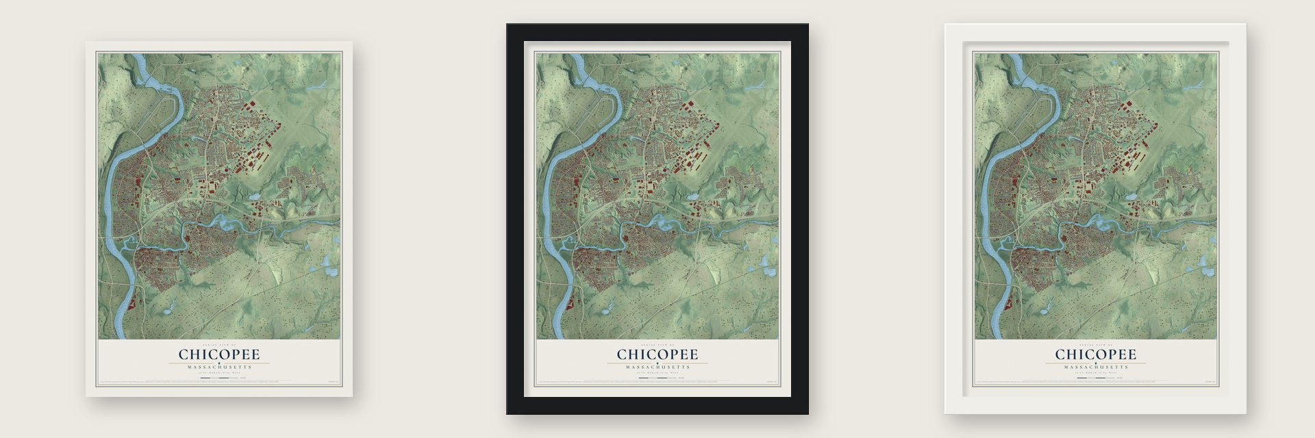
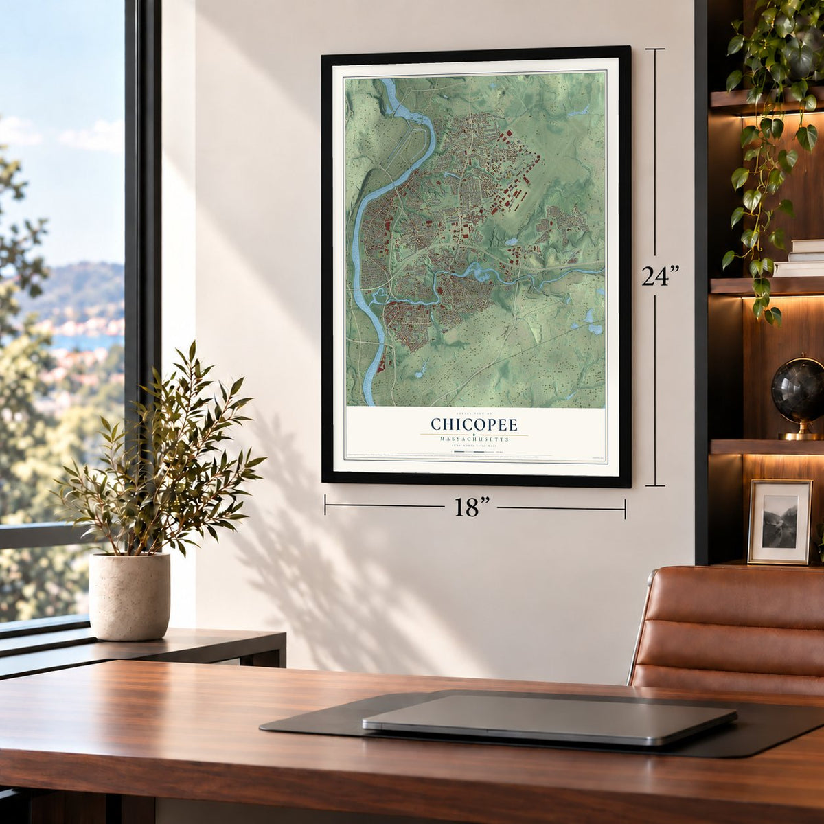
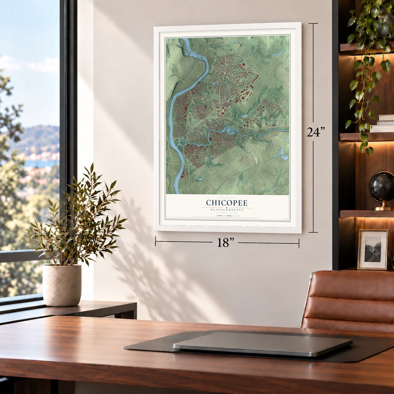
Unframed archival matte, a black wood frame or a white wood frame.
Up close
Geography Worth Displaying
This map was created using accurate cartographic data and authoritative geographic sources, including the U.S. Geological Survey (USGS) and FEMA. The map brings together terrain, waterways, roads, and building detail. The majority of the streets are labeled, houses are accurately depicted, and the topography is derived from government sources. Combining local data with carefully composed color and shading leads to this beautifully detailed Chicopee artwork for your wall.
Rather than simply showing street outlines, we’ve included as many of the street names as we could reasonably fit on the map while keeping their names legible. Zoom in on the high resolution preview to see exactly what’s on the map. We truly set out to create a statement piece for anyone who loves Chicopee. So whether it’s for you, or a gift for someone you love, we hope this map of Chicopee brings back fond memories.
Explore the full map of Chicopee, Massachusetts and read about the local places it shows.

Find your street
Names on the Chicopee map
Every name below is printed on this map. Look for your street, your school, the park where you played, or the pond down the road.
Places and landmarks15
- Downtown
- Bemis Pond
- Bemis Pond Upper Reservoir
- Westover ARB
- North Chicopee
- Mathies Manor
- Willimansett
- Chicopee Falls
- Fairview
- Smith Highlands
- Aldenville
- Duncan Knoll
Show all 15 places
- Freeman Knoll
- Sandy Hill
- Perry Manor
Streets and roads342
- Chicopee Street
- Grattan Street
- Cabot Street
- Memorial Drive
- Center Street
- East Main Street
- Syrek Street
- James Street
- Ferry Street
- Dike Wall
- Prospect Street
- Riverside Drive
- Montgomery Street
- Anderson Road
- Front Street
- Main Street
- Airlift Drive
- Yelle Street
- Dobek Avenue
- Lombard Road
- Valier Avenue
- Bonner Street
- Granby Road
- Sheridan Street
- Burnett Road
- Pendleton Avenue
- McKinstry Avenue
- Shawinigan Drive
- Patriot Avenue
- Westover Road
Show all 342 streets
- Meadow Street
- Britton Street
- Fuller Road
- Broadway Street
- New Ludlow Road
- Perimeter Road
- Springfield Street
- East Street
- Hangar Avenue
- Riverdale Road
- Montcalm Street
- Irene Street
- South Street
- Dale Street
- Hampden Street
- Recall Avenue
- Johnson Road
- College Street
- Oldfield Road
- Columba Street
- Grove Street
- Exchange Street
- Casey Drive
- Eagle Drive
- Lonczak Street
- Griffith Road
- Carew Street
- Beauchamp Terrace
- Stephens Street
- Streiber Drive
- Wildermere Street
- Frontenac Street
- Fairview Avenue
- Tolpa Circle
- Skeele Street
- Ludlow Road
- Woodcrest Drive
- Schoolhouse Road
- Moore Street
- Narragansett Boulevard
- McCarthy Avenue
- Padgette Street
- Murphy Lane
- Ellipse Drive
- Circle Drive
- Wheatland Avenue
- Arcade Street
- Slate Road
- Szetela Drive
- Rolf Avenue
- Depot Street
- Buckley Boulevard
- Basil Road
- Old Lyman Road
- Donohue Road
- Asselin Street
- Plainfield Street
- Pondview Drive
- Clarendon Avenue
- Meeting House Road
- Greenwood Terrace
- Blanchard Street
- Stebbins Street
- Walker Avenue
- Bemis Avenue
- Jacob Street
- Newbury Street
- Royal Street
- Deslauriers Street
- Nelson Street
- Dayton Street
- Robbins Road
- Olko Circle
- Theroux Drive
- Chapel Street
- Empire Street
- Jamrog Drive
- Armory Drive
- New Lombard Road
- Labelle Circle
- Wilson Avenue
- Champagne Avenue
- Beauregard Terrace
- Shawnigan Drive
- Haven Avenue
- Kendall Street
- Amherst Street
- Blanan Drive
- Artisan Street
- Ruskin Street
- Fernhill Street
- Celia Street
- Trilby Avenue
- Monroe Street
- Fair Street
- Cochran Street
- Carriage Road
- Anson Street
- Whitin Avenue
- Church Street
- Ward Street
- First Avenue
- Maui Drive
- Taylor Street
- Acrebrook Drive
- Dulong Circle
- Stedman Street
- Mary Street
- Clark Street
- Terimar Street
- Simard Drive
- Austin Street
- Edward Street
- Medina Street
- Arnold Avenue
- Leo Drive
- Chester Street
- Hilton Street
- Reed Street
- Dixie Terrace
- Peace Street
- Ann Street
- Lauzier Terrace
- Stonina Drive
- Baskin Drive
- Roy Street
- Bell Street
- Harding Street
- Robak Drive
- Neill Avenue
- Pine Street
- Laramee
- Newell Street
- Elm Street
- Allen Street
- Dunn Street
- Daley Street
- Sparrow Drive
- Truro Street
- Abbey Memorial Drive
- Kimball Street
- Langevin Street
- Old Fuller Road Extended
- Mandalay Road
- Goodwin Street
- School Street
- Parkwood Drive
- Telegraph Avenue
- Loomis Drive
- Mayflower Avenue
- Saint James Avenue
- Boutin Street
- Silvin Road
- Joy Street
- Moreau Drive
- Sunrise Lane
- Nutmeg Circle
- Glendale Street
- Edgewood Avenue
- Hendrick Street
- Hafey Street
- Casino Avenue
- Davenport Street
- Broad Street
- Cobb Avenue
- Post Road
- Sandtrap Way
- Sesame Drive
- Deane Street
- Sunflower Avenue
- Champion Drive
- Industry Road
- Fernwood Street
- Marten Street
- Falmouth Road
- Rich Street
- West Main Street
- Keddy Boulevard
- Old Fuller Road
- Orchard Street
- Olsen Street
- Beeler Avenue
- Dejordy Lane
- Rivers Avenue
- Felix Street
- Billings Street
- Beaudry Street
- Royalton Street
- Pervier Avenue
- Fillmore Street
- Thomas Street
- Elmer Drive
- Searles Street
- Hyde Avenue
- Walnut Street
- Park Street
- Hajec Circle
- Cater Street
- Old James Street
- Fisher Road
- Morton Lane
- Duprat Avenue
- Kowal Drive
- Bernard Street
- Maple Street
- Boivin Terrace
- Green Street
- Munger Road
- Laurel Street
- America Street
- Ludger Avenue
- Fedak Drive
- Marble Avenue
- Holyoke Avenue
- Swol Street
- Czepiel Street
- Schley Street
- Ravine Street
- Gladdu Avenue
- Foss Avenue
- Frank Street
- Baltic Avenue
- Taft Avenue
- Kurtz Street
- Brays Street
- Helen Street
- Wells Avenue
- Como Drive
- Rose Street
- Ivy Street
- Rita Street
- Poplar Street
- Horseshoe Drive
- Johnny Cake Hollow Road
- Ingham Street
- Gelinas Drive
- Madison Street
- Academy Street
- Warregan Street
- Holiday Circle
- Broadcast Center
- Taxiway Drive
- Lemuel Avenue
- Kelley Road
- Cherryvale Street
- Ellerton Street
- Cecile Drive
- East Meadow Street
- Archie Street
- Jean Circle
- Riverpark Avenue
- Hampshire Street
- Olea Street
- Dare Way
- Emmett Street
- Dewey Street
- Nye Street
- Sullivan Street
- Lavalle Avenue
- Bennett Street
- Jones Ferry Road
- Perrault Street
- Air Park Way
- Sandra Street
- Macek Drive
- Gagne Street
- Erline Street
- David Street
- Pearl Street
- Linda Avenue
- Quail Drive
- Bridle Path Road
- Waite Avenue
- Edbert Street
- Litwin Lane
- Old Farm Road
- Fairway Drive
- Longwood Drive
- Providence Street
- Wallace Avenue
- Seawolf Avenue
- Crescent Drive
- Jennings Street
- Eighth Avenue
- Frederick Street
- Ohio Avenue
- Mellen Street
- Brentwood Terrace
- Orange Street
- Debra Drive
- Airman Drive
- Sunset Drive
- Florence Street
- Oxford Street
- Voss Avenue
- Auburn Street
- Conrad Street
- Woodland Avenue
- Sixth Avenue
- Mierzwa Street
- Winthrop Street
- Lucretia Avenue
- William Street
- Roberts Pond Lane
- Stanley Drive
- Bernice Street
- Lafond Drive
- Loomis Court
- Morris Street
- Keith Street
- Dalton Avenue
- Ash Street
Names are listed as they appear on the printed map. Zoom into the product photos to find them.
About Chicopee, Massachusetts
Chicopee is a community in Hampden County, Massachusetts, where the 2020 census recorded 55,560 residents. The first settlement dates to 1660.
- 2020 populationThe census recorded 55,560 residents in Chicopee.
- Settled in 1660The first settlement dates to 1660.
- Hampden CountyChicopee is a community in this Massachusetts county.
Keep exploring Massachusetts
Chicopee is one of 470 Massachusetts towns we've mapped. Every dot on the map is a print of its own.
The search covers every state, Massachusetts first.
Near Chicopee
Order 2 or more town maps and save 10%. Shown in the size and finish you picked above, so they hang as a set.
- Holyoke 12" x 18" / Archival Matte Print $39.99
- Springfield 12" x 18" / Archival Matte Print $39.99
- West Springfield 12" x 18" / Archival Matte Print $39.99


More maps nearby: South Hadley, Ludlow, Granby, Wilbraham and Easthampton.
The art of mapping a place
How This Map Was Made
Real places. Remarkable detail. Discover the layers that turn geographic data into a map of home.

The view from above
Aerial imagery reveals the character of the land: woodland, open fields, and the patterns of a place.

The shape of the land
Elevation data brings hills, valleys, and subtle changes in the landscape into view.

The details of home
Roads, waterways, and building footprints come together to make the map feel unmistakably local.

Geography becomes art
Considered color, shading, and typography bring the layers together in a map made for your wall.


Process illustrated with Mendon, Massachusetts. Aerial imagery: USDA NAIP. Terrain: USGS 3D Elevation Program. Map details and finished artwork: KNOWOL.
The Details
About This Print
Choose an archival matte print, or a black or white Ayous wood frame. The archival matte print is unframed.
Select your size and finish above to see the matching product image and price.
Materials & Craftsmanship
A contemporary map with the character of a classic atlas, printed on archival matte paper. Optional frames are made from Ayous wood.
Your printed map does not include the watermark shown in the full-map preview.
Shipping & Delivery
Free shipping within the United States. Every print is made to order in the USA.
Buying a gift? Add a note in your cart and we'll include it. We never put prices in the package.
Prints ship within 2 to 3 business days. Allow 7 to 10 days total from ordering for delivery. Timing may vary during holidays or periods of high order volume.
Read our shipping policy.
Returns and damaged prints
Each print is made to order. Change-of-mind refunds are not available after production.
If your print arrives damaged, misprinted or incorrect, contact support@knowol.com within 30 days of receiving it. Include your order number, photos and a description of the issue.
Read our full refund and replacement policy. For questions about your order, email support@knowol.com.