


Search for another town


Free U.S. delivery 7 to 10 days after you order
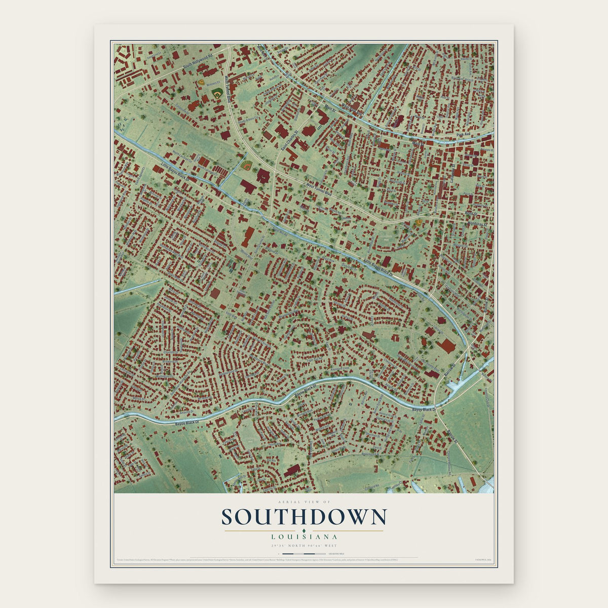
Southdown, Louisiana Map Art
Building by building, with labeled streets and shaded relief.
12" x 18" Archival Matte Print
A Map of Home. A Work of Art.
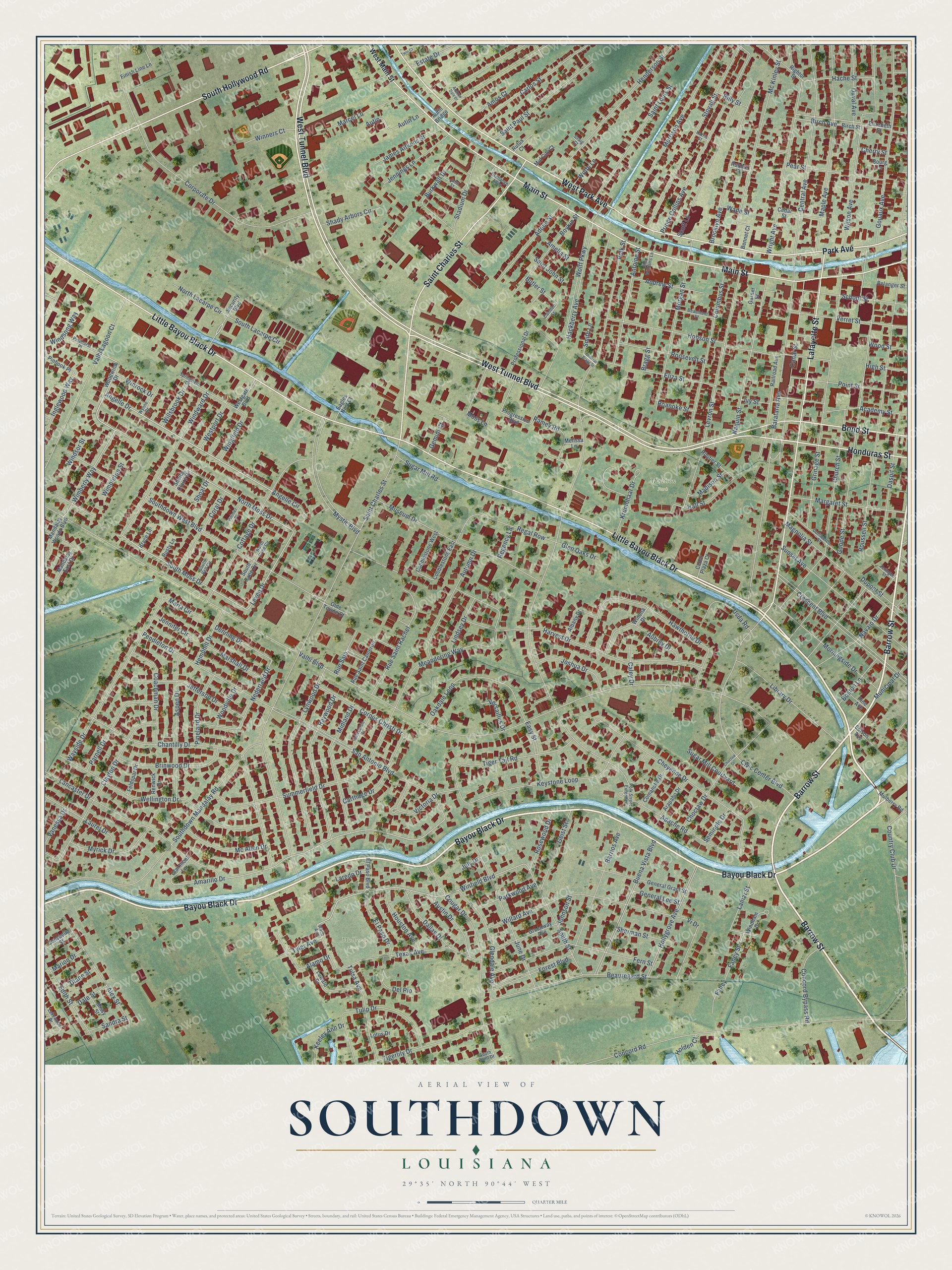
Explore Southdown, Louisiana from a whole new perspective. Created using aerial imagery and detailed geographic data, this map captures Southdown building by building, with labeled streets, familiar landmarks, and shaded topographical relief that highlights the natural contours of the landscape.
Combining modern data with the timeless character of a vintage atlas, this map is just as interesting up close as it is beautiful on the wall. Whether you grew up in Southdown, spent memorable years there, or call it home today, this unique map is a great way to celebrate a place that means something to you. Zoom in on the preview to look for your street, and then order a print to put your memories on the wall.
Three ways to hang it

Unframed archival matte, a black wood frame or a white wood frame.
Up close
Geography Worth Displaying
This map was created using accurate cartographic data and authoritative geographic sources, including the U.S. Geological Survey and the Census Bureau. The map brings together terrain, waterways, roads, and building detail. The majority of the streets are labeled, houses are accurately depicted, and the topography is derived from government sources. Combining local data with carefully composed color and shading leads to this beautifully detailed Southdown artwork for your wall.
Rather than simply showing street outlines, we’ve included as many of the street names as we could reasonably fit on the map while keeping their names legible. Zoom in on the high resolution preview to see exactly what’s on the map. We truly set out to create a statement piece for anyone who loves Southdown. So whether it’s for you, or a gift for someone you love, we hope this map of Southdown brings back fond memories.
Read the story behind this map: Detailed Map of Southdown, Louisiana.

Find your street
Names on the Southdown map
Every name below is printed on this map. Look for your street, your school, the park where you played, or the pond down the road.
Places and landmarks2
- Mulberry Park
- Madison Park
Streets and roads304
- Bayou Black Drive
- Barrow Street
- Little Bayou Black Drive
- West Tunnel Boulevard
- Main Street
- West Park Avenue
- Lafayette Street
- South Hollywood Road
- Saint Charles Street
- Honduras Street
- Bond Street
- Park Avenue
- Angelle Drive
- Wimberly Way
- South Moss Drive
- North Moss Drive
- Levee Drive
- Winfield Boulevard
- Amarillo Drive
- Southdown West Boulevard
- Hache Street
- Valhi Boulevard
- Polk Street
- Roussell Street
- Concord Road
- Barataria Avenue
- Crescent Boulevard
- Chantilly Drive
- Corporate Drive
- San Antonio Boulevard
Show all 304 streets
- Buena Vista Boulevard
- Levron Street
- Church Street
- Goode Street
- Southdown Mandalay Road
- Mystic Boulevard
- Grinage Street
- Harvest Drive
- Museum Drive
- Hollygrove Avenue
- Summerfield Drive
- Central Avenue
- Civic Center Boulevard
- Cheyenne Drive
- Wellington Drive
- Daspit Street
- Wilson Avenue
- Cougar Drive
- Meandering Way
- Keystone Loop
- Hawthorne Drive
- Maple Avenue
- Lancaster Drive
- Stovall Street
- Wright Avenue
- Gouaux Avenue
- Prince Collins Avenue
- Morrison Avenue
- Willard Avenue
- Lynwood Drive
- Mc Kinley Street
- Valhi Lagoon Court
- Wayside Drive
- Canal Street
- Cottage Drive
- Columbus Street
- Hobson Street
- Country Club Drive
- Henderson Street
- Morgan Street
- Clayton Drive
- Forest Boulevard
- Beauregard Street
- June Drive
- Fern Street
- Windward Drive
- Birch Avenue
- Sunset Avenue
- Naquin Street
- Scott Lane
- Brooklyn Avenue
- Magnolia Street
- Tulip Drive
- Raywood Drive
- Texas Avenue
- Pendleton Drive
- Oakdale Loop
- Aspen Drive
- Barrios Avenue
- Hackberry Avenue
- Carlos Street
- Smith Lane
- Tiger Tail Road
- Morningside Drive
- Saint Louis Street
- Jefferson Drive
- Midland Drive
- Library Drive
- Academy Street
- Tigerlily Drive
- Saint Paul Street
- Alex Street
- Autumn Drive
- Rue Saint Rachel
- Glendale Avenue
- Apache Road
- Antoine Street
- Verret Street
- Pear Street
- Regal Row
- Point Street
- South Street
- Margaret Street
- Wolff Parkway
- Nederland Drive
- Burkwall Drive
- Brinwood Drive
- Parnell Drive
- Carthage Drive
- School Street
- Coachman Drive
- Aubrey Drive
- Corpus Christi Drive
- Boykin Street
- Victoria Drive
- Tulsa Avenue
- Easy Street
- Adoue Street
- Estate Drive
- Navajo Drive
- Eliza Street
- Stadium Drive
- Laurel Drive
- Austin Drive
- Edith Street
- Myrick Drive
- Coral Drive
- Pineland Drive
- High Street
- Roosevelt Street
- Mc Allen Drive
- Geist Street
- Vi Drive
- Concord Bypass Road
- Dallas Drive
- Jennings Lane
- Joshua Drive
- Krumbhaar Drive
- Duval Avenue
- Marcel Lane
- Moss Lane
- Inglewood Way
- James Aitkens Street
- Alamo Drive
- Andrew Street
- Houston Avenue
- Lindsey Drive
- Shoal Drive
- Usda Road
- El Paso Drive
- Marshall Drive
- Denning Drive
- Parkwood Avenue
- Sugar Mill Courtyard
- North Lacarpe Circle
- Rosewood Drive
- Shady Arbors Circle
- Ramey Road
- Wingfield Drive
- Hemphill Drive
- Hall Street
- Boston Lane
- Dupont Street
- South Lacarpe Circle
- Amos Court
- Lamar Street
- Keeley Ann Drive
- Wood Street
- Winners Court
- Westport Drive
- Willsbrook Drive
- Angelle Circle
- Sugar Mill Road
- Sherman Street
- General Lee Street
- Fahey Street
- Maria Circle
- Glen Oaks Drive
- Rue Saia
- Del Rio
- Choctaw Drive
- Madison Street
- Municipal Drive
- Windsong Way
- Versailles Drive
- Jennifer Circle
- Tyler Avenue
- Winrock Drive
- Bragg Street
- Woodville Drive
- Saint John Street
- Holden Court
- Sandra Street
- Butler Street
- Seminole Drive
- Vanessa Drive
- Dale Street
- Diane Street
- Marion Drive
- Wimbleton Street
- Gemini Court
- Caley Drive
- Windsor Street
- Roanoke Street
- Autin Lane
- Fahey
- Wolfe Lane
- Billy Street
- Regency Lane
- Laredo Drive
- Johnson Street
- Autin
- Cherry Street
- Amelia Street
- Wade Street
- Ivy Street
- July Drive
- West Main Street
- Woodwind Drive
- Security Boulevard
- Professional Drive
- Birch Street
- Railroad Avenue
- Progressive Boulevard
- General Grant Street
- Mandalay East Drive
- Greenway Avenue
- El Paso Boulevard
- Lewald Drive
- Rightor Street
- Cobblestone East
- Cobblestone West
- Rue Saint Cameron
- Albany Drive
- Belanger Street
- Westgate Boulevard
- Mandalay Woods Boulevard
- Elizabeth Street
- Comanche Drive
- Arapaho Drive
- Cedar Street
- Windham Drive
- Routier Street
- Mulberry Road
- Pinhook Place
- Cedar Plaza Court
- Finish Line Lane
- Renwick Drive
- Missy Street
- Consuello Street
- Garner Street
- Feldspar Drive
- South Cane Circle
- Eagles Nest Court
- Clairmont Lane
- Mid City Court
- Pine Avenue
- Edison Avenue
- Olde Towne Court
- Bennet Court
- Rusty Lane
- Bryce Lane
- Shelby Claire Drive
- Winona Drive
- Lotus Drive
- Robbie Street
- Melissa Lane
- Autin Bridge
- Rufus Court
- Bourg Lane
- Springfield Drive
- Commerce Street
- Galveston Drive
- Waco Avenue
- Beaumont Street
- Pinehurst Place
- South Point Drive
- Polk Street Extended
- Wynne Drive
- Alex Williams Lane
- John Street
- Craig Court
- Lakewood Drive
- South Bell Circle
- North Cane Circle
- Polmer Place
- Exchange Alley
- Camden Street
- Zeringer Street
- Harris Street
- Andrew Dale Drive
- Chactaw Drive
- General Bragg Street
- Twin Court
Names are listed as they appear on the printed map. Zoom into the product photos to find them.
About Southdown, Louisiana
In January 1929, scientists tested sugarcane cut at Southdown plantation near Houma. Some of the cane was burned and some was not. They checked how fast each lost its sugar before milling. The unburned cane held up for four days, while the burned cane lost sugar steadily.
Keep exploring Louisiana
Southdown is one of 594 Louisiana towns we've mapped. Every dot on the map is a print of its own.
The search covers every state, Louisiana first.
Near Southdown
Order 2 or more town maps and save 10%. Shown in the size and finish you picked above, so they hang as a set.
- Houma 12" x 18" / Archival Matte Print $39.99
- Mulberry 12" x 18" / Archival Matte Print $39.99
- Bayou Cane 12" x 18" / Archival Matte Print $39.99
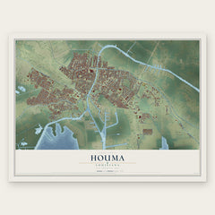
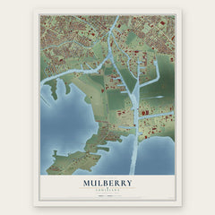

More maps nearby: Bayou Blue, Presquille, Gray, Bourg and Schriever.
The art of mapping a place
How This Map Was Made
Real places. Remarkable detail. Discover the layers that turn geographic data into a map of home.

The view from above
Aerial imagery reveals the character of the land: woodland, open fields, and the patterns of a place.

The shape of the land
Elevation data brings hills, valleys, and subtle changes in the landscape into view.

The details of home
Roads, waterways, and building footprints come together to make the map feel unmistakably local.

Geography becomes art
Considered color, shading, and typography bring the layers together in a map made for your wall.


Process illustrated with Mendon, Massachusetts. Aerial imagery: USDA NAIP. Terrain: USGS 3D Elevation Program. Map details and finished artwork: KNOWOL.
The Details
About This Print
Choose an archival matte print, or a black or white Ayous wood frame. The archival matte print is unframed.
Select your size and finish above to see the matching product image and price.
Materials & Craftsmanship
A contemporary map with the character of a classic atlas, printed on archival matte paper. Optional frames are made from Ayous wood.
Your printed map does not include the watermark shown in the full-map preview.
Shipping & Delivery
Free shipping within the United States. Every print is made to order in the USA.
Buying a gift? Add a note in your cart and we'll include it. We never put prices in the package.
Prints ship within 2 to 3 business days. Allow 7 to 10 days total from ordering for delivery. Timing may vary during holidays or periods of high order volume.
Read our shipping policy.
Returns and damaged prints
Each print is made to order. Change-of-mind refunds are not available after production.
If your print arrives damaged, misprinted or incorrect, contact support@knowol.com within 30 days of receiving it. Include your order number, photos and a description of the issue.
Read our full refund and replacement policy. For questions about your order, email support@knowol.com.