
Search for another town


Free U.S. delivery 7 to 10 days after you order
Southern Pines, North Carolina Map Art
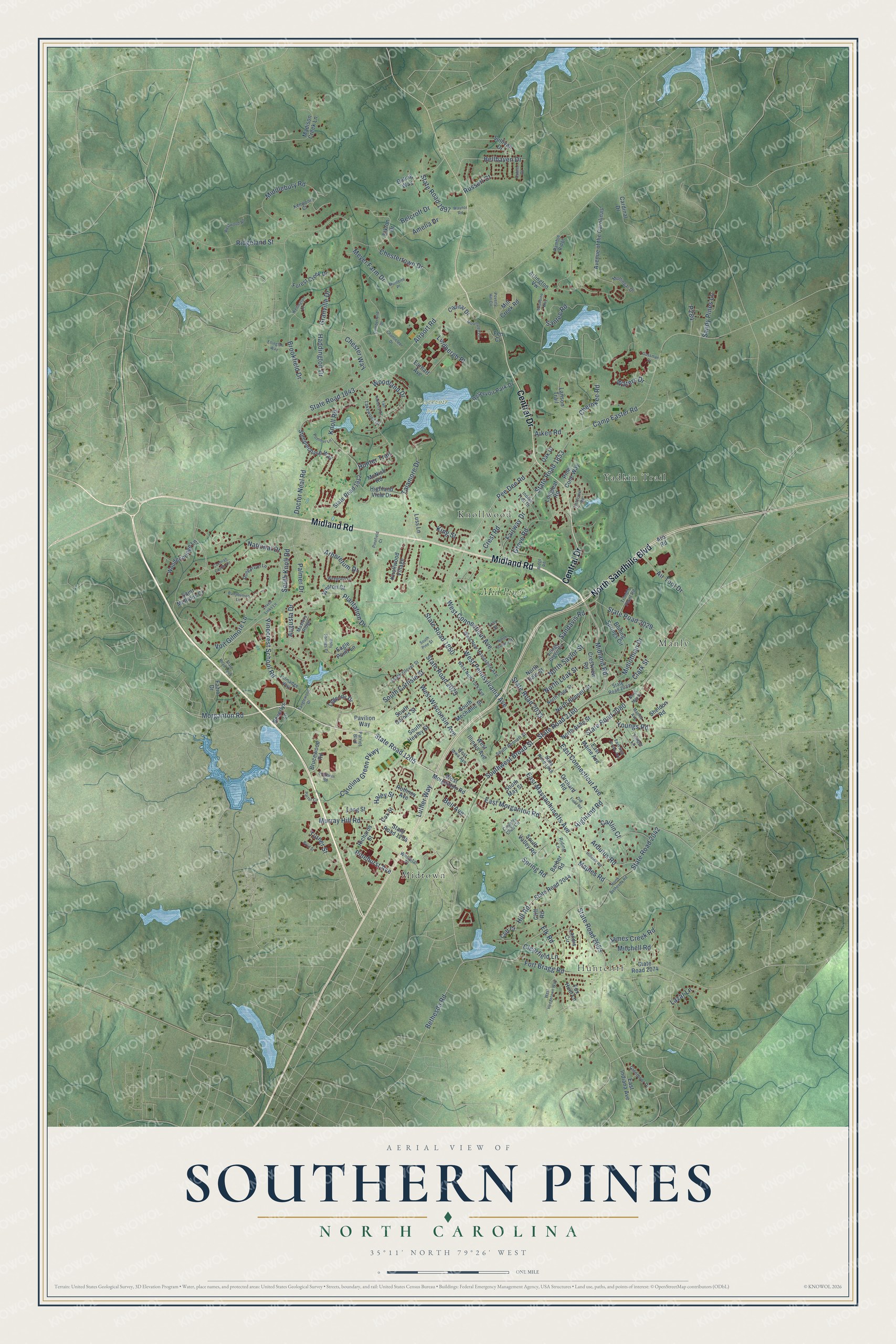
Building by building, with labeled streets and shaded relief.
12" x 18" Archival Matte Print
A Map of Home. A Work of Art.
Explore Southern Pines, North Carolina from a whole new perspective. Created using aerial imagery and detailed geographic data, this map captures Southern Pines building by building, with labeled streets, familiar landmarks, and shaded topographical relief that highlights the natural contours of the landscape.
Combining modern data with the timeless character of a vintage atlas, this map is just as interesting up close as it is beautiful on the wall. Whether you grew up in Southern Pines, spent memorable years there, or call it home today, this unique map is a great way to celebrate a place that means something to you. Zoom in on the preview to look for your street, and then order a print to put your memories on the wall.
Three ways to hang it

Unframed archival matte, a black wood frame or a white wood frame.
Up close
Geography Worth Displaying
This map was created using accurate cartographic data and authoritative geographic sources, including the U.S. Geological Survey and the Census Bureau. The map brings together terrain, waterways, roads, and building detail. The majority of the streets are labeled, houses are accurately depicted, and the topography is derived from government sources. Combining local data with carefully composed color and shading leads to this beautifully detailed Southern Pines artwork for your wall.
Rather than simply showing street outlines, we’ve included as many of the street names as we could reasonably fit on the map while keeping their names legible. Zoom in on the high resolution preview to see exactly what’s on the map. We truly set out to create a statement piece for anyone who loves Southern Pines. So whether it’s for you, or a gift for someone you love, we hope this map of Southern Pines brings back fond memories.
Read the story behind this map of Southern Pines, North Carolina from 2026.

Find your street
Names on the Southern Pines map
Every name below is printed on this map. Look for your street, your school, the park where you played, or the pond down the road.
Places and landmarks7
- Huntcliff
- Reservoir Park
- Knollwood
- Manly
- Midtown
- Yadkin Trail
- Mid Pines
Streets and roads211
- Midland Road
- North Sandhills Boulevard
- Central Drive
- State Road 1205
- West Pennsylvania Avenue
- Pee Dee Road
- State Road 2160
- East Morganton Road
- Southwest Broad Street
- State Road 2053
- Maples Road
- State Road 2075
- Pinecrest School Road
- Hill Road
- Meyer Farm Drive
- National Drive
- State Road 1853
- State Road 2033
- Plantation Drive
- Airport Road
- State Road 1843
- State Road 2042
- Morganton Road
- State Road 2080
- State Road 1850
- East Massachusetts Avenue
- Fort Bragg Road
- West Connecticut Avenue
- East Connecticut Avenue
- Knoll Road
Show all 211 streets
- Fairway Drive
- South Carlisle Street
- West Wisconsin Avenue
- Middlebury Road
- Talamore Drive
- Camp Easter Road
- South Knoll Road
- Crest Road
- Chestertown Drive
- North Leak Street
- Air Tool Drive
- North Saylor Street
- Grove Road
- Waters Drive
- Ridgeland Street
- Arboretum Drive
- Carolina Green Parkway
- Murray Hill Road
- Elk Road
- State Road 1897
- State Road 2029
- Palmer Drive
- Midlothian Drive
- Santee Road
- James Creek Road
- Brookfield Drive
- Woodland Drive
- Clark Street
- Highland Road
- Clearfield Lane
- Hunter Trail
- Pinehurst Avenue
- King Street
- Arbutus Road
- Belcroft Drive
- Amelia Drive
- Augusta Drive
- Spring Road
- Cherokee Road
- Mitchell Road
- Lindbergh Place
- Voit Gilmore Lane
- Haley Street
- Haddington Drive
- Aiken Road
- Doctor Neal Road
- Sandy Pines Lane
- Bellhaven Drive
- Bethesda Road
- Turner Street
- Bell Avenue
- Sandavis Road
- Russett Court
- Youngs Road
- Chester Way
- Luther Way
- Lazar Lane
- Granville Drive
- Caitlin Court
- West Morganton Road
- Elkton Drive
- South Valley Road
- Knollwood Village
- State Road 2044
- Fazio Drive
- East Indiana Avenue
- Avenue of the Carolinas
- State Road 2074
- State Road 1912
- West Illinois Avenue
- Boiling Springs Circle
- South Mechanic Street
- South Henley Street
- North Ashe Street
- South Gaines Street
- State Road 1204
- Brucewood Road
- Steeplechase Way
- North Bennett Street
- South May Street
- Crestview Road
- Richards Street
- Madison Creek Lane
- Lanson Trail
- North Hale Street
- Legends Drive
- Sullivan Drive
- East Maine Avenue
- Mill Creek Road
- Reservoir Park Drive
- Woodenbridge Lane
- Barber Road
- Highland View Drive
- Cliff Road
- Sheldon Road
- Rothney Avenue
- Forest Creek Drive
- Oak Drive
- Long Street
- Longleaf Road
- Pavilion Way
- McNish Road
- Eagle Point Lane
- Earhart Avenue
- Pine Cone Way
- Aro Road
- Cliff Court
- Saint Mellions Court
- Capital Drive
- Orchard Road
- Weston Court
- Cardinal Drive
- Boling Way
- Arlington Vw
- Fox Hunt Lane
- Beverlys Lane
- Luss Lane
- Cox Street
- Landis Circle
- Fen Court
- State Road 1848
- West New York Avenue
- West New Hampshire Avenue
- South Bennett Street
- West Iowa Avenue
- North Page Street
- Village Green Circle
- South Glover Street
- State Road 2032
- Country Club Circle
- Dungarvan Lane
- Indian Trail Drive
- Lakewood Drive
- Patriot Boulevard
- Glenmoor Drive
- Ramble Ridge
- Masters Ridge
- Mullingar Drive
- Trimble Plant Road
- Timber Lane
- Riding Lane
- Talmadge Way
- Kenwood Court
- Windstar Place
- Tray Street
- State Road 1905
- Wiregrass Lane
- North May Street
- North Bethesda Road
- Waynor Road
- West Hedgelawn Way
- Tall Timbers Drive
- East New Jersey Avenue
- Westwood Road
- Cochran Castle Circle
- Moonseed Lane
- North Gaines Street
- Leven Links Lane
- Hillside Road
- Fieldcrest Road
- Ridge Road
- Cumberland Drive
- Manley Avenue
- Woodbine Way
- Poverty Hill Circle
- Old Field Road
- Ellington Way
- Ballybunion Lane
- Holly Springs Court
- Tanglewood Drive
- Wellington Drive
- Southern Road
- Chanticleer Drive
- South Pine Street
- Pommel Lane
- Parter Circle
- Dublin Court
- Gossman Drive
- Pinefield Court
- Monteith Place
- Byrd Street
Names are listed as they appear on the printed map. Zoom into the product photos to find them.
About Southern Pines, North Carolina
Southern Pines is a town of 15,545 people in the Sandhills of Moore County, North Carolina. The town has kept growing, from 12,334 people in 2010 to its count in 2020.
The center of town sits on high ground between two river systems. Rain falling on its west side drains toward Aberdeen Creek and on to the Lumber River, while the east and north sides drain toward the Little River and the Cape Fear.
- Donald Ross golf in 1906Golfers founded the Southern Pines Golf Club in 1906. Its course ranks among the earliest that the designer Donald Ross laid out.
- A boyhood at WeymouthJames Boyd, a journalist and novelist, came to love North Carolina as a boy, when he visited Weymouth, his grandfather's estate in Southern Pines.
Keep exploring North Carolina
Southern Pines is one of 952 North Carolina towns we've mapped. Every dot on the map is a print of its own.
The search covers every state, North Carolina first.
Near Southern Pines
Order 2 or more town maps and save 10%. Shown in the size and finish you picked above, so they hang as a set.
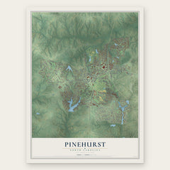
- Pinehurst 12" x 18" / Archival Matte Print $39.99
- Whispering Pines 12" x 18" / Archival Matte Print $39.99
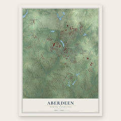
- Aberdeen 12" x 18" / Archival Matte Print $39.99

More maps nearby: Taylortown, Lakeview, Pinebluff, Ashley Heights and Vass.
The art of mapping a place
How This Map Was Made
Real places. Remarkable detail. Discover the layers that turn geographic data into a map of home.

The view from above
Aerial imagery reveals the character of the land: woodland, open fields, and the patterns of a place.

The shape of the land
Elevation data brings hills, valleys, and subtle changes in the landscape into view.

The details of home
Roads, waterways, and building footprints come together to make the map feel unmistakably local.

Geography becomes art
Considered color, shading, and typography bring the layers together in a map made for your wall.


Process illustrated with Mendon, Massachusetts. Aerial imagery: USDA NAIP. Terrain: USGS 3D Elevation Program. Map details and finished artwork: KNOWOL.
The Details
About This Print
Choose an archival matte print, or a black or white Ayous wood frame. The archival matte print is unframed.
Select your size and finish above to see the matching product image and price.
Materials & Craftsmanship
A contemporary map with the character of a classic atlas, printed on archival matte paper. Optional frames are made from Ayous wood.
Your printed map does not include the watermark shown in the full-map preview.
Shipping & Delivery
Free shipping within the United States. Every print is made to order in the USA.
Buying a gift? Add a note in your cart and we'll include it. We never put prices in the package.
Prints ship within 2 to 3 business days. Allow 7 to 10 days total from ordering for delivery. Timing may vary during holidays or periods of high order volume.
Read our shipping policy.
Returns and damaged prints
Each print is made to order. Change-of-mind refunds are not available after production.
If your print arrives damaged, misprinted or incorrect, contact support@knowol.com within 30 days of receiving it. Include your order number, photos and a description of the issue.
Read our full refund and replacement policy. For questions about your order, email support@knowol.com.