
Search for another town





Free U.S. delivery 7 to 10 days after you order
Spencer, Massachusetts Map Art
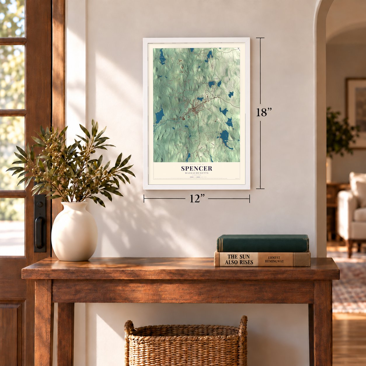
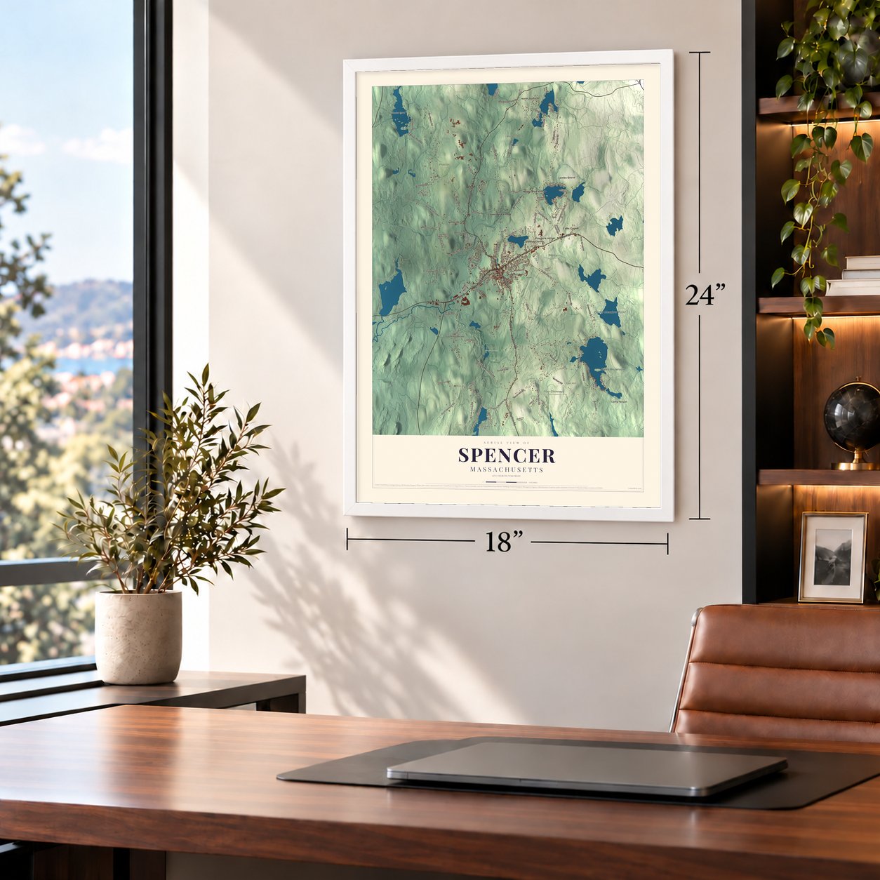
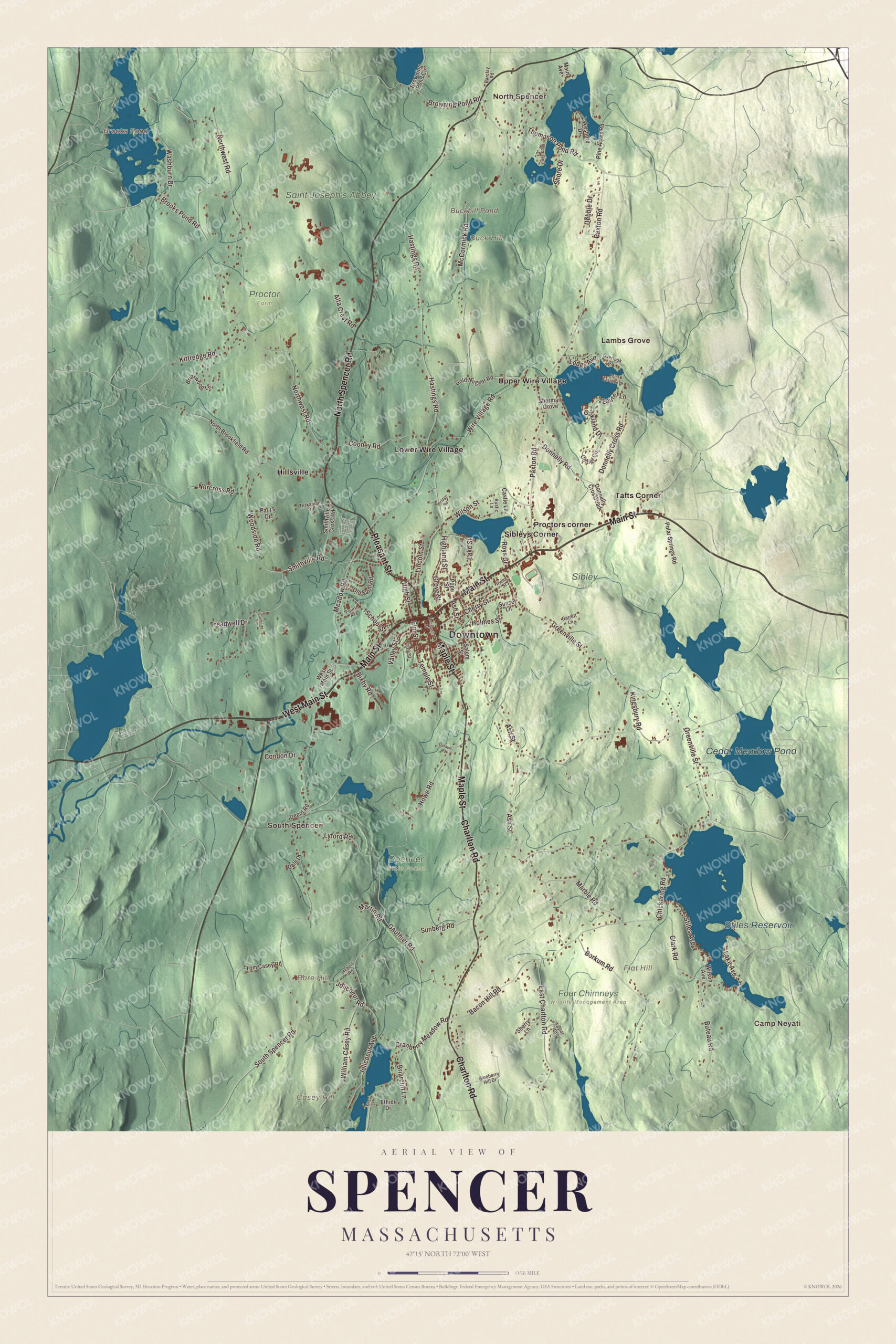
A new map of Spencer, Massachusetts, made in 2026 and printed to order on thick archival matte paper.
12" x 18" Archival Matte Print
A Map of Home. A Work of Art.
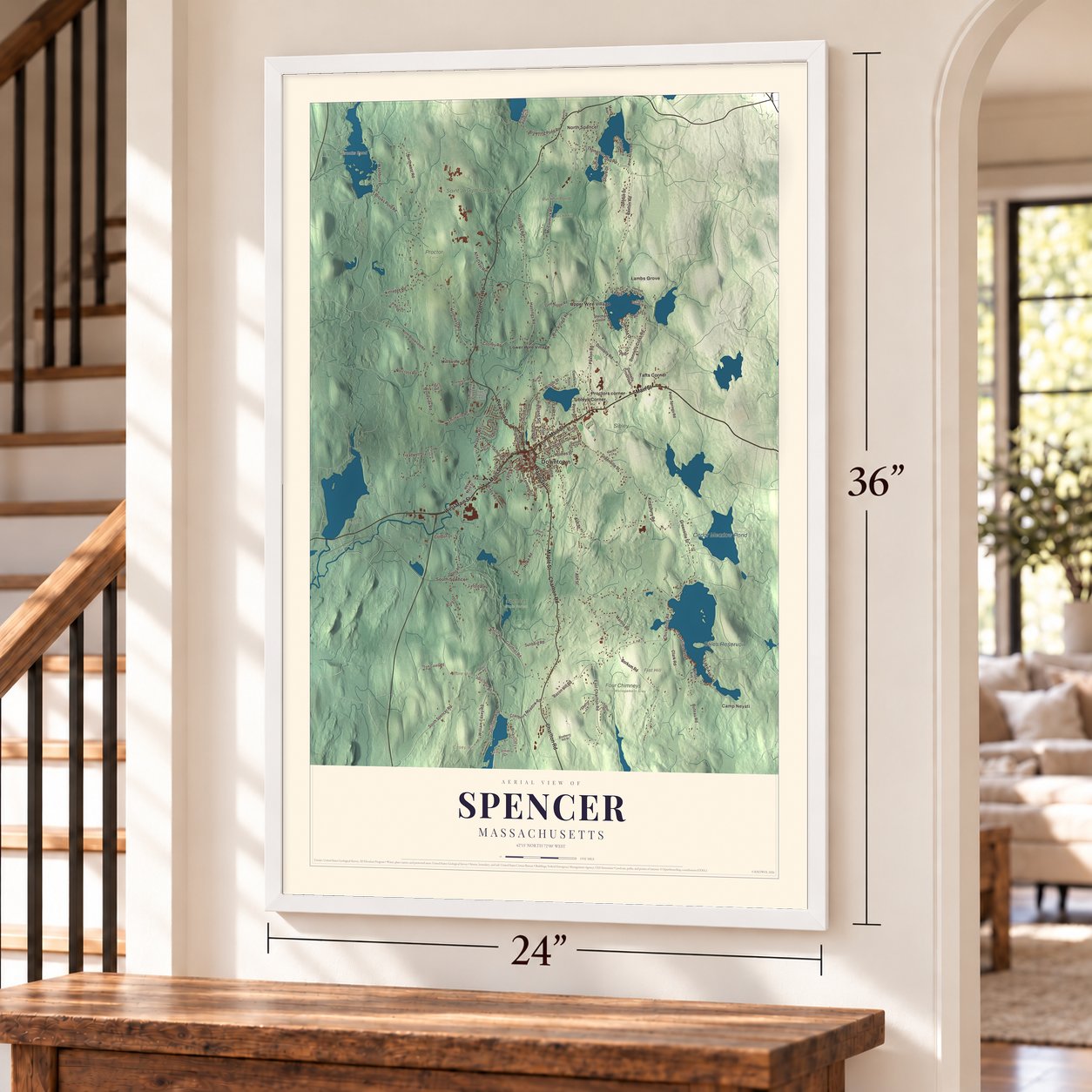
Explore Spencer, Massachusetts from a whole new perspective. Created using aerial imagery and detailed geographic data, this map captures Spencer building by building, with labeled streets, familiar landmarks, and shaded topographical relief that highlights the natural contours of the landscape.
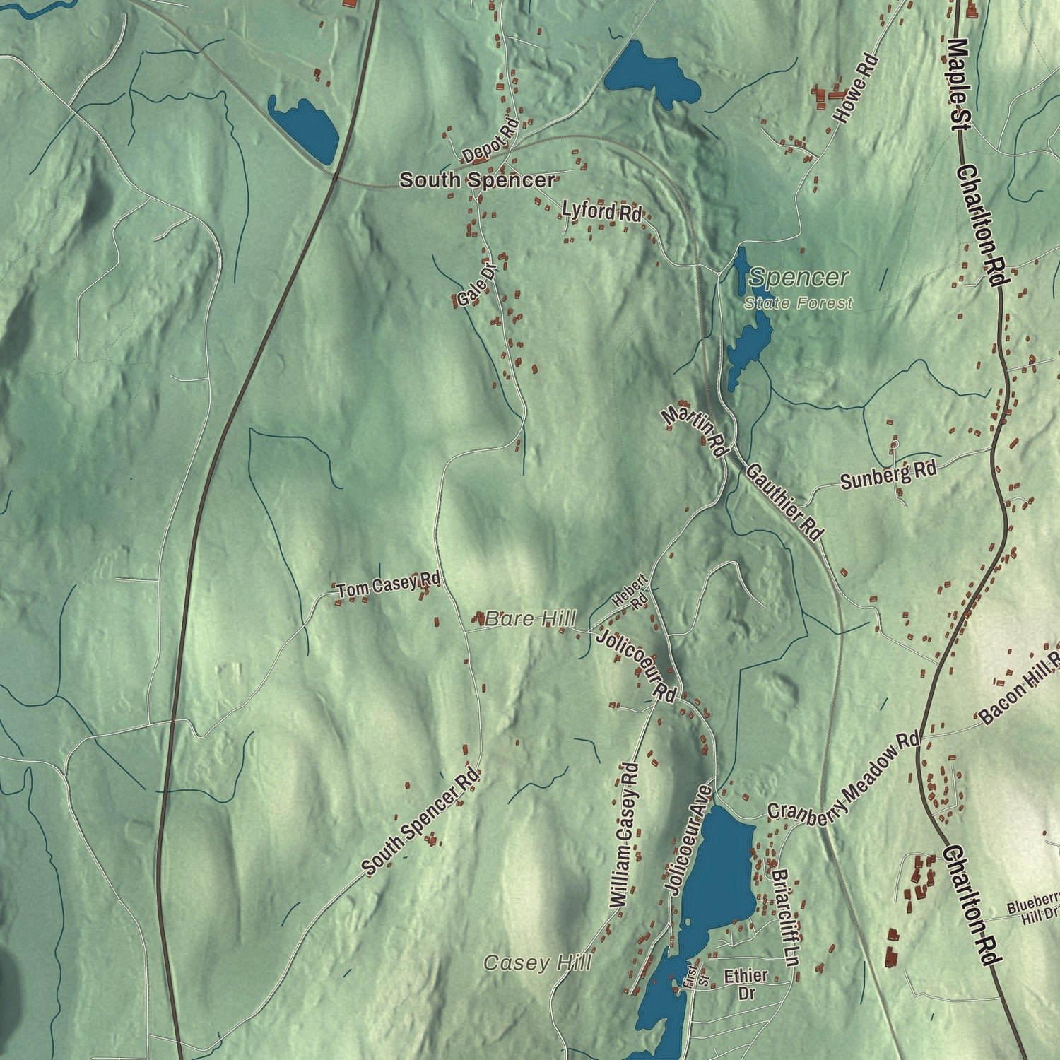
Combining modern data with the timeless character of a vintage atlas, this map is just as interesting up close as it is beautiful on the wall. Whether you grew up in Spencer, spent memorable years there, or call it home today, this unique map is a great way to celebrate a place that means something to you. Zoom in on the preview to look for your street, and then order a print to put your memories on the wall.
Three ways to hang it
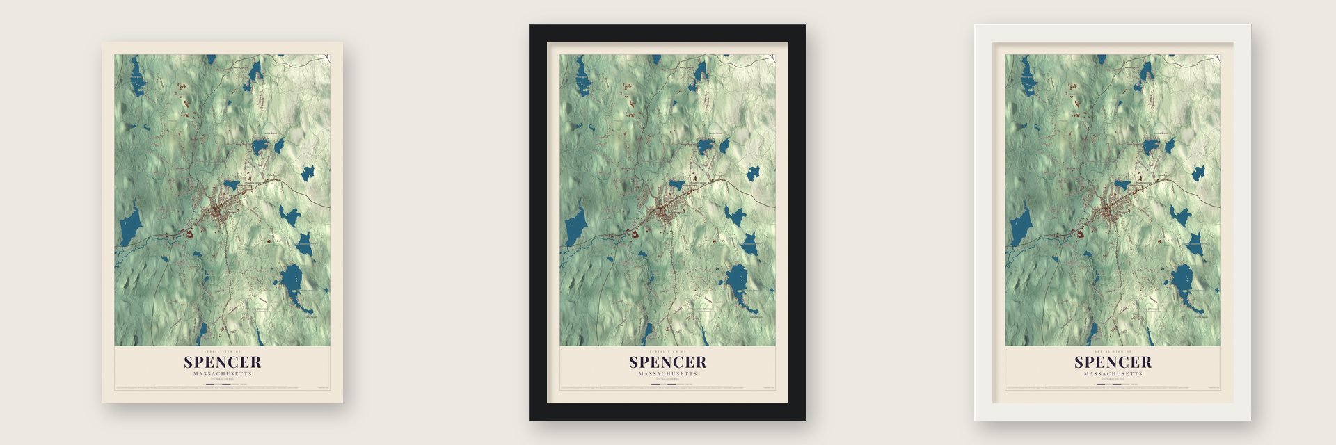
Unframed archival matte, a black wood frame or a white wood frame.
Up close
Geography Worth Displaying
This map was created using accurate cartographic data and authoritative geographic sources, including the U.S. Geological Survey (USGS) and FEMA. The map brings together terrain, waterways, roads, and building detail. The majority of the streets are labeled, houses are accurately depicted, and the topography is derived from government sources. Combining local data with carefully composed color and shading leads to this beautifully detailed Spencer artwork for your wall.
Rather than simply showing street outlines, we’ve included as many of the street names as we could reasonably fit on the map while keeping their names legible. Zoom in on the high resolution preview to see exactly what’s on the map. We truly set out to create a statement piece for anyone who loves Spencer. So whether it’s for you, or a gift for someone you love, we hope this map of Spencer brings back fond memories.
Explore the full map of Spencer, Massachusetts and read about the local places it shows.

About Spencer, Massachusetts
Spencer is a town of 11,992 people in Worcester County. Nathaniel Wood settled here in 1717, and Samuel Bemis made the first permanent settlement four years later, in 1721. A mill went up on the Seven Mile River in 1740, and on April 12, 1753, the settlement broke away from Leicester and took the name of Spencer Phips, then acting governor. It was incorporated as a town in 1775.
The village grew up on the stage road between Boston and Springfield, and that road shaped it. In 1788 the lower village had only three houses, and every one of them was a tavern. Coaches changed horses here, so a crowd of fifteen at midday was common and twenty-five came on busy days. The best known stop was the Jenks tavern, where George Washington stopped in 1789.
“The chambers were neat, the beds good, the sheets clean, the supper passable; cider, tea, punch, and all for fourteen pence per head.”
- The Howe trussWilliam Howe, born in Spencer on May 12, 1803, kept a tavern while he worked as a carpenter and builder. While raising a long-roofed church in Warren, he devised the bracing now called the Howe truss, and he soon used it on a bridge in West Warren. The county history called it the safest truss of its day, and it went into railroad bridges, depots and roofs. Tyler Howe, his brother, held a patent on a spring bed.
- A sewing machine patent, 1846Elias Howe Jr., William's nephew, was born in Spencer on July 9, 1819. Spencer State Forest now holds the estate he later owned in town, along with the mill pond and dam he built.
- Boots from a back roomIn 1820 Isaac Prouty started making boots to order in a single small room of his house in North Spencer. The orders kept growing, and in 1856 he opened a new factory in the village; by 1899 the firm was named among the largest boot and shoe makers anywhere.
- Wire Village on the riverElliot Prouty began drawing wire in his own mill in 1812. Richard Sugden, an Englishman, learned of Spencer's wire works from a handbook he read on the voyage over in 1845. In 1847 he and Nathaniel Myrick bought a small wire works here, and in 1876 Sugden bought the Prouty works in Lower Wire Village and formed the Spencer Wire Company. By 1885 the town counted 83 private firms.
- A schoolhouse full in two yearsAs the factories drew families, the town put up the Grove Street School in 1876, a one-story brick building. By 1878 it was already full, so in 1883 it gained a second story, built to plans by Fuller & Delano, with heavy brackets and decorated bargeboards on its jerkin-headed gables. It joined the National Register in 1996.
Find your street
Names on the Spencer map
Every name below is printed on this map. Look for your street, your school, the park where you played, or the pond down the road.
Places and landmarks24
- Downtown
- Camp Neyati
- North Spencer
- Lambs Grove
- South Spencer
- Bare Hill
- Buck Hill
- Casey Hill
- Flat Hill
- Brooks Pond
- Buckhill Pond
- Stiles Reservoir
Show all 24 places
- Cedar Meadow Pond
- Four Chimneys Wildlife Management Area
- Proctor Farm
- Saint Joseph's Abbey
- Sibley Farm
- Spencer State Forest
- Hillsville
- Lower Wire Village
- Proctors corner
- Sibleys Corner
- Tafts Corner
- Upper Wire Village
Streets and roads110
- Main Street
- West Main Street
- North Spencer Road
- Charlton Road
- Maple Street
- Pleasant Street
- Meadow Road
- Thompson Pond Road
- Ledge Avenue
- South Spencer Road
- Browning Pond Road
- Borkum Road
- Elm Street
- Northwest Road
- Paxton Road
- Greenville Street
- East Charlton Road
- Hastings Road
- Cranberry Meadow Road
- McCormick Road
- Ash Street
- Smithville Road
- Clark Road
- Wire Village Road
- Brooks Pond Road
- Howe Road
- Wilson Street
- Chickering Road
- Woodside Road
- Donnelly Cross Road
Show all 110 streets
- Stiles Avenue
- William Casey Road
- Bacon Hill Road
- Donnelly Road
- Gauthier Road
- Kingsbury Road
- Buteau Road
- Cooney Road
- Marble Road
- Cherry Street
- Lyford Road
- Jolicoeur Avenue
- Kittredge Road
- Washburn Drive
- Sunberg Road
- Highland Street
- Oakland Drive
- Norcross Road
- School Street
- Briarcliff Lane
- Lincoln Street
- Valley Street
- Lake Avenue
- Grove Street
- Debbie Drive
- Temple Street
- Lake Street
- Bixby Road
- Jolicoeur Road
- Condon Drive
- Alta Crest Road
- High Street
- Treadwell Drive
- Holmes Street
- Shore Drive
- Martin Road
- Roys Drive
- Laurel Lane
- Pine Acres Road
- North Brookfield Road
- Donnelly Crossroad
- Gold Nugget Road
- Wilson Avenue
- Lakeshore Drive
- Collier Circle
- Old Farm Road
- Browning Pond Circle
- Smithville Cross Road
- Paul's Drive
- Briarwood Lane
- Polar Springs Road
- Sherman Grove
- Tom Casey Road
- Depot Road
- Sunset Lane
- Sherry Lane
- Pope Street
- Castle Lane
- Ethier Drive
- Salem Street
- Gale Drive
- Main Avenue
- Hebert Road
- Blueberry Hill Drive
- Irving Street
- Overlook Drive
- Terkanian Drive
- Westland Drive
- Fourth Avenue
- Taylor Drive
- Garrett Lane
- Rustic Lane
- Barclay Road
- Early Street
- Mechanic Street
- Point Eastalee Drive
- Laliberte Lane
- Dufault Road
- Hiridge Road
- First Street
Names are listed as they appear on the printed map. Zoom into the product photos to find them.
The art of mapping a place
How This Map Was Made
Real places. Remarkable detail. Discover the layers that turn geographic data into a map of home.

The view from above
Aerial imagery reveals the character of the land: woodland, open fields, and the patterns of a place.

The shape of the land
Elevation data brings hills, valleys, and subtle changes in the landscape into view.

The details of home
Roads, waterways, and building footprints come together to make the map feel unmistakably local.

Geography becomes art
Considered color, shading, and typography bring the layers together in a map made for your wall.


Process illustrated with Mendon, Massachusetts. Aerial imagery: USDA NAIP. Terrain: USGS 3D Elevation Program. Map details and finished artwork: KNOWOL.
The Details
About This Print
Choose an archival matte print, or a black or white Ayous wood frame. The archival matte print is unframed.
Select your size and finish above to see the matching product image and price.
Materials & Craftsmanship
A contemporary map with the character of a classic atlas, printed on archival matte paper. Optional frames are made from Ayous wood.
Your printed map does not include the watermark shown in the full-map preview.
Shipping & Delivery
Free shipping within the United States. Every print is made to order in the USA.
Buying a gift? Add a note in your cart and we'll include it. We never put prices in the package.
Prints ship within 2 to 3 business days. Allow 7 to 10 days total from ordering for delivery. Timing may vary during holidays or periods of high order volume.
Read our shipping policy.
Returns and damaged prints
Each print is made to order. Change-of-mind refunds are not available after production.
If your print arrives damaged, misprinted or incorrect, contact support@knowol.com within 30 days of receiving it. Include your order number, photos and a description of the issue.
Read our full refund and replacement policy. For questions about your order, email support@knowol.com.
Find your town
Looking for another city?
Find a map of home in our Massachusetts collection, or any town in the country.
Nearby
Maps of towns near Spencer
Know someone from one of these towns? Their map makes a great gift.
 East Brookfield
, Massachusetts
From $39.99See the map
 North Brookfield
, Massachusetts
From $39.99See the map
 Leicester
, Massachusetts
From $39.99See the map
More maps nearby: Paxton, Brookfield, Oakham, Charlton and Auburn.