
Search for another town





Free U.S. delivery 7 to 10 days after you order
Spring Mills, West Virginia Map Art
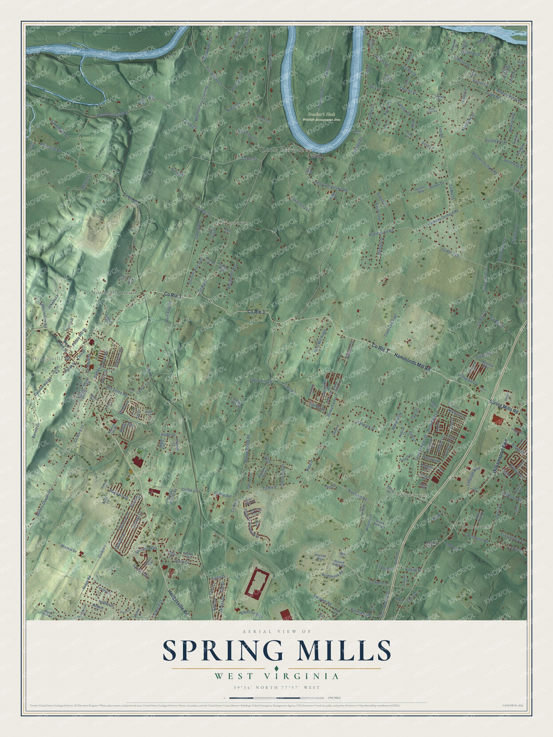
A new map of Spring Mills, West Virginia, made in 2026 and printed to order on thick archival matte paper.
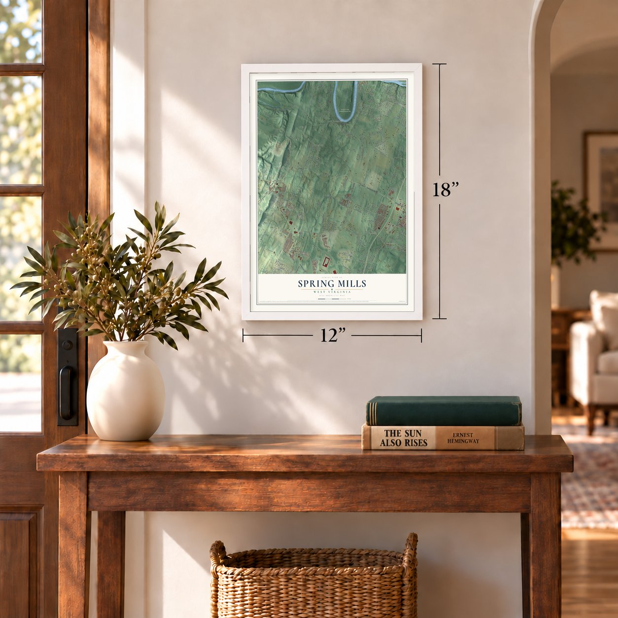
12" x 18" Archival Matte Print
A Map of Home. A Work of Art.
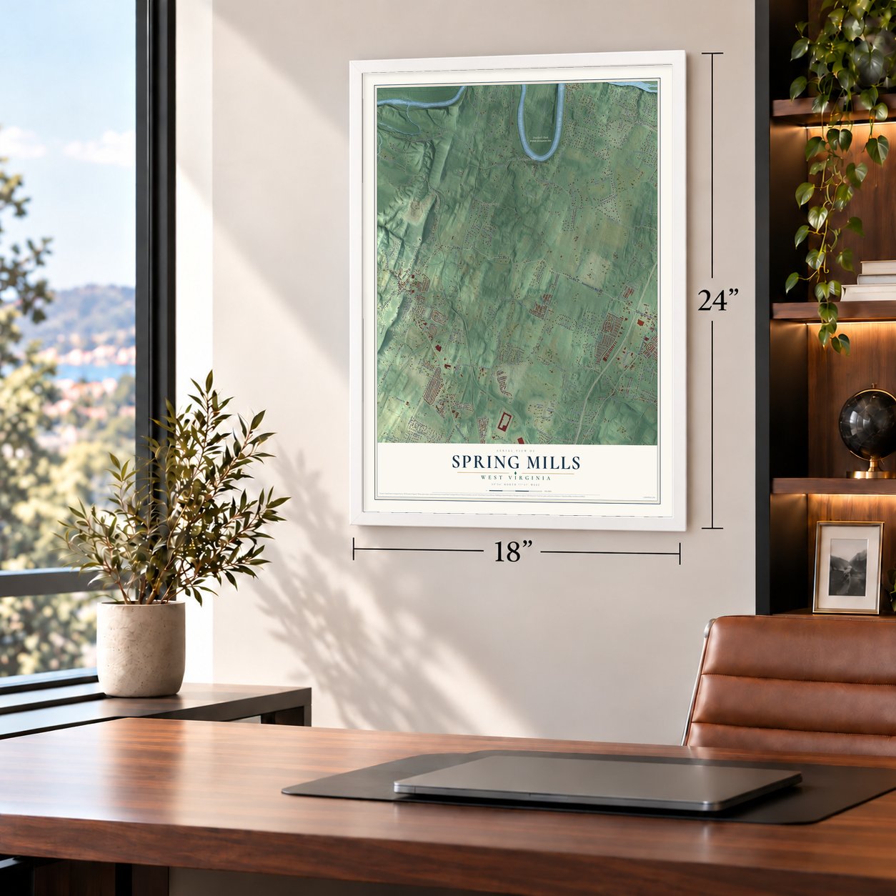
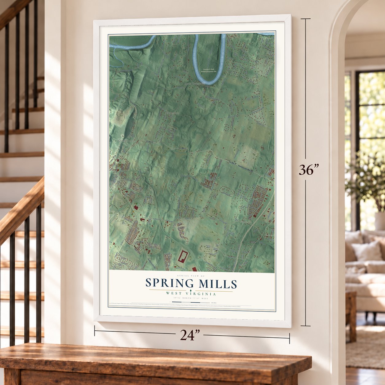
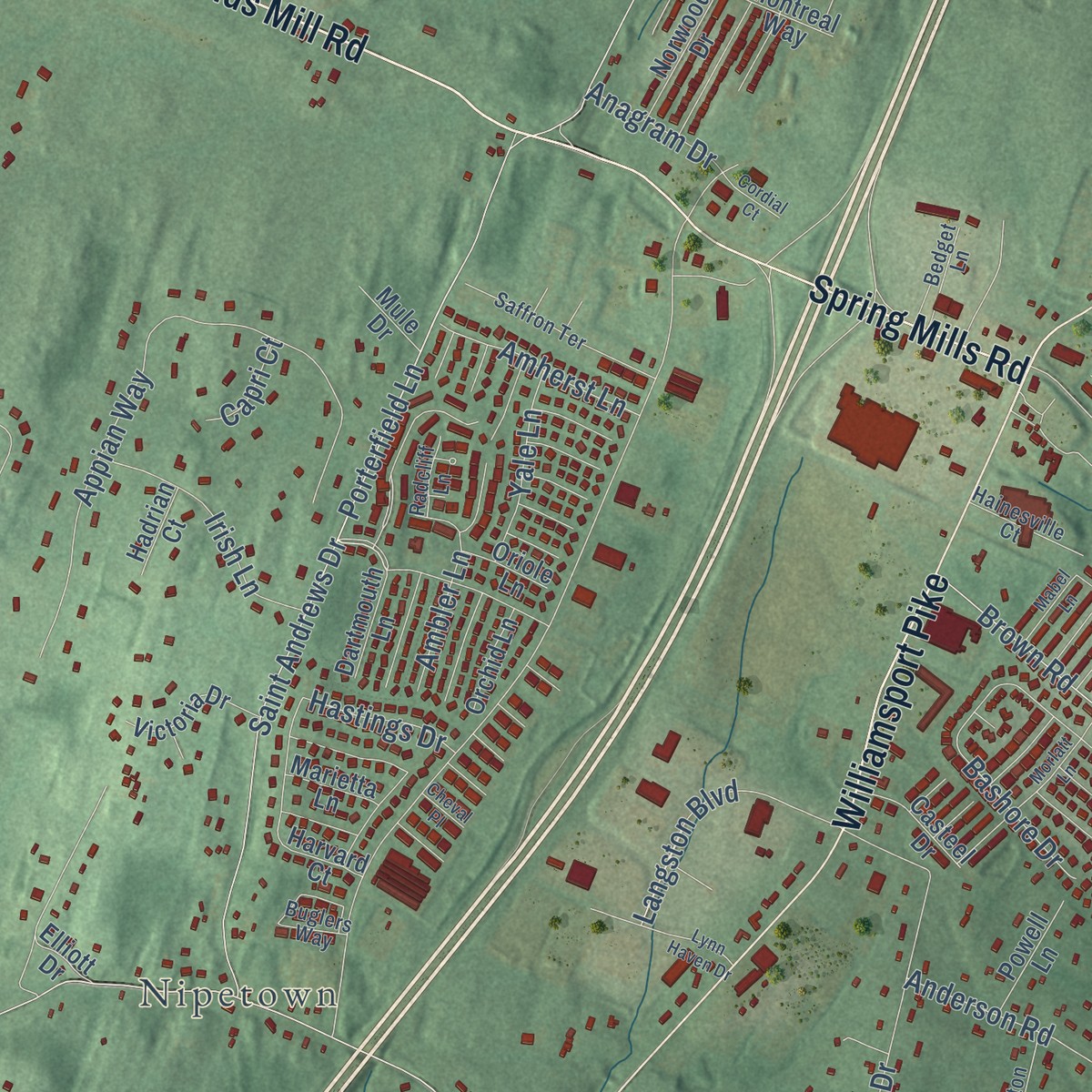
Explore Spring Mills, West Virginia from a whole new perspective. Created using aerial imagery and detailed geographic data, this map captures Spring Mills building by building, with labeled streets, familiar landmarks, and shaded topographical relief that highlights the natural contours of the landscape.
Combining modern data with the timeless character of a vintage atlas, this map is just as interesting up close as it is beautiful on the wall. Whether you grew up in Spring Mills, spent memorable years there, or call it home today, this unique map is a great way to celebrate a place that means something to you. Zoom in on the preview to look for your street, and then order a print to put your memories on the wall.
Three ways to hang it
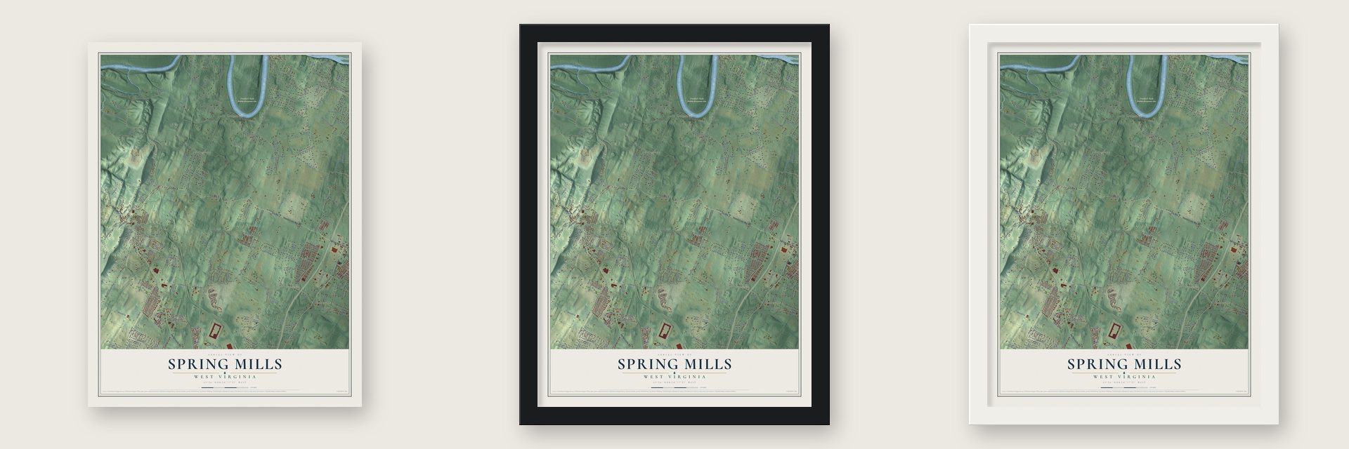
Unframed archival matte, a black wood frame or a white wood frame.
Up close
Geography Worth Displaying
This map was created using accurate cartographic data and authoritative geographic sources, including the U.S. Geological Survey and the Census Bureau. The map brings together terrain, waterways, roads, and building detail. The majority of the streets are labeled, houses are accurately depicted, and the topography is derived from government sources. Combining local data with carefully composed color and shading leads to this beautifully detailed Spring Mills artwork for your wall.
Rather than simply showing street outlines, we’ve included as many of the street names as we could reasonably fit on the map while keeping their names legible. Zoom in on the high resolution preview to see exactly what’s on the map. We truly set out to create a statement piece for anyone who loves Spring Mills. So whether it’s for you, or a gift for someone you love, we hope this map of Spring Mills brings back fond memories.
Read the story behind this map: Detailed Map of Spring Mills, West Virginia.

Find your street
Names on the Spring Mills map
Every name below is printed on this map. Look for your street, your school, the park where you played, or the pond down the road.
Places and landmarks7
- Nipetown
- Hedgesville
- Prather’s Neck Wildlife Management Area
- Georgetown
- North Mountain
- Little Georgetown
- Hainesville
Streets and roads255
- Hammonds Mill Road
- Spring Mills Road
- Hedgesville Road
- County Route 3
- Williamsport Pike
- Weaver Lane
- Rumbling Rock Road
- Waltson Drive
- Panorama Drive
- Porterfield Lane
- Holden Drive
- Colston Drive
- Koontztown Road
- Kitchens Orchard Road
- Grade Road
- Aldrin Lane
- Nipetown Road
- County Route 1
- County Route 4
- Ridge Road
- Harlan Spring Road
- Vineyard Road
- County Route 2
- Little Georgetown Road
- Allensville Road
- County Route 32
- County Route 8
- County Route 22
- Ropp Drive
- McCoys Ferry Crossing
Show all 255 streets
- Beards Crossing Road
- County Route 23
- County Route 15
- Tice Road
- County Route 14
- Butlers Chapel Road
- Americana Lane
- Hallmark Drive
- Cumbo Road
- Ankenney Lane
- Ankenney Road
- Appian Way
- Nimitz Lane
- Stolipher Road
- Emerson Drive
- Ben Speck Road
- Talisman Drive
- Bedington Road
- County Route 5
- Anacostia Lane
- Middle Farm Drive
- County Route 24
- Keepsake Drive
- Davis Drive
- Canterbury Drive
- Saint Andrews Drive
- Michelle Drive
- Burnside Drive
- Knighton Lane
- Piscataway Lane
- Wasser Drive
- Kitchen Orchard Road
- Dorchester Drive
- Flight-O-Arrows Way
- Josiah Street
- Barrett Lane
- Salida Trail
- Bashore Drive
- Ploughman Way
- Cannon Hill Road
- Gordon Drive
- Pacific Boulevard
- Statice Drive
- Jersey Farm Lane
- Gantt Drive
- Ross Mill Ridge
- Langston Boulevard
- Rejoice Lane
- Avalon Trail
- Quality Terrace
- Caperton Boulevard
- Larkspur Lane
- Hockman Drive
- Coon Dog Trail
- Pastoral Court
- Chesapeake Lane
- Ontario Drive
- Severna Parkway
- Dove Lane
- Saddlebred Drive
- Irish Lane
- Kodiak Drive
- Berkshire Drive
- Kates Hollow Road
- Take Off Drive
- Canal Road
- County Route 33
- Janesa Drive
- Rushbrook Road
- Amherst Lane
- Potato Hill Street
- Limestone Lane
- Sumter Drive
- Varick Trail
- Anderson Road
- Yale Lane
- Brown Road
- Evening Star Lane
- Mabdarin Drive
- Ambler Lane
- Jokada Lane
- Speedway Drive
- Vaquero Drive
- Alydar Drive
- Austin Drive
- Louie Lane
- Violet Lane
- Ski Lane
- Tasley Court
- Officers Lane
- Sutton Drive
- Hastings Drive
- Gail Drive
- Anagram Drive
- Chesley Drive
- Chris Drive
- Kim Lane
- Zion Street
- Capri Court
- Sill Drive
- West Main Street
- North Ridge Road
- Roland Ridge Road
- Saunders Drive
- Marshall Drive
- Chisholm Drive South
- Stoney Lick Road
- Skylab Terrace
- Rumsey Terrace Road
- Falling Waters Drive
- Fancy Filly Circle
- Amelia Drive
- Basket Drive
- Justins Way
- Ceritos Trail
- Weeping Willow Road
- Harvard Court
- Appomattox Drive
- Miss Staci Drive
- Dinner Belle Court
- Collins Drive
- Molly Pitcher Court
- Taxi Way Drive
- Dartmouth Lane
- Montreal Way
- Yukon Drive
- Affirmed Court
- Rural Hill Lane
- Emerald Drive
- Sharpsburg Court
- Brant Lane
- Trevor Court
- Victoria Drive
- Carrington Drive
- Capricorn Drive
- Roaring Lion Drive
- Norwood Drive
- McNeill Drive
- Rolling Hills Drive
- Planters Way
- Butcher Road
- Casteel Drive
- Powell Lane
- Boat Dock Drive
- Isaiah Lane
- Orrick Riner Lane
- Ran Rue Drive
- Delva Jo Drive
- Drawing Arm Lane
- Vinca Lane
- Nukirk Road
- Major King Circle
- Orchid Lane
- Tinks Drive
- Sedona Court
- Mopar Lane
- Pricilla Street
- Weller Drive
- Marietta Lane
- Lever Road
- Riner Lane
- Hadrian Court
- Durham Court
- Oriole Lane
- Havilab Way
- Catalina Point
- Halifax Court
- Mule Drive
- Hogbin Lane
- Border Drive
- Sage Drive
- Ruby Drive
- Tufts Lane
- Trouble Lane
- Vane Drive
- Irwin Court
- Calico Drive
- Elliott Drive
- Harley Drive
- Gabi Court
- Saffron Terrace
- Clevenger Circle
- Herkimer Way
- Buglers Way
- Henson Boulevard
- Estates Drive
- Hot Springs Drive
- Confederate Drive
- Paxton Cut Drive
- Hainesville Court
- Luttrell Avenue
- Compton Lane
- Norinton Drive
- Petersburg Lane
- Musterfield Court
- Bedget Lane
- Lyle Street
- Defense Court
- Cinnamon Drive
- Dumpling Drive
- Calebs Point
- Ruble Circle
- Radcliff Lane
- Dave Acres Road
- Clarke Lane
- Bertha Lane
- Peking Lane
- Tara Drive
- Earl Drive
- Folk Drive
- Lucky Bottom Drive
- Morlatt Lane
- Artillery Way
- Humphrey Lane
- Knox Drive
- Shadow Lane
- Lynn Haven Drive
- Boarman Road
- Blanchard Lane
- Jackson Lane
- Mabel Lane
- Duvall Lane
- Cordial Court
- Chet Drive
- Cheval Place
Names are listed as they appear on the printed map. Zoom into the product photos to find them.
The art of mapping a place
How This Map Was Made
Real places. Remarkable detail. Discover the layers that turn geographic data into a map of home.

The view from above
Aerial imagery reveals the character of the land: woodland, open fields, and the patterns of a place.

The shape of the land
Elevation data brings hills, valleys, and subtle changes in the landscape into view.

The details of home
Roads, waterways, and building footprints come together to make the map feel unmistakably local.

Geography becomes art
Considered color, shading, and typography bring the layers together in a map made for your wall.


Process illustrated with Mendon, Massachusetts. Aerial imagery: USDA NAIP. Terrain: USGS 3D Elevation Program. Map details and finished artwork: KNOWOL.
The Details
About This Print
Choose an archival matte print, or a black or white Ayous wood frame. The archival matte print is unframed.
Select your size and finish above to see the matching product image and price.
Materials & Craftsmanship
A contemporary map with the character of a classic atlas, printed on archival matte paper. Optional frames are made from Ayous wood.
Your printed map does not include the watermark shown in the full-map preview.
Shipping & Delivery
Free shipping within the United States. Every print is made to order in the USA.
Buying a gift? Add a note in your cart and we'll include it. We never put prices in the package.
Prints ship within 2 to 3 business days. Allow 7 to 10 days total from ordering for delivery. Timing may vary during holidays or periods of high order volume.
Read our shipping policy.
Returns and damaged prints
Each print is made to order. Change-of-mind refunds are not available after production.
If your print arrives damaged, misprinted or incorrect, contact support@knowol.com within 30 days of receiving it. Include your order number, photos and a description of the issue.
Read our full refund and replacement policy. For questions about your order, email support@knowol.com.
Find your town
Looking for another city?
Find a map of home in our West Virginia collection, or any town in the country.
Nearby
Maps of towns near Spring Mills
Know someone from one of these towns? Their map makes a great gift.
 Hedgesville
, West Virginia
From $39.99See the map
 Falling Waters
, West Virginia
From $39.99See the map
 Bedington
, West Virginia
From $39.99See the map
More maps nearby: Berkeley, Tomahawk, Marlowe, Martinsburg and Pikeside.