
Search for another town





Free U.S. delivery 7 to 10 days after you order
St. Augustine, Florida Map Art
Building by building, with labeled streets and shaded relief.
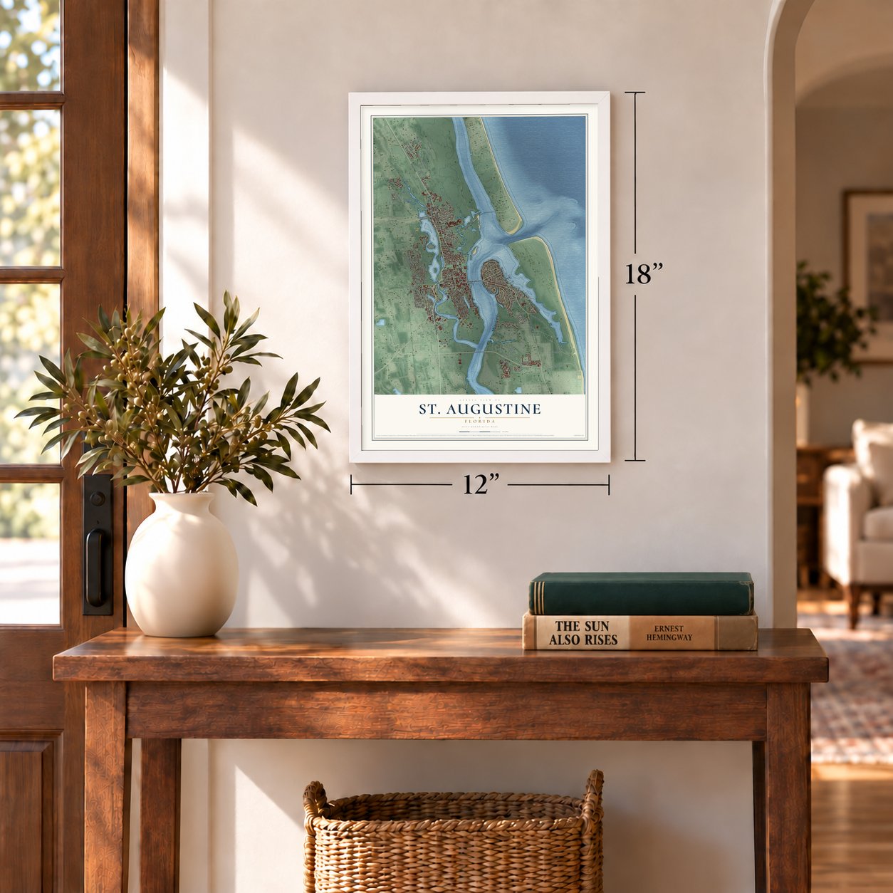
12" x 18" Archival Matte Print
A Map of Home. A Work of Art.
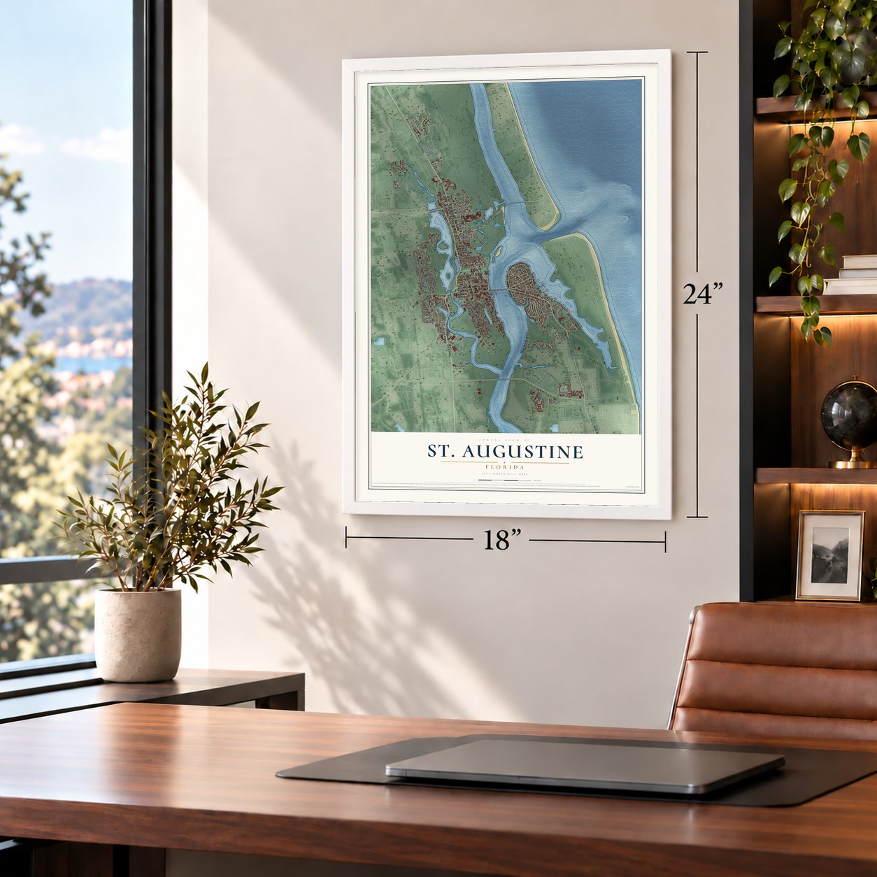
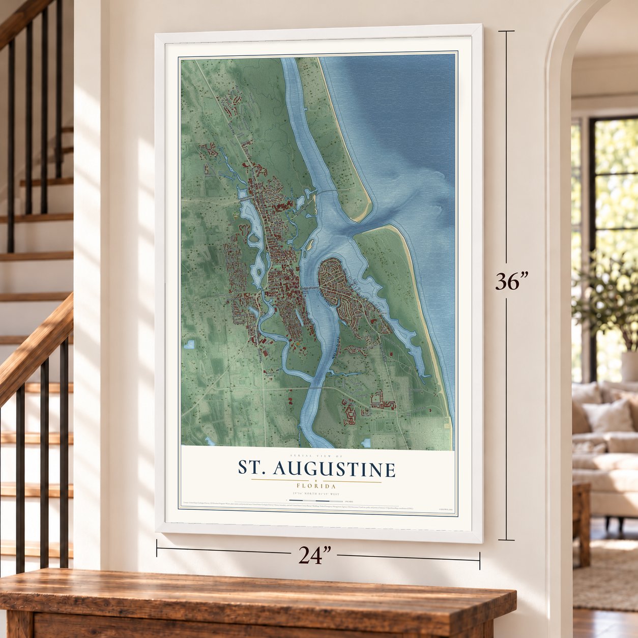
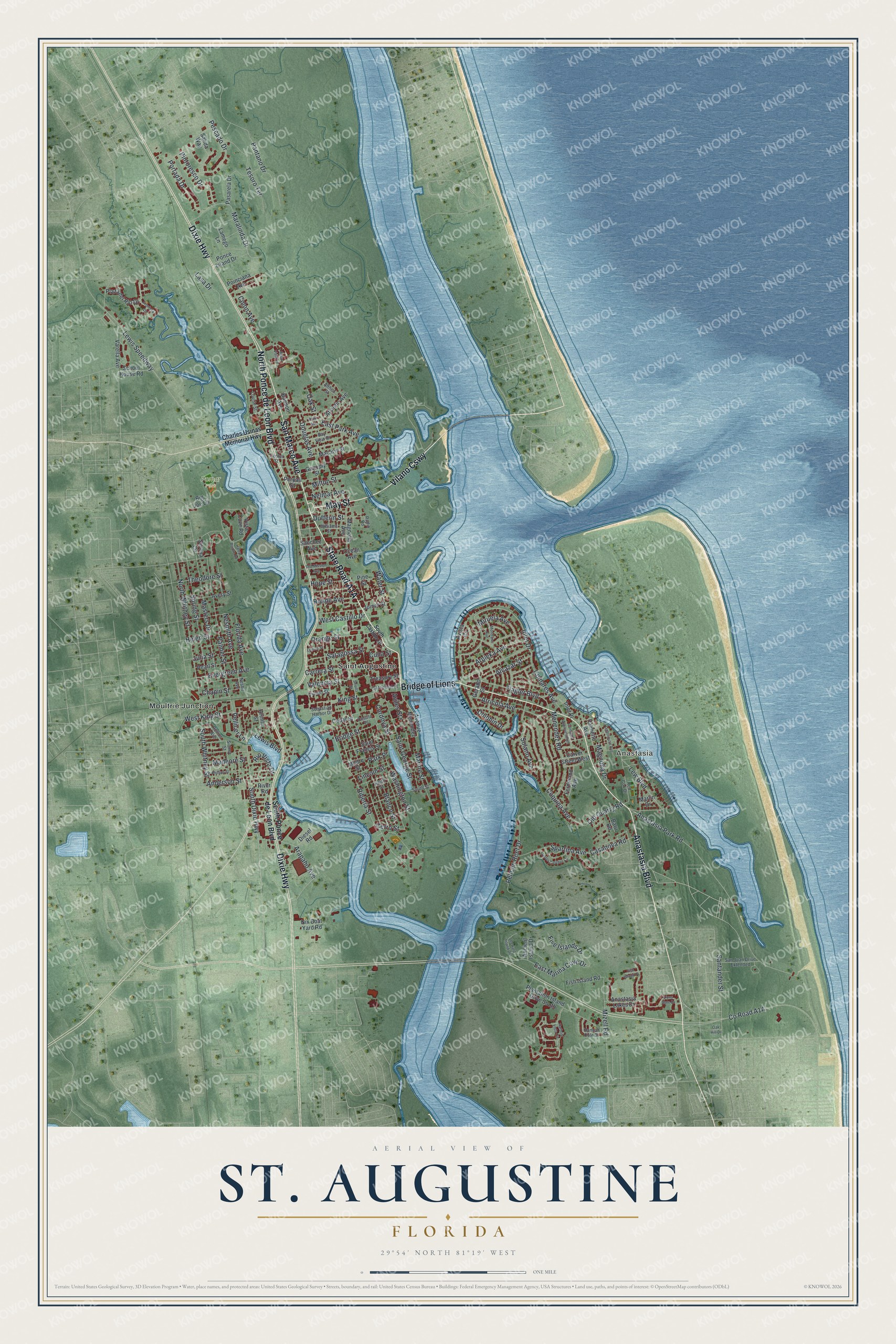
Explore St. Augustine, Florida from a whole new perspective. Created using aerial imagery and detailed geographic data, this map captures St. Augustine building by building, with labeled streets, familiar landmarks, and shaded topographical relief that highlights the natural contours of the landscape.
Combining modern data with the timeless character of a vintage atlas, this map is just as interesting up close as it is beautiful on the wall. Whether you grew up in St. Augustine, spent memorable years there, or call it home today, this unique map is a great way to celebrate a place that means something to you. Zoom in on the preview to look for your street, and then order a print to put your memories on the wall.
Three ways to hang it
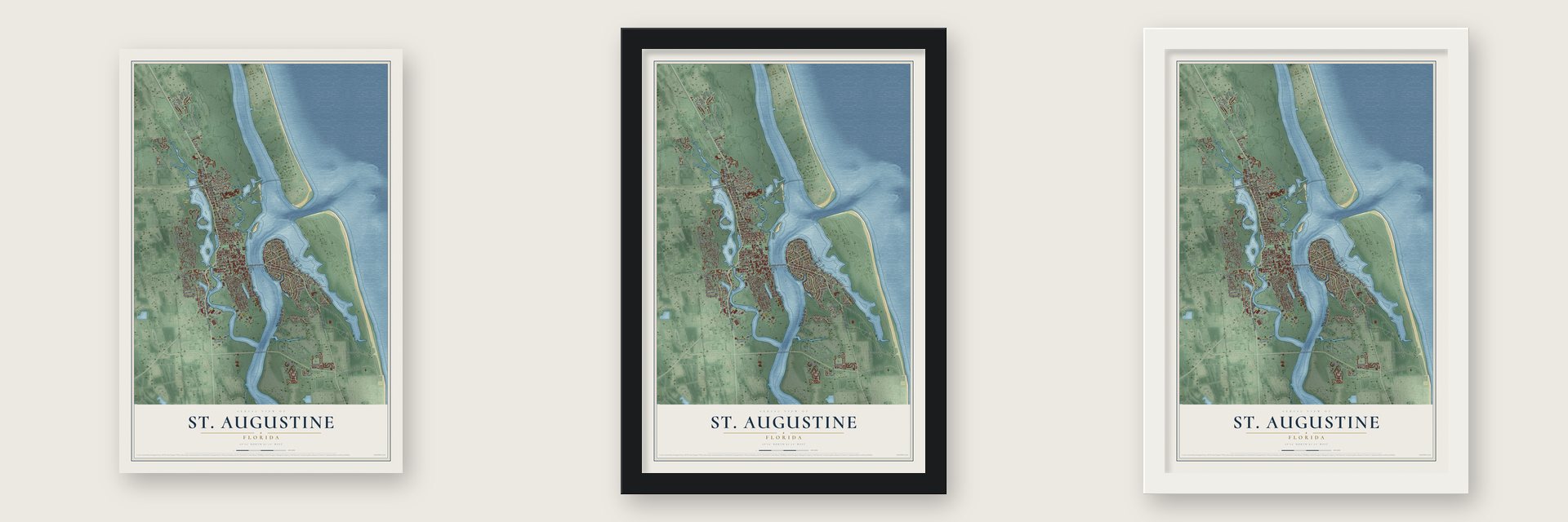
Unframed archival matte, a black wood frame or a white wood frame.
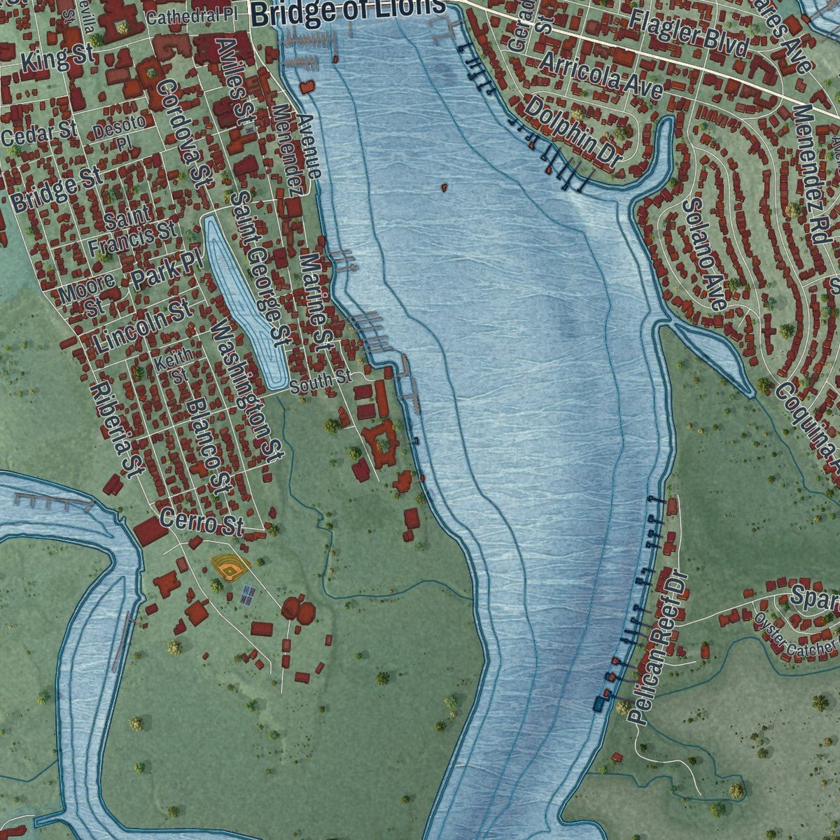
Up close
Geography Worth Displaying
This map was created using accurate cartographic data and authoritative geographic sources, including the U.S. Geological Survey (USGS) and FEMA. The map brings together terrain, waterways, roads, and building detail. The majority of the streets are labeled, houses are accurately depicted, and the topography is derived from government sources. Combining local data with carefully composed color and shading leads to this beautifully detailed St. Augustine artwork for your wall.
Rather than simply showing street outlines, we’ve included as many of the street names as we could reasonably fit on the map while keeping their names legible. Zoom in on the high resolution preview to see exactly what’s on the map. We truly set out to create a statement piece for anyone who loves St. Augustine. So whether it’s for you, or a gift for someone you love, we hope this map of St. Augustine brings back fond memories.
Explore the full map of St. Augustine, Florida and read about the local places it shows.

Find your street
Names on the St. Augustine map
Every name below is printed on this map. Look for your street, your school, the park where you played, or the pond down the road.
Places and landmarks4
- Anastasia
- Pomar Park
- Moultrie Junction
- Saint Augustine
Streets and roads167
- Anastasia Boulevard
- Vilano Causeway
- Bridge of Lions
- May Street
- San Marco Avenue
- North Ponce de Leon Boulevard
- Dixie Highway
- Inlet Drive
- Alcazar Street
- Park Place
- Anastasia Park Road
- South Dixie Highway
- Lew Boulevard
- Riberia Street
- Cordova Street
- Pantano Drive
- Masters Drive
- Saint George Street
- Palmer Street
- Arricola Avenue
- Spring Street
- North Whitney Street
- Coquina Avenue
- Marine Street
- Maralinda Drive
- West King Street
- King Street
- Lewis Speedway
- Arapaho Avenue
- West Castillo Drive
Show all 167 streets
- Pelican Reef Drive
- Nesmith Avenue
- Pescado Drive
- Washington Street
- Tesoro Terrace
- Menendez Road
- Santander Street
- Bridge Street
- Douglas Avenue
- Orange Street
- Lewis Boulevard
- Dolphin Drive
- Flagler Boulevard
- Spartina Avenue
- Anderson Street
- South Whitney Street
- Arpieka Avenue
- Comares Avenue
- East Marina Cove Drive
- Portada Drive
- Pintoresco Drive
- Evergreen Avenue
- Valencia Street
- Helen Street
- Magnolia Drive
- Carrera Street
- Julia Street
- Saragossa Street
- Mizell Road
- Florida Avenue
- Five Islands Drive
- Miruela Avenue
- Dufferin Street
- Casanova Road
- Madeore Street
- Theodore Street
- Blanco Street
- Water Street
- Lasa Drive
- Rohde Avenue
- Old Quarry Road
- East Park Avenue
- Chapin Street
- Milton Street
- Nelmar Avenue
- Rio Vista Drive
- Hope Street
- Lincoln Street
- Solano Avenue
- Cuna Street
- Pellicer Lane
- Colon Avenue
- Cerro Street
- Aviles Street
- Oak Street
- South Ponce de Leon Boulevard
- Avenue Menendez
- Saint Francis Street
- Vista Cove Road
- Plantation Island Drive South
- Anastasia Lakes Drive
- Magnolia Avenue
- Pasarela Drive
- Lamego Lane
- Plaza del Rio Drive
- Serena Circle
- Avery Street
- Macaris Street
- Avista Circle
- Palmetto Avenue
- Varella Avenue
- Cedar Street
- Salida Way
- Ponce Island Drive
- Pearl Street
- Fish Island Road
- Gerado Street
- Atlantic Avenue
- Carver Street West
- Ocean Avenue
- Pine Street
- School House Road
- Arenta Street
- Nix Boat Yard Road
- Ferdinand Avenue
- Poinciana Avenue
- Big Joe Lane
- Treasury Street
- Baru Road
- Genoply Street
- Diesel Road
- Joiner Street
- Sanchez Avenue
- Ancient Island Drive
- Bannon Avenue
- River Road
- Moore Street
- Perpall Street
- Inlet Place
- Marlin Drive
- Charles Usinas Memorial Highway
- Red Cox Drive
- South Street
- Bay View Drive
- Sidney Street
- San Juan Drive Extended
- Hannah Cole Drive
- Sebastian Harbor Drive
- Williams Street
- Cathedral Place
- Rollins Avenue
- Center Street
- Oviedo Street
- Althea Street
- Louise Street
- Desoto Place
- Nesbit Avenue
- Radio Road
- Keith Street
- South Castillo Drive
- Harbour Vista Circle
- Lions Gate Drive
- Sevilla Street
- Oyster Catcher Circle
- Leeward Island Drive
- Park Avenue
- Phillips Street
- Old Mission Avenue
- Comares Avenue South
- Lighthouse Avenue
- Montrano Avenue
- Frontera Drive
- Aqua Vista Lane
- Lemon Street
- Haley Pointe Road
- Fish Island Place
- Oak Hill Drive
Names are listed as they appear on the printed map. Zoom into the product photos to find them.
About St. Augustine, Florida
St. Augustine is the county seat of St. Johns County, a city of 14,329 people on the Atlantic coast of northeastern Florida. Pedro Menéndez de Avilés, the Spanish admiral who became Florida's first governor, founded it on September 8, 1565, on the site of the former Timucua village of Seloy. His fleet had spotted the Florida coast on the feast day of St. Augustine, August 28, so he named the town for the saint, San Agustín. No other town founded by Europeans in the contiguous United States has been lived in for longer.
Spain governed its Florida colony from here for more than 200 years, and the town stayed a capital under the flags that followed. Britain made it the seat of East Florida in 1763, and Spain kept it as its capital after winning Florida back in 1783. Once the United States took over in 1821, it shared the territorial capital role with Pensacola until Tallahassee won the title for good in 1824.
- A stone fort in 1672The English buccaneer Robert Searle raided the town in 1668 and killed sixty people. The raid pushed the Spanish Crown to pay for a stone fort, and workers began laying coquina for the Castillo de San Marcos in 1672, finishing in 1695. James Moore's Carolina forces besieged it for 58 days in 1702 and burned the town as they left. Georgia's James Oglethorpe tried again in 1740. Neither army took the fort.
- Fort Mose, 1738Governor Manuel de Montiano ordered a settlement built two miles north of town in 1738 for Black men and women who had fled slavery in the English colonies to the north. Its men joined the Florida militia and became Catholics in exchange for their freedom, and they guarded the northern approach to St. Augustine. Fort Mose was the first free Black town that the law recognized anywhere in the present United States.
- Flagler's hotels of 1888Henry Flagler, a Standard Oil co-founder, wintered here in 1883 and set out to make the city a cold-weather retreat for wealthy visitors. His Hotel Ponce de Leon opened to guests in January 1888. Built of poured concrete mixed with local coquina, it had electricity from the start, with generators from Thomas Edison. The 250-room Alcazar Hotel was finished that same year. Since 1968 the Ponce de Leon has been the centerpiece of Flagler College.
- The Bridge of LionsWork began on the drawbridge across Matanzas Bay to Anastasia Island in 1925, and it was completed in 1927. Two lions of Carrara marble, named Firm and Faithful, stand at its end, modeled on the Medici lions in Florence. They were a final gift from Dr. Andrew Anderson, a former mayor who did not live to see them installed. The rebuilt bridge reopened in 2010, and the lions returned in 2011.
- Dr. King's arrest in 1964Robert Hayling, a local civil rights leader, asked the Southern Christian Leadership Conference and Martin Luther King Jr. to come help in the spring of 1964. Marches, sit-ins, pray-ins and wade-ins went on from May into July, and hundreds of supporters, Black and white, went to jail. King was arrested here on June 11, 1964, his only arrest in Florida, and the sympathy the protests won helped Congress pass the Civil Rights Act of 1964.
Keep exploring Florida
St. Augustine is one of 1,067 Florida towns we've mapped. Every dot on the map is a print of its own.
The search covers every state, Florida first.
Near St. Augustine
Order 2 or more town maps and save 10%. Shown in the size and finish you picked above, so they hang as a set.
- Vilano Beach 12" x 18" / Archival Matte Print $39.99
- St. Augustine South 12" x 18" / Archival Matte Print $39.99
- St. Augustine Beach 12" x 18" / Archival Matte Print $39.99

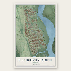
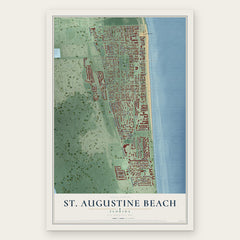
More maps nearby: St. Augustine Shores, Butler Beach, World Golf Village, Crescent Beach and Nocatee.
The art of mapping a place
How This Map Was Made
Real places. Remarkable detail. Discover the layers that turn geographic data into a map of home.

The view from above
Aerial imagery reveals the character of the land: woodland, open fields, and the patterns of a place.

The shape of the land
Elevation data brings hills, valleys, and subtle changes in the landscape into view.

The details of home
Roads, waterways, and building footprints come together to make the map feel unmistakably local.

Geography becomes art
Considered color, shading, and typography bring the layers together in a map made for your wall.


Process illustrated with Mendon, Massachusetts. Aerial imagery: USDA NAIP. Terrain: USGS 3D Elevation Program. Map details and finished artwork: KNOWOL.
The Details
About This Print
Choose an archival matte print, or a black or white Ayous wood frame. The archival matte print is unframed.
Select your size and finish above to see the matching product image and price.
Materials & Craftsmanship
A contemporary map with the character of a classic atlas, printed on archival matte paper. Optional frames are made from Ayous wood.
Your printed map does not include the watermark shown in the full-map preview.
Shipping & Delivery
Free shipping within the United States. Every print is made to order in the USA.
Buying a gift? Add a note in your cart and we'll include it. We never put prices in the package.
Prints ship within 2 to 3 business days. Allow 7 to 10 days total from ordering for delivery. Timing may vary during holidays or periods of high order volume.
Read our shipping policy.
Returns and damaged prints
Each print is made to order. Change-of-mind refunds are not available after production.
If your print arrives damaged, misprinted or incorrect, contact support@knowol.com within 30 days of receiving it. Include your order number, photos and a description of the issue.
Read our full refund and replacement policy. For questions about your order, email support@knowol.com.