
Search for another town





Free U.S. delivery 7 to 10 days after you order
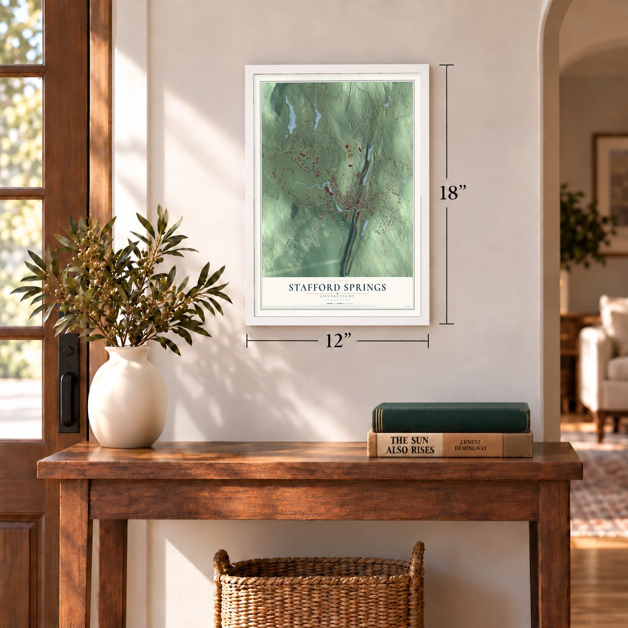
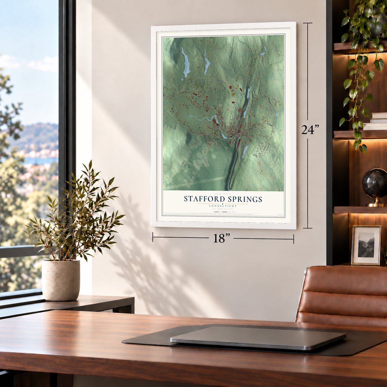
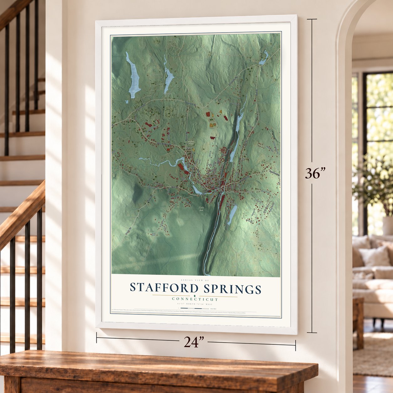
Stafford Springs, Connecticut Map Art
Building by building, with labeled streets and shaded relief.
12" x 18" Archival Matte Print
A Map of Home. A Work of Art.
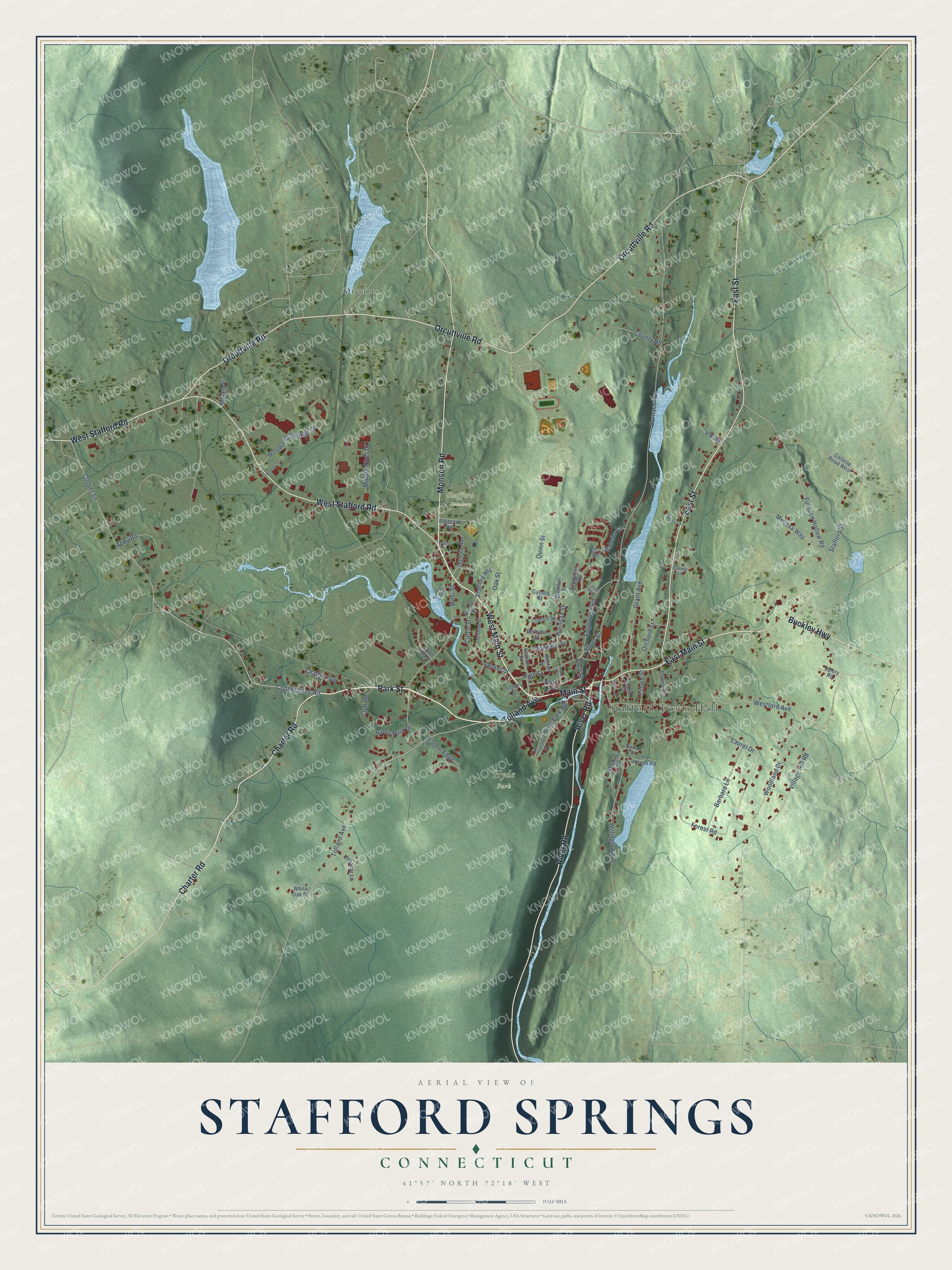
Explore Stafford Springs, Connecticut from a whole new perspective. Created using aerial imagery and detailed geographic data, this map captures Stafford Springs building by building, with labeled streets, familiar landmarks, and shaded topographical relief that highlights the natural contours of the landscape.
Combining modern data with the timeless character of a vintage atlas, this map is just as interesting up close as it is beautiful on the wall. Whether you grew up in Stafford Springs, spent memorable years there, or call it home today, this unique map is a great way to celebrate a place that means something to you. Zoom in on the preview to look for your street, and then order a print to put your memories on the wall.
Three ways to hang it
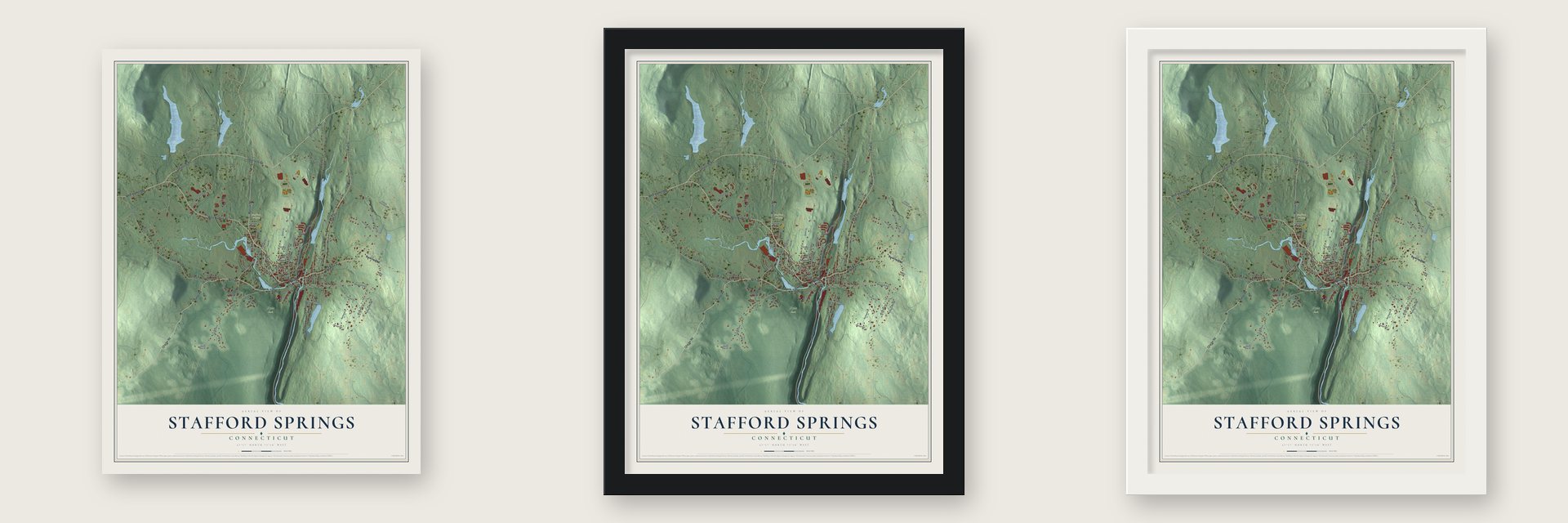
Unframed archival matte, a black wood frame or a white wood frame.
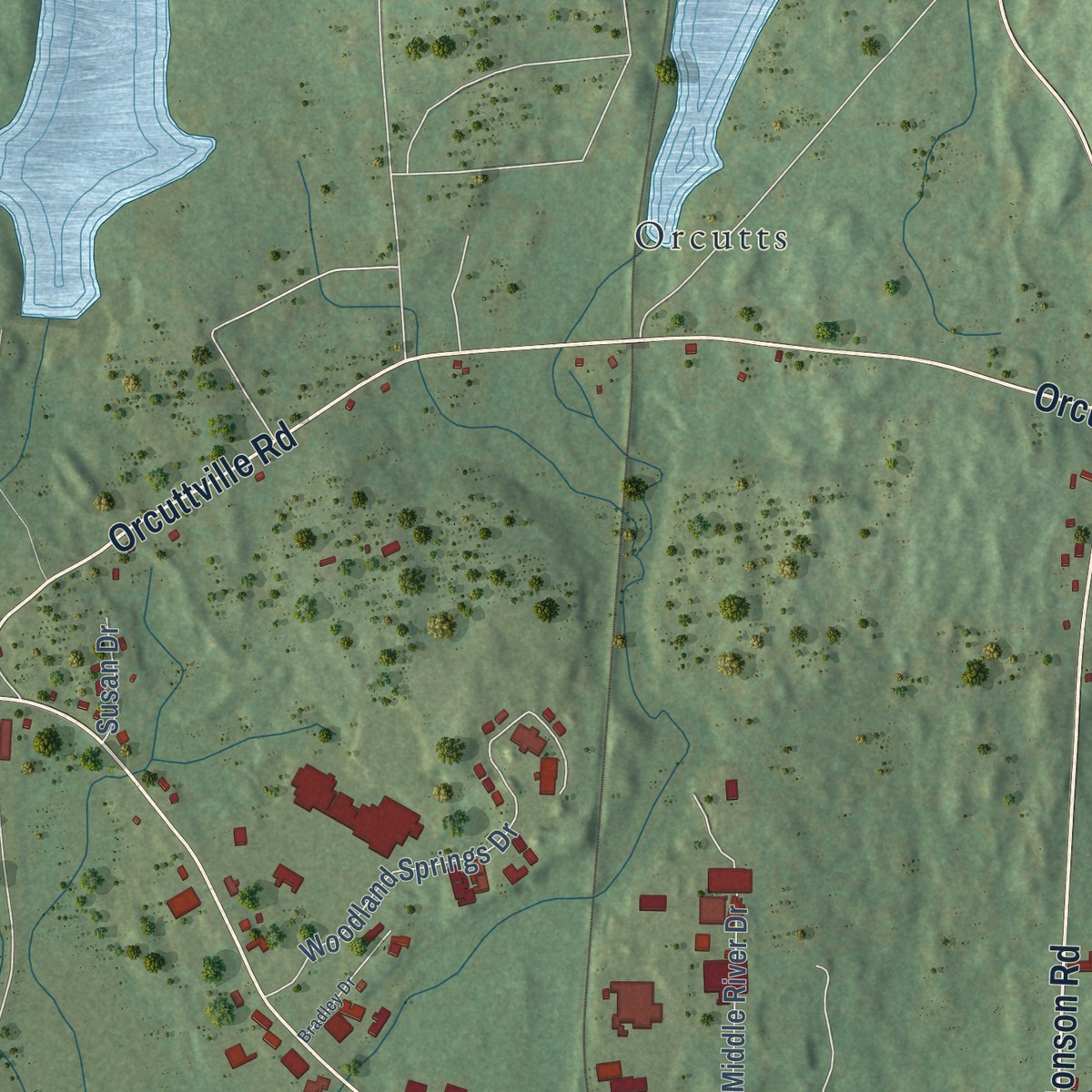
Up close
Geography Worth Displaying
This map was created using accurate cartographic data and authoritative geographic sources, including the U.S. Geological Survey and the Census Bureau. The map brings together terrain, waterways, roads, and building detail. The majority of the streets are labeled, houses are accurately depicted, and the topography is derived from government sources. Combining local data with carefully composed color and shading leads to this beautifully detailed Stafford Springs artwork for your wall.
Rather than simply showing street outlines, we’ve included as many of the street names as we could reasonably fit on the map while keeping their names legible. Zoom in on the high resolution preview to see exactly what’s on the map. We truly set out to create a statement piece for anyone who loves Stafford Springs. So whether it’s for you, or a gift for someone you love, we hope this map of Stafford Springs brings back fond memories.
Read the story behind this map of Stafford Springs, Connecticut from 2026.

Find your street
Names on the Stafford Springs map
Every name below is printed on this map. Look for your street, your school, the park where you played, or the pond down the road.
Places and landmarks4
- Stafford Town Hall
- Hyde Park
- Stafford Cemetery
- Orcutts
Streets and roads85
- West Main Street
- Park Street
- Tolland Avenue
- Main Street
- Charter Road
- East Main Street
- Orcuttville Road
- West Stafford Road
- East Street
- River Road
- Monson Road
- Buckley Highway
- Cooper Lane
- West Street
- Gold Street
- Stafford Heights
- Brendan Street
- Furnace Avenue
- Cooper Lane Road
- Village Hill Road
- Willington Avenue
- Westford Avenue
- Stafford Street
- Furnace Hollow Road
- Woodland Springs Drive
- Woodland Drive
- Forest Road
- Hyde Park Road
- Quinn Street
- County Road
Show all 85 streets
- Laurel Drive
- Prospect Street
- Barbara Lane
- Grant Avenue
- Middle River Drive
- Melissa Way
- High Street
- Center Street
- Edgewood Road
- Charter Avenue
- Abby Road
- Forest Edge
- Orchard Street
- Isabella Circle
- Oak Street
- Avery Park Drive
- Crown Street
- Club Road
- Susan Drive
- Curtis Street
- Vlk Road
- Silver Street
- Hicks Avenue
- Brendon Street
- Church Street
- Collette Road West
- Dennis Lane
- Evergreen Heights
- Jennifer Lane
- Mountain Road
- Green Street
- West End Street
- Olympic Avenue
- Bellrose Street
- Ice House Road
- Clinton Street
- Galotto Street
- Benton Street
- Valery Road
- School Street
- Pleasant Road
- Dadalt Street
- White Oak Drive
- Converse Street
- Sellars Lane
- Penny Lane
- Tammy Lane
- Jill's Way
- Highland Terrace
- Bradley Drive
- Laurel Way
- Fiske Avenue
- Mill Pond Condos
- Maple Street
- Topsy Drive
Names are listed as they appear on the printed map. Zoom into the product photos to find them.
About Stafford Springs, Connecticut
Stafford Springs is a village of 4,780 people in the town of Stafford, close to where the Willimantic River begins. The Nipmuck people drank from its iron and sulfur springs long before English settlers arrived in 1719. The springs stayed mostly a local matter until 1765, when a Mr. Field of East Windsor told others about the cures he credited to the water. After the Revolution, visitors traveled from all over the country to try it, and Dr. Samuel Willard opened a luxury hotel beside the springs in 1802.
The resort trade faded in the second half of the 19th century, and the river's waterpower turned the village into a mill town. Its shops built spinning mules and cloth-dressing machines, and Simon Fairman's lathe chuck, patented in 1840, became standard in machine shops nationwide. During the Civil War its factories cast cannonballs for the Union. The mills made the village big enough to incorporate as a borough in 1873, and it stayed one until November 1991, when it handed its government back to the Town of Stafford.
- John Adams takes the cureOn June 4, 1771, John Adams, a young lawyer worn down by overwork, rode out to the mineral spring. A man named Childs had built a small house nearby for sick and lame visitors, and Mrs. Child gave Adams a broken glass mug pieced back together. He drank plenty, then plunged twice into a cold wooden bath under a shed, and judged the second plunge a mistake that did more harm than good.
- The first woolen mill, 1839Solva Converse opened the village's first woolen mill, the Mineral Springs Manufacturing Company, on Spring Street in 1839. Rebuilt in 1848 after a bad fire, with his brother Parley as partner, it was Solva's alone by 1854, and he switched from satinets to woolens. The Middle River Woolen Company bought it in 1899, a huge fire destroyed it in August 1913, and the Stafford Worsted Company built a new factory on the site in 1916.
- Weaving since 1853The Warren Mills opened in 1853 and rank among the oldest textile mills in the country that have never stopped running. The Italian luxury firm Loro Piana bought the complex in 1988 and kept it going for 26 years. With state help, the American Woolen Company took it over in 2014, and it still weaves worsted and woolen cloth there for men's suits and fine coats.
- Holt Memorial Fountain, 1894Charles Holt owned the Phoenix Woolen Company and led the Stafford Savings Bank. After he died in 1892, his wife, Joana, and daughter, Celia, gave the village a granite fountain under a canopy on four pillars, built in 1894. It stands where Route 32, Route 190 and Furnace Avenue meet, making one of New England's oldest traffic circles. When a 1990 plan called for moving it to speed up traffic, residents fought back, and the fountain stayed put.
- From fairgrounds to NASCARThe Stafford Springs Agricultural Park opened in 1870 as a 100-acre fairgrounds with some of New England's biggest farm shows and a half-mile harness track. After World War II the track switched to cars, signed on with NASCAR in 1959 and was paved in 1967. Geoff Bodine built his career there before he won the 1986 Daytona 500.
Keep exploring Connecticut
Stafford Springs is one of 382 Connecticut towns we've mapped. Every dot on the map is a print of its own.
The search covers every state, Connecticut first.
Near Stafford Springs
Order 2 or more town maps and save 10%. Shown in the size and finish you picked above, so they hang as a set.
- Stafford 12" x 18" / Archival Matte Print $39.99
- West Stafford 12" x 18" / Archival Matte Print $39.99
- Crystal Lake 12" x 18" / Archival Matte Print $39.99

More maps nearby: Willington, Lake Chaffee, Tolland, Union and Somers.
The art of mapping a place
How This Map Was Made
Real places. Remarkable detail. Discover the layers that turn geographic data into a map of home.

The view from above
Aerial imagery reveals the character of the land: woodland, open fields, and the patterns of a place.

The shape of the land
Elevation data brings hills, valleys, and subtle changes in the landscape into view.

The details of home
Roads, waterways, and building footprints come together to make the map feel unmistakably local.

Geography becomes art
Considered color, shading, and typography bring the layers together in a map made for your wall.


Process illustrated with Mendon, Massachusetts. Aerial imagery: USDA NAIP. Terrain: USGS 3D Elevation Program. Map details and finished artwork: KNOWOL.
The Details
About This Print
Choose an archival matte print, or a black or white Ayous wood frame. The archival matte print is unframed.
Select your size and finish above to see the matching product image and price.
Materials & Craftsmanship
A contemporary map with the character of a classic atlas, printed on archival matte paper. Optional frames are made from Ayous wood.
Your printed map does not include the watermark shown in the full-map preview.
Shipping & Delivery
Free shipping within the United States. Every print is made to order in the USA.
Buying a gift? Add a note in your cart and we'll include it. We never put prices in the package.
Prints ship within 2 to 3 business days. Allow 7 to 10 days total from ordering for delivery. Timing may vary during holidays or periods of high order volume.
Read our shipping policy.
Returns and damaged prints
Each print is made to order. Change-of-mind refunds are not available after production.
If your print arrives damaged, misprinted or incorrect, contact support@knowol.com within 30 days of receiving it. Include your order number, photos and a description of the issue.
Read our full refund and replacement policy. For questions about your order, email support@knowol.com.