
Search for another town


Free U.S. delivery 7 to 10 days after you order
Stratham, New Hampshire Map Art
Building by building, with labeled streets and shaded relief.
12" x 18" Archival Matte Print
A Map of Home. A Work of Art.
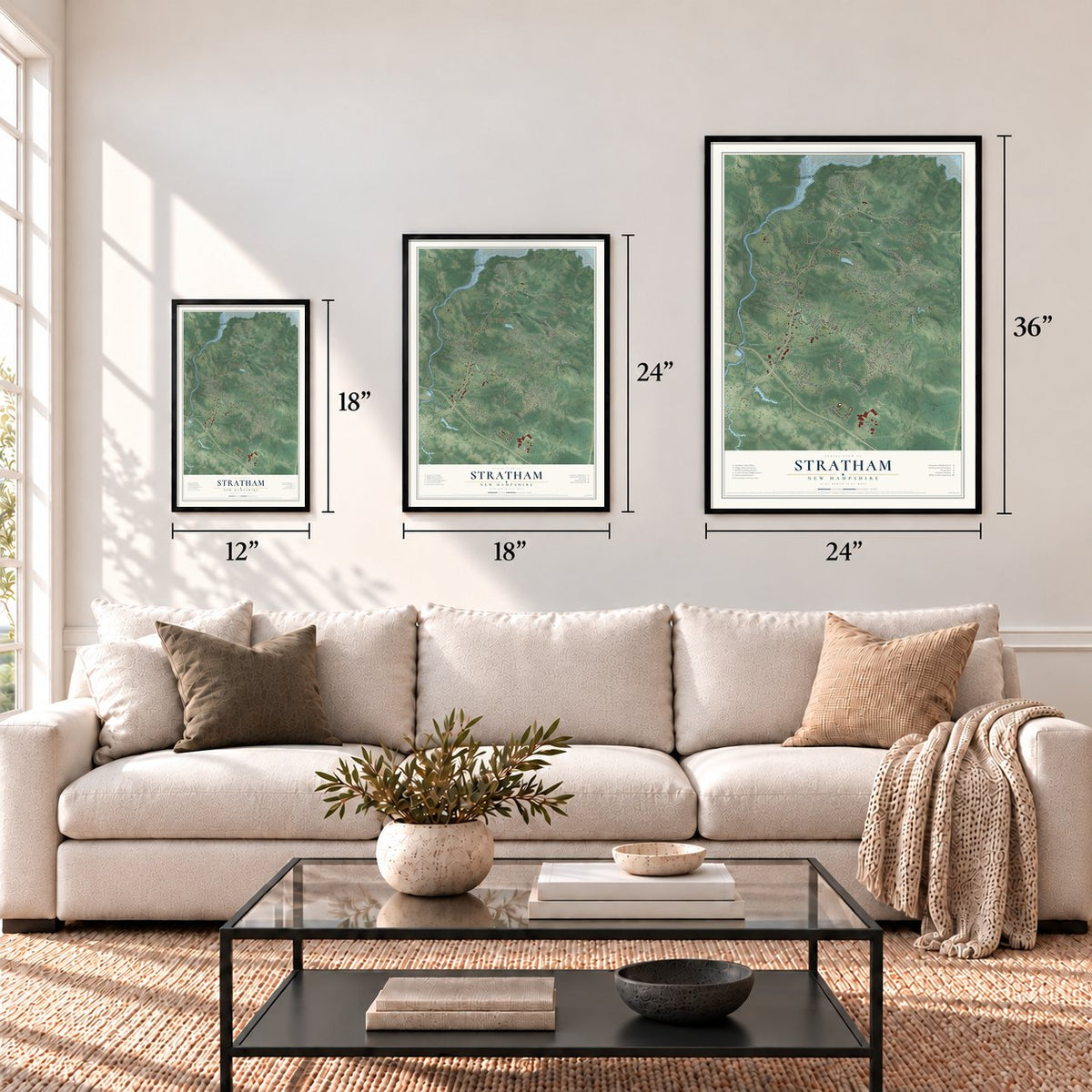
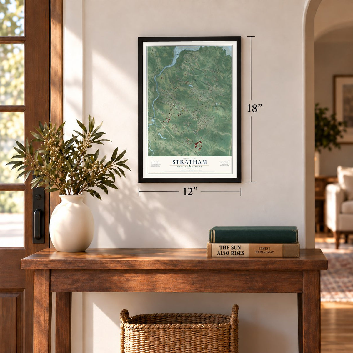
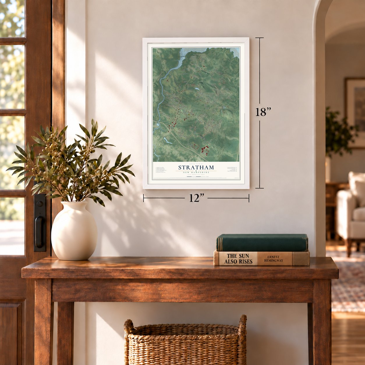
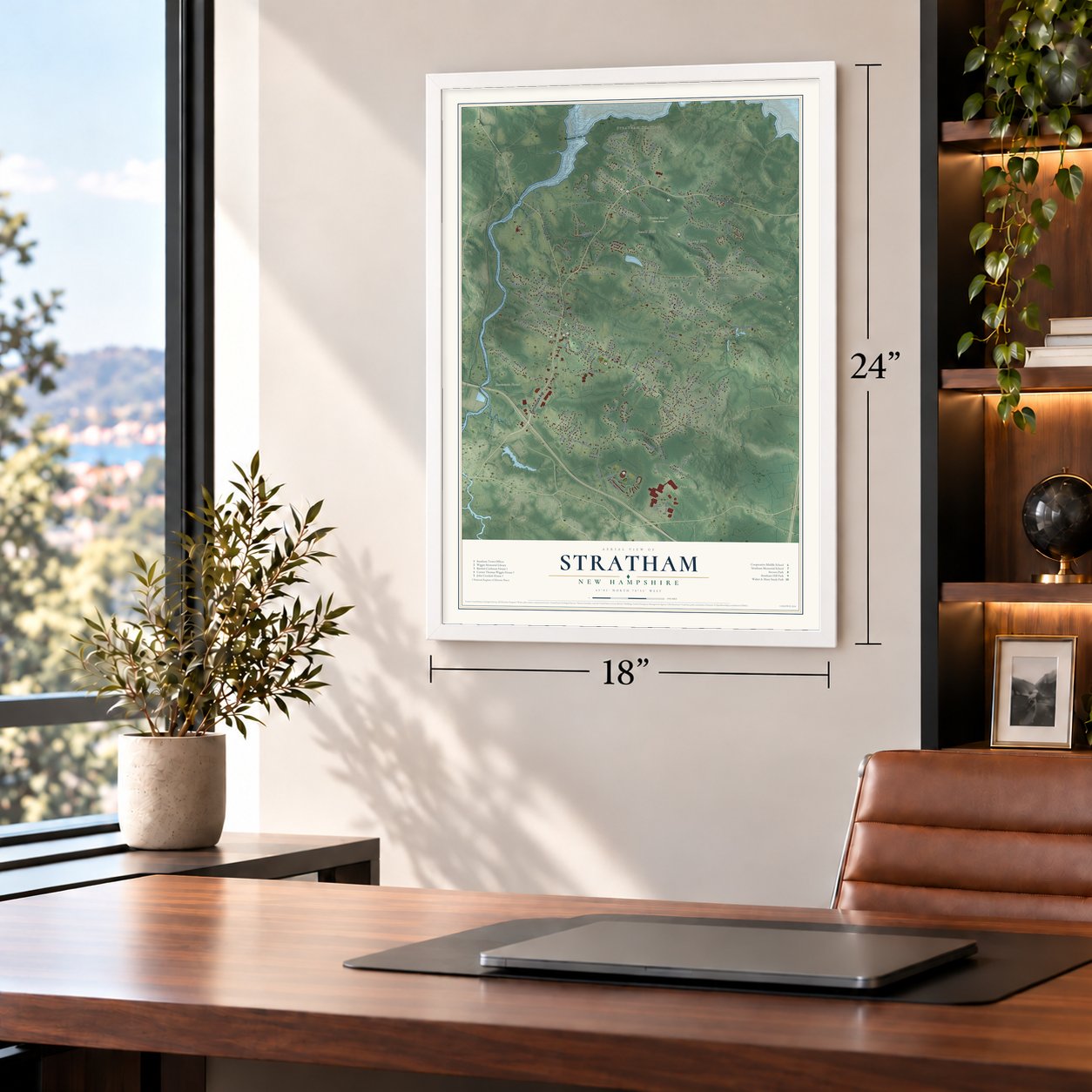
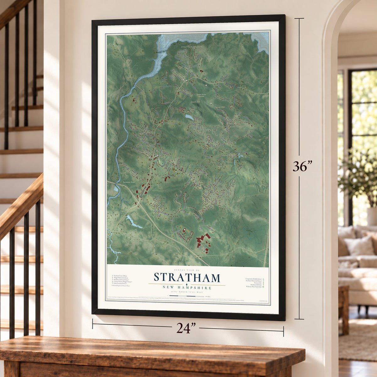
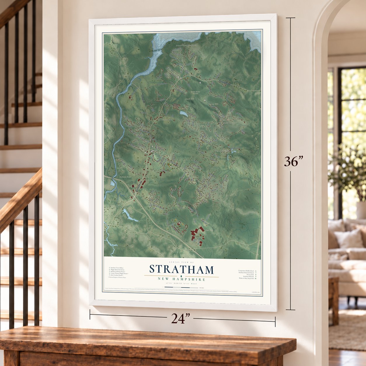
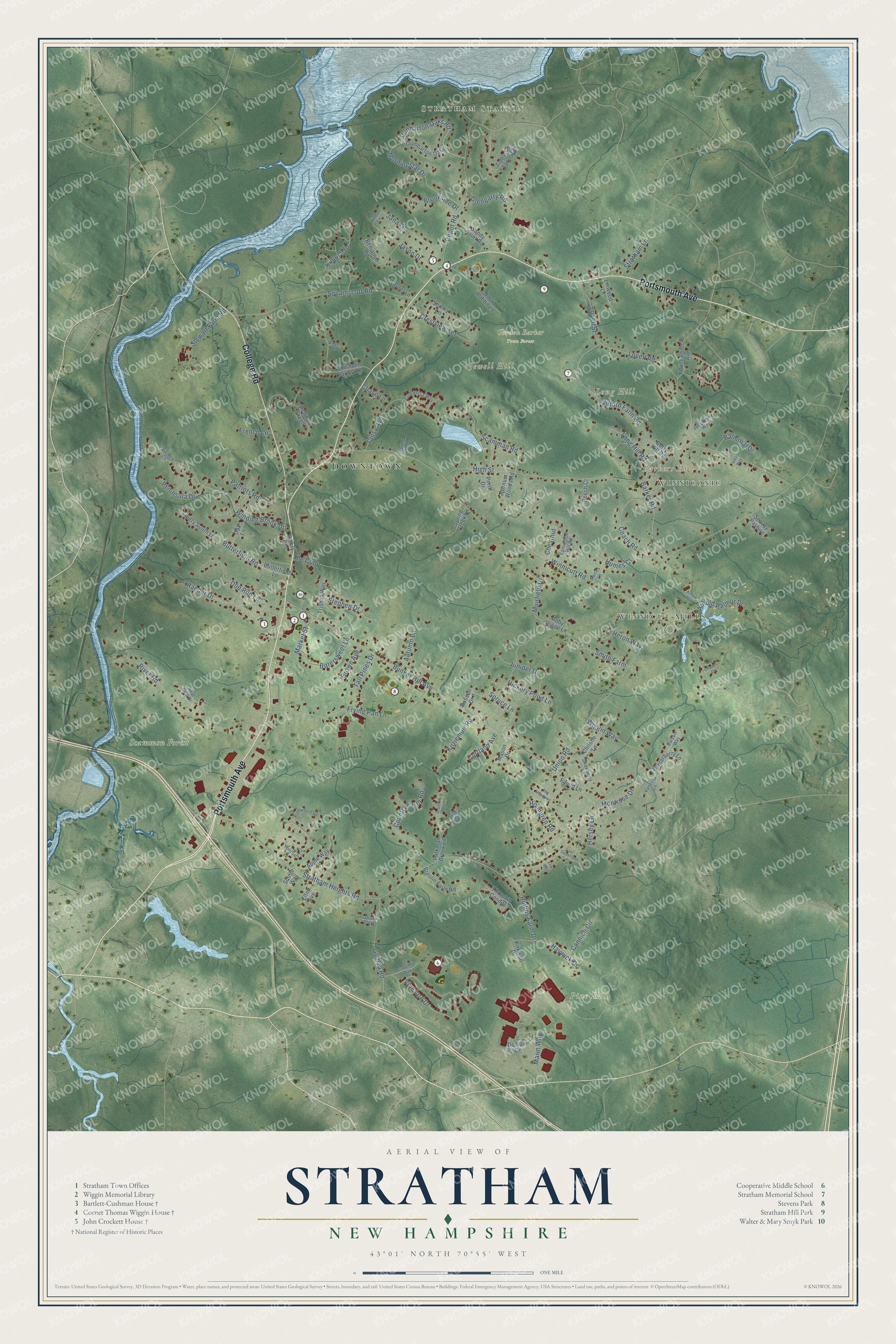
Explore Stratham, New Hampshire from a whole new perspective. Created using aerial imagery and detailed geographic data, this map captures Stratham building by building, with labeled streets, familiar landmarks, and shaded topographical relief that highlights the natural contours of the landscape.
Combining modern data with the timeless character of a vintage atlas, this map is just as interesting up close as it is beautiful on the wall. Whether you grew up in Stratham, spent memorable years there, or call it home today, this unique map is a great way to celebrate a place that means something to you. Zoom in on the preview to look for your street, and then order a print to put your memories on the wall.
Three ways to hang it
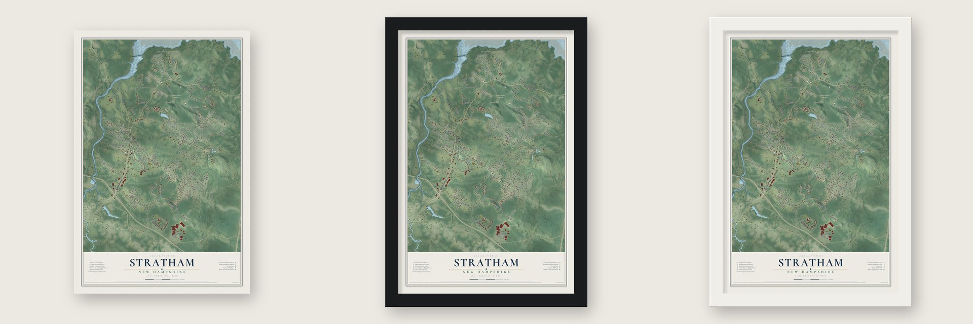
Unframed archival matte, a black wood frame or a white wood frame.
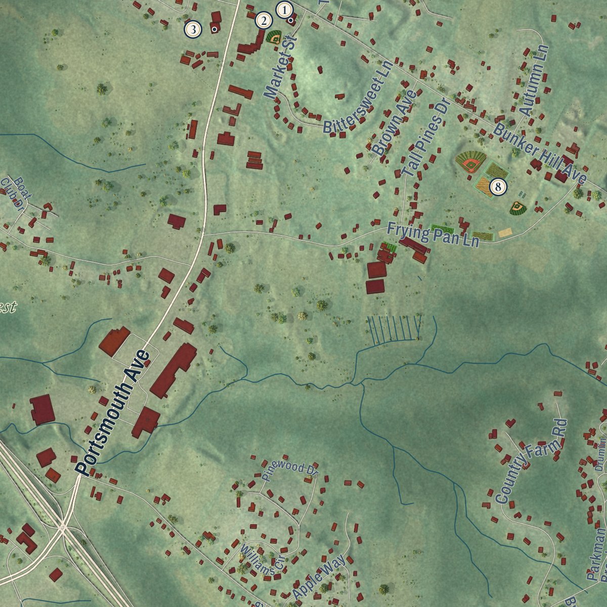
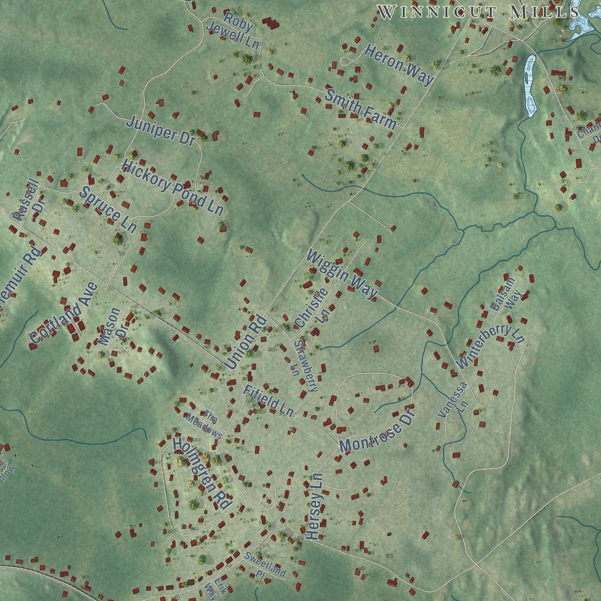
Up close
Geography Worth Displaying
This map was created using accurate cartographic data and authoritative geographic sources, including the U.S. Geological Survey (USGS) and FEMA. The map brings together terrain, waterways, roads, and building detail. The majority of the streets are labeled, houses are accurately depicted, and the topography is derived from government sources. Combining local data with carefully composed color and shading leads to this beautifully detailed Stratham artwork for your wall.
Rather than simply showing street outlines, we’ve included as many of the street names as we could reasonably fit on the map while keeping their names legible. Zoom in on the high resolution preview to see exactly what’s on the map. We truly set out to create a statement piece for anyone who loves Stratham. So whether it’s for you, or a gift for someone you love, we hope this map of Stratham brings back fond memories.
Explore the full map of Stratham, New Hampshire and read about the local places it shows.

Find your street
Names on the Stratham map
Every name below is printed on this map. Look for your street, your school, the park where you played, or the pond down the road.
Places and landmarks10
- Downtown
- Stratham Station
- Winnicut Mills
- Winniconic
- Barkers Hill
- Jewell Hill
- Long Hill
- Pine Hill
- Gordon Barker Town Forest
- Scammon Forest
Streets and roads127
- Portsmouth Avenue
- College Road
- Peninsula Drive
- Dunbarton Oaks Road
- Brookside Drive
- Winding Brook Drive
- Scamman Road
- Bunker Hill Avenue
- Winnicutt Road
- Stratham Heights Road
- Union Road
- High Street
- River Road
- Squamscott Road
- Frying Pan Lane
- Depot Road
- Gifford Farm Road
- Vineyard Drive
- Muirfield Drive
- Butterfield Road
- Crestview Terrace
- Country Farm Road
- Holmgren Road
- Barker Road
- Raeder Drive
- Patriots Road
- Montrose Drive
- Tansy Avenue
- Morningstar Drive
- Glengarry Road
Show all 127 streets
- Coach Road
- Doe Run Lane
- Lovell Road
- Wiggin Way
- Guinea Road
- Marin Way
- Jason Drive
- Arnold Palmor Drive
- Stephen Drive
- Spruce Lane
- Jana Lane
- Bittersweet Lane
- Rollins Farm Drive
- Juniper Drive
- The Coop
- Hickory Pond Lane
- Lovell Street
- Kirriemuir Road
- Smith Farm
- Long Hill Road
- Tall Pines Drive
- Haywick Drive
- Autumn Lane
- Heron Way
- Stewart Farm Road
- Hersey Lane
- Balmoral Drive
- Cannich Circle
- Kinloch Drive
- Stratham Lane
- Market Street
- Brown Avenue
- Cortland Avenue
- Humes Court
- French Lane
- Chase Lane
- Chestnut
- Stratham Green
- Winterberry Lane
- Emery Lane
- Dumbarton Oaks
- Tidewater Farm Road
- Emery South Lane
- Chisholm Farms Road
- Willowbrook Avenue
- Birnum Woods Road
- Benjamin Road
- Jack Rabbit Lane
- Domain Drive
- Parkman Brook Lane
- Butterfield Lane
- Thornhill Condos
- Apple Way
- Christie Lane
- Sandy Point Road
- Roby Jewell Lane
- Kirkwall Drive
- Trishas Way
- Breslin Farm Road
- Spring Creek Lane
- Elton Avenue
- Oak Lane
- Linwood Lane
- Laurel Lane
- Berry Hill Road
- Beech Court
- Mason Drive
- Fifield Lane
- Perth Drive
- Seavey Pasture
- Shirley Lane
- Russell Drive
- Squire Way
- Pinewood Drive
- Linda Lane
- Williams Circle
- Strawberry Lane
- Academic Way
- Crockett's Way
- Merles Lane
- Lamington Hill Road
- Jacqueline Way
- Vanessa Lane
- Boat Club Drive
- Balsam Way
- Wingate Court
- Spring Creek
- Drury Plains
- Aspen Lane
- Drumlin Road
- Annas Way
- Sweetland Place
- The Meadows
- Quail Hollow
- Charles Drive
- Alex Way
- Erik Way
Names are listed as they appear on the printed map. Zoom into the product photos to find them.
About Stratham, New Hampshire
Stratham is a town of 7,669 people in Rockingham County, with the Squamscott River along its western edge. The Pennacook people called this land Winnicutt. English settlers came in 1631 and used two names for it, the Squamscott Patent and Point of Rocks, because it lay between Great Bay and the river. By 1631 Thomas Wiggin, who had crossed the ocean with the Winthrop Fleet, governed the Upper Plantation, which also took in Dover and Durham, and he made his home here on the large Squamscott patent.
Stratham was incorporated in 1716, making it the colony's sixth town. It took its name from Wriothesley Russell, Baron Howland of Streatham, who was a friend of Governor Samuel Shute. In 1793 Phinehas Merrill drew a map of the entire town, which was rare for a New England place of its size, so historians can still tell which of its buildings stood before that year.
- Kenniston's Tavern, 1780 to 1883Ephraim Crockett and his son John, both known builders in town, raised this Georgian house on Portsmouth Road around 1760, near the time John married. In 1780 Henry Kenniston, a tailor, bought it and opened an inn, since it sat midway on the road between Portsmouth and Exeter. His family ran it as Kenniston's Tavern until 1883. The John Crockett House joined the National Register in 1983.
- Finished after Wiggin diedCornet Thomas Wiggin began a house near Depot Road about 1775, but he died before it was done, and arguments over his estate held up the work. It seems to have been completed in the 1790s, probably by his son-in-law Nathan Barker, who finished the interior and later bought it. The Federal-period house has changed little, its barn is thought to date from the same years, and it joined the National Register in 1983.
- Split granite for Dr. BartlettLocal builder Joshua Pike built this Federal-style house in the town center for Josiah Bartlett III, a doctor new to practice in Stratham. Its granite foundation stones were split with plug drills and feathers, among the earliest known uses of that method in New Hampshire. Bartlett's descendants lived there until 1904, and Susie and Arthur Cushman later made it a two-family home for relatives.
- A stone library from 1912Private libraries served Stratham from 1793, and in 1896 the town began funding the last of them. In 1912 Emma Blodgett Wiggin paid for a stone library at 158 Portsmouth Avenue, named for her and her husband, George. The library stayed until 1989 and now uses a newer building on Bunker Hill Avenue, while the Stratham Historical Society occupies the stone one.
- Strawberries for Portsmouth, 1855In 1855 John Emery started raising vegetables at Emery Farm and selling them house to house from Dover to Portsmouth, which is believed to be the first market gardening in New Hampshire. Other Stratham farms took up the idea, and Emery gets credit for bringing fresh strawberries to Portsmouth.
Keep exploring New Hampshire
Stratham is one of 279 New Hampshire towns we've mapped. Every dot on the map is a print of its own.
The search covers every state, New Hampshire first.
Near Stratham
Order 2 or more town maps and save 10%. Shown in the size and finish you picked above, so they hang as a set.
- Greenland 12" x 18" / Archival Matte Print $39.99
- Exeter 12" x 18" / Archival Matte Print $39.99
- Newfields 12" x 18" / Archival Matte Print $39.99


More maps nearby: North Hampton, Newmarket, Newington, Hampton and Hampton Falls.
The art of mapping a place
How This Map Was Made
Real places. Remarkable detail. Discover the layers that turn geographic data into a map of home.

The view from above
Aerial imagery reveals the character of the land: woodland, open fields, and the patterns of a place.

The shape of the land
Elevation data brings hills, valleys, and subtle changes in the landscape into view.

The details of home
Roads, waterways, and building footprints come together to make the map feel unmistakably local.

Geography becomes art
Considered color, shading, and typography bring the layers together in a map made for your wall.


Process illustrated with Mendon, Massachusetts. Aerial imagery: USDA NAIP. Terrain: USGS 3D Elevation Program. Map details and finished artwork: KNOWOL.
The Details
About This Print
Choose an archival matte print, or a black or white Ayous wood frame. The archival matte print is unframed.
Select your size and finish above to see the matching product image and price.
Materials & Craftsmanship
A contemporary map with the character of a classic atlas, printed on archival matte paper. Optional frames are made from Ayous wood.
Your printed map does not include the watermark shown in the full-map preview.
Shipping & Delivery
Free shipping within the United States. Every print is made to order in the USA.
Buying a gift? Add a note in your cart and we'll include it. We never put prices in the package.
Prints ship within 2 to 3 business days. Allow 7 to 10 days total from ordering for delivery. Timing may vary during holidays or periods of high order volume.
Read our shipping policy.
Returns and damaged prints
Each print is made to order. Change-of-mind refunds are not available after production.
If your print arrives damaged, misprinted or incorrect, contact support@knowol.com within 30 days of receiving it. Include your order number, photos and a description of the issue.
Read our full refund and replacement policy. For questions about your order, email support@knowol.com.